-
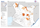
ASAL Humanitarian Network Drought Response - Targeted Households by Ward
The map shows the targeted number of households by ward for the planned and ongoing multi-purpose cash program implemented by the ASAL Humanitarian Network, in response to the... -
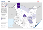
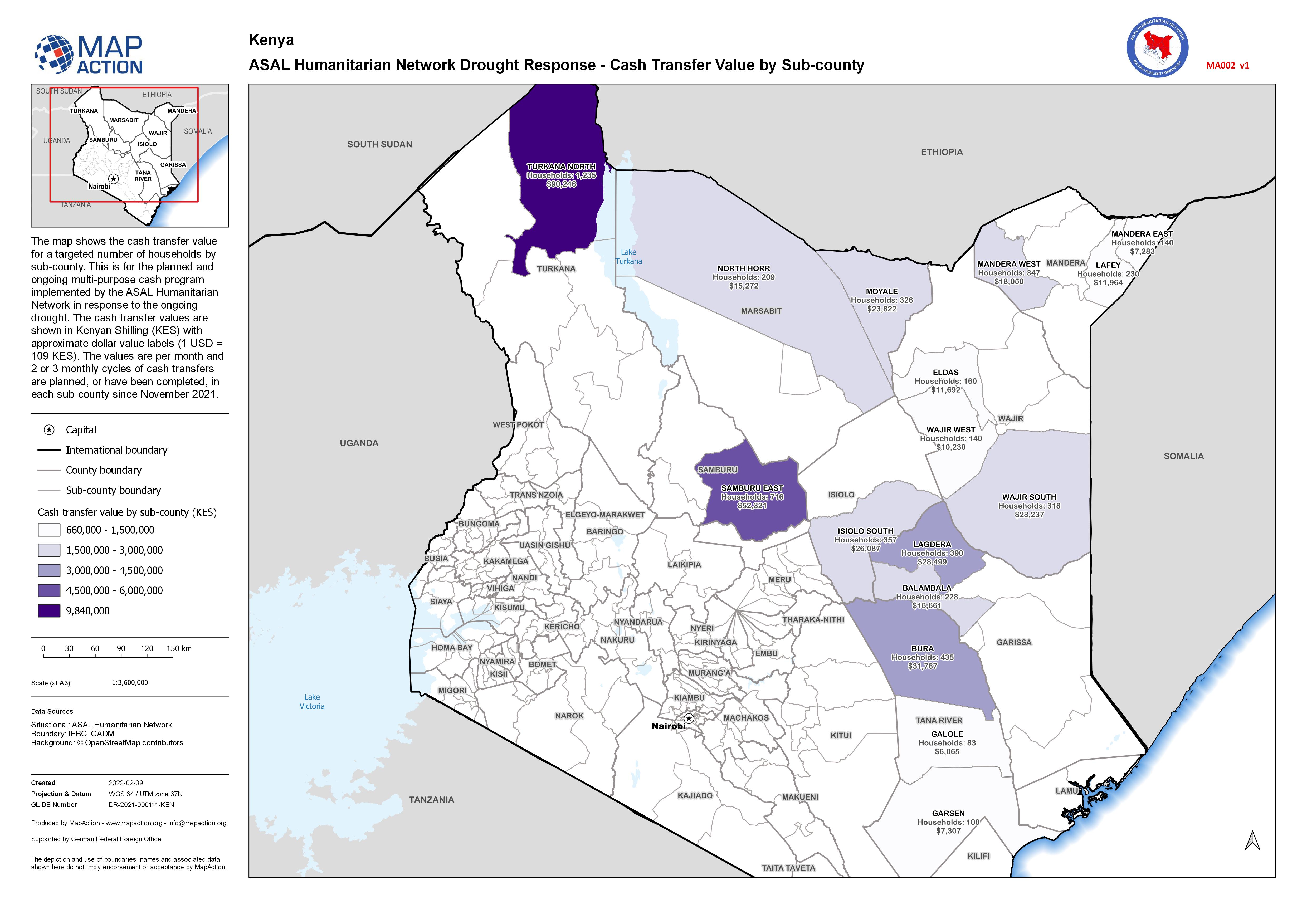
ASAL Humanitarian Network Drought Response - Cash Transfer Value by Sub-county
The map shows the cash transfer value for a targeted number of households by sub-county. This is for the planned and ongoing multi-purpose cash program implemented by the ASAL... -

Current Displaced People and Households at District level (As of 8th Feb 2022)
This map shows the number of displaced people and households in Districts of Madagascar as of 8th Feb 2022 -

Habitat Damage at District level (As of 8th Feb 2022)
This map shows the number of destroyed and damaged habitats in Districts of Madagascar as of 8th Feb 2022 -

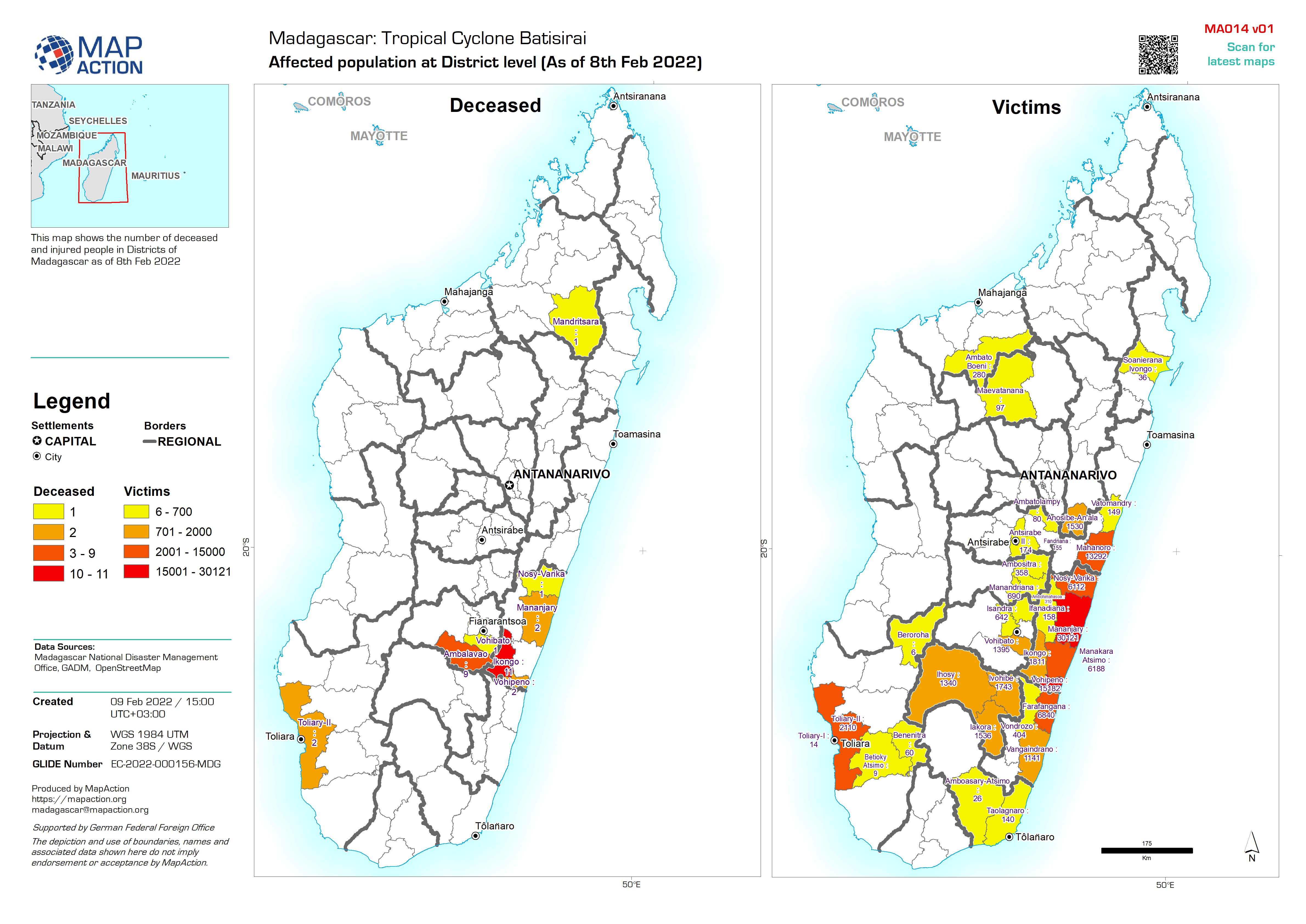
Affected population at District level (As of 8th Feb 2022)
This map shows the number of deceased and injured people in Districts of Madagascar as of 8th Feb 2022 -

Country overview
Map shows major settlements, transport links and physical features of Madagascar. -

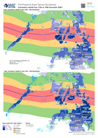
Forecasted and actual storm path with population density (2020 estimate) - as...
Map shows the actual and forecasted storm track (as at 07 Feb 2022) and with population density. All forecasted storm positions, path and wind speeds are the best available,... -

Regions and districts of Madagascar
Country overview with detail of Region and District boundaries and major cities -

-
Cumulative rainfall from 13th to 19th December 2021 along the storm path of S...
These two maps shows the cumulative rainfall that has fallen up to 21 December 2021. The left map shows the 3 day value while the right map shows the 7 day value. -

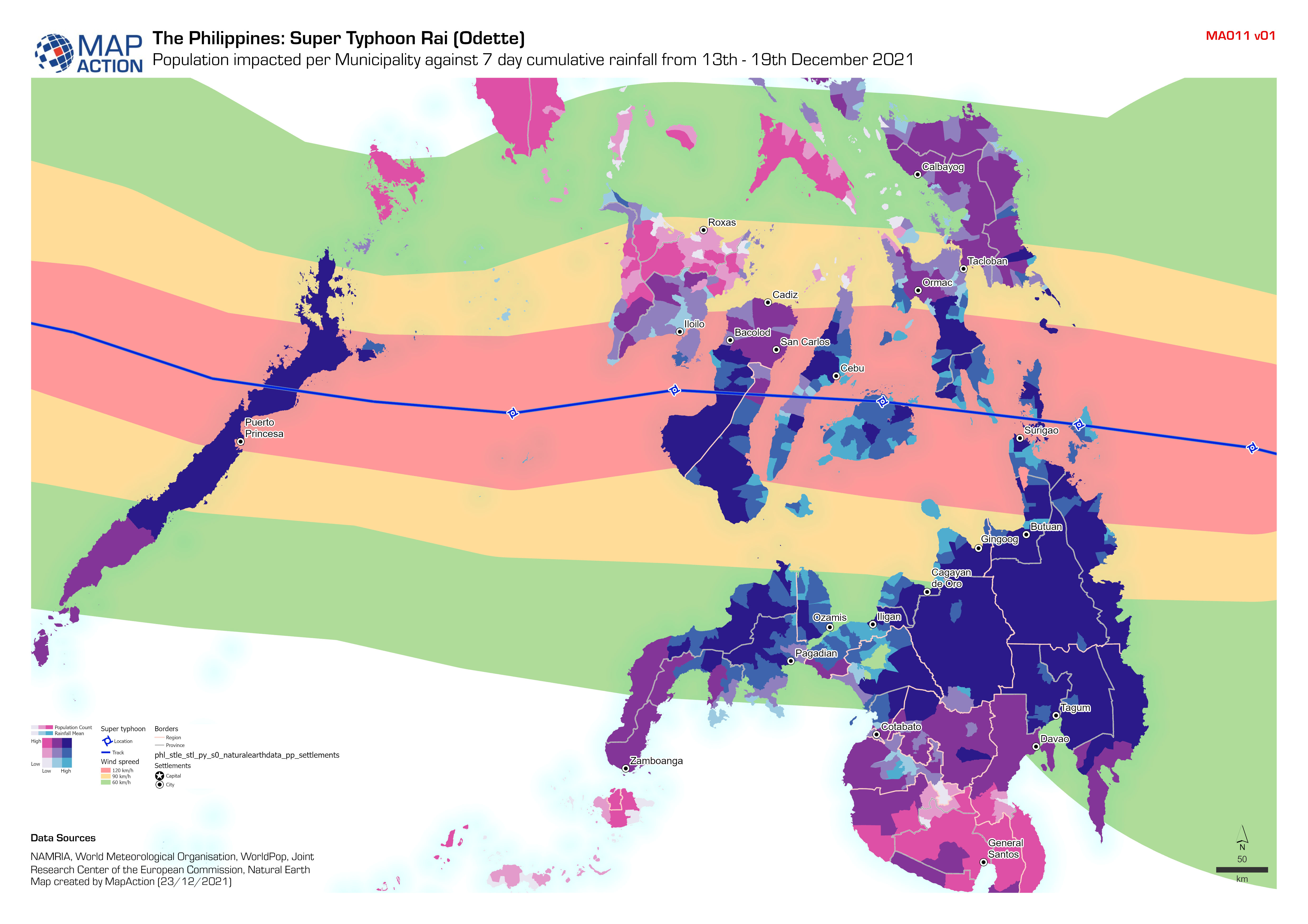
Population impacted per Municipality against 7 day cumulative rainfall from 1...
Bivariate analysis using the 7 day cumulative rainfall (from 13th - 19th December 2021) provided by the World Meteorological Organisation and the Municipality population using... -

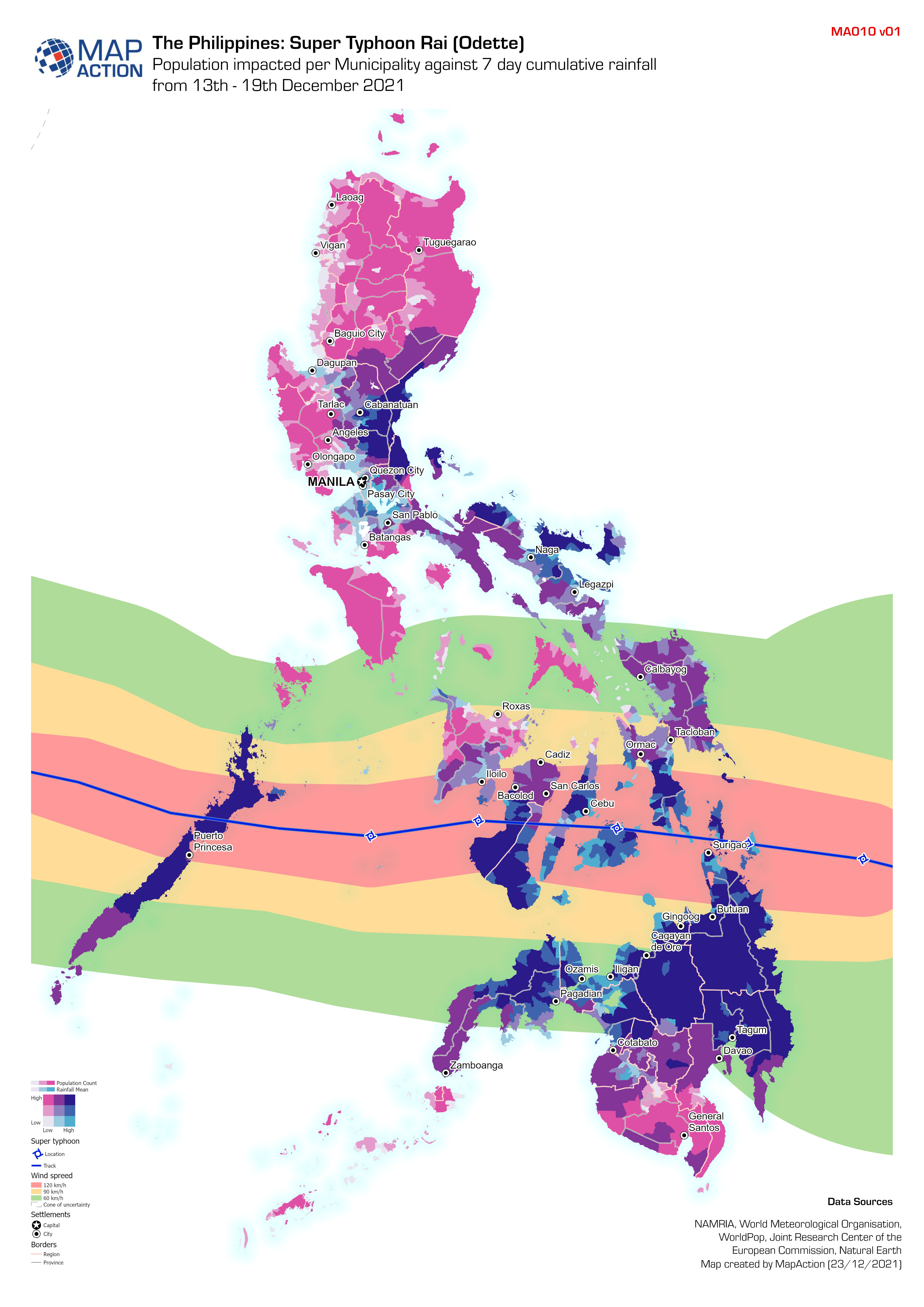
Population impacted per Municipality against 7 day cumulative rainfall from 1...
Bivariate analysis using the 7 day cumulative rainfall (from 13th - 19th December 2021) provided by the World Meteorological Organisation and the Municipality population using... -

Cumulative rainfall from 13th to 19th December 2021 for the Philippines
These two maps shows the cumulative rainfall that has fallen up to 21 December 2021. The left map shows the 3 day value while the right map shows the 7 day value. -
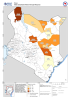
ASAL Humanitarian Network Drought Response
The map shows the targeted number of households by sub-county and ward for the planned and ongoing multi-purpose cash program implemented by the ASAL Humanitarian Network in... -

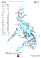
Affected population by Municipality (as of 08:00, 22 Dec 21)
Map shows the affected population per Municipality (admin 3). -
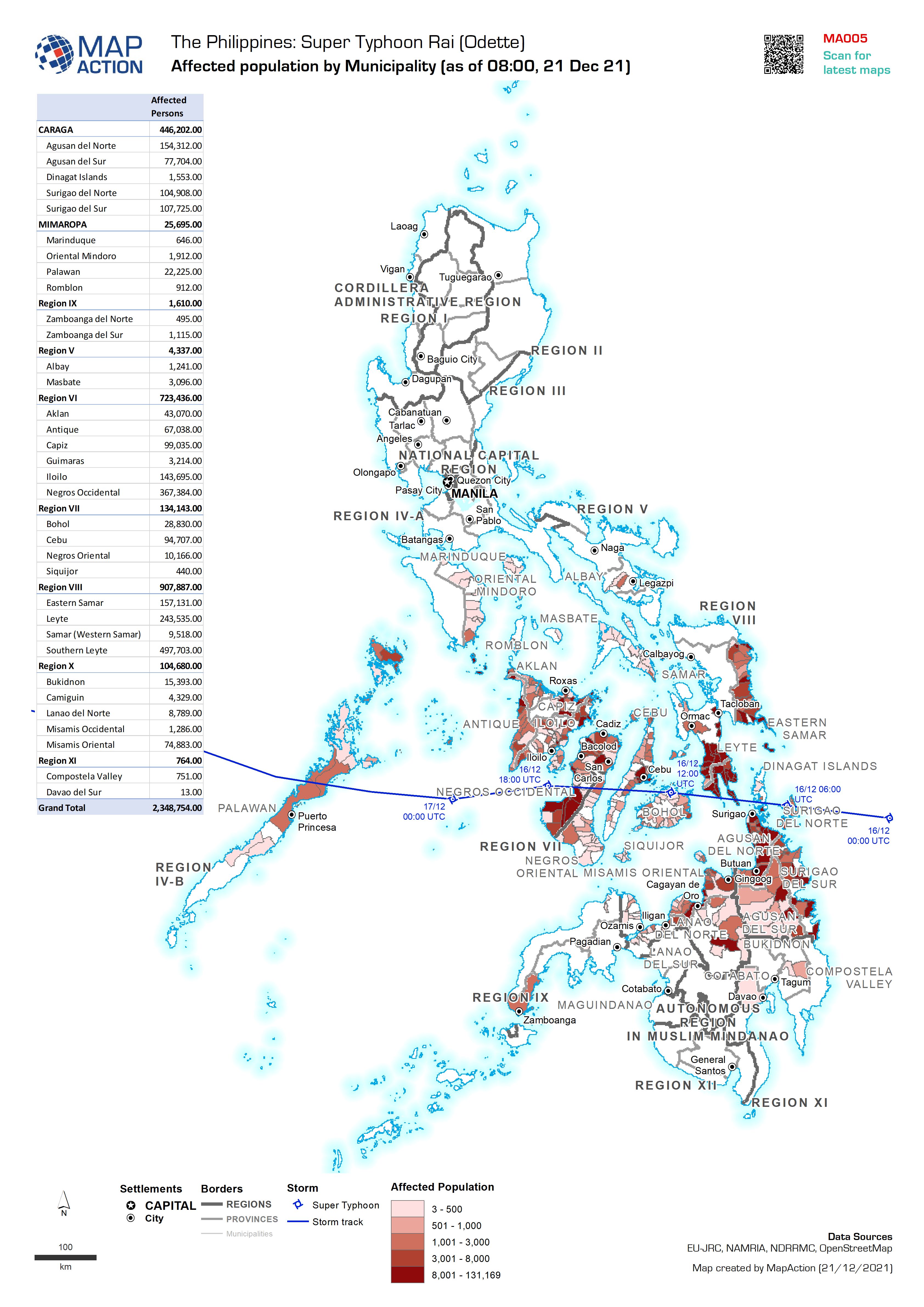
Affected population by Municipality (as of 08:00, 21 Dec 21)
Map shows the affected population per Municipality (admin 3). -
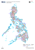
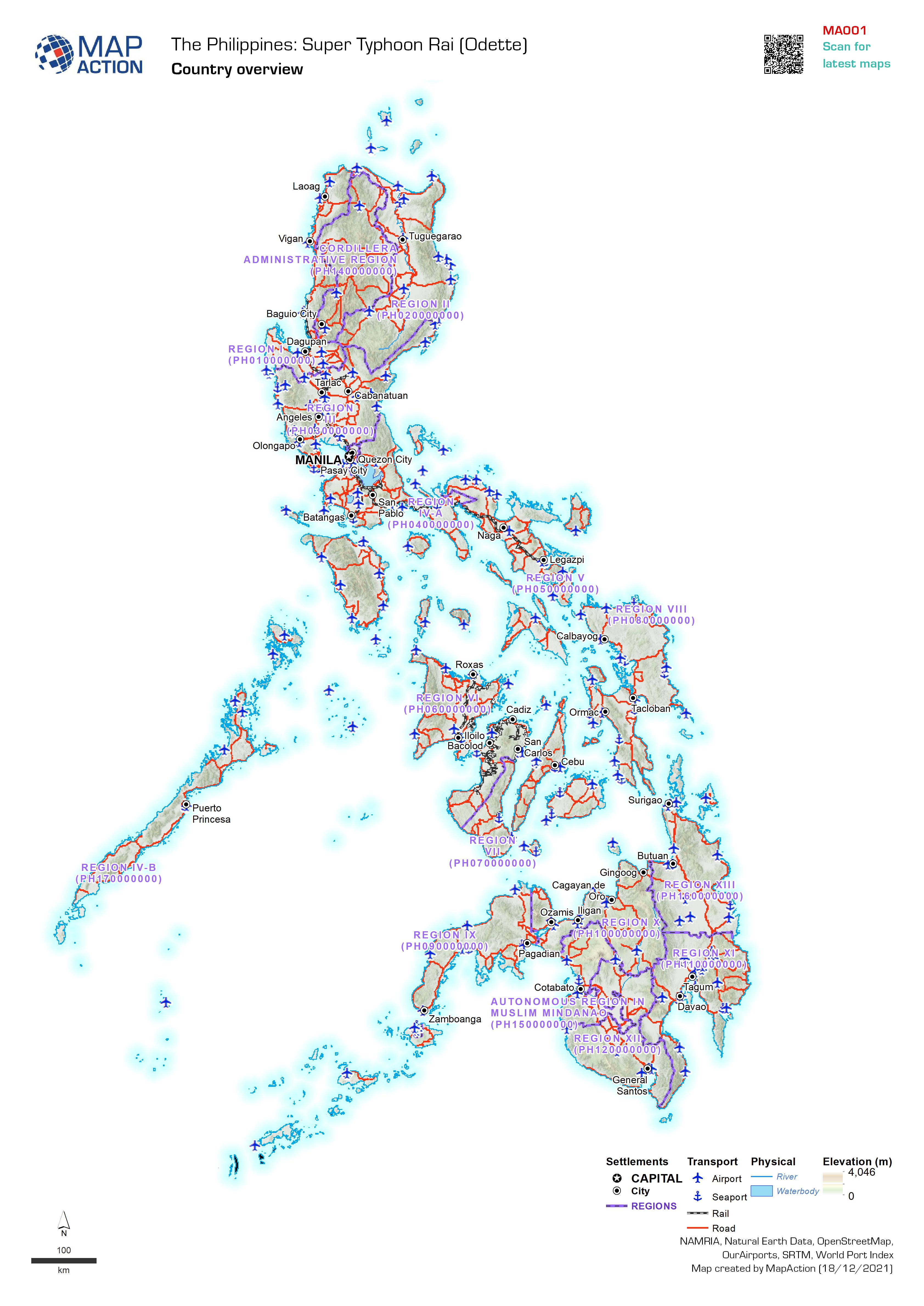
Country overview of the Philippines
Map provides an simple overview and orientation of the Philippines for use in reports and general briefings. -

Path of Typhoon Rai (Odette) - as of 17 Dec 21
Map shows the path of the Super Typhoon Rai (Odette) and estimated wind speeds. The cone of uncertainty shows where the storm could go.