-

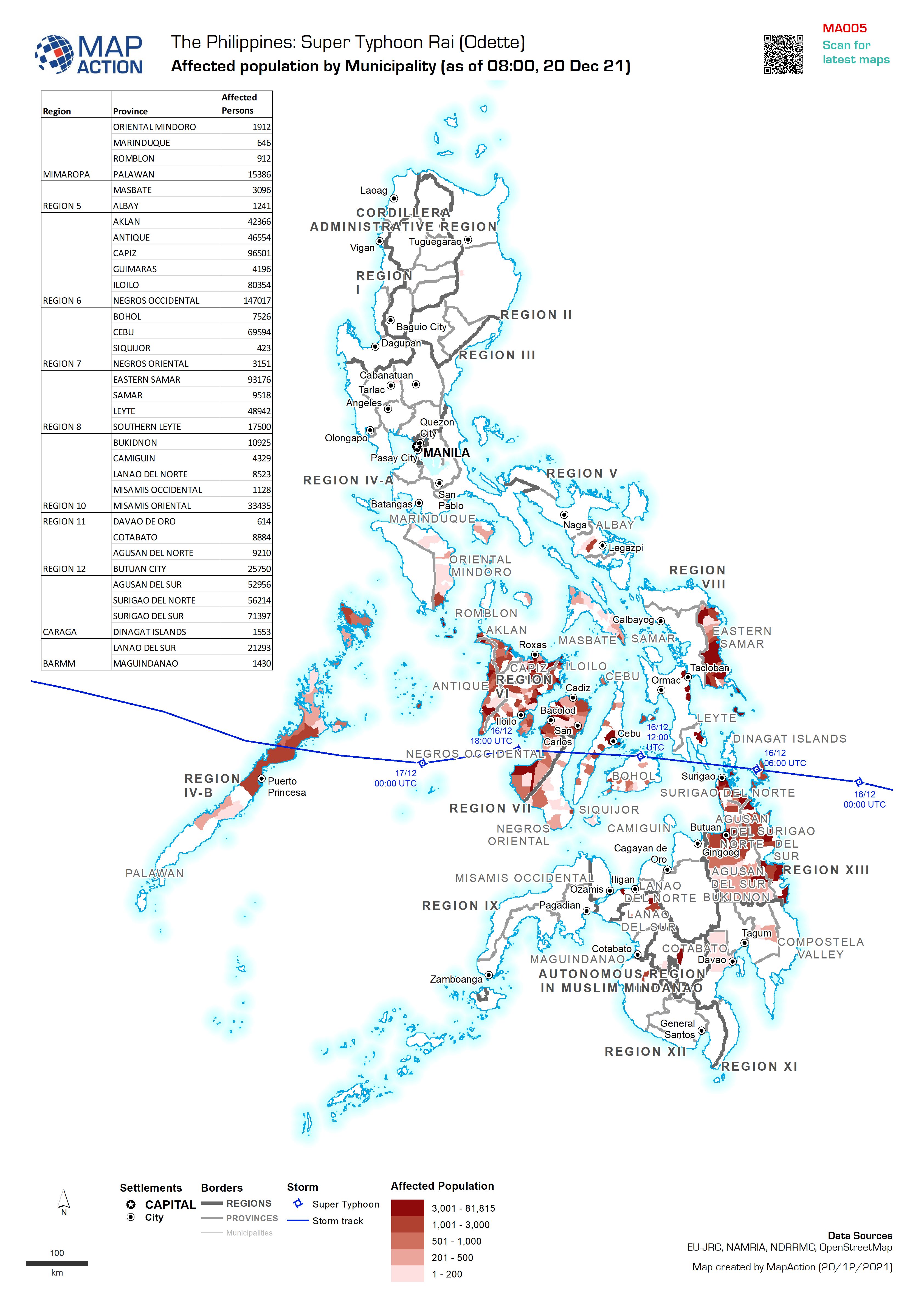
Affected population by Municipality (as of 08:00, 20 Dec 21)
Map shows the affected population per Municipality (admin 3). -

Ethiopia: Location of locusts (1 Jan - 16 Jul 2020) with most likely food sec...
High levels of acute food insecurity persist across much of central and eastern Ethiopia due to compounding effects of COVID-19 related restrictions, continued drought recovery,... -

Areas of Control and Conflict Induced Displacement
Areas of influence and arrivals of conflict-displaced Afghans by province in 2021 -

Aid item distribution in the WASH sector (as of 22 Sept 2021)
Map showing aid items distribution in the WASH sector and total population counts for communes in Grand'Anse, Nippes and Sud. -
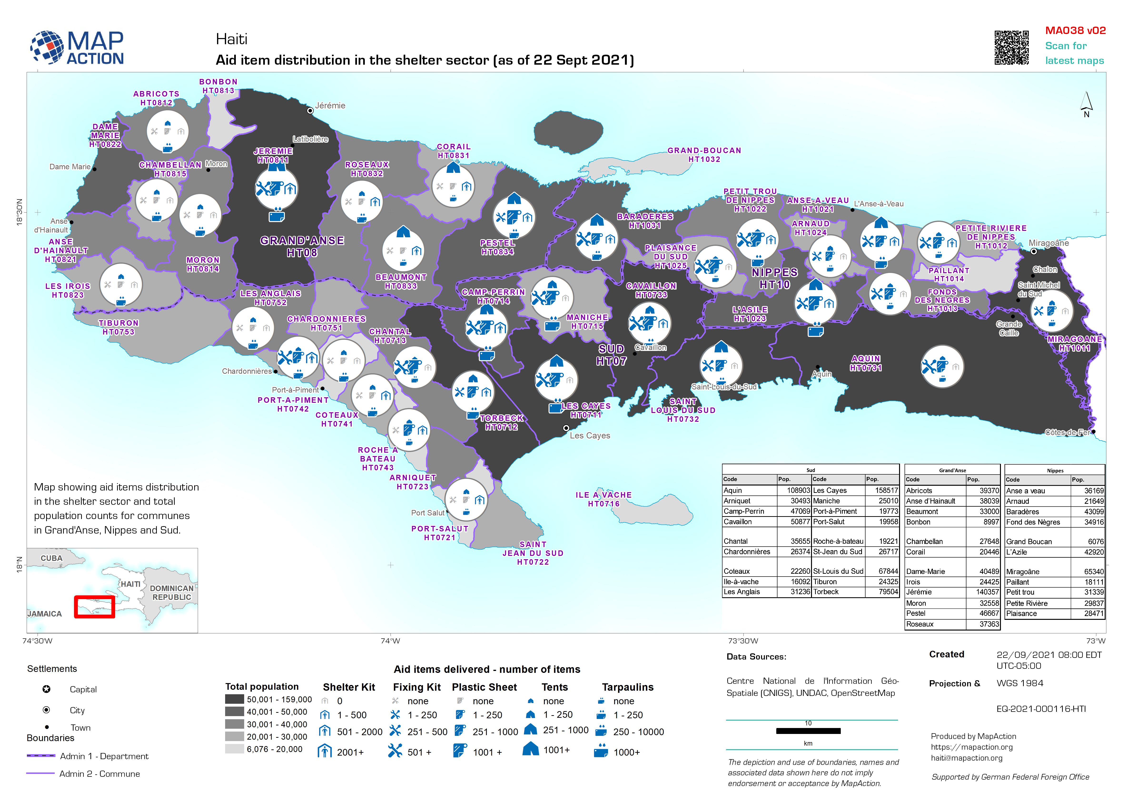
Aid item distribution in the shelter sector (as of 22 Sept 2021)
Map showing aid items distribution in the shelter sector and total population counts for communes in Grand'Anse, Nippes and Sud. -

Aid item distribution in the food sector (as of 21 Sept 2021)
Map showing aid items distribution in the food sector and total population counts for communes in Grand'Anse, Nippes and Sud. -
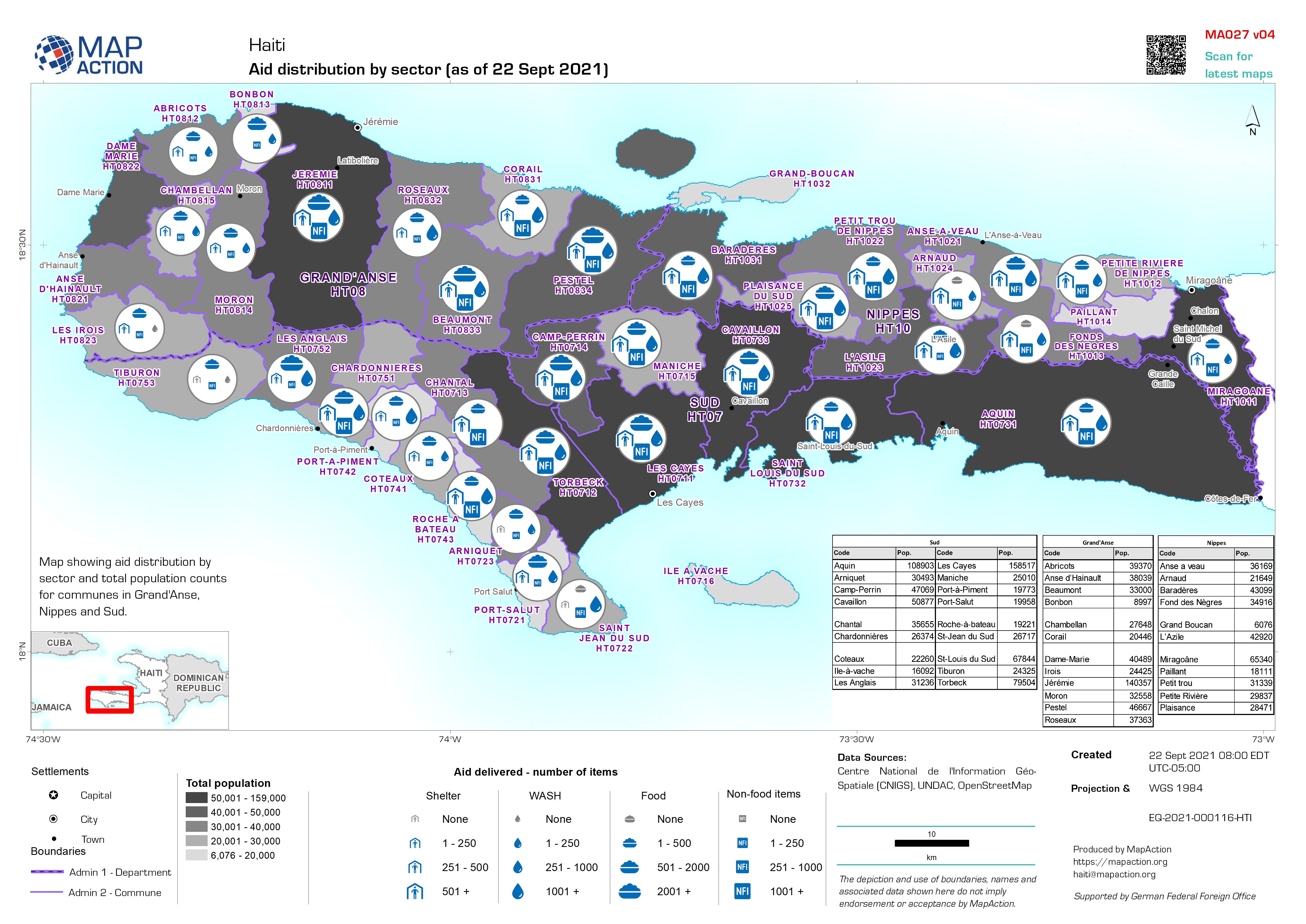
Aid distribution by sector (as of 22 Sept 2021)
Map showing aid distribution by sector and total population counts for communes in Grand'Anse, Nippes and Sud. -

Summary of damage and aid distributed per Commune in Sud, Grand'Anse, and Nip...
One map for each of three Departements: Sud, Grand'Anse, and Nippe. Each map shows the damage status of health facilities, the number of schools damaged, and results of a WASH... -

Département: Summary of damage per Commune, and aid distributed.
Département: Map shows damage status of health facilities, number of schools damaged and results of WASH evaluation survey points. The call out labels summarise the status of... -

Département: Summary of damage per commune, and aid distributed.
Département: Map shows damage status of health facilities, number of schools destroyed, and results of WASH evaluation survey points. The call-out labels summarise the status... -
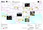
Map of EU activities in Sud
This map gives the location, images and type of EU Civil Defence Modules deploy in Haiti. -
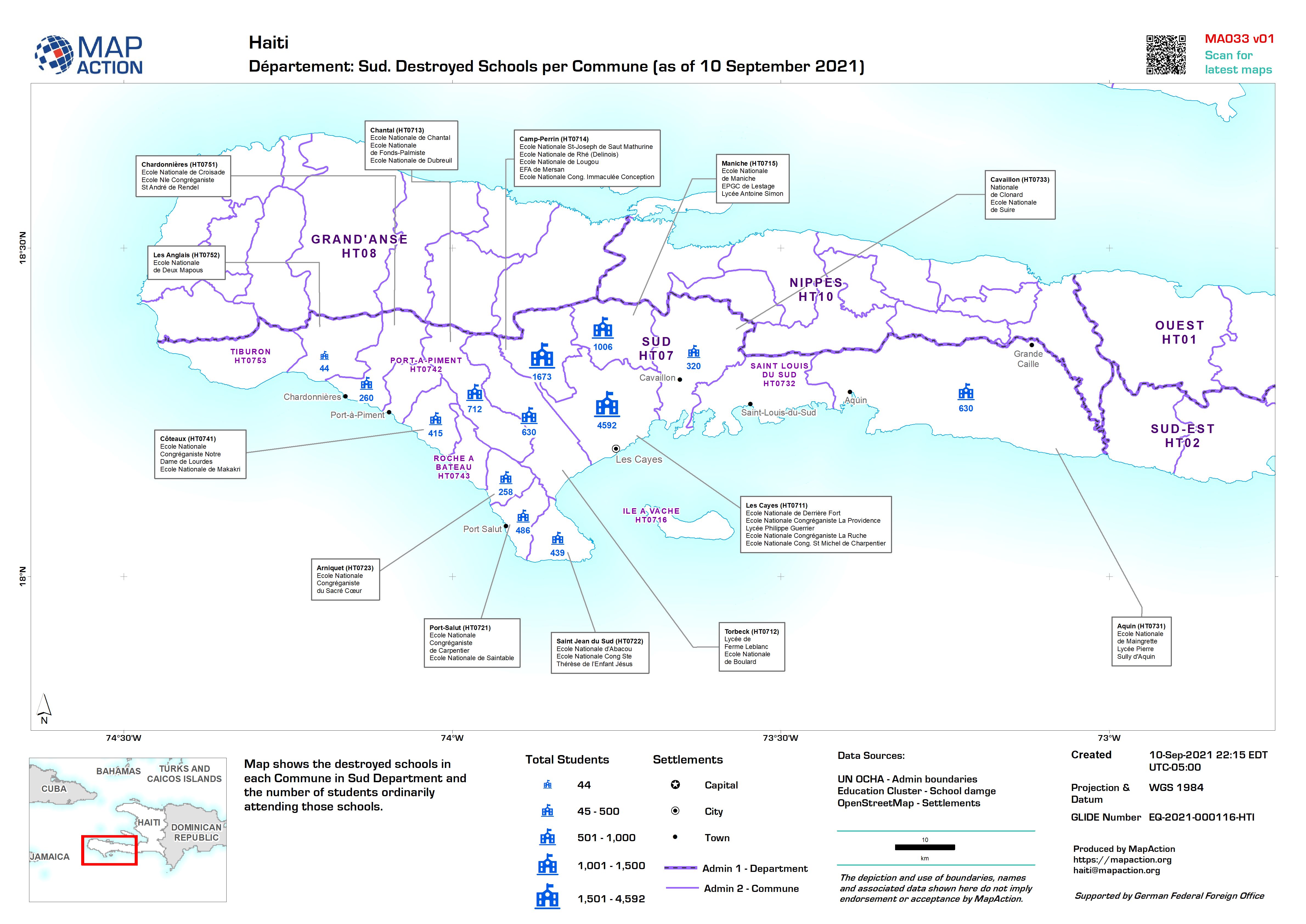
Département: Sud. Destroyed Schools per Commune (as of 10 September 2021)
Map shows the destroyed schools in each Commune in Sud Department and the number of students ordinarily attending those schools. -

Département: Damage to health facilities and water supply, with summary of ai...
Département: Map shows damage status of health facilities and results of WASH evaluation survey points. The call-out labels summarise the status of these for each Commune... -
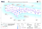
Number of persons with disabilities per Commune
Map shows the total number of persons with disabilities per Commune and, where available, disaggregated by age and gender. -
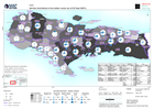
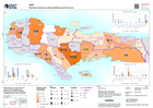
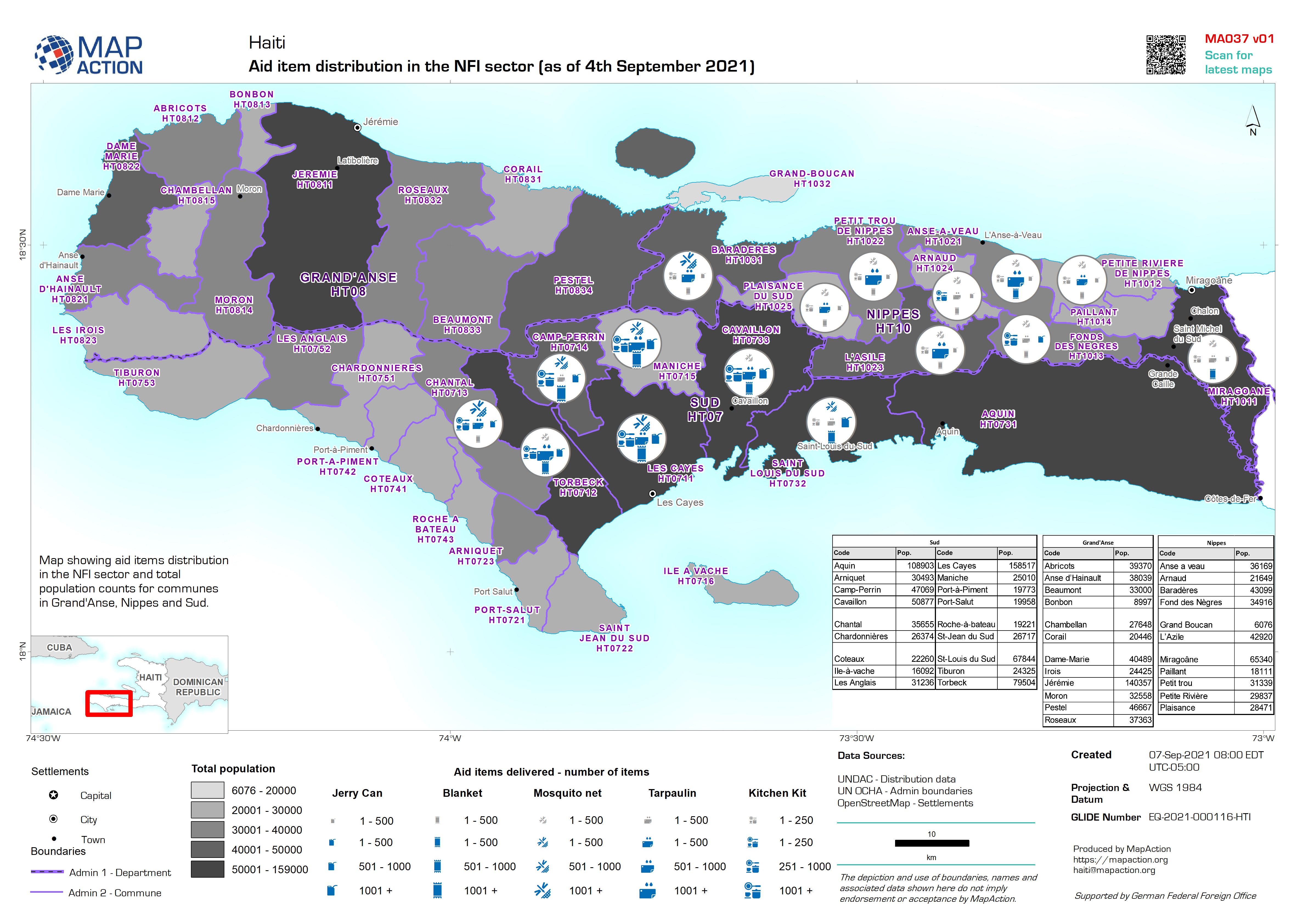
Aid item distribution in the NFI sector (as of 4th September 2021)
Map showing aid items distribution in the NFI sector and total population counts for communes in Grand'Anse, Nippes and Sud. -

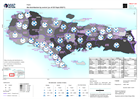
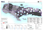
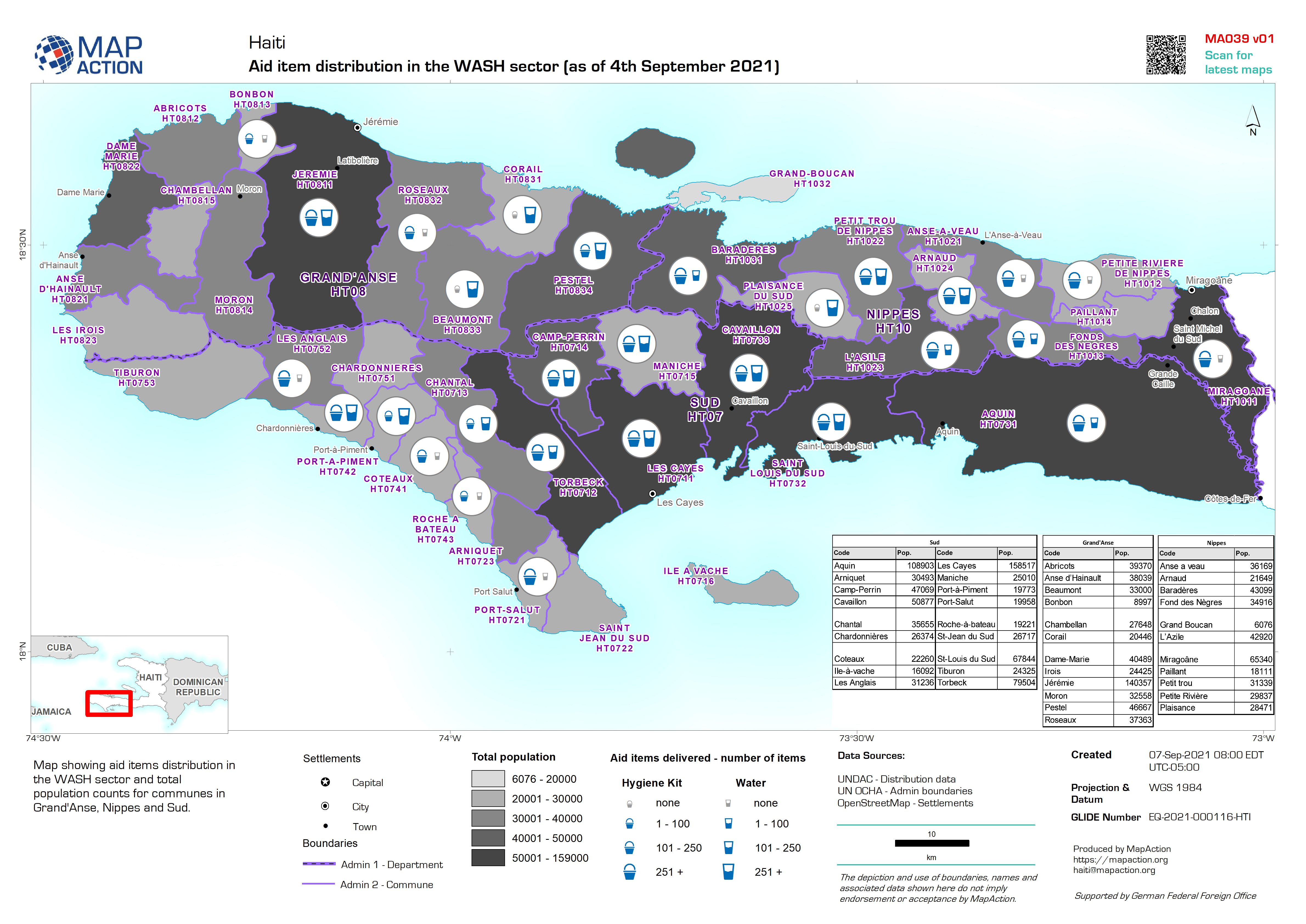
Aid item distribution in the WASH sector (as of 4th September 2021)
Map showing aid items distribution in the WASH sector and total population counts for communes in Grand'Anse, Nippes and Sud. -
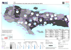
Aid item distribution in the shelter sector (as of 4th September 2021)
Map showing aid items distribution in the shelter sector and total population counts for communes in Grand'Anse, Nippes and Sud. -
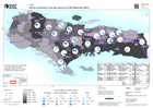
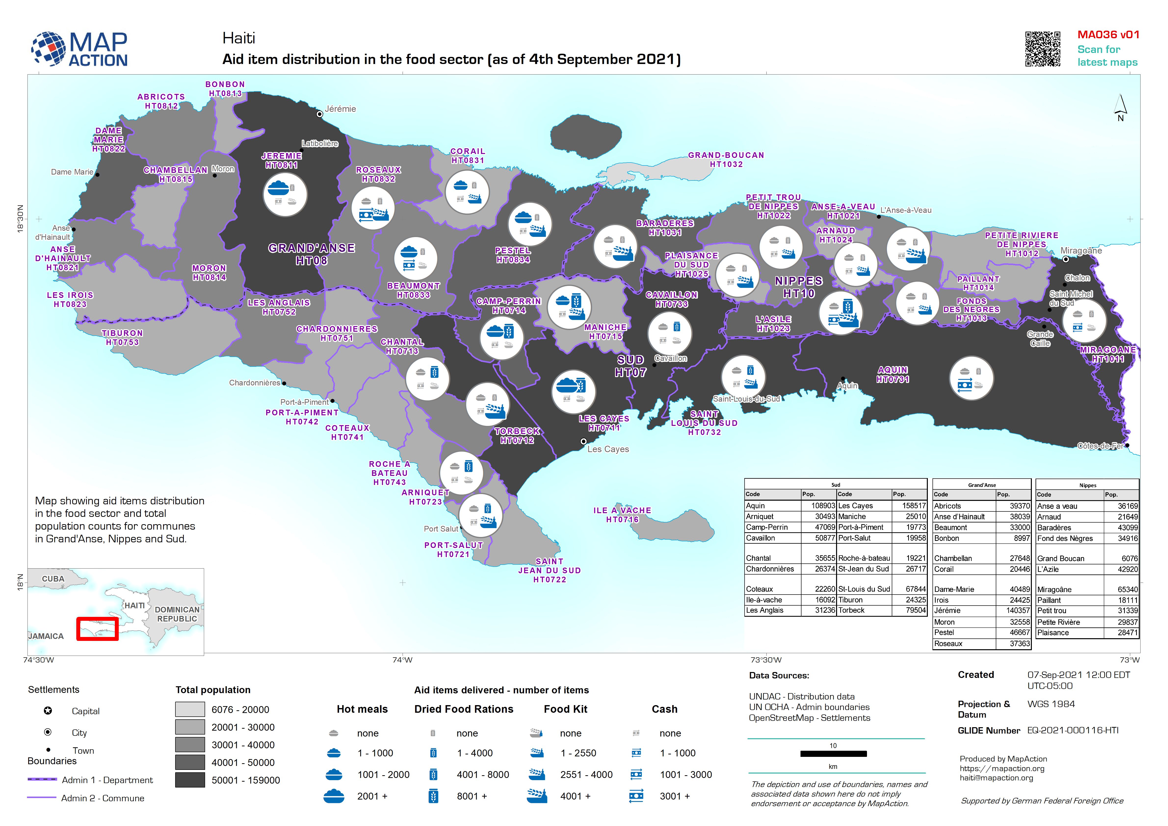
Aid item distribution in the food sector (as of 4th September 2021)
Map showing aid items distribution in the food sector and total population counts for communes in Grand'Anse, Nippes and Sud. -

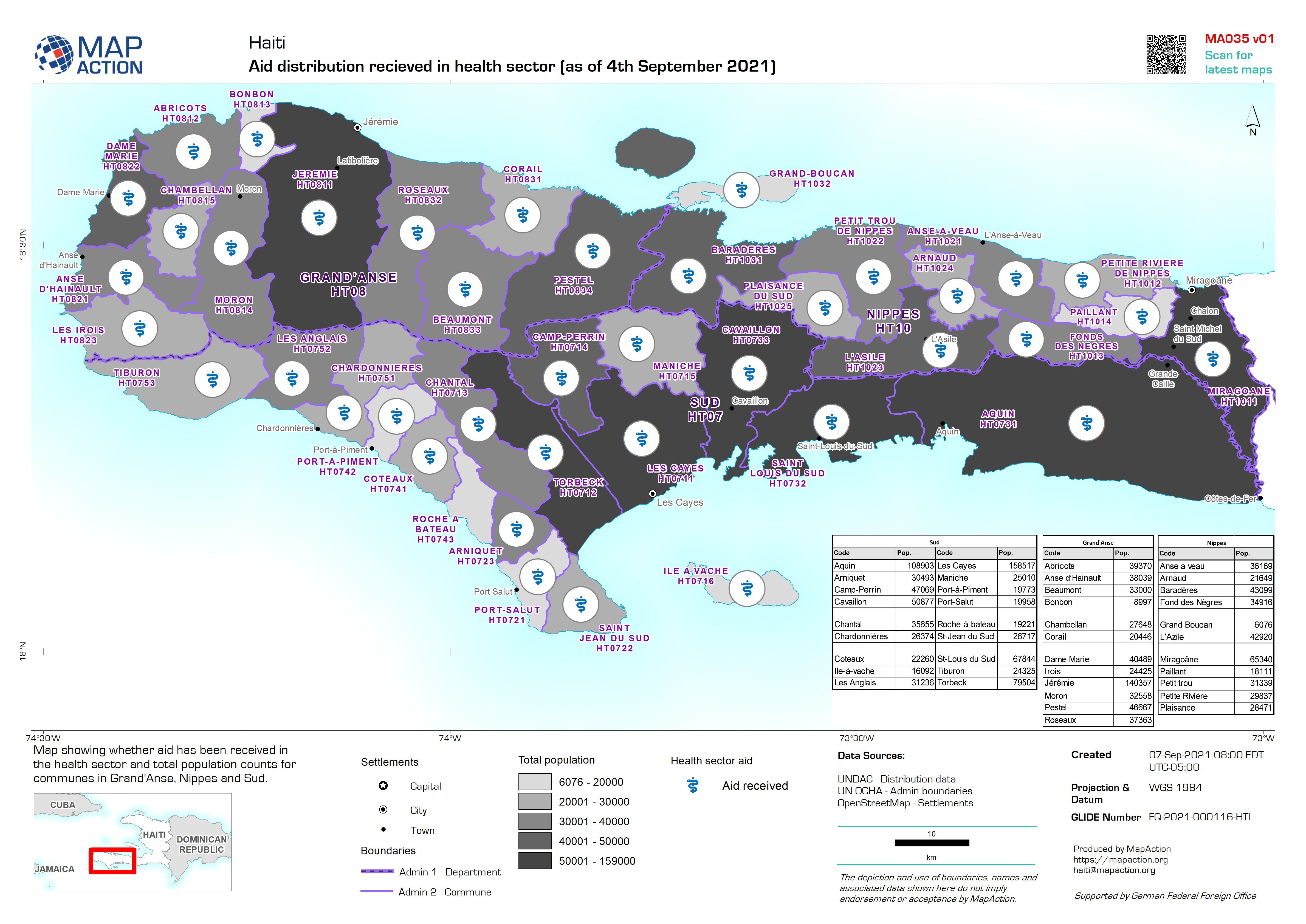
Aid distribution recieved in health sector (as of 4th September 2021)
Map showing whether aid has been received in the health sector and total population counts for communes in Grand'Anse, Nippes and Sud. -

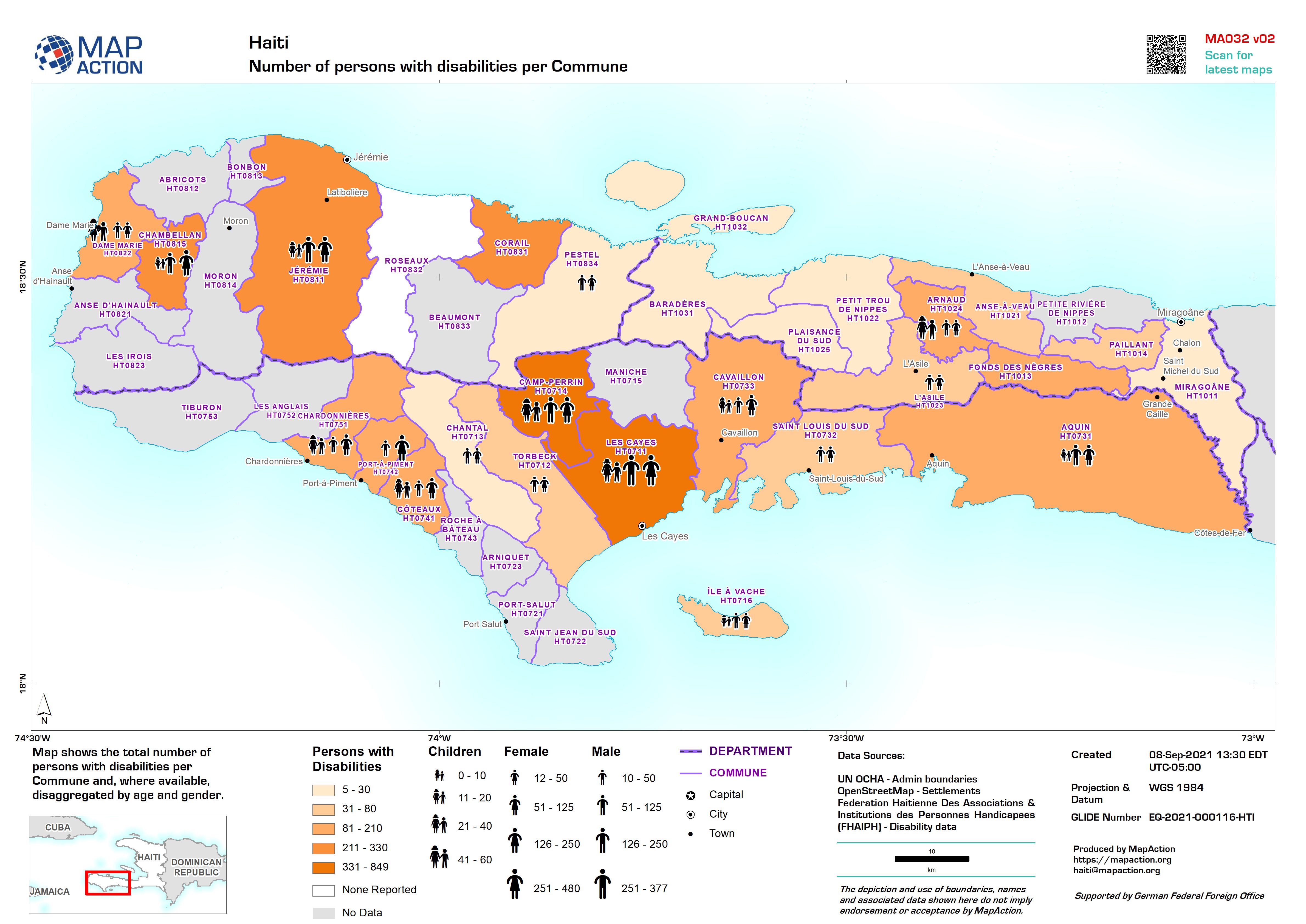
Number of persons with disabilities per Commune
Map shows the total number of persons with disabilities per Commune and, where available, disaggregated by age and gender.