-

Emergency Shelters for the 2024 Hurricane Season: Parish
Map shows the locations of emergency shelters identified by NaDMA Grenada for the 2024 hurricane season -
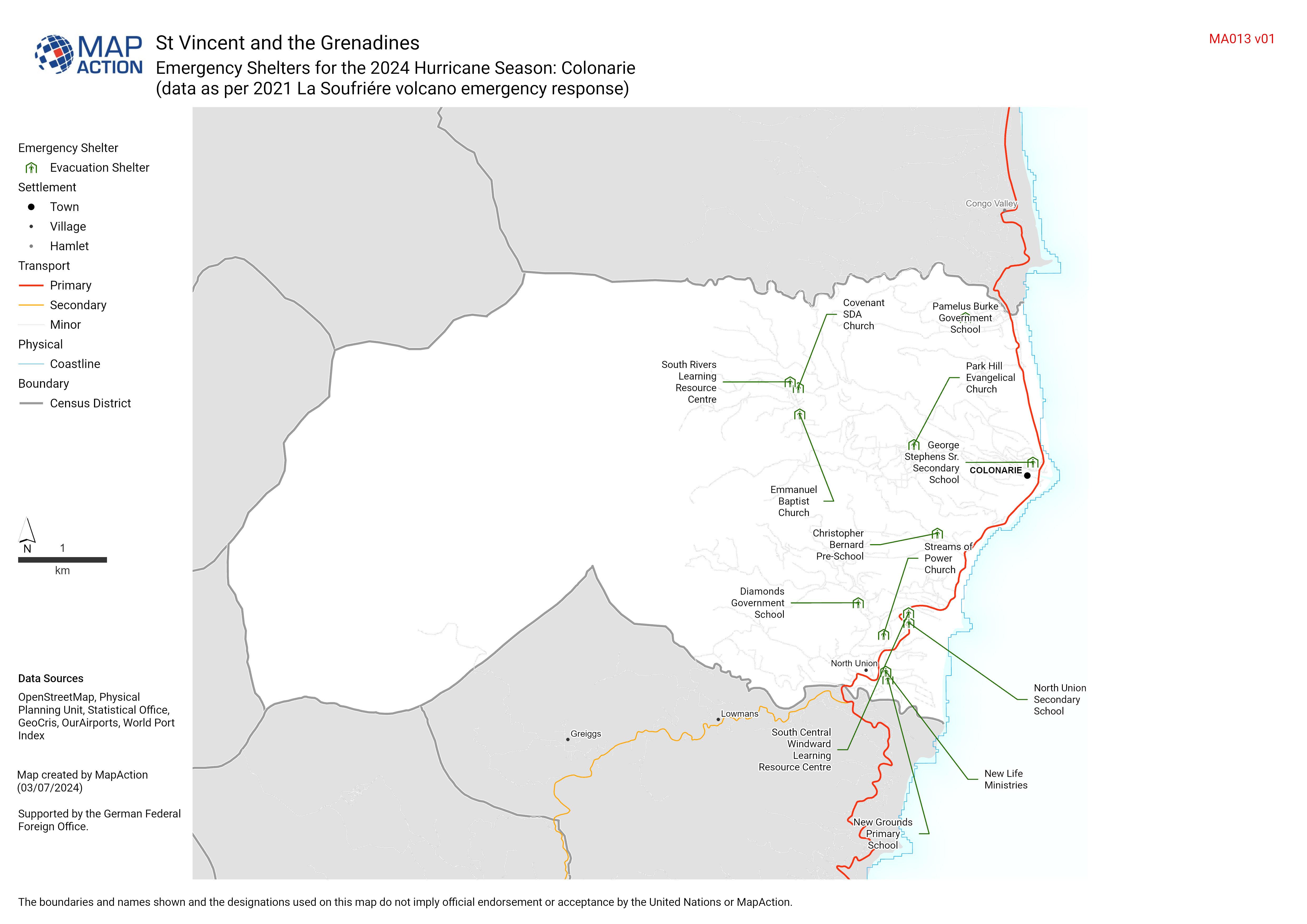
Emergency Shelters for the 2024 Hurricane Season: Census District (data as pe...
Add summary text here (update via layout tool). Even when not displayed on the map it is added to metadata -
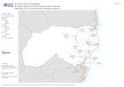
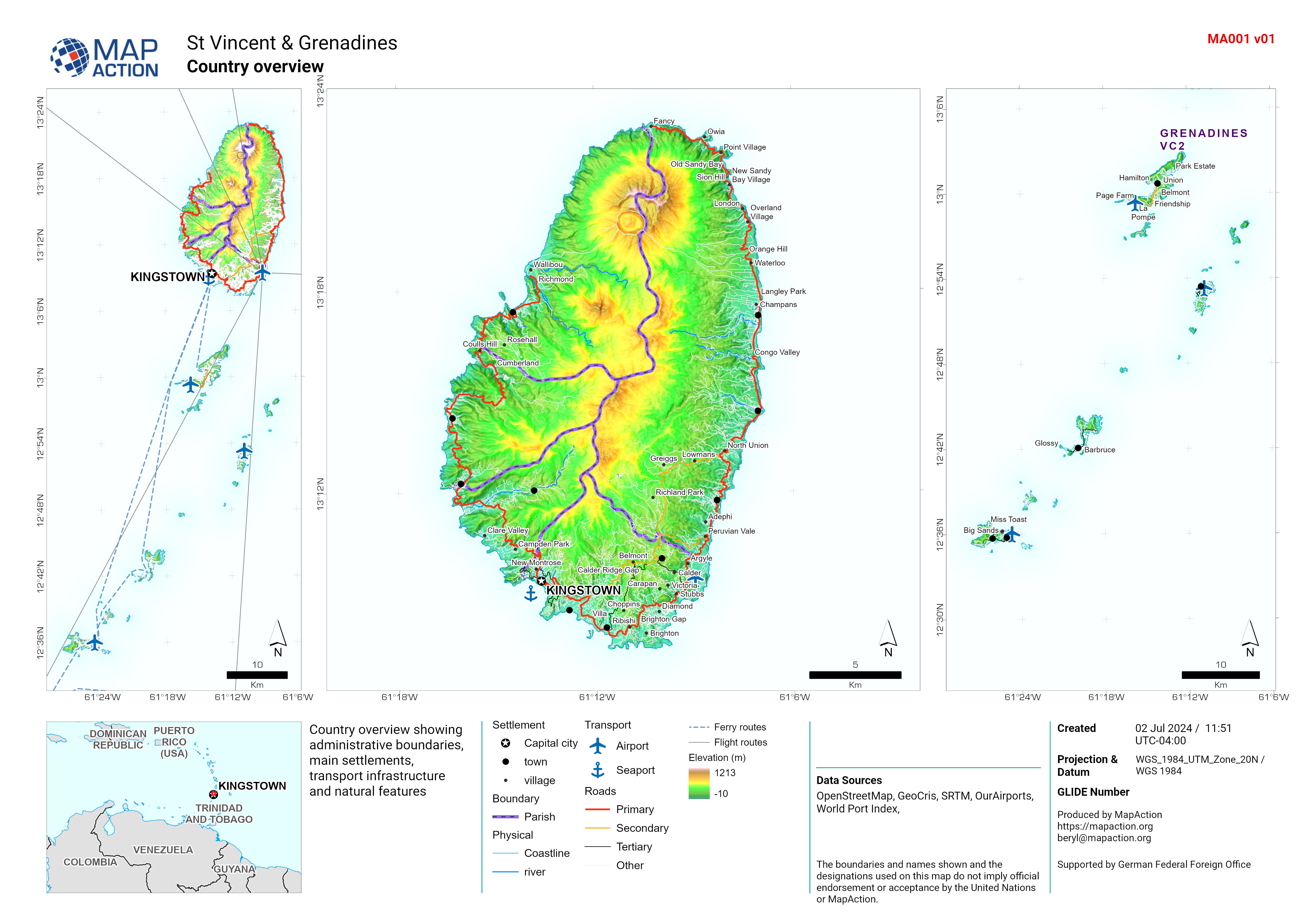
Country overview
Country overview showing administrative boundaries, main settlements, transport infrastructure and natural features -
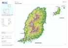
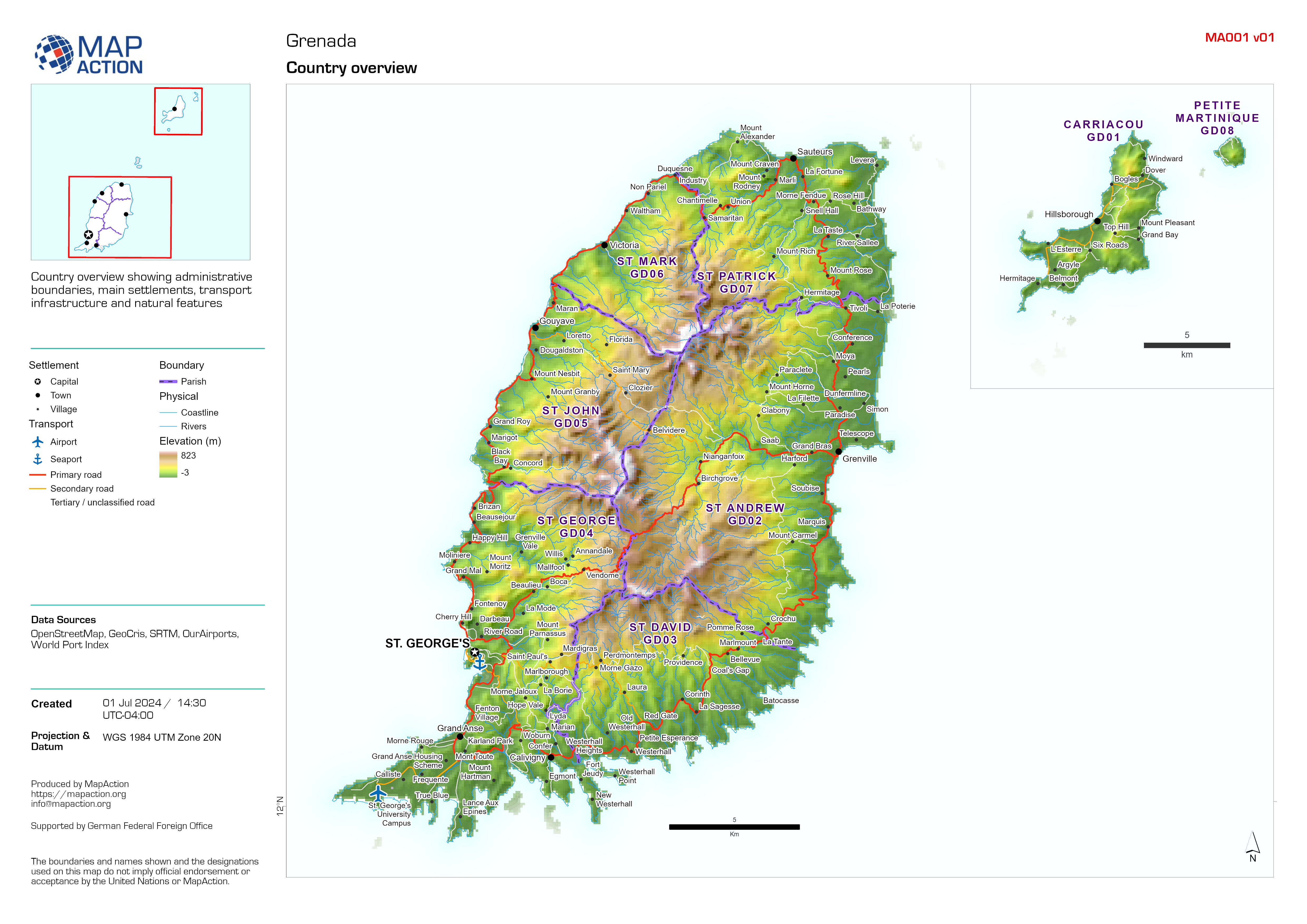
Country overview
Country overview showing administrative boundaries, main settlements, transport infrastructure and natural features -

Buildings and Extent of Wildfires within NEMO Area of Focus:
A map showing building footprints and the extent of wildfires derived by the Copernicus Emergency Mapping Service (EMS) and from Sentinel-2 satellite images. Populated areas and... -

Shelter locations by district
Shelter locations are displayed, categorised by ability to withstand wind speeds (due to Hurricane planning). Tables show shelter name and capacity. -

Extent of Wild Fires from the Copernicus EMSR726 Activation:
A map showing the extent of wildfires derived by the Copernicus Emergency Mapping Service (EMS). Affected areas shown in context of populated areas and main road network on... -

NEMO Area of Focus:
A map showing the indicative extent of wildfires from aerial imagery within areas of interest (AOI) in the context of populated areas and main road network on district (admin 1)... -

Protected Areas and Extent of Wildfires within NEMO Area of Focus:
A map showing protected areas and the extent of wildfires derived by the Copernicus Emergency Mapping Service (EMS) and from Sentinel-2 satellite images. Populated areas and... -

Protected Areas and Extent of Wildfires:
A map showing protected areas and the extent of wildfires derived by the Copernicus Emergency Mapping Service (EMS) and Sentinel-2 satellite images. Populated areas and main... -

Indicative Areas Affected by Wildfires in Cayo and Toledo districts
A map showing the indicative extent of wildfires from aerial imagery in the context of populated areas and main road network on district (admin 1) level -

Settlements
A map showing the location of settlements of different type along with major roads and rivers. "Other" refers to persons living along areas that cannot be classified as any... -

Atlas of settlements within each district of Belize
A map showing the location of settlements of different type along with major roads and rivers. "Other" refers to persons living along areas that cannot be classified as any... -

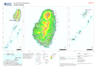
Rainfall-Triggered Landslide Hazard within Mountain Pine Ridge
The Global Rainfall-Triggered Landslide Hazard Map presents a quantitative representation of landslide hazard. This component is the mean annual rainfall-triggered landslide... -

Rainfall-Triggered Landslide Hazard
The Global Rainfall-Triggered Landslide Hazard Map presents a quantitative representation of landslide hazard. This component is the mean annual rainfall-triggered landslide... -

Population per settlement for district:
Population per settlement based on 2010 census data (Note urban population is estimated to have increased by 16% between 2011 - 2024) -

Baseline population for 2020 disaggregated by sex and age, by District
District-level (adm1) population from WorldPop (2020) disaggregated by sex and age


