-
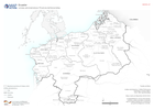
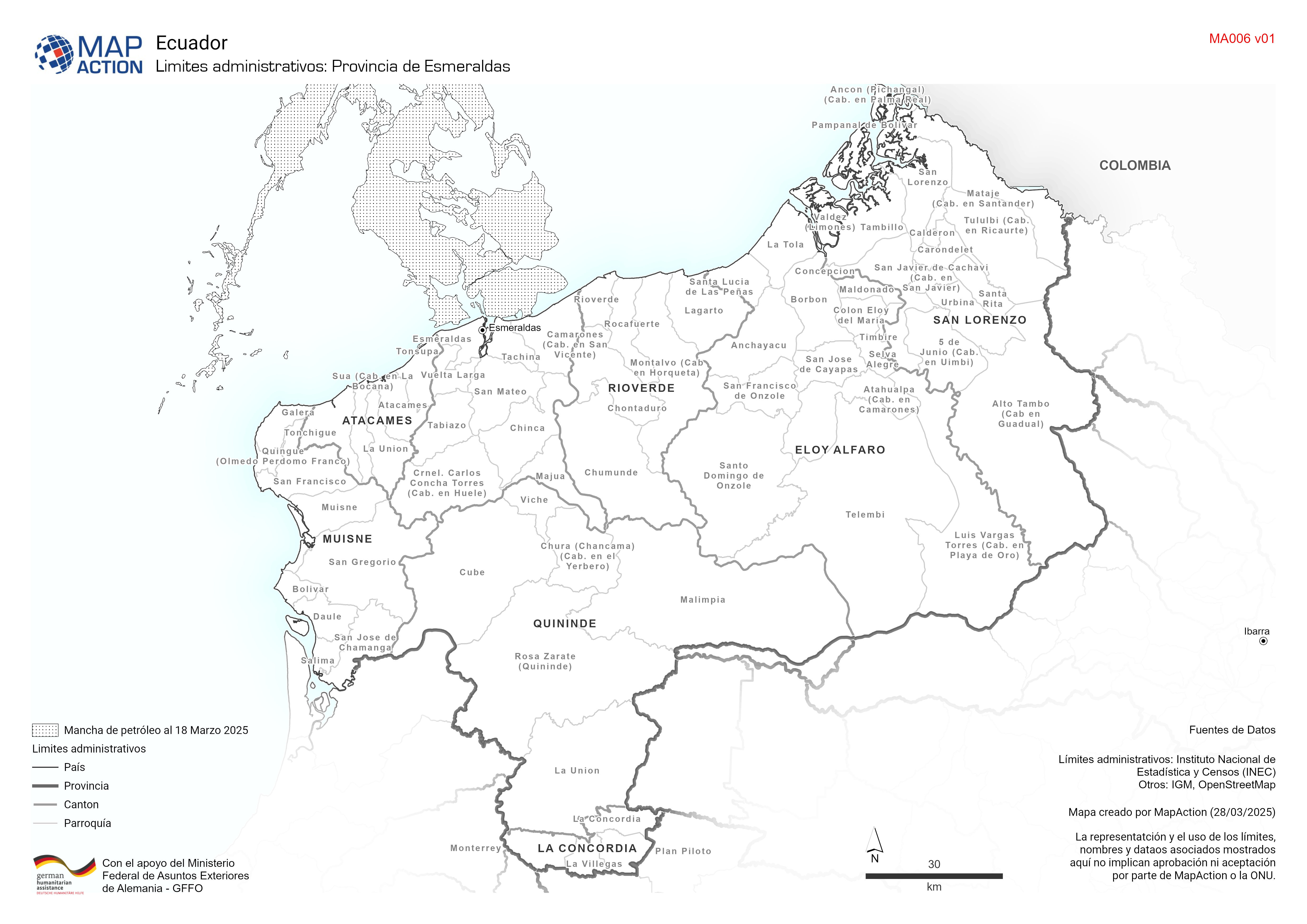
Limites administrativos: Provincia de Esmeraldas
Cantones y parroquías de la provincia de esmeraldas -

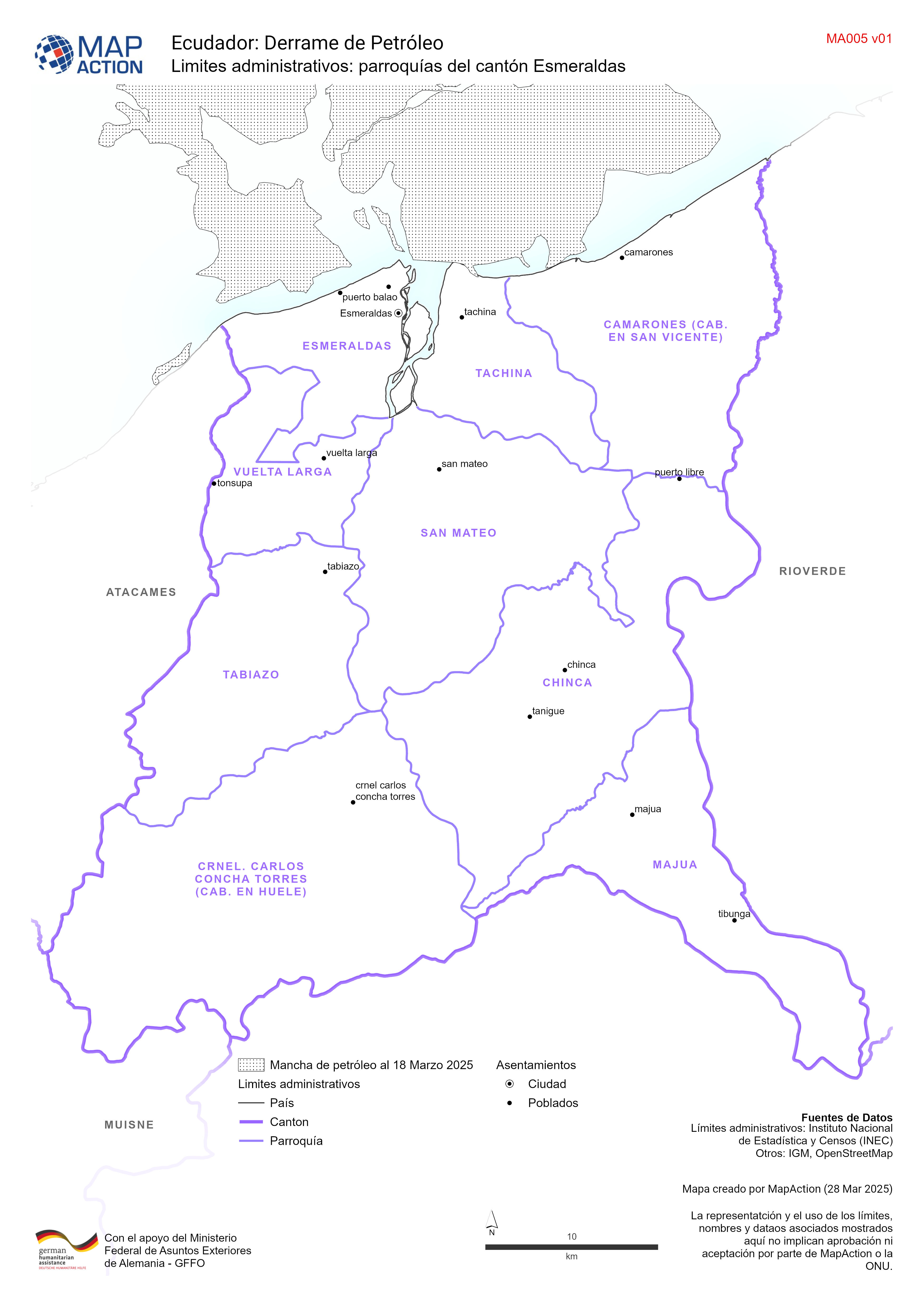
Limites administrativos: parroquías del cantón Esmeraldas
Parroquías del cantón de esmeraldas -

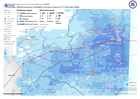
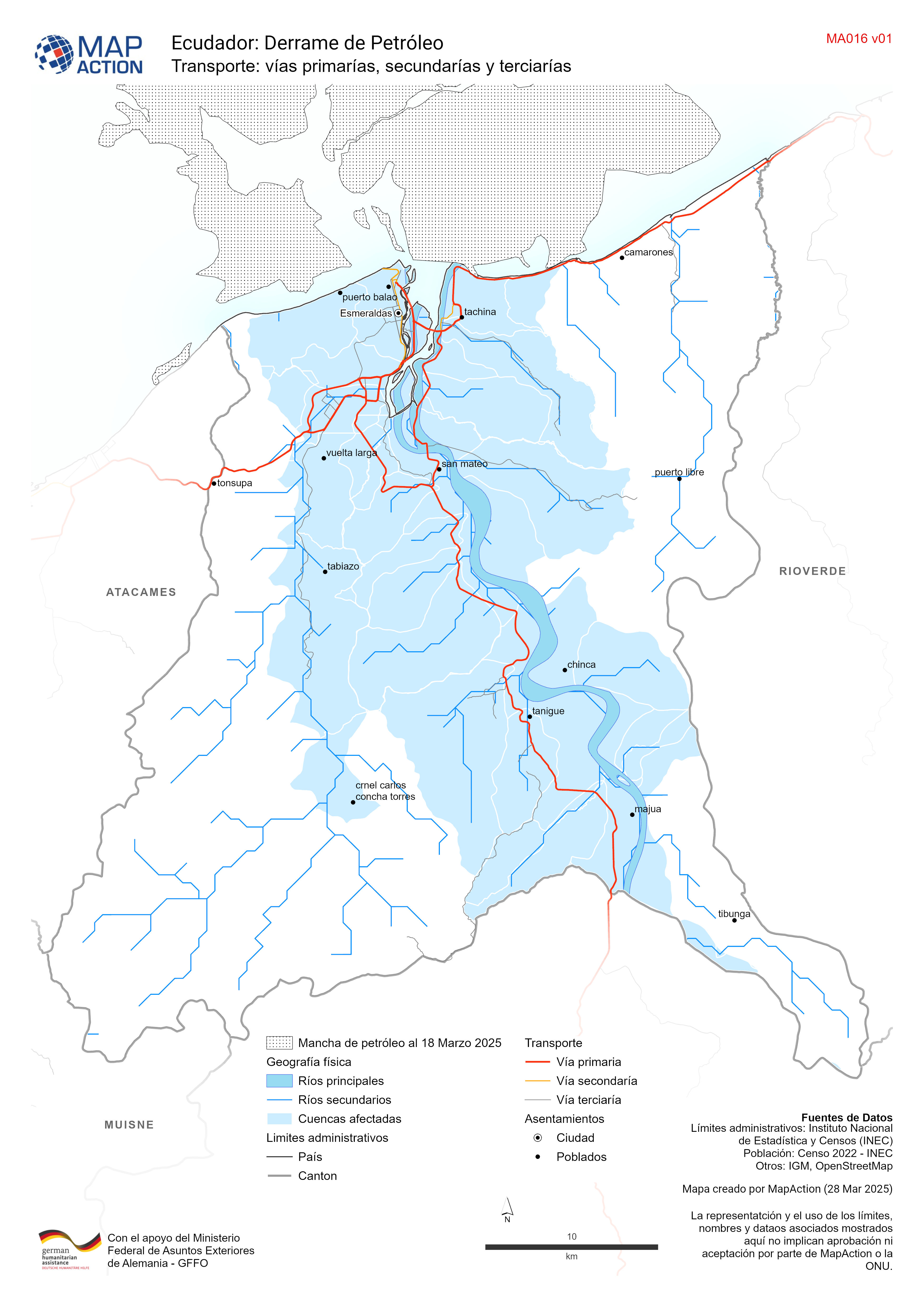
Transporte: vías primarías, secundarías y terciarías
Red de transporte del cantón de esmeraldas -

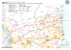
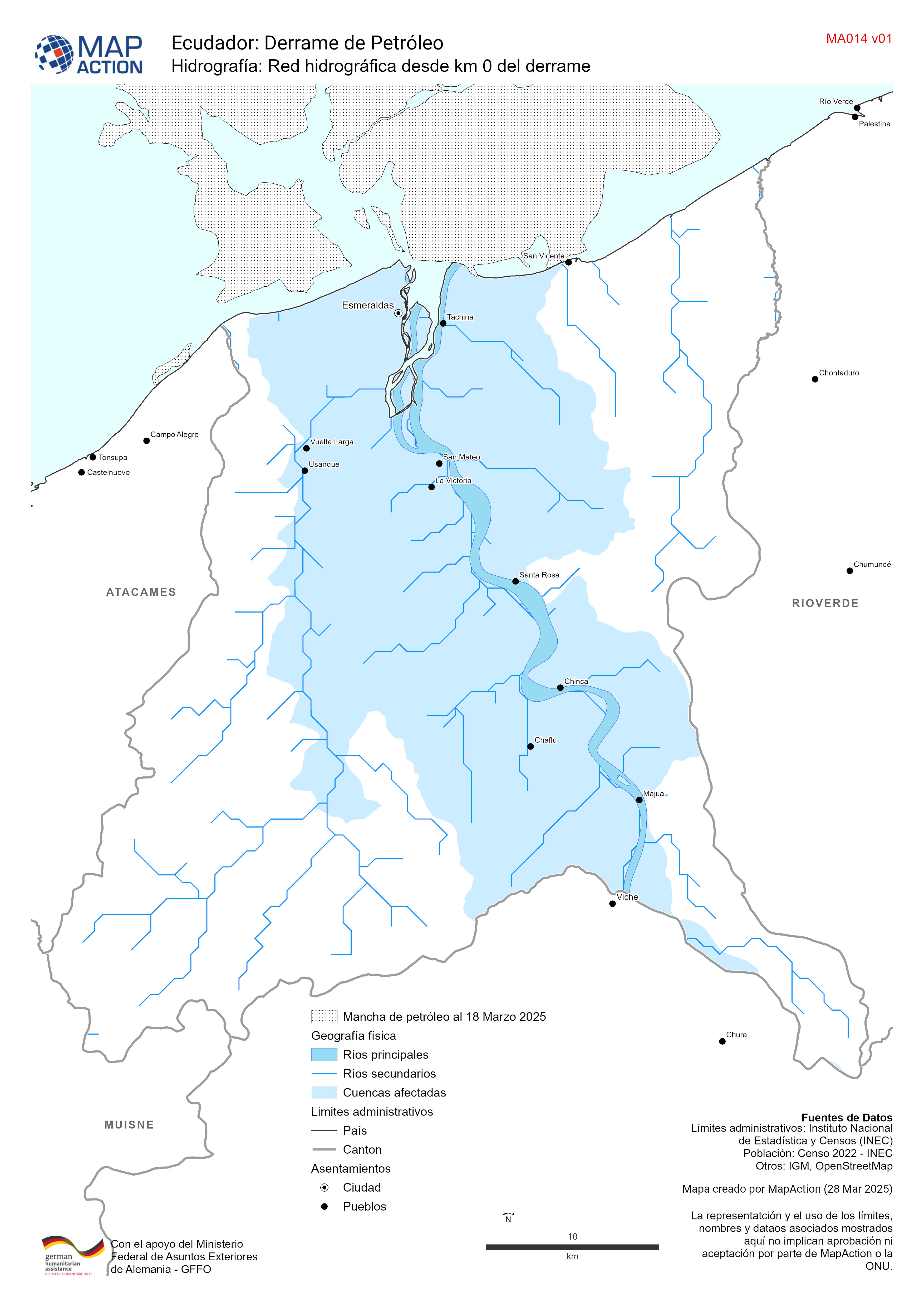
Hidrografía: Red hidrográfica desde km 0 del derrame
Red hidrográfica del cantón de esmeraldas -

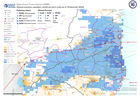
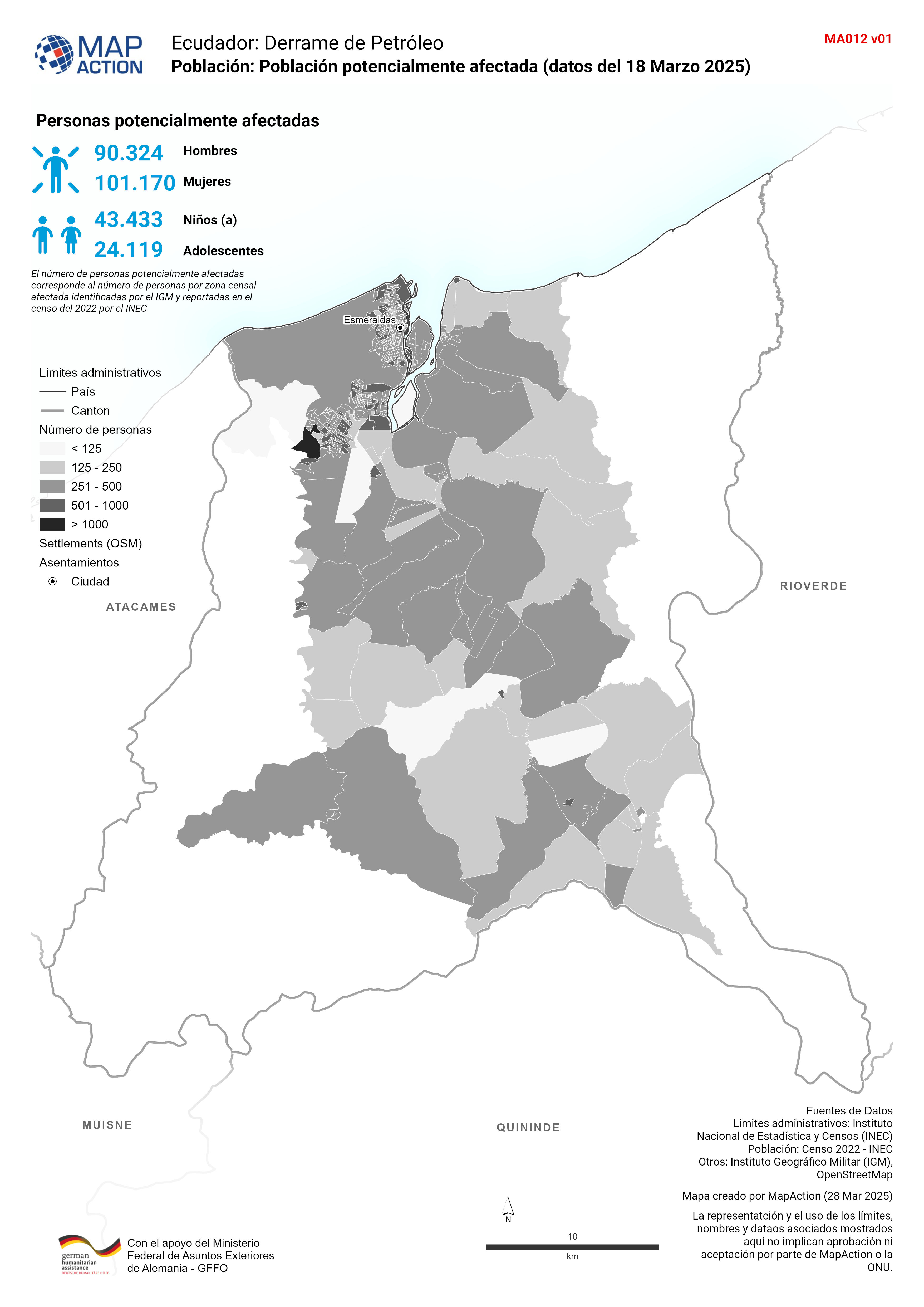
Población: Población potencialmente afectada (datos del 18 Marzo 2025)
Población total por zonas censales del 2022 para el cantón de Esmeraldas -

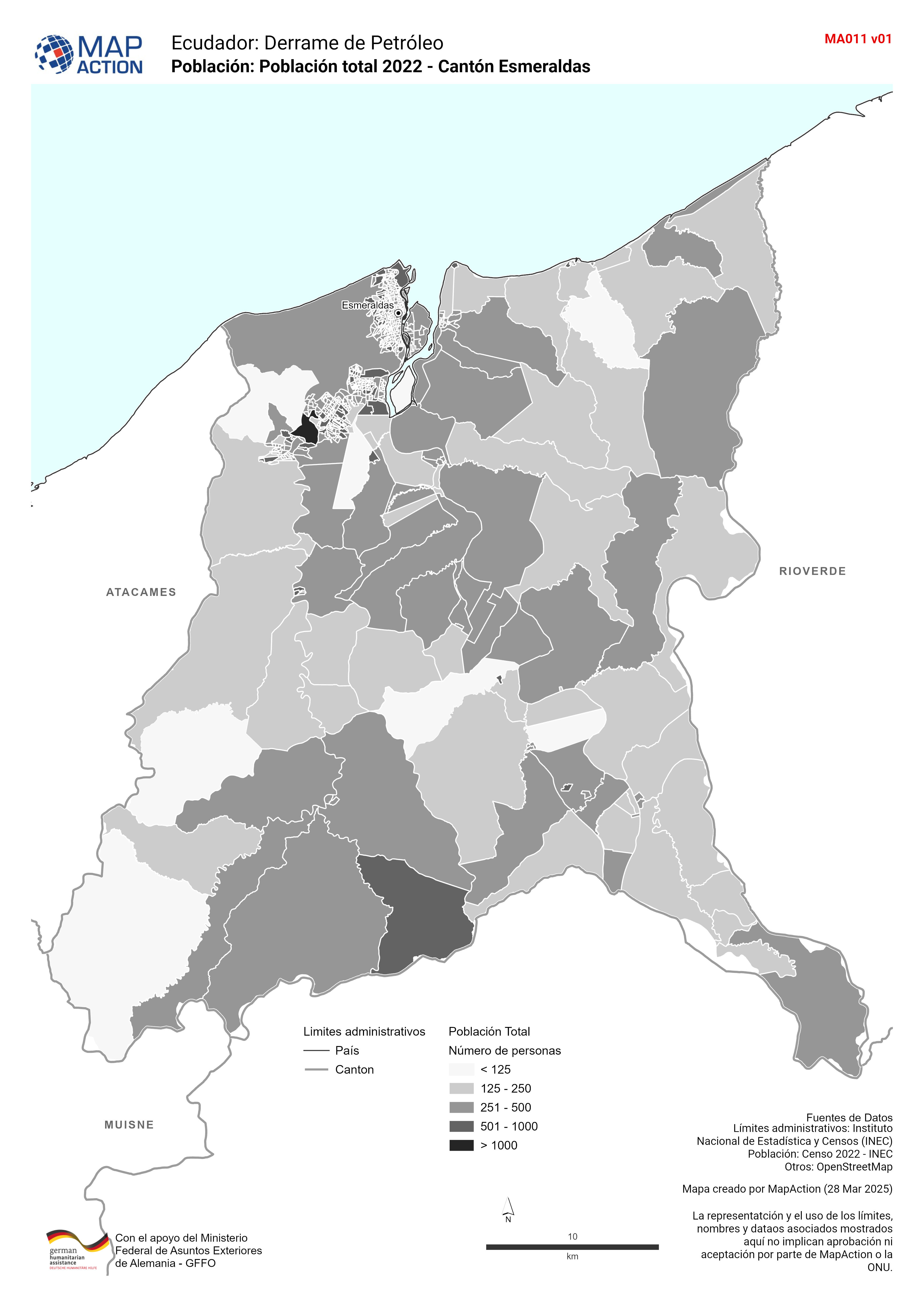
Población: Población total 2022 - Cantón Esmeraldas
Población total por zonas censales del 2022 para el cantón de Esmeraldas -

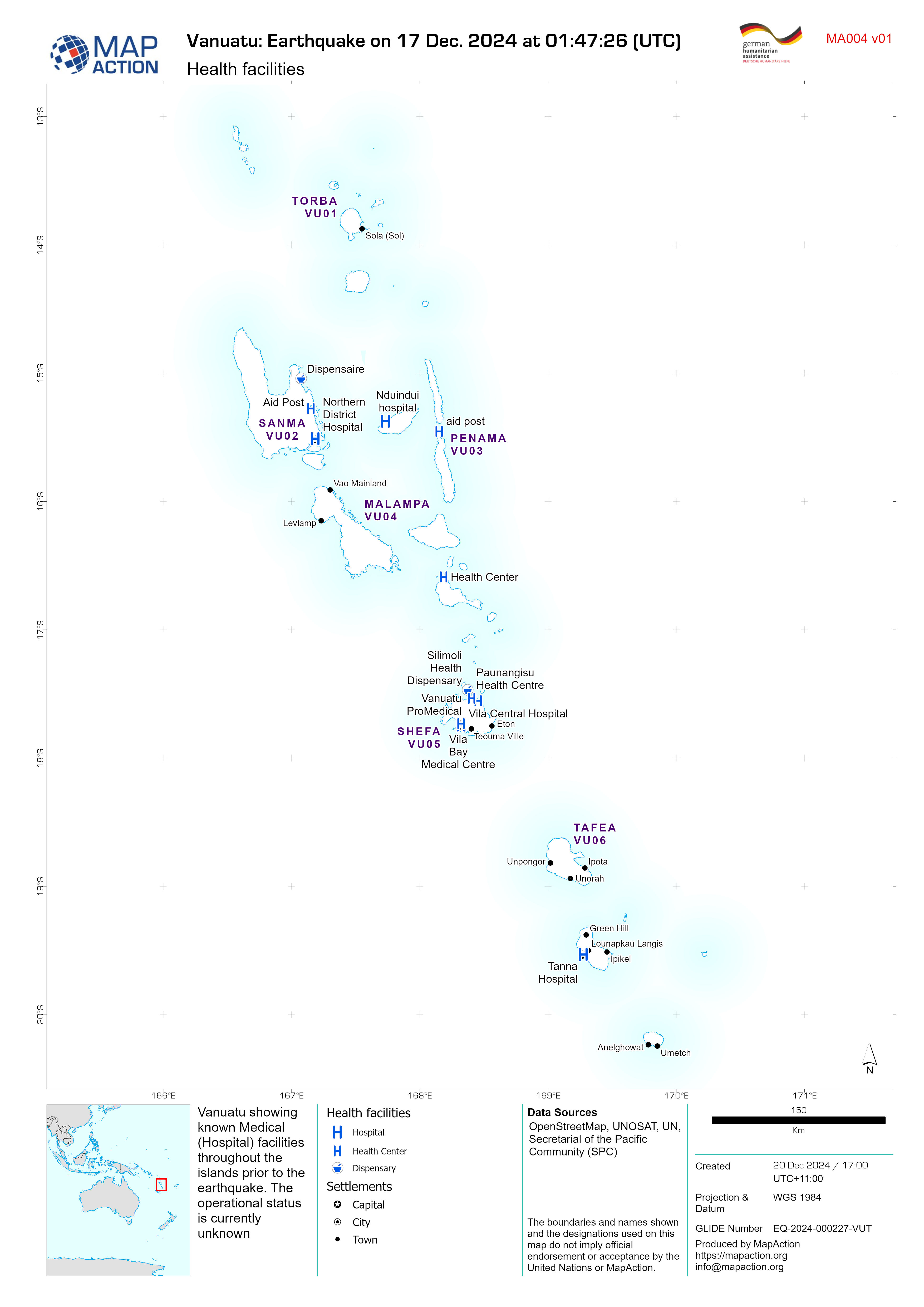
Health facilities
Vanuatu showing known Medical (Hospital) facilities throughout the islands prior to the earthquake. The operational status is currently unknown -

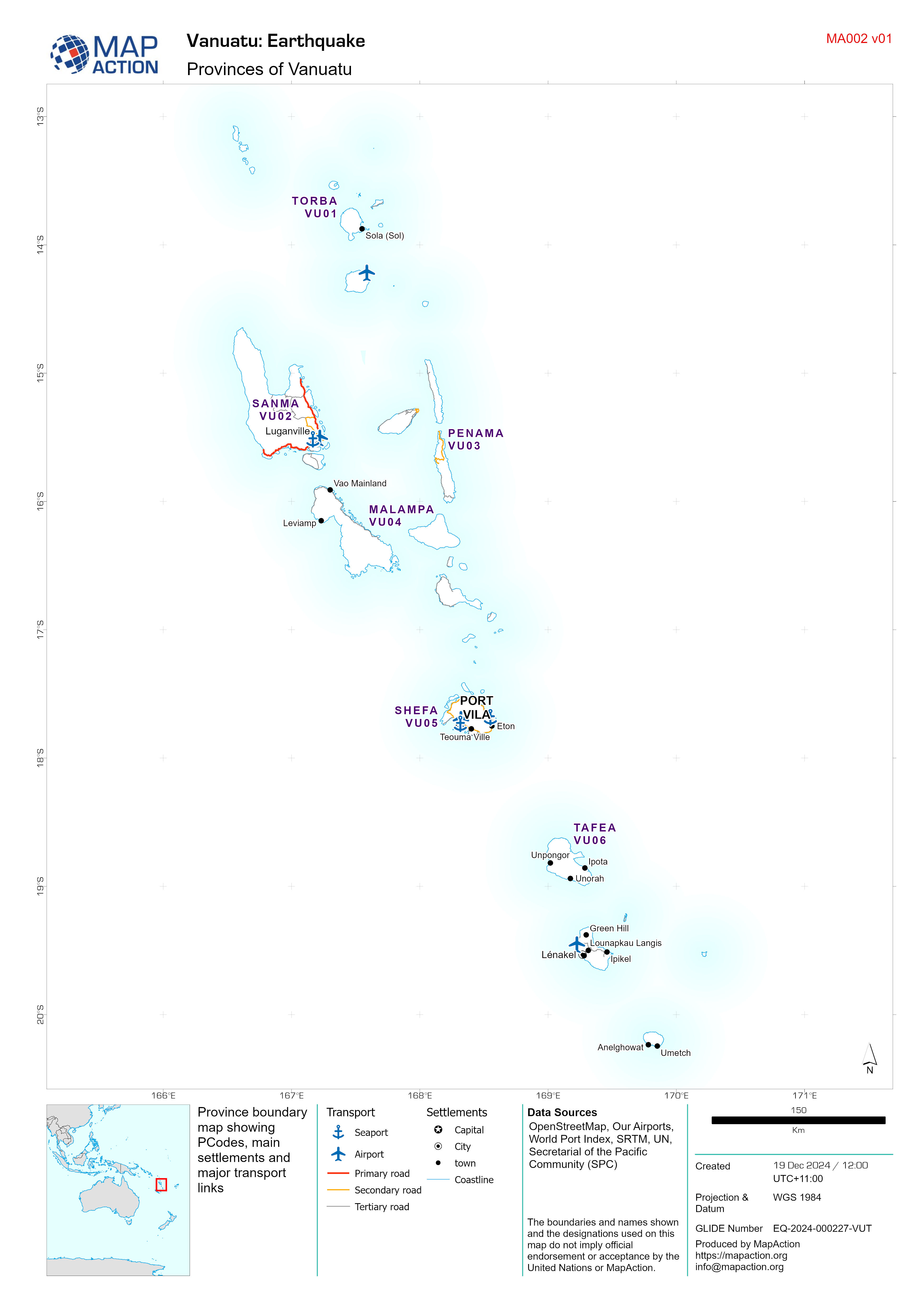
Provinces of Vanuatu
Province boundary map showing PCodes, main settlements and major transport links -

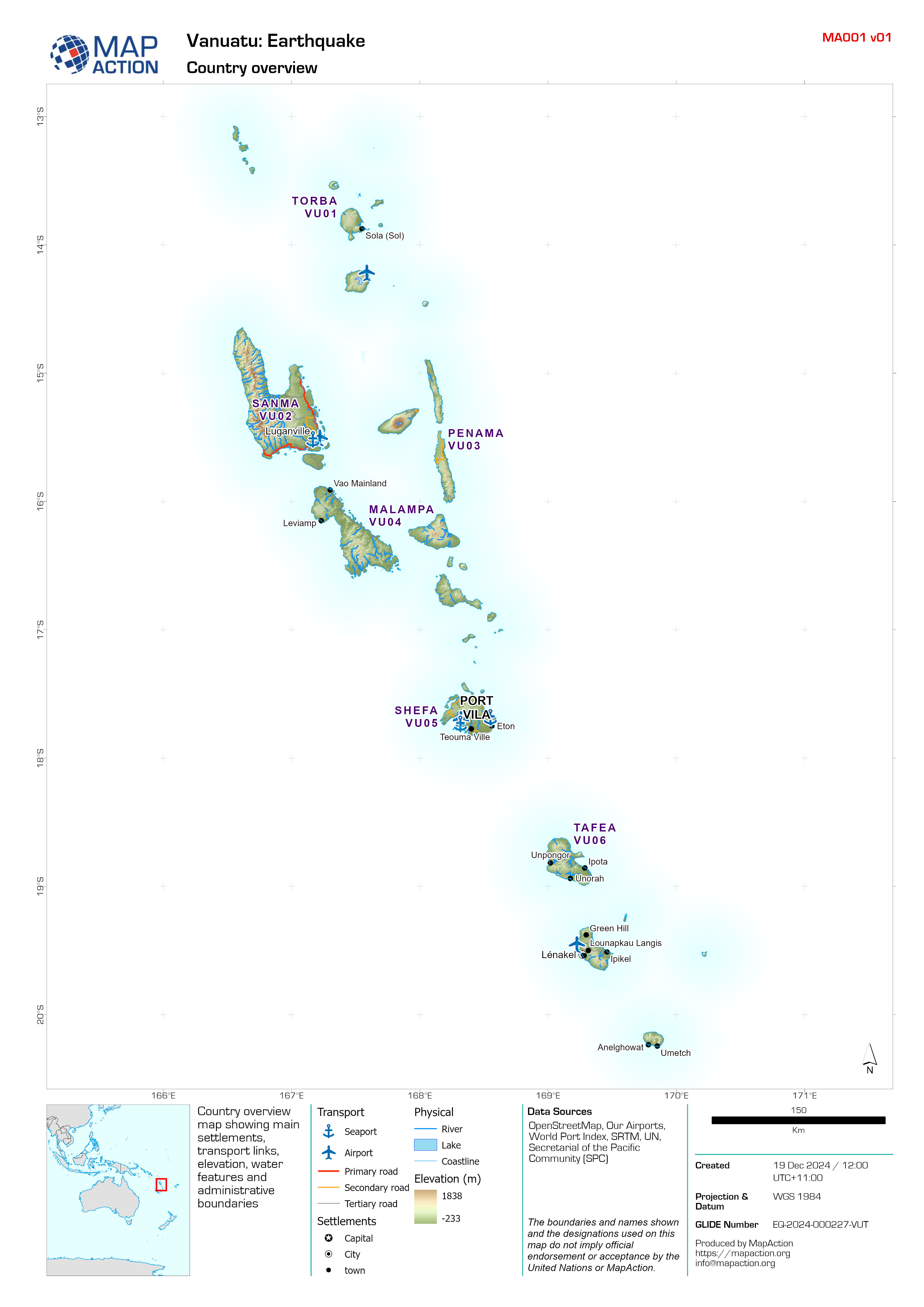
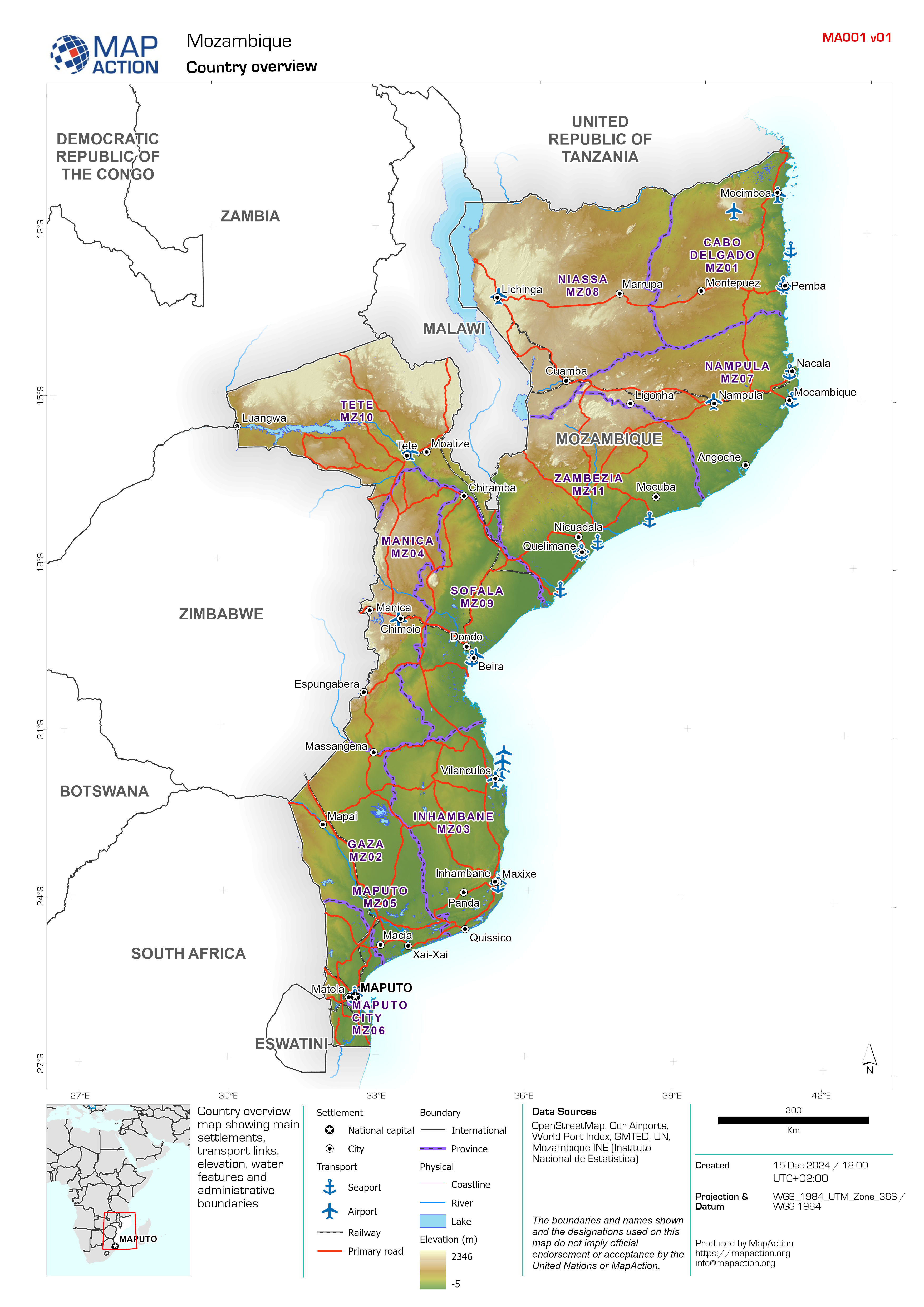
Country overview
Country overview map showing main settlements, transport links, elevation, water features and administrative boundaries -

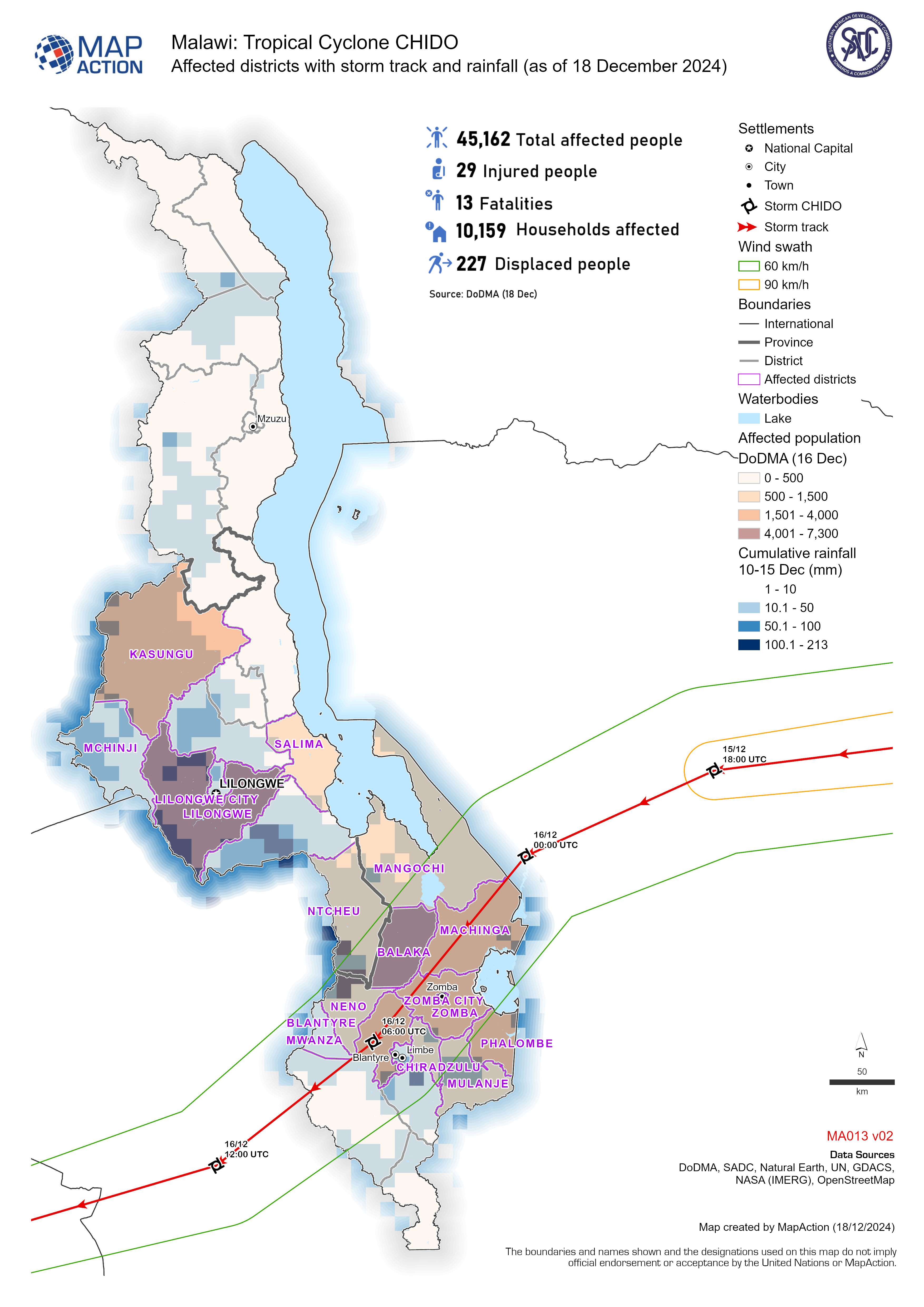
Affected districts with storm track and rainfall (as of 18 December 2024)
Affected population and households with storm track and rainfall for tropical cyclone Chido -
Affected provinces, population, rainfall and storm track (as of 18 December 2...
Affected population by tropical cyclone Chido, showing population density, cumulative rainfall and storm track. -
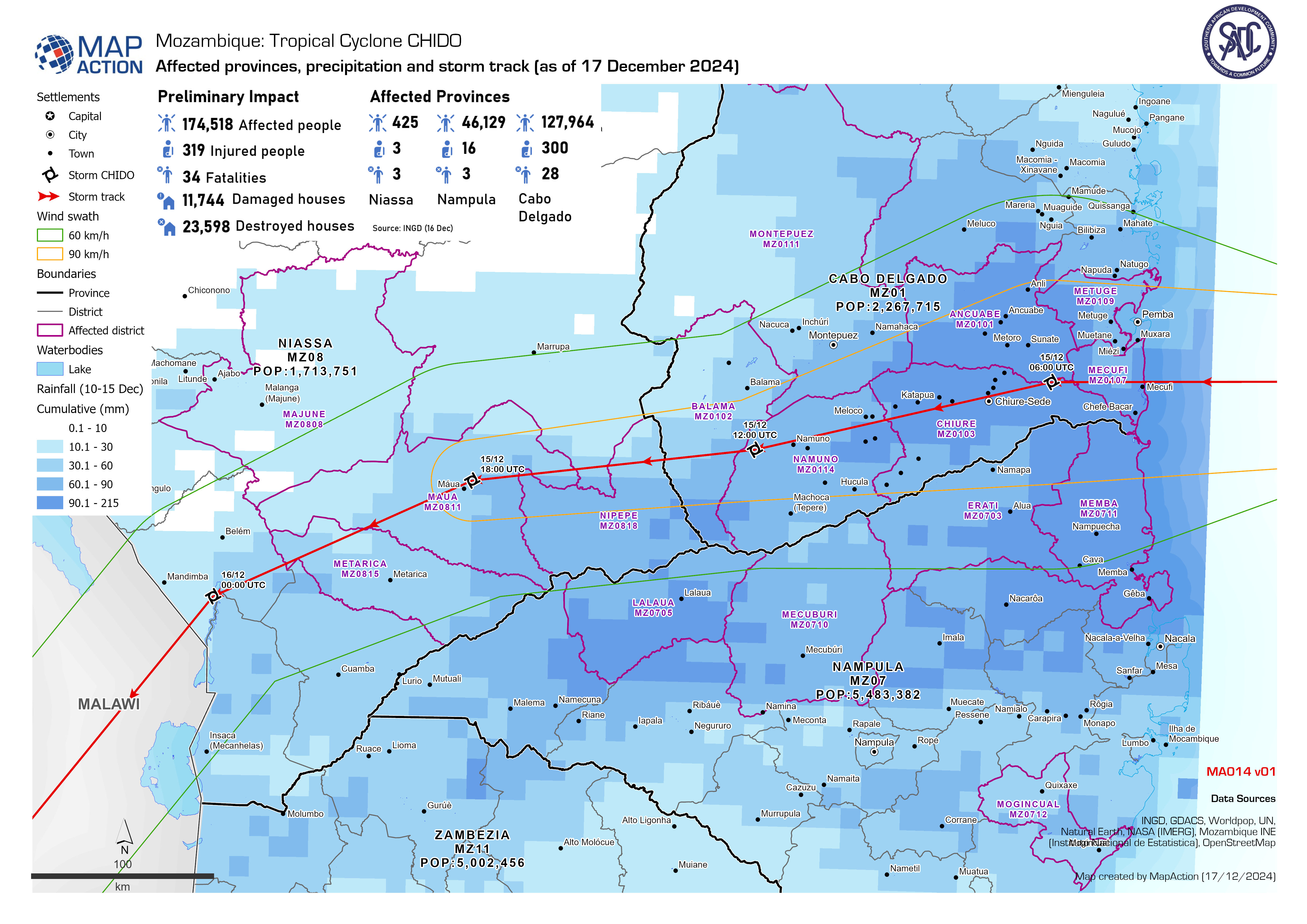
Affected provinces, precipitation and storm track (as of 17 December 2024)
Affected population by the tropical cyclone Chido, showing cumulative rainfall and storm track. -
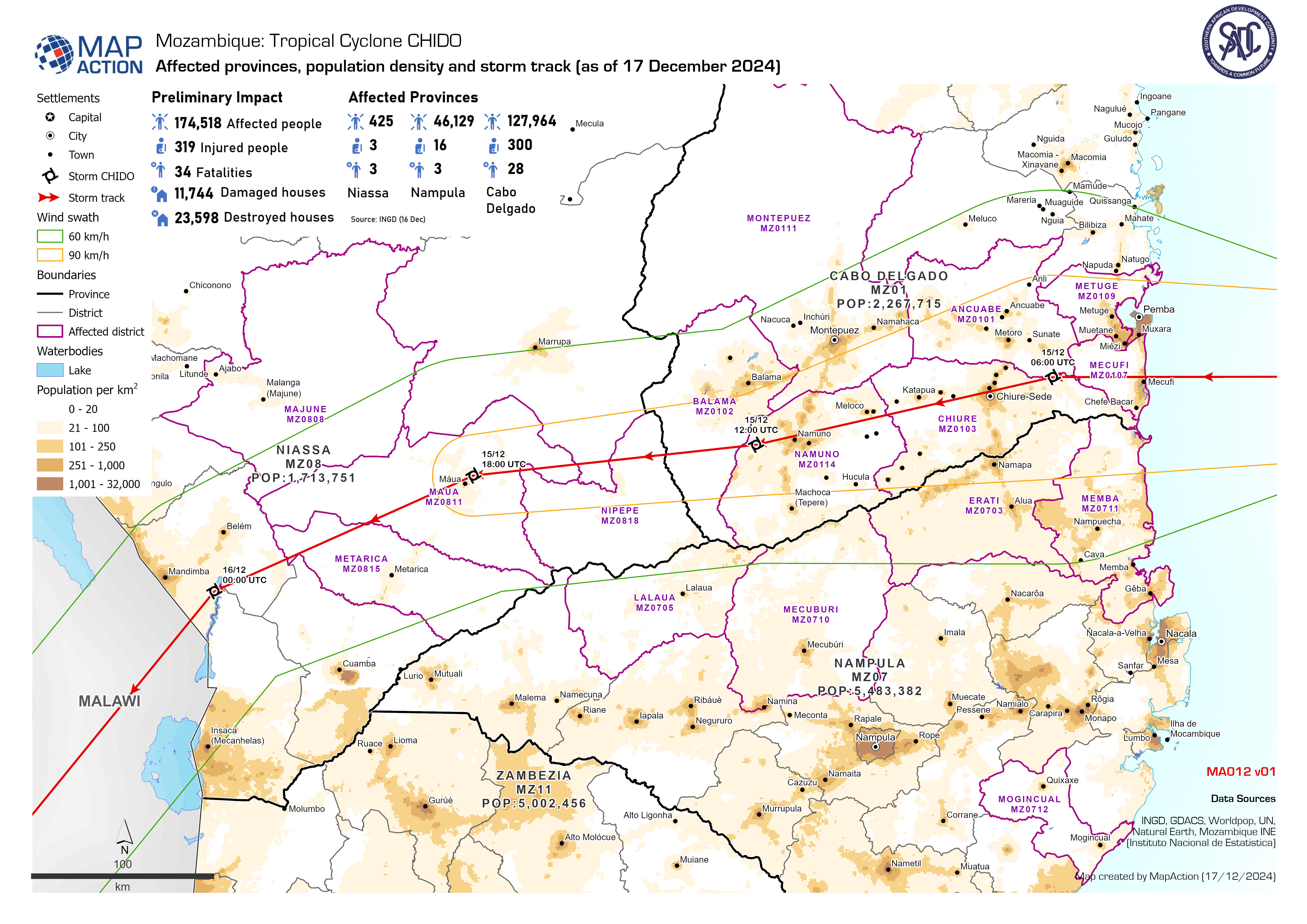
Affected provinces, population density and storm track (as of 17 December 2024)
Affected population by tropical cyclone Chido, showing population density, cumulative rainfall and storm track. -

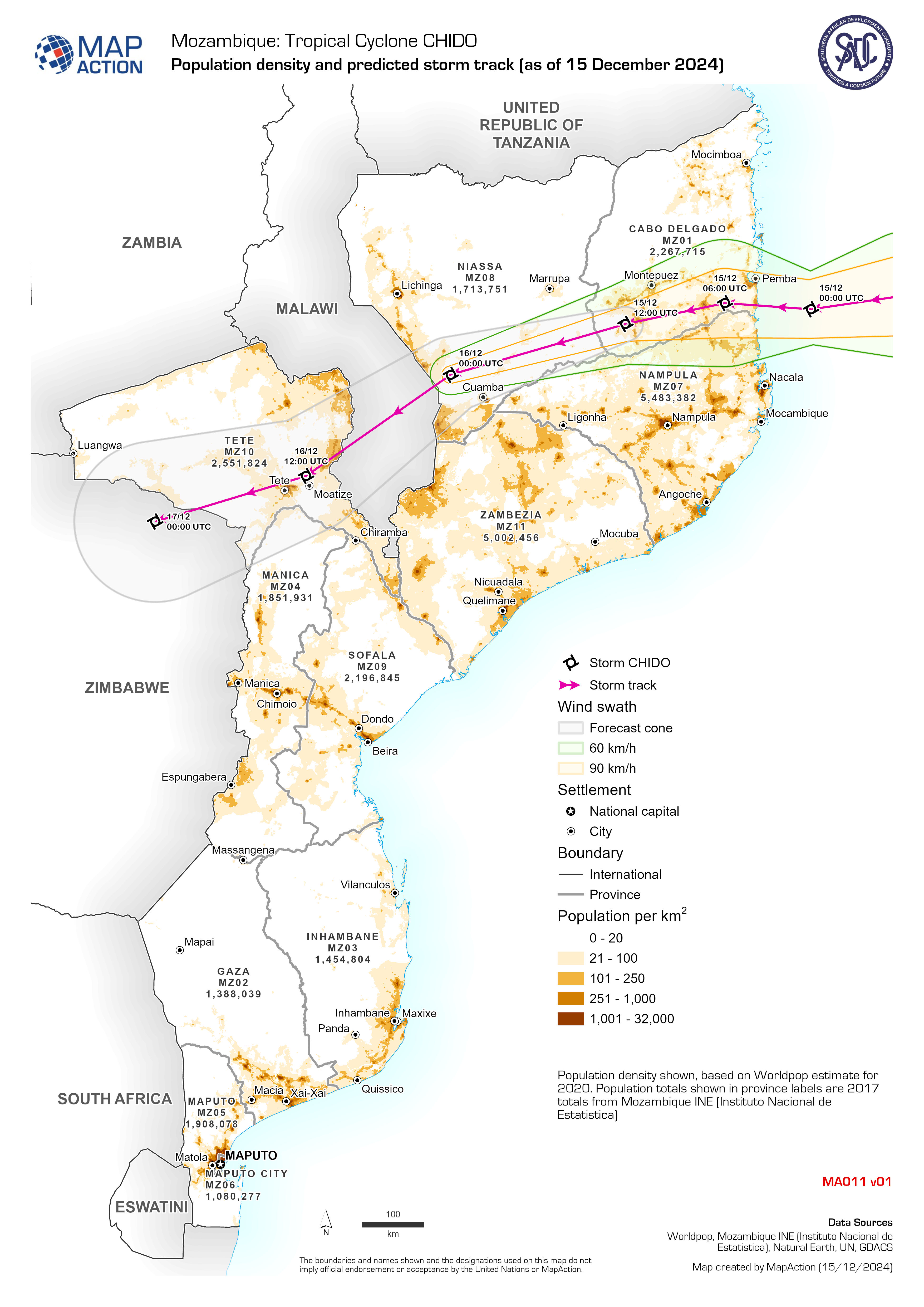
Population density and predicted storm track (as of 15 December 2024)
Population density shown, based on Worldpop estimate for 2020. Population totals shown in province labels are 2017 totals from Mozambique INE (Instituto Nacional de Estatistica) -

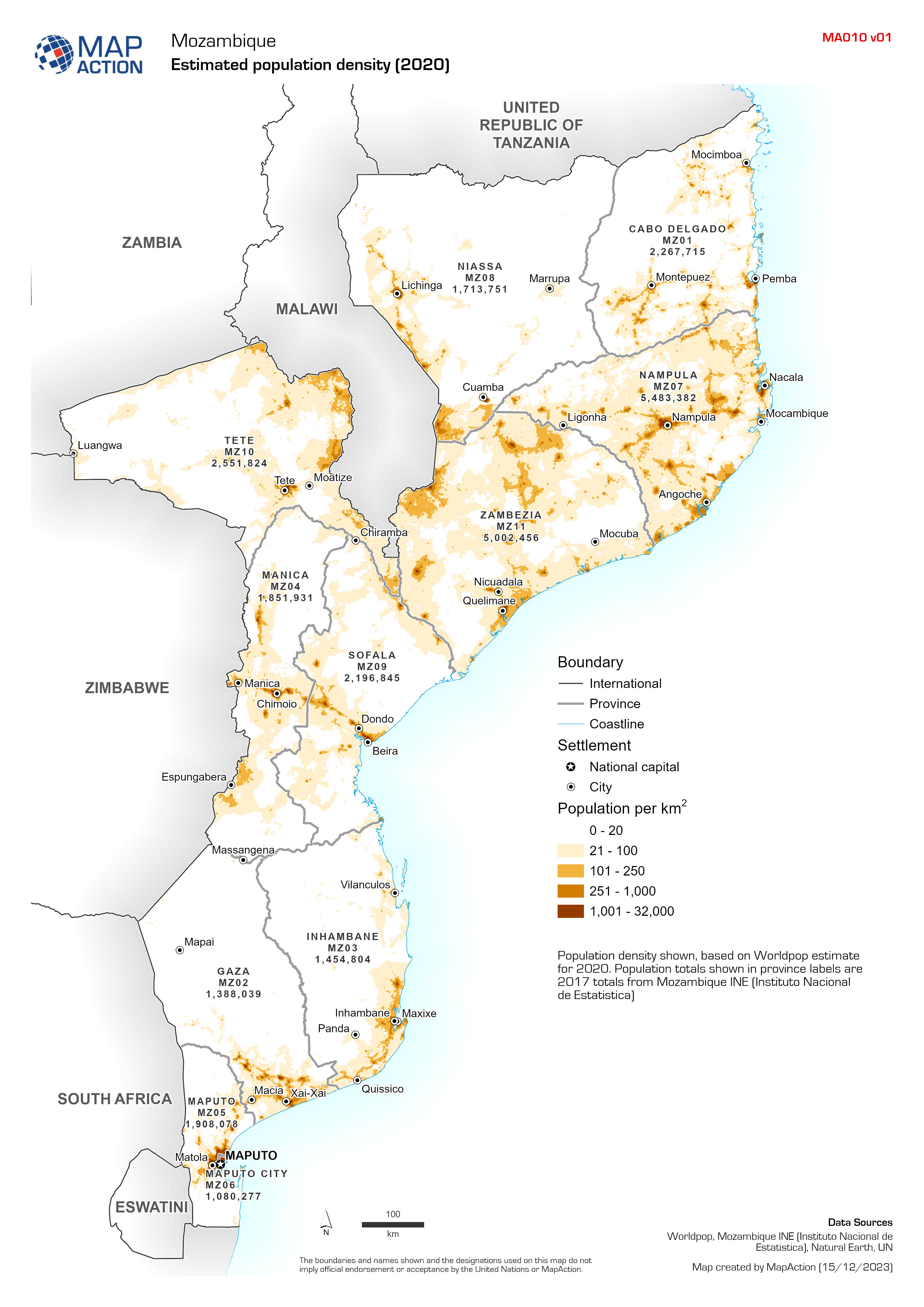
Estimated population density (2020)
Population density shown, based on Worldpop estimate for 2020. Population totals shown in province labels are 2017 totals from Mozambique INE (Instituto Nacional de Estatistica) -

-

Country overview
Country overview map showing main settlements, transport links, elevation, water features and administrative boundaries -

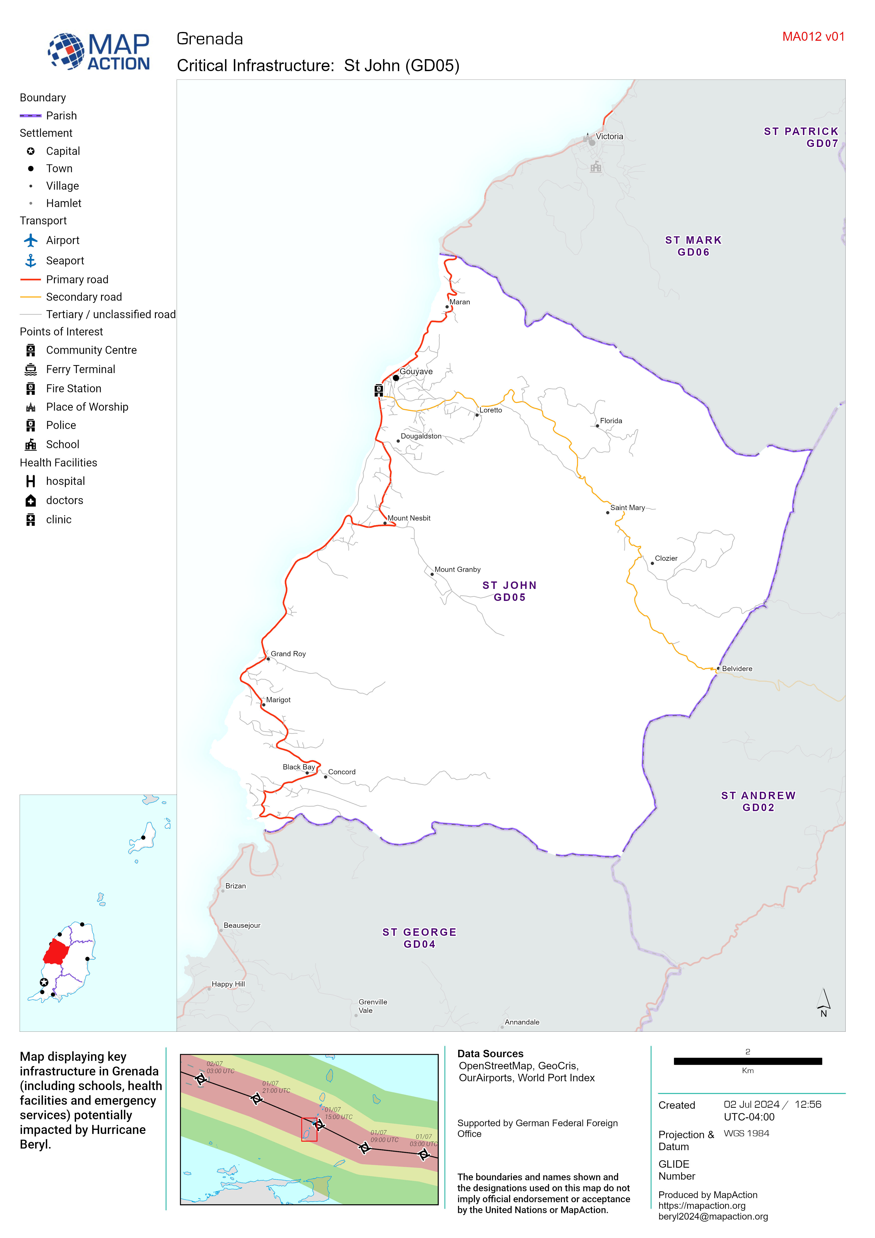
Critical Infrastructure Map Atlas - MapAction
Map displaying key infrastructure in Grenada (including schools, health facilities and emergency services) potentially impacted by Hurricane Beryl.

