-
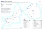
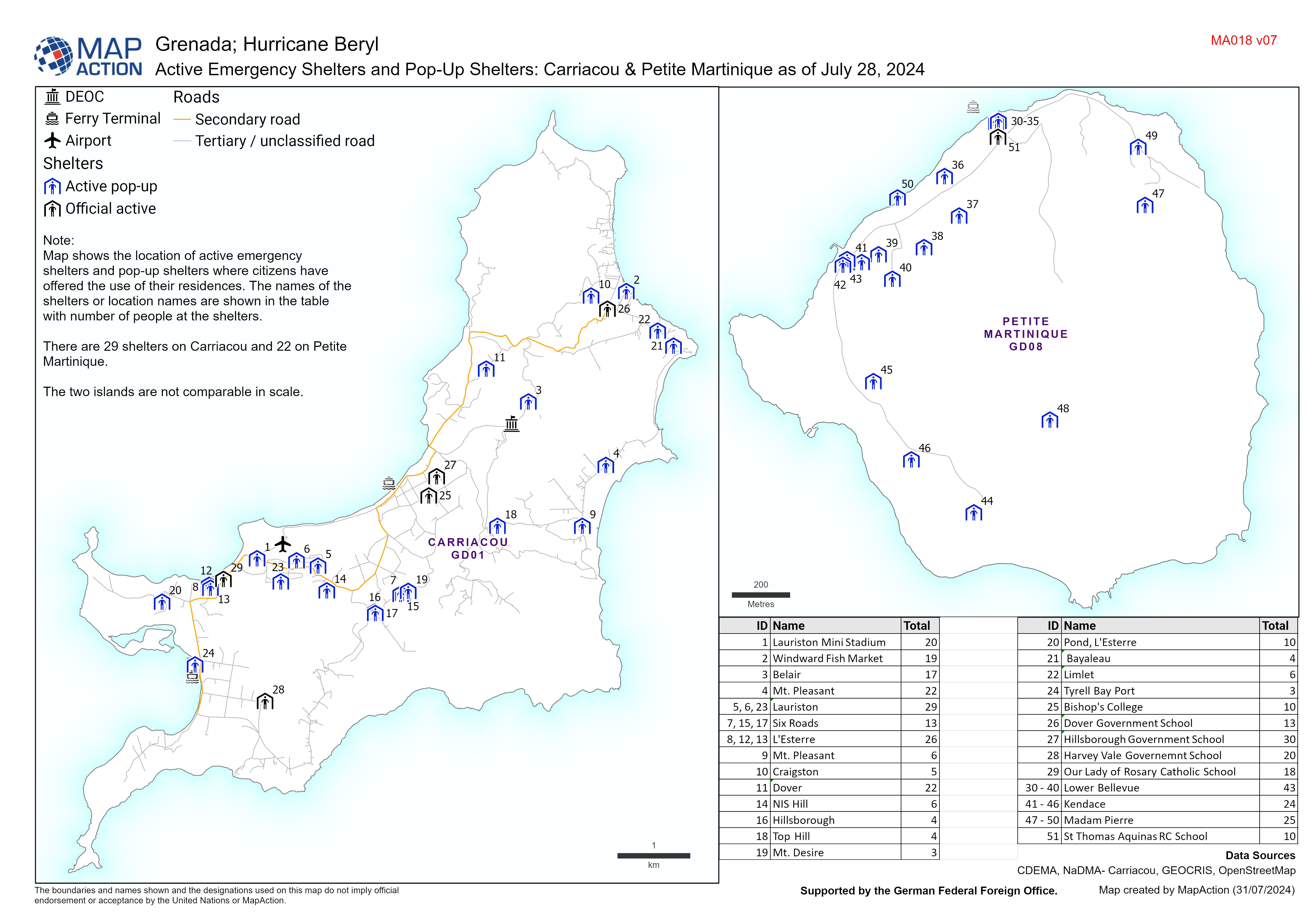
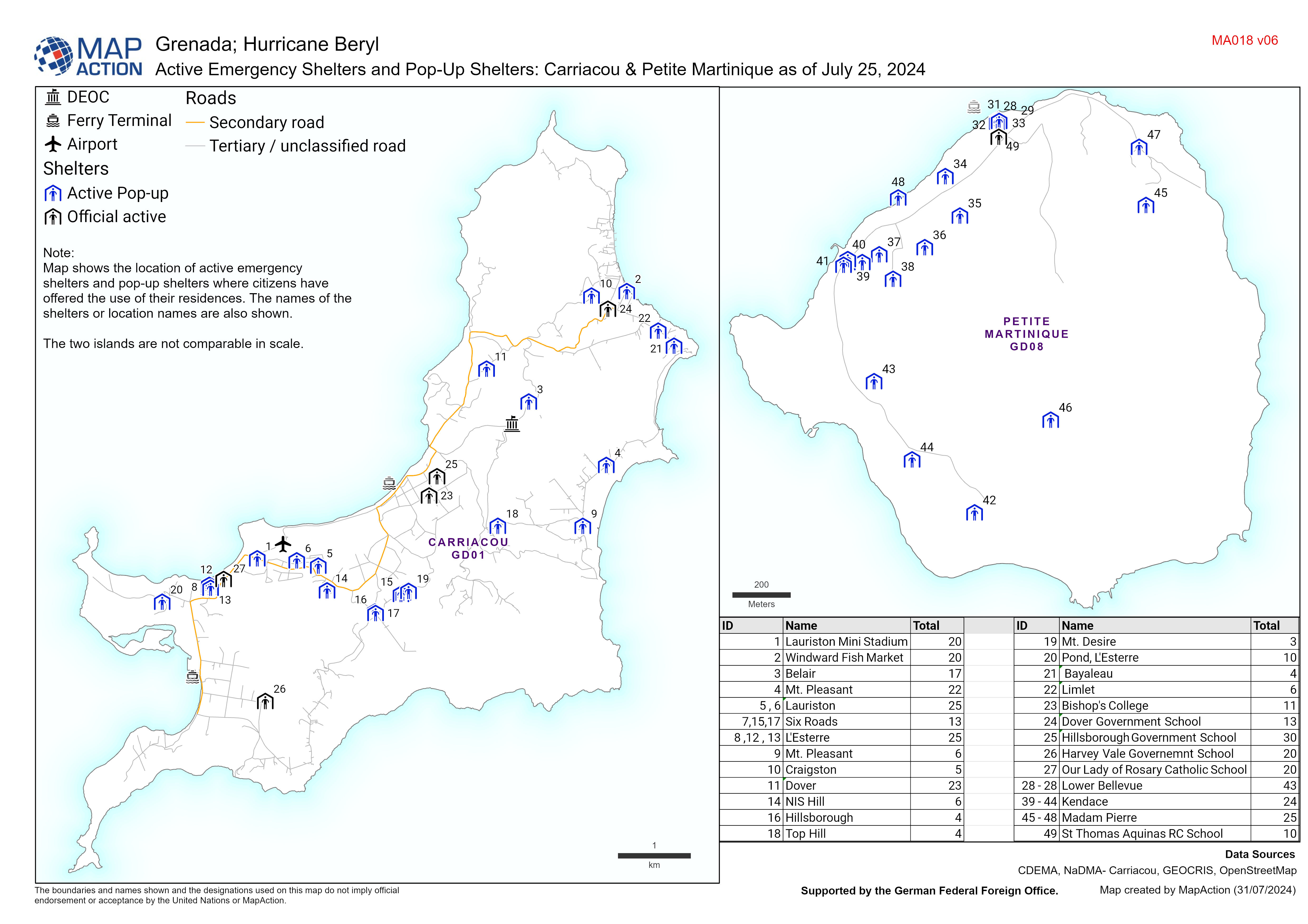
Active Emergency Shelters and Pop-Up Shelters: Carriacou & Petite Martinique ...
Map displaying active emergency shelters and pop-up shelters in Carriacou/Petite Martinique. The names of the shelters or location names are also shown. -
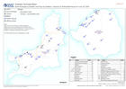
Active Emergency Shelters and Pop-Up Shelters: Carriacou & Petite Martinique ...
Map displaying active emergency shelters and pop-up shelters in Carriacou/Petite Martinique. The names of the shelters or location names are also shown. -
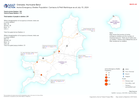
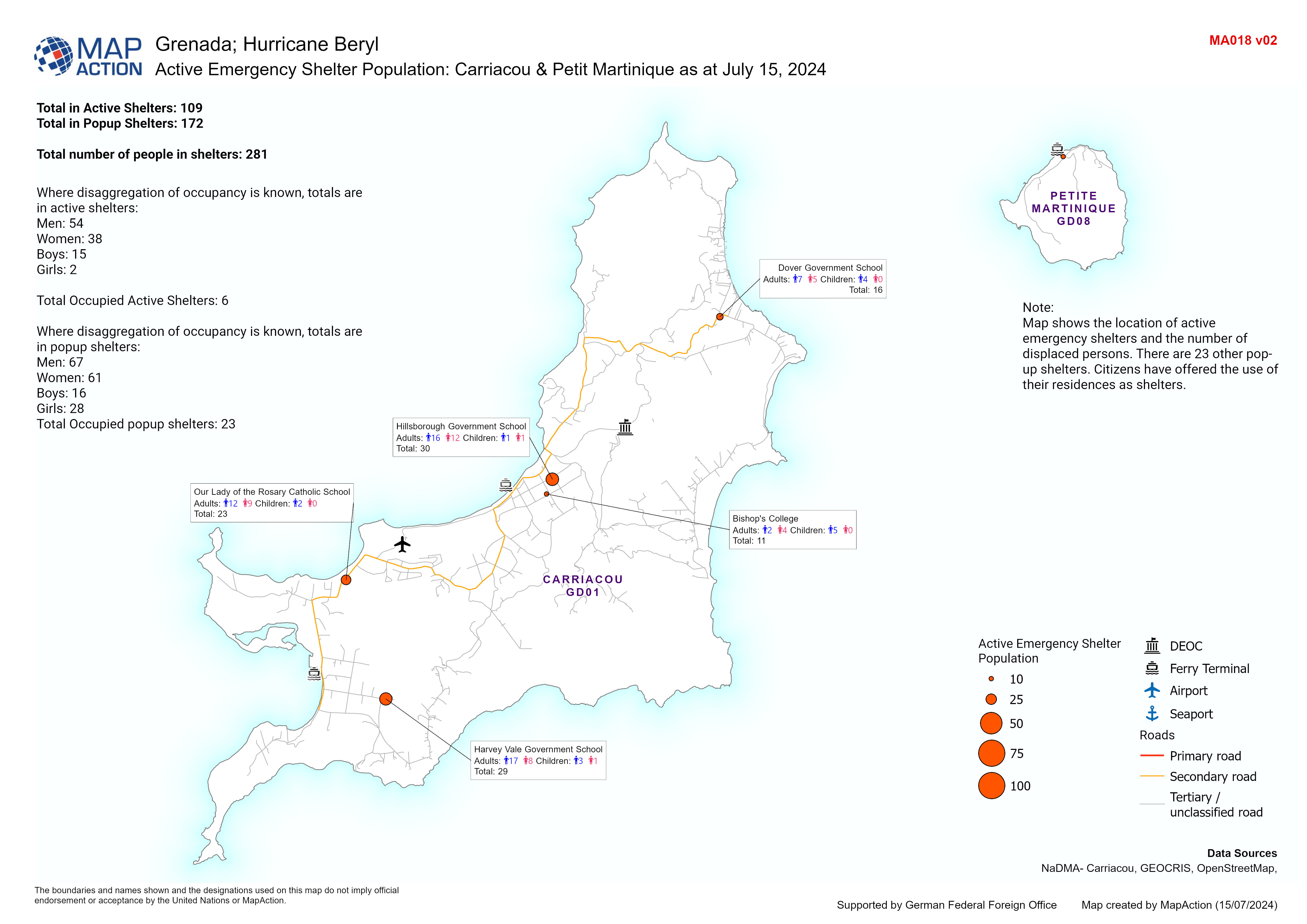
Active Emergency Shelter Population: Carriacou & Petit Martinique as at July ...
Map displaying population of active emergency shelters in Carriacou and the number of displaced persons that are in them. -

Grenadines Shelter Occupancy - 12 July 2024
Overview map of the Grenadines showing Shelter Occupancy as of 12 July 2024. -

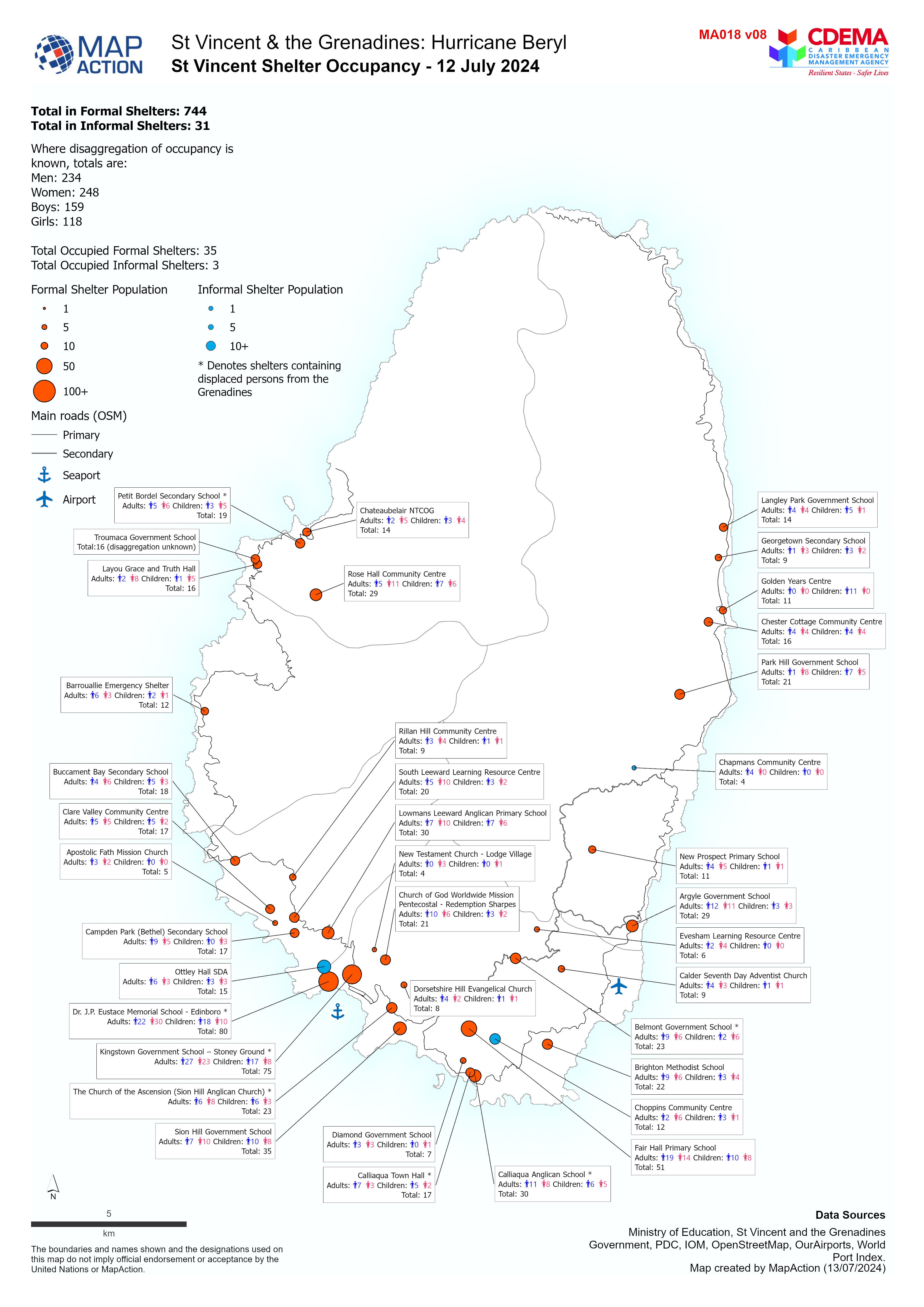
St Vincent Shelter Occupancy - 12 July 2024
Overview map of St Vincent showing Shelter Occupancy as of 12 July 2024. -

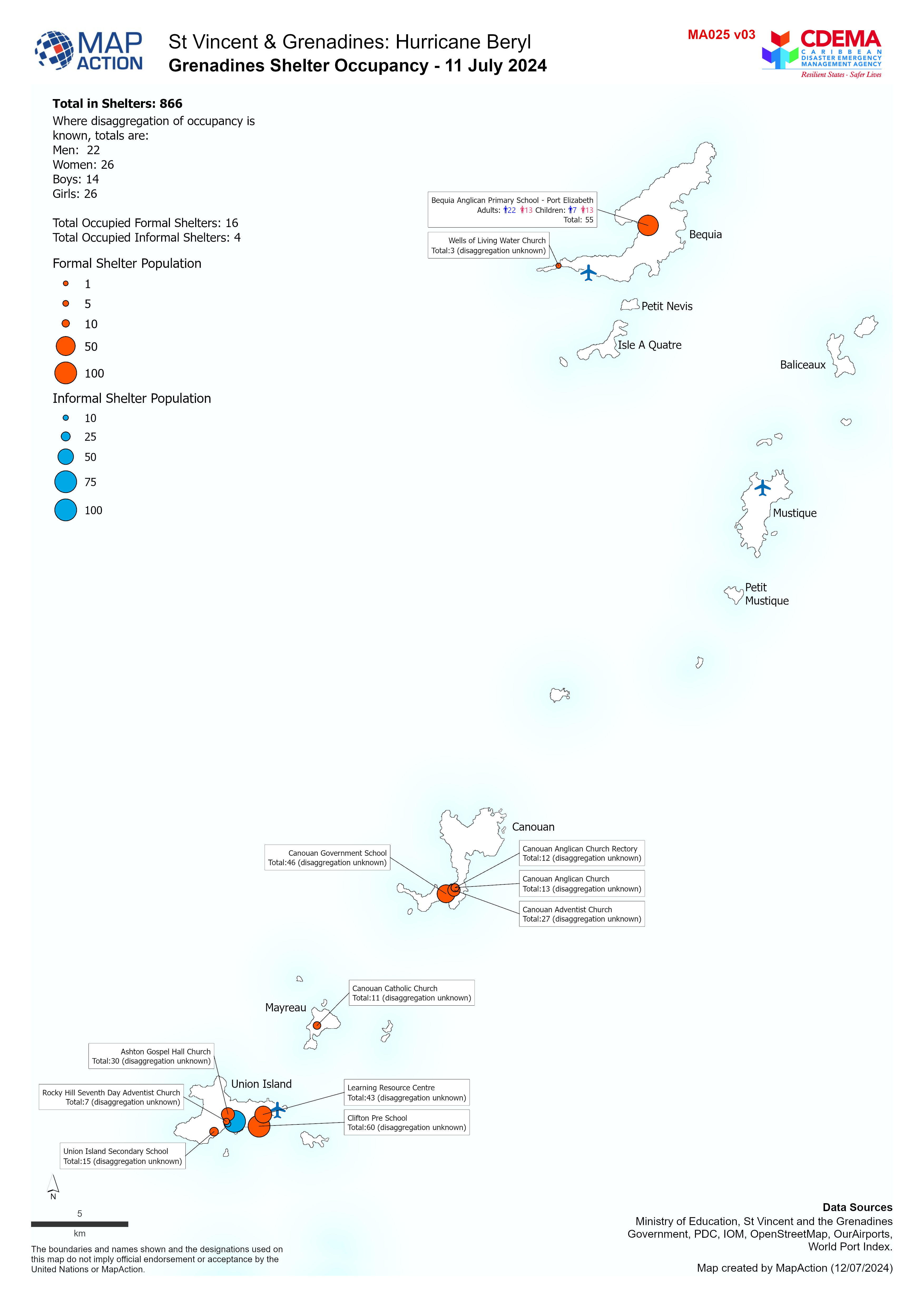
Grenadines Shelter Occupancy - 11 July 2024
Overview map of the Grenadines showing Shelter Occupancy as of 11 July 2024. -

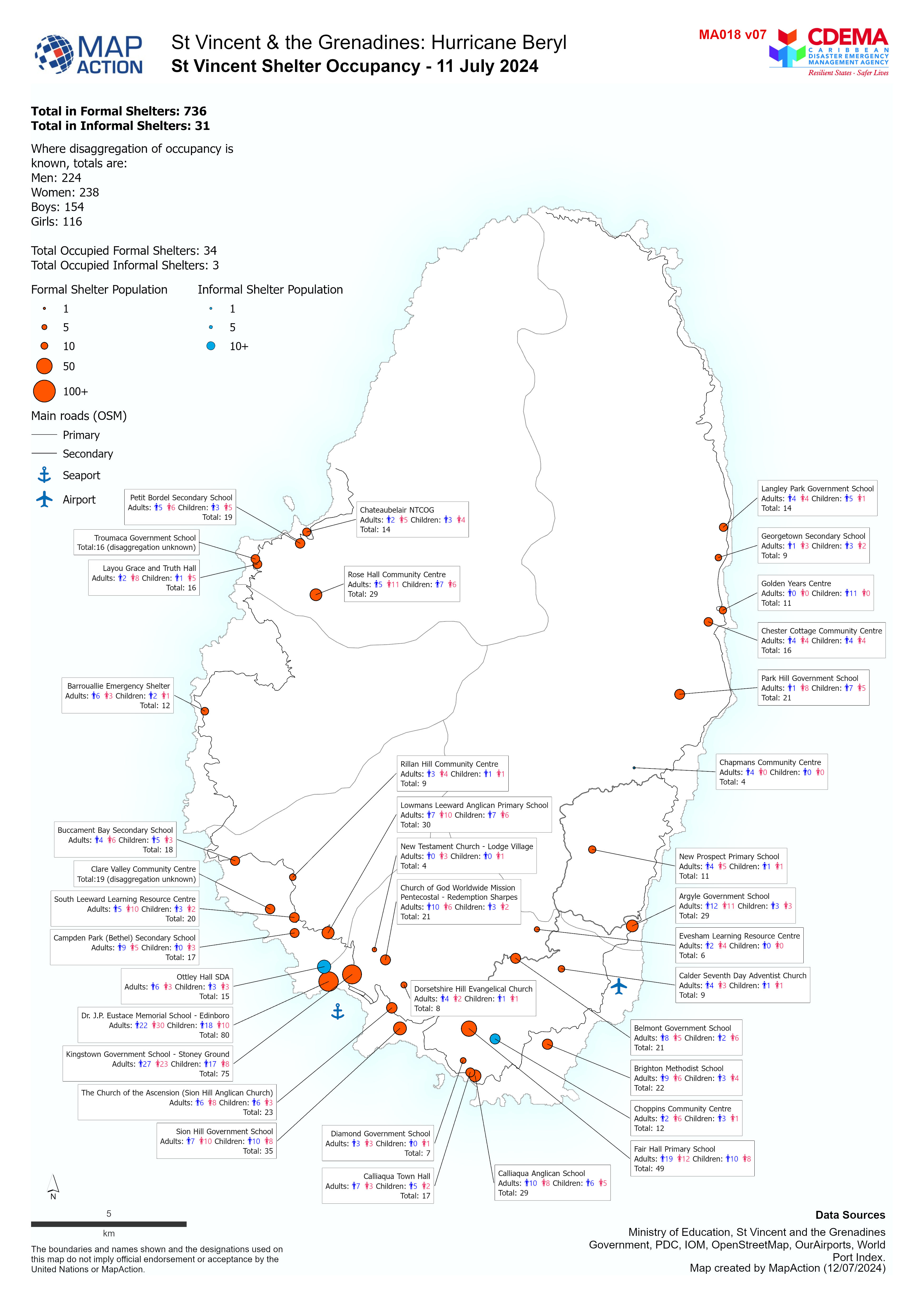
St Vincent Shelter Occupancy - 11 July 2024
Overview map of St Vincent showing Shelter Occupancy as of 11 July 2024. -

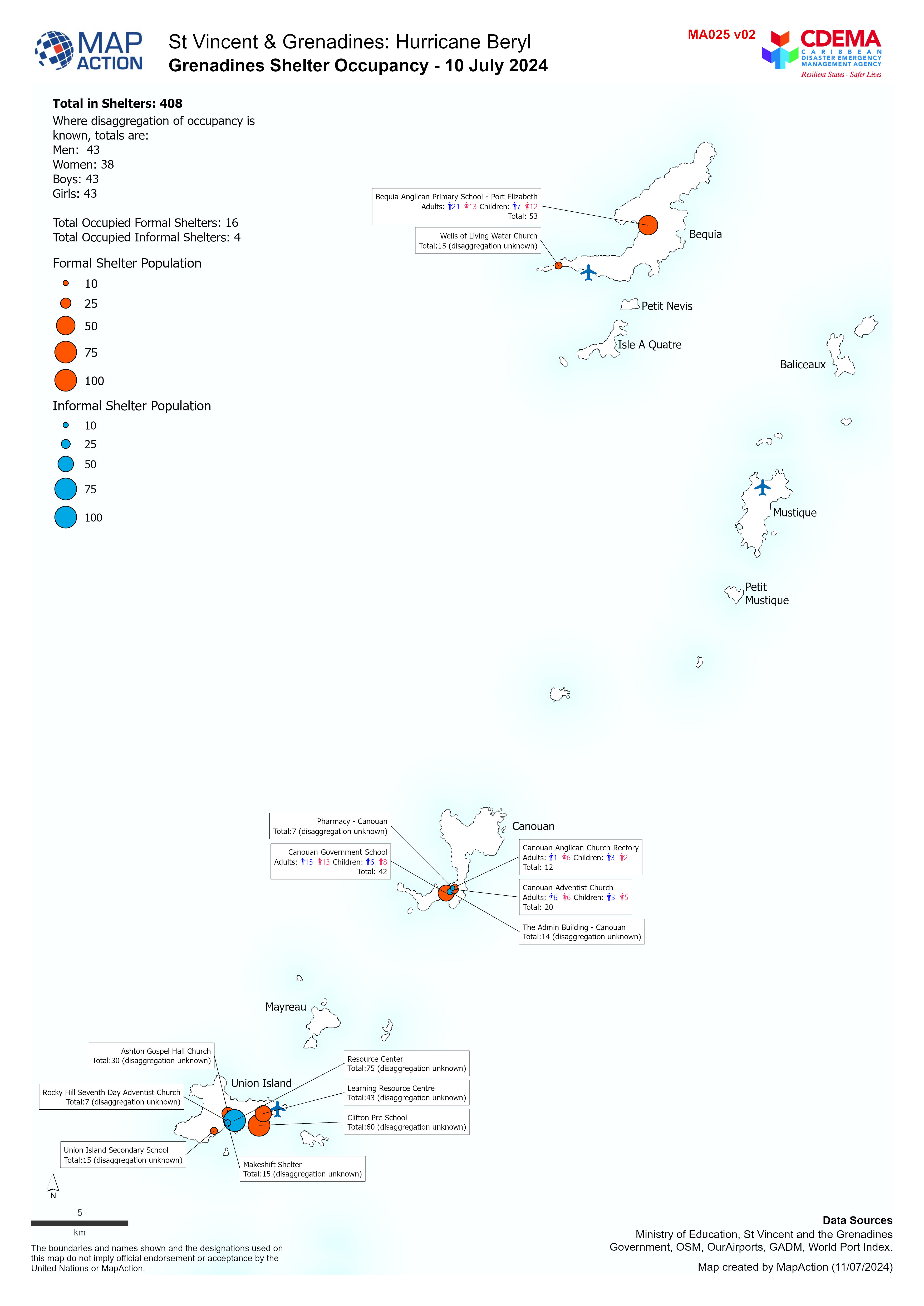
Grenadines Shelter Occupancy - 10 July 2024
Overview map of the Grenadines showing Shelter Occupancy as of 10 July 2024. -

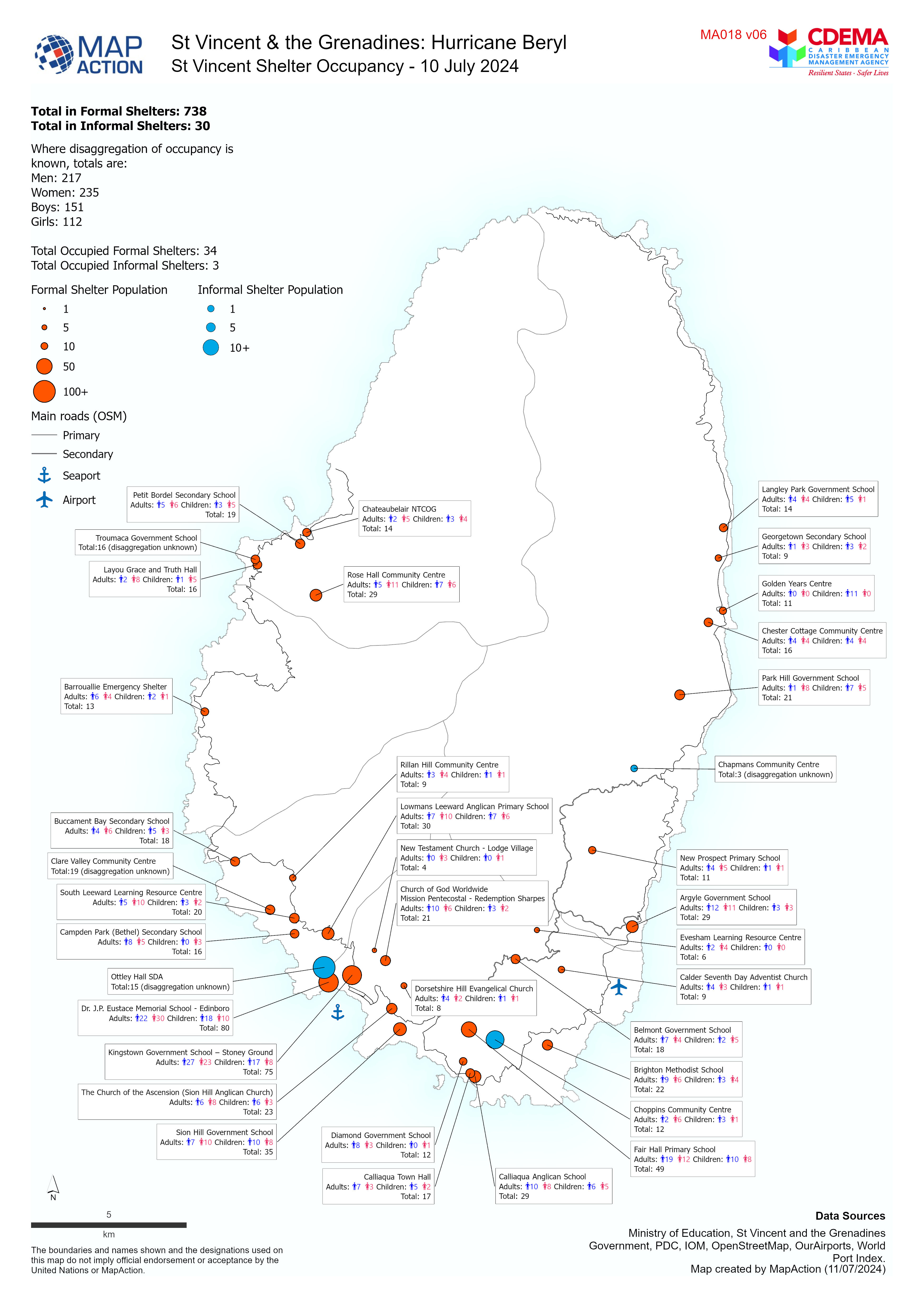
St Vincent Shelter Occupancy - 10 July 2024
Overview map of St Vincent showing Shelter Occupancy as of 10 July 2024. -

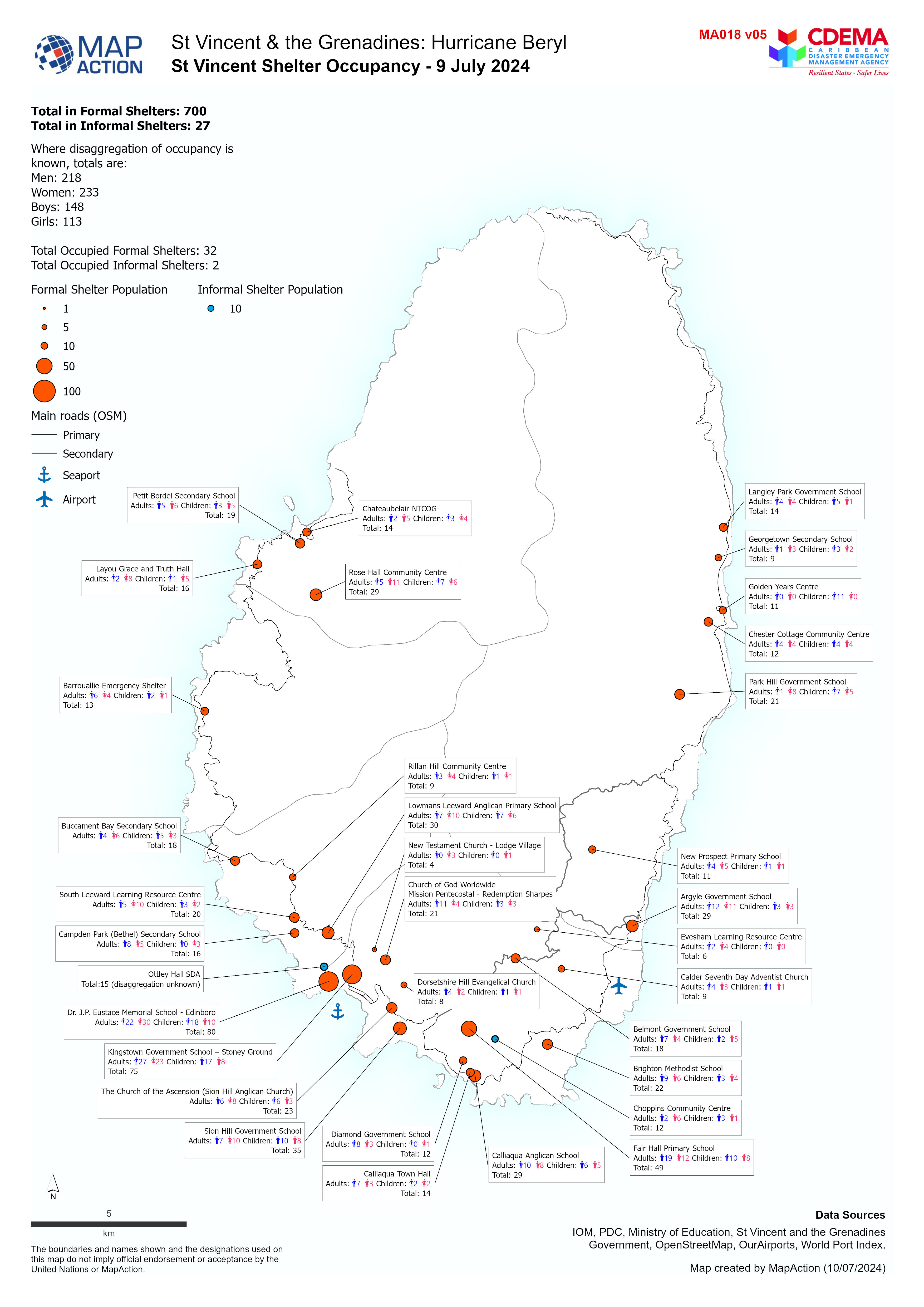
St Vincent Shelter Occupancy - 9 July 2024
Overview map of St Vincent showing Shelter Occupancy as of 9 July 2024. -
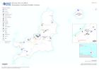
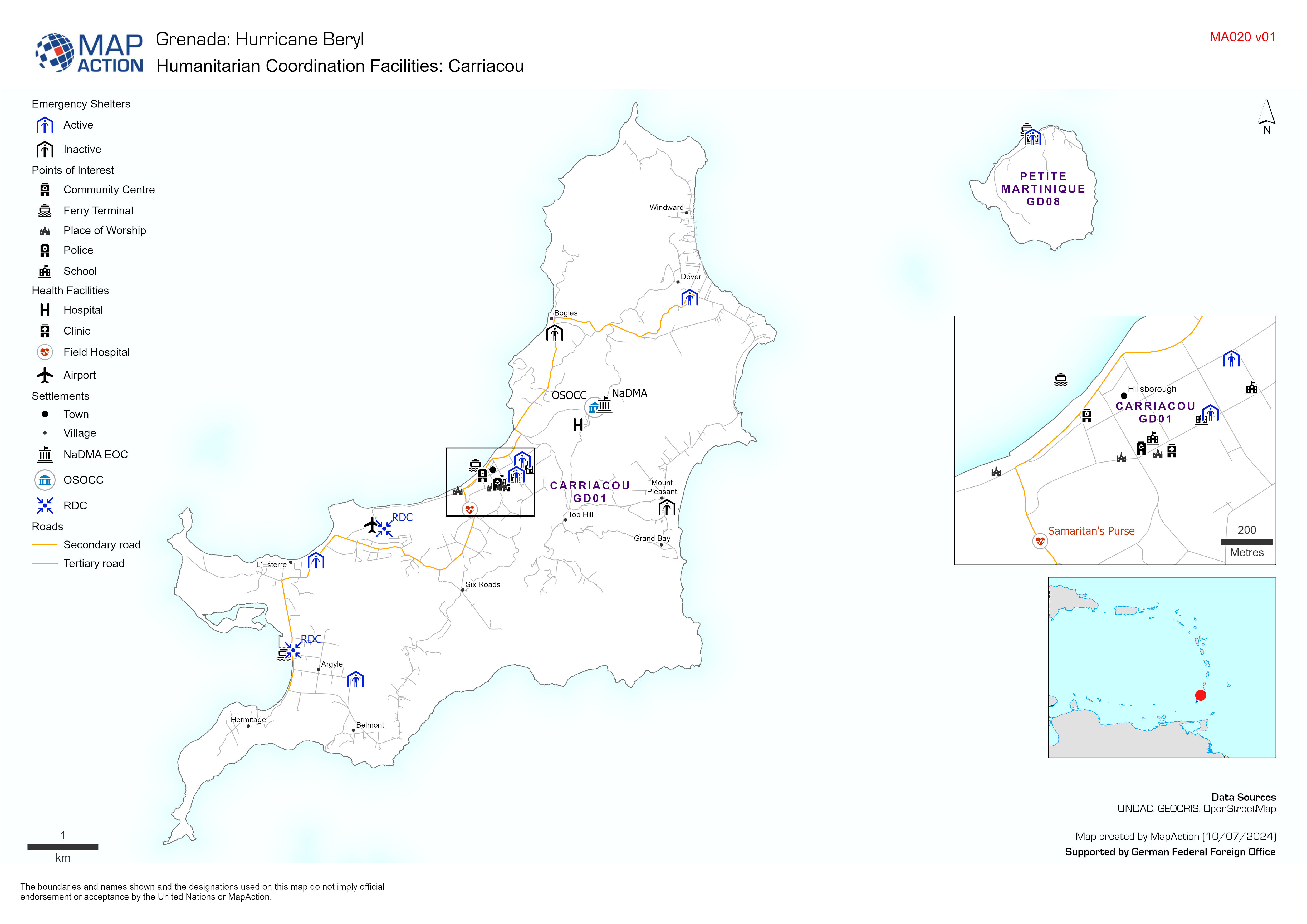
Humanitarian Coordination Facilities: Carriacou
Map displaying key infrastructure locations in Carriacou and Humanitarian Coordination facilities set up in response to Hurricane Beryl. -
Situation Overview
Situation overview as of 08 July 2024. Showing settlements, baseline population, affected areas for assessment and populated evacuation centers -
Active Emergency Shelters: Carriacou & Petit Martinique as at July 9, 2024
Map displaying active emergency shelters in Carriacou and the number of displaced persons that are in them. -

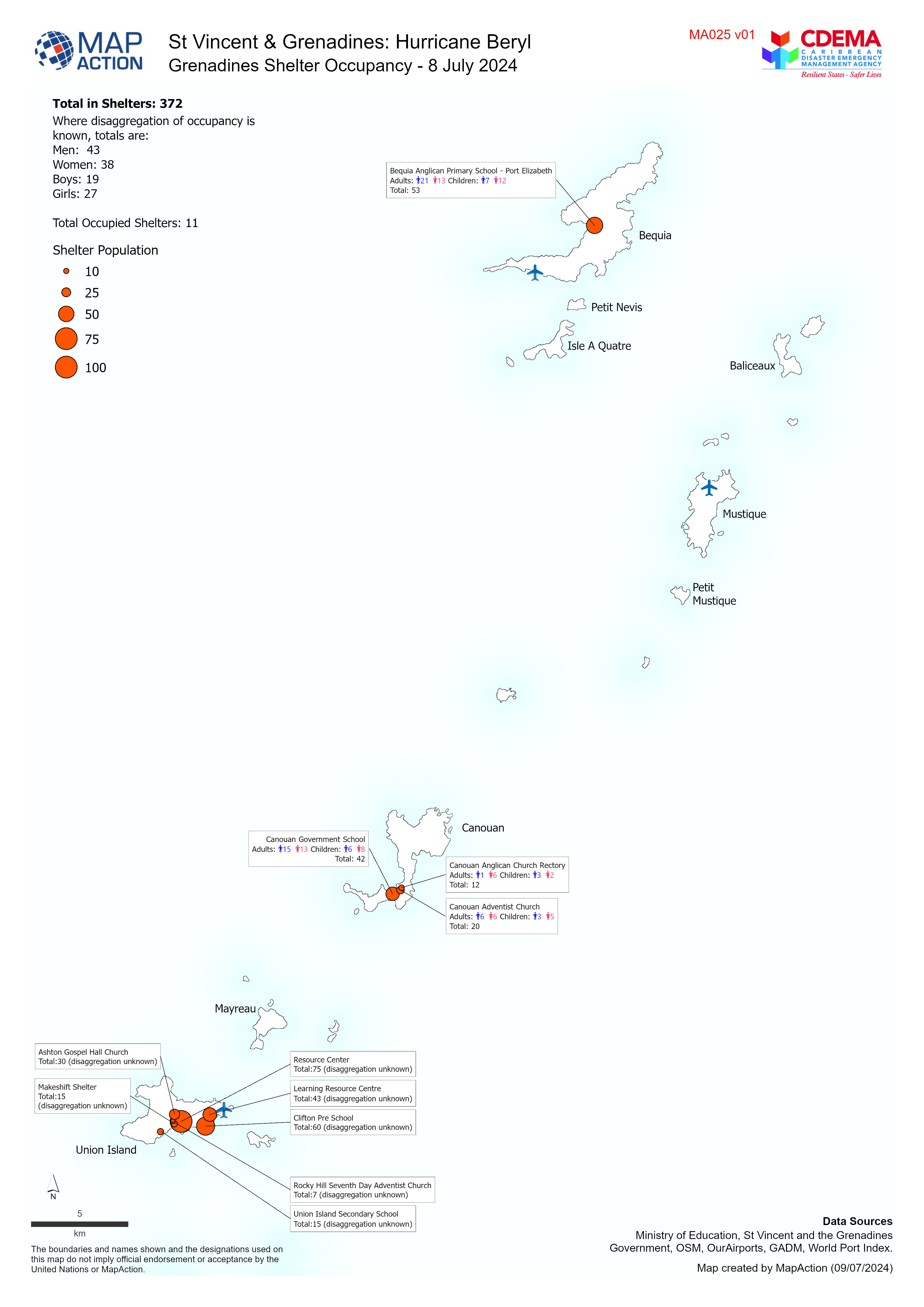
Grenadines Shelter Occupancy - 8 July 2024
Overview map of the Grenadines showing Shelter Occupancy as of 8 July 2024. -

St Vincent Shelter Occupancy - 8 July 2024
Overview map of St Vincent showing Shelter Occupancy as of 8 July 2024. -

St Vincent Shelter Occupancy - 7 July 2024
Overview map of St Vincent showing Shelter Occupancy as of 7 July 2024. -

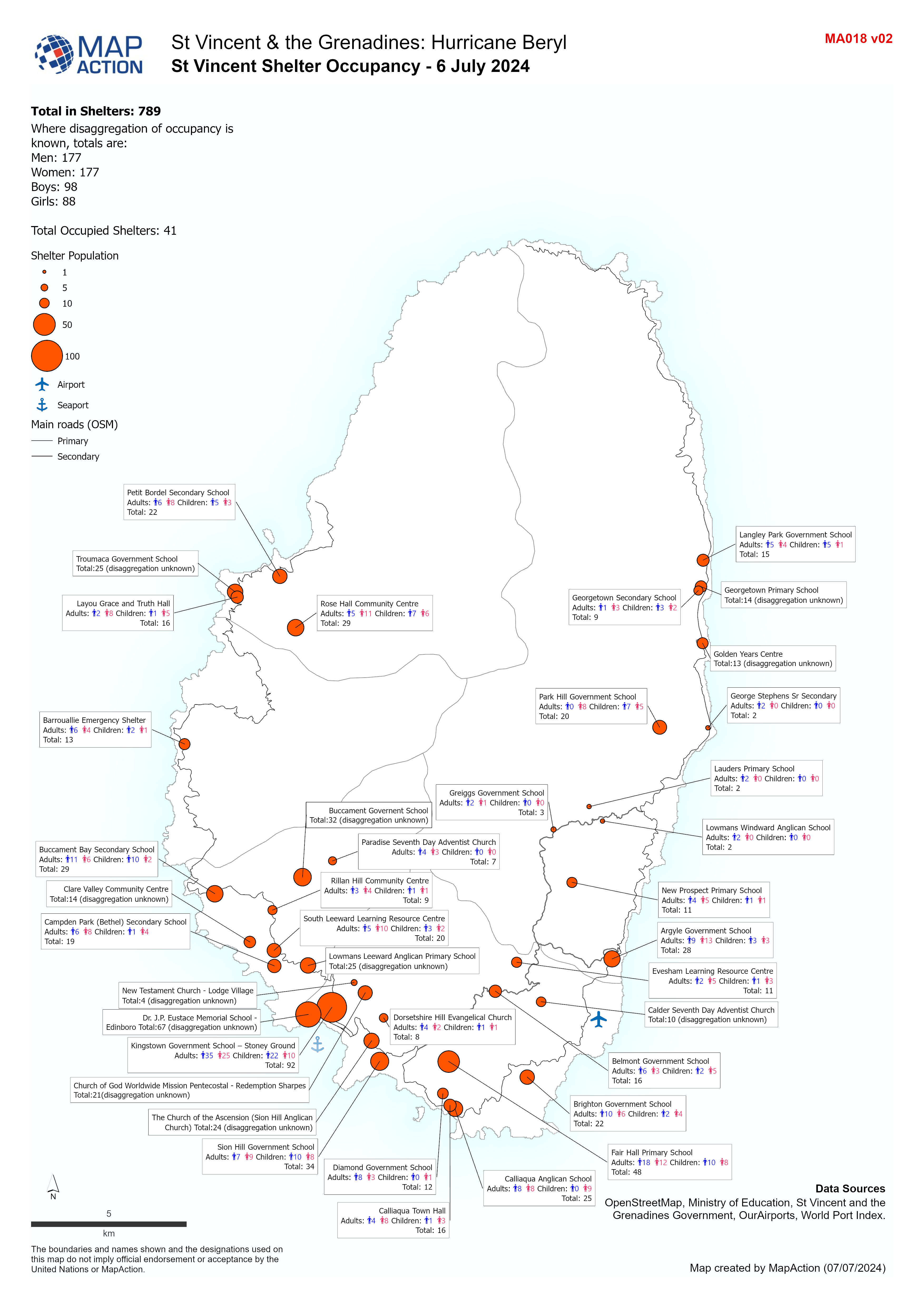
St Vincent Shelter Occupancy - 6 July 2024
Overview map of St Vincent showing Shelter Occupancy as of 6 July 2024. -
-

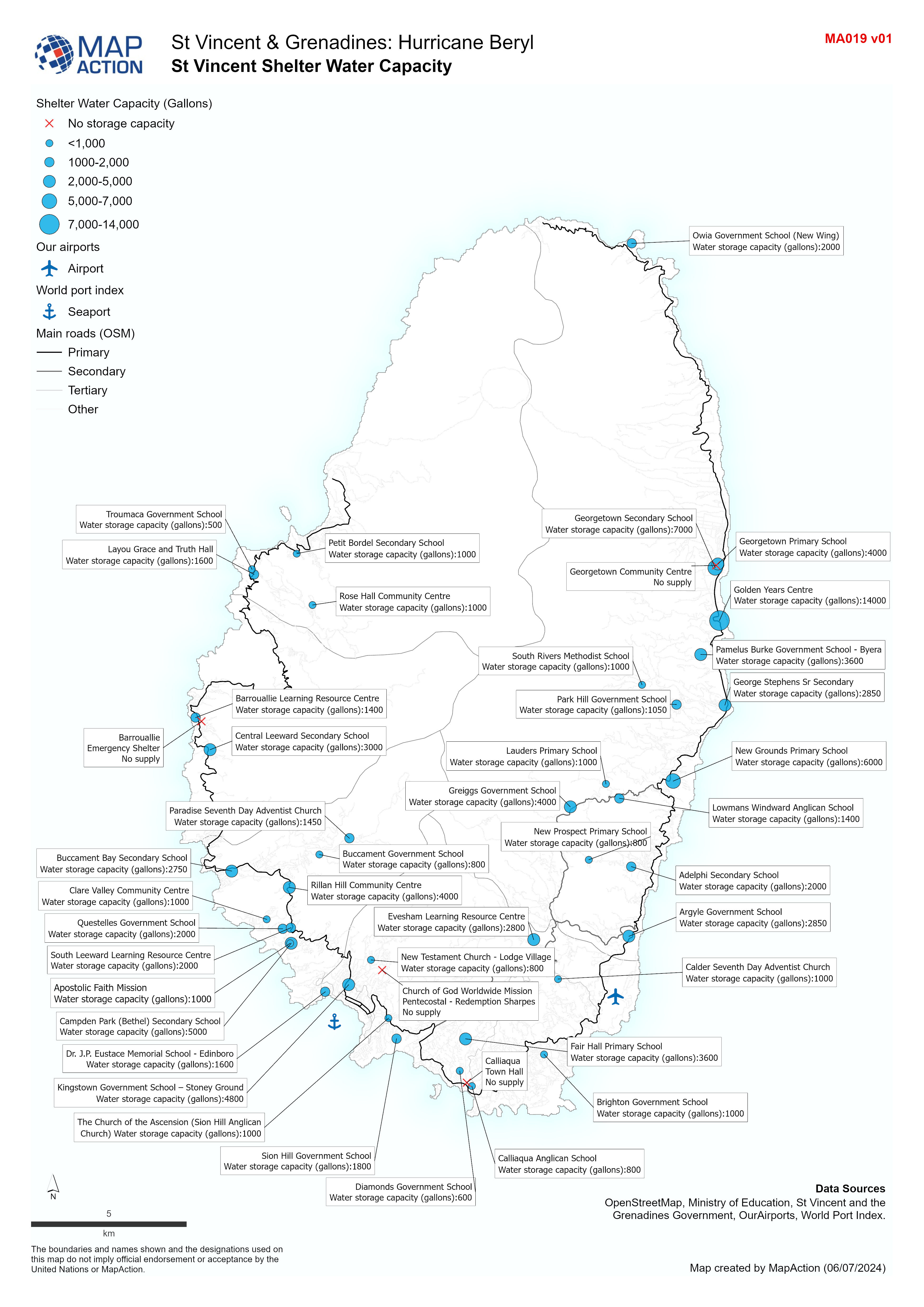
St Vincent Shelter Water Capacity
Overview map of St Vincent showing Shelter water capacity. -

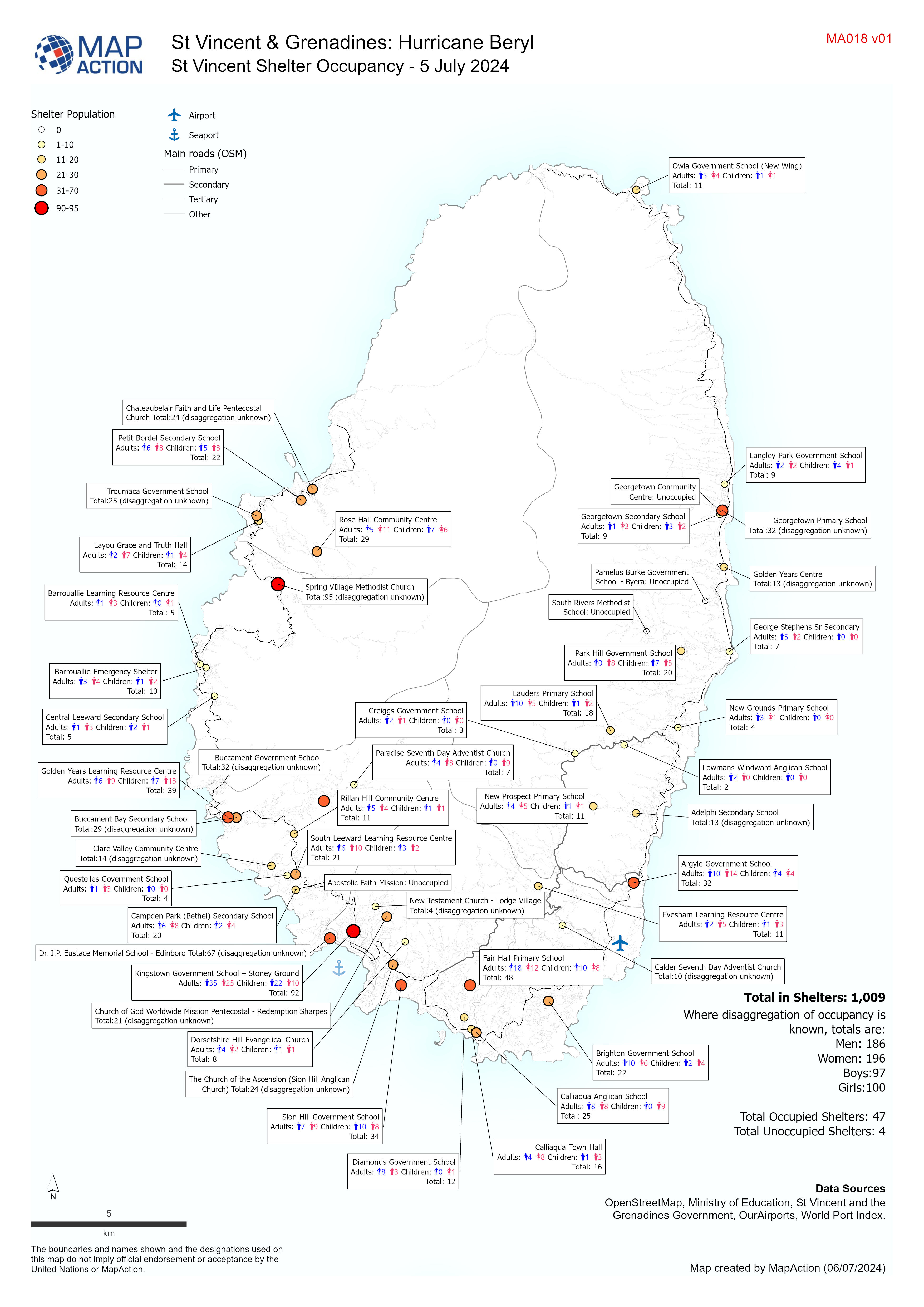
St Vincent Shelter Occupancy - 5 July 2024
Overview map of St Vincent showing Shelter Occupancy as of 5 July 2024.