-
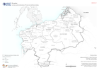
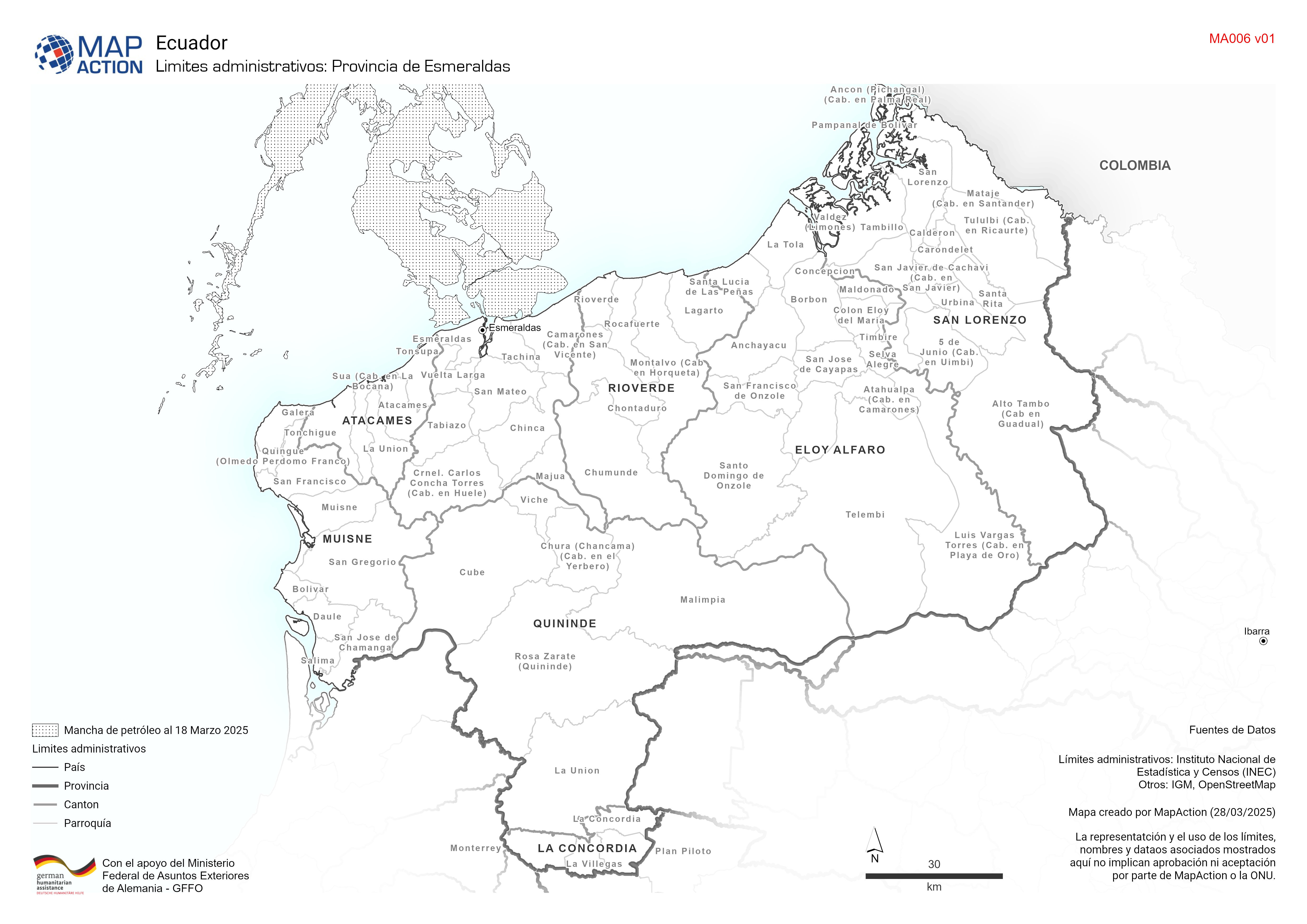
Limites administrativos: Provincia de Esmeraldas
Cantones y parroquías de la provincia de esmeraldas -

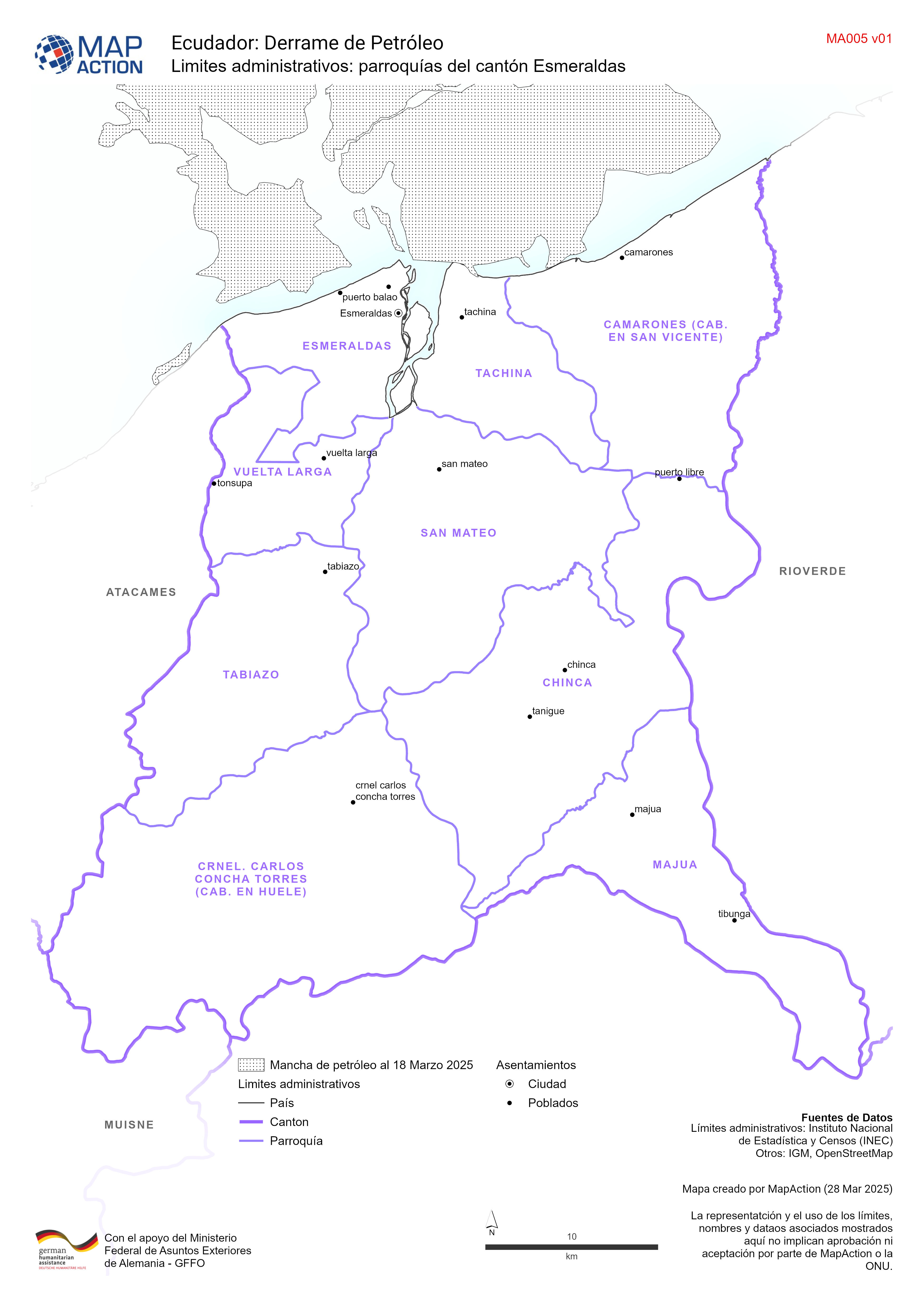
Limites administrativos: parroquías del cantón Esmeraldas
Parroquías del cantón de esmeraldas -

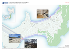
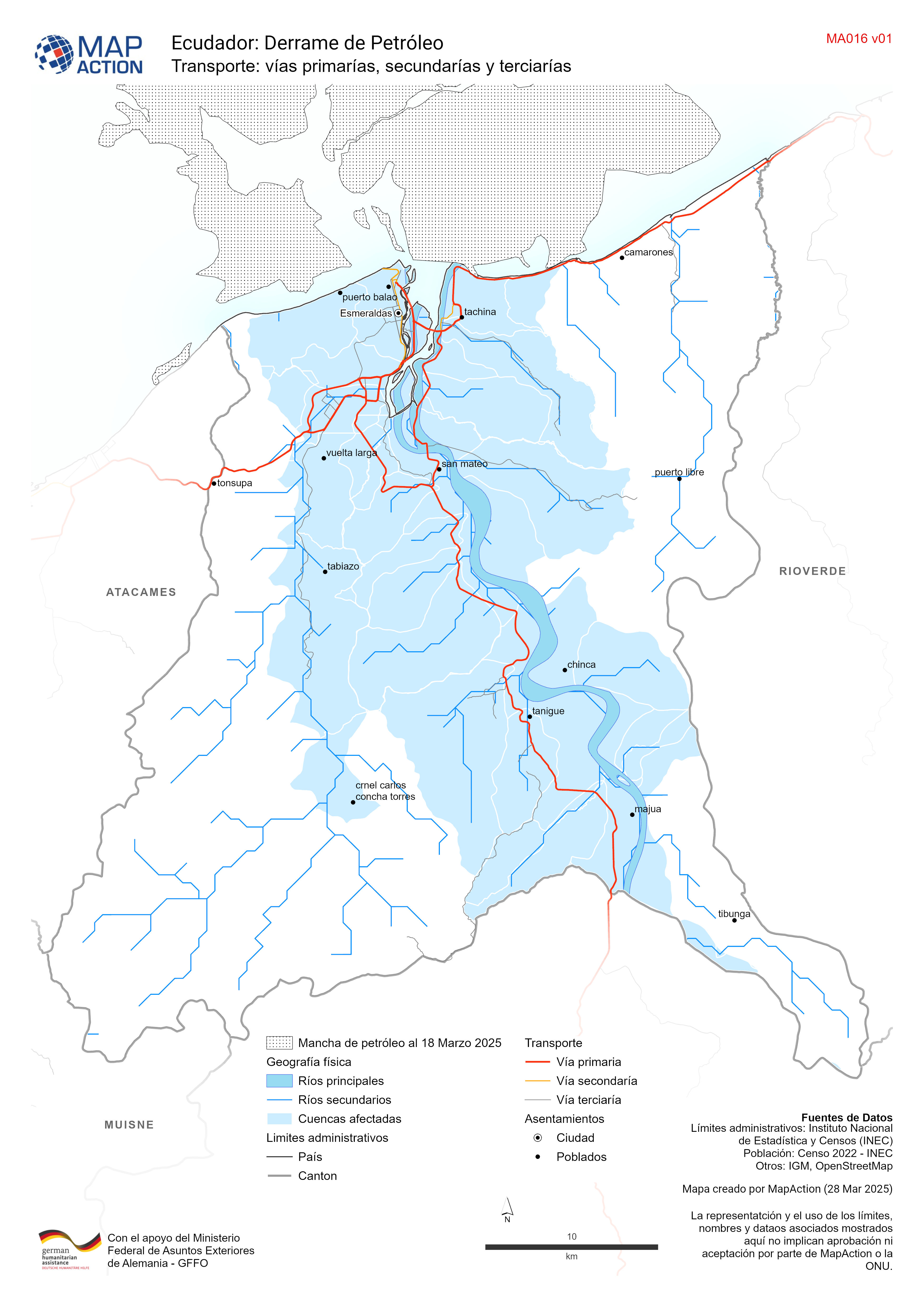
Transporte: vías primarías, secundarías y terciarías
Red de transporte del cantón de esmeraldas -

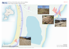
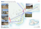
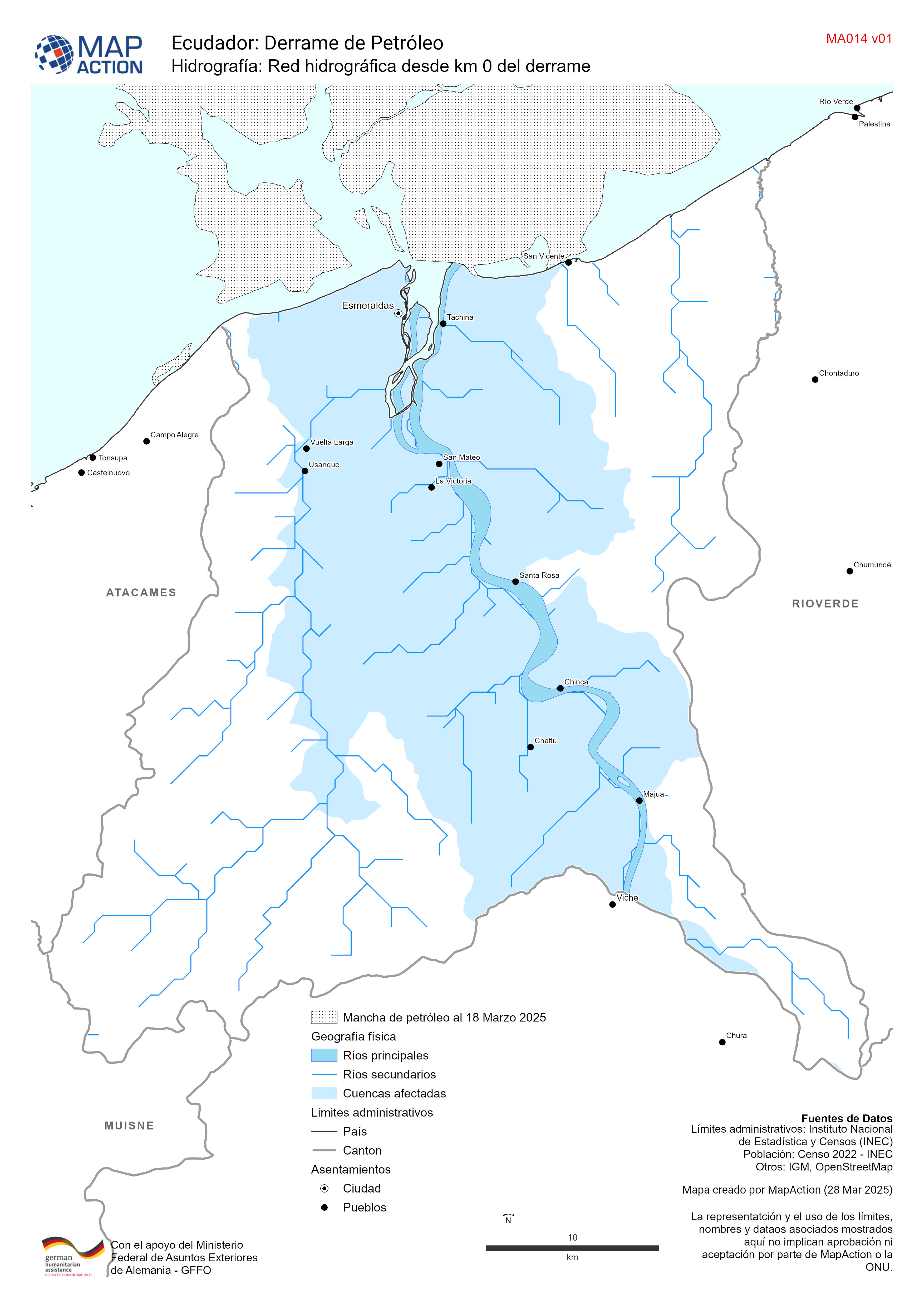
Hidrografía: Red hidrográfica desde km 0 del derrame
Red hidrográfica del cantón de esmeraldas -
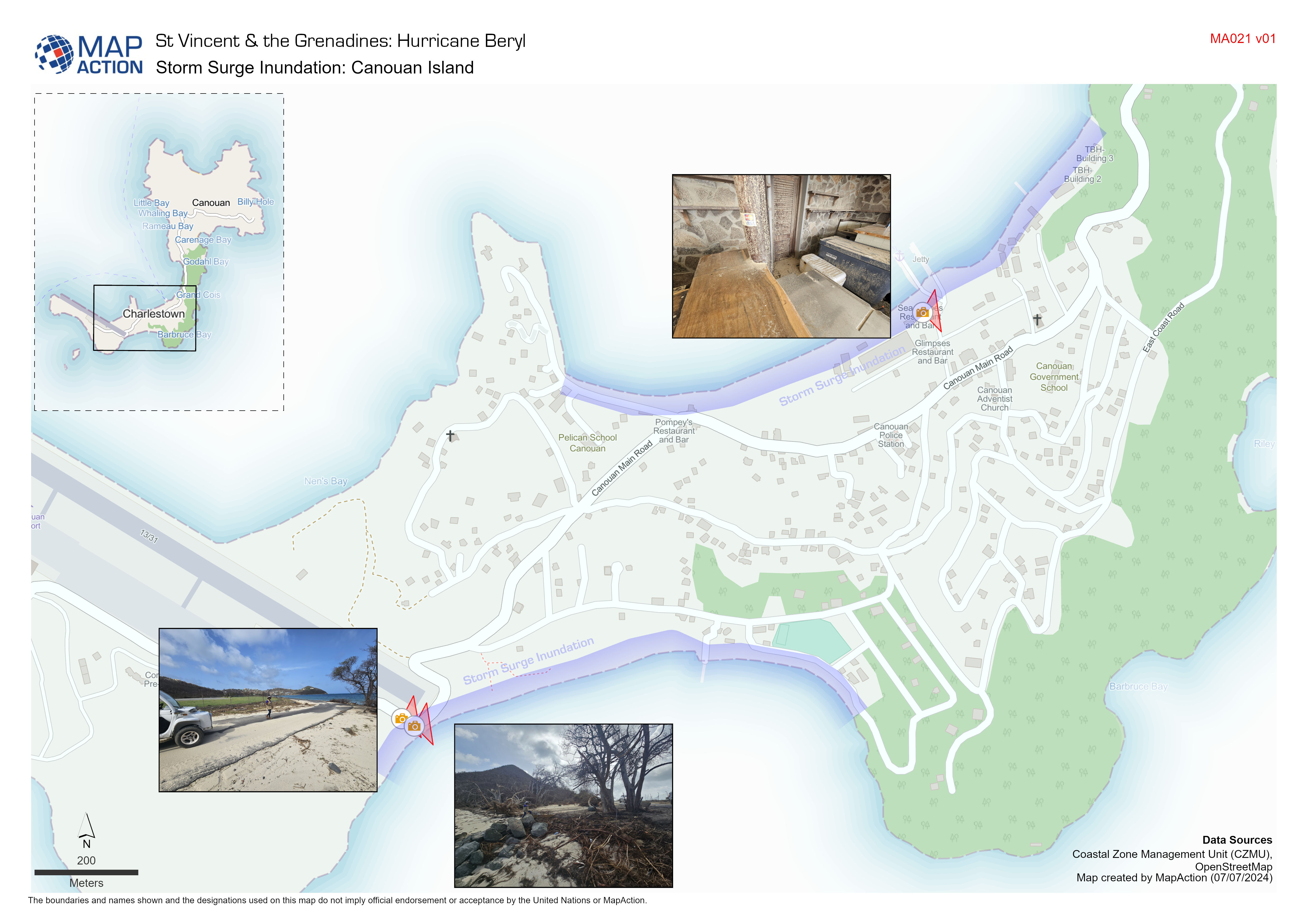
Storm Surge Inundation: Canouan Island
Indicative storm surge inundation from field observations conducted by Coastal Zone Management Unit. -
Storm Surge Inundation: Mayreau Island
Indicative storm surge inundation from field observations conducted by Coastal Zone Management Unit -
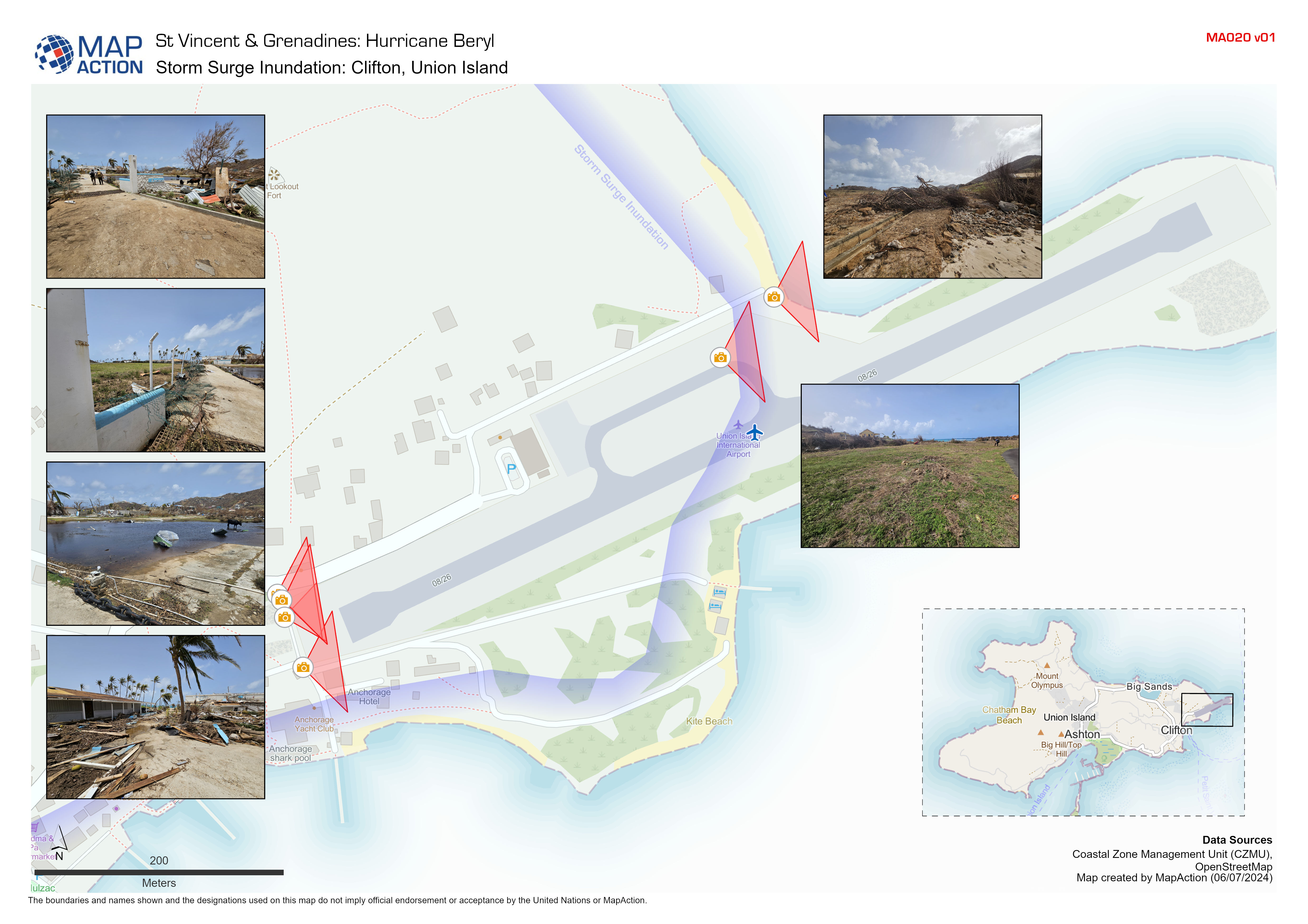
Storm Surge Inundation: Clifton, Union Island
Indicative storm surge inundation from field observations conducted by Coastal Zone Management Unit -

Protected Areas and Extent of Wildfires within NEMO Area of Focus:
A map showing protected areas and the extent of wildfires derived by the Copernicus Emergency Mapping Service (EMS) and from Sentinel-2 satellite images. Populated areas and... -

Protected Areas and Extent of Wildfires:
A map showing protected areas and the extent of wildfires derived by the Copernicus Emergency Mapping Service (EMS) and Sentinel-2 satellite images. Populated areas and main... -

Rainfall-Triggered Landslide Hazard within Mountain Pine Ridge
The Global Rainfall-Triggered Landslide Hazard Map presents a quantitative representation of landslide hazard. This component is the mean annual rainfall-triggered landslide... -

Rainfall-Triggered Landslide Hazard
The Global Rainfall-Triggered Landslide Hazard Map presents a quantitative representation of landslide hazard. This component is the mean annual rainfall-triggered landslide... -

-

Storm path tropical cyclone Mocha (as of 15 May 2023) with baseline populatio...
Storm path as reported by Joint Typhoon Warning Centre. Population totals in table are 2022 estimates by UNFPA and US Census Bureau (USCB). Baseline population distribution... -

Storm path tropical cyclone Mocha (as of 14 May 2023) with baseline populatio...
Storm path as reported by Joint Typhoon Warning Centre. Population totals in table are 2022 estimates by UNFPA and US Census Bureau (USCB). Baseline population distribution... -

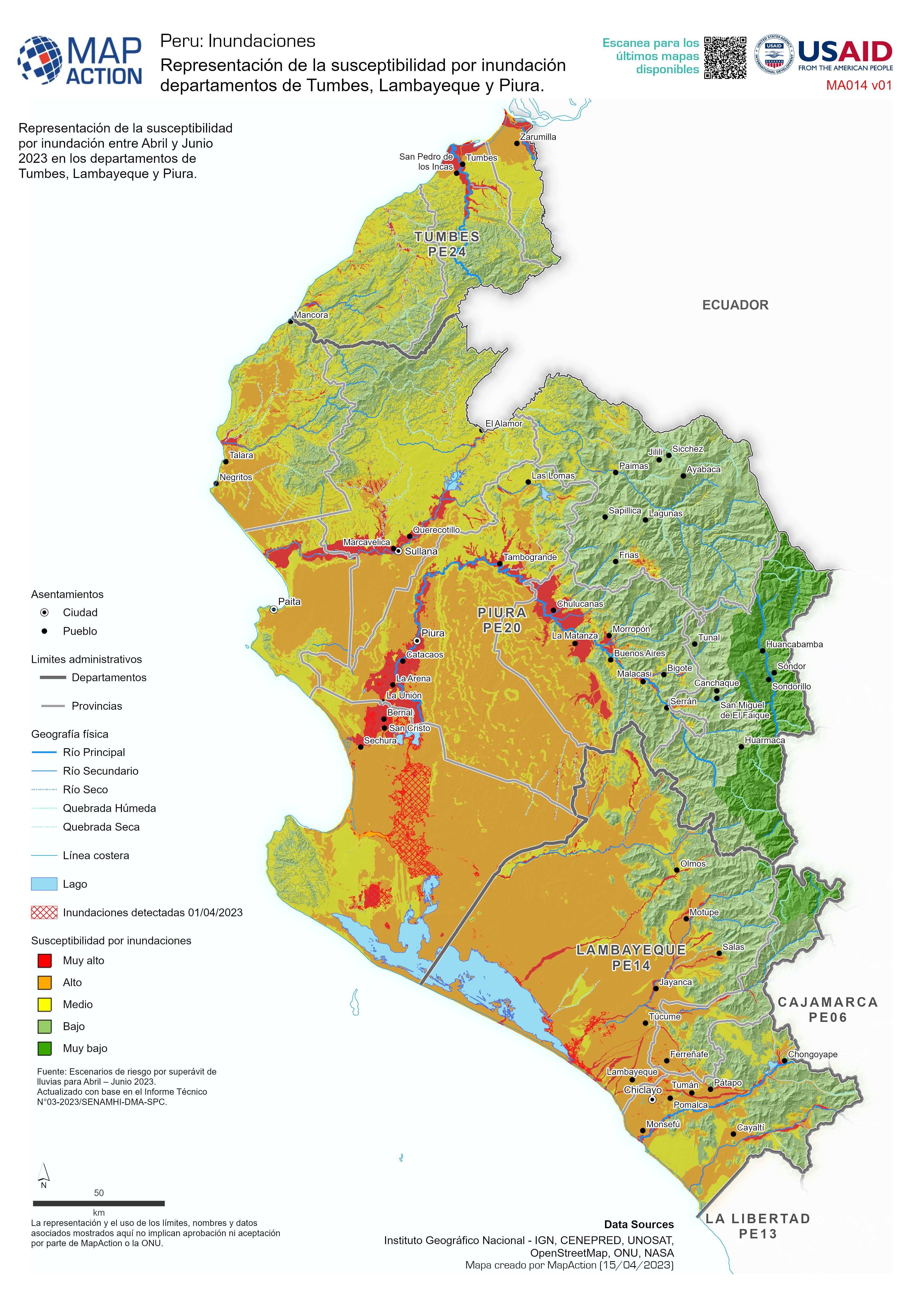
Representación de la susceptibilidad por inundación departamentos de Tumbes, ...
Representación de la susceptibilidad por inundación entre Abril y Junio 2023 en los departamentos de Tumbes, Lambayeque y Piura. -

Precipitación acumulada en los departamentos afectados entre el 28 de marzo y...
Lluvia acumulada en los departamentos afectados entre el 28 de marzo y el 10 de abril de 2023 -

Cumulative Rainfall (1st - 13th March 2023), and affected population. MA019
Southern Region: Total Rainfall (1st - 15th March 2023), and affected population per Traditional Authority


