-

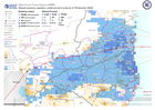
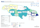
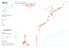
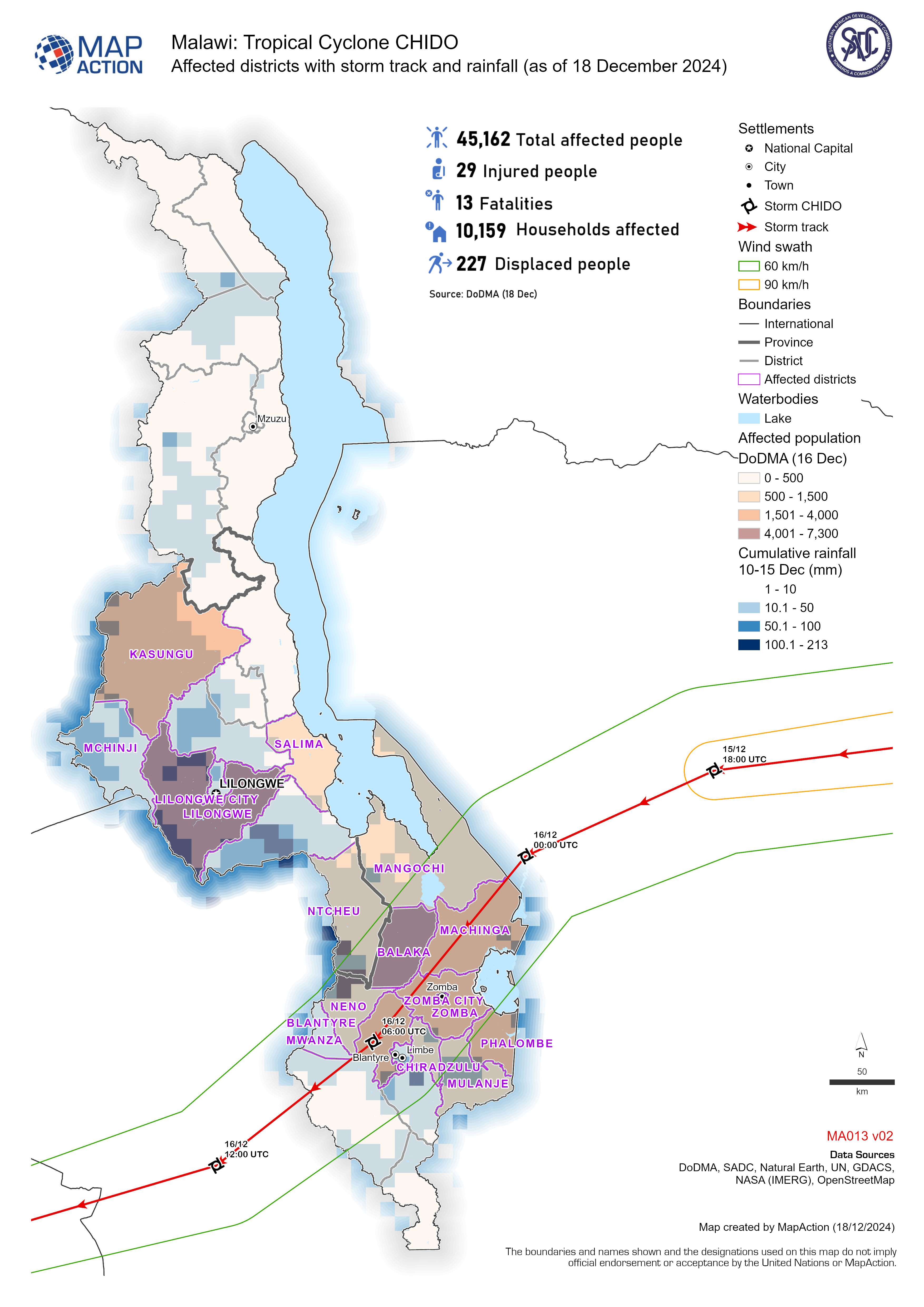
Affected districts with storm track and rainfall (as of 18 December 2024)
Affected population and households with storm track and rainfall for tropical cyclone Chido -
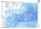
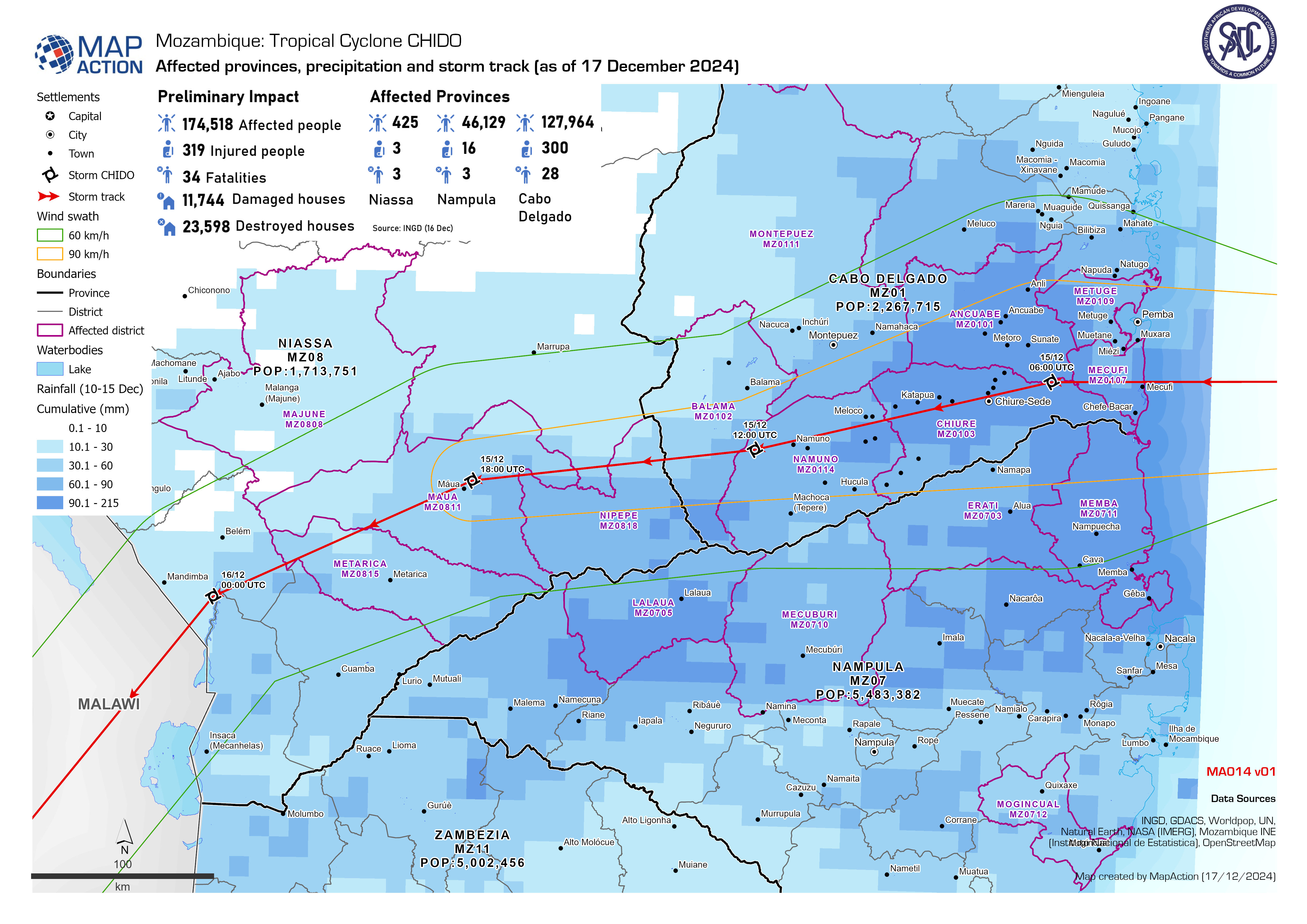
Affected provinces, population, rainfall and storm track (as of 18 December 2...
Affected population by tropical cyclone Chido, showing population density, cumulative rainfall and storm track. -
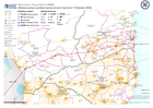
Affected provinces, precipitation and storm track (as of 17 December 2024)
Affected population by the tropical cyclone Chido, showing cumulative rainfall and storm track. -
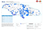
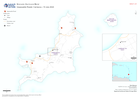
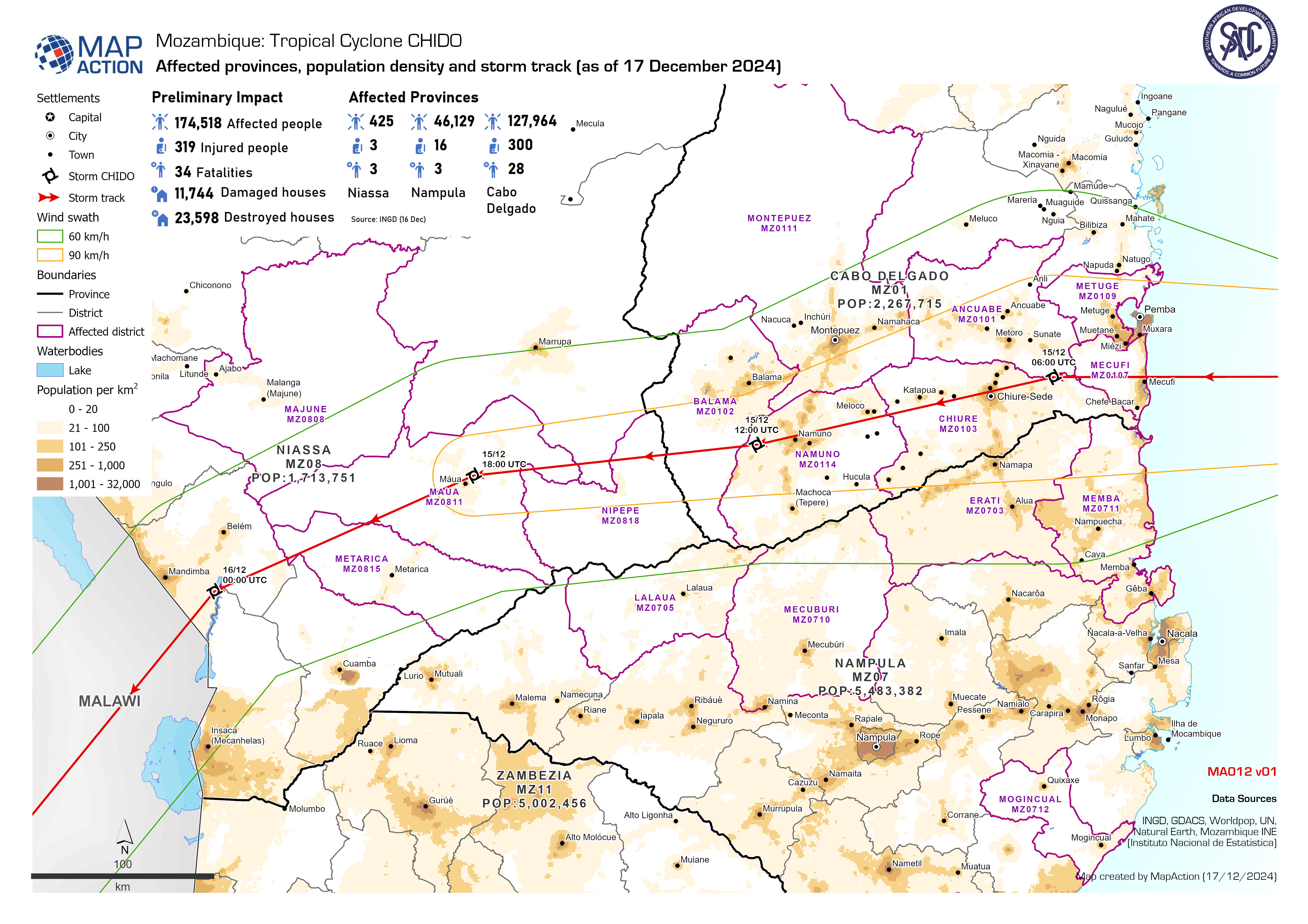
Affected provinces, population density and storm track (as of 17 December 2024)
Affected population by tropical cyclone Chido, showing population density, cumulative rainfall and storm track. -

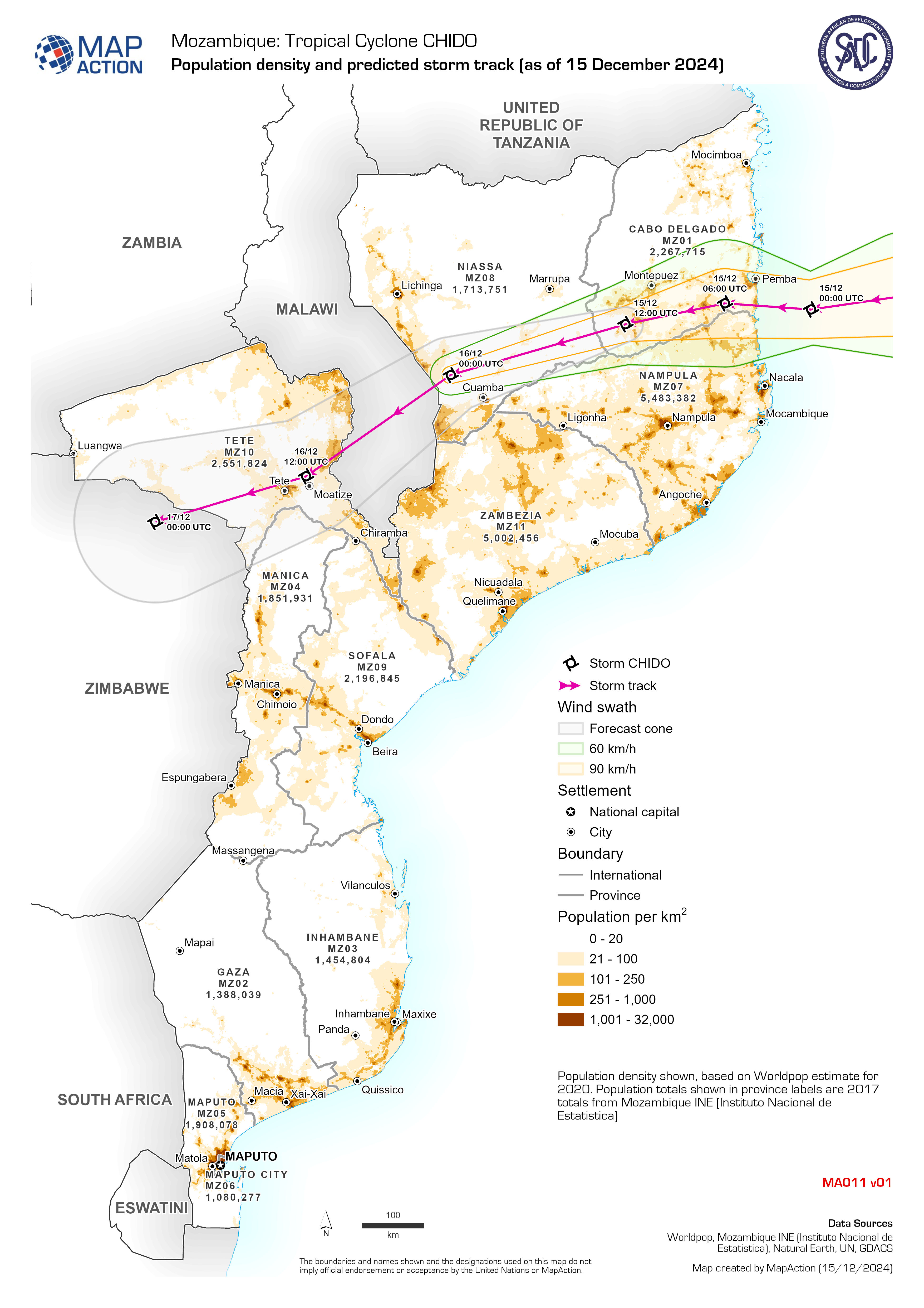
Population density and predicted storm track (as of 15 December 2024)
Population density shown, based on Worldpop estimate for 2020. Population totals shown in province labels are 2017 totals from Mozambique INE (Instituto Nacional de Estatistica) -
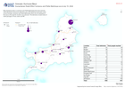
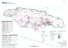
Reported storm affected communities (as of 18 July)
Situational overview showing communities affected by hurricane Beryl, as reported to the Office of Disaster Preparedness and Emergency Management (ODPEM) and priority... -

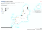
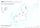
Assessment locations - 10 and 15 July 2024
Map shows the location of the assessments carried out on 10 July 2024. Teams included members from ODPEM, UNDAC, OIM, FAO, UNDSS, UNDP, UNICEF, ATLAS, JEU and TSF. Roads,... -
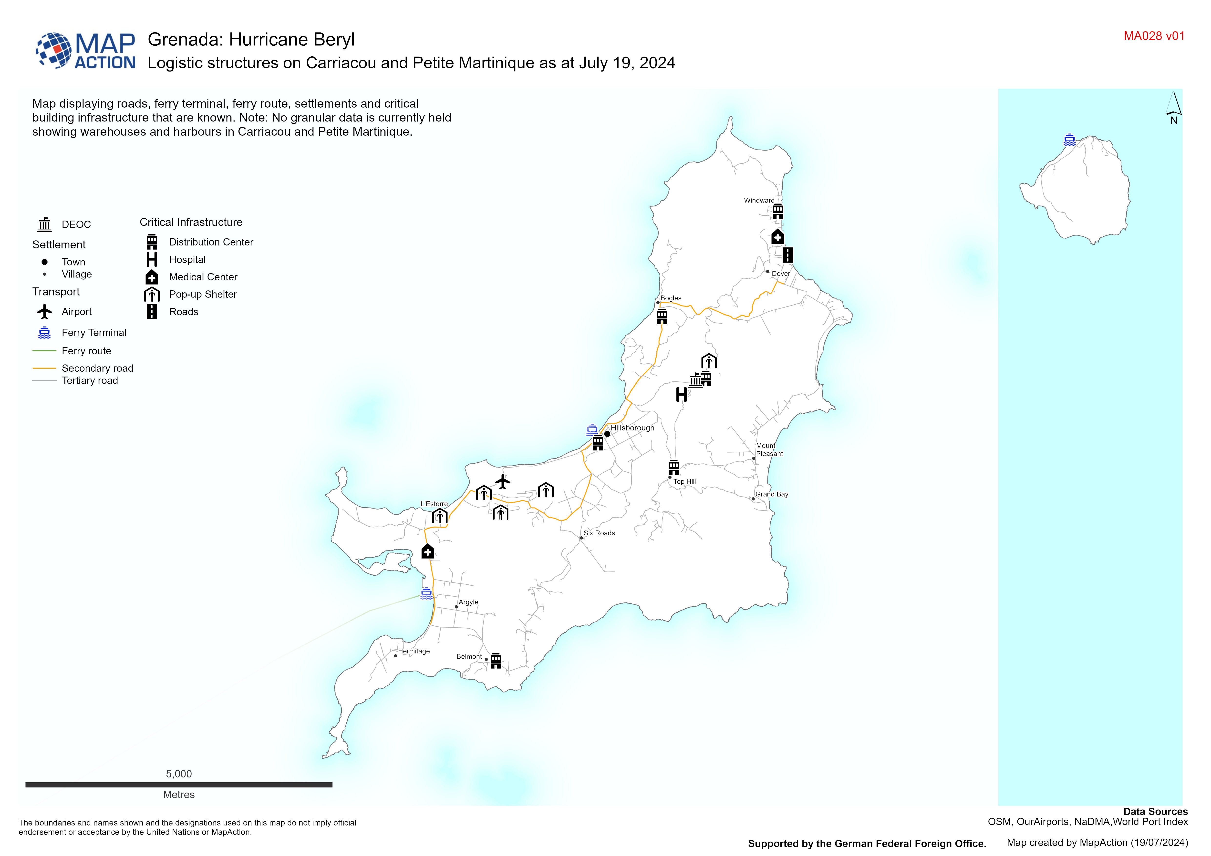
Logistic structures on Carriacou and Petite Martinique as at July 19, 2024
Map displaying roads, ferry terminal, ferry route, settlements and critical building infrastructure that are known. Note: No granular data is currently held showing warehouses... -
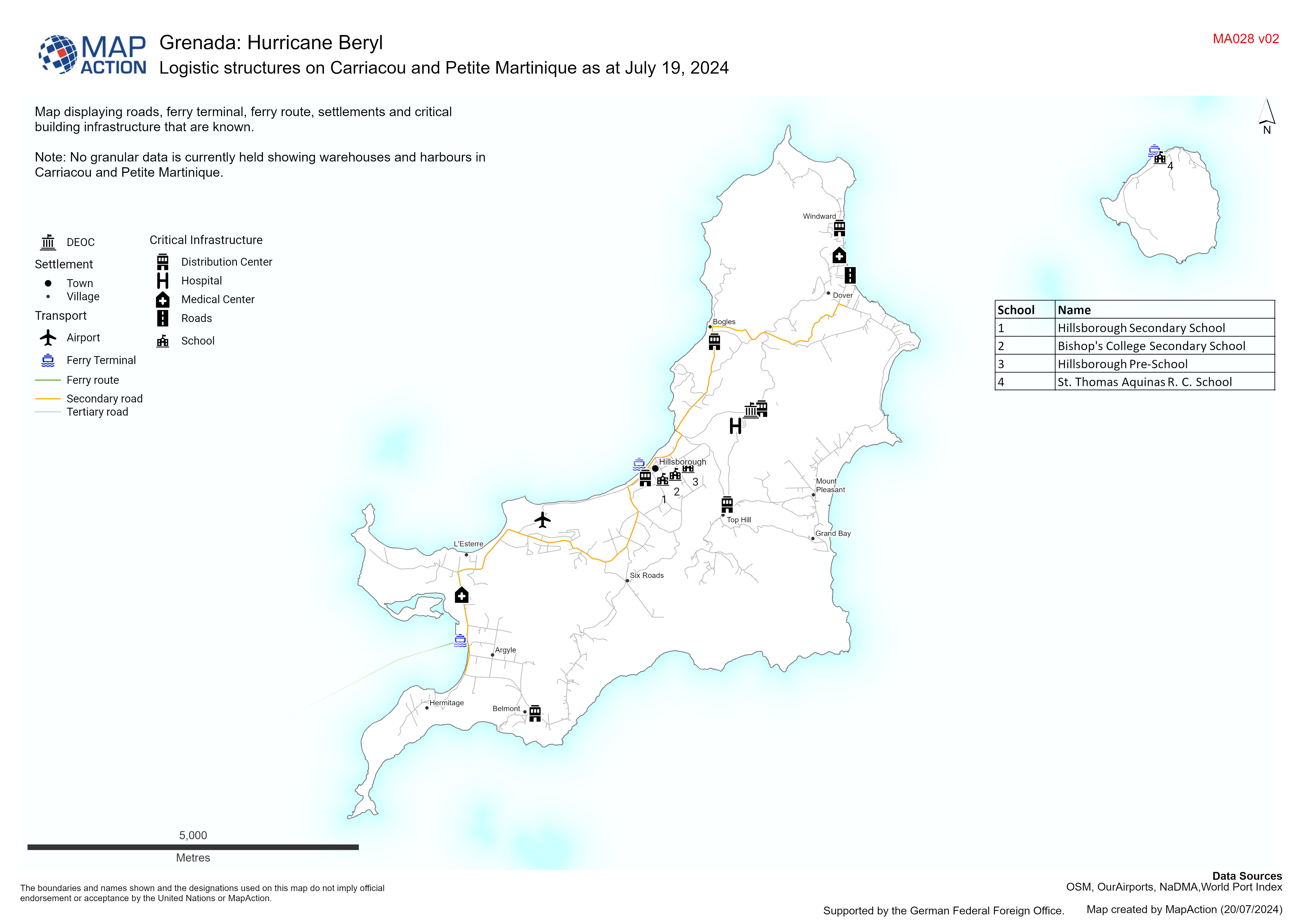
Logistic structures on Carriacou and Petite Martinique as at July 19, 2024
Map displaying roads, ferry terminal, ferry route, settlements and critical building infrastructure that are known. Note: No granular data is currently held showing warehouses... -
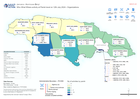
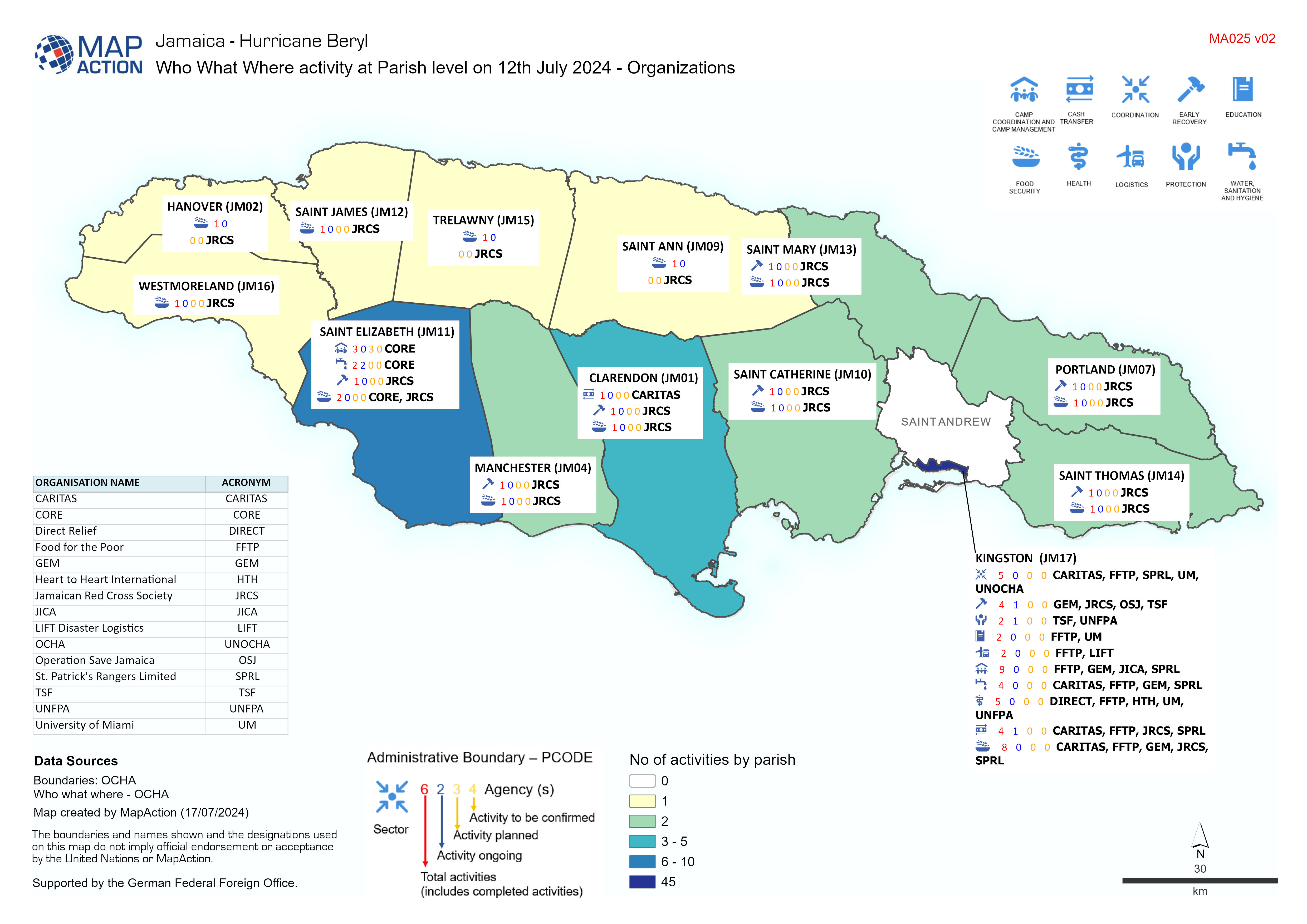
Who What Where activity at Parish level on 12th July 2024 - Organizations
Who what where information at Parish level for organizations working in Jamaica -
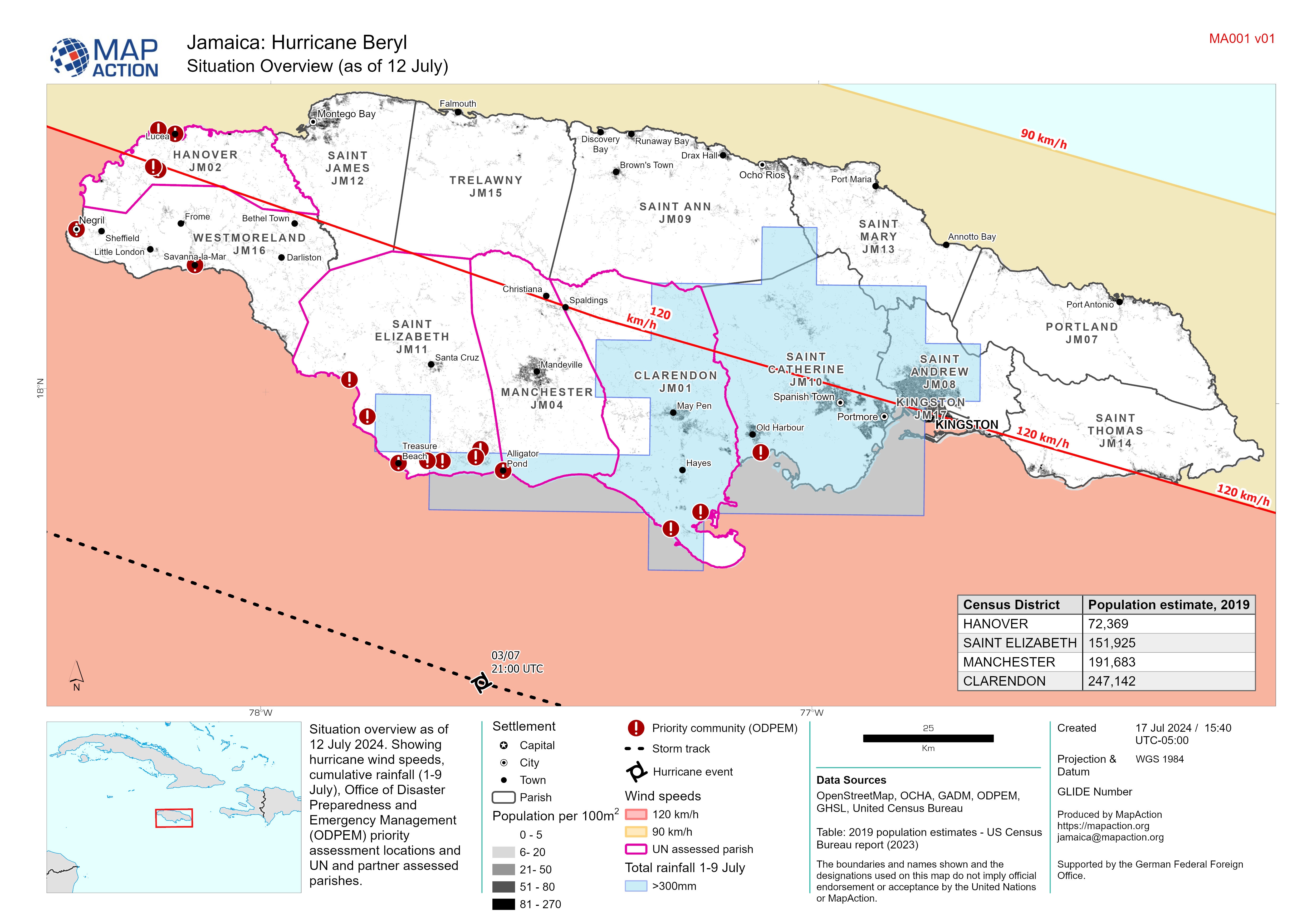
Situation Overview (as of 12 July)
Situation overview as of 12 July 2024. Showing hurricane wind speeds, cumulative rainfall (1-9 July), Office of Disaster Preparedness and Emergency Management (ODPEM) priority... -
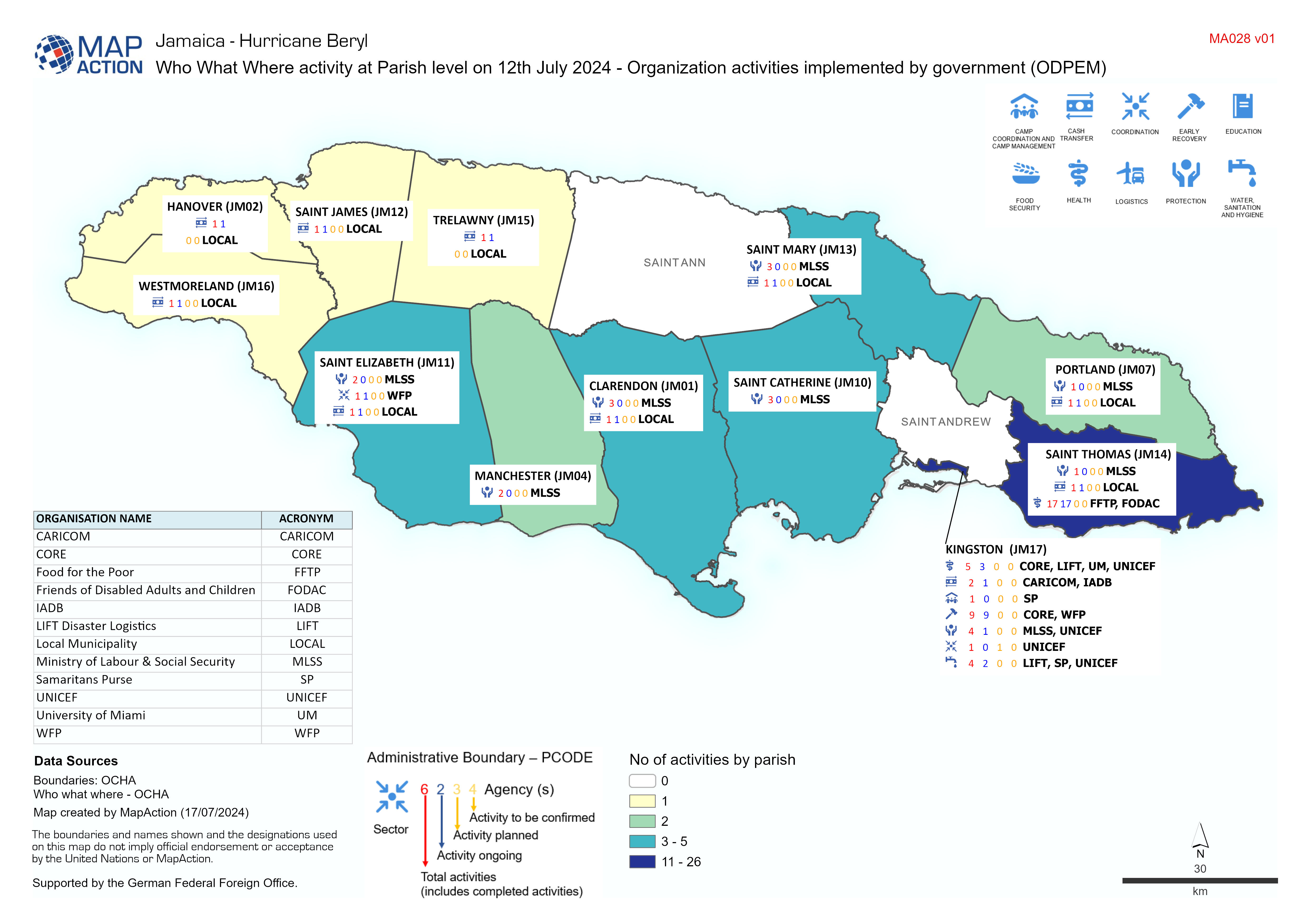
Who What Where activity at Parish level on 12th July 2024 - Organization acti...
Map shows who what where activity at Parish level for organization activities implemented by the government. -
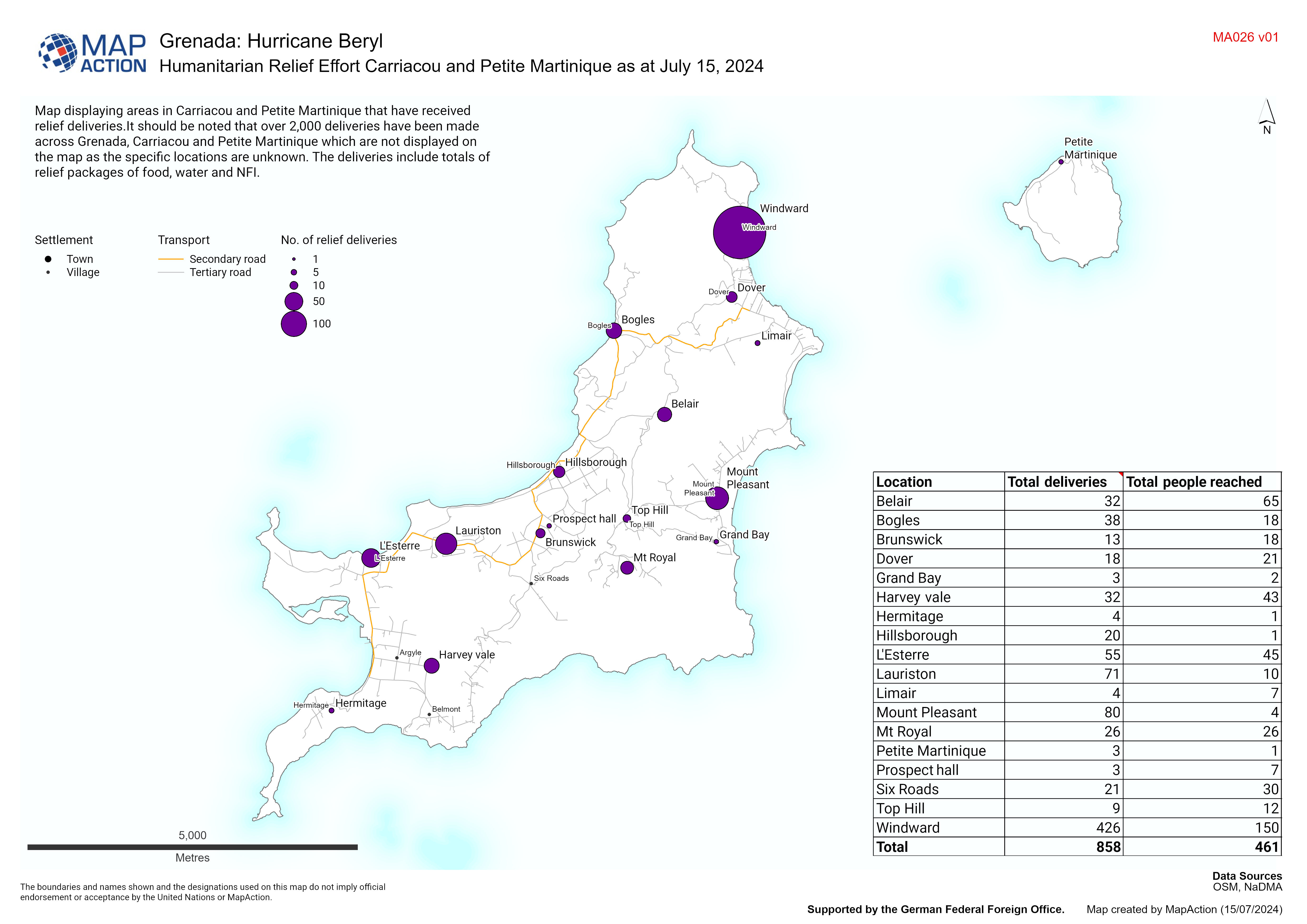
Humanitarian Relief Effort Carriacou and Petite Martinique as at July 15, 2024
Map displaying areas in Carriacou and Petite Martinique that have received relief deliveries.It should be noted that over 2,000 deliveries have been made across Grenada,... -
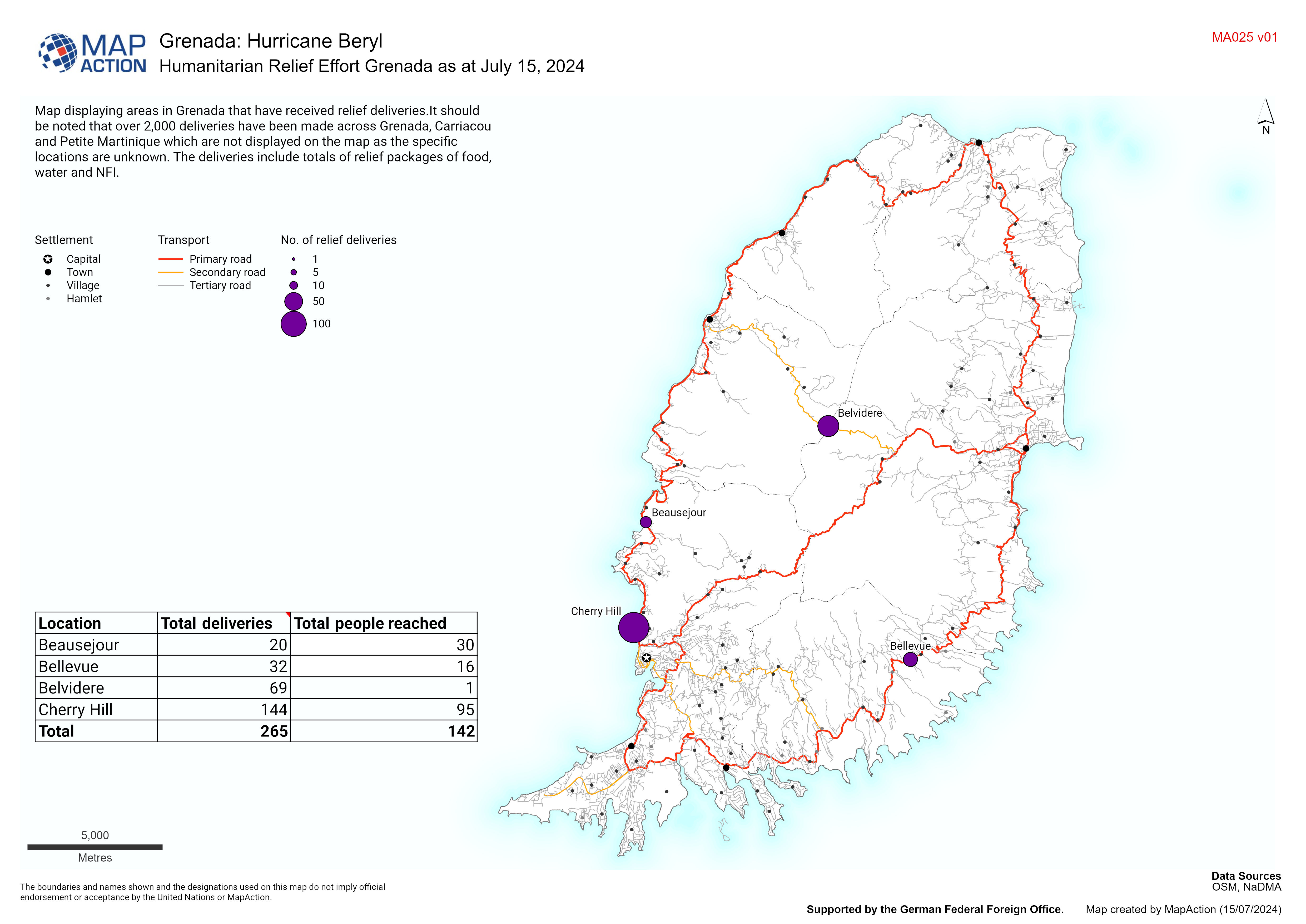
Humanitarian Relief Effort Grenada as at July 15, 2024
Map displaying areas in Grenada that have received relief deliveries.It should be noted that over 2,000 deliveries have been made across Grenada, Carriacou and Petite Martinique... -
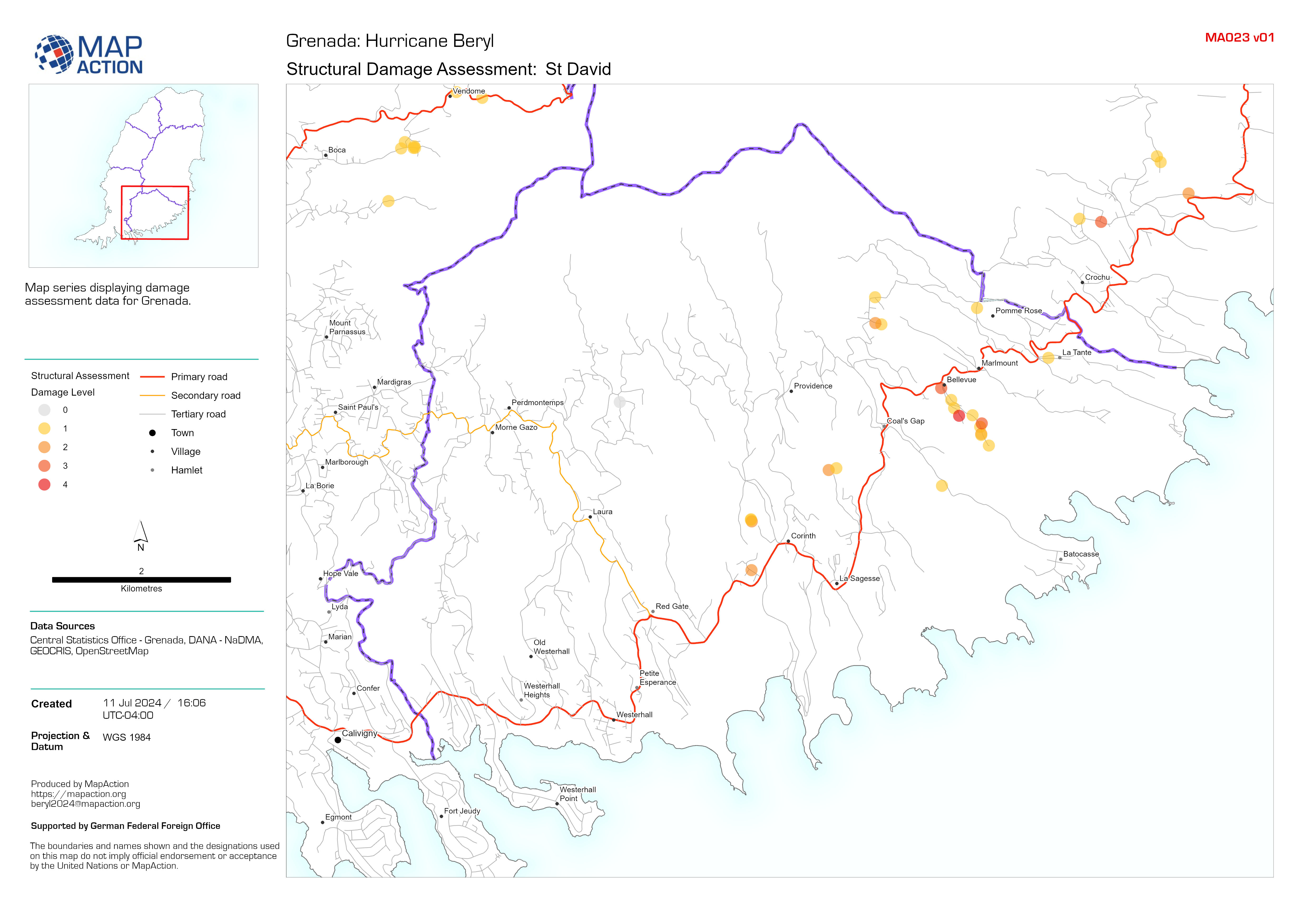
Structural Damage Assessment: Grenada
Map series displaying damage assessment data for Grenada. -
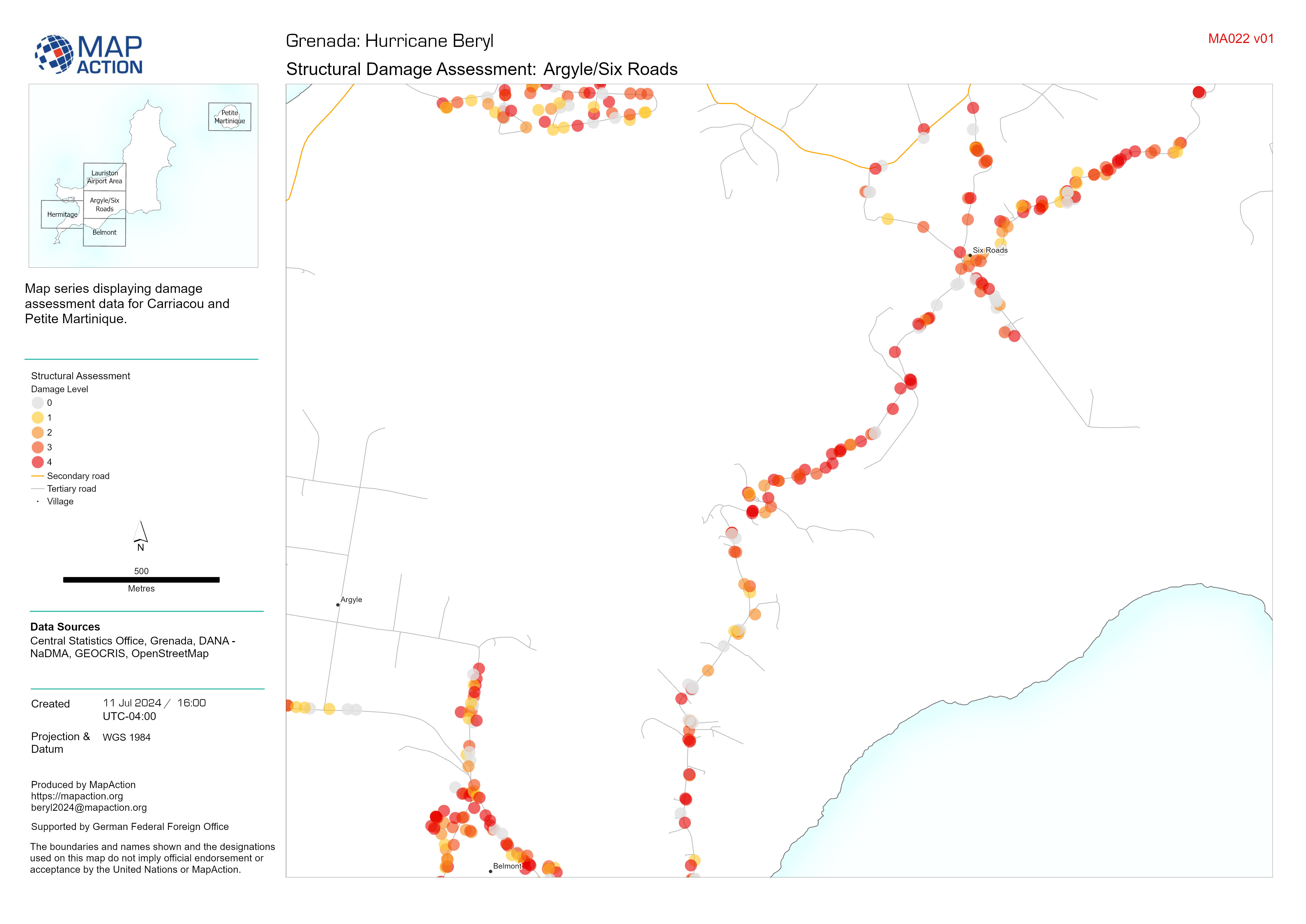
Structural Damage Assessment: Carriacou and Petite Martinique
Map series displaying damage assessment data for Carriacou and Petite Martinique. -
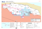
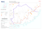
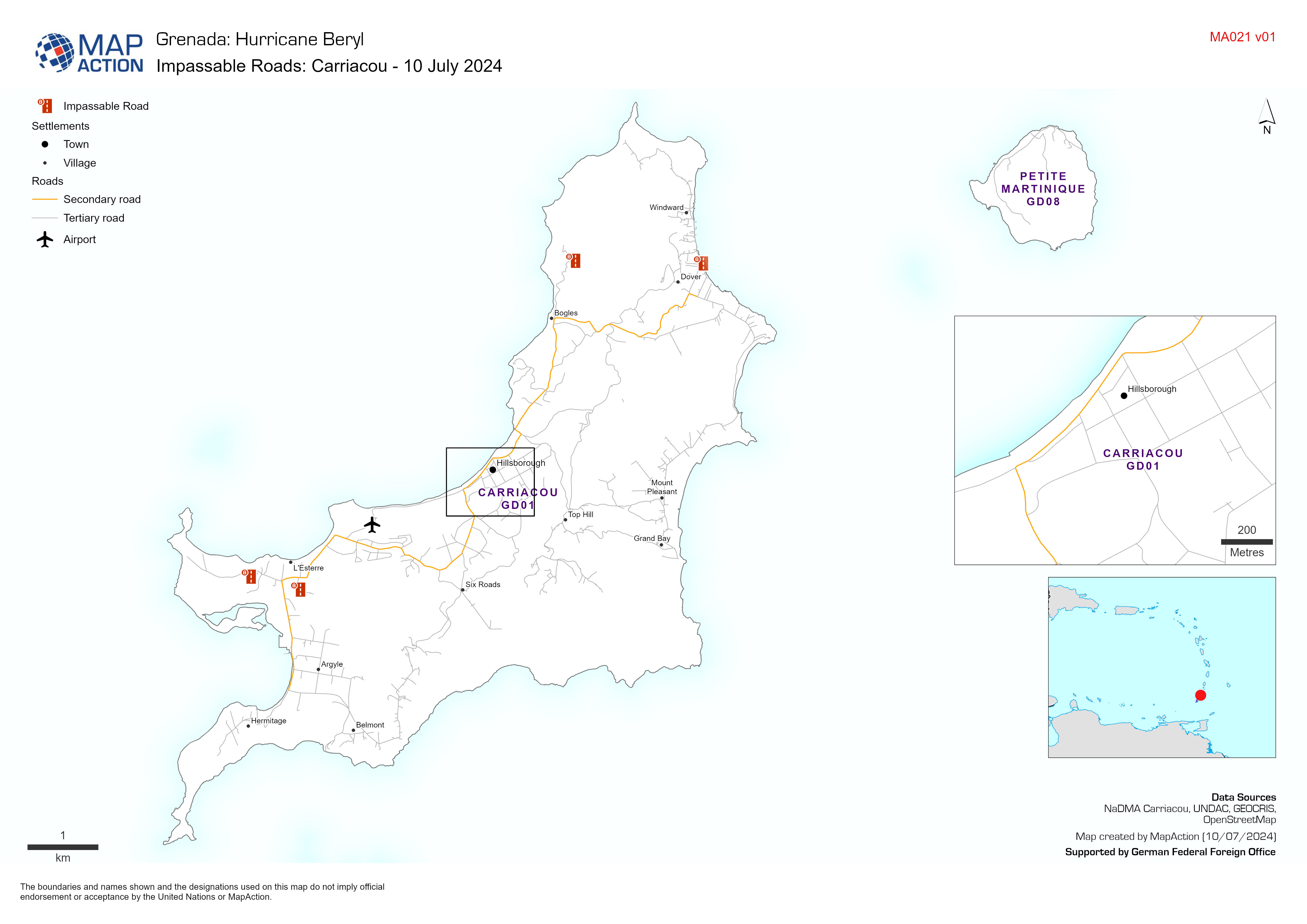
Impassable Roads: Carriacou - 10 July 2024
Map displaying key infrastructure and impassable roads from field observations -
Situation Overview
Situation overview as of 08 July 2024. Showing settlements, baseline population, affected areas for assessment and populated evacuation centers -
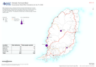
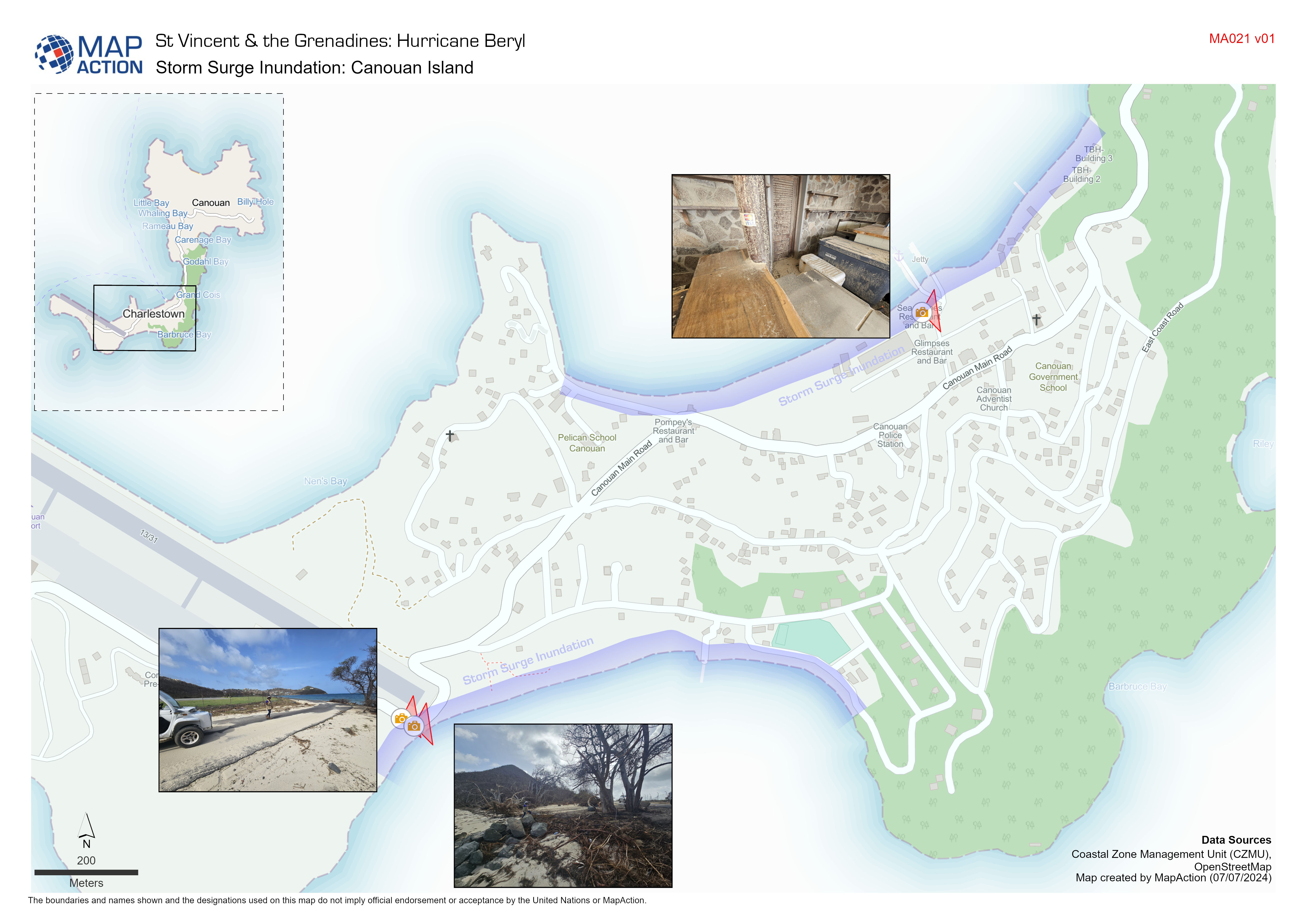
Storm Surge Inundation: Canouan Island
Indicative storm surge inundation from field observations conducted by Coastal Zone Management Unit. -
Storm Surge Inundation: Mayreau Island
Indicative storm surge inundation from field observations conducted by Coastal Zone Management Unit