-

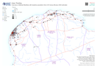
Transport: Road status as of 31 March 2025
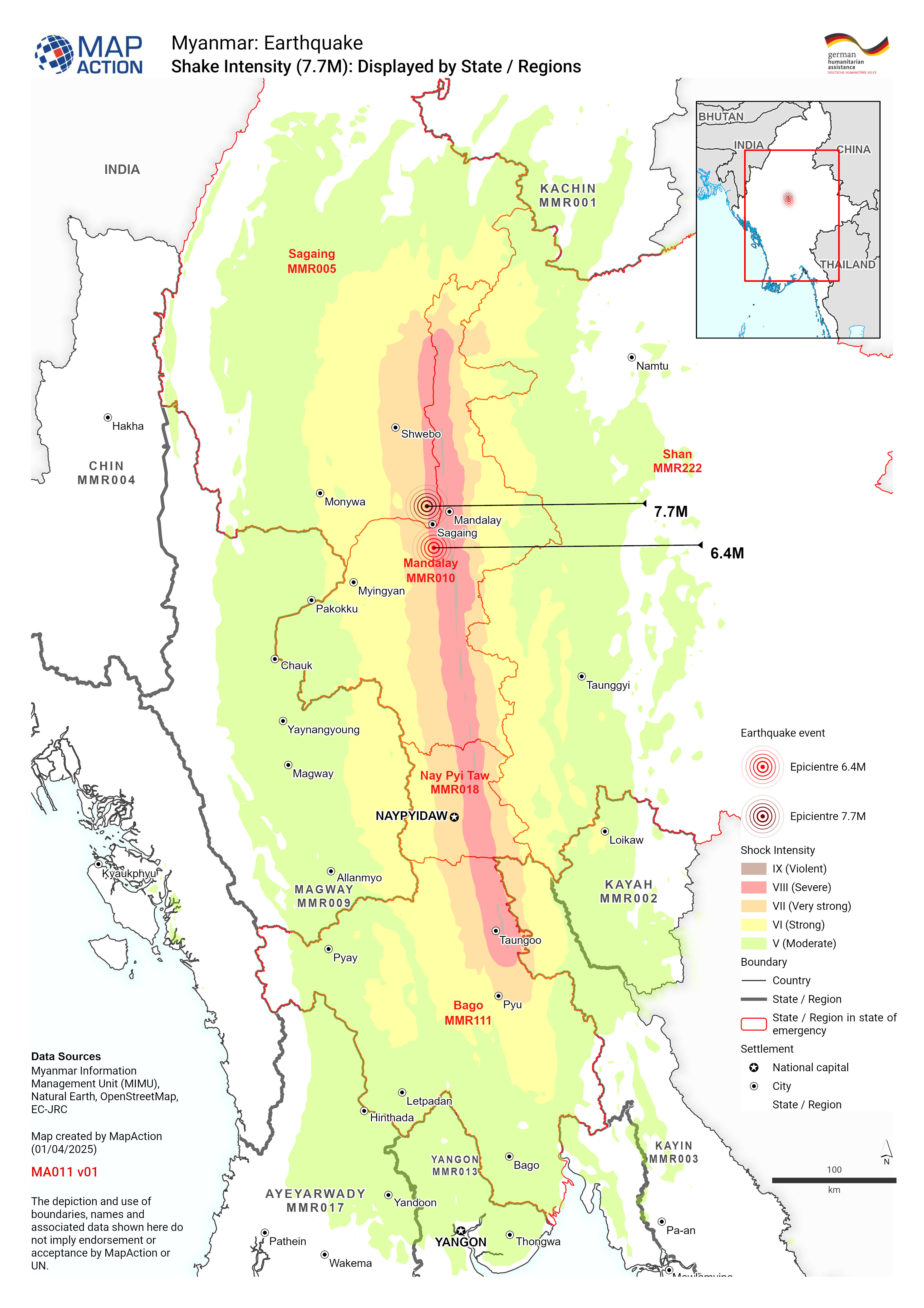
Earthquake shake intensity bands displayed over State - Regions of Myanmar -

Shake Intensity (7.7M): Displayed by State / Regions
Earthquake shake intensity bands displayed over State - Regions of Myanmar -

State / Region Administrative Overview
Myanmar country overview showing administrative boundaries, main settlements, transport infrastructure and natural features -

Country Overview
Myanmar country overview showing administrative boundaries, main settlements, transport infrastructure and natural features -
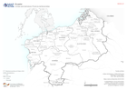
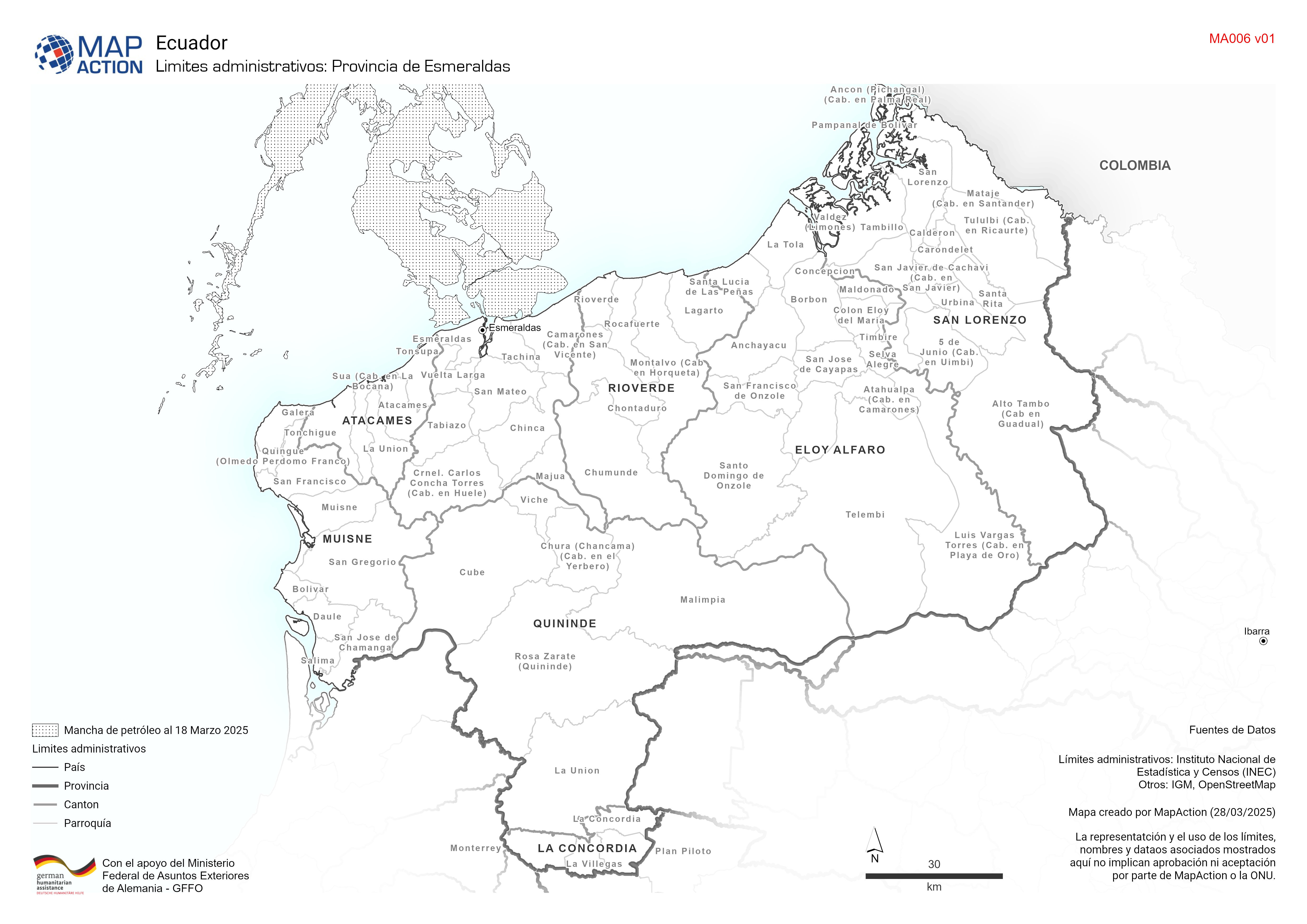
Limites administrativos: Provincia de Esmeraldas
Cantones y parroquías de la provincia de esmeraldas -

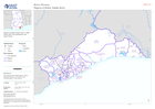
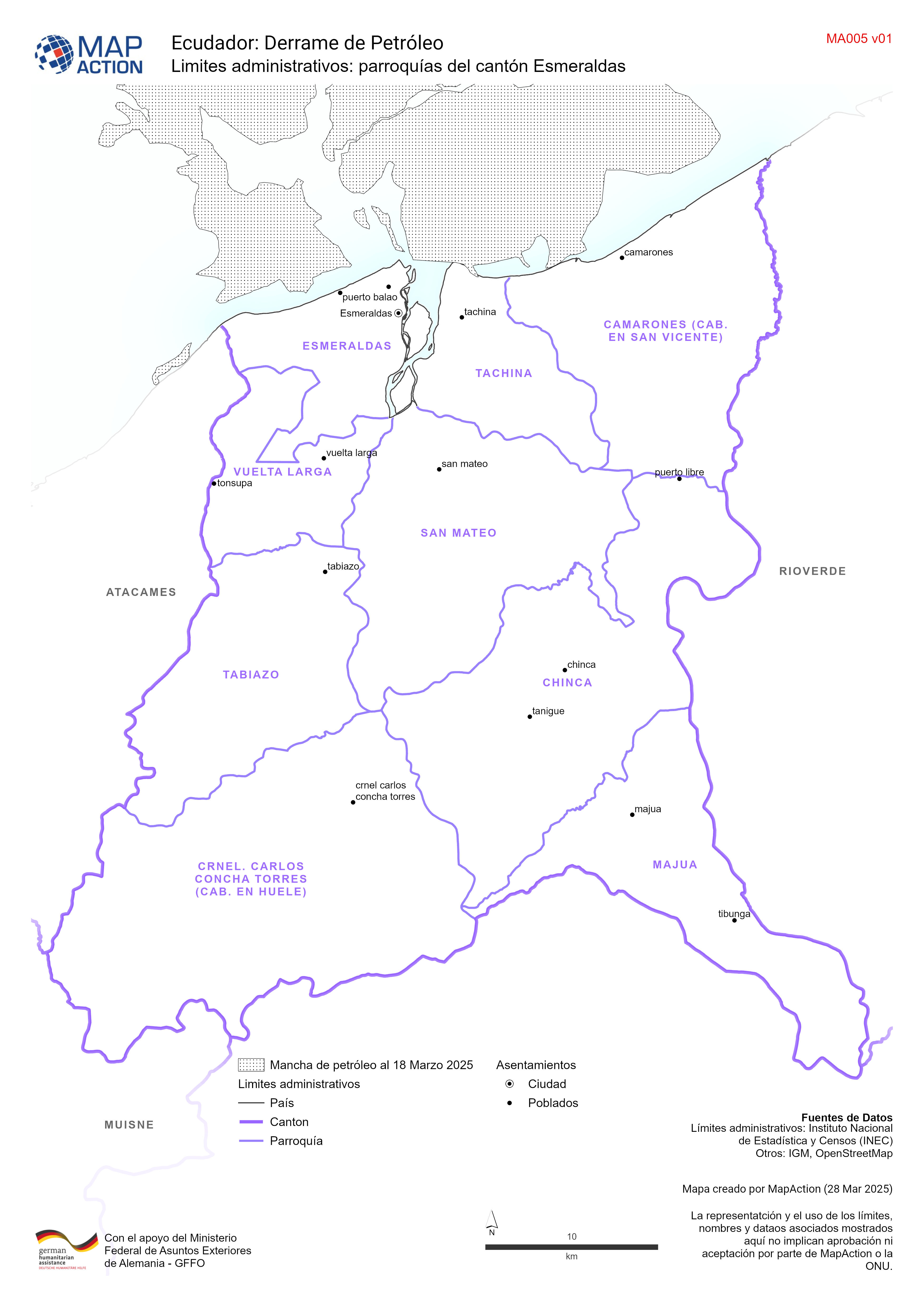
Limites administrativos: parroquías del cantón Esmeraldas
Parroquías del cantón de esmeraldas -

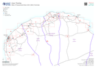
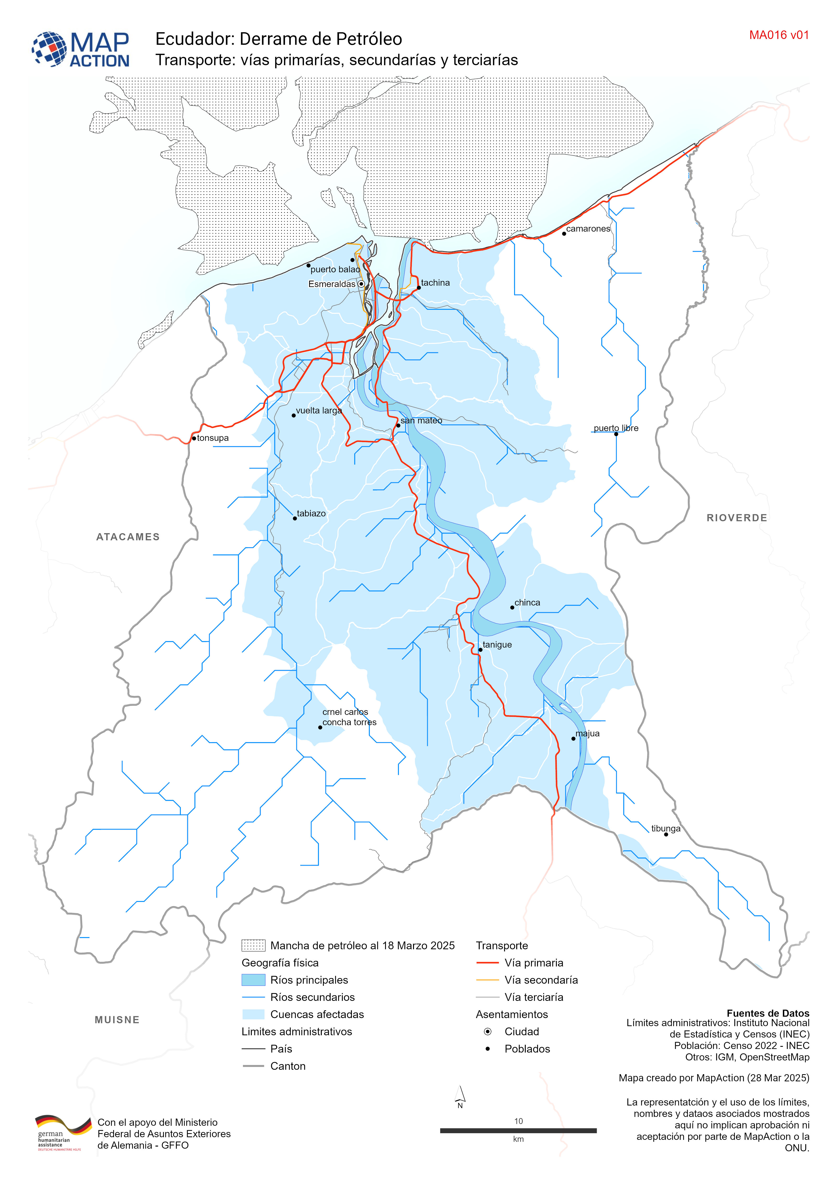
Transporte: vías primarías, secundarías y terciarías
Red de transporte del cantón de esmeraldas -

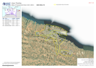
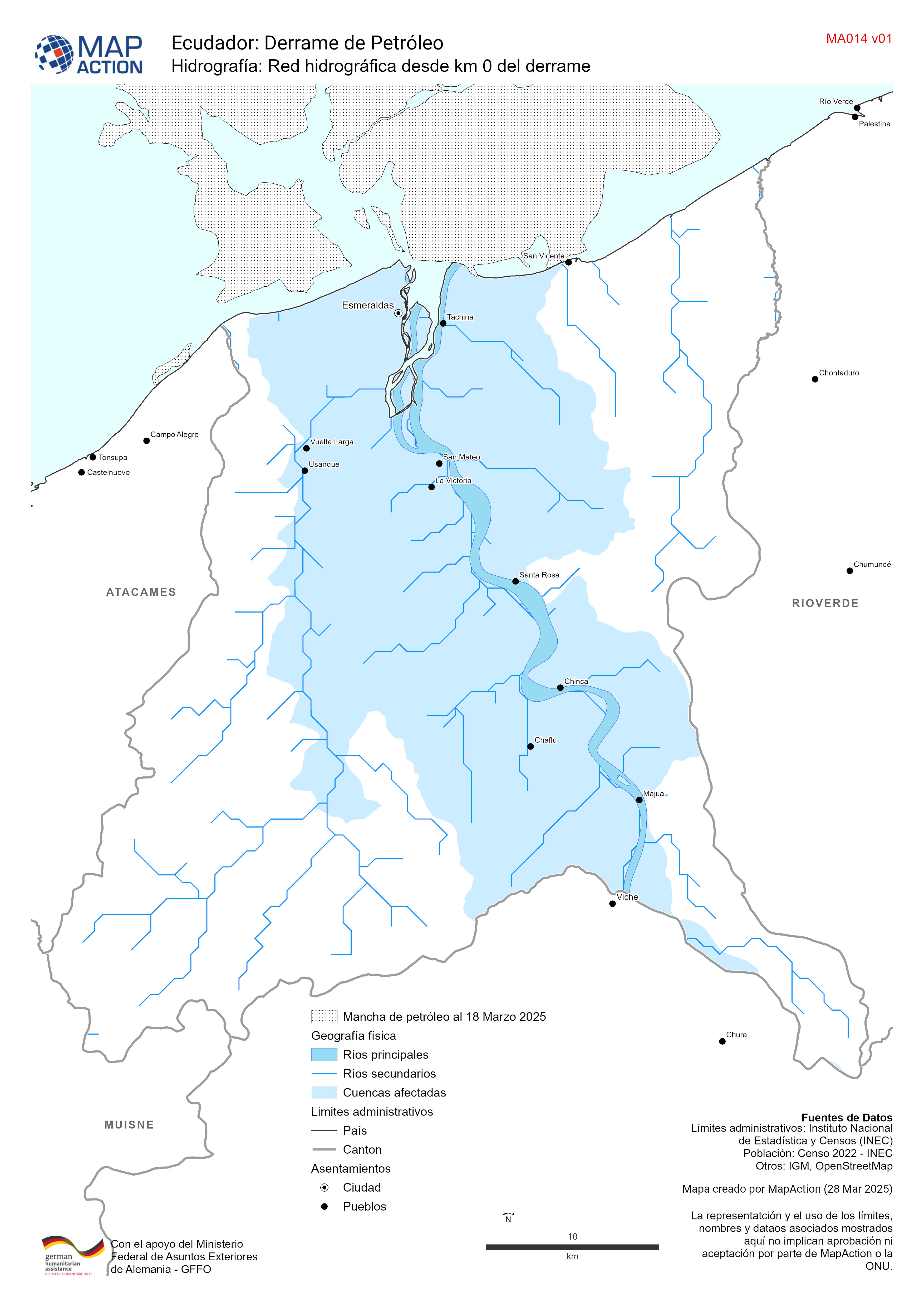
Hidrografía: Red hidrográfica desde km 0 del derrame
Red hidrográfica del cantón de esmeraldas -

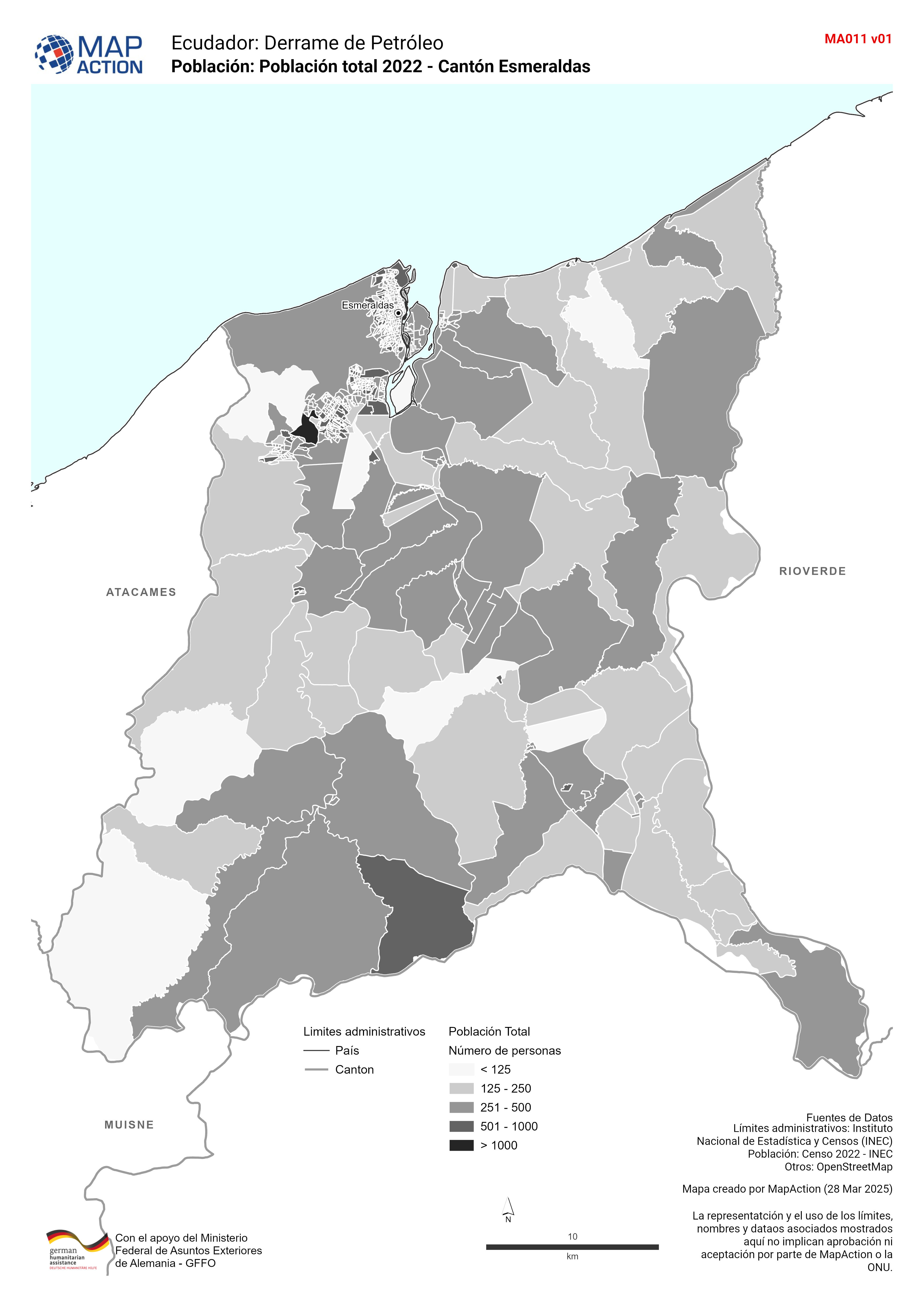
Población: Población total 2022 - Cantón Esmeraldas
Población total por zonas censales del 2022 para el cantón de Esmeraldas -

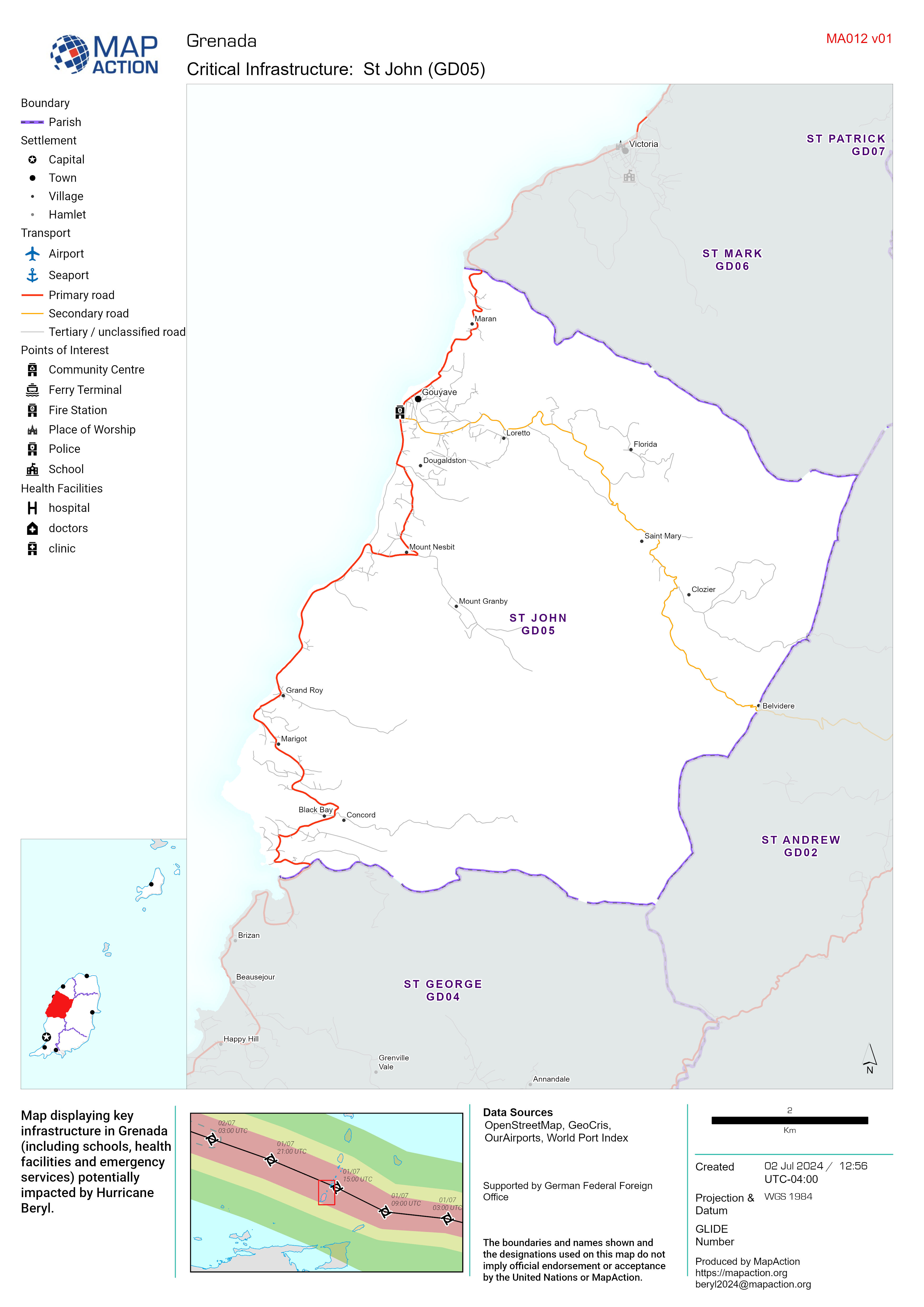
Critical Infrastructure Map Atlas - MapAction
Map displaying key infrastructure in Grenada (including schools, health facilities and emergency services) potentially impacted by Hurricane Beryl. -

Population Density with Baseline Population by District
The map shows population distribution based on WorldPop density estimates (2020). Each district is also labelled with the estimated baseline population count (2021). The chart... -

Flood Extent (02 Dec) and Baseline Population for South Somalia
The maps show the flood extent combined with population density to highlight potentially affected areas. The table shows the estimated baseline population by district (2021).... -
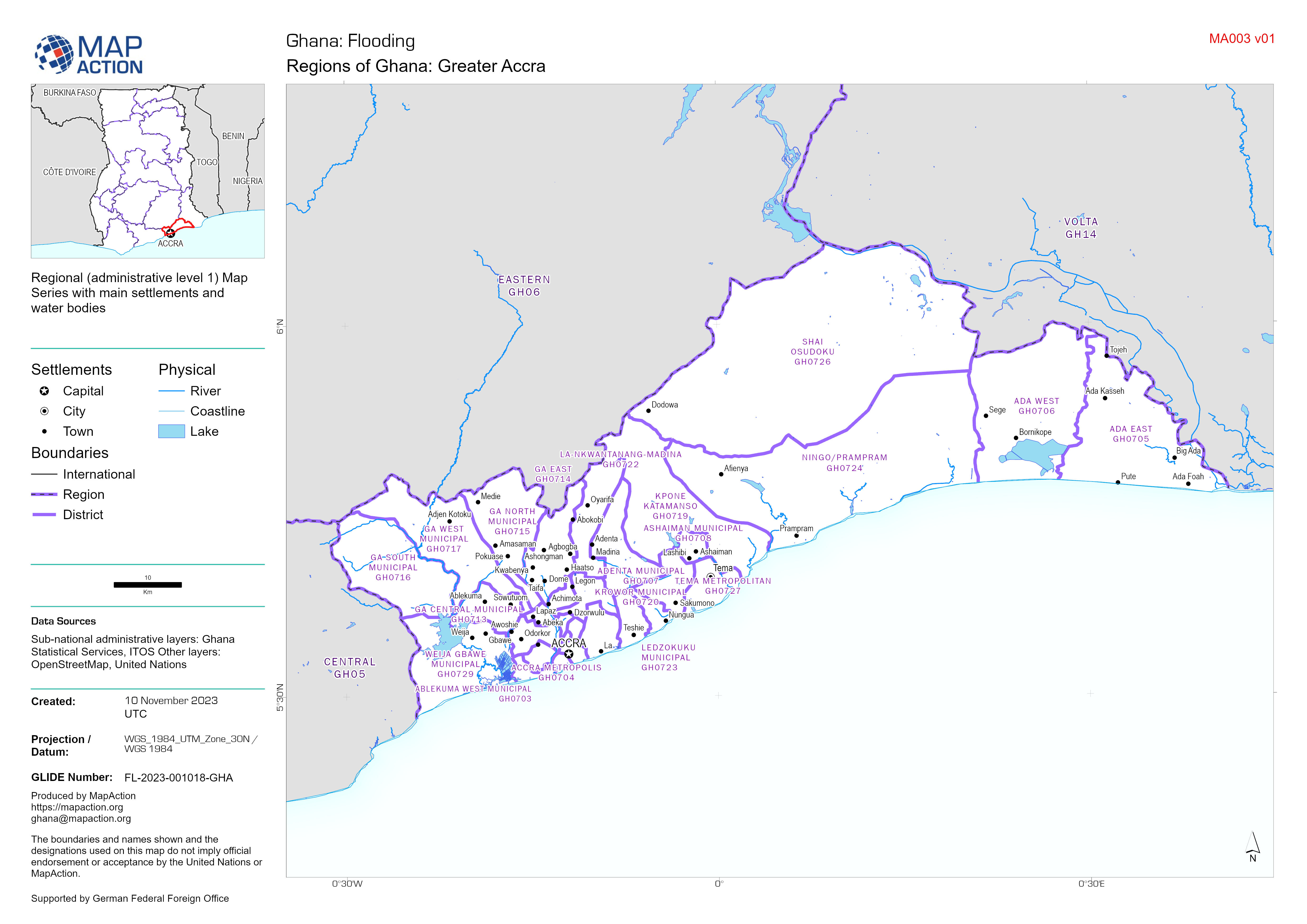
Regions of Ghana Map Series - Central, Eastern, Greater Accra, Volta
Regional (administrative level 1) Map Series with main settlements and water bodies -

ASAL Humanitarian Network Drought Response - Activity by Sub County (as of 23...
The map shows the 3w (who, what, where) response activity by sub-county for the planned and ongoing multi-purpose cash program implemented by the ASAL Humanitarian Network... -

Atlas of 'Assessment Area Units' (AAU) Overview
Atlas showing Assesment Area Units (AAUs) for urban area between Benghazi and Derna -

Atlas of 'Assessment Area Units' (AAU):
Atlas showing Assessment Area Units (AAUs) for urban area between Benghazi and Derna -

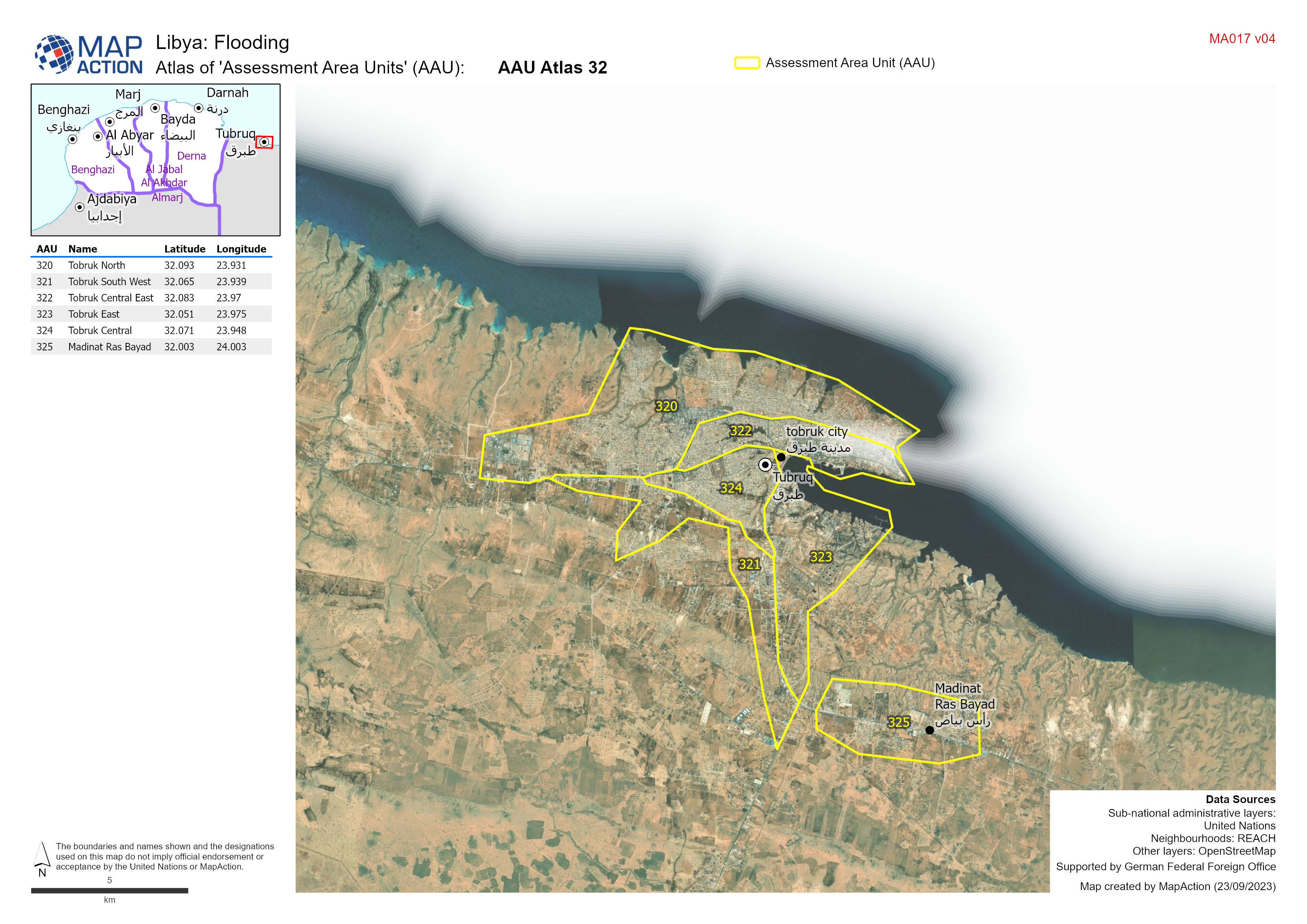
Atlas of 'Assessment Area Units' (AAU):
Atlas showing Assessment Area Units (AAUs) for urban area between Benghazi and Derna -
Atlas of 'Assessment Area Units' (AAU):
Atlas showing Assessment Area Units (AAUs) for urban area between Benghazi and Derna -
'Assessment Area Units' (AAU) Overview
Showing Assesment Area Units (AAUs) atlas ages for urban area between Benghazi and Derna -
Overview of affected Mantikas with baseline population (from US Census Bureau...
Overview of affected governorates with baseline population (from US Census Bureau 2020 estimate)