-

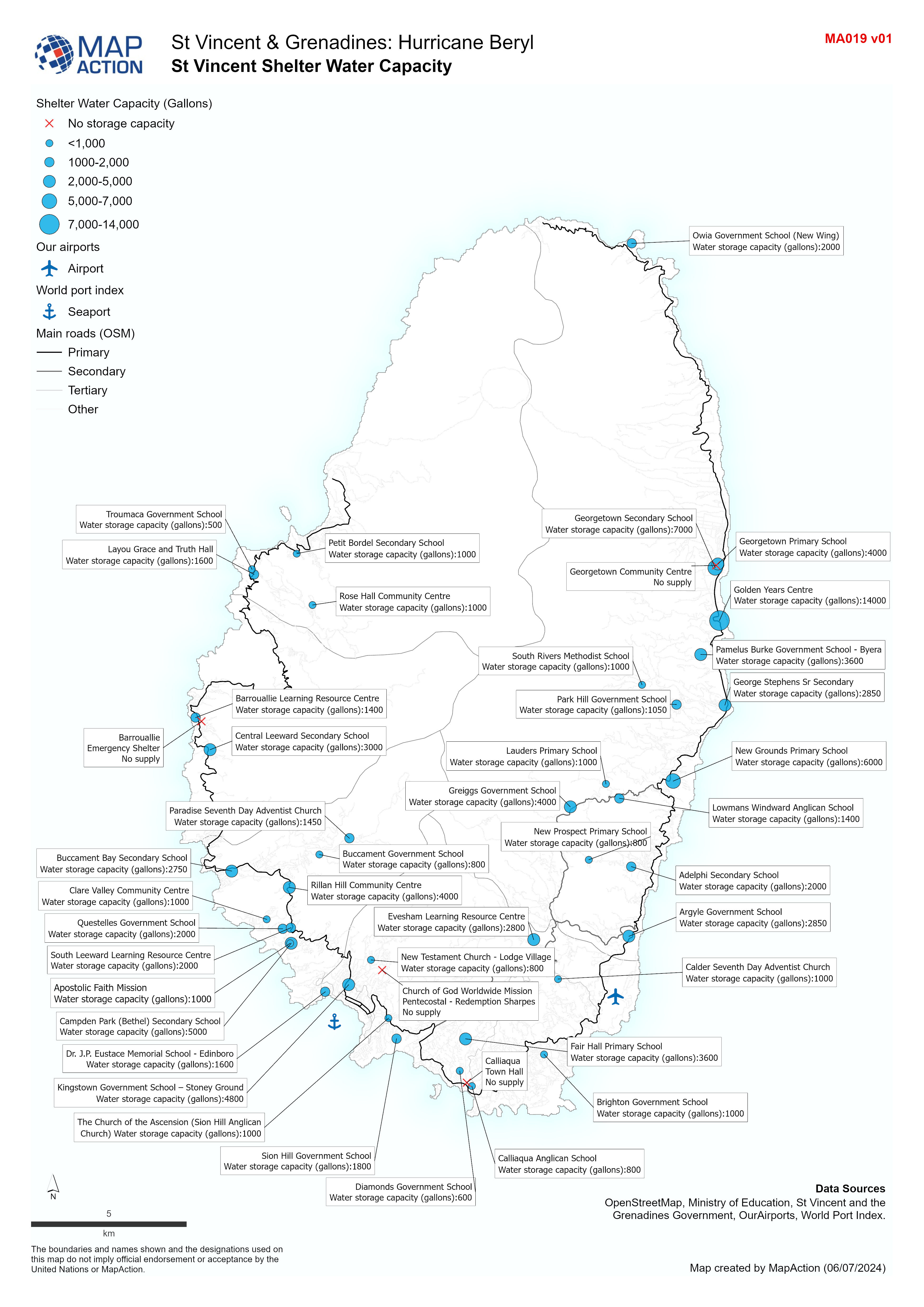
St Vincent Shelter Water Capacity
Overview map of St Vincent showing Shelter water capacity. -

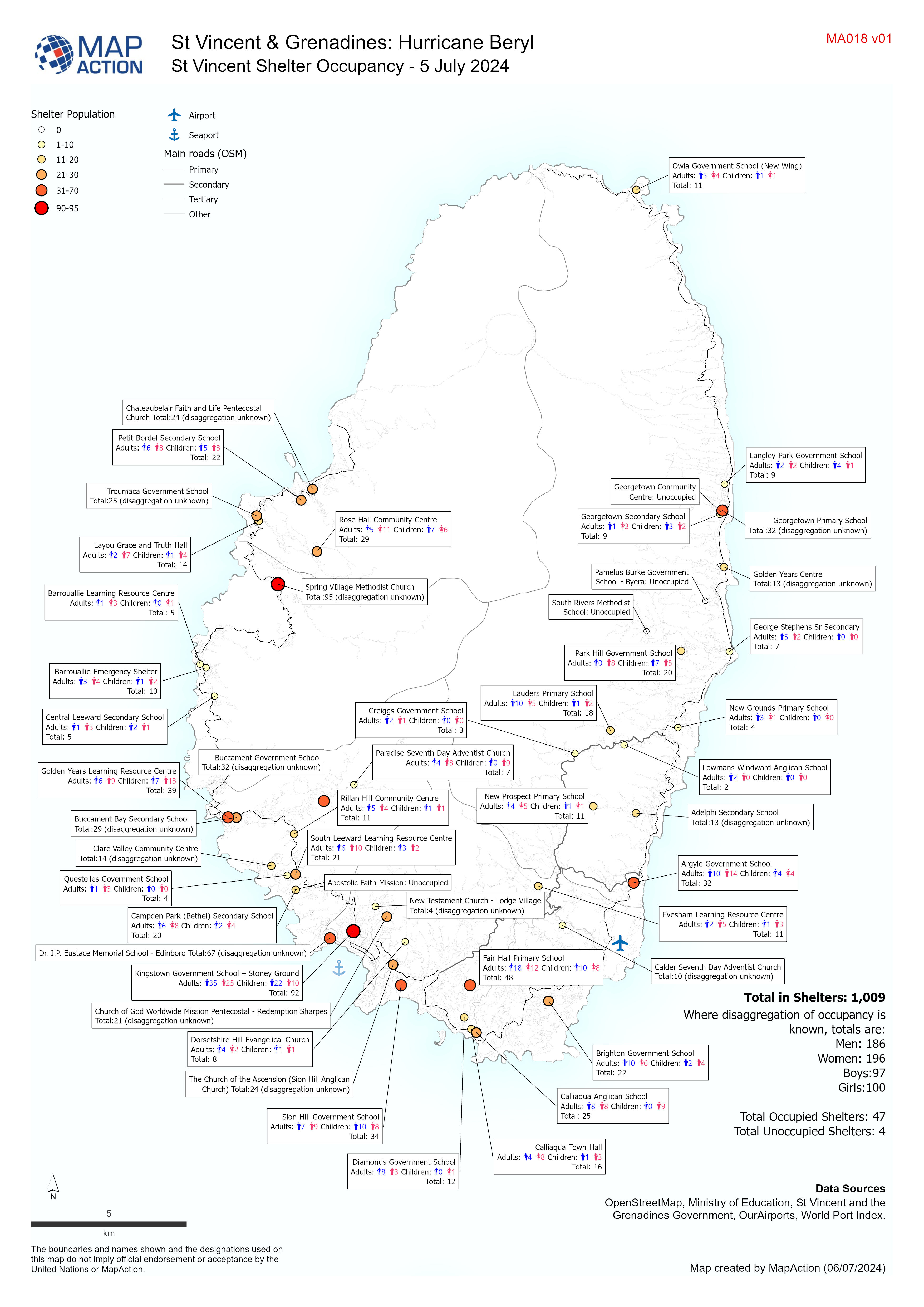
St Vincent Shelter Occupancy - 5 July 2024
Overview map of St Vincent showing Shelter Occupancy as of 5 July 2024. -

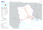
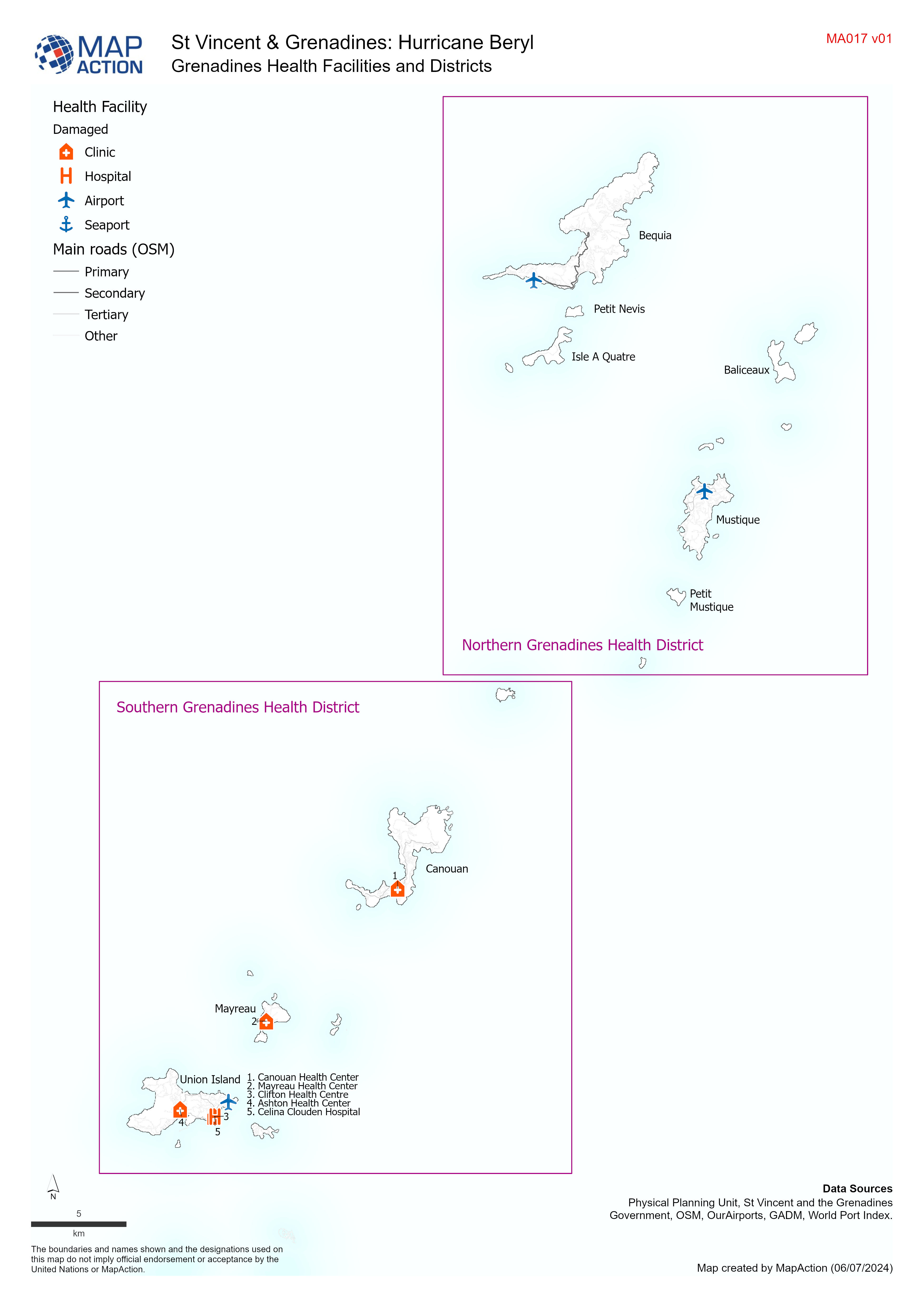
Grenadines Health Facilities and Districts
Overview map of the Grenadines showing Health Facilities, Districts and major roads. -

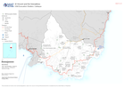
St Vincent Health Facilities and Districts
Overview map of St Vincent showing Health Facilities, Districts and major roads. -

COPERNICUS EMS Building Assessment 5 July - Union Island: Atlas
Overview of Union Island showing damage assessment data sourced from Copernicus EMS, 5 July. -

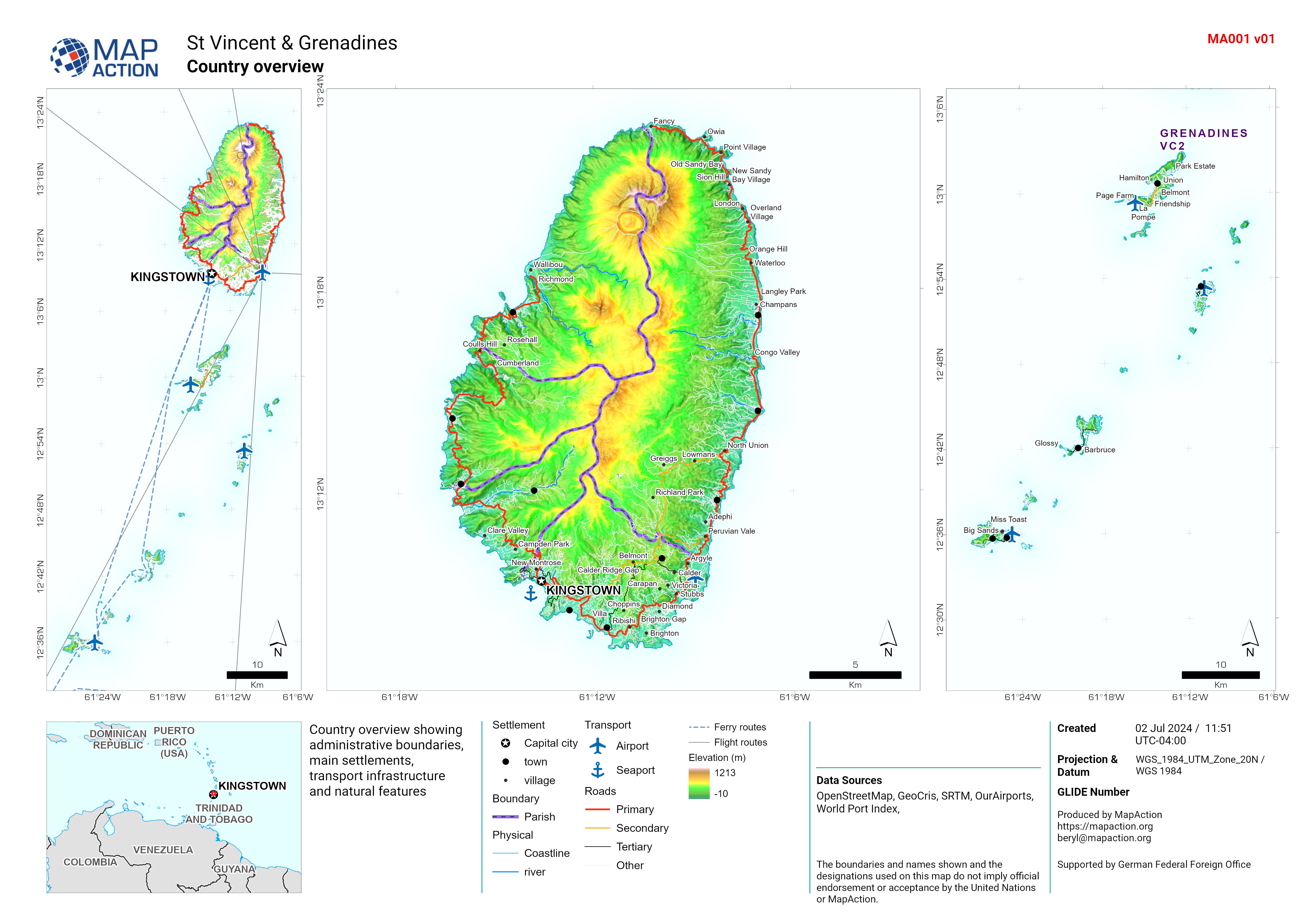
St Vincent overview
Country overview showing administrative boundaries, main settlements, transport infrastructure and natural features -

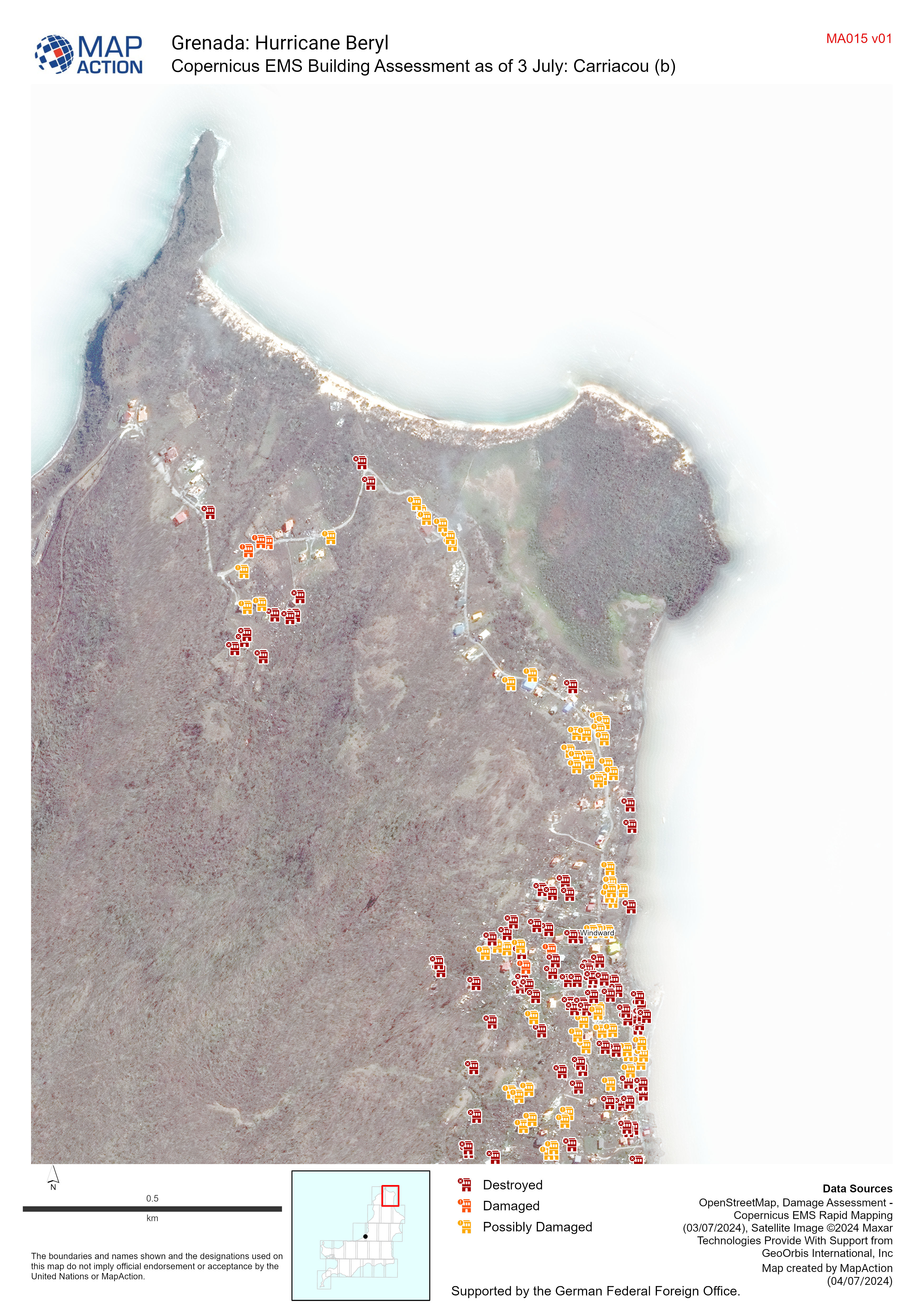
Copernicus EMS Building Assessment as of 3 July Carriacou
Map shows the building assessment done by Copernicus EMS as of 3 July -
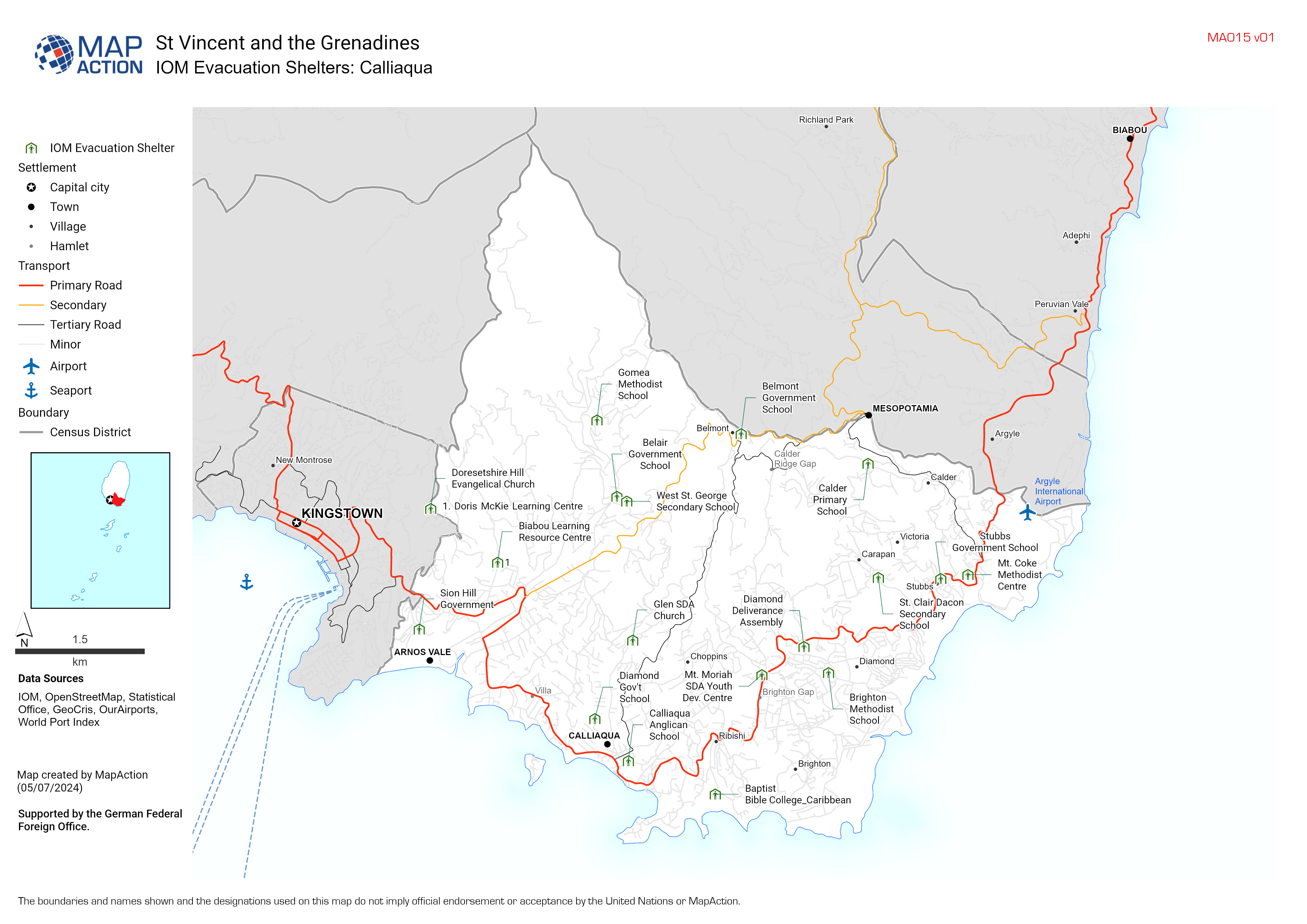
IOM Evacuation Shelters Atlas
IOM Emergency Shetlers for Hurricane Beryl in St. Vincent and the Grenadines -
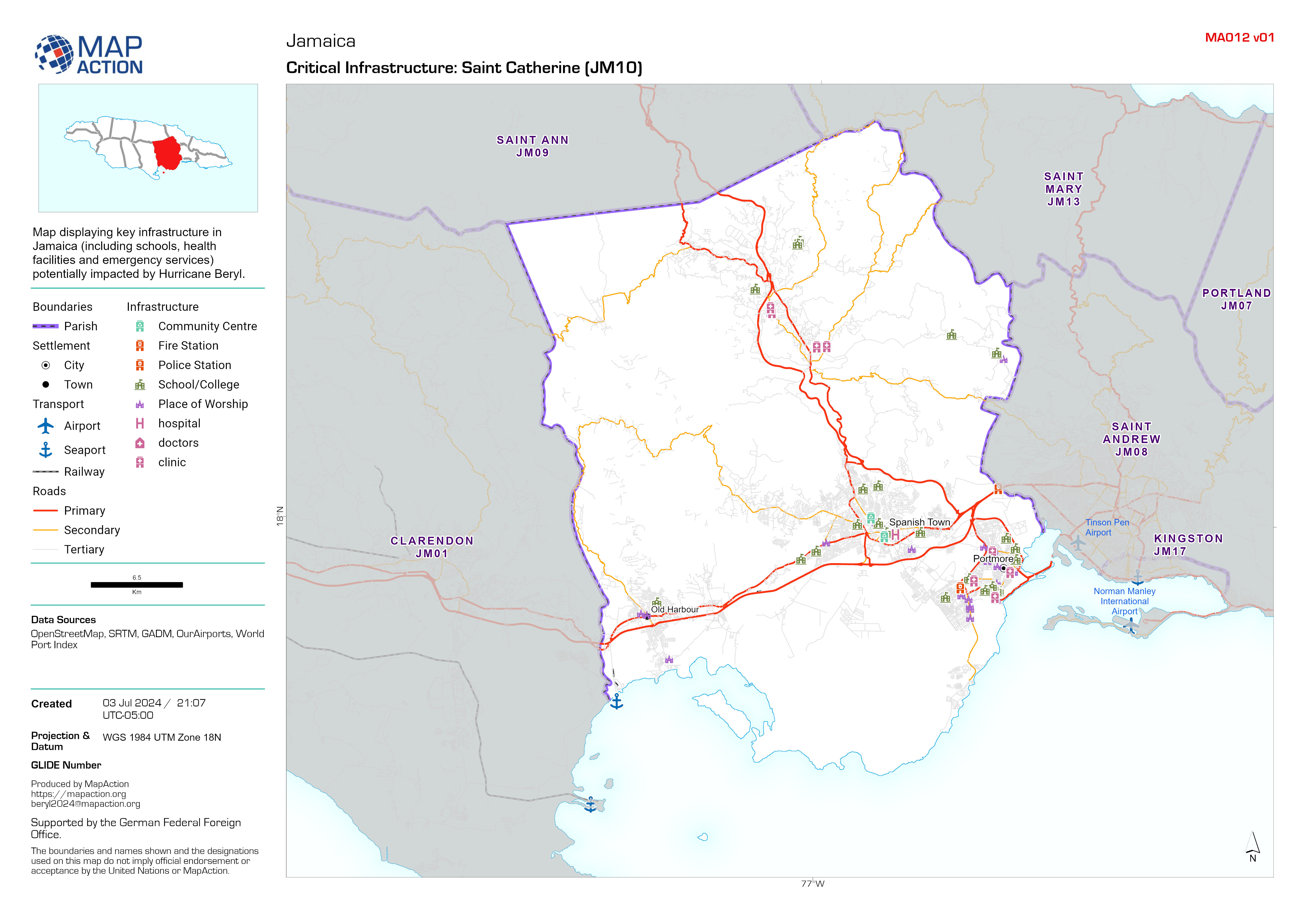
Critical Infrastructure map atlas
Map displaying key infrastructure in Jamaica (including schools, health facilities and emergency services) potentially impacted by Hurricane Beryl. -

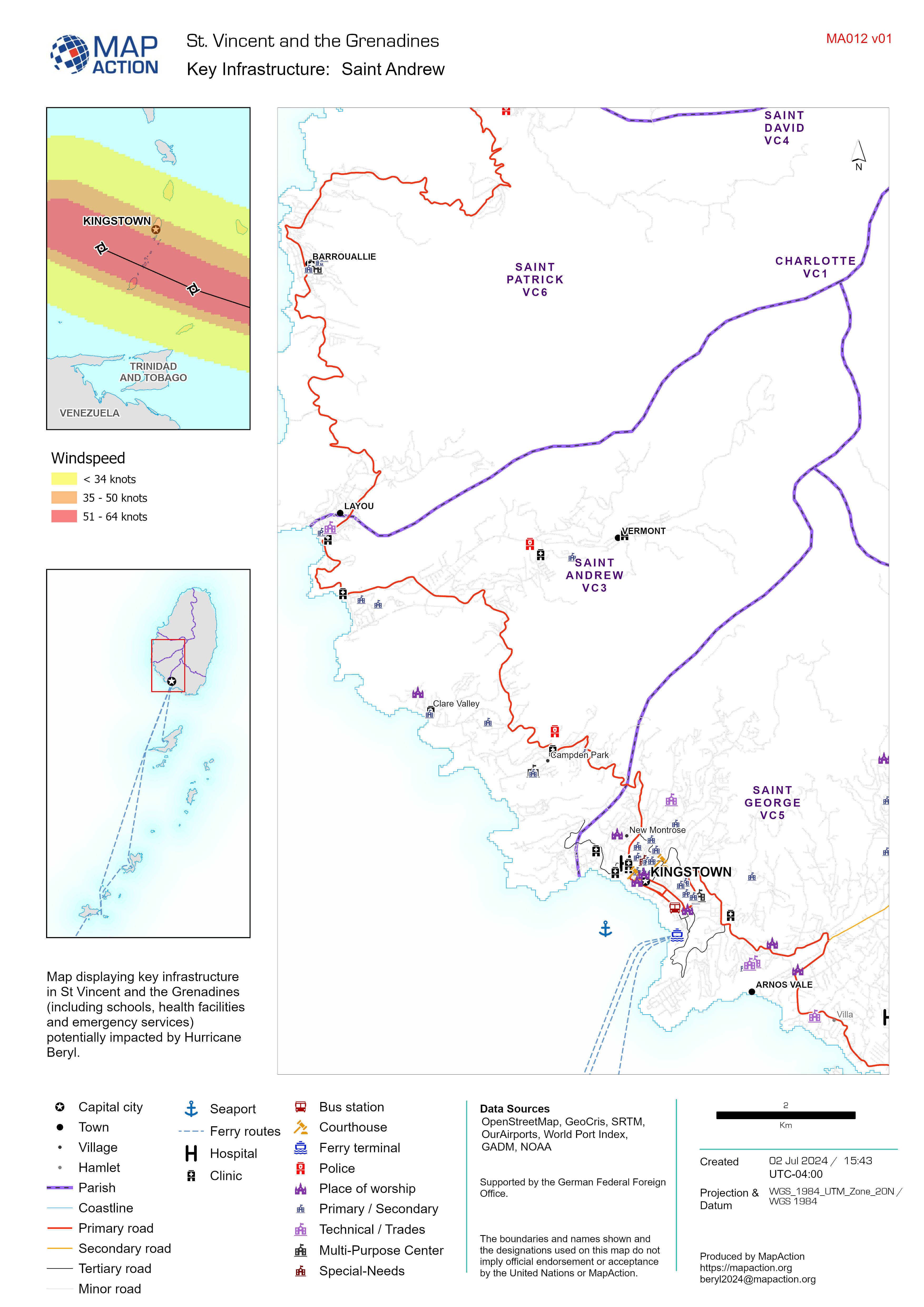
Key Infrastructure Map Atlas
Map displaying key infrastructure in St Vincent and the Grenadines (including schools, health facilities and emergency services) potentially impacted by Hurricane Beryl. -
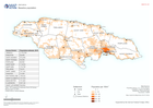
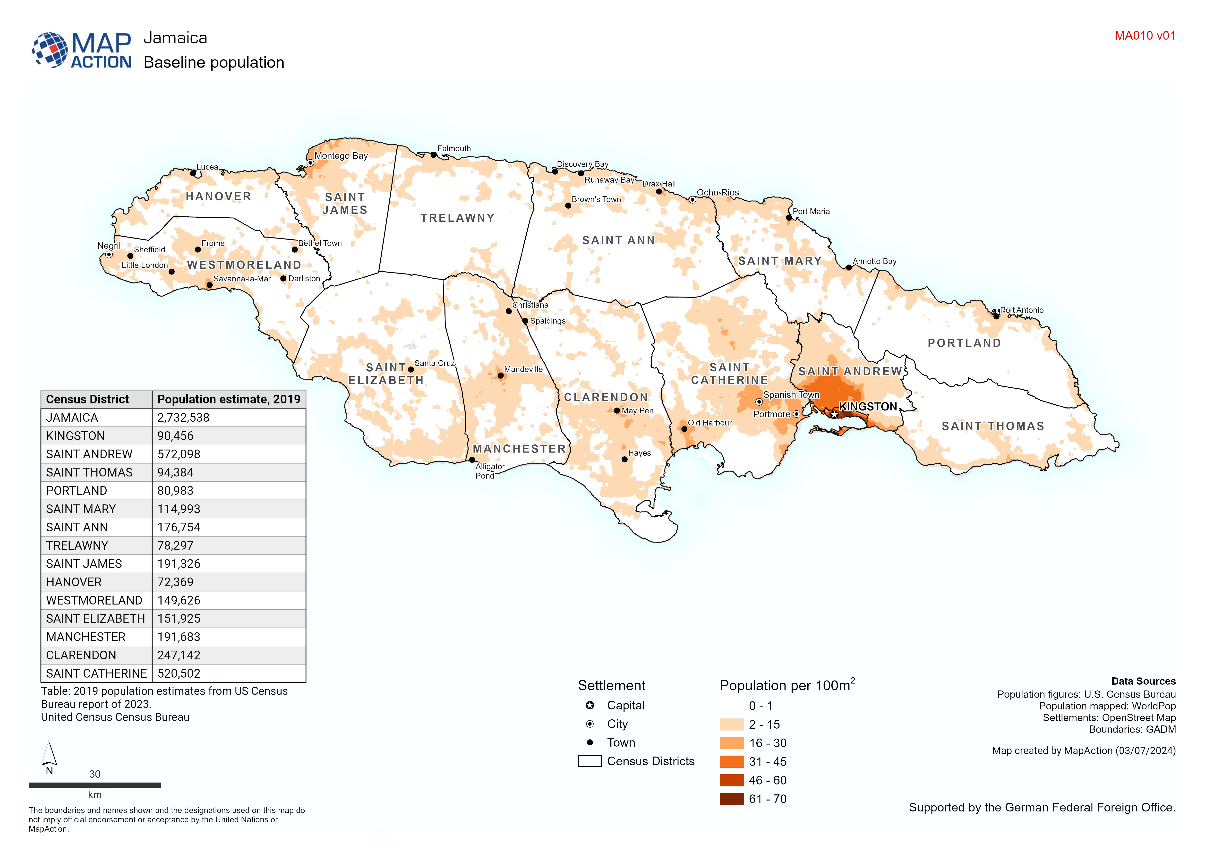
Baseline population
Baseline Population: Map based on 2020 estimate from WorldPop. Table based on 2023 estimate from U.S. Census Bureau -

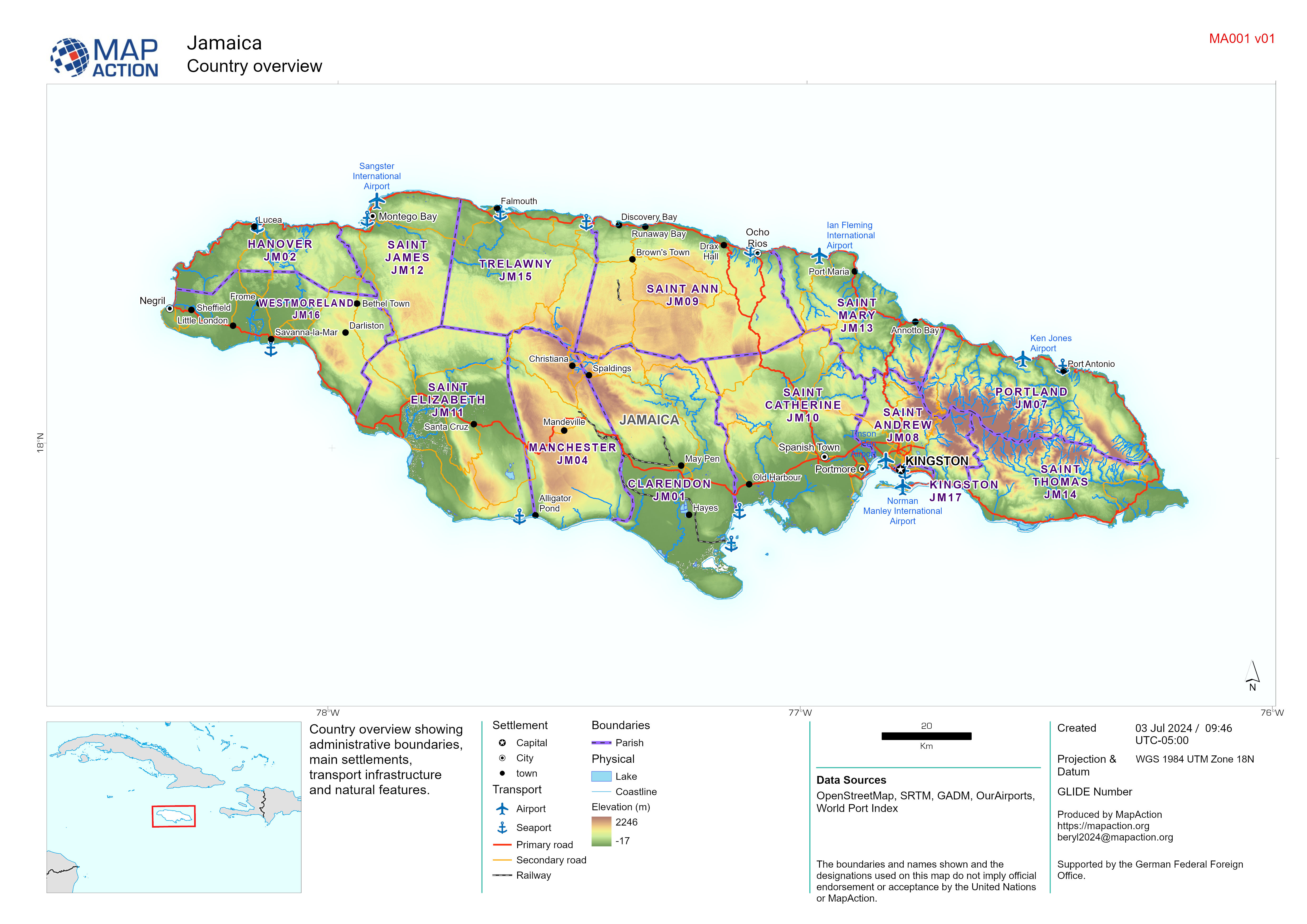
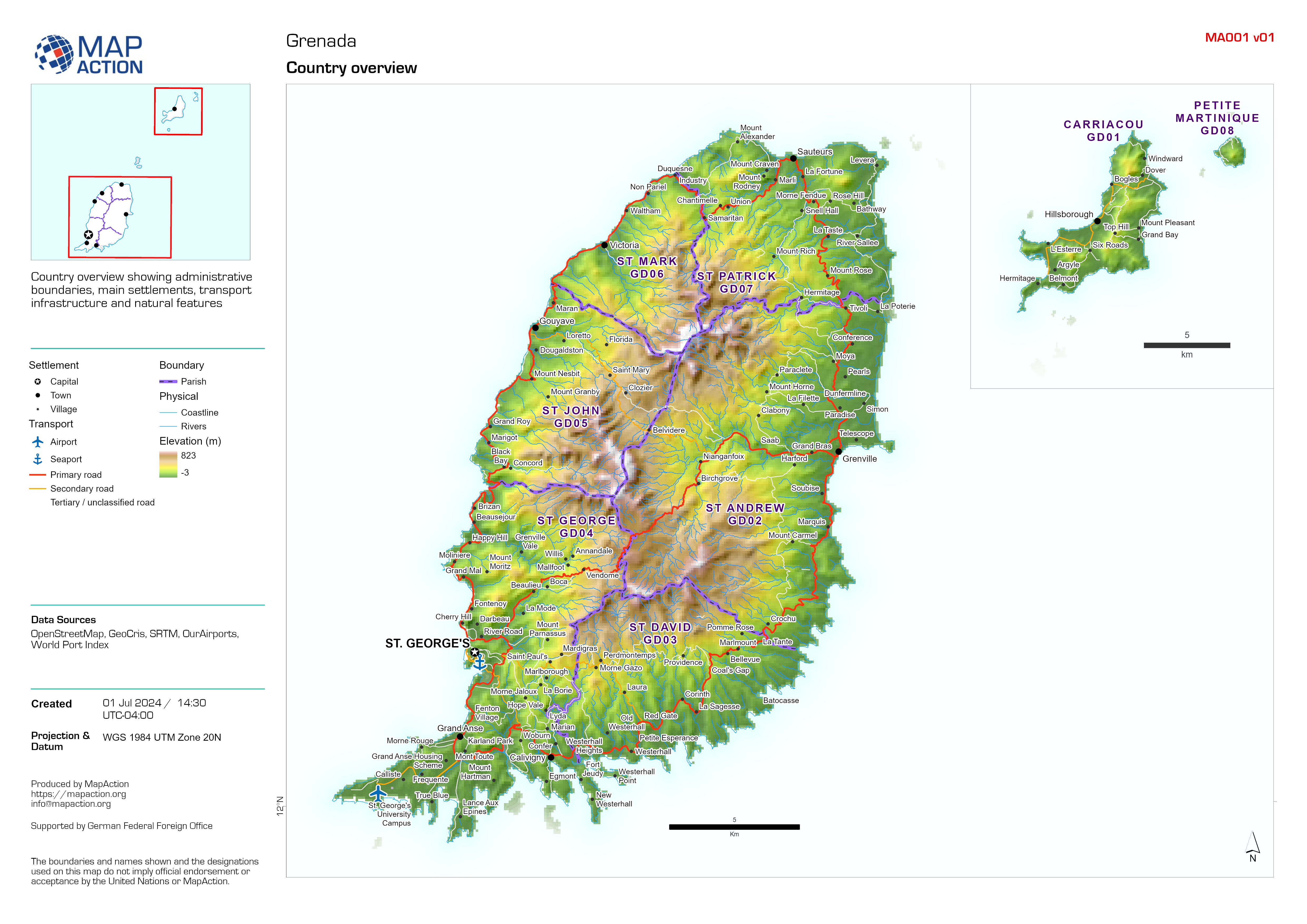
Country overview
Country overview showing administrative boundaries, main settlements, transport infrastructure and natural features. -
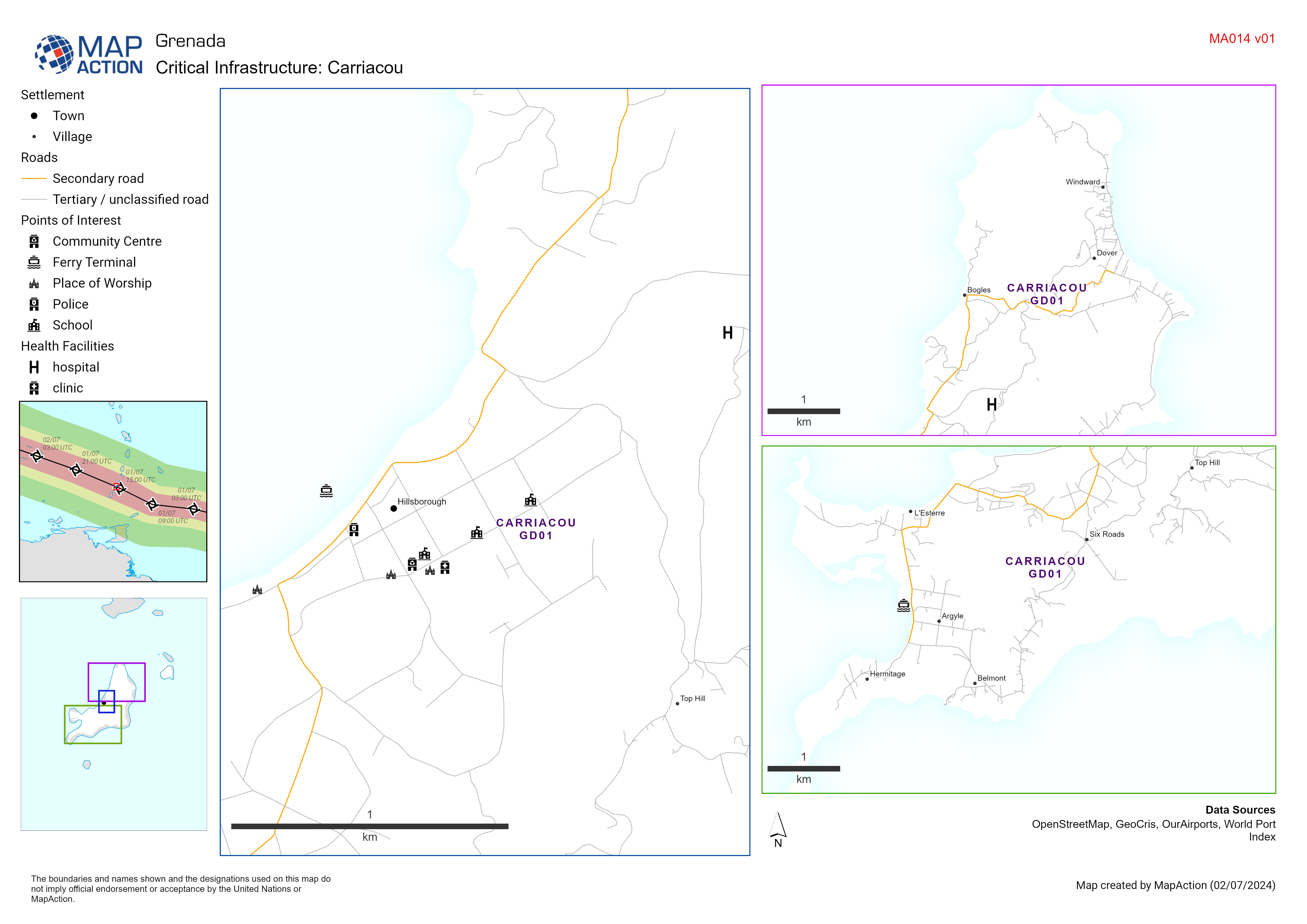
Critical Infrastructure: Carriacou
Map displaying key infrastructure in Carriacou Grenada (including schools, health facilities and emergency services) potentially impacted by Hurricane Beryl. -

Emergency Shelters for the 2024 Hurricane Season: Parish
Map shows the locations of emergency shelters identified by NaDMA Grenada for the 2024 hurricane season -
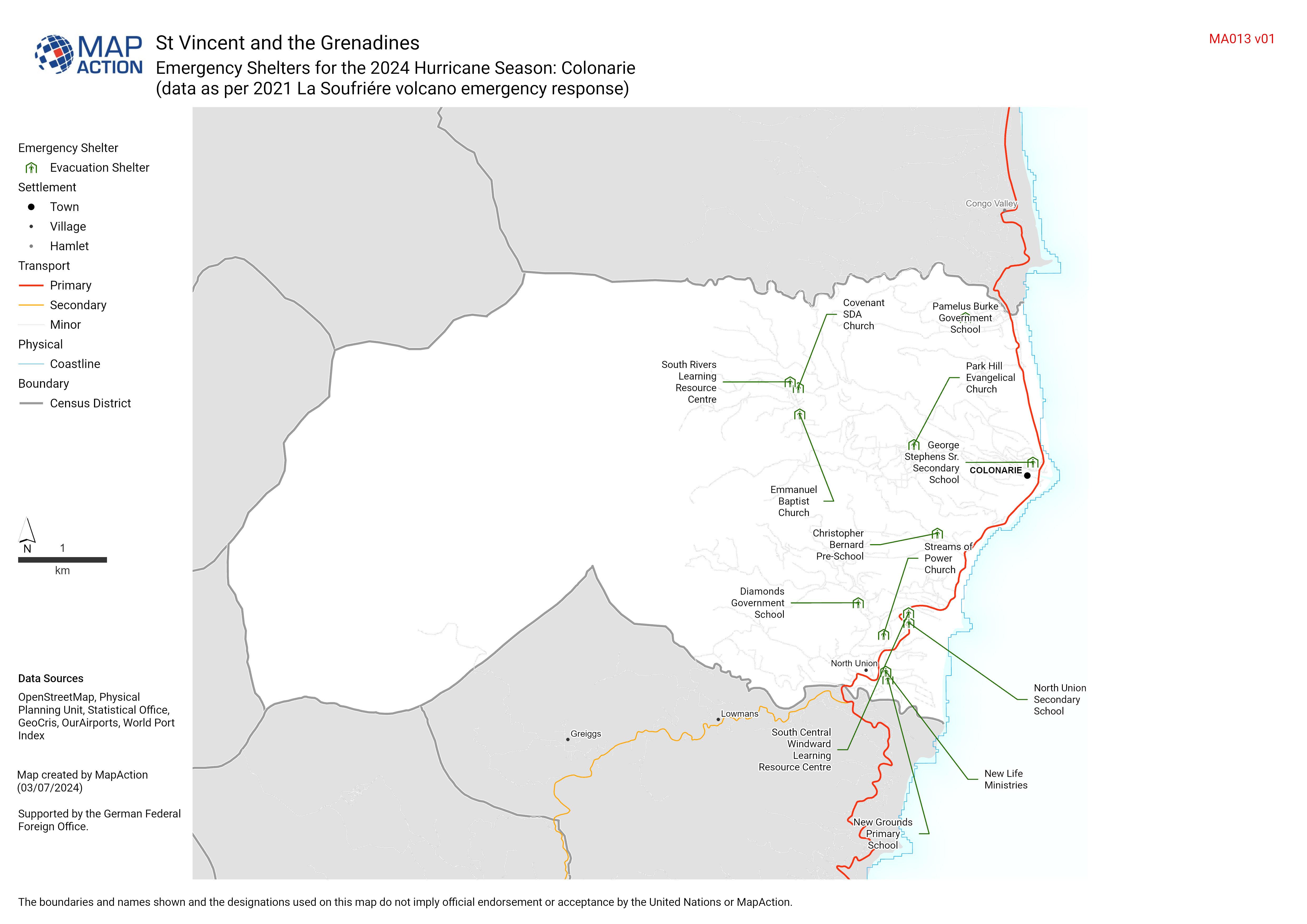
Emergency Shelters for the 2024 Hurricane Season: Census District (data as pe...
Add summary text here (update via layout tool). Even when not displayed on the map it is added to metadata -
Country overview
Country overview showing administrative boundaries, main settlements, transport infrastructure and natural features -
Country overview
Country overview showing administrative boundaries, main settlements, transport infrastructure and natural features -

Buildings and Extent of Wildfires within NEMO Area of Focus:
A map showing building footprints and the extent of wildfires derived by the Copernicus Emergency Mapping Service (EMS) and from Sentinel-2 satellite images. Populated areas and... -

Shelter locations by district
Shelter locations are displayed, categorised by ability to withstand wind speeds (due to Hurricane planning). Tables show shelter name and capacity. -

Extent of Wild Fires from the Copernicus EMSR726 Activation:
A map showing the extent of wildfires derived by the Copernicus Emergency Mapping Service (EMS). Affected areas shown in context of populated areas and main road network on...