-

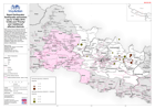
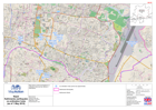
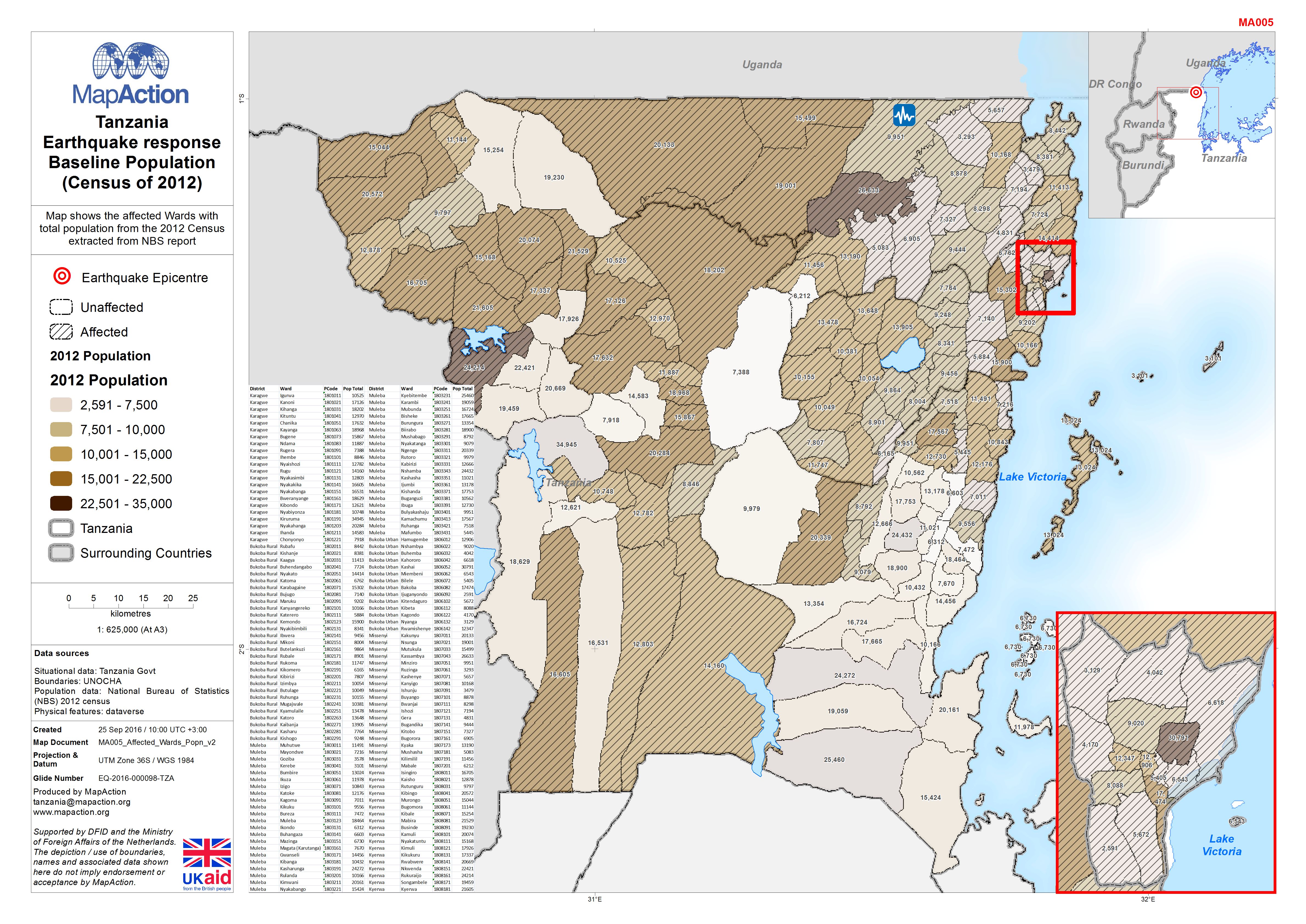
Tanzania Earthquake response Baseline Population (Census of 2012)
Map shows the affected Wards with total population from the 2012 Census extracted from NBS report. -

Tanzania Earthquake response Baseline Population (Census of 2012)
Map shows the affected Wards with total population from the 2012 Census extracted from NBS report -
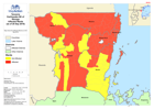
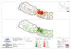
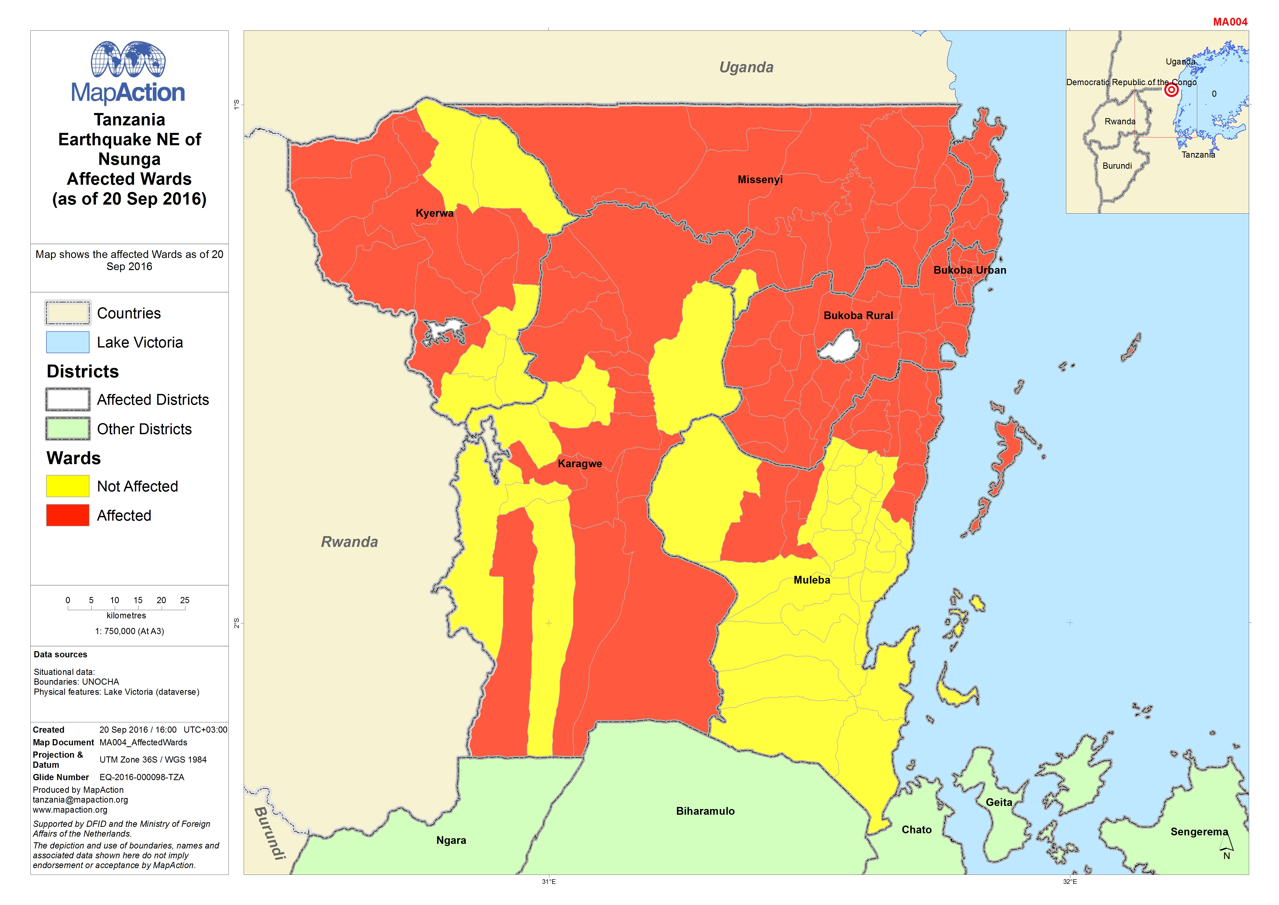
Tanzania Earthquake NE of Nsunga Affected Wards (as of 20 Sep 2016)
Map shows the affected Wards as of 20 Sep 2016 -

Nepal: Earthquake - District Assessment - Preliminary findings Sindhupalchok ...
KEY FINDINGS According to key informants, 55% of the population in the assessed VDCs, 64 out of 79 in total, is inneed, with 38% in immediate need of support.99% of the... -

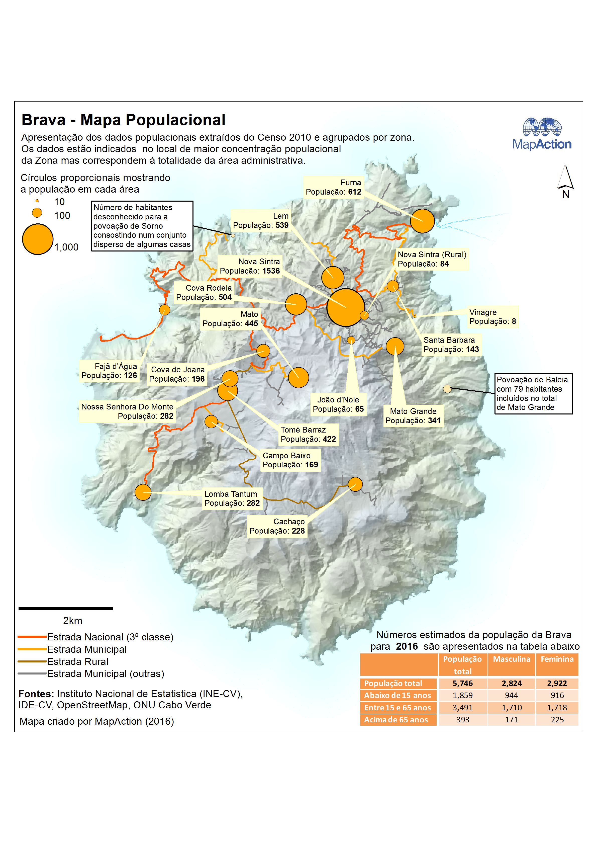
Cape Verde - Brava - Population Map (Mapa Populacional) - Portuguese Version
Map showing main population centres in Brava (Portuguese version). Population data from the 2010 Census collected by Zona is displayed. Data is displayed at the point of the... -

Cape Verde - Structural Map of Brava (Mapa Estrutural da Ilha Brava)
Map of Brava showing distribution of past recent eruption centres (craters and domes) and main fractures along which magma can be intruded and erupt; an explosive eruption is... -

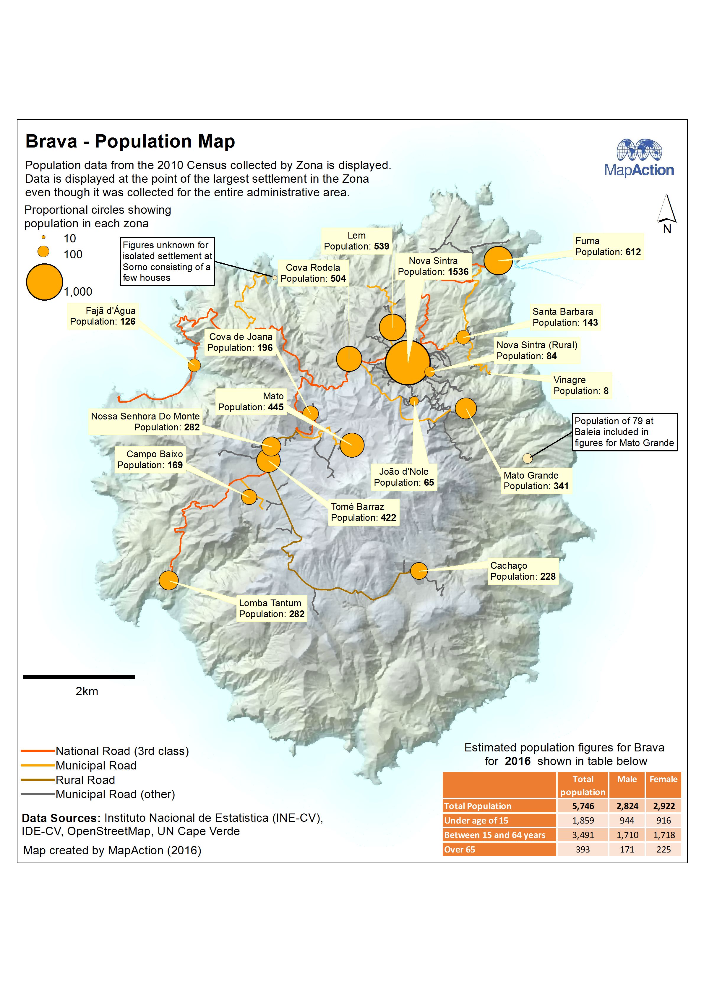
Cape Verde - Brava - Population Map
Map showing main population centres in Brava. Population data from the 2010 Census collected by Zona is displayed. Data is displayed at the point of the largest settlement in... -
Cape Verde - Structural Map of Brava
Map of Brava showing distribution of past recent eruption centres (craters and domes) and main fractures along which magma can be intruded and erupt; an explosive eruption is... -

Cape Verde - Brava - Reference Map (Mapa de Referência)
Basic reference map of Brava island in Cape Verde showing terrain and location of port, transport routes and main settlements (Portuguese version) -

Cape Verde - Brava - Reference Map
Basic reference map of Brava island in Cape Verde showing terrain and location of port, transport routes and main settlements -
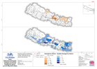
Nepal: Earthquake - Epicentres (up to 12 May 2015 14:00) and 'Priority' and '...
Map shows Priority Affected Districts as designated by the Government of Nepal in the week following the original earthquake, and Additional Affected Districts designated on 10... -

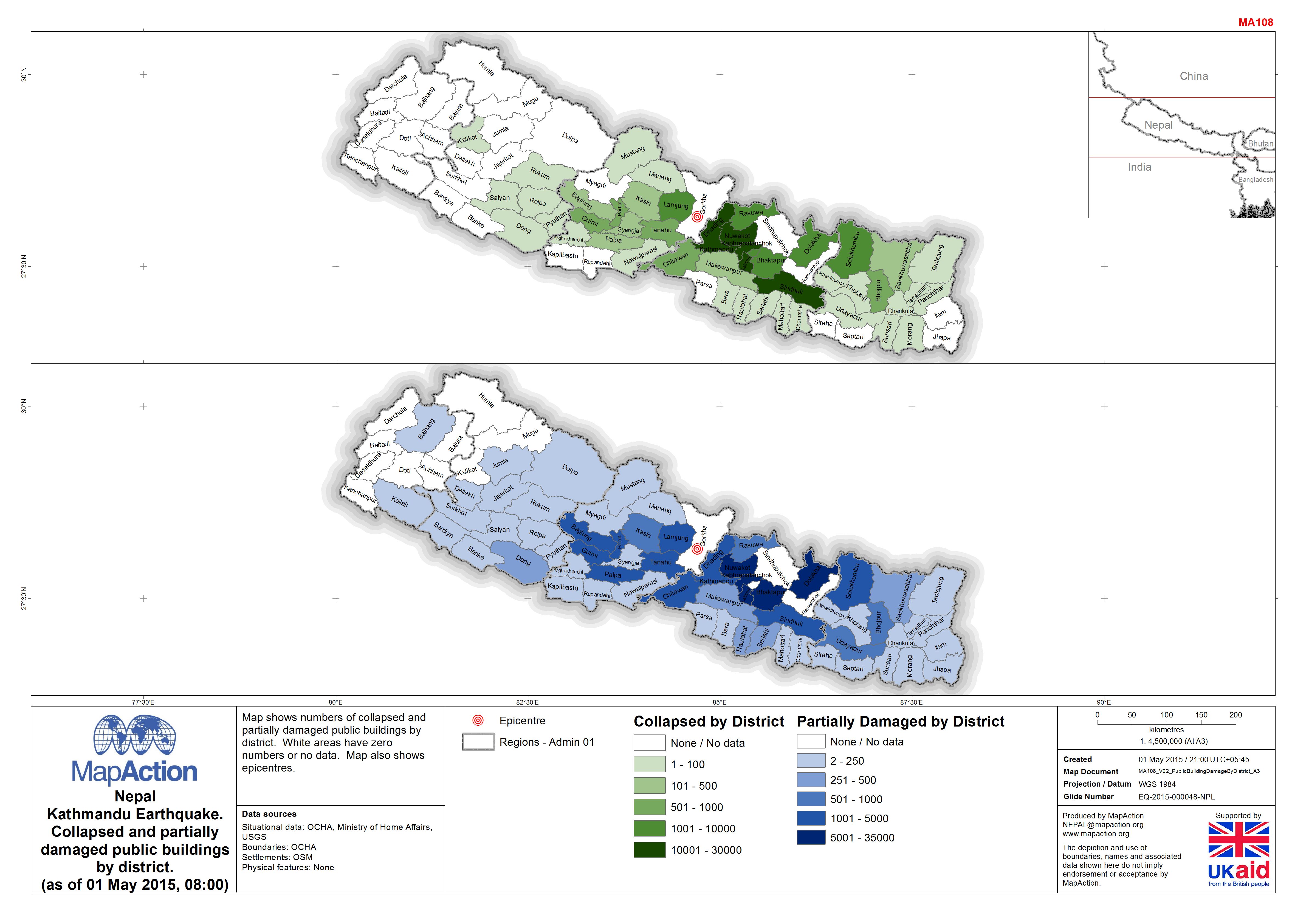
Nepal: Earthquake - Collapsed and partially damaged public buildings by distr...
Map shows numbers of collapsed and partially damaged public buildings by district. White areas have zero numbers or no data. Map also shows epicentres. -
Nepal: Earthquake - Collapsed and partially damaged government buildings by d...
Map shows numbers of collapsed and partially damaged government buildings by district. White areas have zero numbers, grey areas have no data. Map also shows epicentres. -

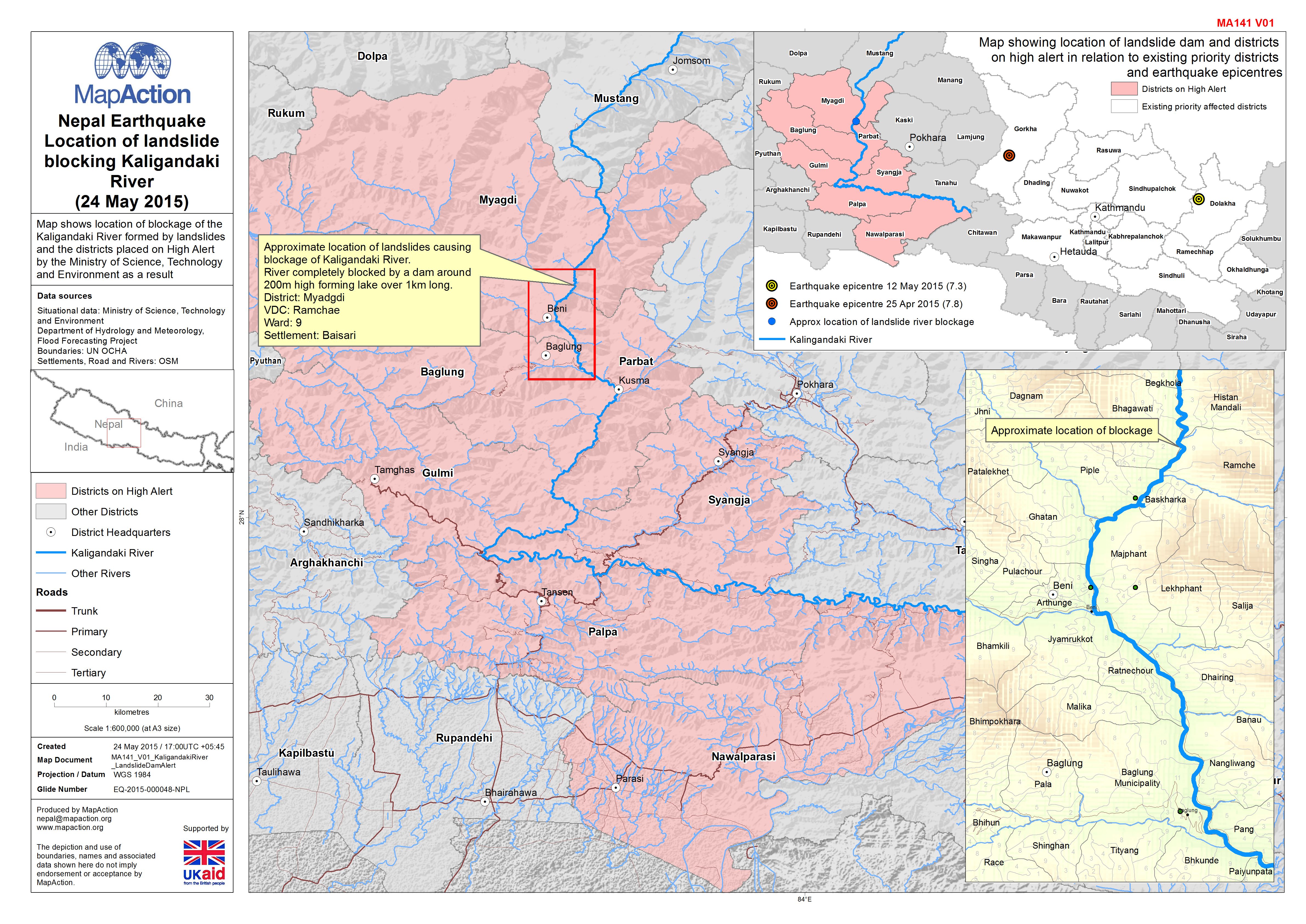
Nepal: Earthquake - Location of landslide blocking Kaligandaki River (24 May ...
Map shows location of blockage of the Kaligandaki River formed by landslides and the districts placed on High Alert by the Ministry of Science, Technology and Environment as a... -
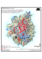
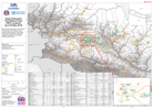
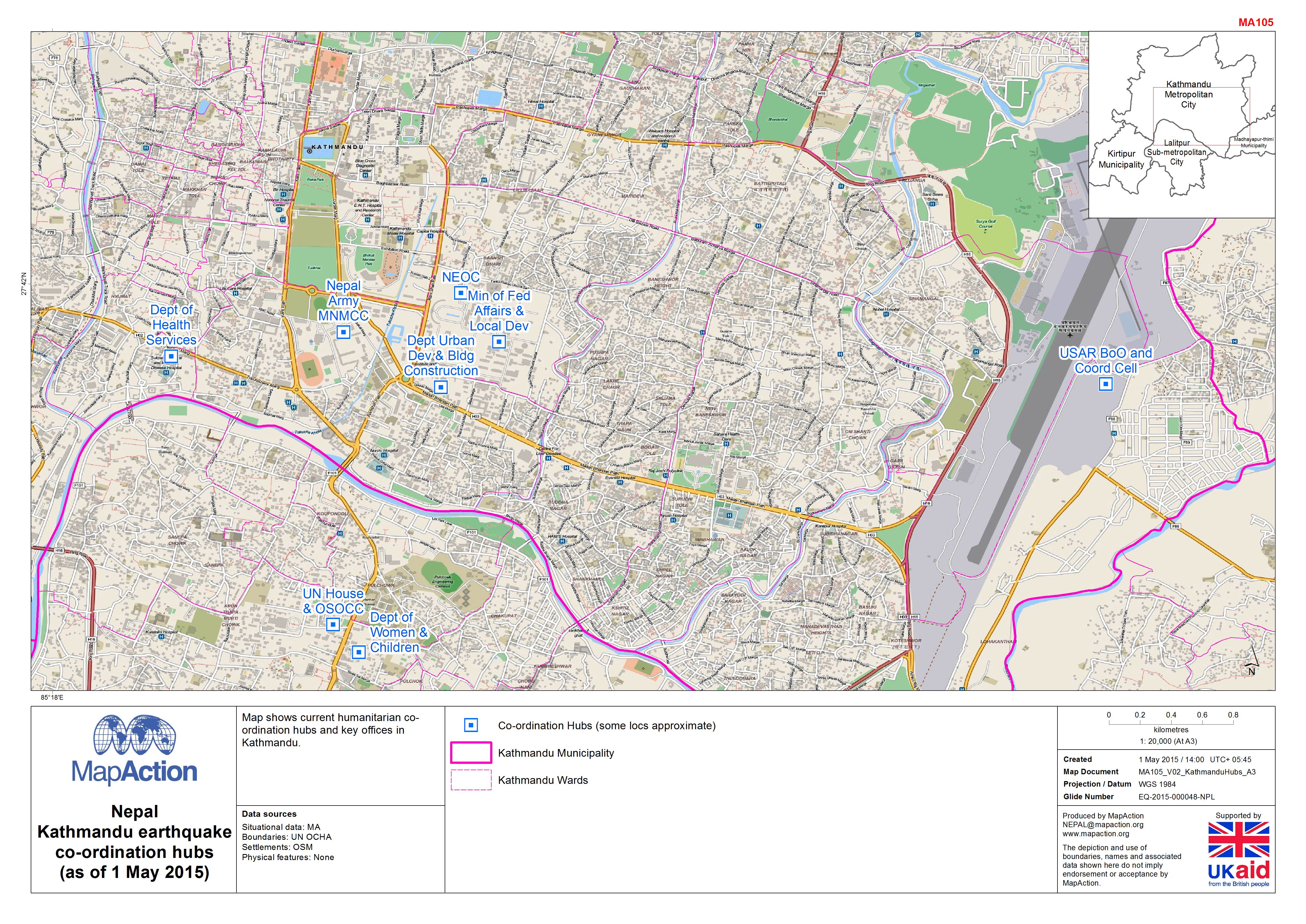
Nepal: Earthquake - Co-ordination hubs (as of 1 May 2015)
Map shows current humanitarian co-ordination hubs and key offices in Kathmandu. -
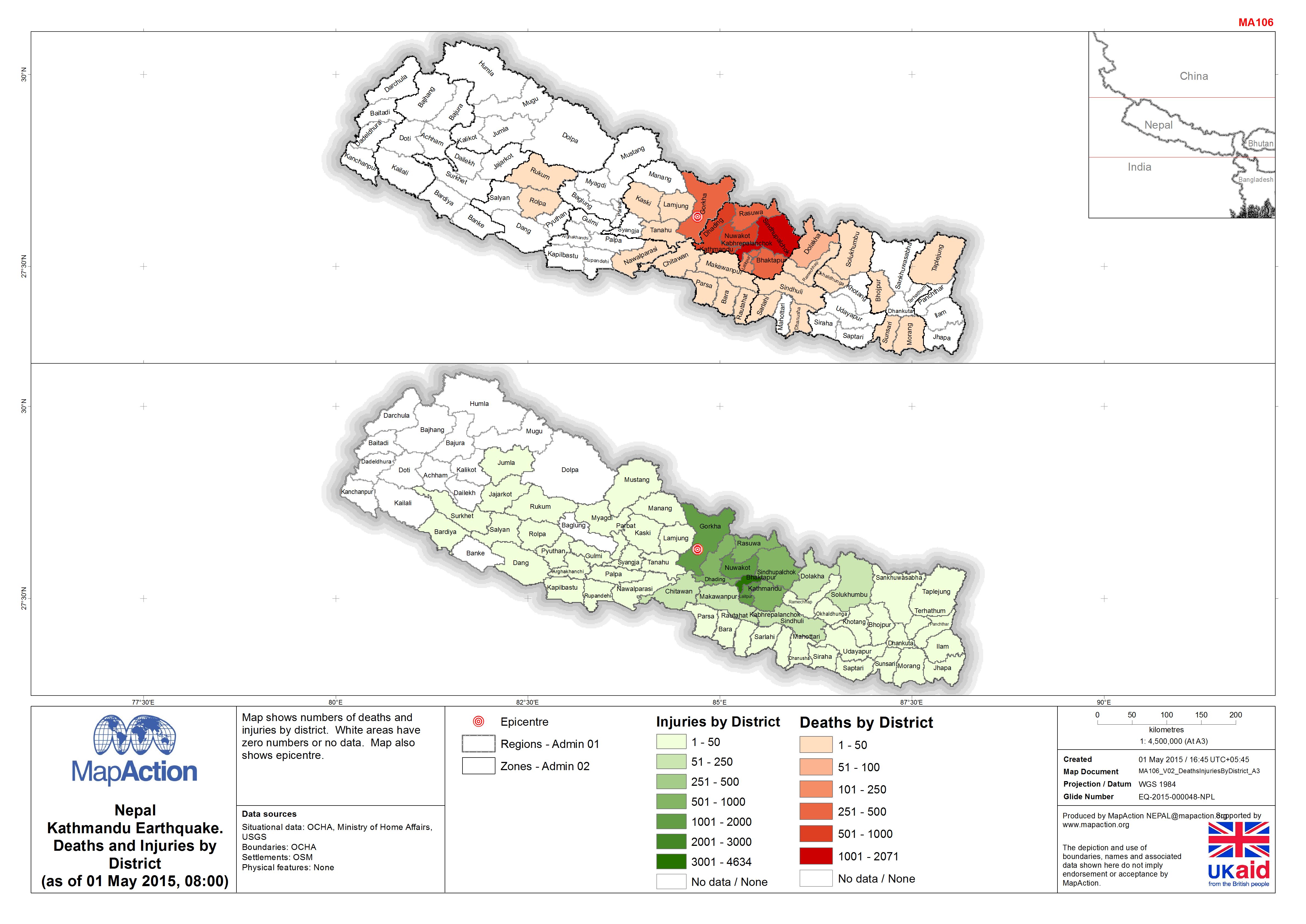
Nepal: Earthquake - Deaths and Injuries by District (as of 01 May 2015, 08:00)
Map shows numbers of deaths and injuries by district. White areas have zero numbers or no data. Map also shows epicentre. -
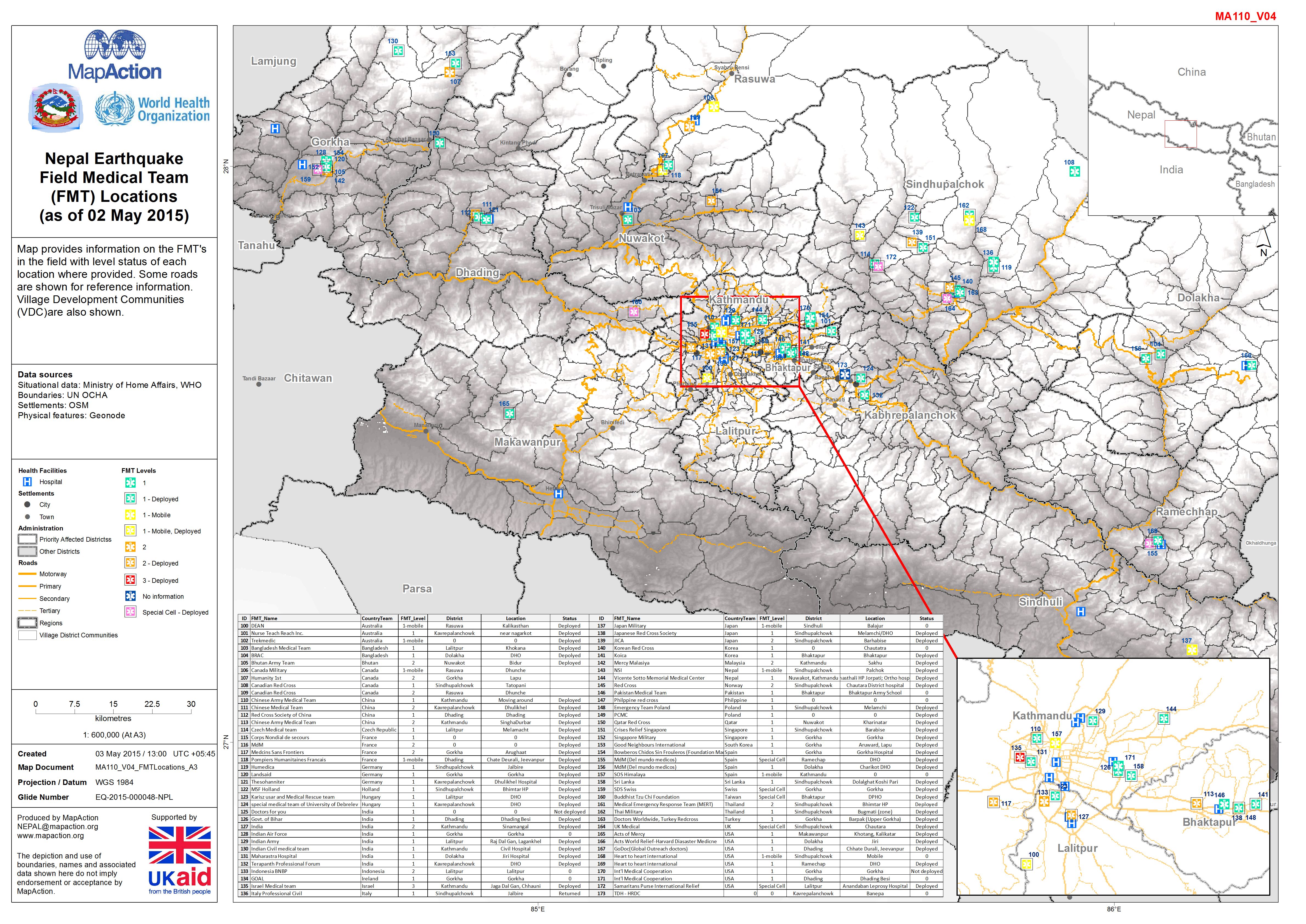
Nepal: Earthquake - Field Medical Team (FMT) Locations (as of 02 May 2015)
Map provides information on the FMT's in the field with level status of each location where provided. Some roads are shown for reference information. Village Development... -
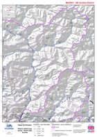
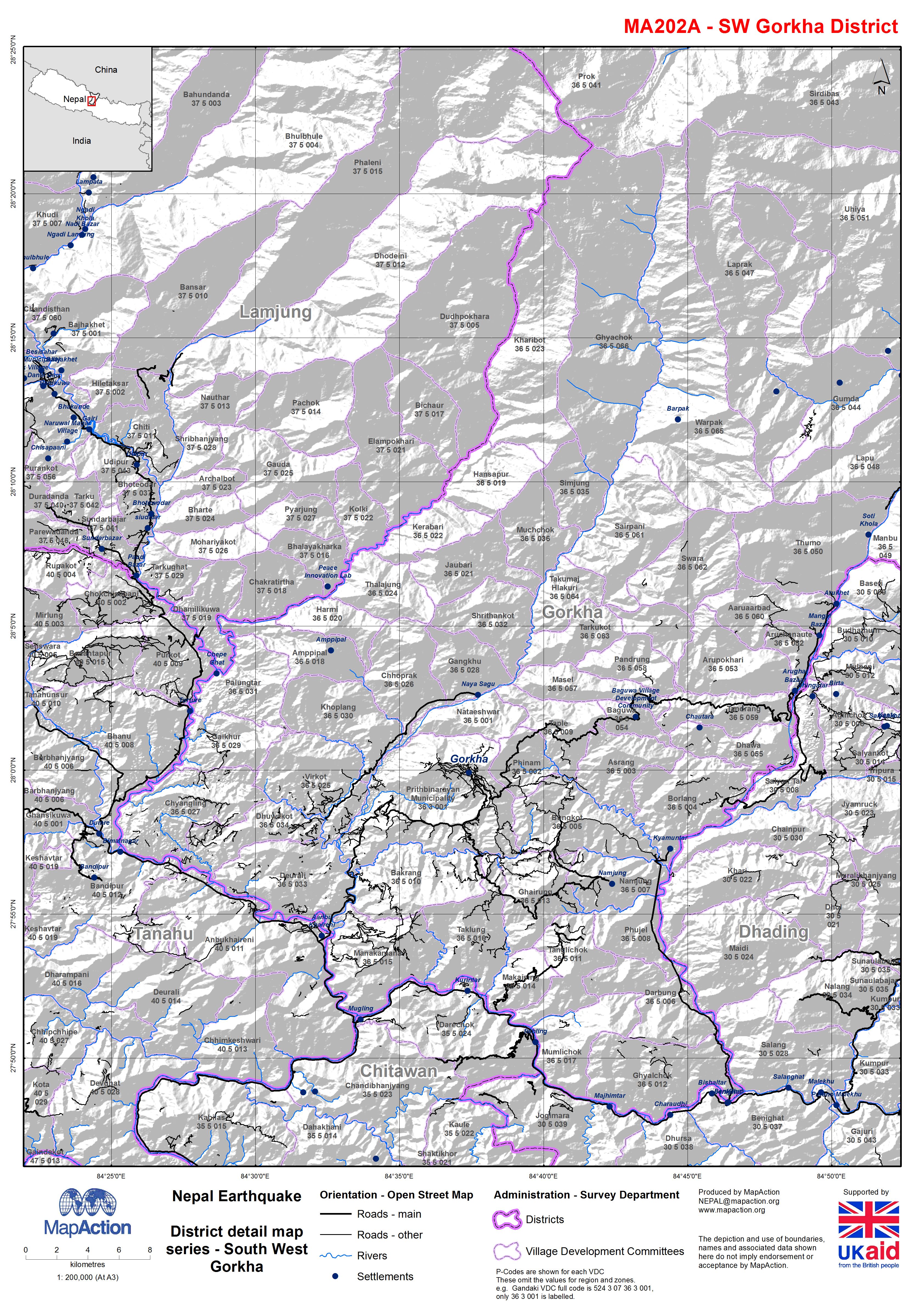
Nepal: Earthquake - District detail map series - South West Gorkha
Map shows the terrain, roads, rivers and settlements. -

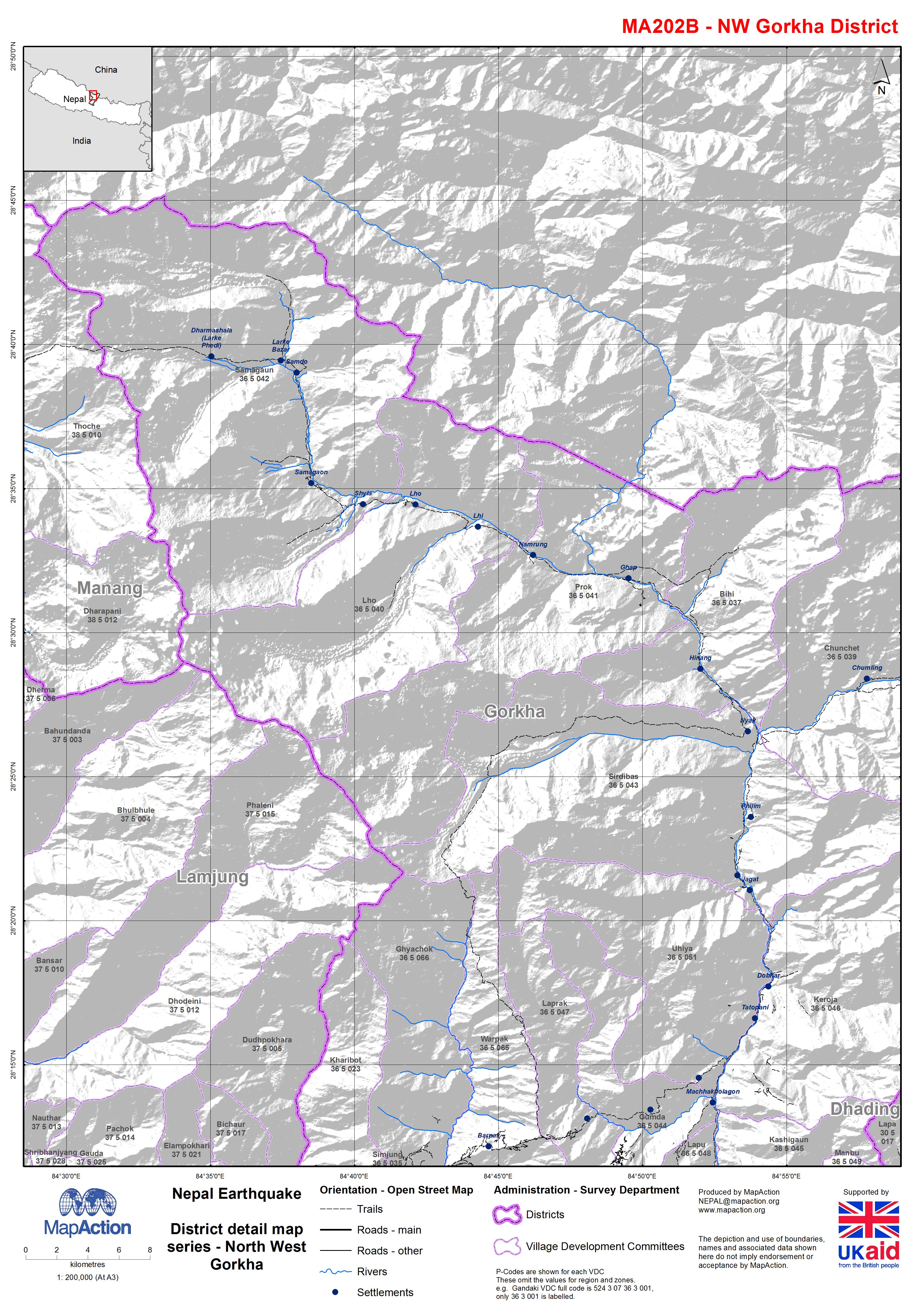
Nepal: Earthquake - District detail map series - North West Gorkha
Map shows the terrain, roads, rivers and settlements. -
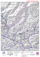
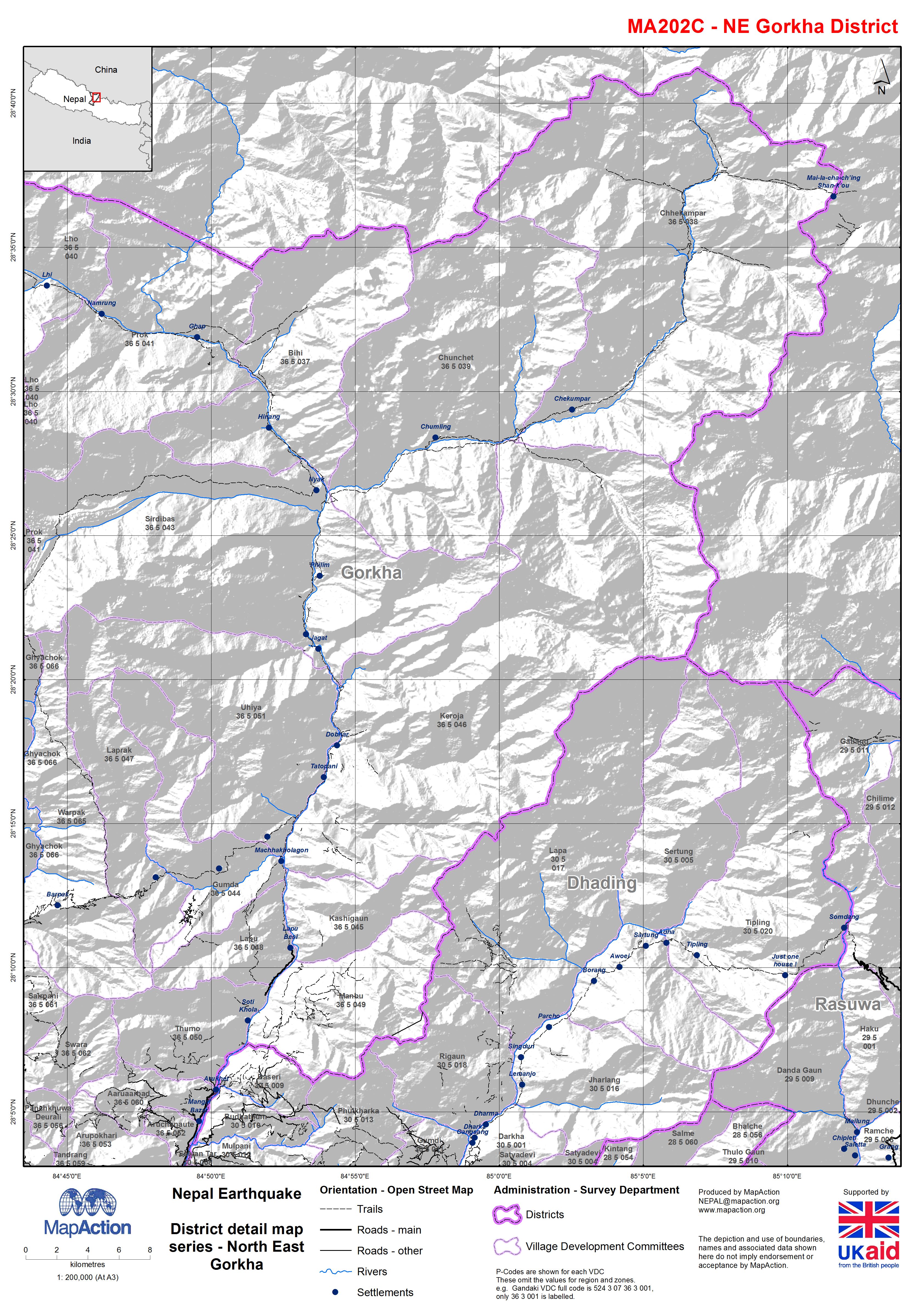
Nepal: Earthquake - District detail map series - North East Gorkha
Map shows the terrain, roads, rivers and settlements.