-

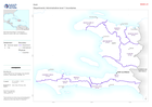
Overview of affected governorates
Overview of affected area showing transport infrastructure and natural features -

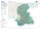
Country overview
Country overview showing administrative boundaries, main settlements, transport infrastructure and natural features -

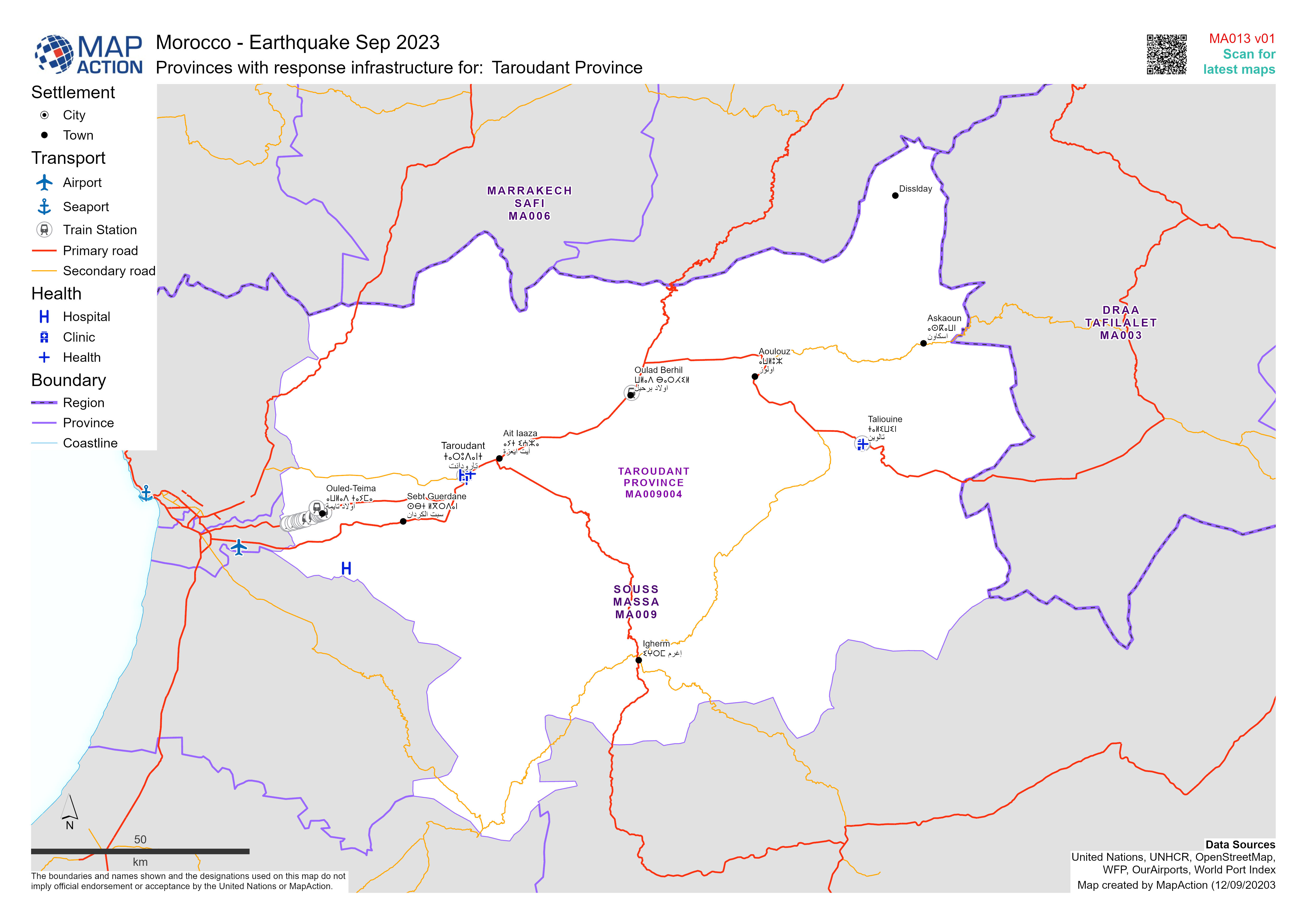
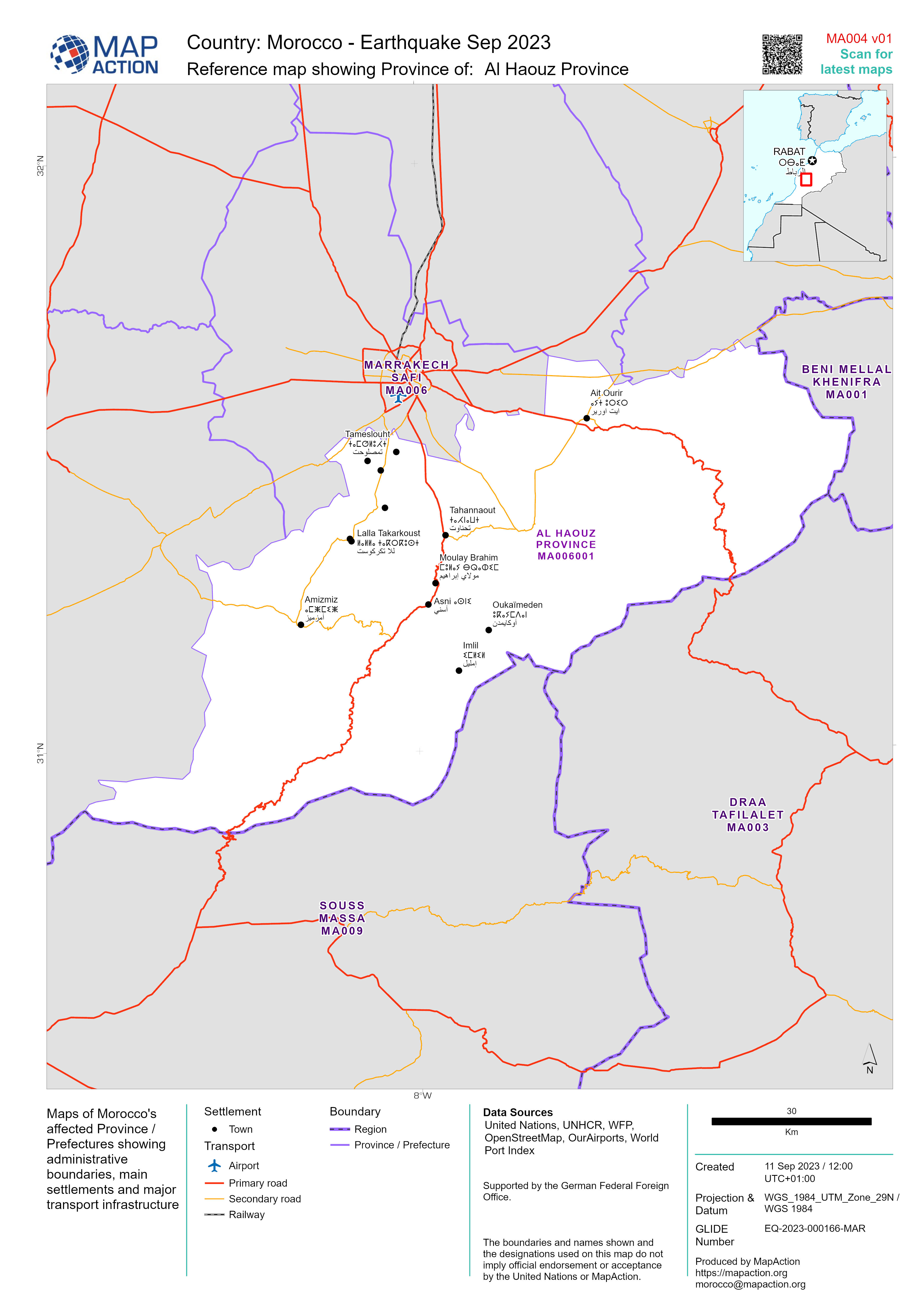
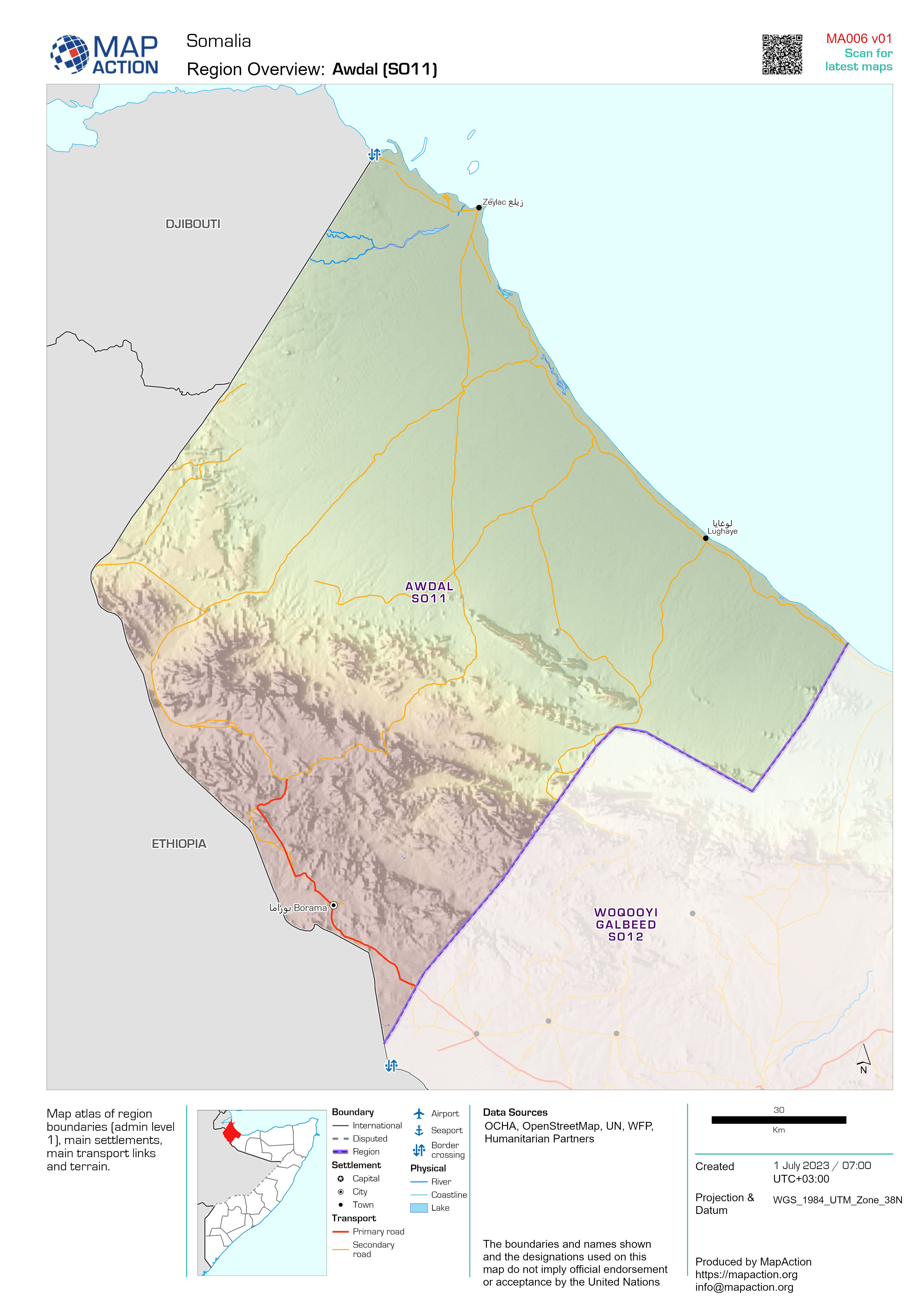
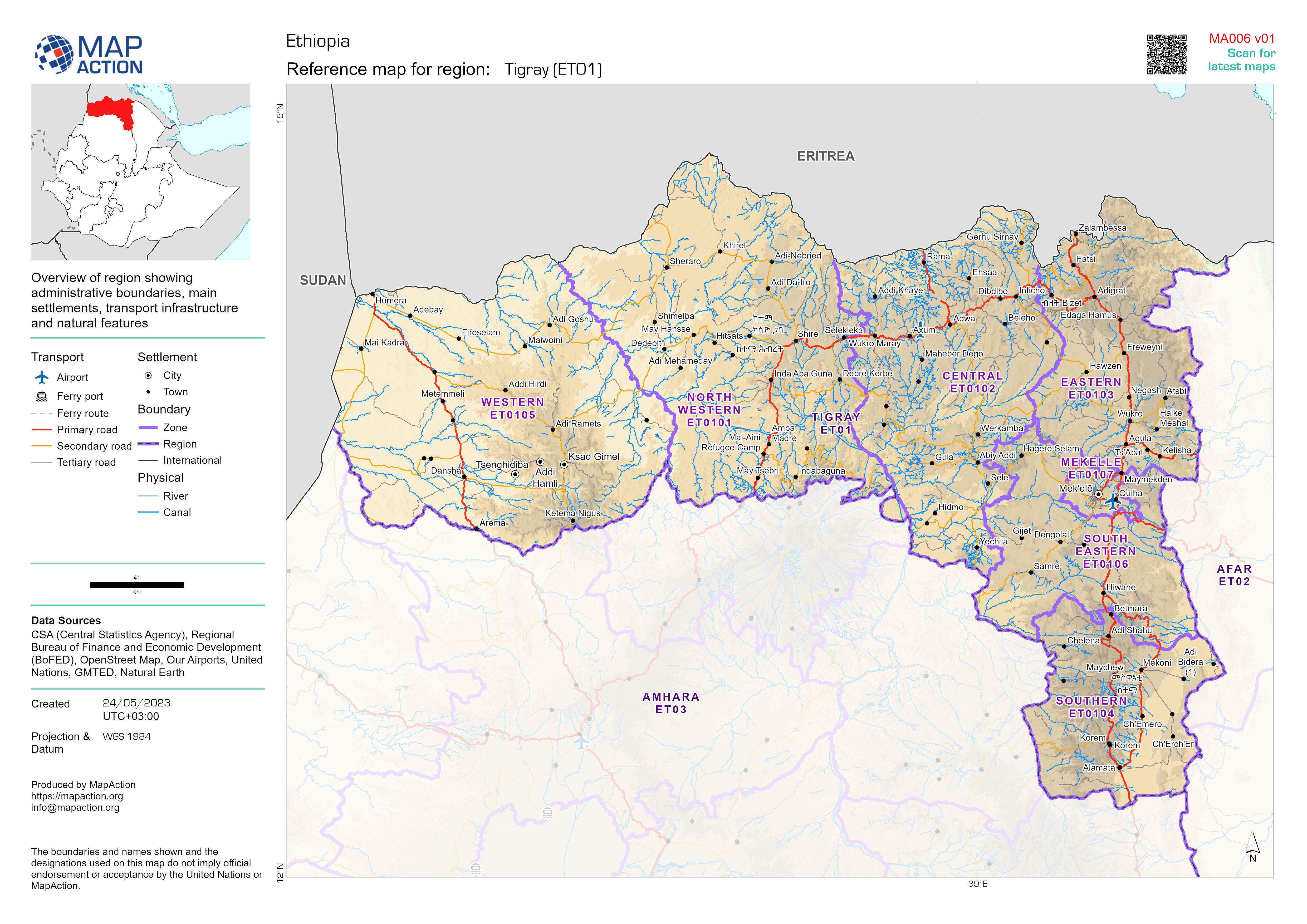
Reference map showing Province of:
Maps of Morocco's affected Province / Prefectures showing administrative boundaries, main settlements and major transport infrastructure -

Reference map showing affected Province / Prefectures
Maps of Morocco's affected Province / Prefectures showing administrative boundaries, main settlements and major transport infrastructure -

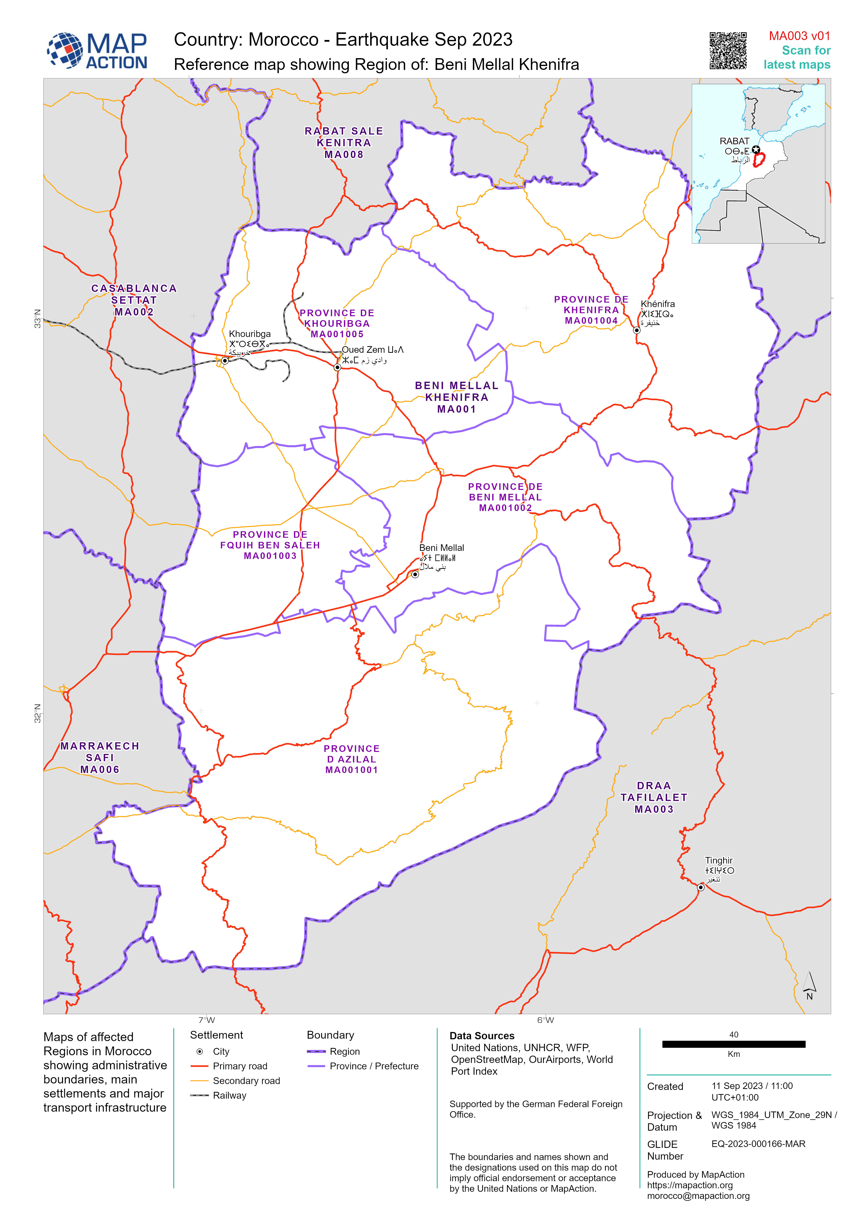
Reference maps showing affected Regions
Maps of affected Regions in Morocco showing administrative boundaries, main settlements and major transport infrastructure -

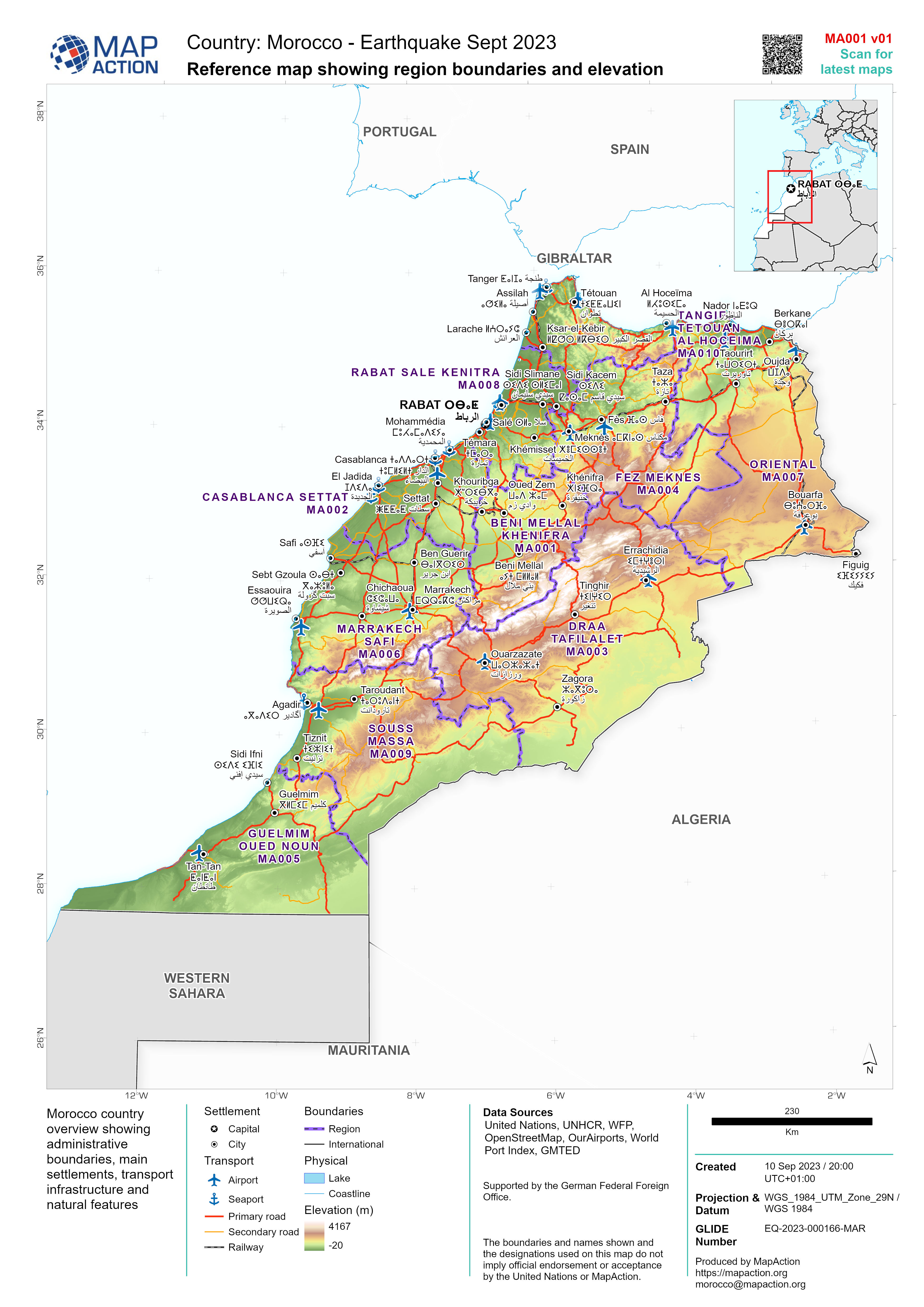
Reference map showing region boundaries and elevation
Morocco country overview showing administrative boundaries, main settlements, transport infrastructure and natural features -
Departments: Administrative level 1 boundaries
Administrative level 1 boundaries (departments) with main settlements -

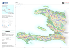
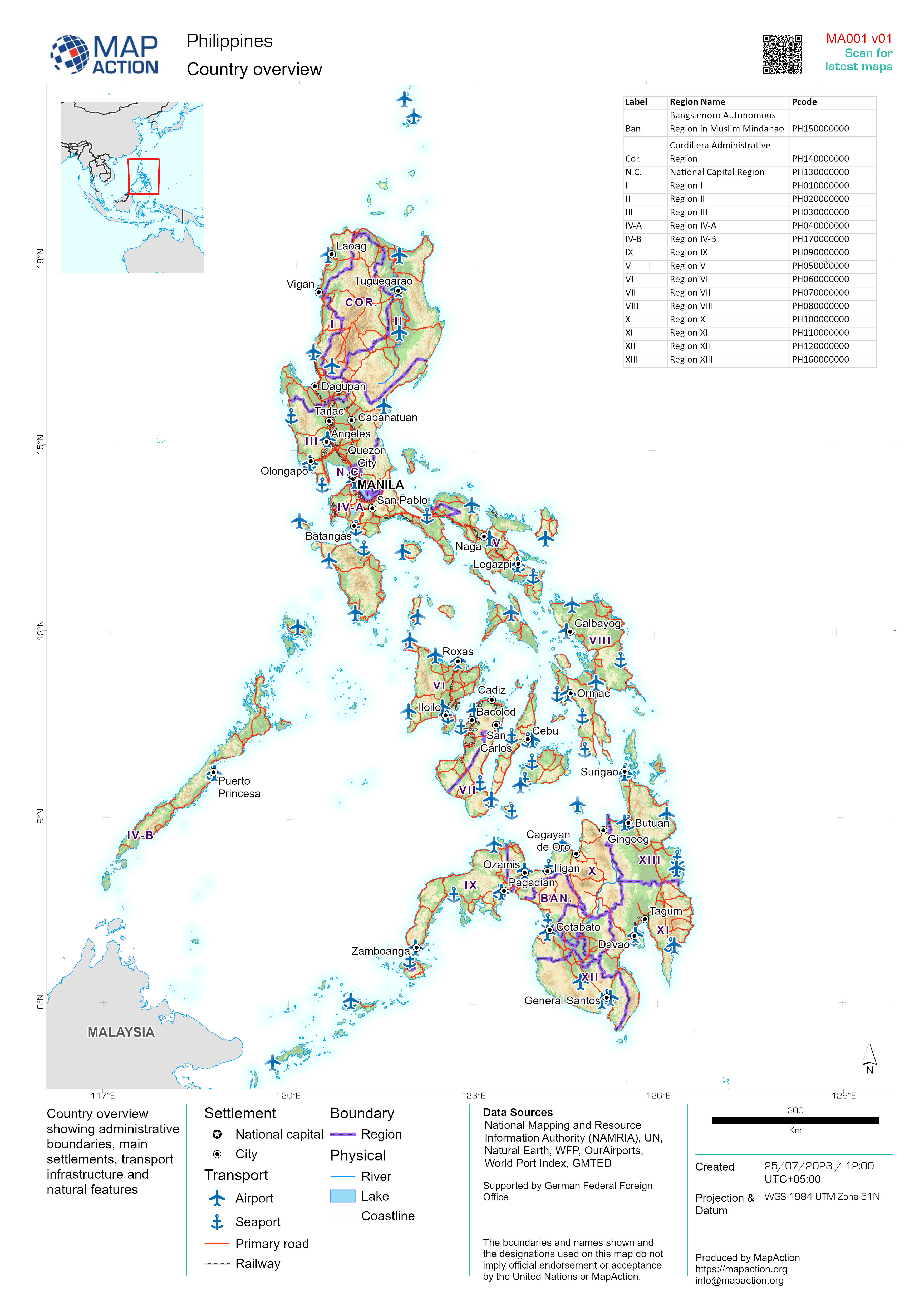
Country overview
Country overview showing administrative boundaries, main settlements, transport infrastructure and natural features -
Country Overview
Country overview showing administrative boundaries, main settlements, transport infrastructure and natural features -

Reference map atlas for states of Sudan
Reference map atlas of each state (administrative level 1) -
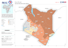
Arid and Semi-Arid Lands (ASALs)
The map shows the Arid and Semi-Arid Lands (ASALs), which occupy over 80% of the country. The annual rainfall in the arid areas is between 150-550mm and in the semi-arid areas... -

Country overview
Example: Country overview showing administrative boundaries, main settlements, transport infrastructure and natural features -

Administrative Boundaries: Districts (admin level 2)
Map atlas of district boundaries (admin level 2) within region (admin level 1) and main settlements -

Divisions (administrative level 1)
Overview map showing divisions (administrative level 1) with main settlements -

State boundaries (administrative level 1)
State boundaries (administrative level 1) and main settlements


