-

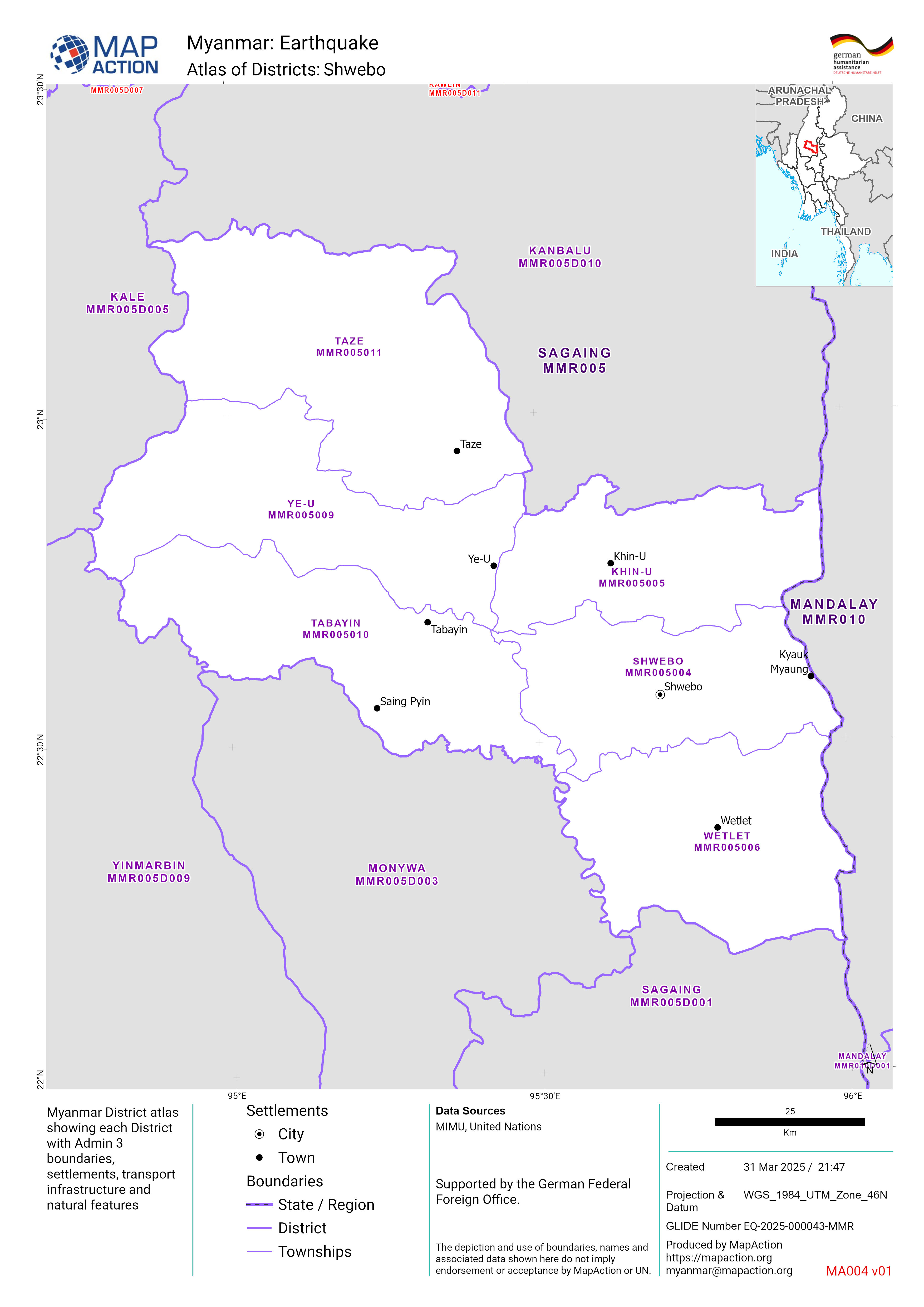
Atlas of Districts:
Myanmar District atlas showing each District with Admin 3 boundaries, settlements, transport infrastructure and natural features -

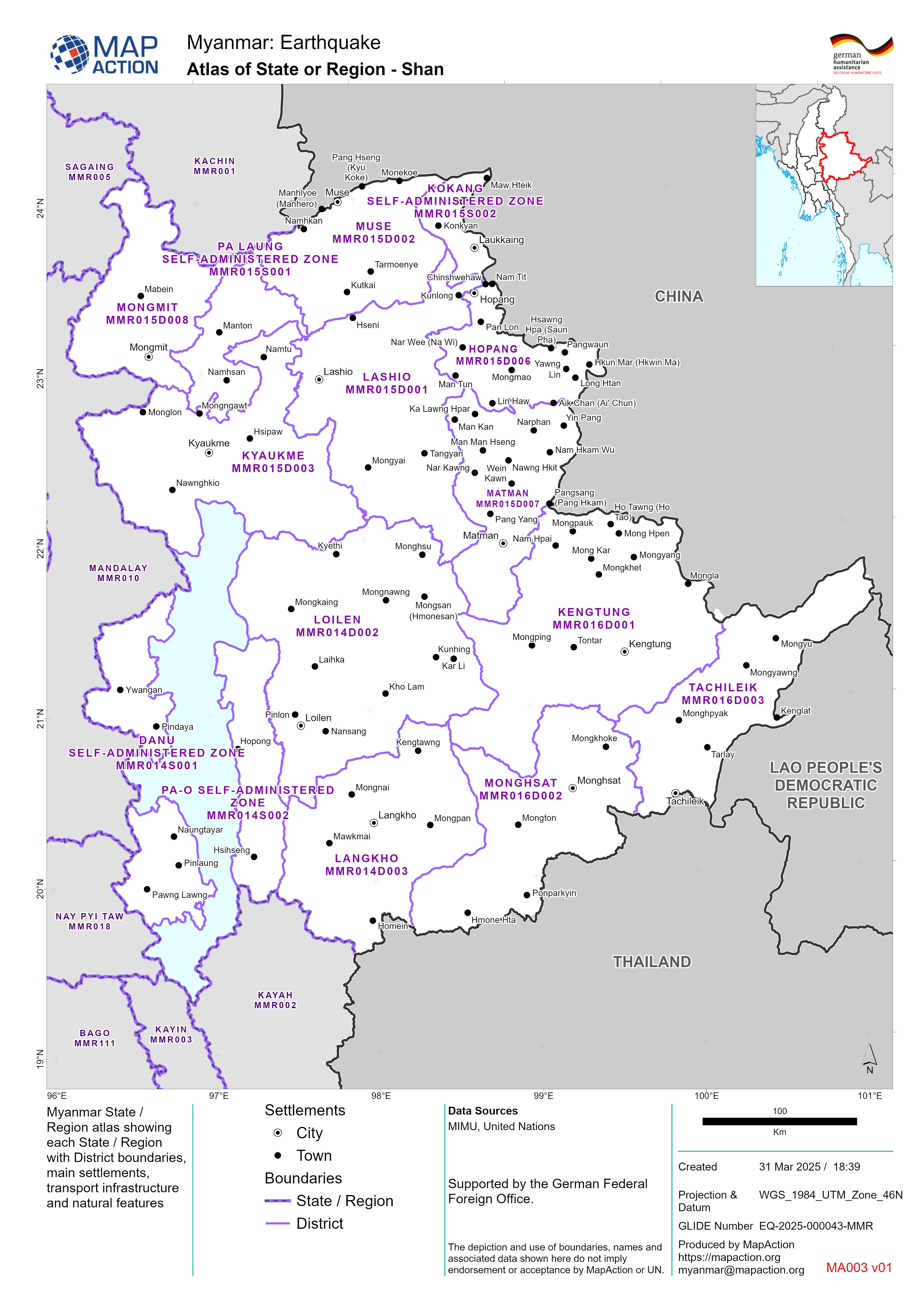
Atlas of State or Region - <dyn type="page" property="name"/>
Myanmar State / Region atlas showing each State / Region with District boundaries, main settlements, transport infrastructure and natural features -

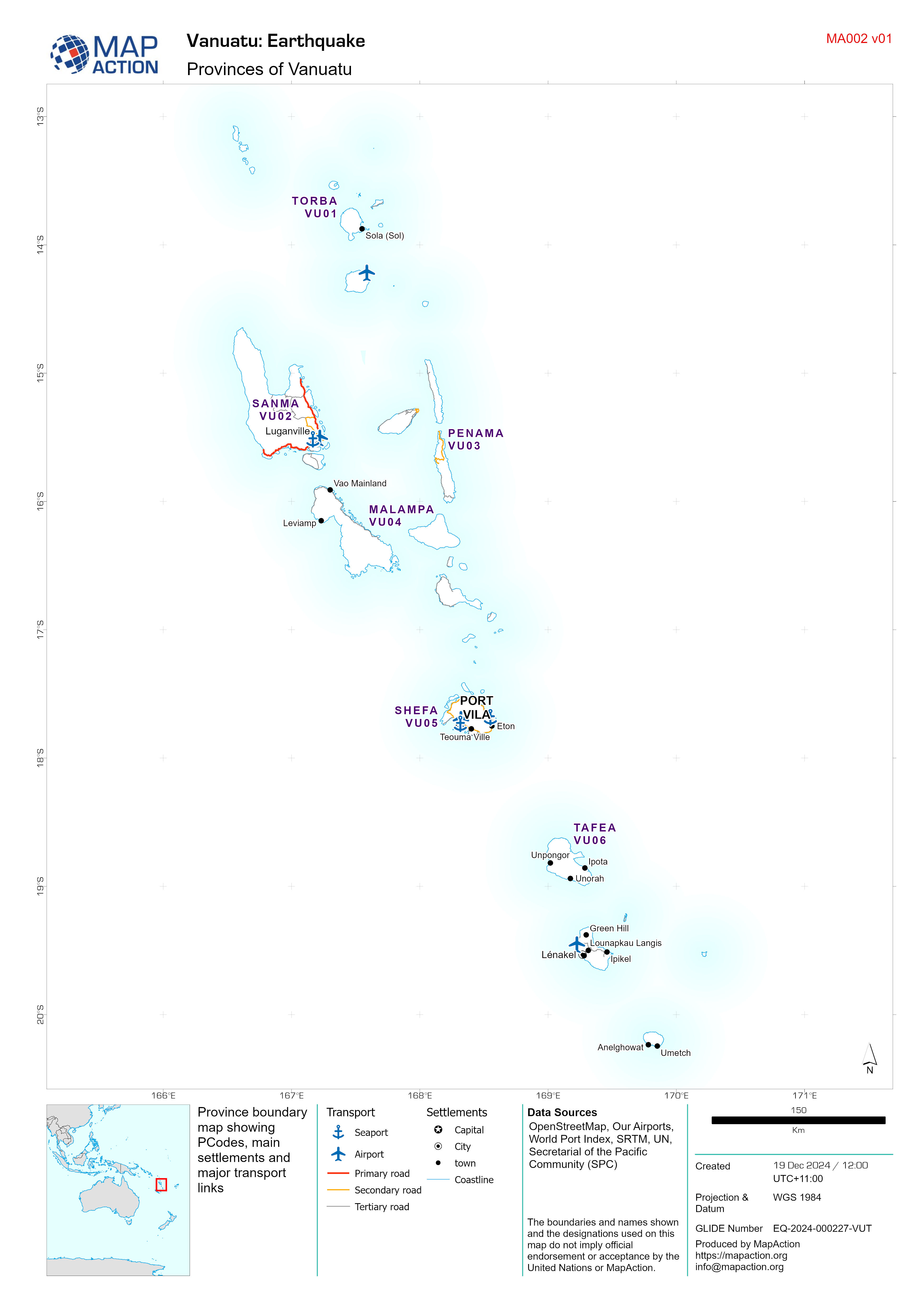
Provinces of Vanuatu
Province boundary map showing PCodes, main settlements and major transport links -

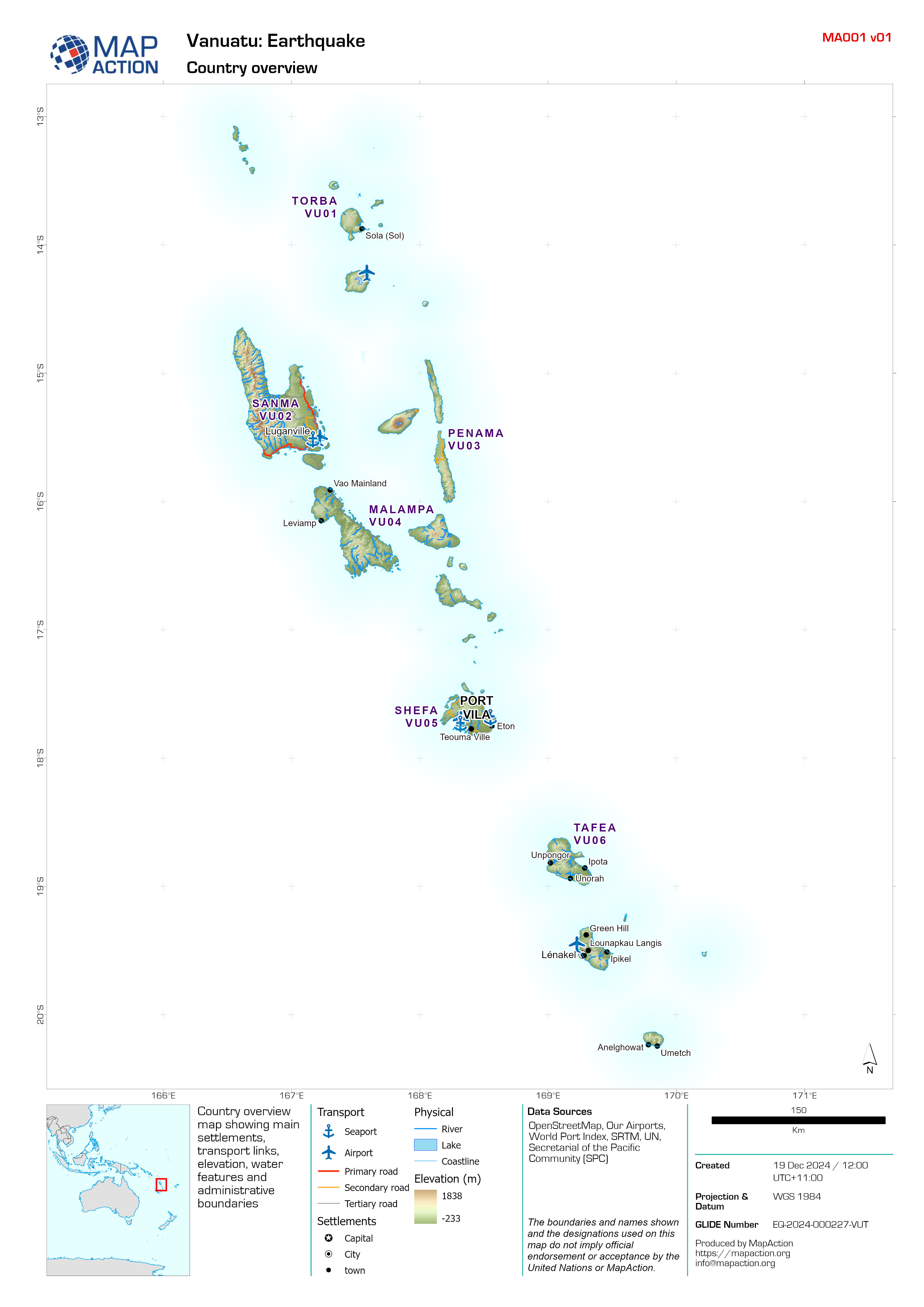
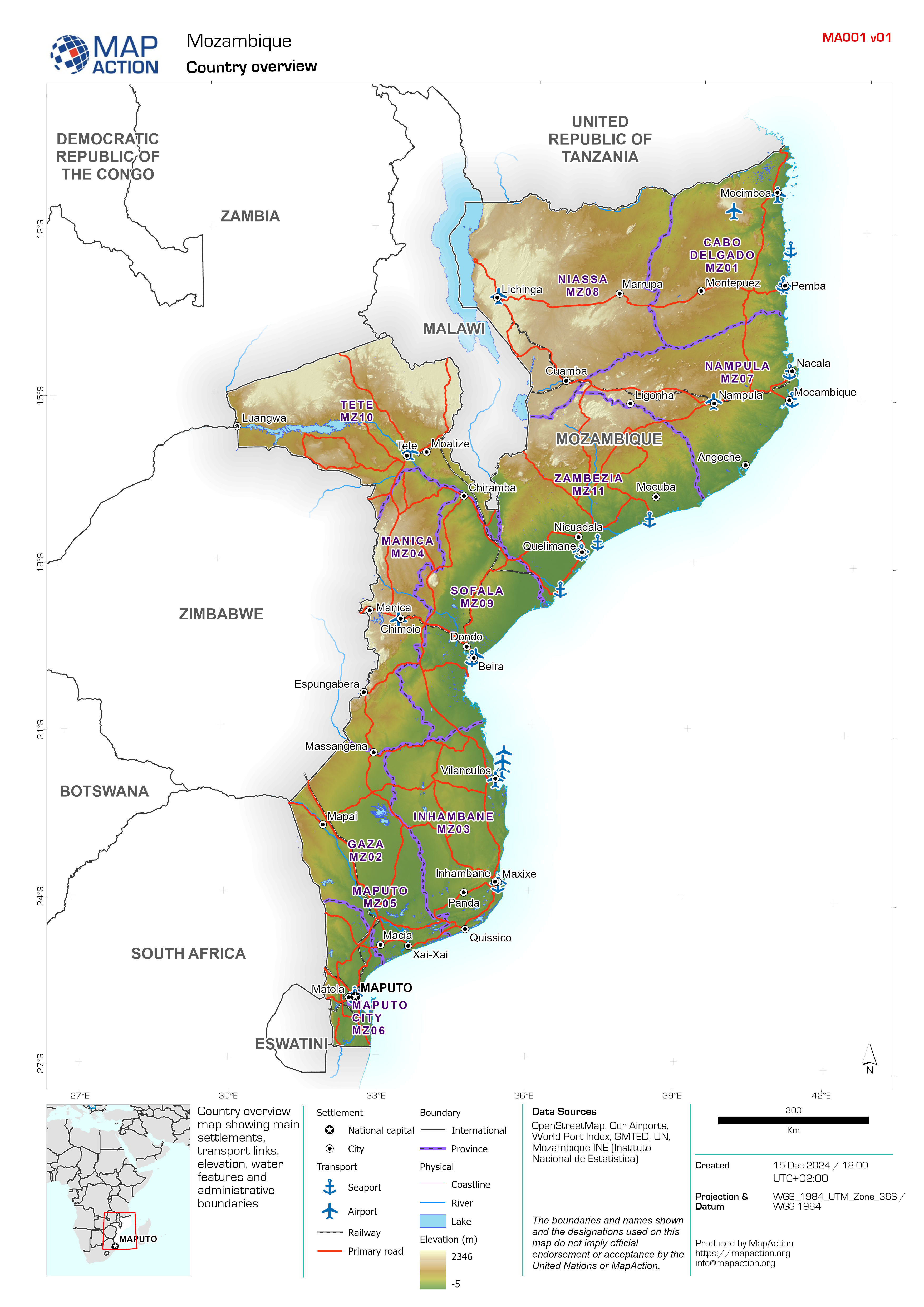
Country overview
Country overview map showing main settlements, transport links, elevation, water features and administrative boundaries -

-

Country overview
Country overview map showing main settlements, transport links, elevation, water features and administrative boundaries -

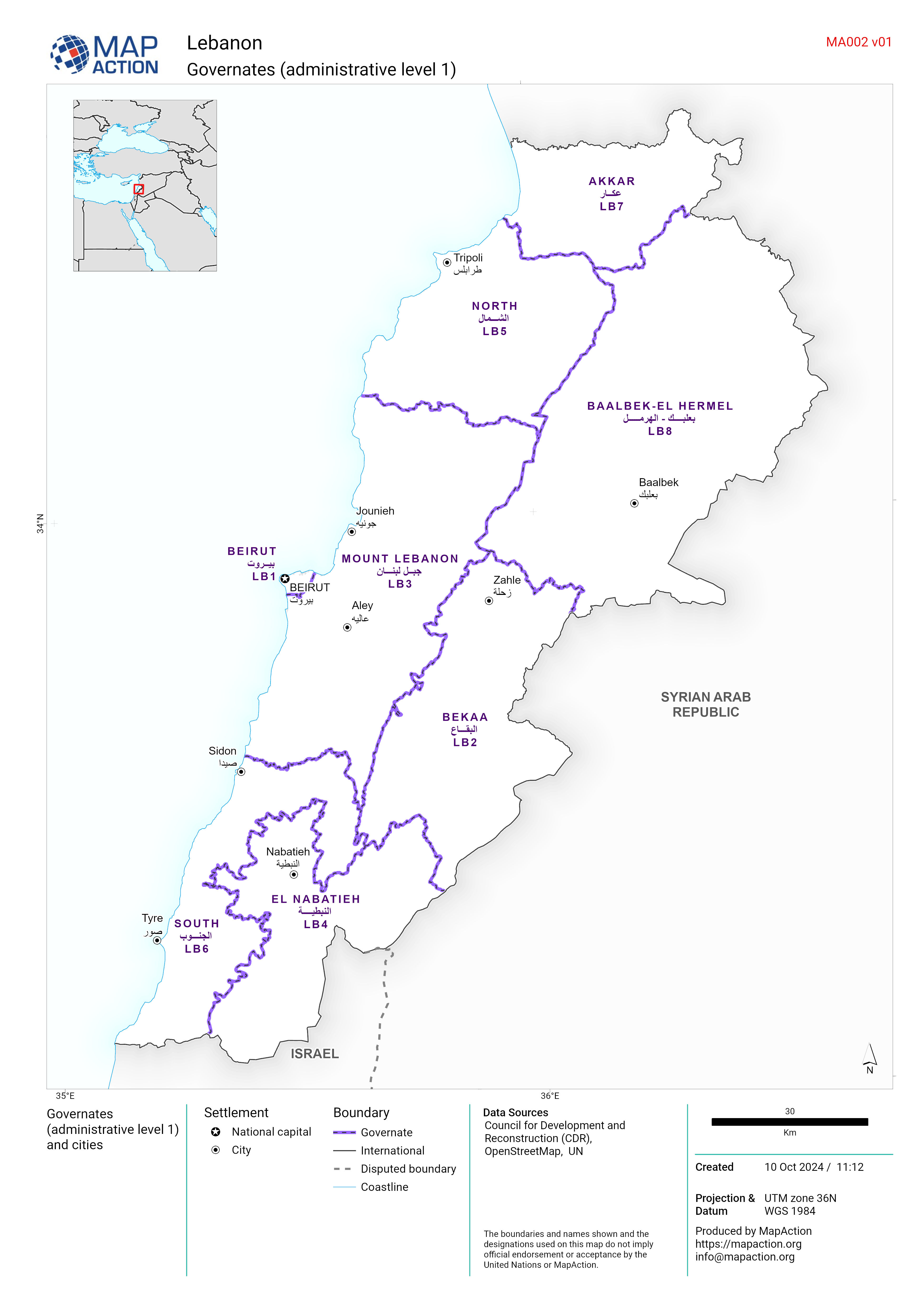
Governates (administrative level 1)
Map showing Governates (administrative level 1) and cities in Lebanon -

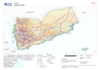
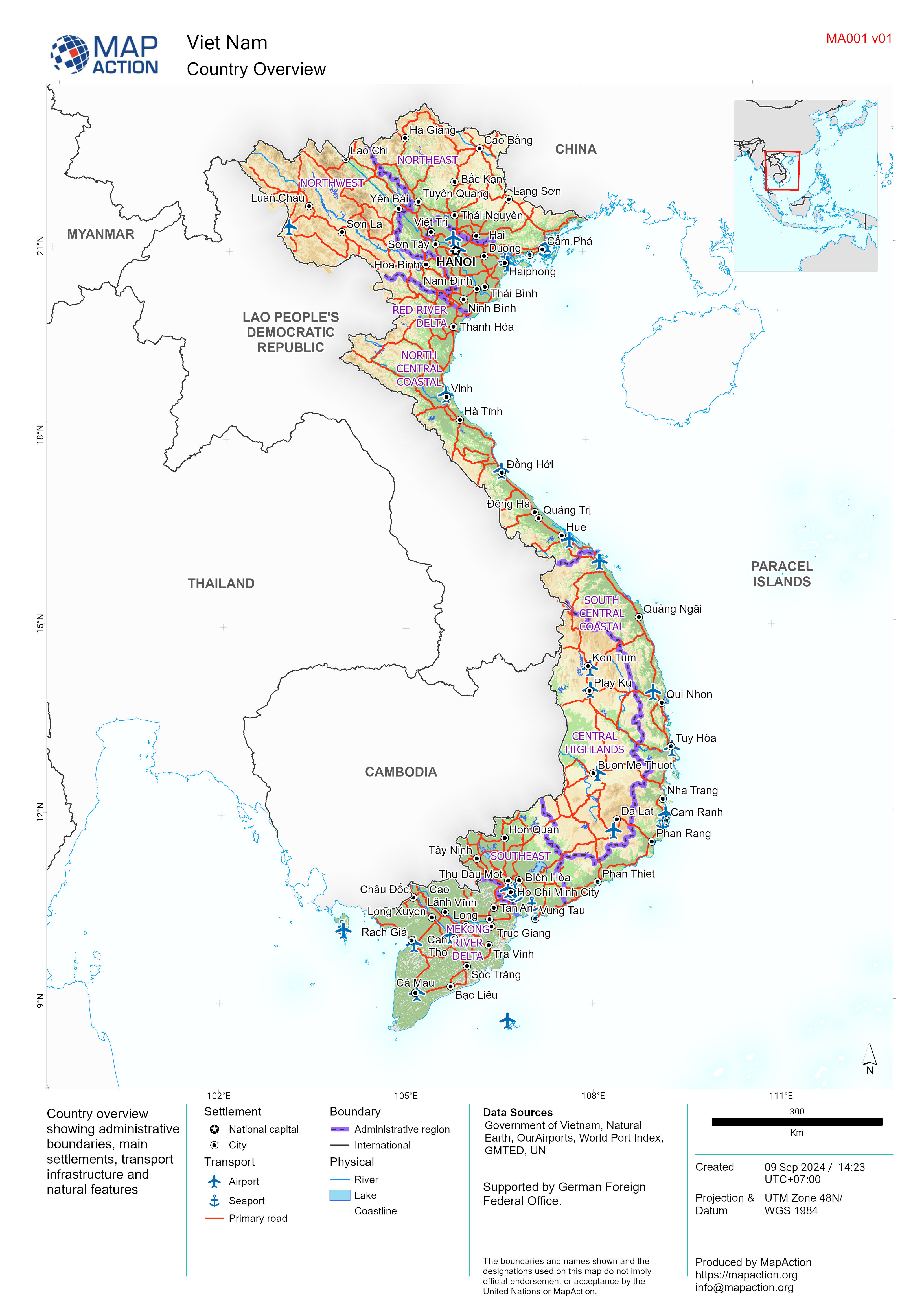
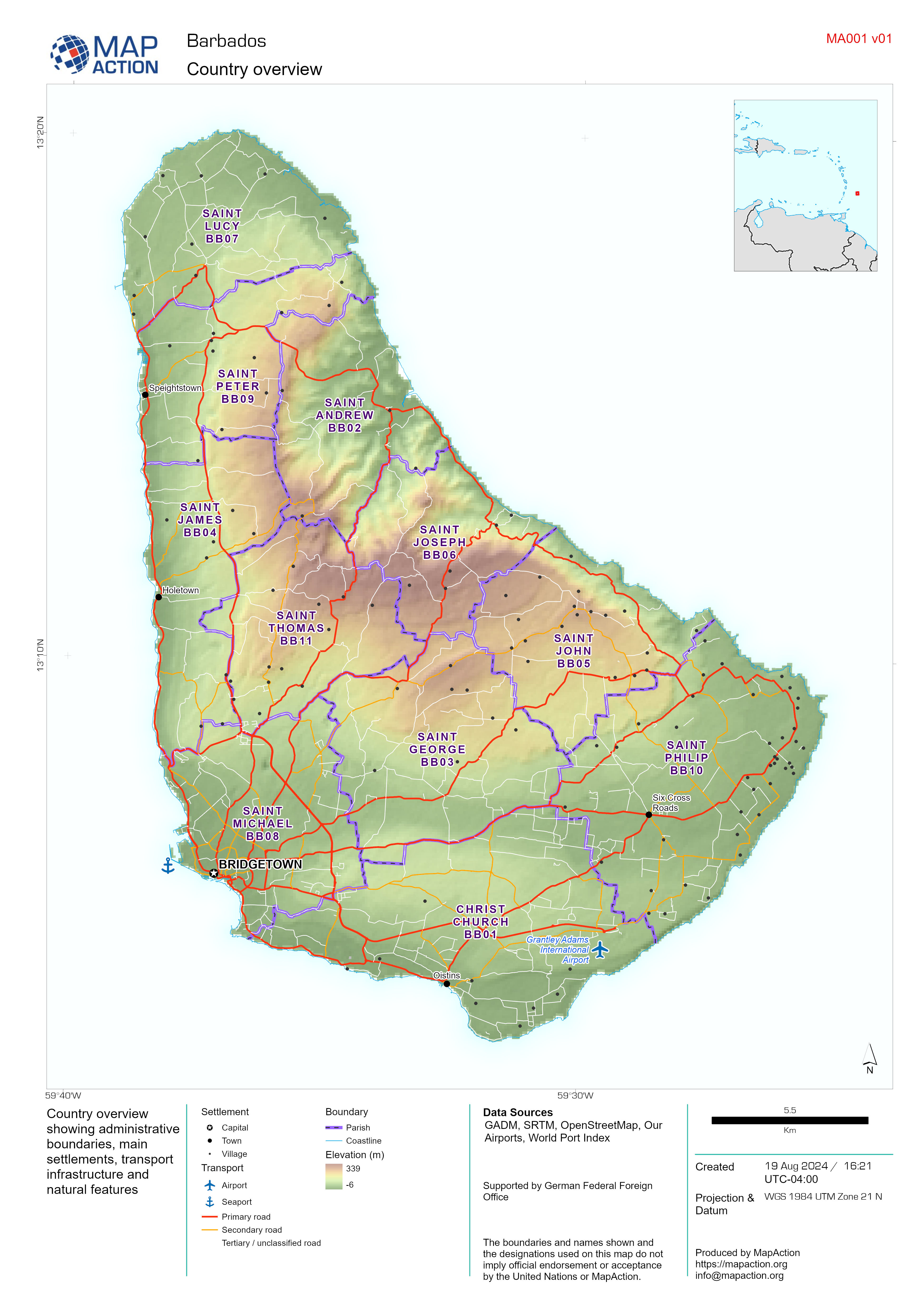
Country Overview
Country overview showing administrative boundaries, main settlements, transport infrastructure and natural features -

Assessment locations - 10 and 15 July 2024
Map shows the location of the assessments carried out on 10 July 2024. Teams included members from ODPEM, UNDAC, OIM, FAO, UNDSS, UNDP, UNICEF, ATLAS, JEU and TSF. Roads,... -

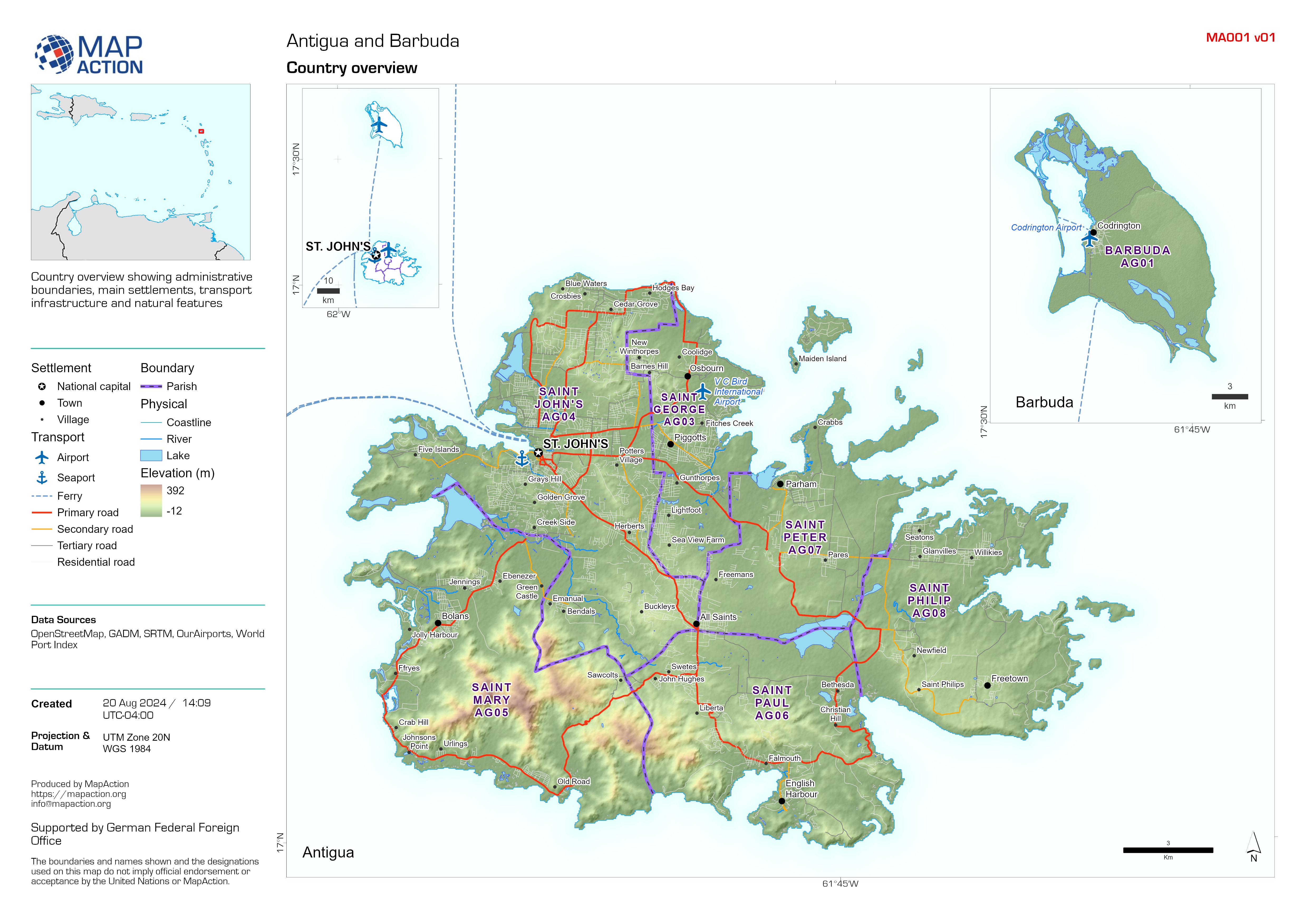
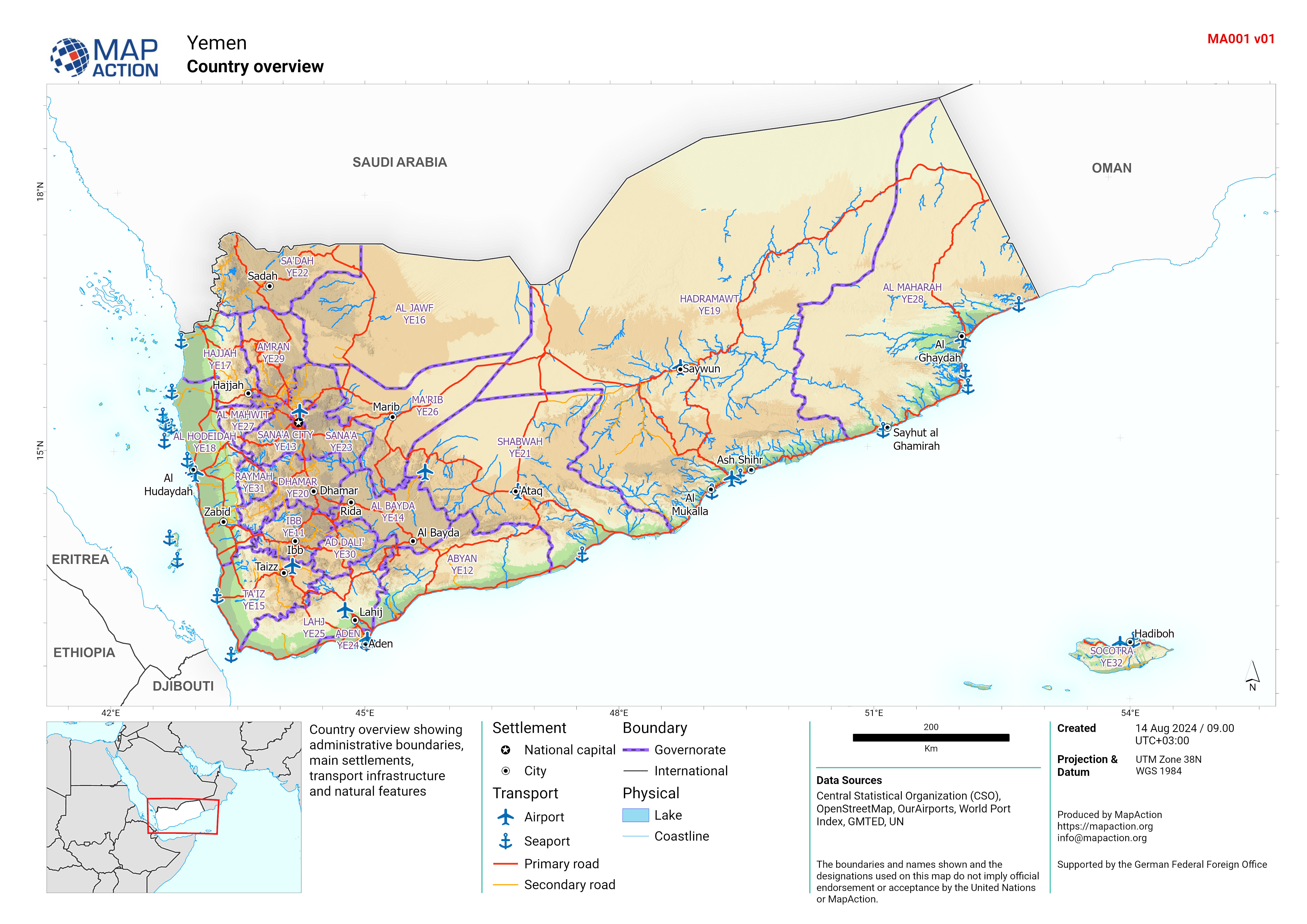
Country overview
Country overview showing administrative boundaries, main settlements, transport infrastructure and natural features -

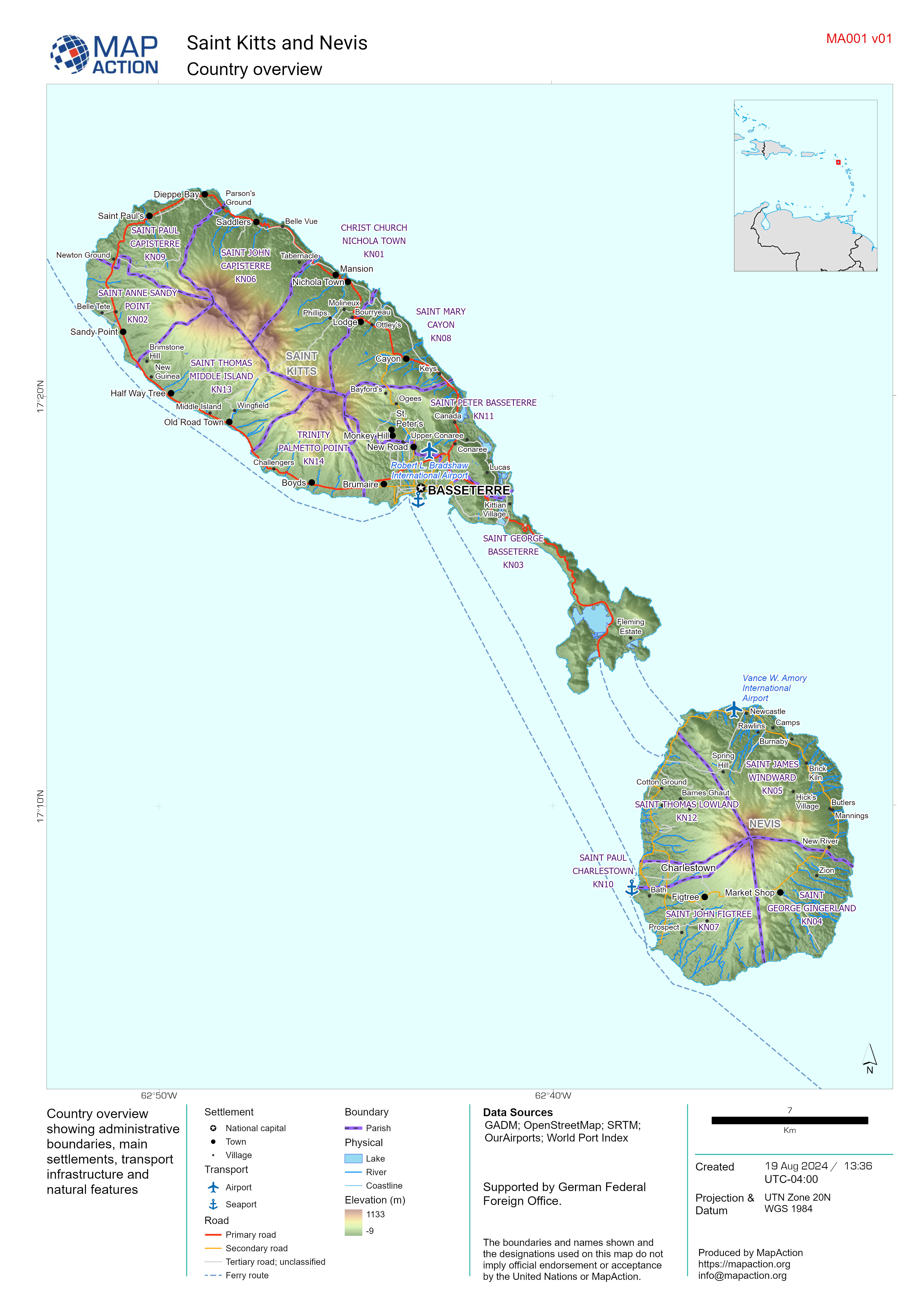
Country overview
Country overview showing administrative boundaries, main settlements, transport infrastructure and natural features -

Country overview
Country overview showing administrative boundaries, main settlements, transport infrastructure and natural features -

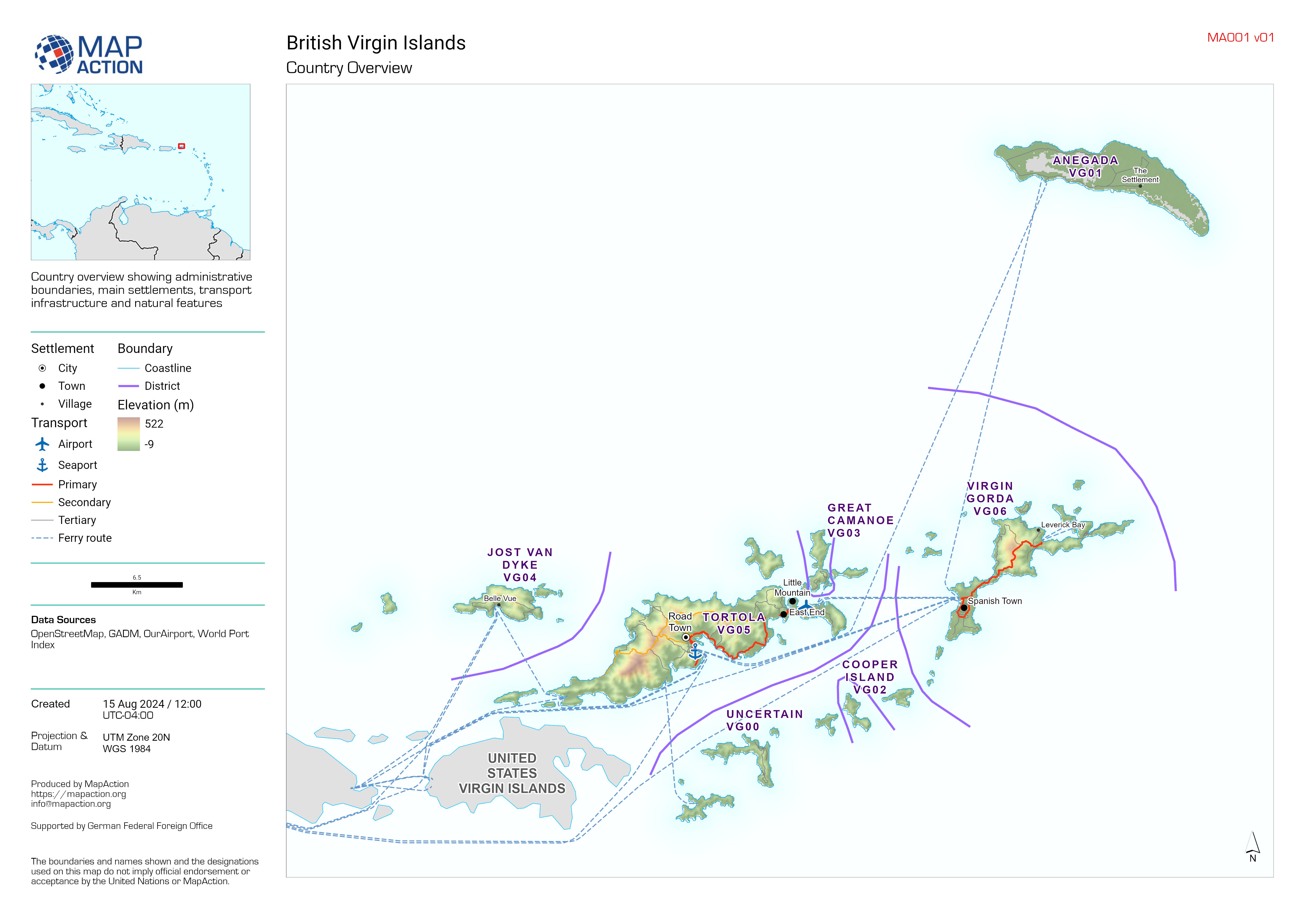
Country Overview
Country overview showing administrative boundaries, main settlements, transport infrastructure and natural features -
Country Overview
Country overview showing administrative boundaries, main settlements, transport infrastructure and natural features -
Country overview
Country overview showing administrative boundaries, main settlements, transport infrastructure and natural features -
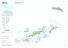
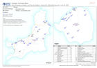
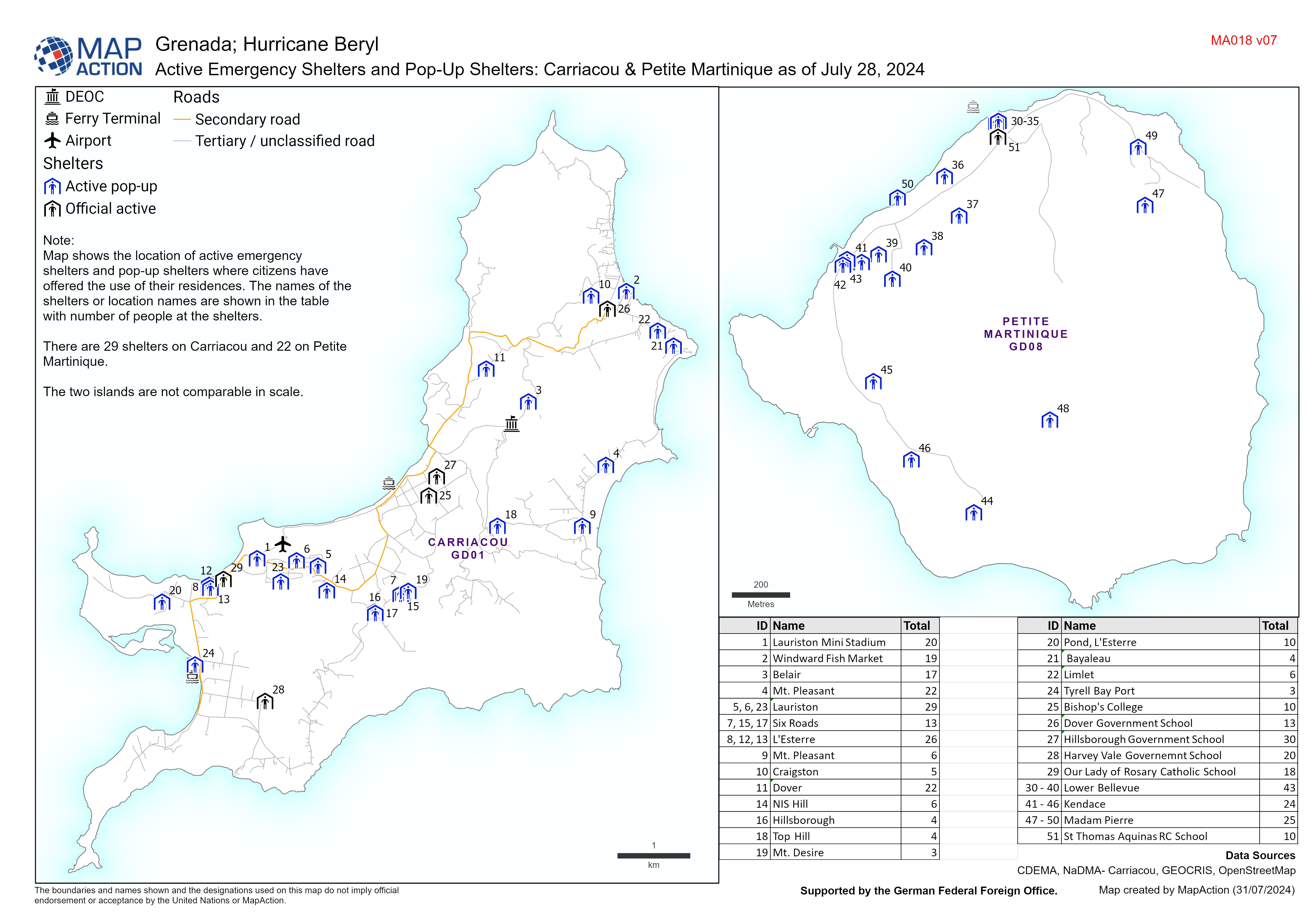
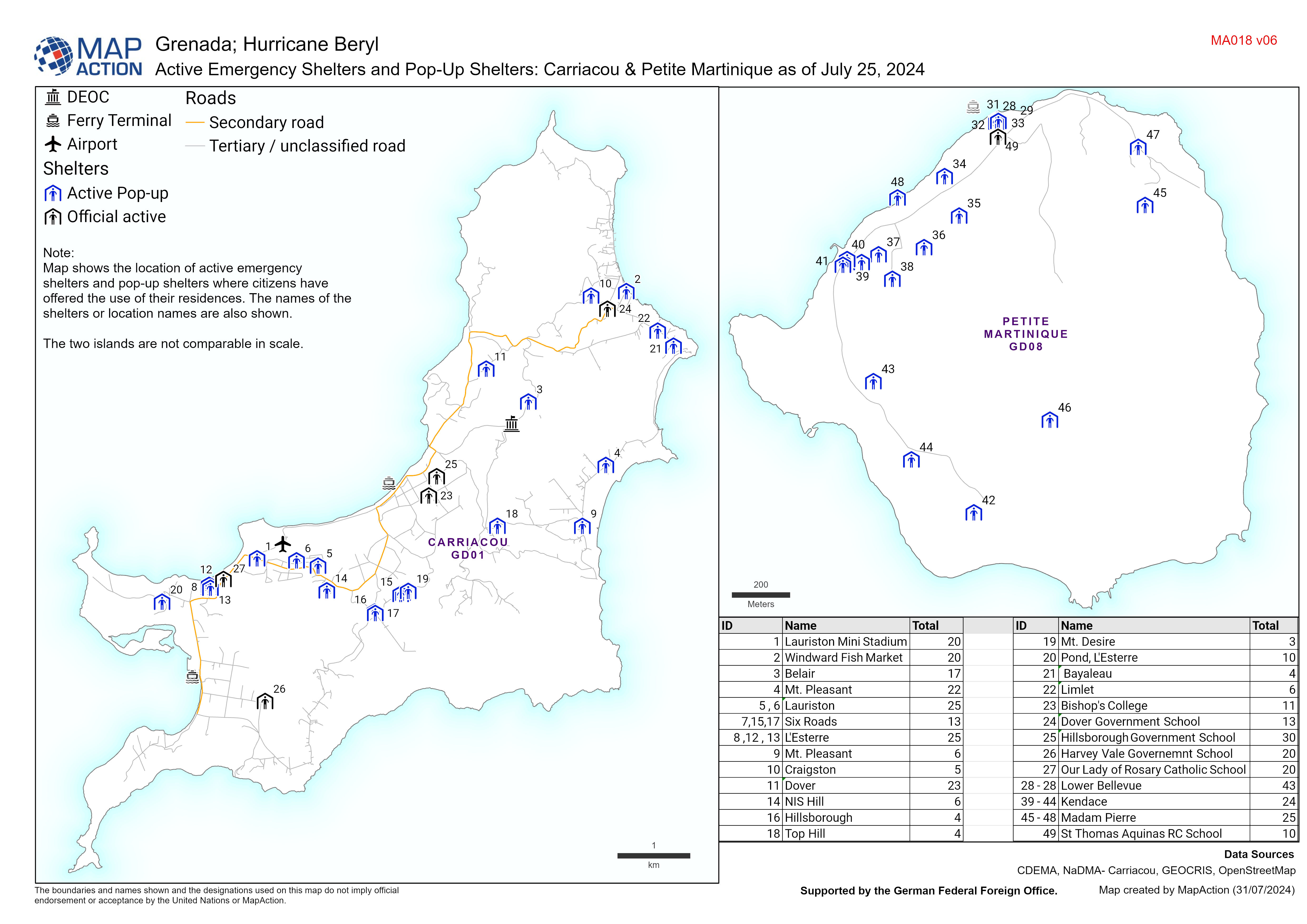
Active Emergency Shelters and Pop-Up Shelters: Carriacou & Petite Martinique ...
Map displaying active emergency shelters and pop-up shelters in Carriacou/Petite Martinique. The names of the shelters or location names are also shown. -
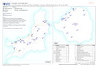
Active Emergency Shelters and Pop-Up Shelters: Carriacou & Petite Martinique ...
Map displaying active emergency shelters and pop-up shelters in Carriacou/Petite Martinique. The names of the shelters or location names are also shown.


