-
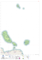
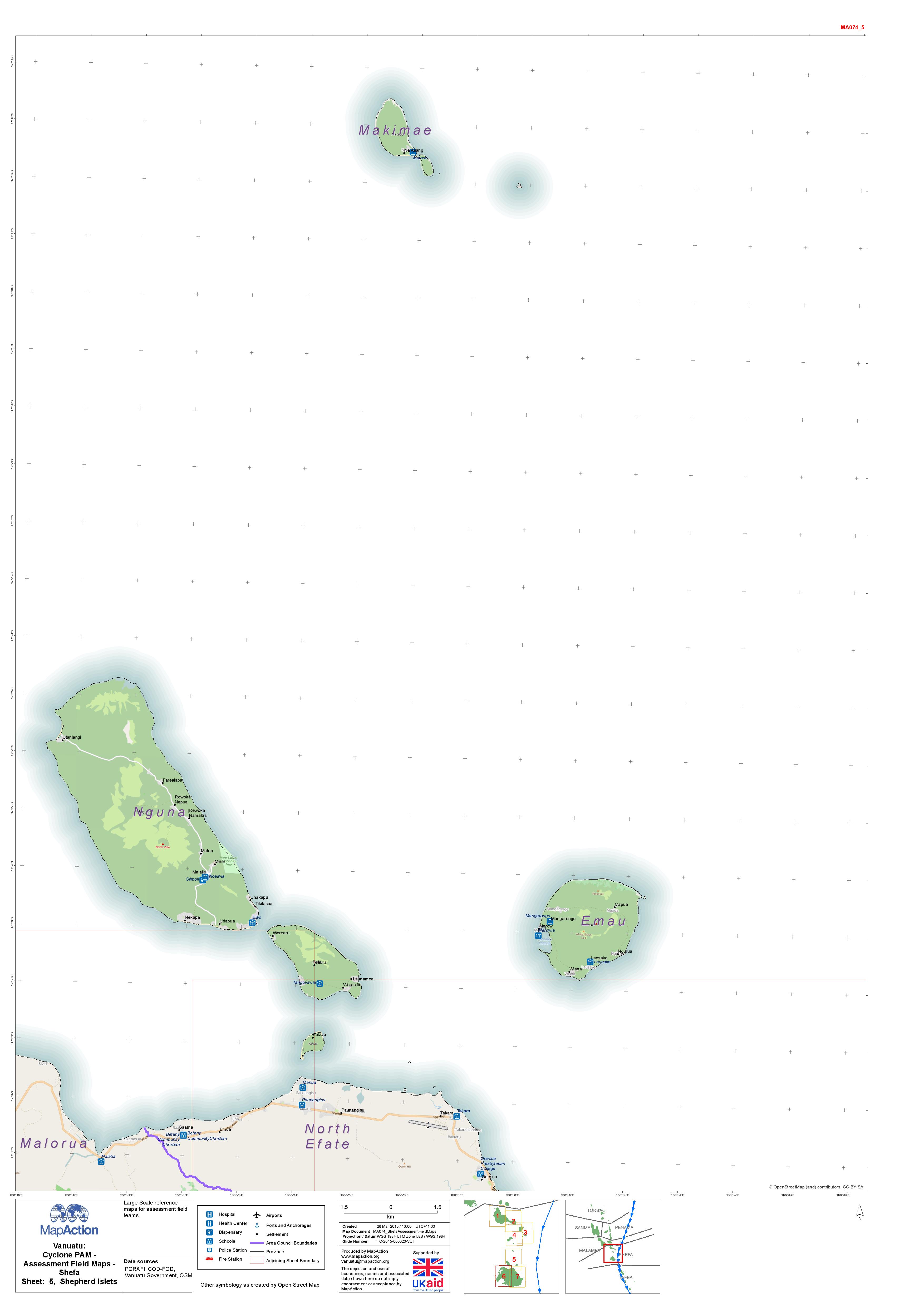
Vanuatu: Cyclone PAM - Assessment Field Maps - Shefa Sheet: 5, Shepherd Islets
Cyclone PAM - Assessment Field Maps - Shefa Sheet: 5, Shepherd Islets -
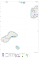
Vanuatu: Cyclone PAM - Assessment Field Maps - Shefa Sheet: 4, Emae
Cyclone PAM - Assessment Field Maps - Shefa Sheet: 4, Emae -

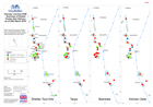
Vanuatu: Cyclone PAM - Assessment Field Maps - Shefa Sheet: 2, East Epi
Vanuatu: Cyclone PAM - Assessment Field Maps - Shefa Sheet: 2, East Epi -
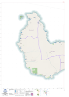
Vanuatu: Cyclone PAM - Assessment Field Maps - Shefa Sheet: 1, West Epi
Vanuatu: Cyclone PAM - Assessment Field Maps - Shefa Sheet: 1, West Epi -

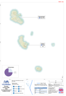
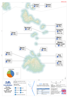
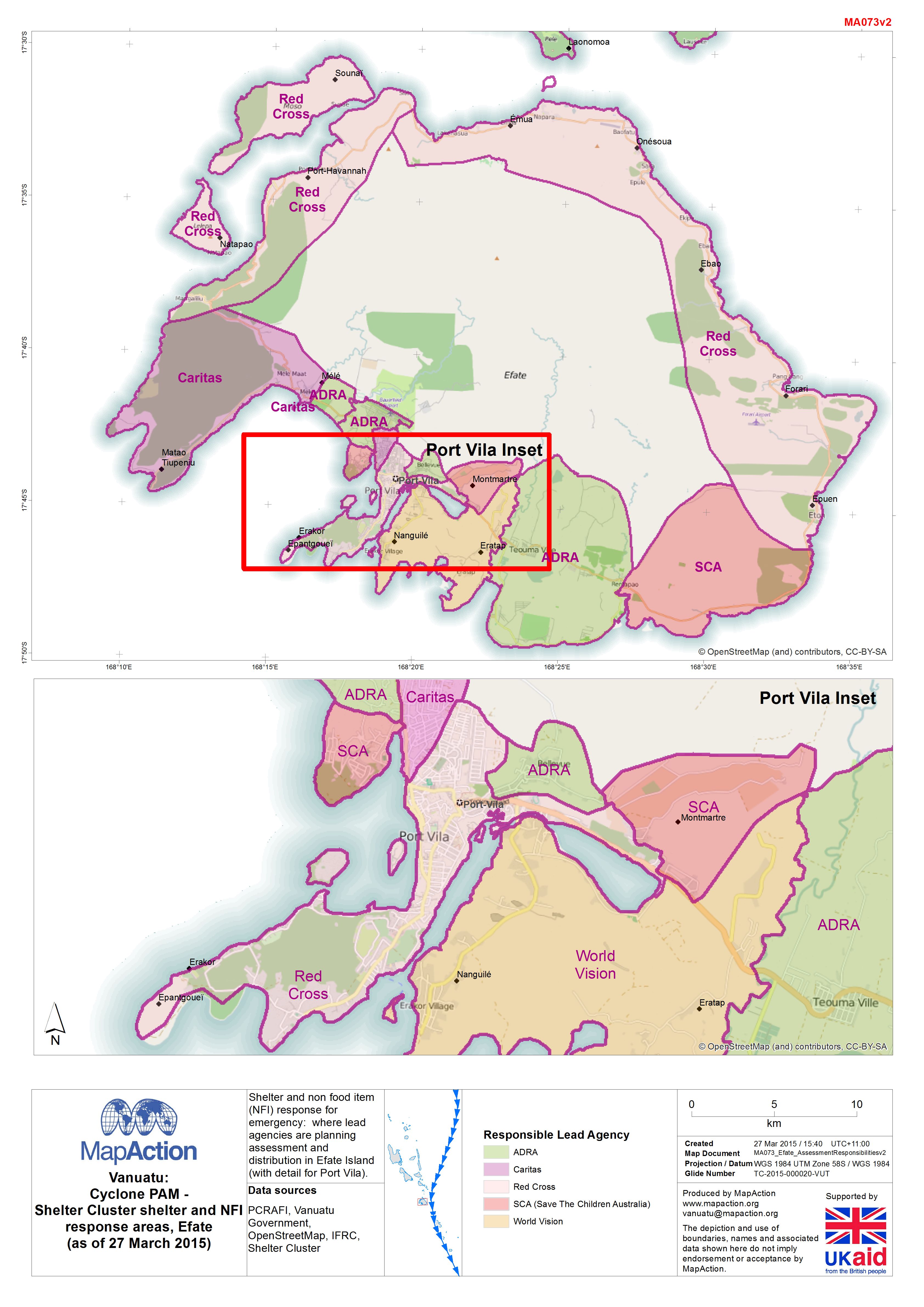
Vanuatu: Cyclone PAM - Shelter Cluster shelter and NFI response areas, Efate(...
Shelter and non food item (NFI) response for emergency: where lead agencies are planning assessment and distribution in Efate Island (with detail for Port Vila). -

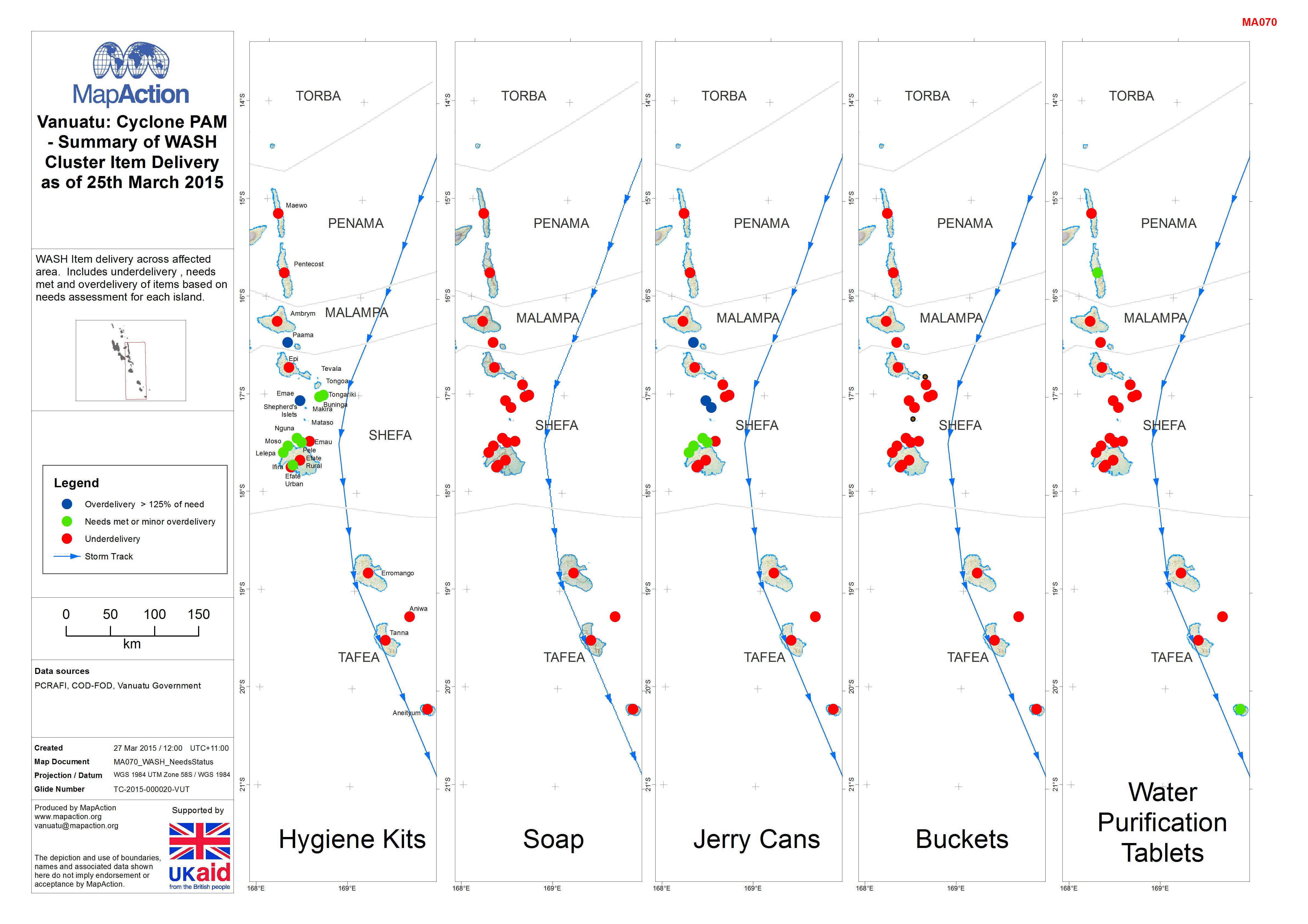
Vanuatu: Cyclone PAM - Summary of WASH Cluster Item Delivery as of 25th March...
WASH Item delivery across affected area. Includes underdelivery , needs met and overdelivery of items based on needs assessment for each island. -
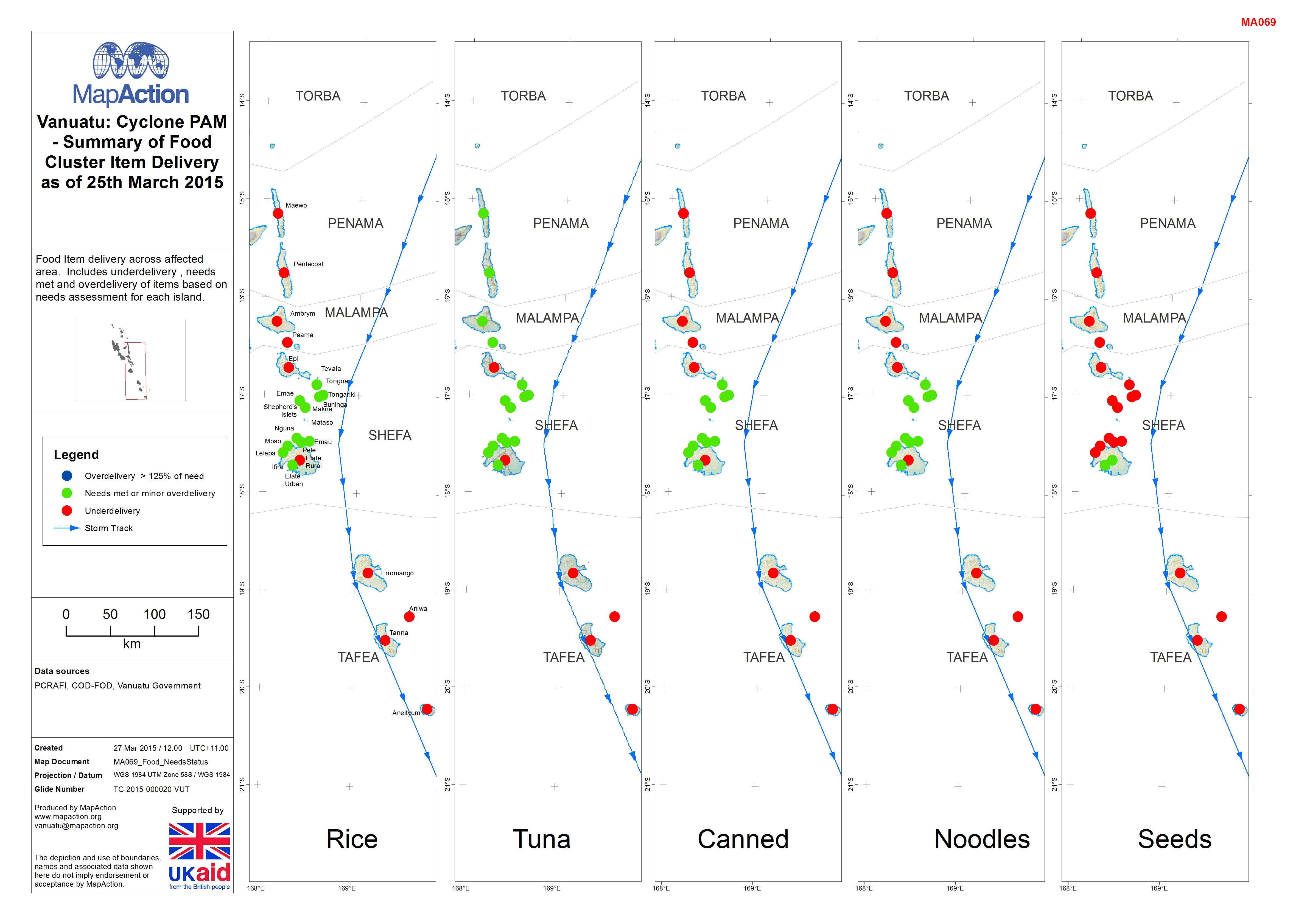
Vanuatu: Cyclone PAM - Summary of Food Cluster Item Delivery as of 25th March...
Food Item delivery across affected area. Includes underdelivery , needs met and overdelivery of items based on needs assessment for each island. -
Vanuatu: Cyclone PAM - Summary of Shelter Cluster Item Delivery as of 25th Ma...
Shelter Item delivery across affected area. Includes underdelivery , needs met and overdelivery of items based on needs assessment for each island. -
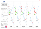
Vanuatu: Cyclone PAM - Tafea 3w Protection
Map shows organisations per island per cluster. Pie chart shows the status of activities -
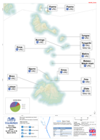
Vanuatu: Cyclone PAM - Penama 3w Protection
Map shows organisations per island per cluster. Pie chart shows the status of activities -
Vanuatu: Cyclone PAM - Tafea 3w NFI
Map shows organisations per island per cluster. Pie chart shows the status of activities -
Vanuatu: Cyclone PAM - Shefa 3w NFI
Map shows organisations per island per cluster. Pie chart shows the status of activities -

Vanuatu: Cyclone PAM - Malampa 3w NFI
Map shows organisations per island per cluster. Pie chart shows the status of activities -

-

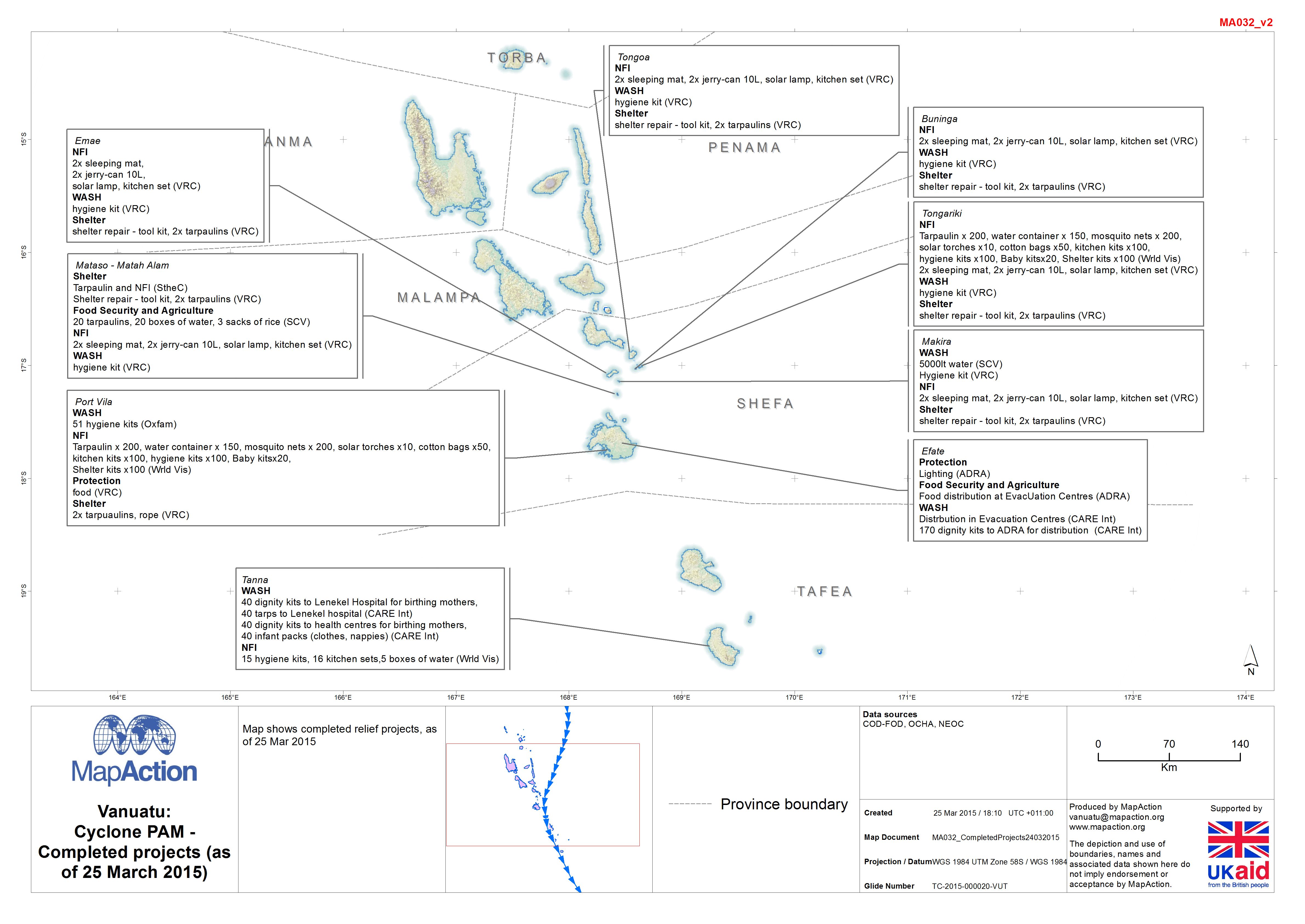
Vanuatu: Cyclone PAM - Completed projects (as of 25 March 2015)
Map shows completed relief projects, as of 25 Mar 2015. -

-
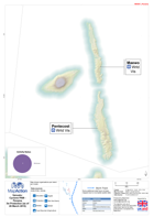
Vanuatu: Cyclone PAM - Helicopter landing zones in the Shepherd Islands(as of...
This dataset has no description
-

-

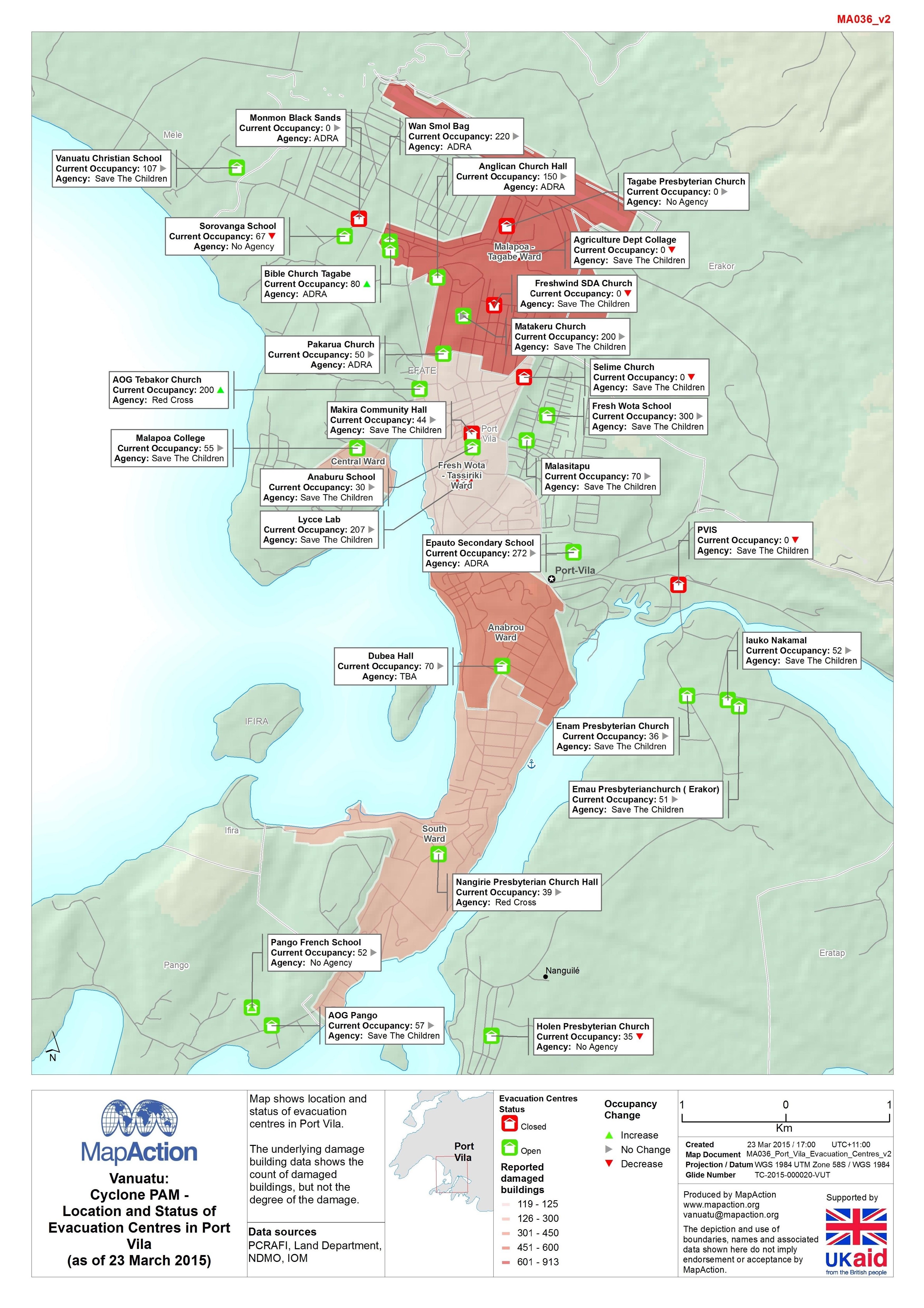
Vanuatu: Cyclone PAM - Location and Status of Evacuation Centres in Port Vila...
Map shows location and status of evacuation centres in Port Vila. The underlying damage building data shows the count of damaged buildings, but not the degree of the damage. -
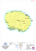
Vanuatu: Cyclone PAM - Number of Households per Area Council
Maps show the number of households for each of the 63 area councils in Vanuatu.