-

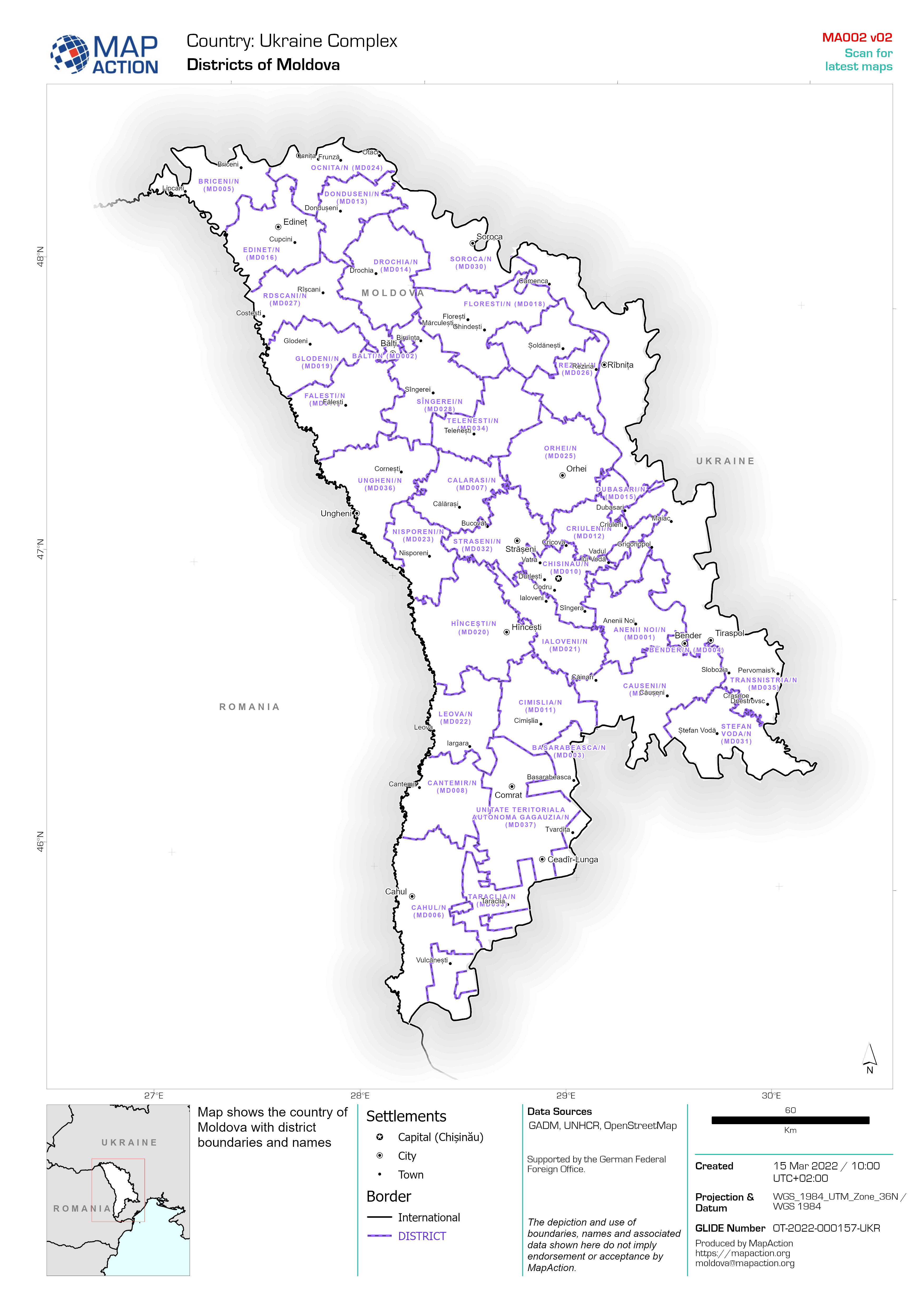
District overview with traditional authority boundaries
Map Series map showing Traditional Authorities in individual Districts, also showing main settlements, transport links and water features -

-

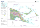
Country Overview
Country overview map showing main settlements, transport links, elevation, water features and administrative boundaries -

Overview of the affected area
Map showing major settlements, transport links, elevation, water features and administrative boundaries -

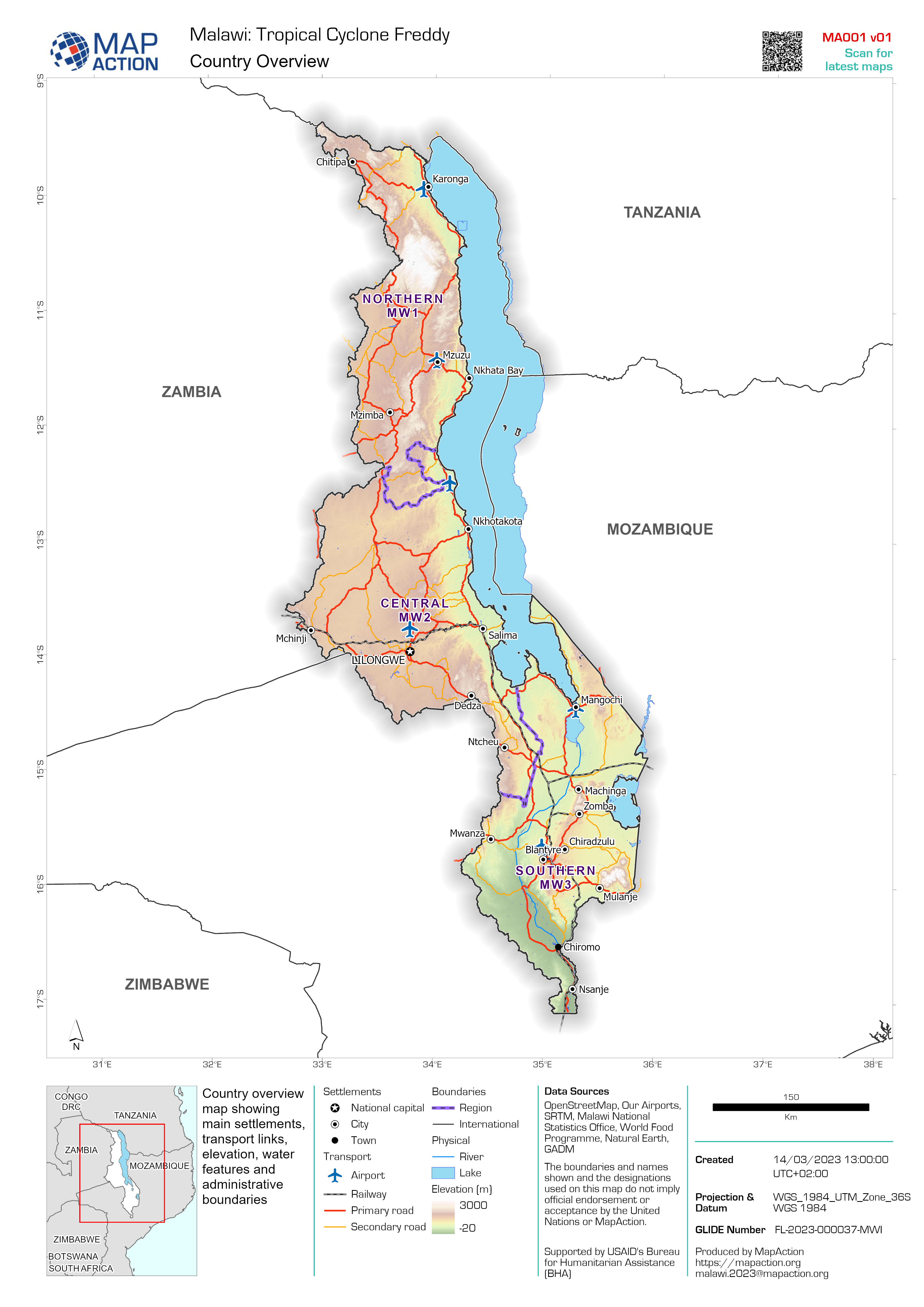
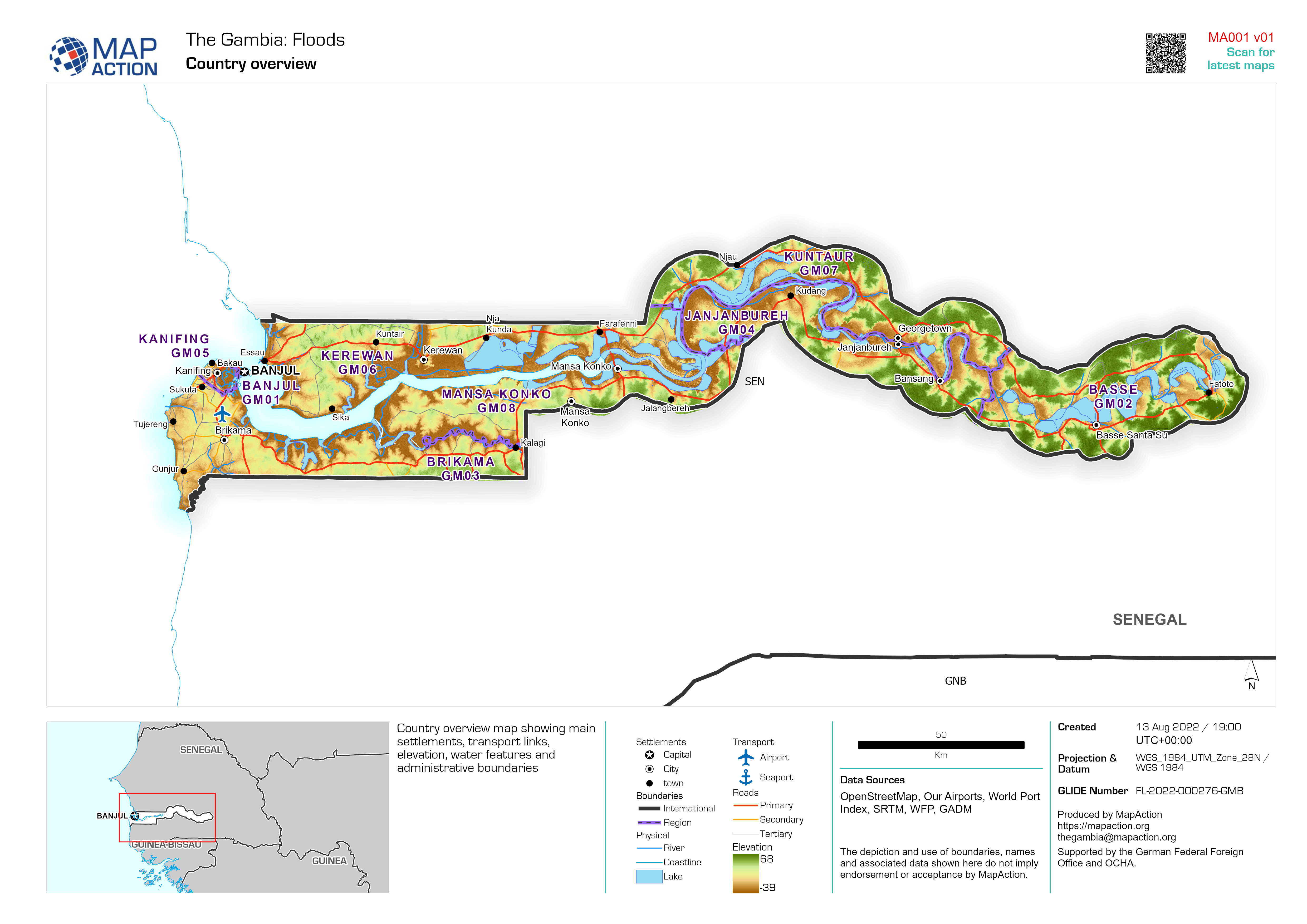
Country overview
Country overview map showing main settlements, transport links, elevation, water features and administrative boundaries -

Categorías de Sequía (US Drought Monitor) 26 Junio 2022 al 25 Septiembre 2022
MIRA - Comunidades identificadas para la recolección de datos primarios en los departamentos de Boquerón, Presidente Hayes -

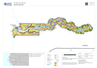
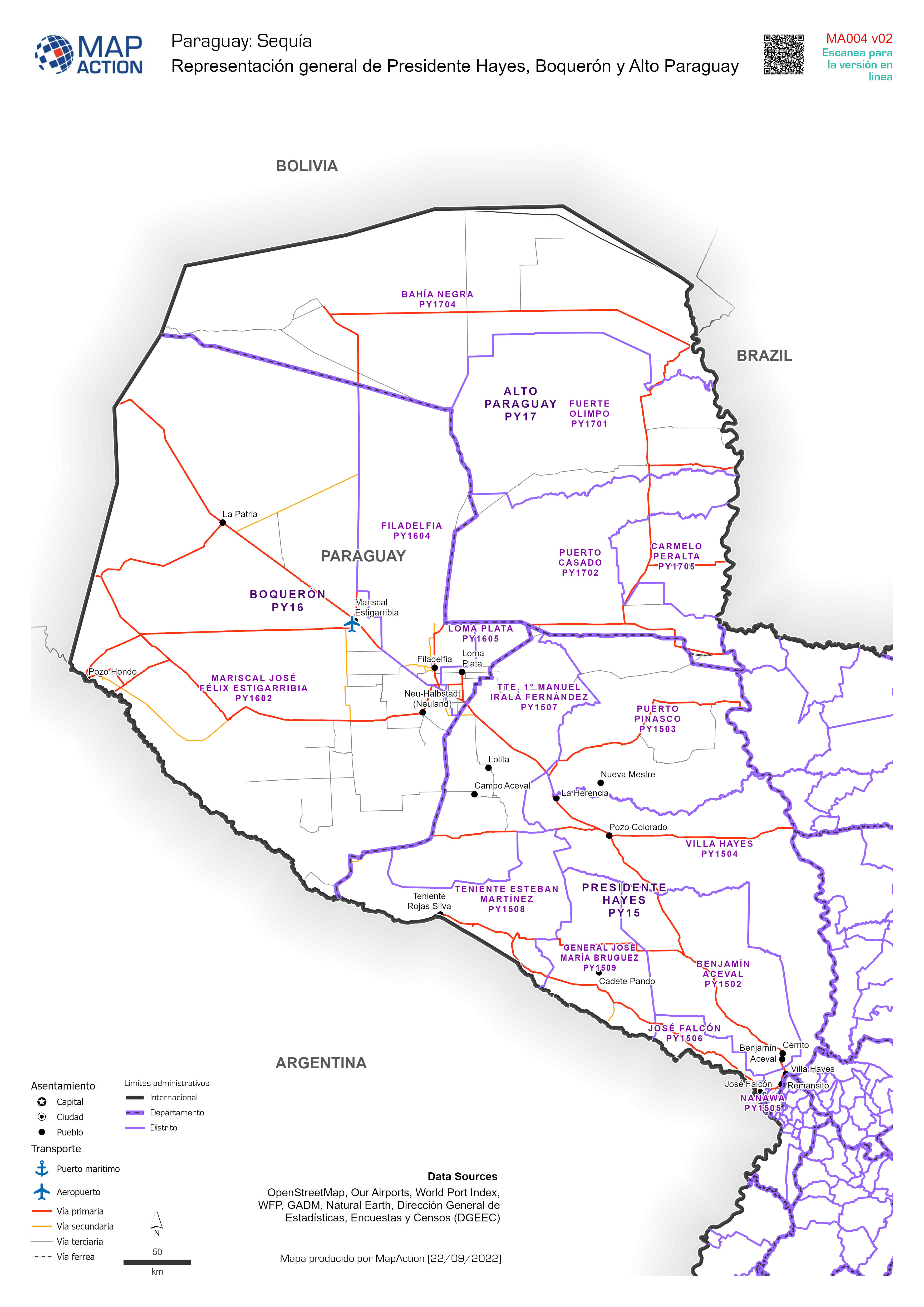
Representación general de Presidente Hayes, Boquerón y Alto Paraguay
Overview of Presidente Hayes, Boquerón and Alto Paraguay showing main settlements, and transport. Representación general de Presidente Hayes, Boquerón and Alto Paraguay ,... -
Country overview
Country overview map showing main settlements, transport links, elevation, water features and administrative boundaries -
Country overview
Country overview map showing main settlements, transport links, elevation, water features and administrative boundaries -

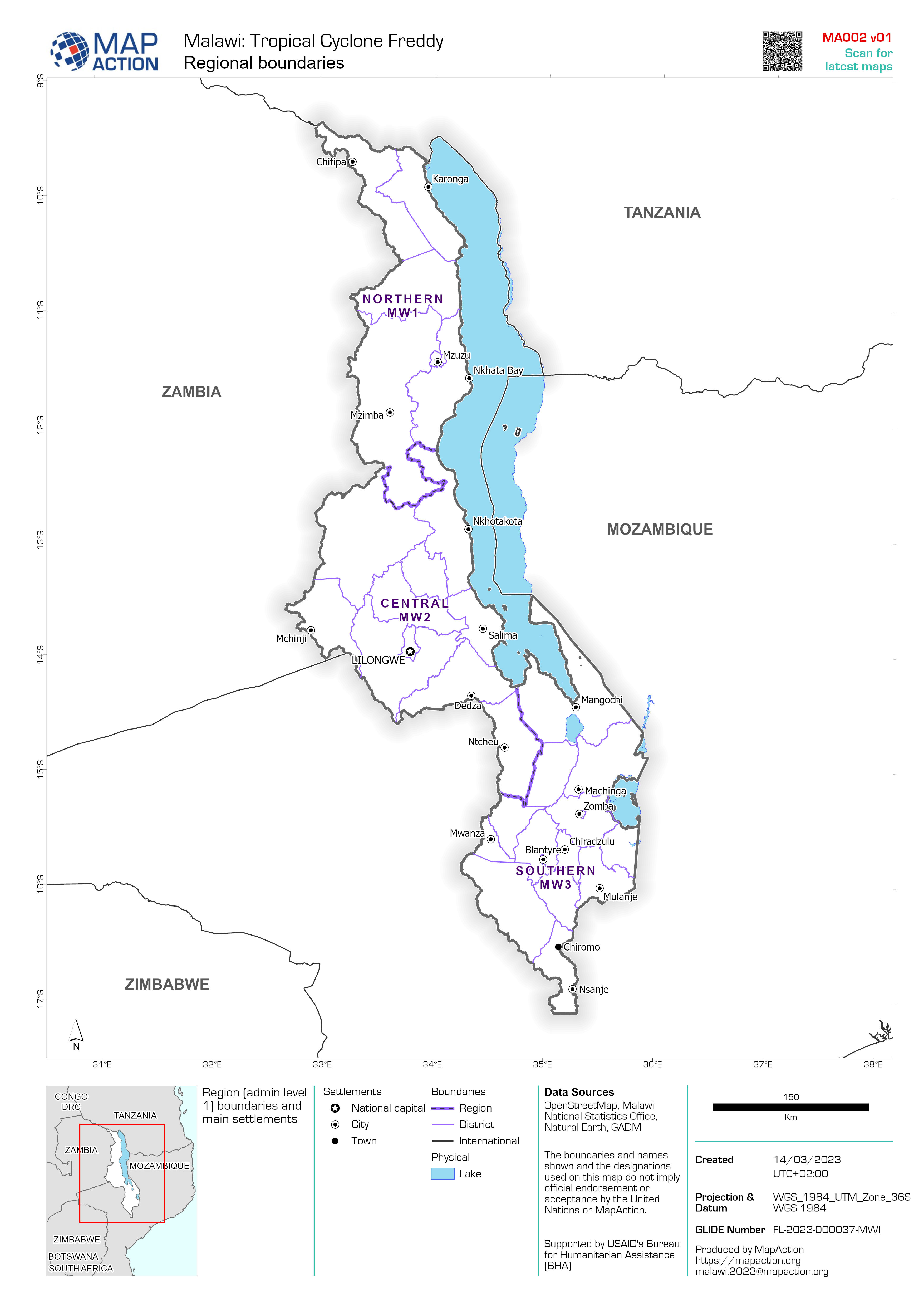
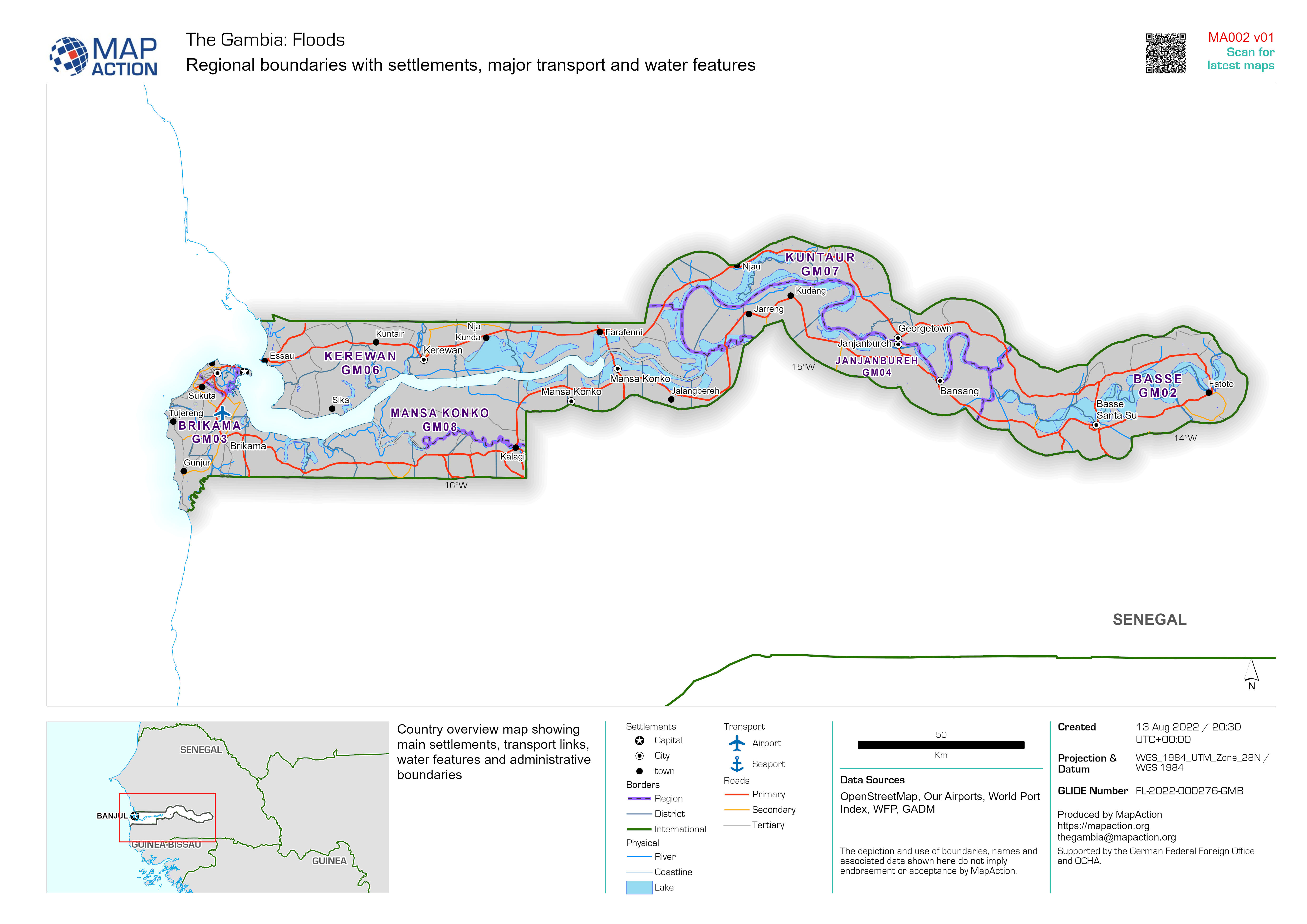
Regional boundaries with settlements, major transport and water features
Country overview map showing main settlements, transport links, water features and administrative boundaries -

-
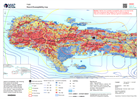
Hazard Susceptibility map
Hazard susceptibility map, showing flood zones and landslide susceptibility mapping, together with earthquake shake intensity information and rainfall isohyets from the last 7... -

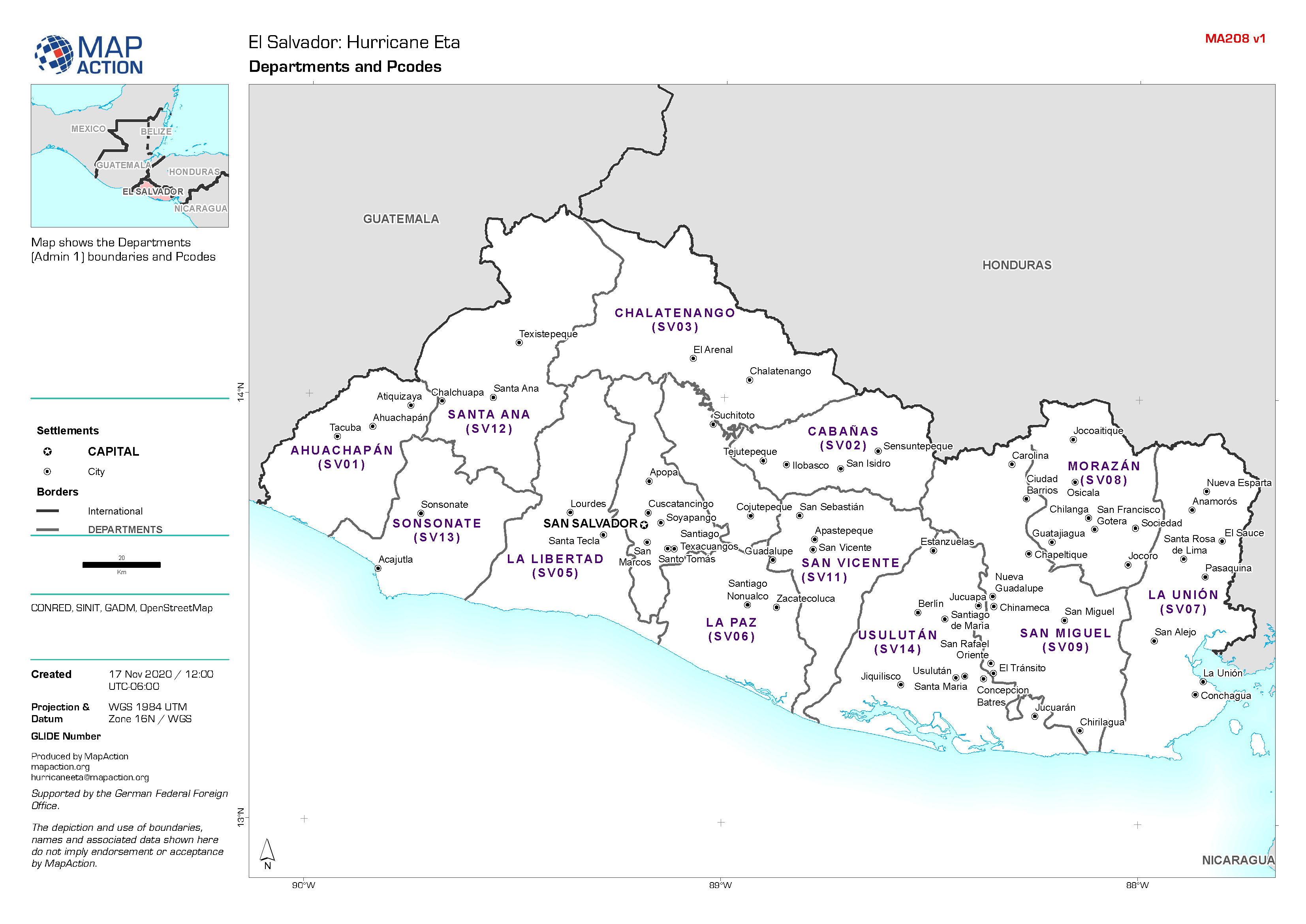
El Salvador: Departments and Pcodes
Map shows the Departments (Admin 1) boundaries and Pcodes. -

-

Nicaragua: Hurricane Eta - Potential Storm Track and Administrative Departmen...
This map shows the potential storm track for hurricane Eta with administration level 1 departments for Nicaragua and Honduras. -

-

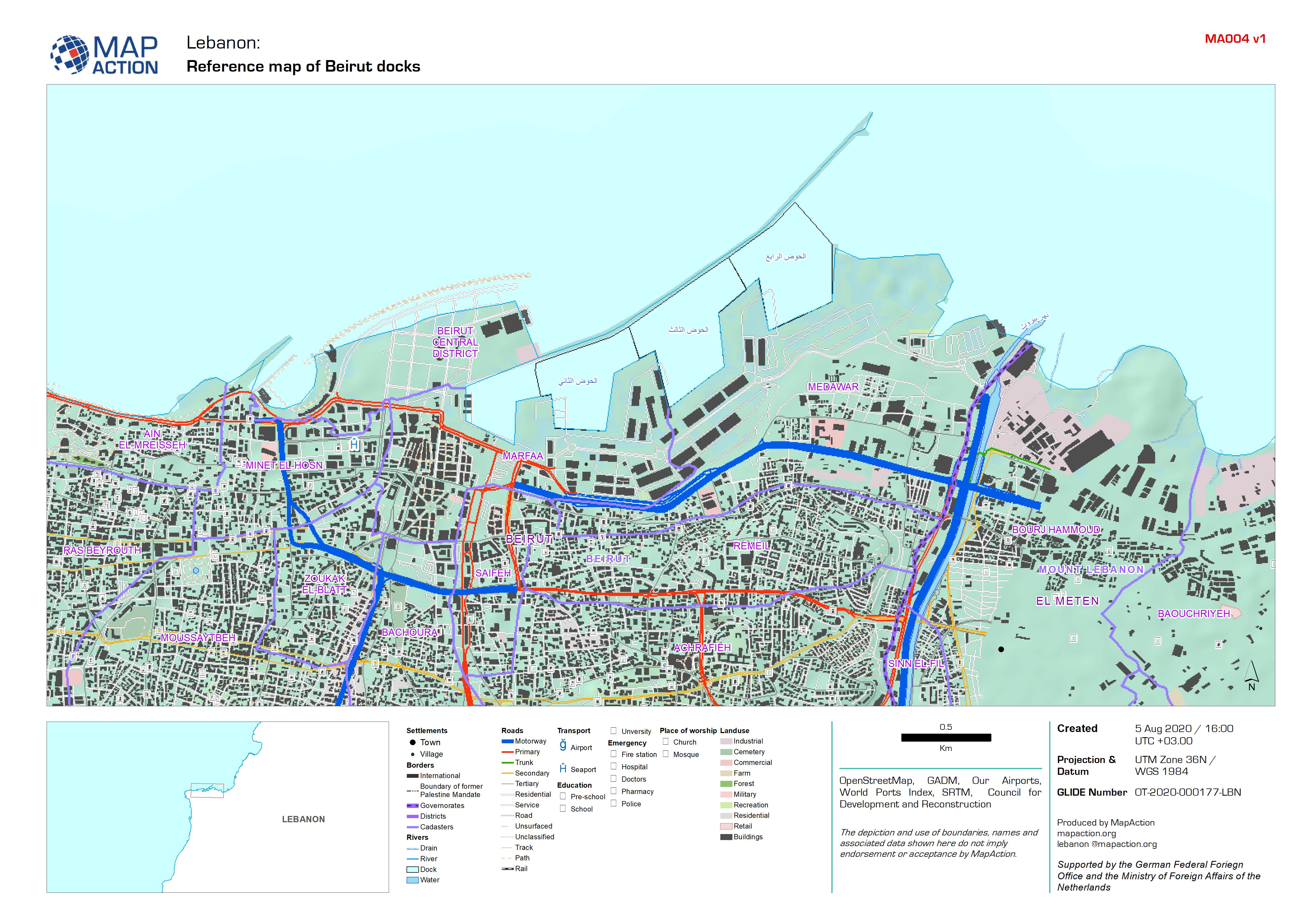
Reference map of Beirut docks
A detailed reference map of the Beirut docks and surrounding area. -
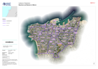
Cadasters and Neighbourhoods in Beirut
Map shows the admininistrative areas of Beirut Governorate. These called Cadasters and Neighbourhoods. -

Guyana: Reference Map: Elevation
This reference map shows digital elevation data at 90m scale, with primary roads, airports and major settlements for Guyana.
