-

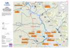
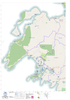
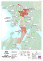
Malawi: Floods - Results of UNDAC assessement of Nsjanje District, 17th to 19...
This map shows the Nsjanje district and its Traditional Authorities.Several rapid assessments were undertaken by UNDAC teams from the 17th to the 19th of January. -
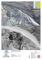
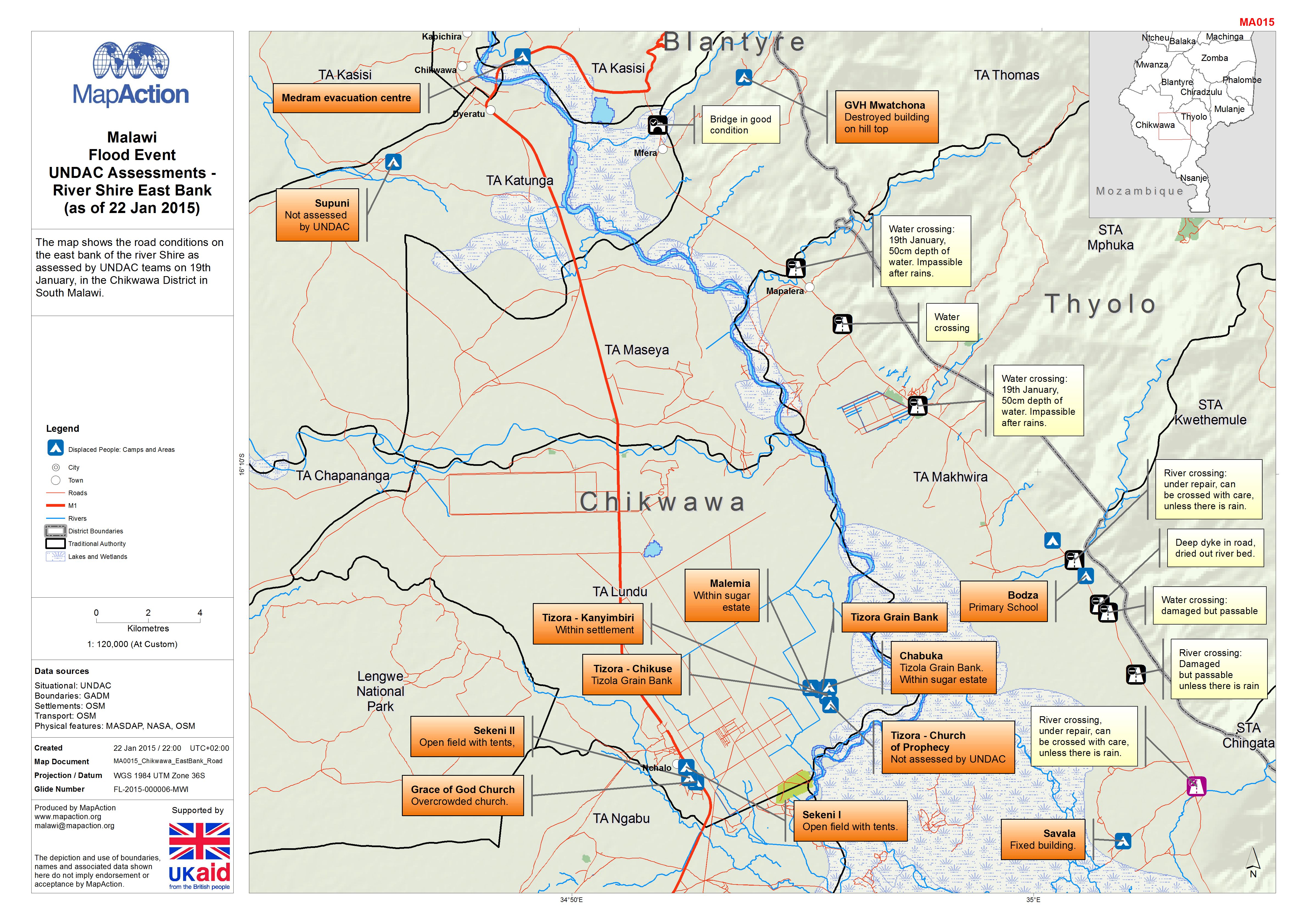
Malawi: Floods - UNDAC Assessments - River Shire East Bank (as of 22 Jan 2015)
The map shows the road conditions on the east bank of the river Shire as assessed by UNDAC teams on 19th January, in the Chikwawa District in South Malawi. -
-
-

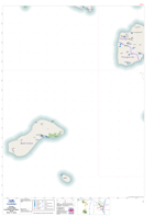
Vanuatu - Cyclone Pam 2nd Assessment Drop Off and Pick Up Points Penama
2nd Assessment Drop off and Pick Up Points for Penama Province including Mere Lava in Torba Province, with name of location and latitude and longitude. -

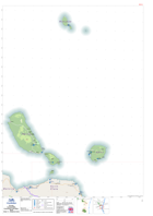
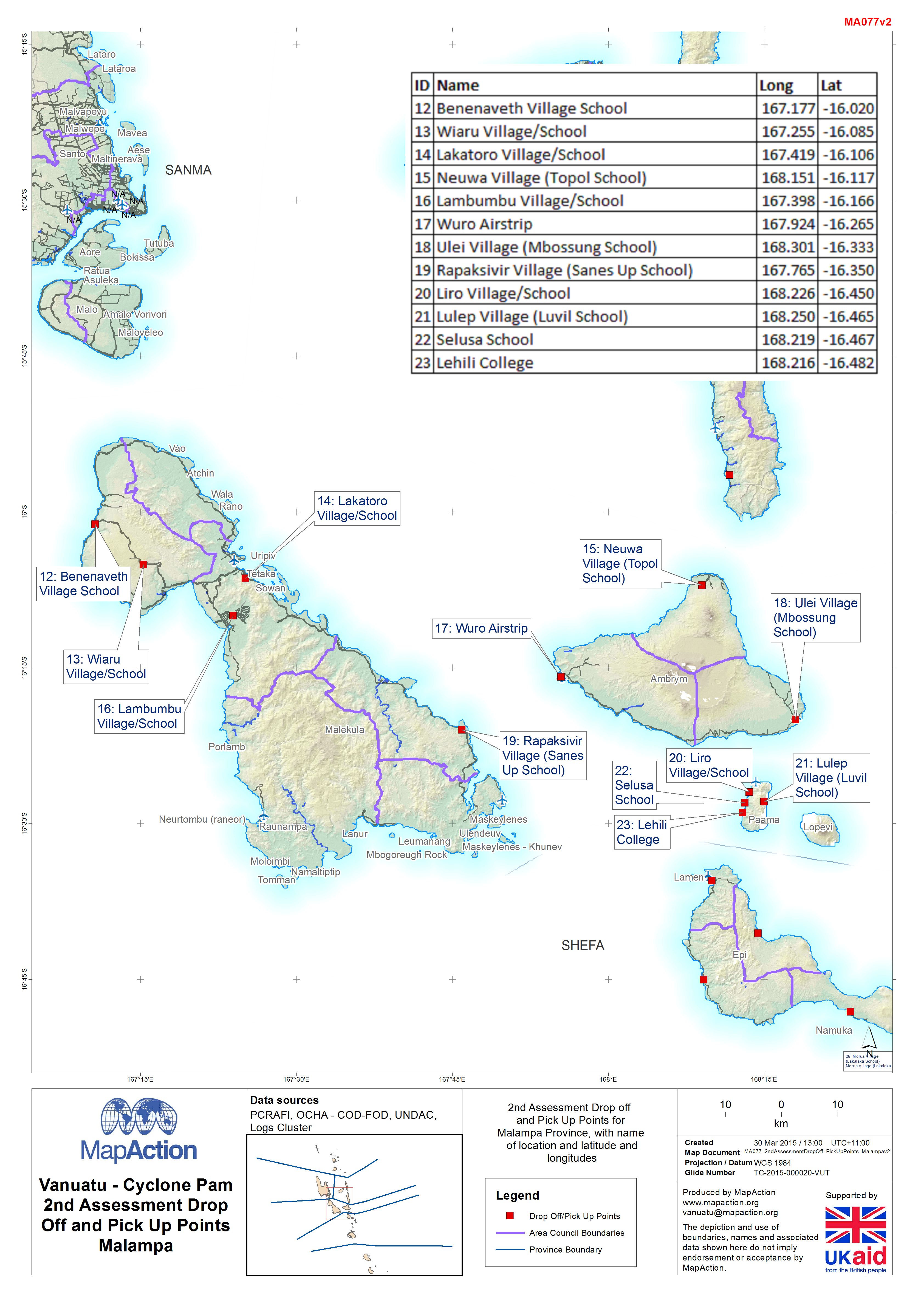
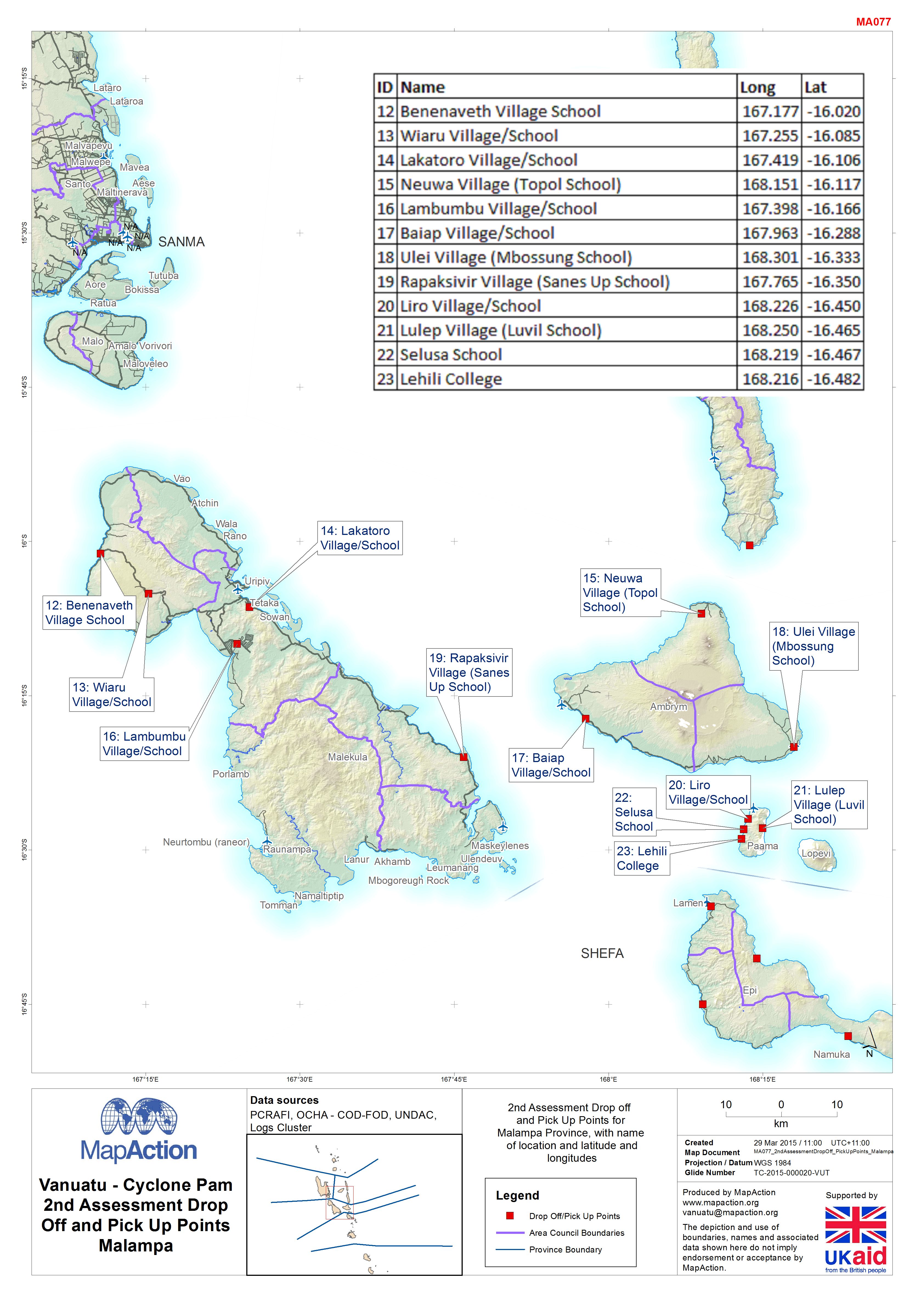
Vanuatu - Cyclone Pam 2nd Assessment Drop Off and Pick Up Points Malampa
2nd Assessment Drop off and Pick Up Points for Malampa Province, with name of location and latitude and longitude. -
Vanuatu - Cyclone Pam 2nd Assessment Drop Off and Pick Up Points Penema
Map shows 2nd Assessment drop off and pick up points in Penema Province with name of locations with latitude and longitudes. -

Vanuatu - Cyclone Pam 2nd Assessment Drop Off and Pick Up Points Malampa
Map shows 2nd Assessment drop off and pick up points in Malampa Province with name of locations with latitude and longitudes. -

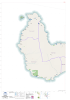
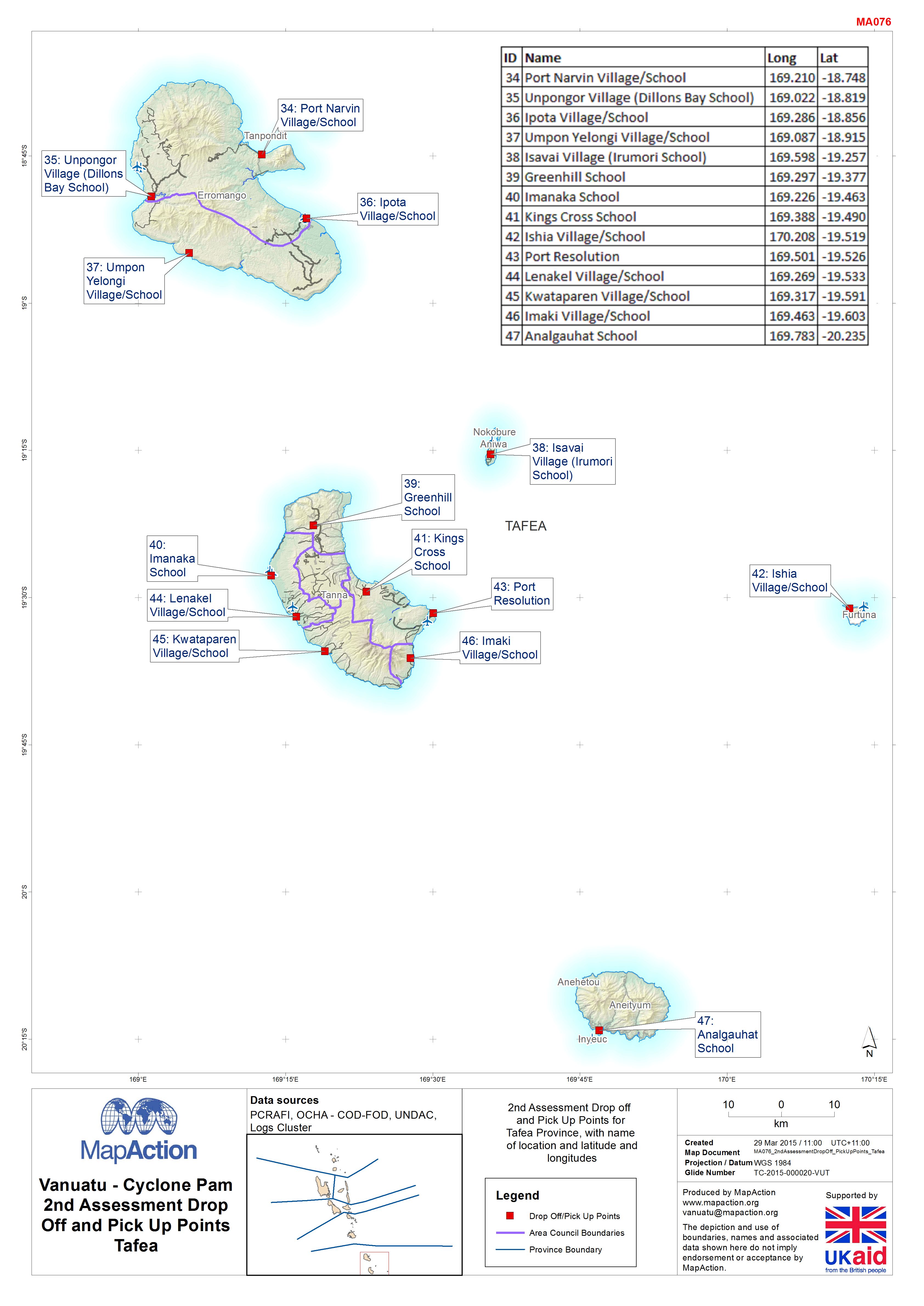
Vanuatu - Cyclone Pam 2nd Assessment Drop Off and Pick Up PointsTafea
Map shows 2nd Assessment drop off and pick up points in Tafea Province with name of locations with latitude and longitudes. -

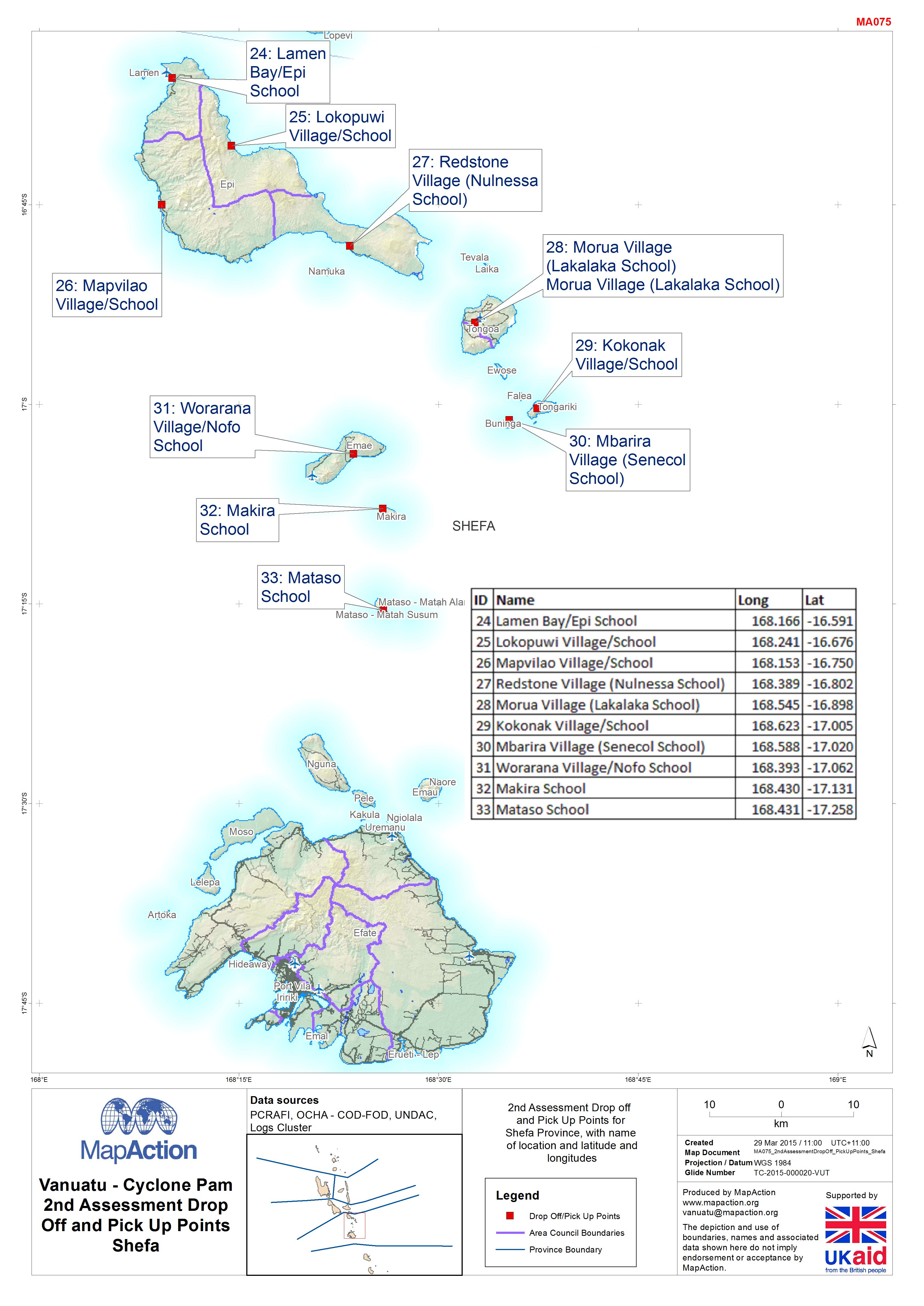
Vanuatu - Cyclone Pam 2nd Assessment Drop Off and Pick Up PointsShefa
Map shows 2nd Assessment drop off and pick up points in Shefa Province with name of locations with latitude and longitudes. -

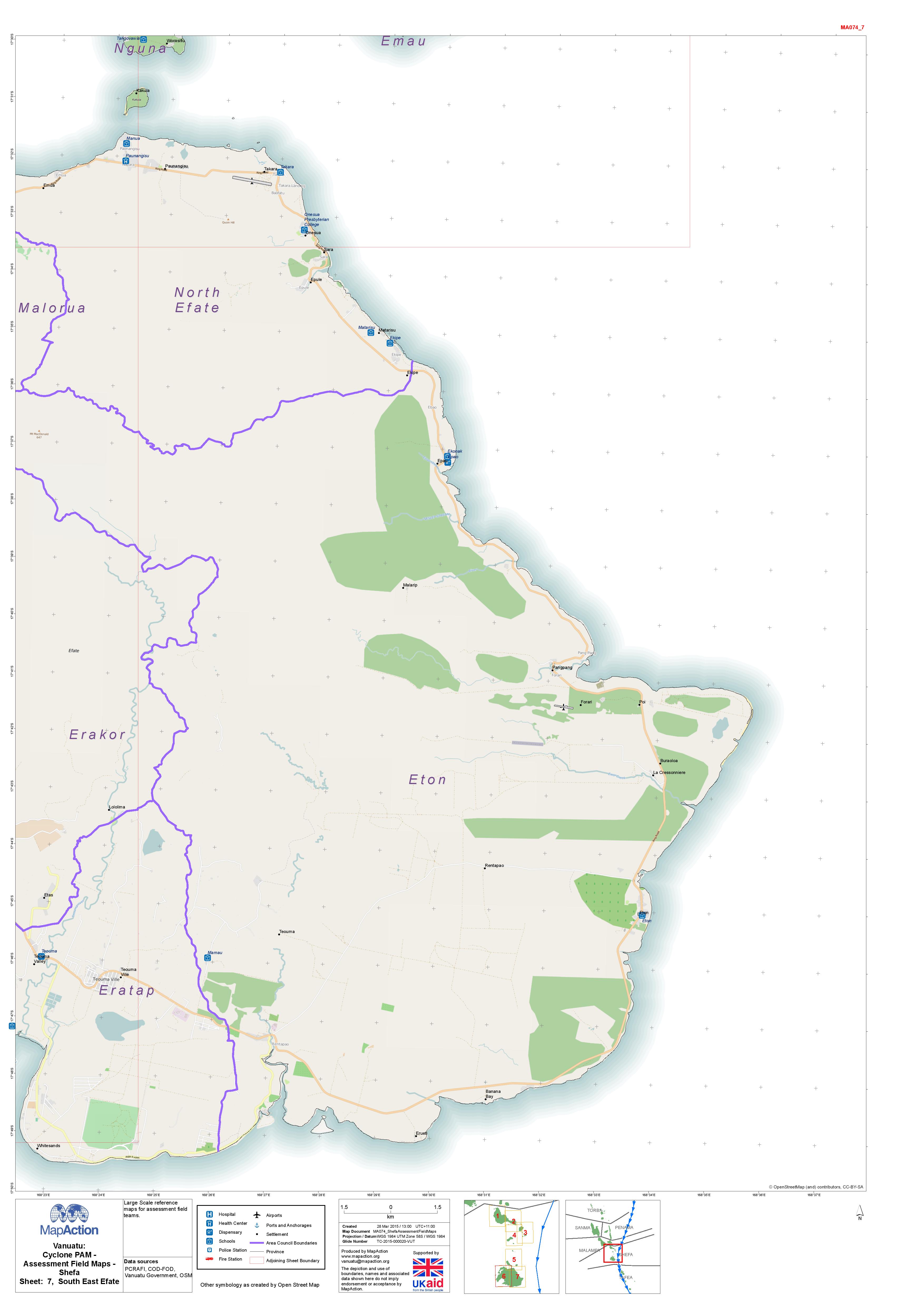
Vanuatu: Cyclone PAM - Assessment Field Maps - Shefa Sheet: 7, South East Efate
Cyclone PAM - Assessment Field Maps - Shefa Sheet: 7, South East Efate -
Vanuatu: Cyclone PAM - Assessment Field Maps - Shefa Sheet: 6, West Efate
Cyclone PAM - Assessment Field Maps - Shefa Sheet: 6, West Efate -
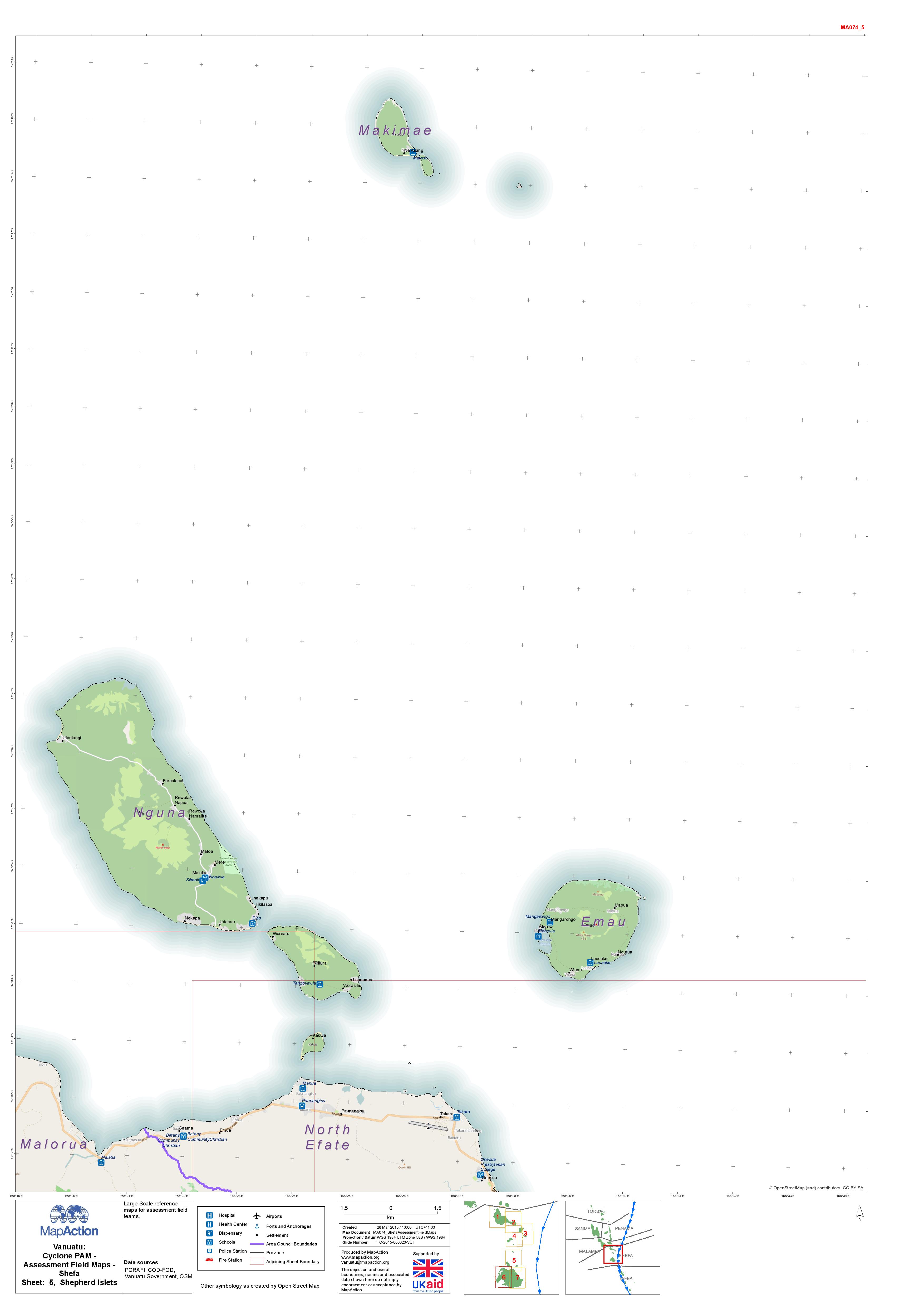
Vanuatu: Cyclone PAM - Assessment Field Maps - Shefa Sheet: 5, Shepherd Islets
Cyclone PAM - Assessment Field Maps - Shefa Sheet: 5, Shepherd Islets -
Vanuatu: Cyclone PAM - Assessment Field Maps - Shefa Sheet: 4, Emae
Cyclone PAM - Assessment Field Maps - Shefa Sheet: 4, Emae -

Vanuatu: Cyclone PAM - Assessment Field Maps - Shefa Sheet: 2, East Epi
Vanuatu: Cyclone PAM - Assessment Field Maps - Shefa Sheet: 2, East Epi -
Vanuatu: Cyclone PAM - Assessment Field Maps - Shefa Sheet: 1, West Epi
Vanuatu: Cyclone PAM - Assessment Field Maps - Shefa Sheet: 1, West Epi -

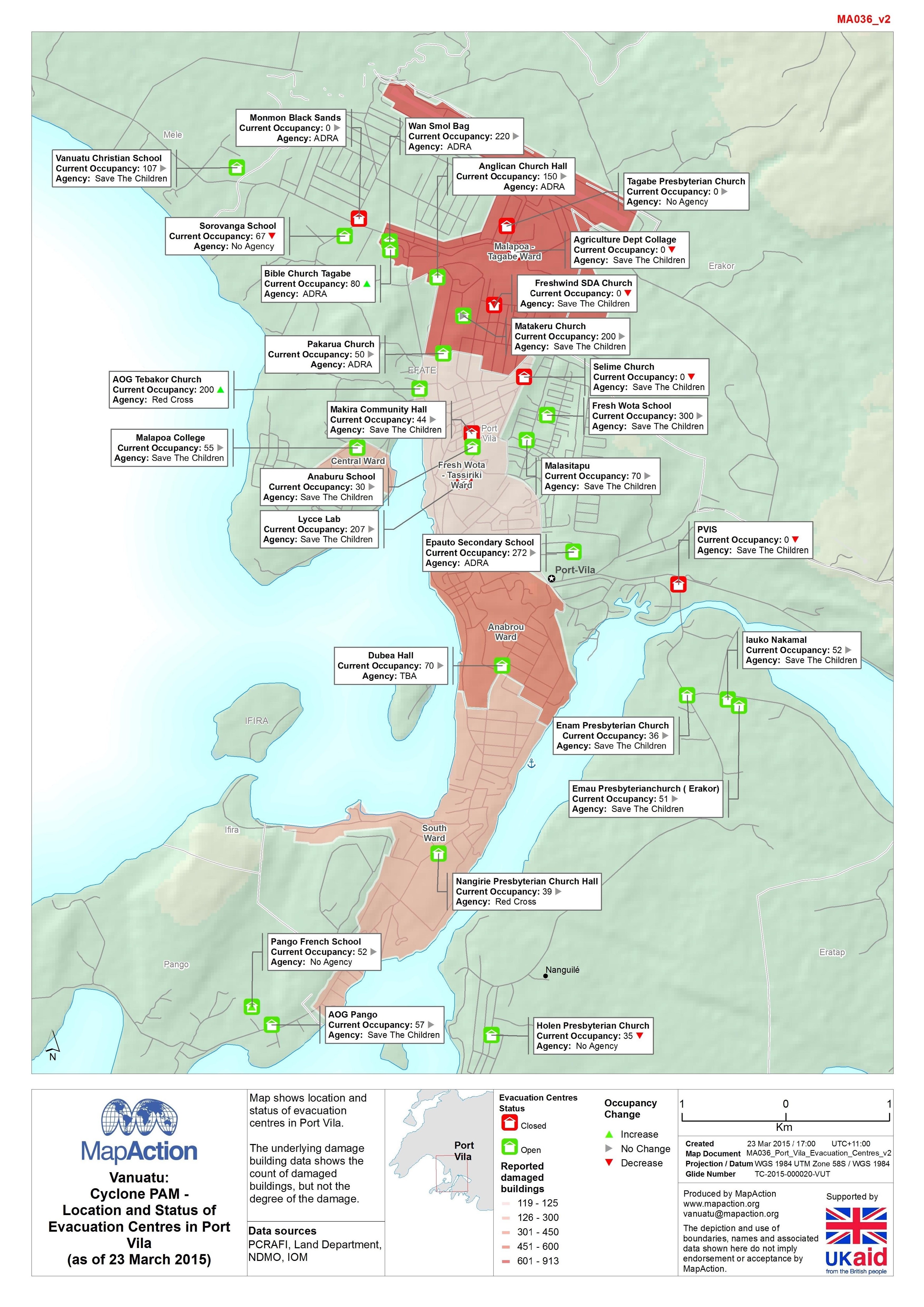
Vanuatu: Cyclone PAM - Location and Status of Evacuation Centres in Port Vila...
Map shows location and status of evacuation centres in Port Vila. The underlying damage building data shows the count of damaged buildings, but not the degree of the damage. -
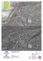
Vanuatu: Cyclone PAM - Reported damage in Port Vila(as of 22 March 2015)
Map shows the number of location and status of evacation centres in Port Vila. The underlying damage building data shows the count of damaged buildings, but not the degree of... -

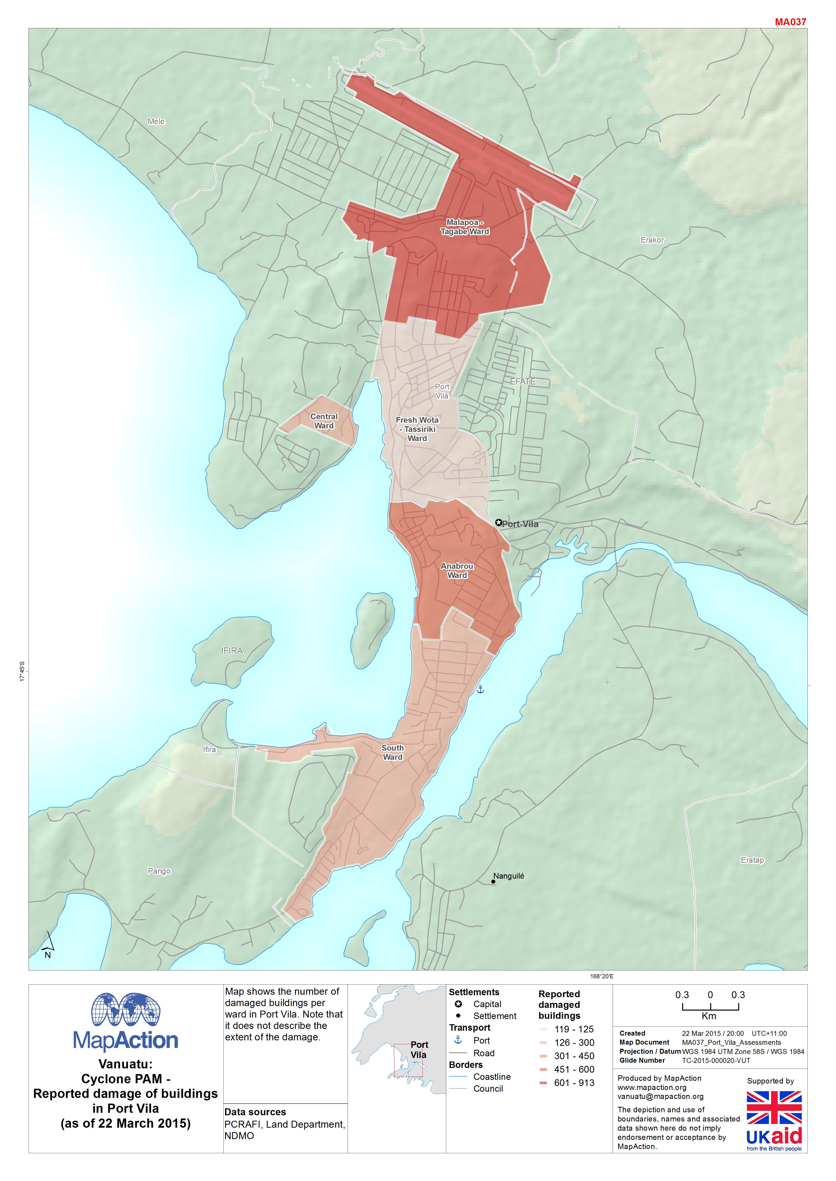
Vanuatu: Cyclone PAM - Reported damage of buildings in Port Vila(as of 22 Mar...
Map shows the number of damaged buildings per ward in Port Vila. Note that it does not describe the extent of the damage. -

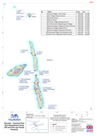
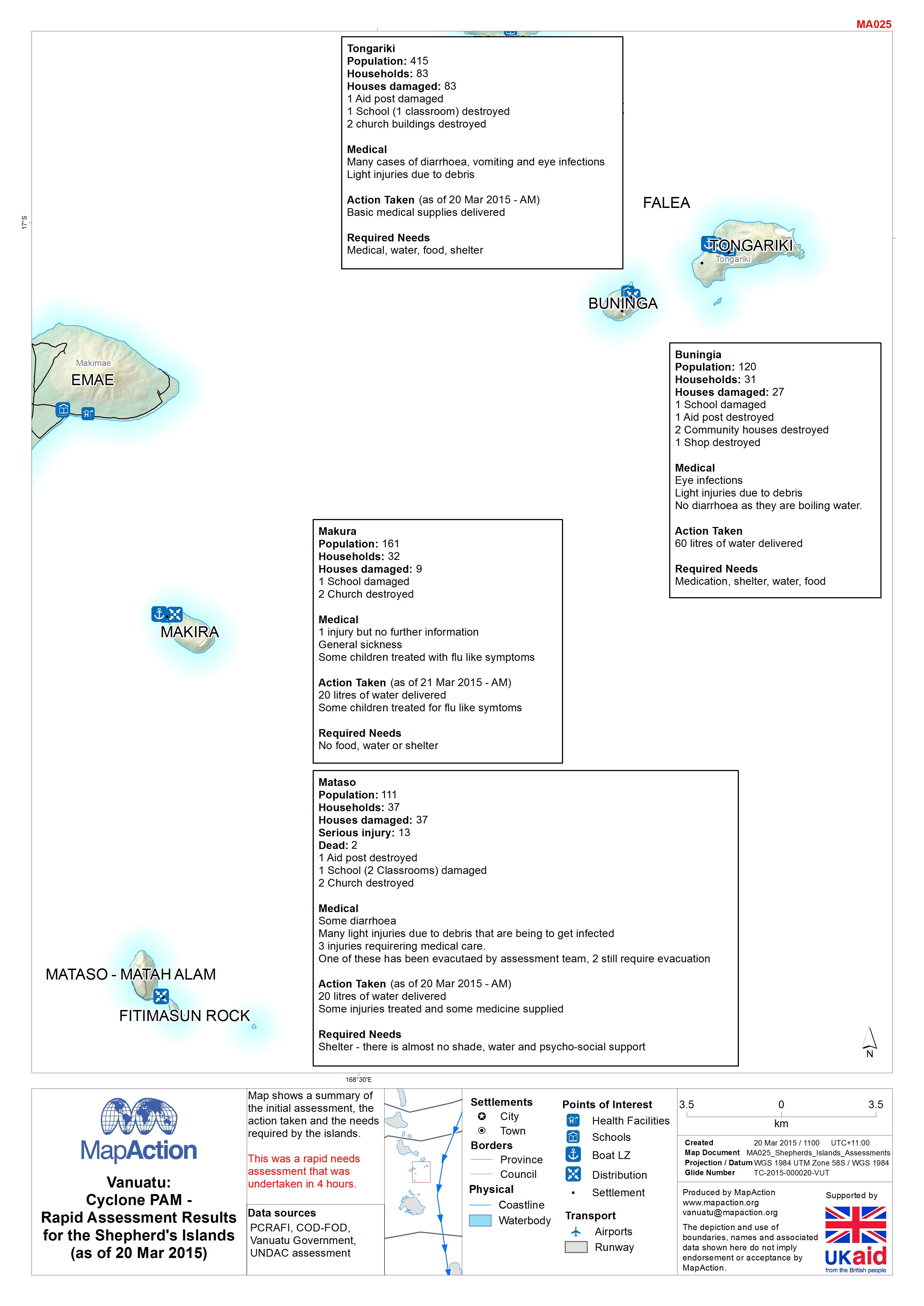
Vanuatu: Cyclone PAM - Rapid Assessment Results for the Shepherd's Islands(as...
Map shows a summary of the initial assessment, the action taken and the needs required by the islands.This was a rapid needs assessment that was undertaken in 4 hours.