-

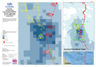
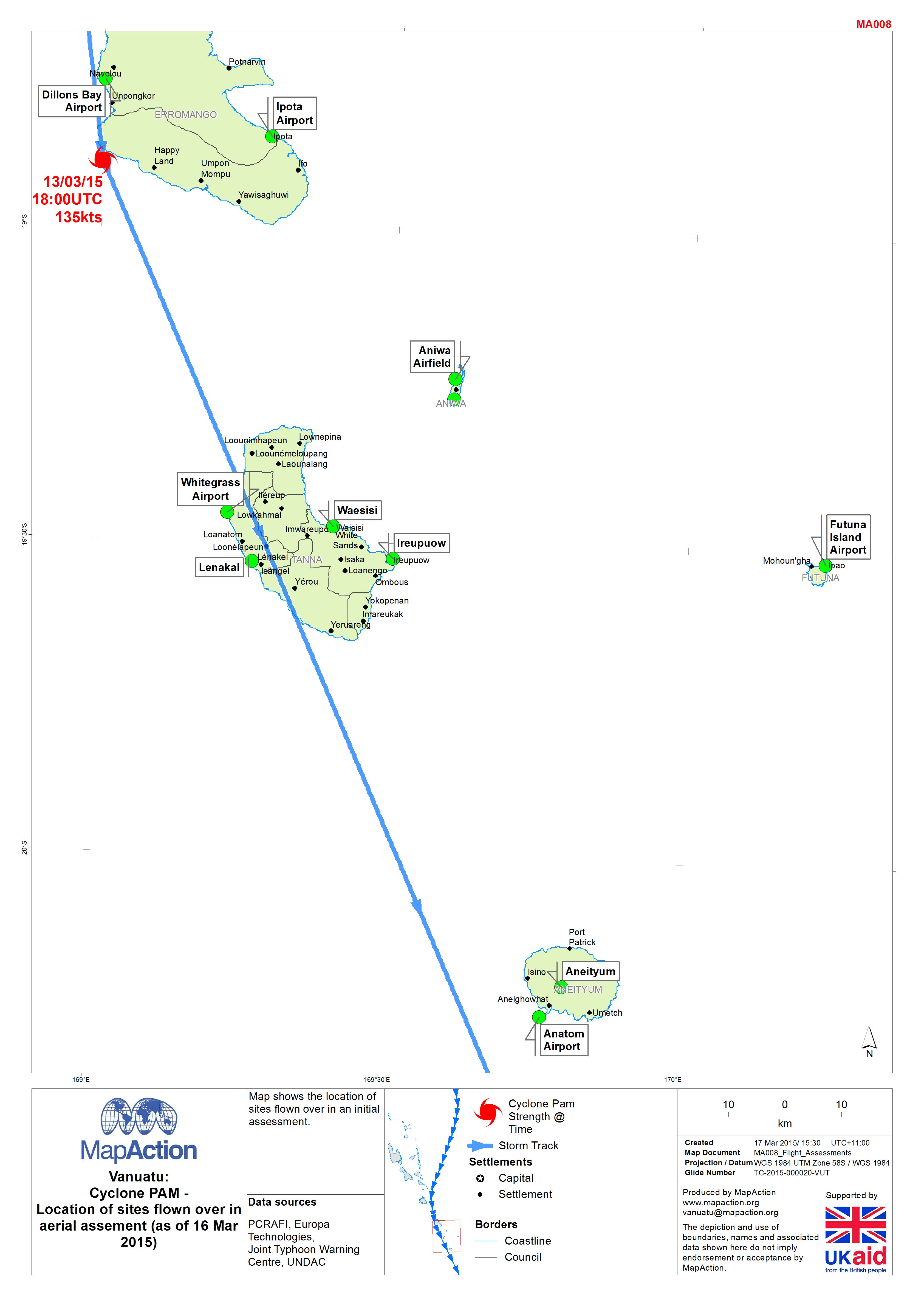
Vanuatu: Cyclone PAM - Location of sites flown over in aerial assement (as of...
Map shows the location of sites flown over in an initial assessment. -
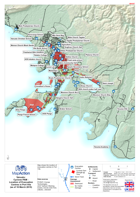
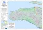
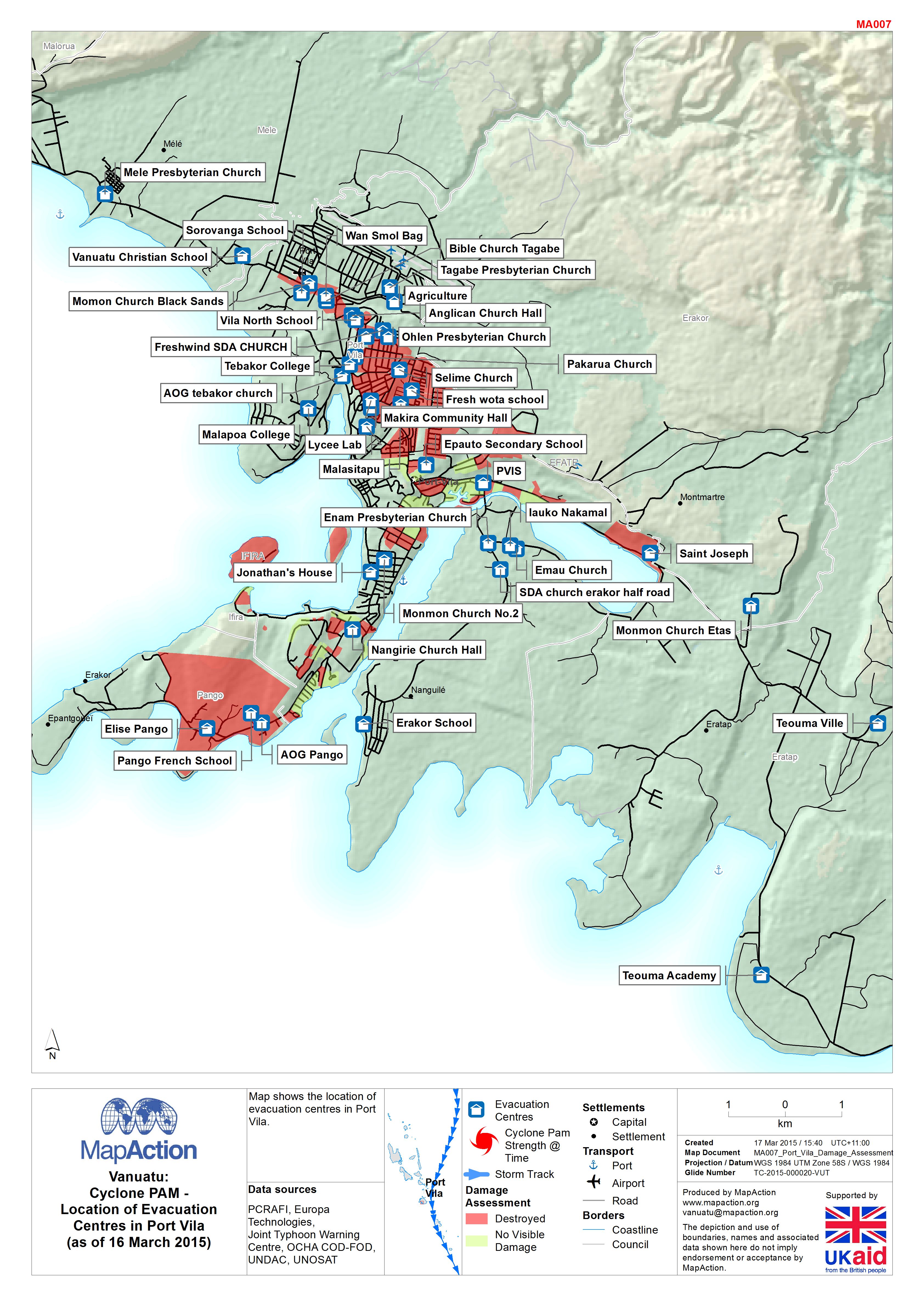
Vanuatu: Cyclone PAM - Location of Evacuation Centres in Port Vila (as of 16 ...
Map shows the location of evacuation centres in Port Vila. -
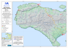
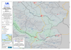
Vanuatu: Cyclone PAM - Accumulated Rainfall - 24 Hour Total (mm) (as of 14 Ma...
Map shows the 24 hourly accumulated rainfall total, the storm track of Cyclone Pam and its strength at specific times and locations. -

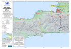
Vanuatu: Cyclone PAM - Accumulated Rainfall - 3 Hour Totals (mm) (as of 14 Ma...
Map shows selected 3 hourly accumulated rainfall totals at selected times and the storm track / intensity of Cyclone Pam. Note: This does not show the total rainfall - please... -
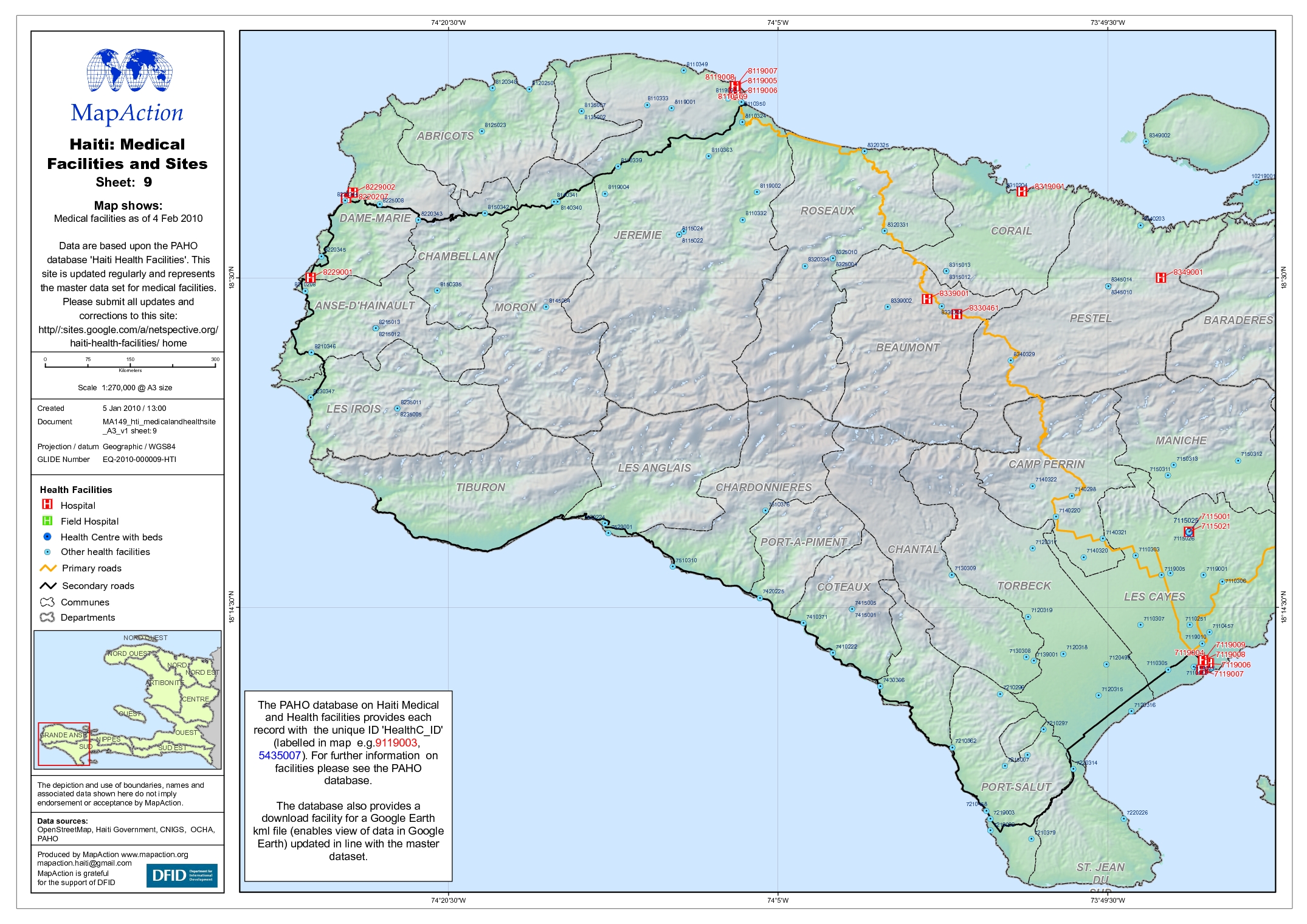
Haiti: Medical Facilities and Sites Map 9
Map shows Medical facilities as of 4 Feb 2010 Data are based upon the PAHO database 'Haiti Health Facilities'. This site is updated regularly and represents the master data set... -

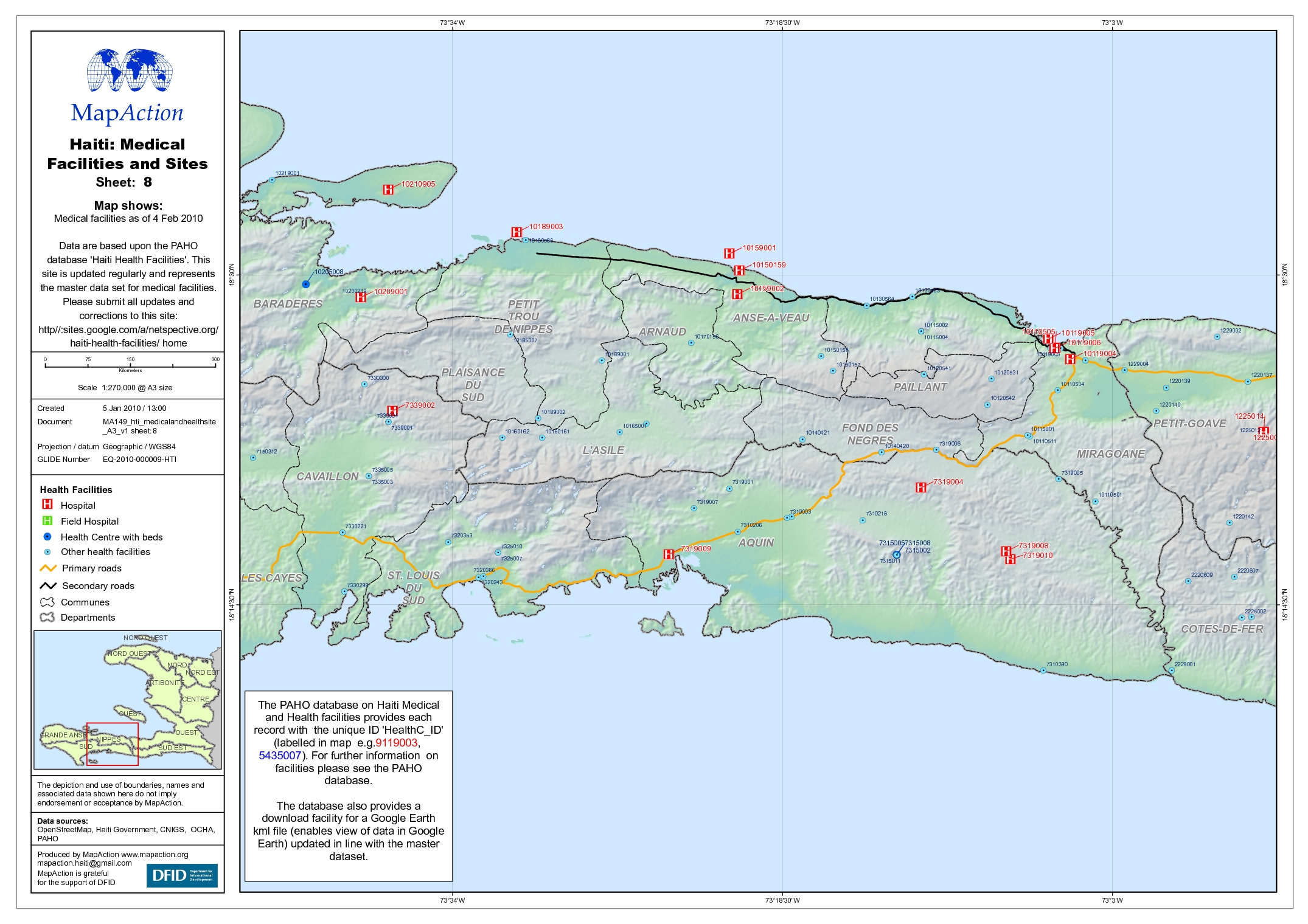
Haiti: Medical Facilities and Sites Map 8
Map shows Medical facilities as of 4 Feb 2010 Data are based upon the PAHO database 'Haiti Health Facilities'. This site is updated regularly and represents the master data set... -
Haiti: Medical Facilities and Sites Map 7
Map shows Medical facilities as of 4 Feb 2010 Data are based upon the PAHO database 'Haiti Health Facilities'. This site is updated regularly and represents the master data set... -

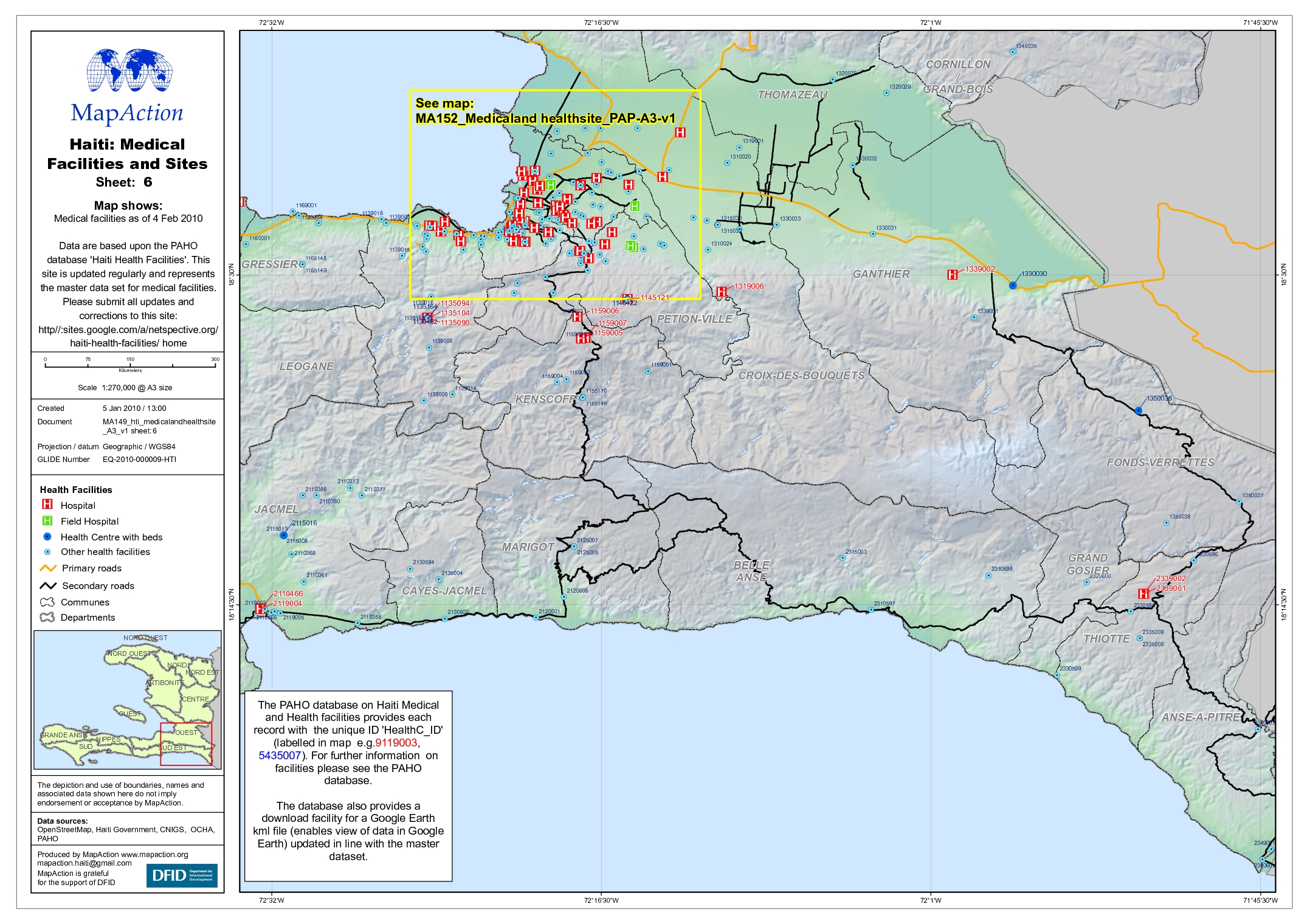
Haiti: Medical Facilities and Sites Map 6
Map shows Medical facilities as of 4 Feb 2010 Data are based upon the PAHO database 'Haiti Health Facilities'. This site is updated regularly and represents the master data set... -
Haiti: Medical Facilities and Sites Map 5
Map shows Medical facilities as of 4 Feb 2010 Data are based upon the PAHO database 'Haiti Health Facilities'. This site is updated regularly and represents the master data set... -

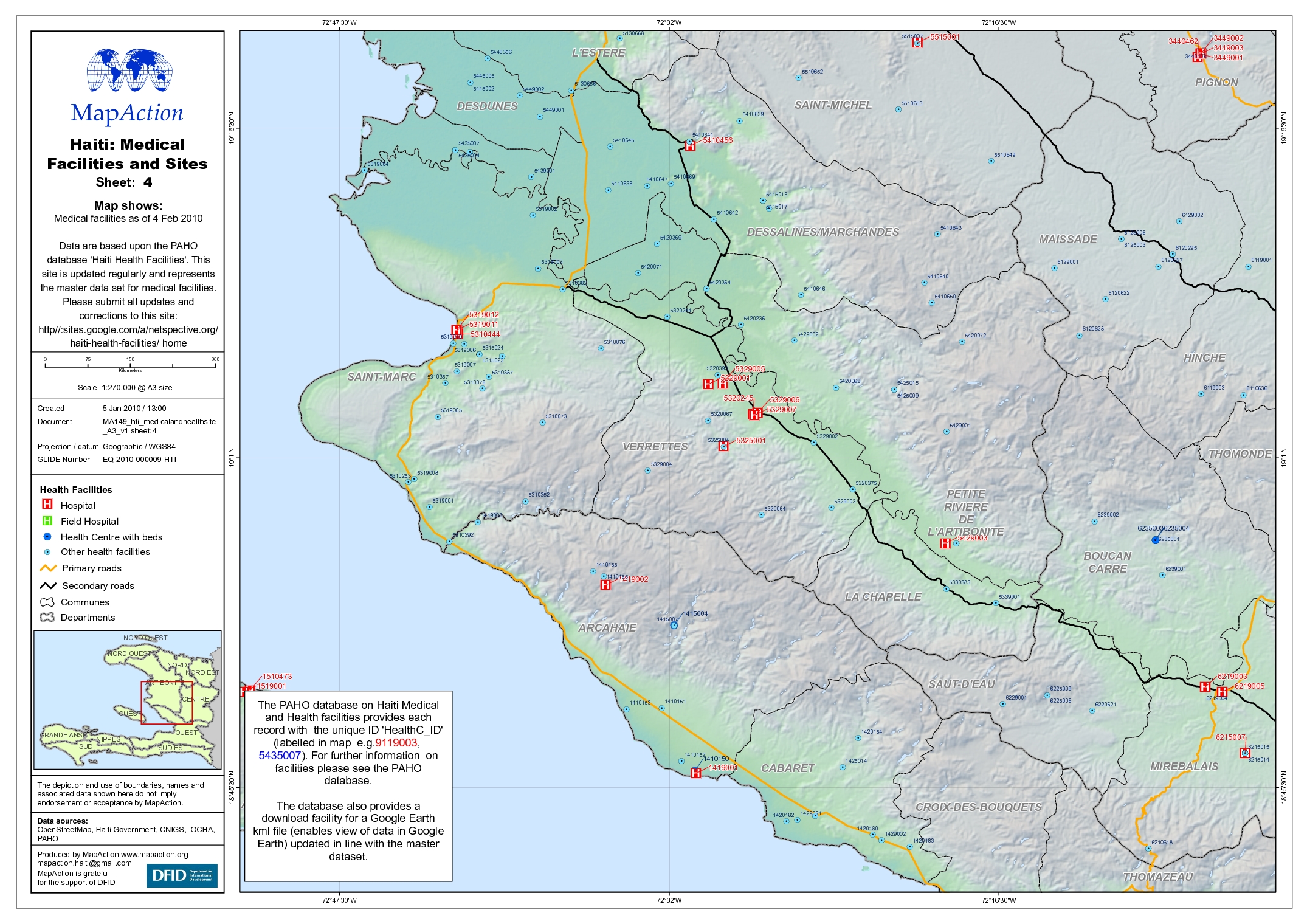
Haiti: Medical Facilities and Sites Map 4
Map shows Medical facilities as of 4 Feb 2010 Data are based upon the PAHO database 'Haiti Health Facilities'. This site is updated regularly and represents the master data set... -

Haiti: Medical Facilities and Sites Map 3
Map shows Medical facilities as of 4 Feb 2010 Data are based upon the PAHO database 'Haiti Health Facilities'. This site is updated regularly and represents the master data set... -

Haiti: Medical Facilities and Sites Map 2
Map shows Medical facilities as of 4 Feb 2010 Data are based upon the PAHO database 'Haiti Health Facilities'. This site is updated regularly and represents the master data set... -
Haiti: Medical Facilities and Sites Map 1
Map shows Medical facilities as of 4 Feb 2010 Data are based upon the PAHO database 'Haiti Health Facilities'. This site is updated regularly and represents the master data set... -

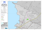
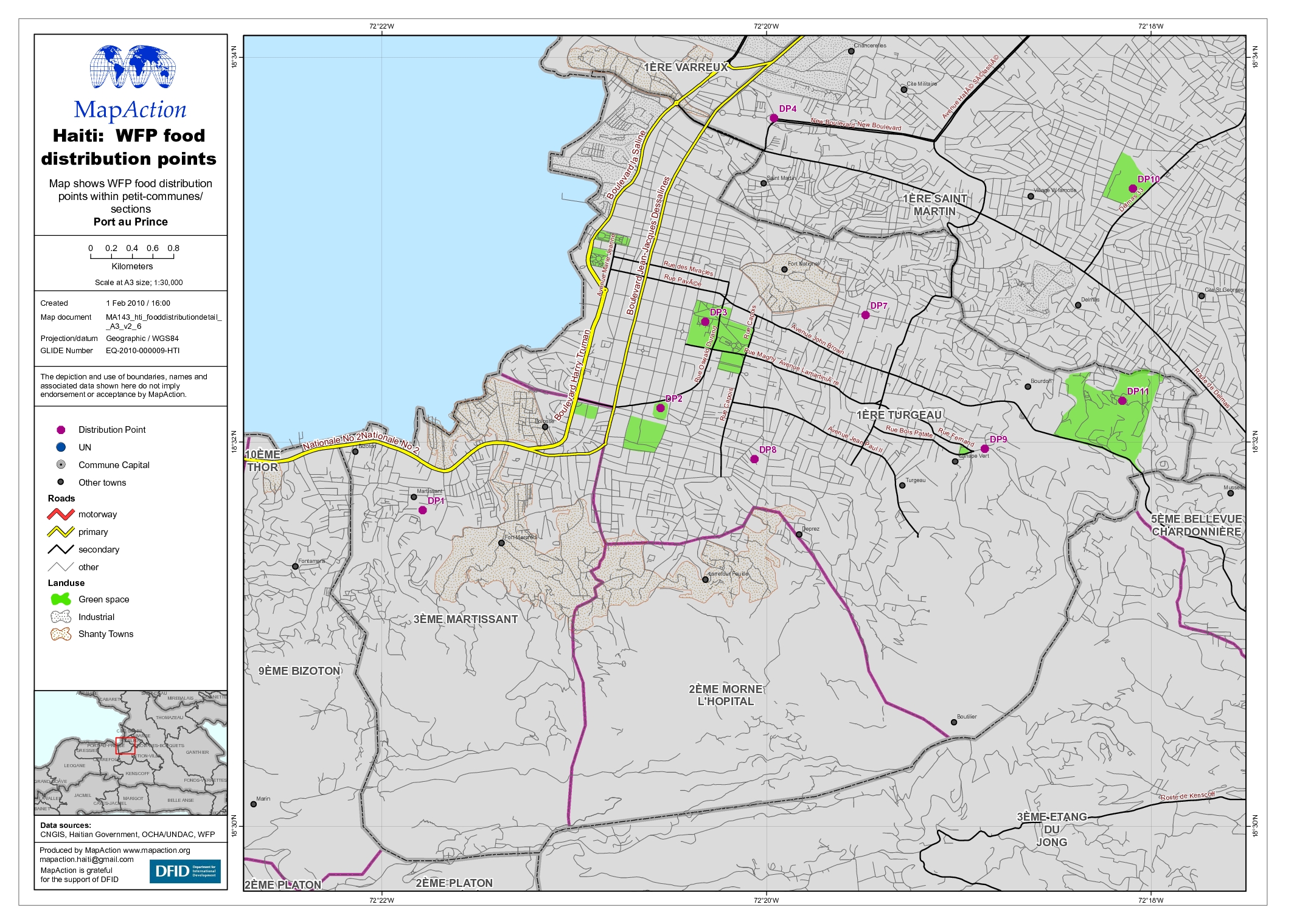
Haiti: WFP food distribution points Port au Prince
Map shows WFP food distribution points within the Port au Prince petit-commune/ sections -

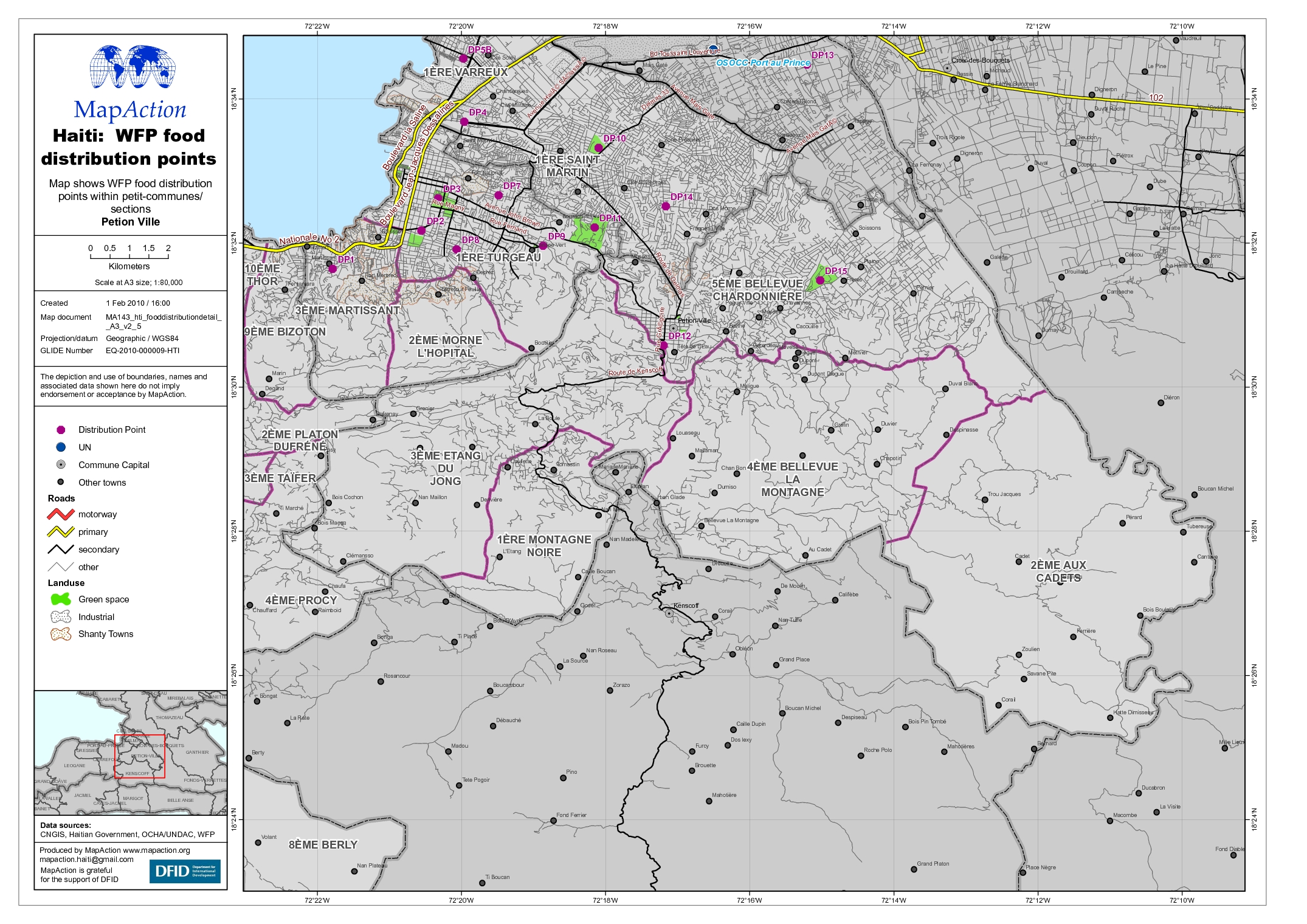
Haiti: WFP food distribution points Petion Ville
Map shows WFP food distribution points within the Petion Ville petit-commune/ sections -

Haiti: WFP food distribution points Delmas
Map shows WFP food distribution points within the Delmas petit-commune/ sections -
Haiti: WFP food distribution points Cite Soleil
Map shows WFP food distribution points within the Cite Soleil petit-commune/ sections -

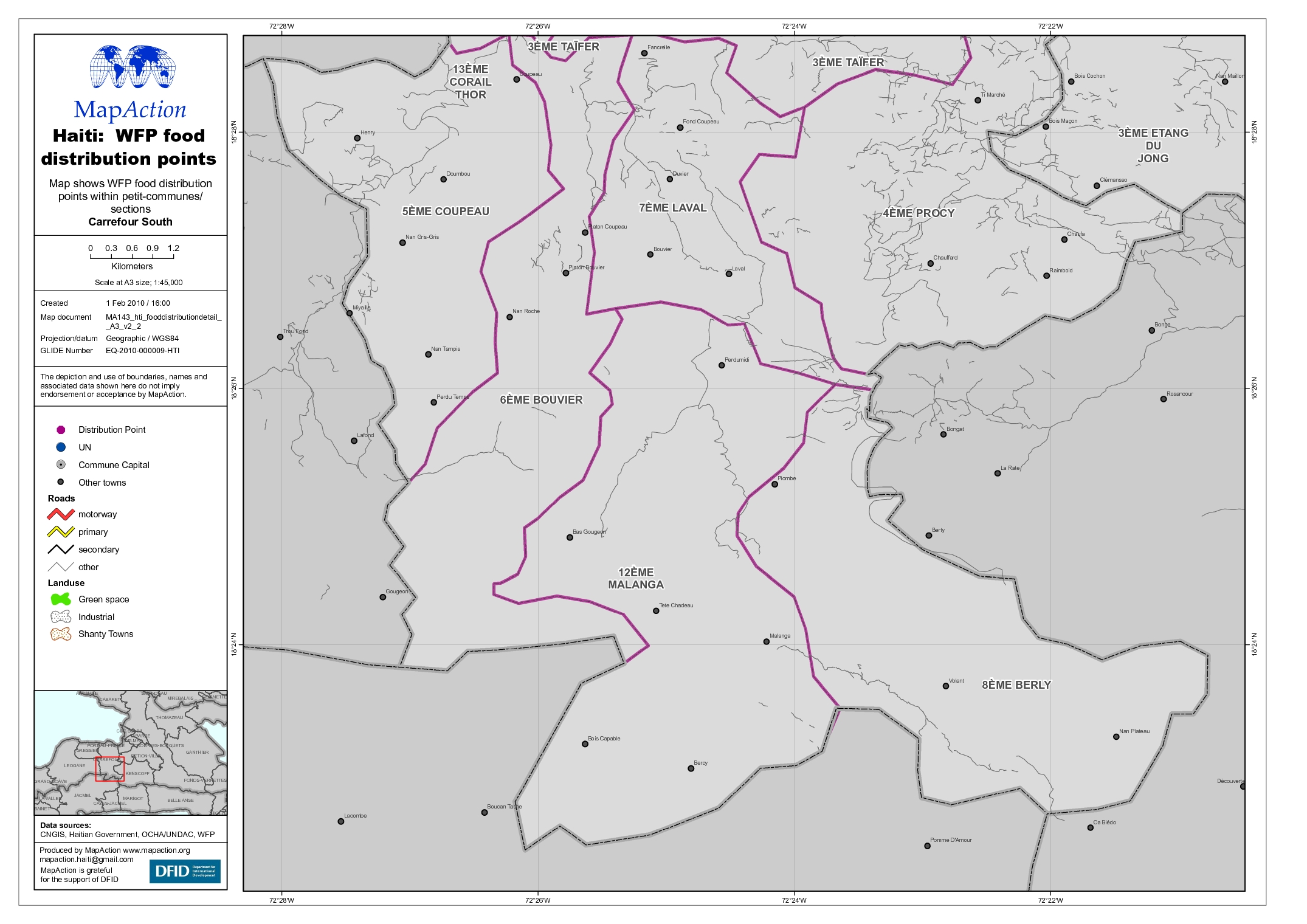
Haiti: WFP food distribution points Carrefour South
Map shows WFP food distribution points within the Carrefour South petit-commune/ sections -

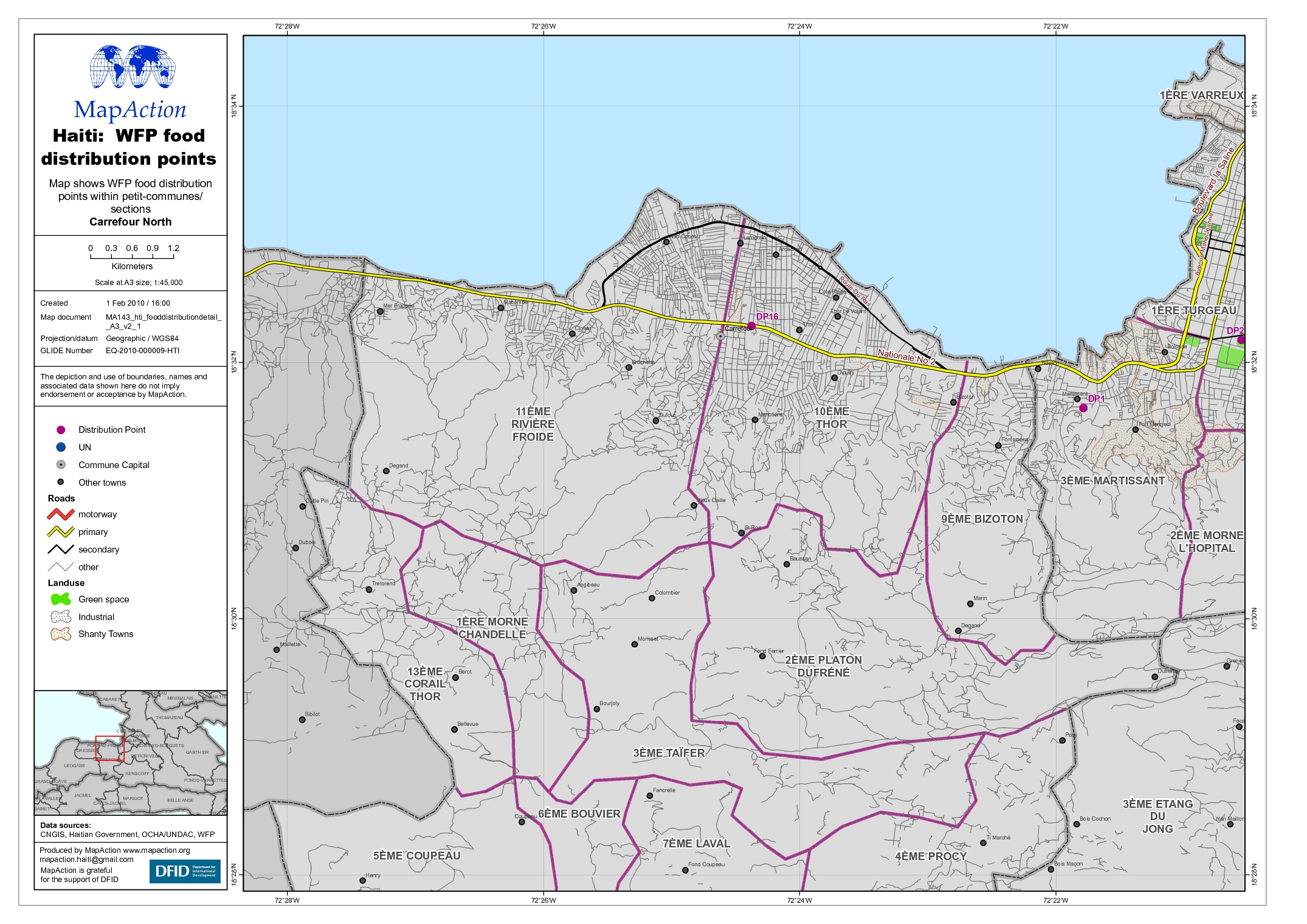
Haiti: WFP food distribution points Carrefour North
Map shows WFP food distribution points within the Carrefour North petit-commune/ sections -
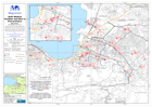
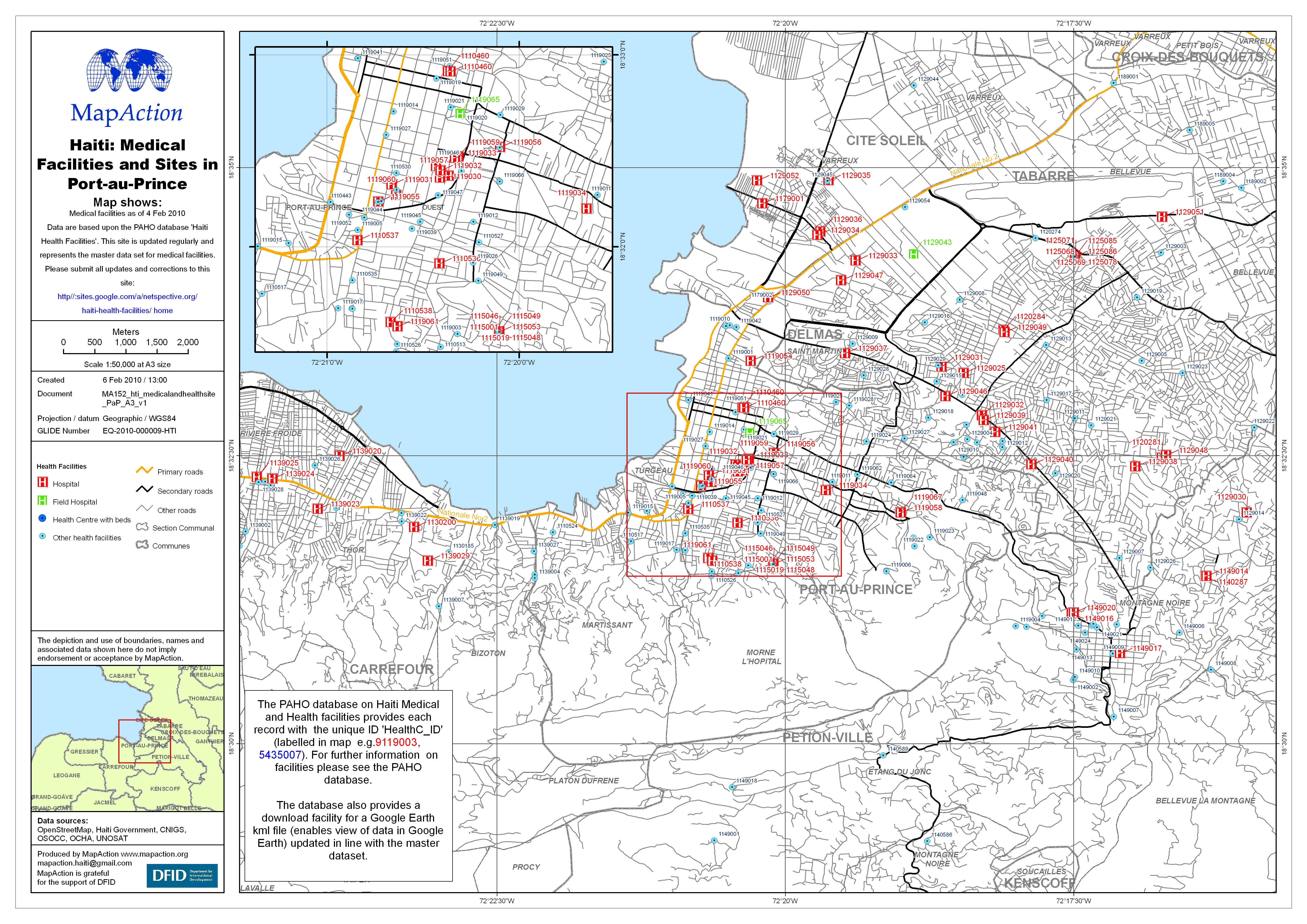
Haiti: Medical Facilities and Sites in Port-au-Prince
Map shows Medical facilities as of 4 Feb 2010 Data are based upon the PAHO database 'Haiti Health Facilities'. This site is updated regularly and represents the master data set...