-
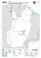
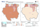
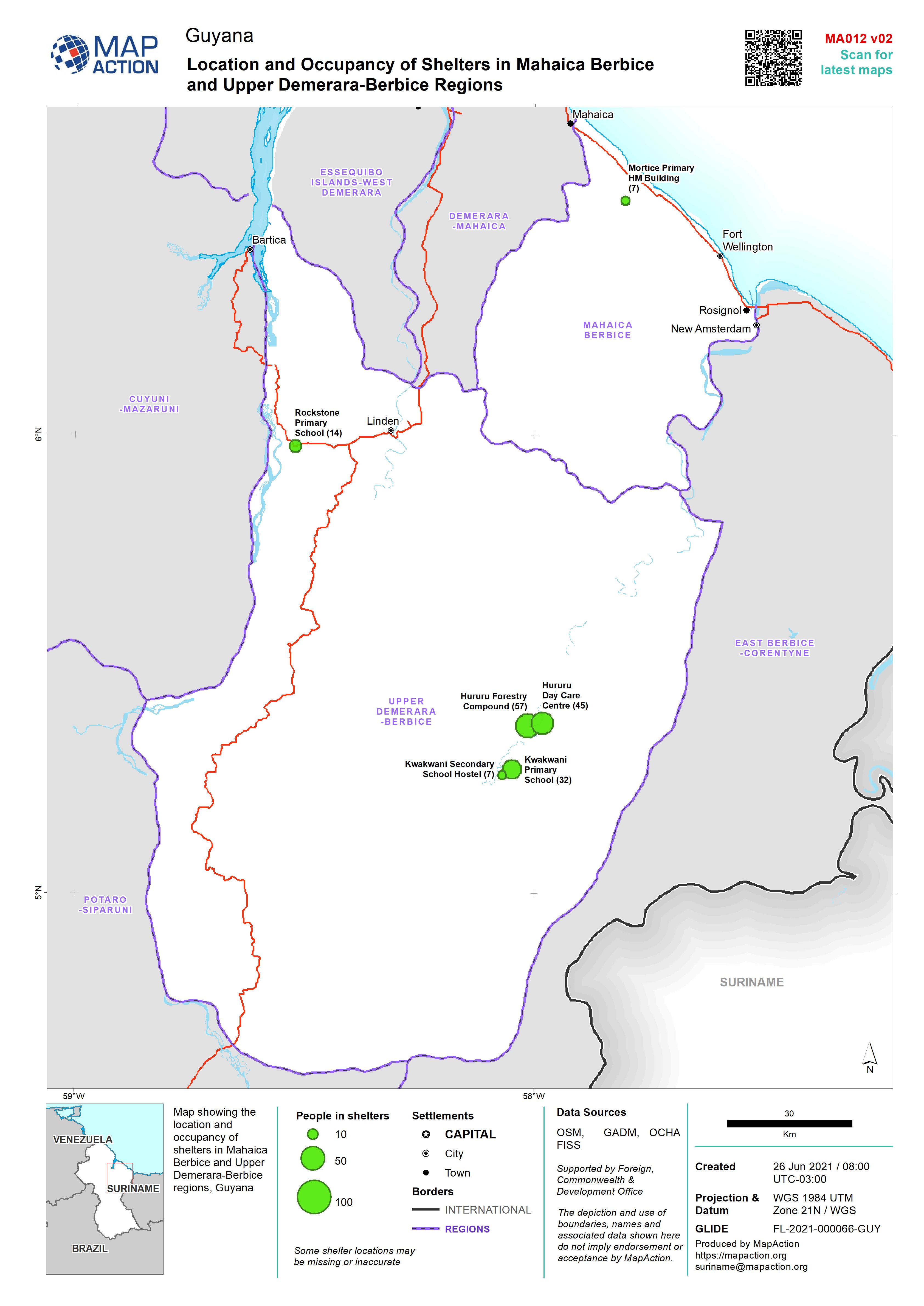
Location and Occupancy of Shelters in Mahaica Berbice and Upper Demerara-Berb...
Map showing the location and occupancy of shelters in Mahaica Berbice and Upper Demerara-Berbice regions, Guyana -
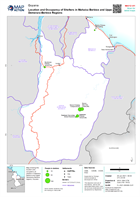
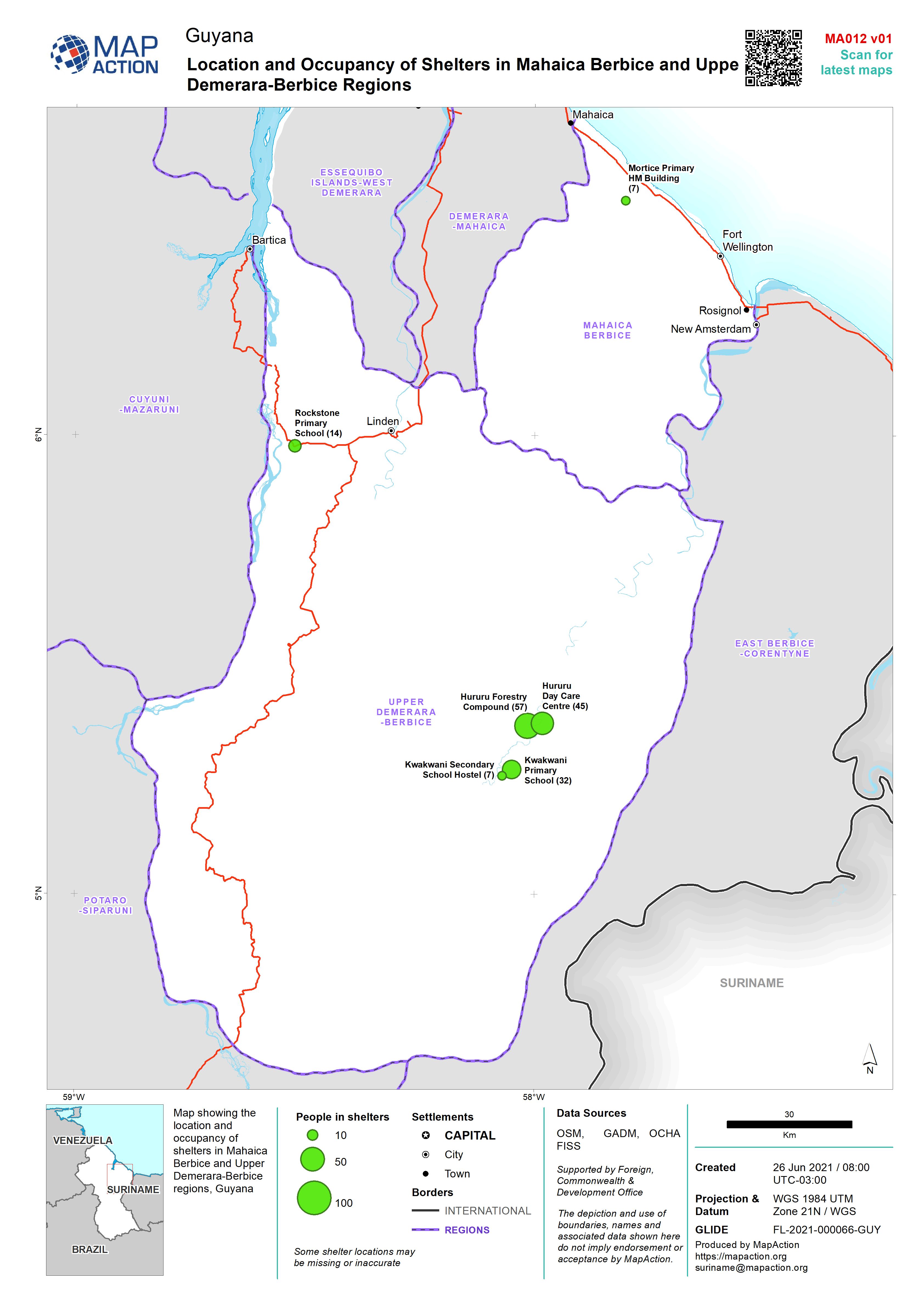
Location and Occupancy of Shelters in Mahaica Berbice and Upper Demerara-Berb...
Map showing the location and occupancy of shelters in Mahaica Berbice and Upper Demerara-Berbice regions, Guyana -

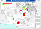
Pakistan Emergency Shelter Cluster - Shelter Gap by Province - 26-August 2010
This dataset has no description
-

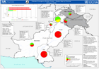
Pakistan Emergency Shelter Cluster - Shelter Gap by Province - 26-August 2010
This dataset has no description
-
Pakistan Emergency Shelter Cluster - shelter Gap by Province - 21 August 2010
This dataset has no description
-
Pakistan Emergency Shelter Cluster - Shelter Gap by Province - 23 August 2010
This dataset has no description
-

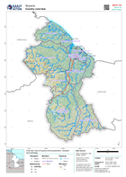
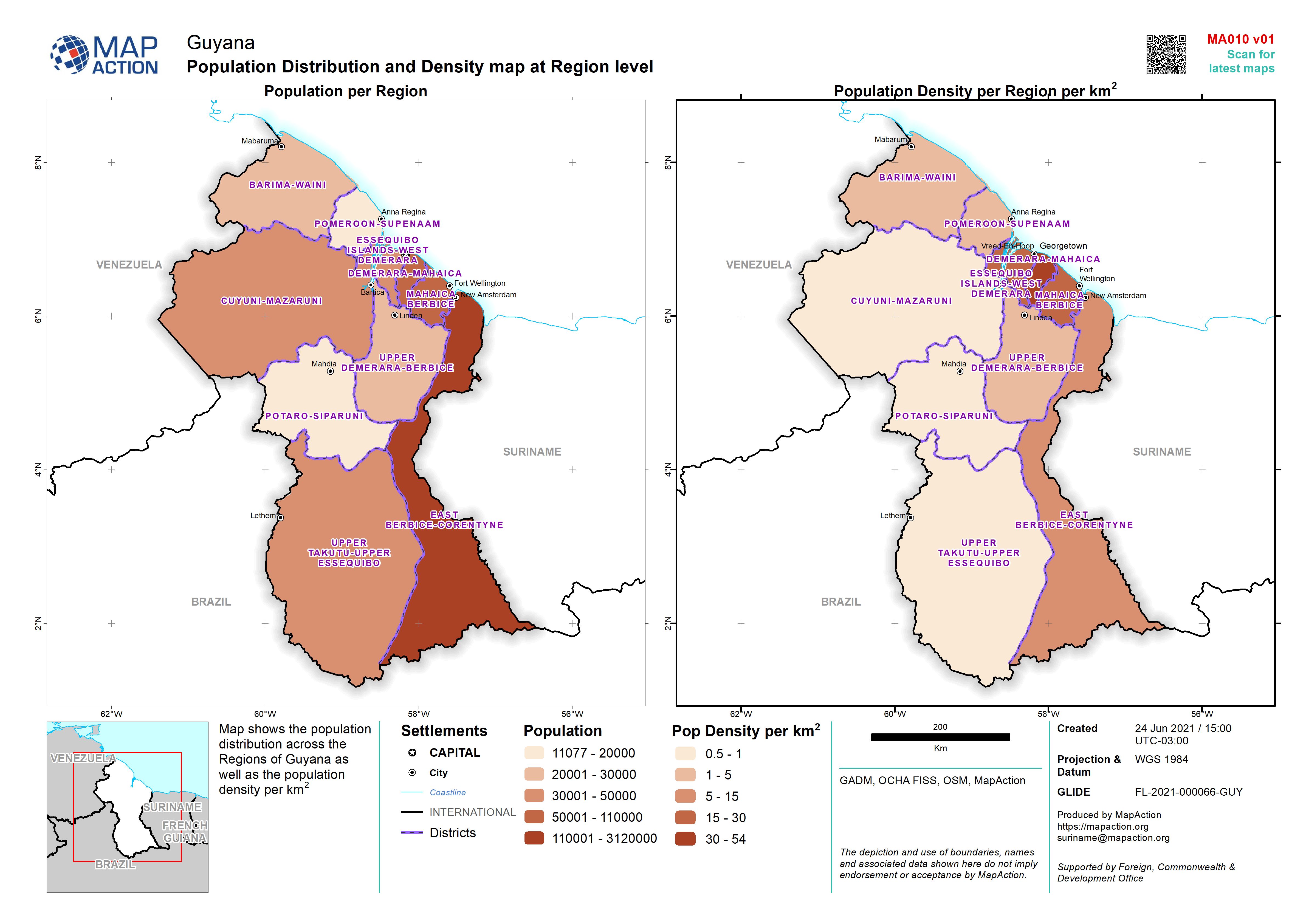
Population Distribution and Density map at Region level
Map shows the population distribution across the Regions of Guyana as well as the population density per km2 -

-
-
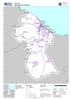
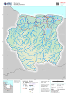
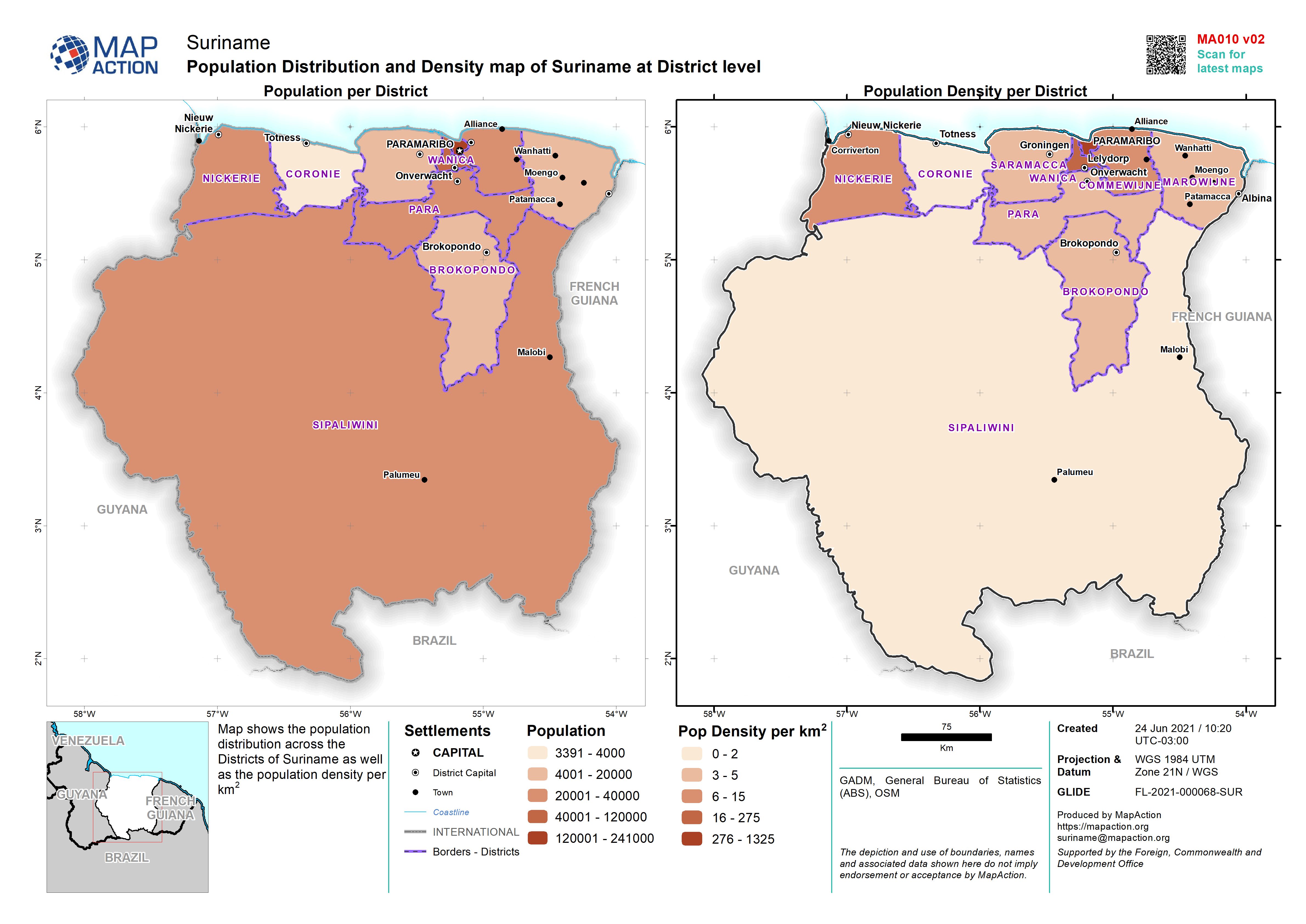
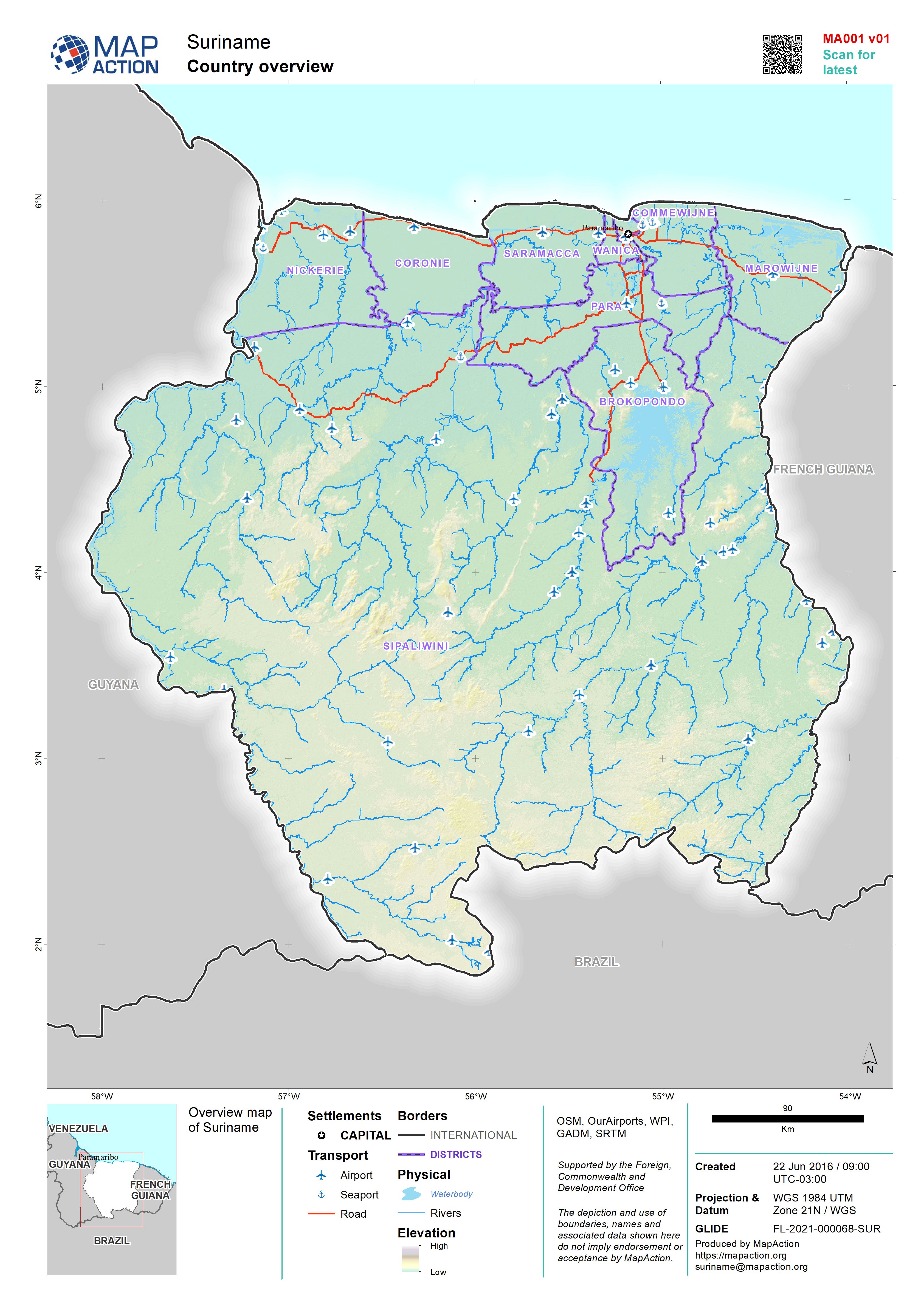
Population Distribution and Density map of Suriname at District level
Map shows the population distribution across the Districts of Suriname as well as the population density per km2 -

Population Distribution and Density map of Suriname at District level
Map shows the population distribution across the Districts of Suriname as well as the population density per km2 -

-
-
-
-
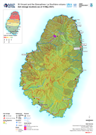
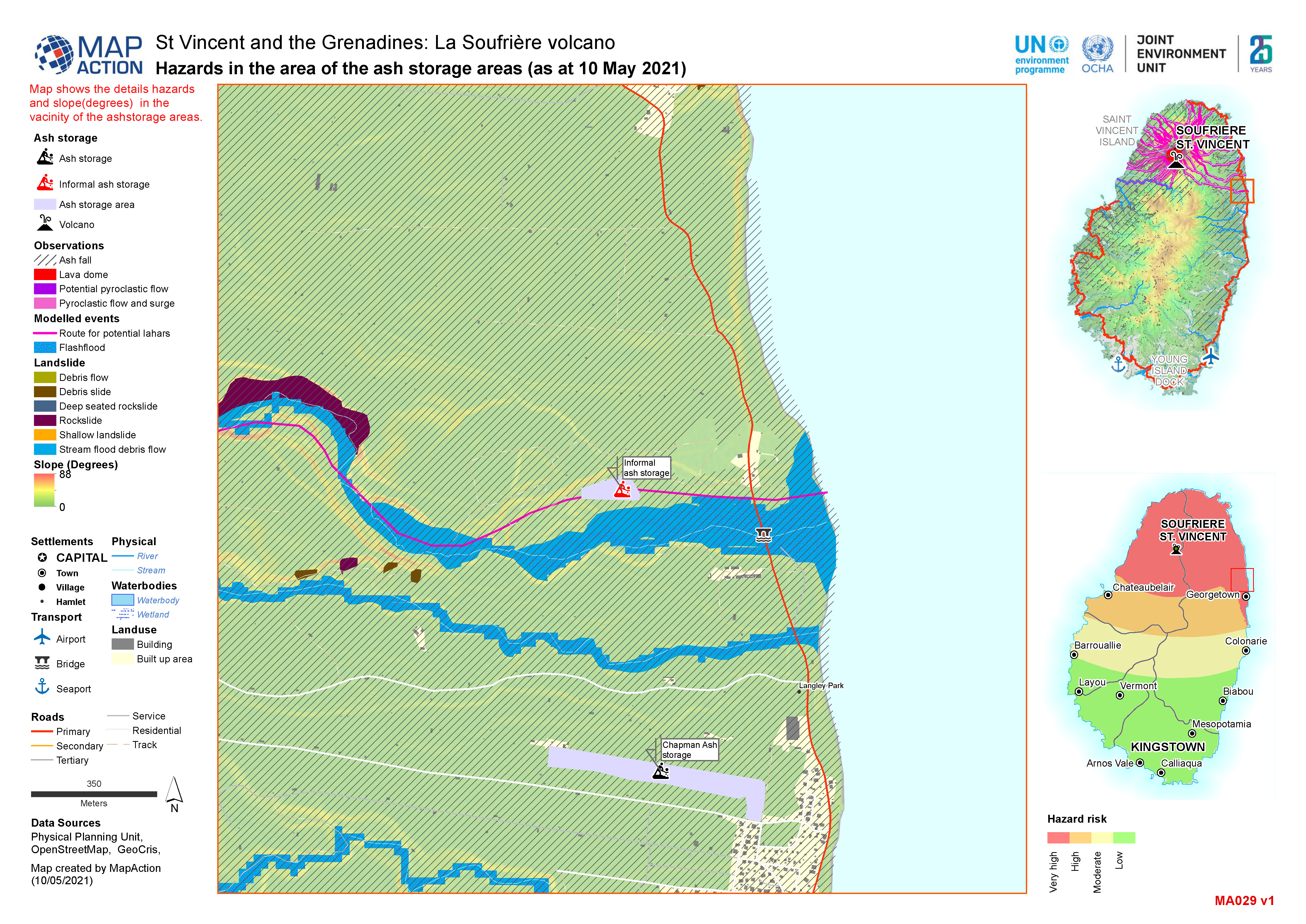
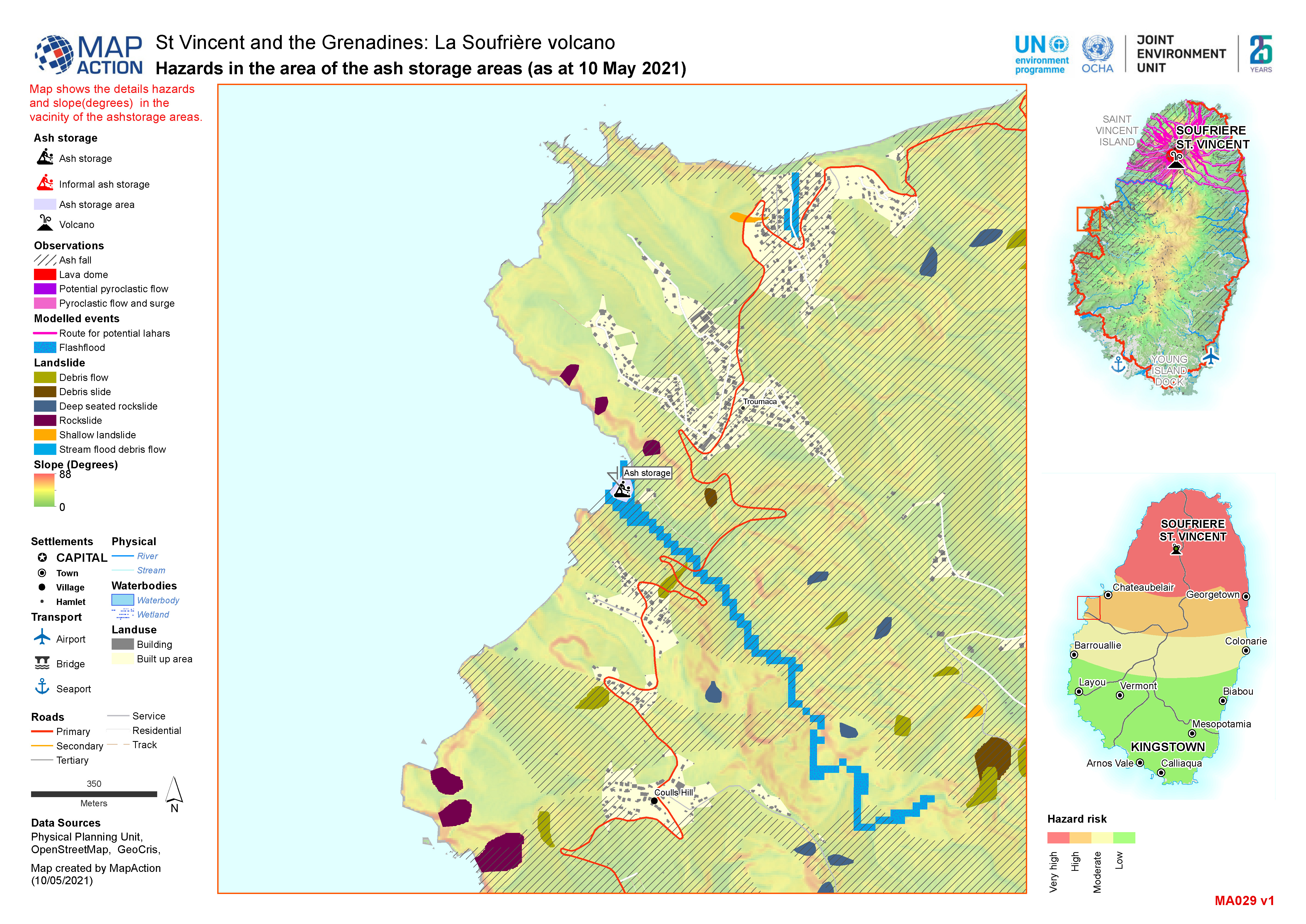
Ash storage locations (as at 10 May 2021)
Map shows the slopes of Saint Vincent and the location of known ash storage. -
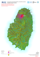
Modelled drainage channels
Map shows modelled drainage channels using a combination of 5m and 30m resolution elevation data. Whilst many of the channelsdo have water (i.e. streams and rivers) in them some... -
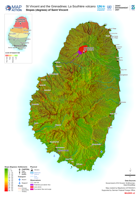
Slopes (degrees) of Saint Vincent
Map shows the slopes of Saint Vincent and the extent of the ash from the La Soufrière eruptions. -
