-

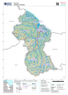
Population Distribution, Density, Households affected and Humanitarian Assist...
Map shows the population distribution across the regions of Guyana as well as the population density per km2. The left map shows the affected households per regions while the... -
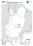
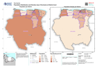
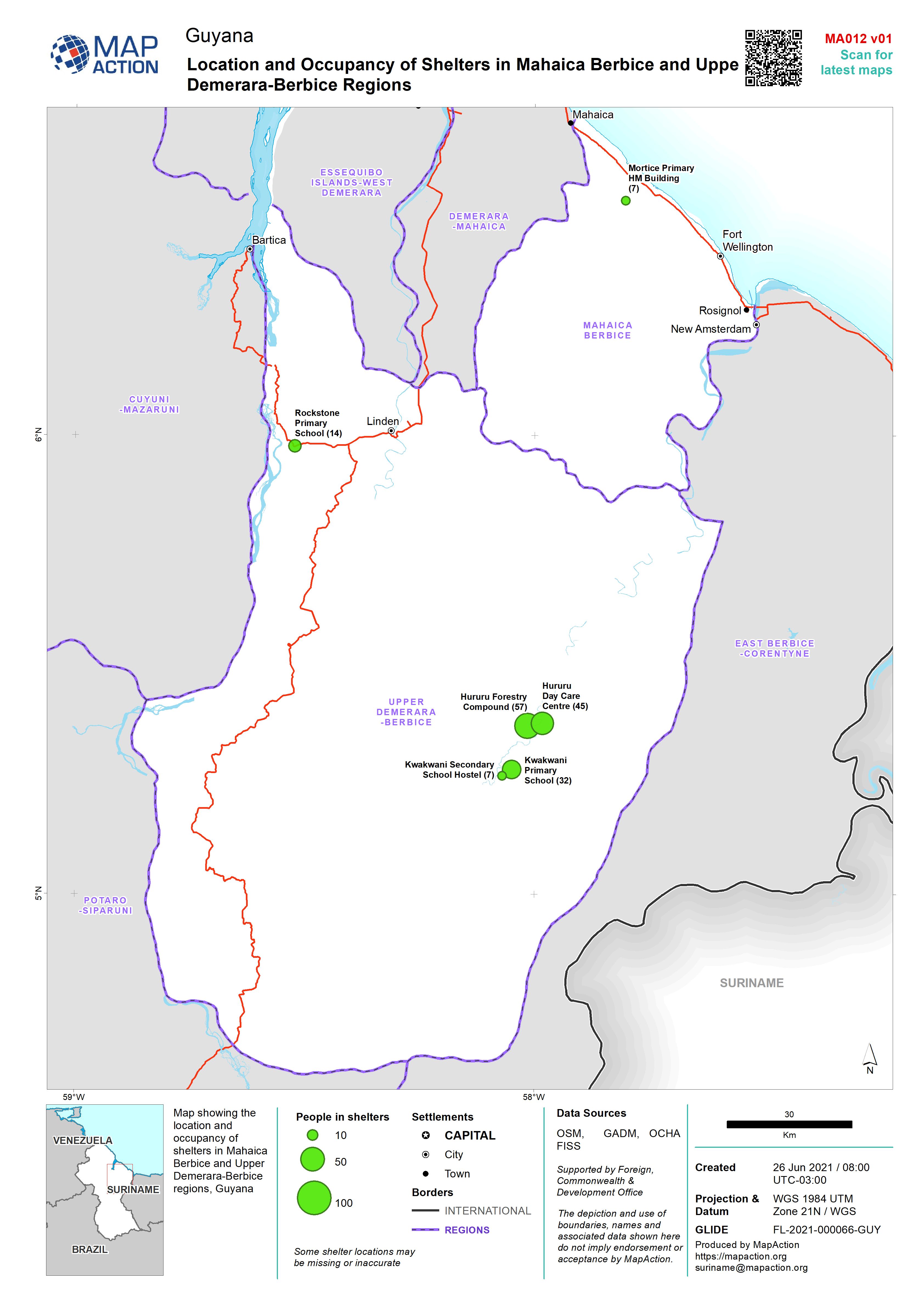
Location and Occupancy of Shelters in Mahaica Berbice and Upper Demerara-Berb...
Map showing the location and occupancy of shelters in Mahaica Berbice and Upper Demerara-Berbice regions, Guyana -
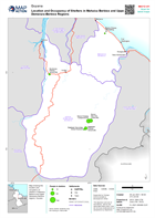
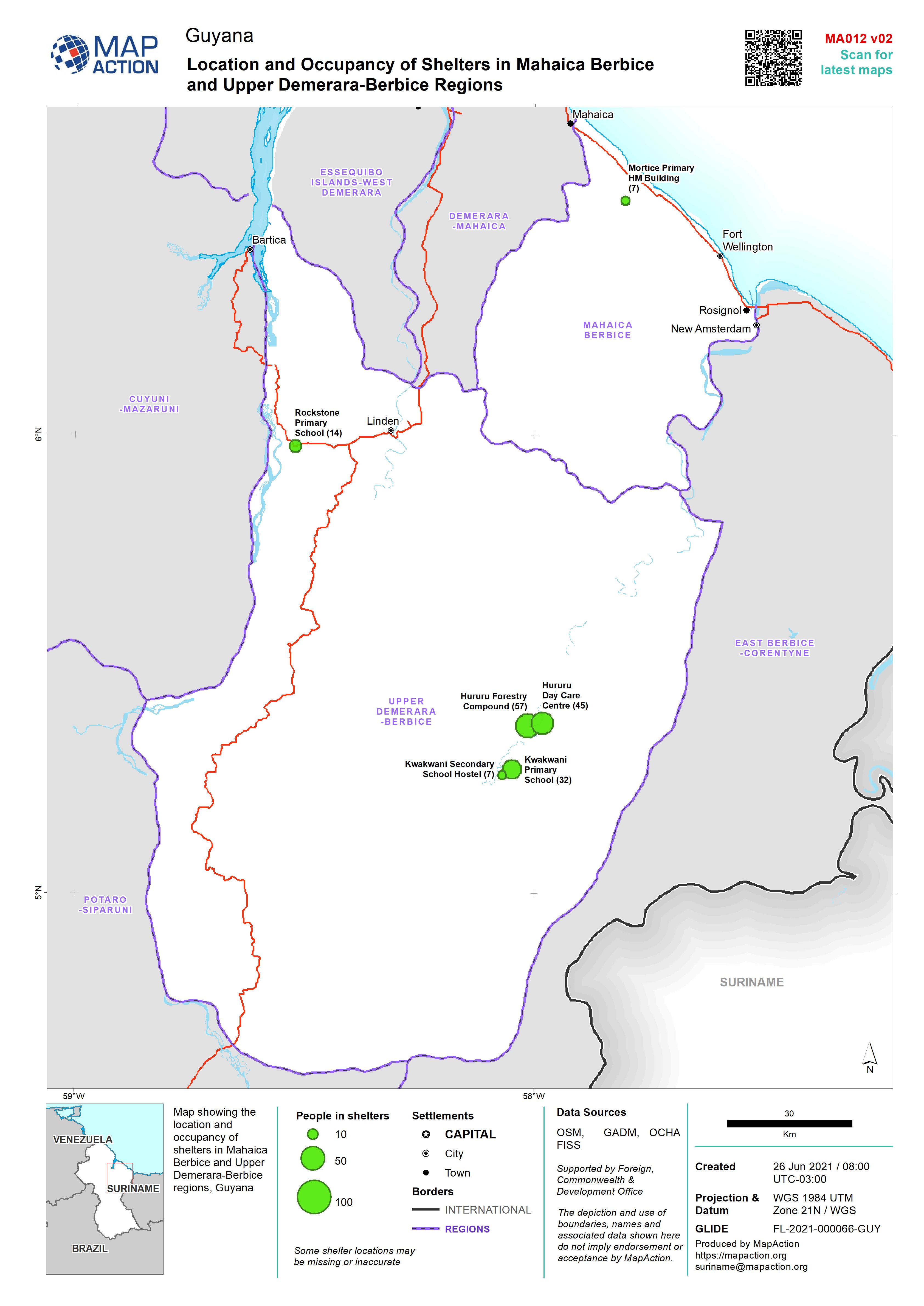
Location and Occupancy of Shelters in Mahaica Berbice and Upper Demerara-Berb...
Map showing the location and occupancy of shelters in Mahaica Berbice and Upper Demerara-Berbice regions, Guyana -

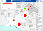
Pakistan Emergency Shelter Cluster - Shelter Gap by Province - 26-August 2010
This dataset has no description
-

Pakistan Emergency Shelter Cluster - Shelter Gap by Province - 26-August 2010
This dataset has no description
-
Pakistan Emergency Shelter Cluster - shelter Gap by Province - 21 August 2010
This dataset has no description
-
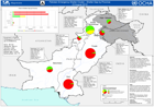
Pakistan Emergency Shelter Cluster - Shelter Gap by Province - 23 August 2010
This dataset has no description
-

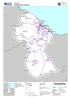
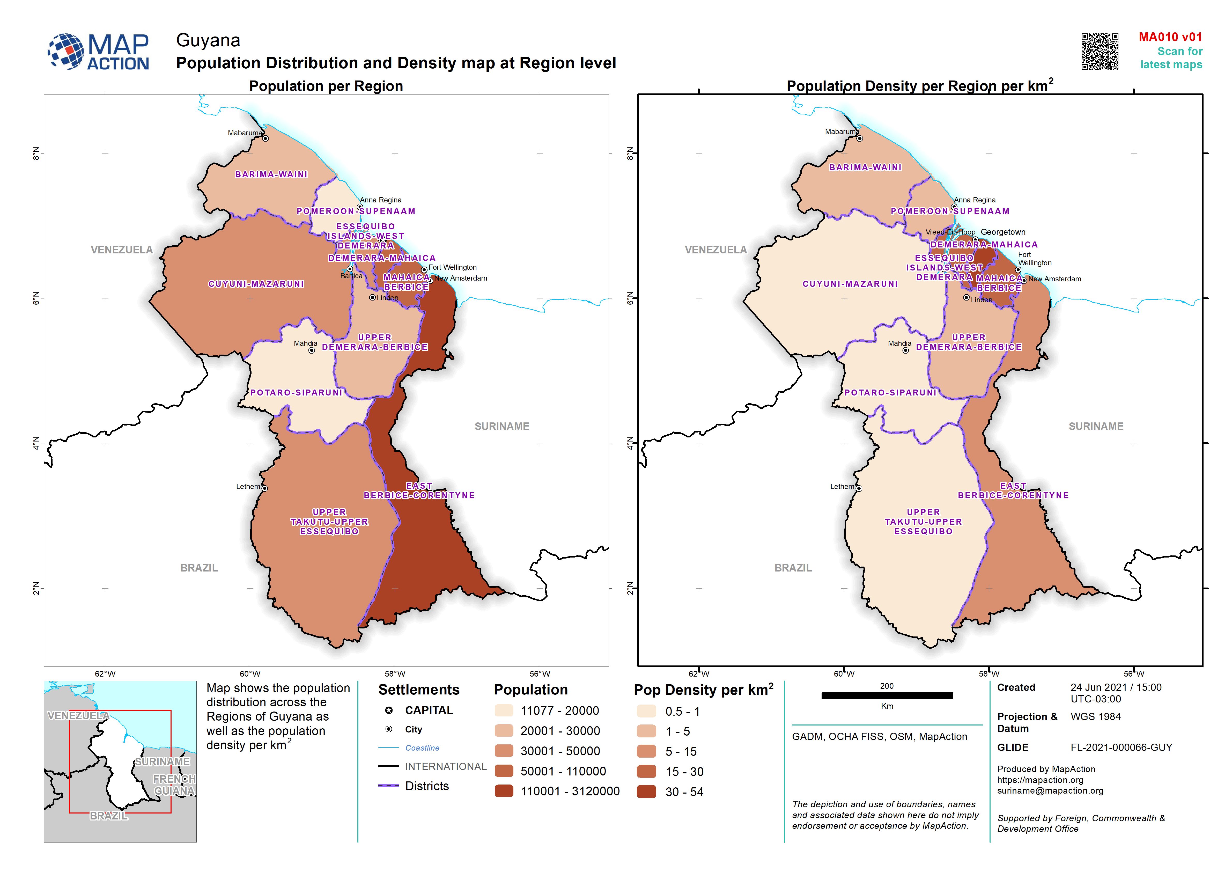
Population Distribution and Density map at Region level
Map shows the population distribution across the Regions of Guyana as well as the population density per km2 -

-
-
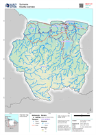
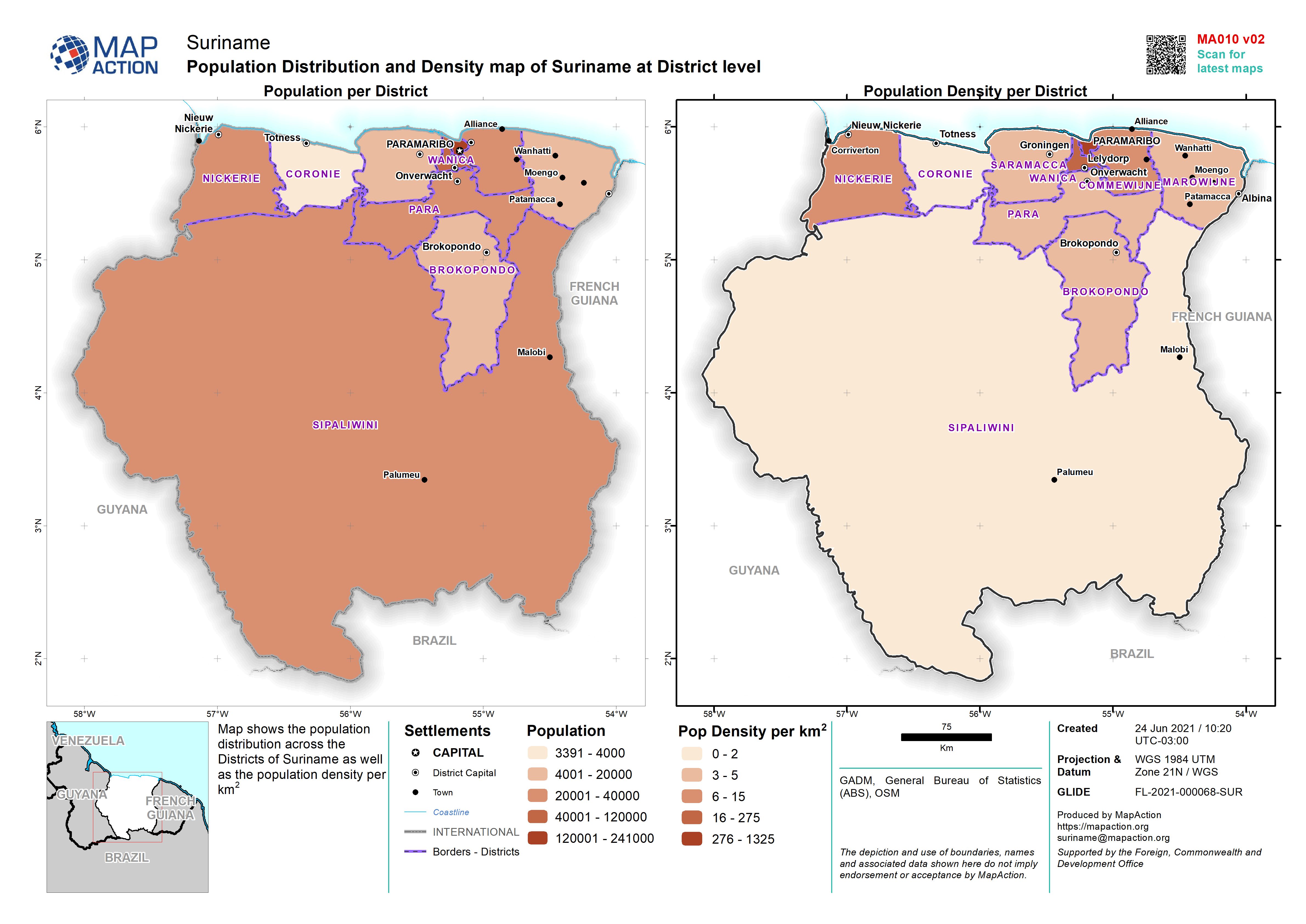
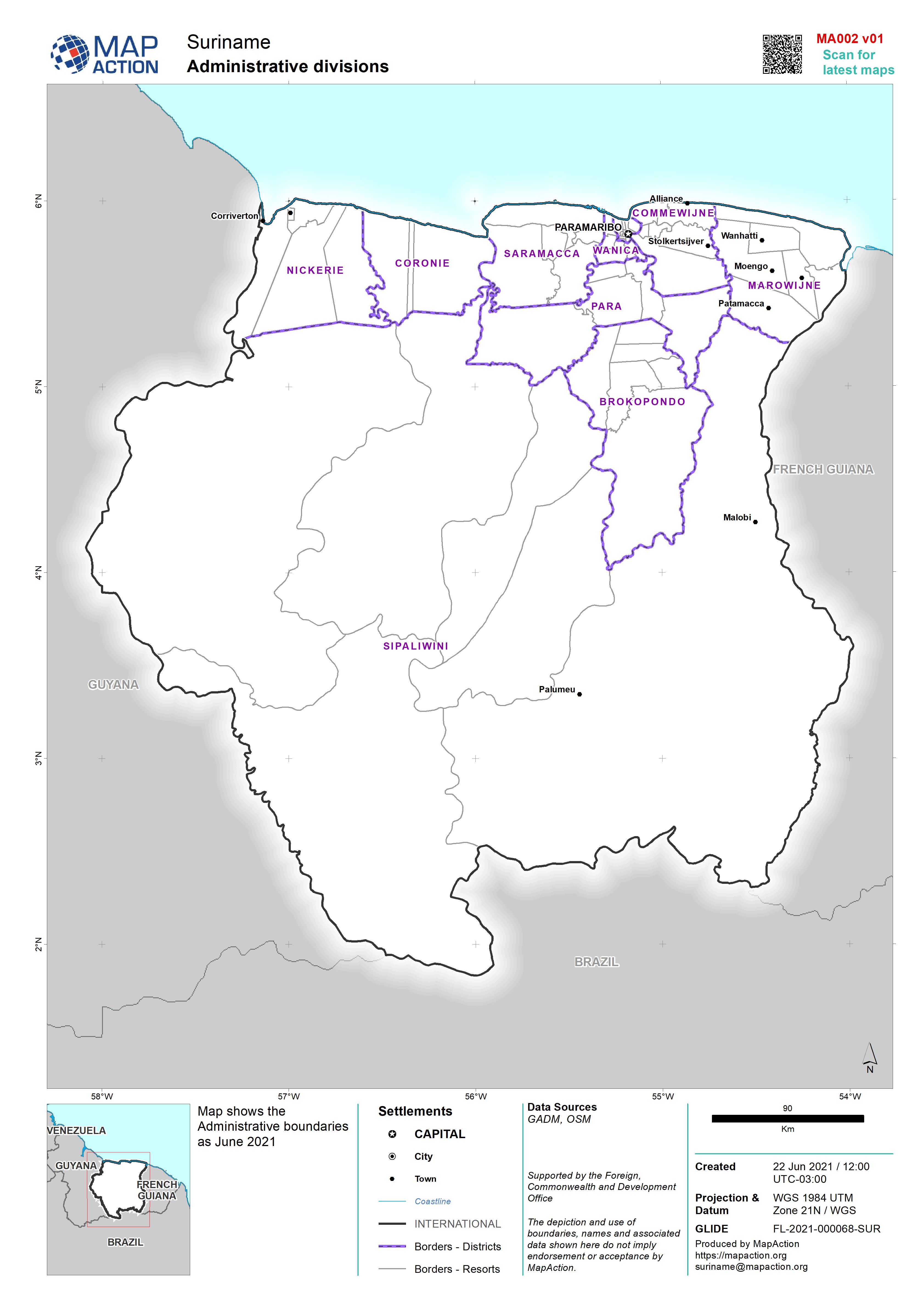
Population Distribution and Density map of Suriname at District level
Map shows the population distribution across the Districts of Suriname as well as the population density per km2 -

Population Distribution and Density map of Suriname at District level
Map shows the population distribution across the Districts of Suriname as well as the population density per km2 -

-
-
-
-
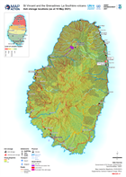
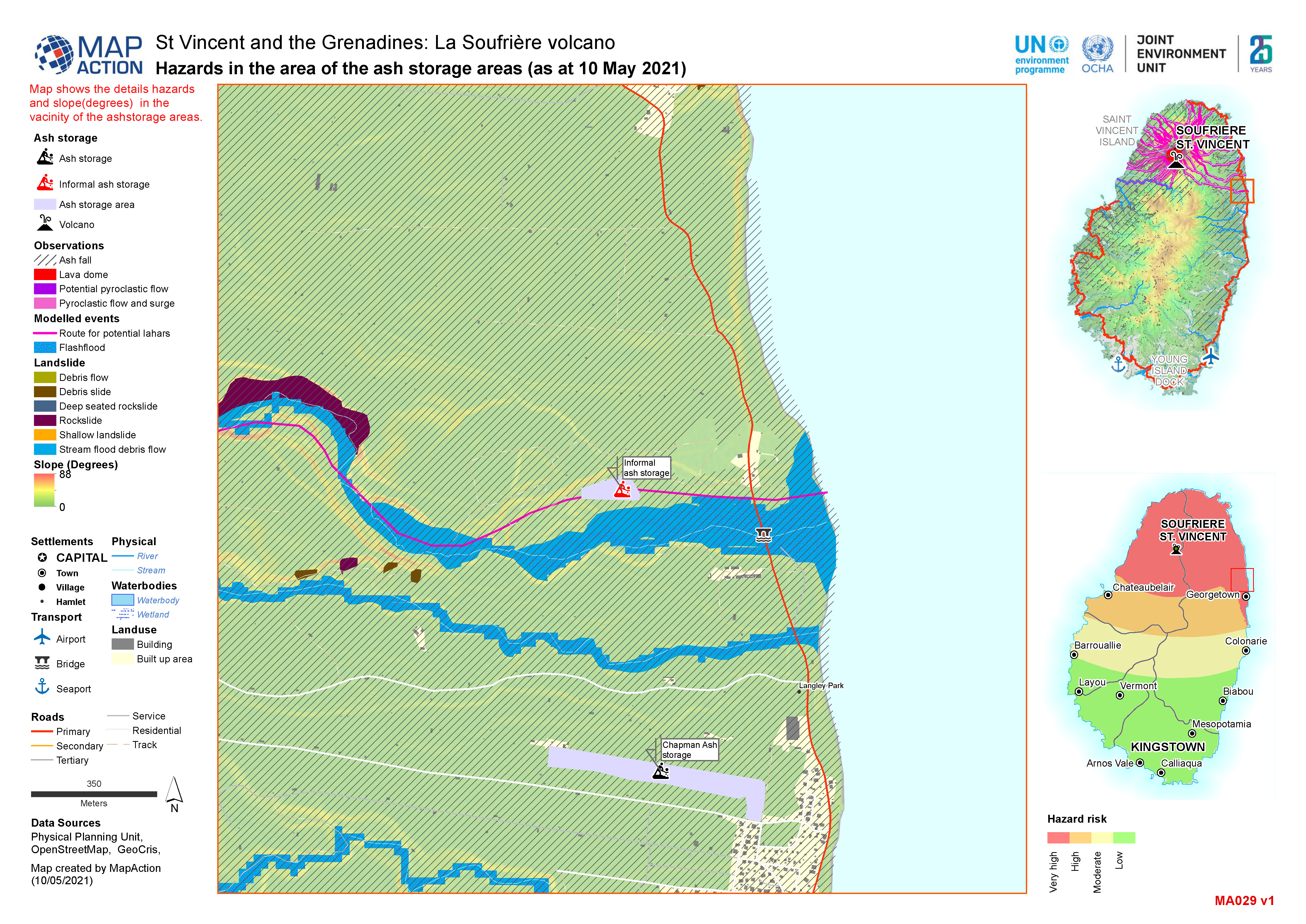
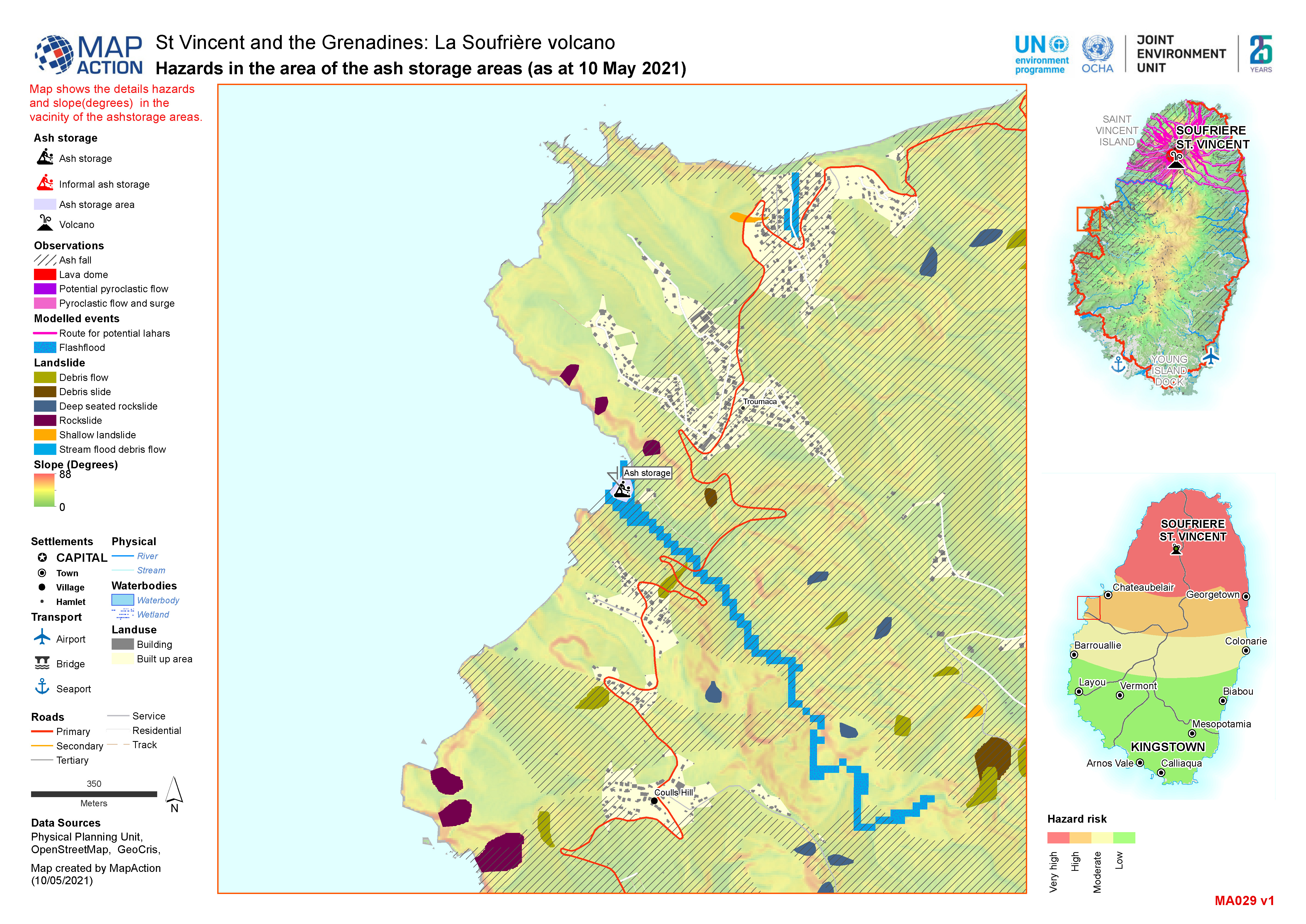
Ash storage locations (as at 10 May 2021)
Map shows the slopes of Saint Vincent and the location of known ash storage.
