-
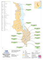
Malawi: Floods Nutrition Cluster Overview (as of 11 Feb 2015)
This dataset has no description
-

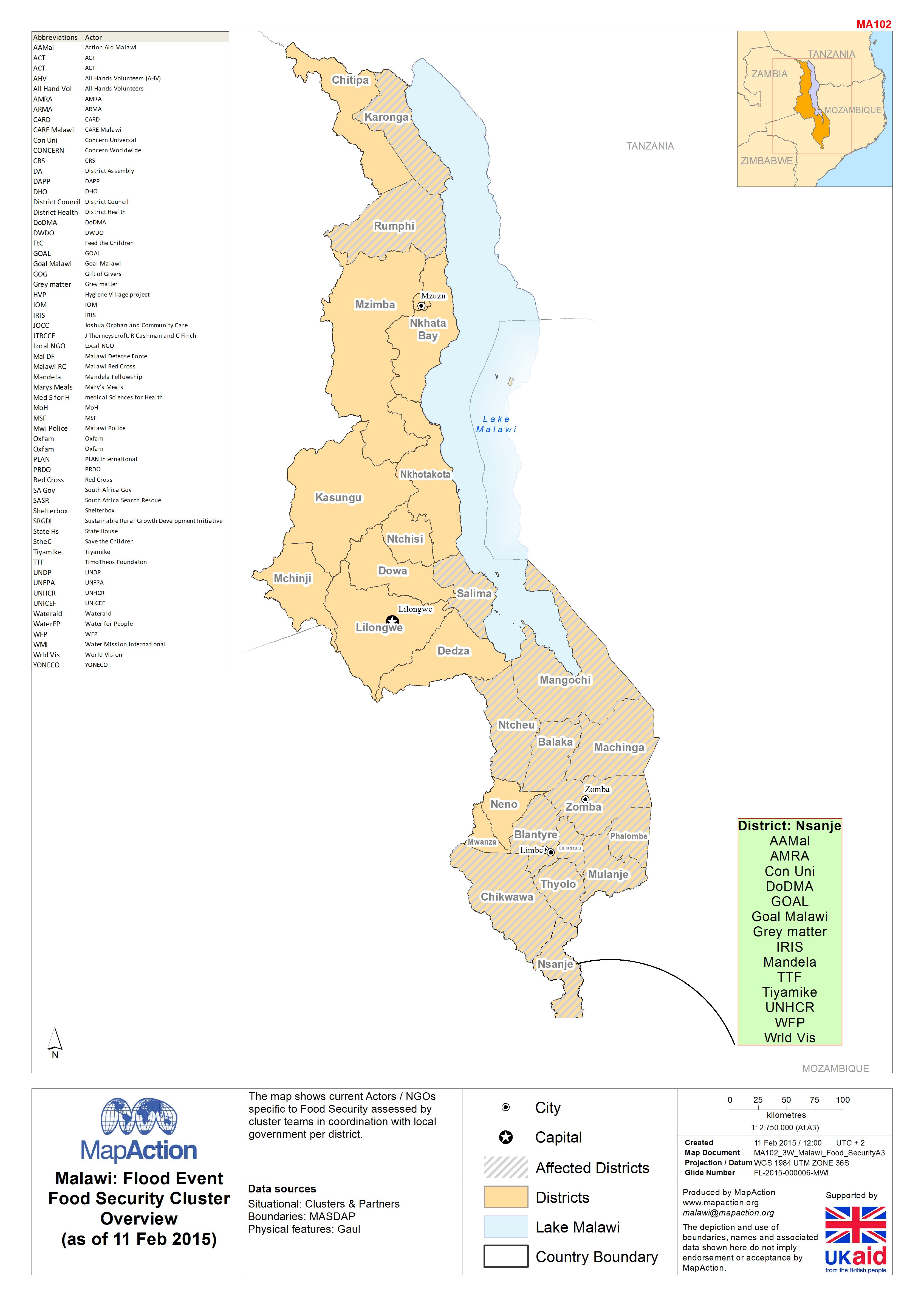
Malawi: Floods - Food Security Cluster Overview (as of 11 Feb 2015)
This dataset has no description
-
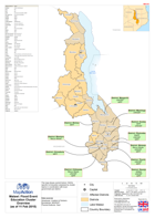
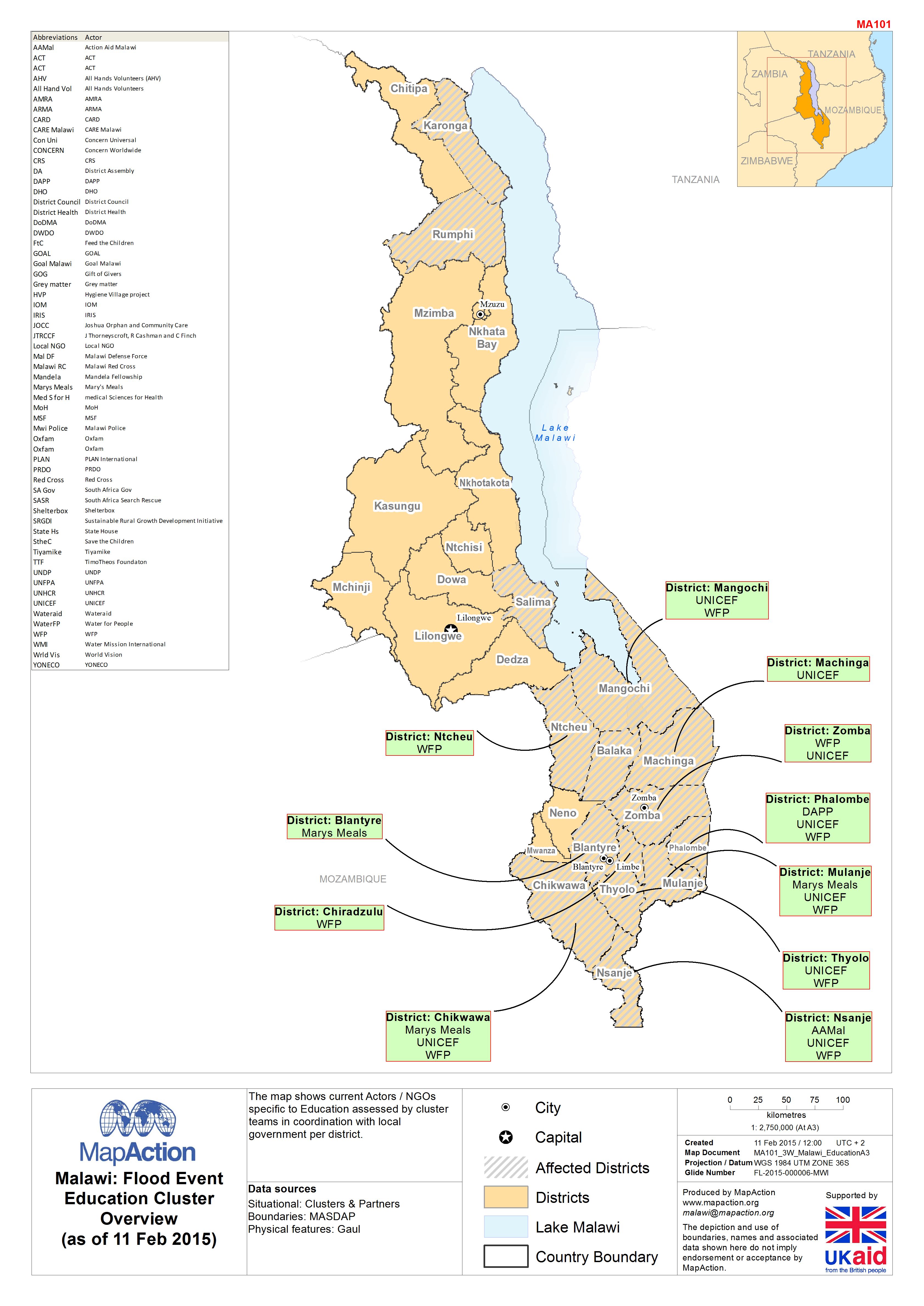
Malawi: Floods - Education Cluster Overview (as of 11 Feb 2015)
This dataset has no description
-

-

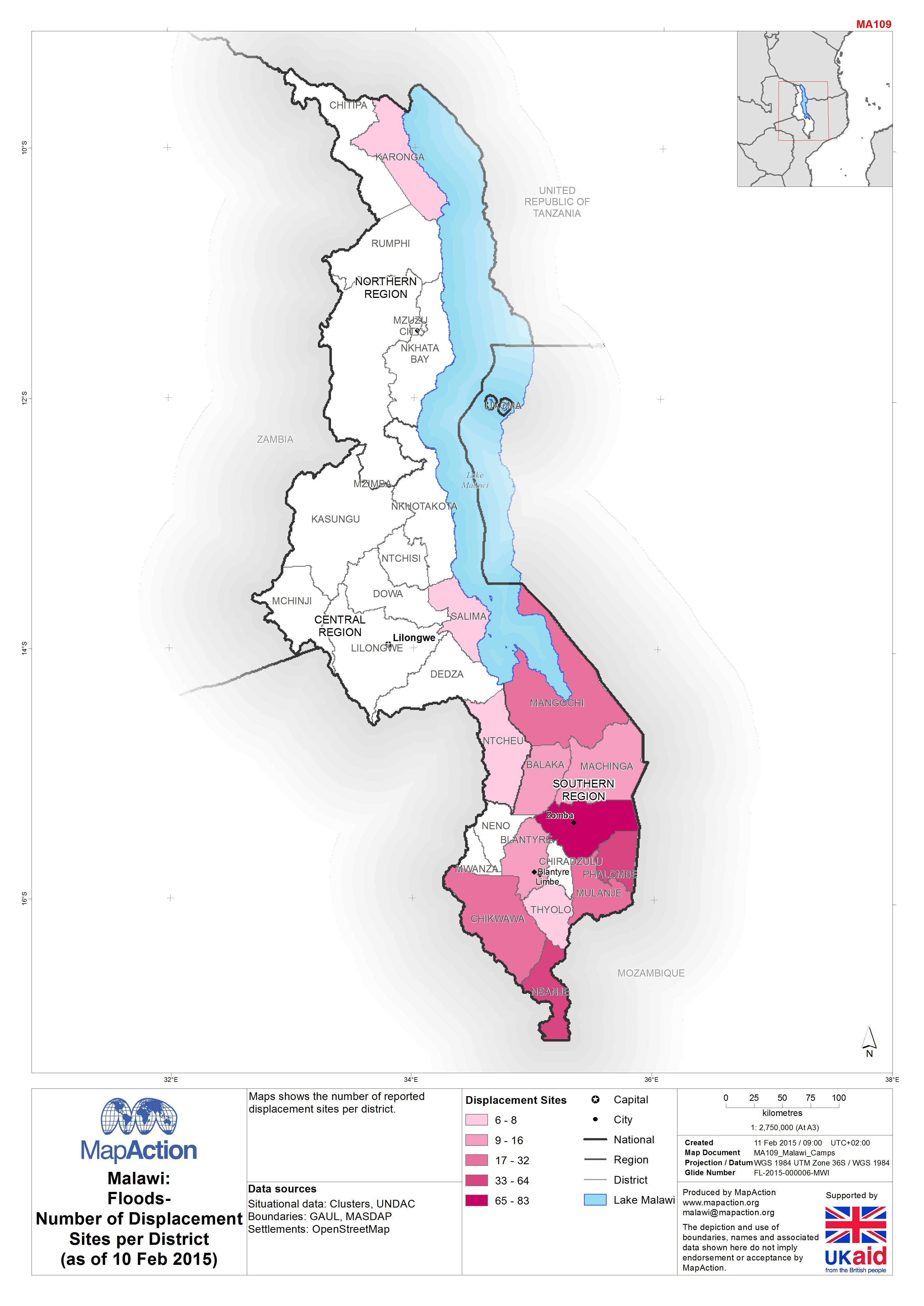
Malawi: Floods-Number of Displacement Sites per District(as of 10 Feb 2015)
Maps shows the number of reported displacement sites per district. -

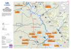
Malawi: Floods - Overview of UNDAC assessements of Nsjanje District, as of 26...
This map shows the Nsjanje district and its Traditional Authorities.Situational information was supplied through several rapid assessments by UNDAC teams in coordination with... -

Malawi: Floods - Results of UNDAC assessement of the Traditional Authority Mb...
This map shows the southern Nsanje district. This rapid assessment was undertaken by UNDAC teams from 19th of January to 26th of January. -

Malawi: Floods -Situational view ofSouthern NsanjeDistrict, as of 26th of Jan...
This map shows the southern Nsanje district. Situational information is from UNDAC assessments and coordination with local government. -

Malawi: Floods - 3W - Chikwawa District (as of 26 Jan 2015)
This 3w map (who, what, where) shows assistance in camps for internally displaced people (IDP), as assessed by UNDAC teams in coordination with local government in the Chikwawa... -
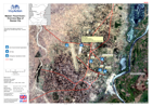
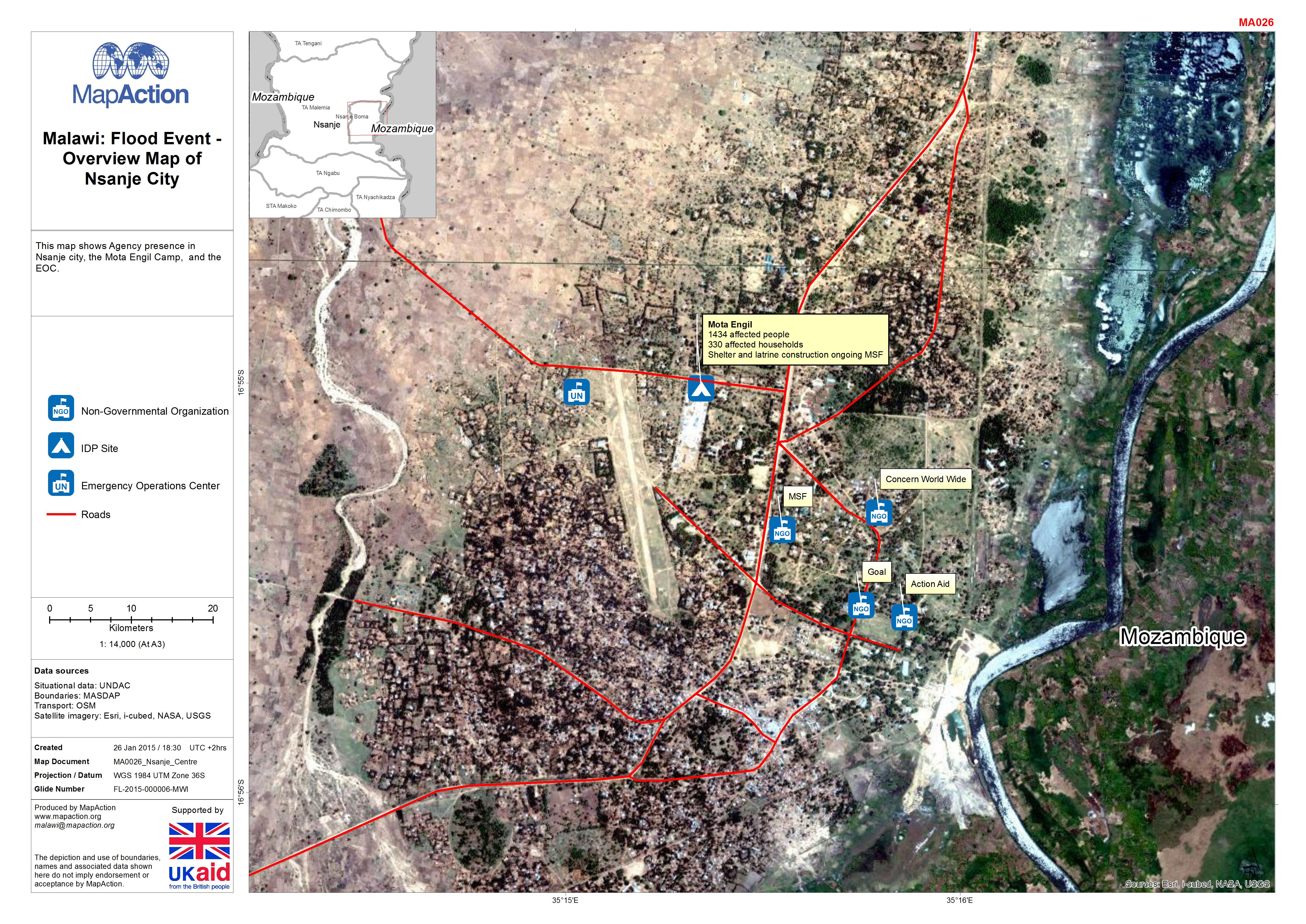
Malawi: Floods - Overview Map of Nsanje City
This map shows Agency presence in Nsanje city, the Mota Engil Camp, and the EOC. -

Malawi: Floods - Results of UNDAC assessement of Nsjanje District, 17th to 19...
This map shows the Nsjanje district and its Traditional Authorities.Several rapid assessments were undertaken by UNDAC teams from the 17th to the 19th of January. -
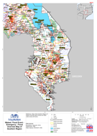
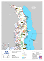
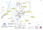
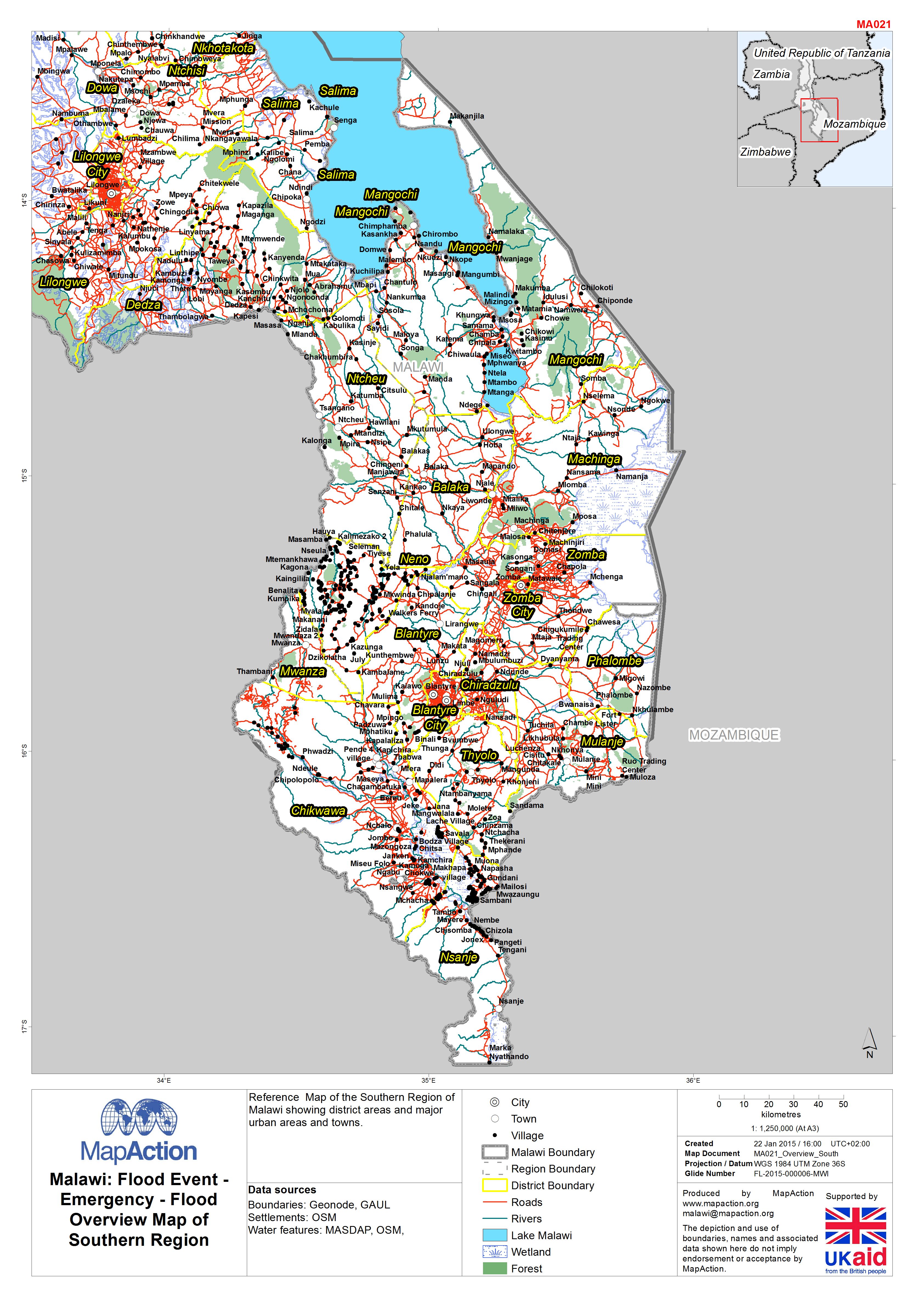
Malawi: Floods - Emergency - Flood Overview Map of Southern Region
Reference Map of the Southern Region of Malawi showing district areas and major urban areas and towns. -
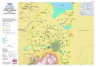
Malawi: Floods - Emergency - Flood Overview Map of Northern Region
Reference Map of the Northern Region of Malawi showing district areas and major urban areas and towns. -
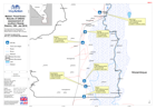
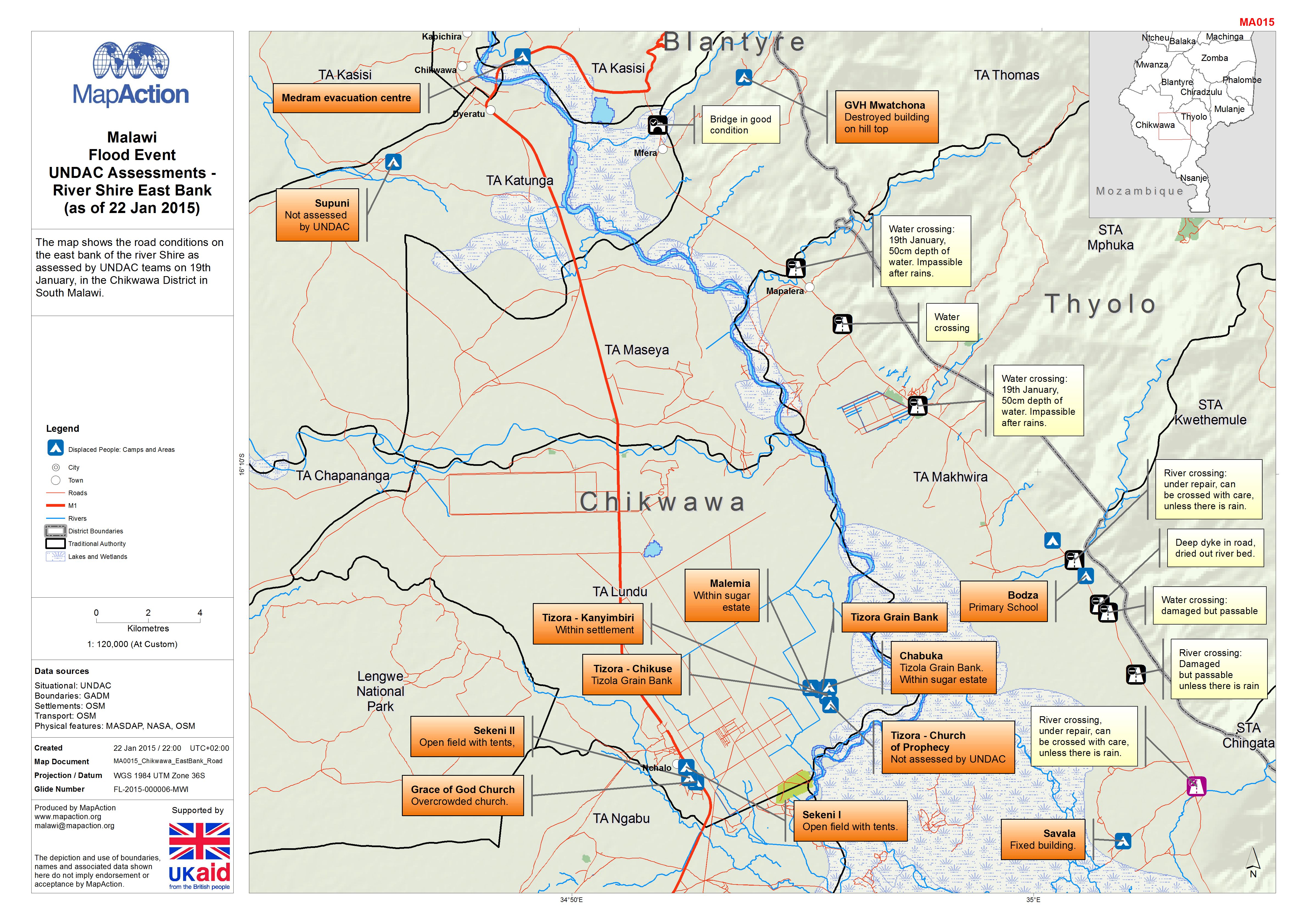
Malawi: Floods - UNDAC Assessments - River Shire East Bank (as of 22 Jan 2015)
The map shows the road conditions on the east bank of the river Shire as assessed by UNDAC teams on 19th January, in the Chikwawa District in South Malawi. -
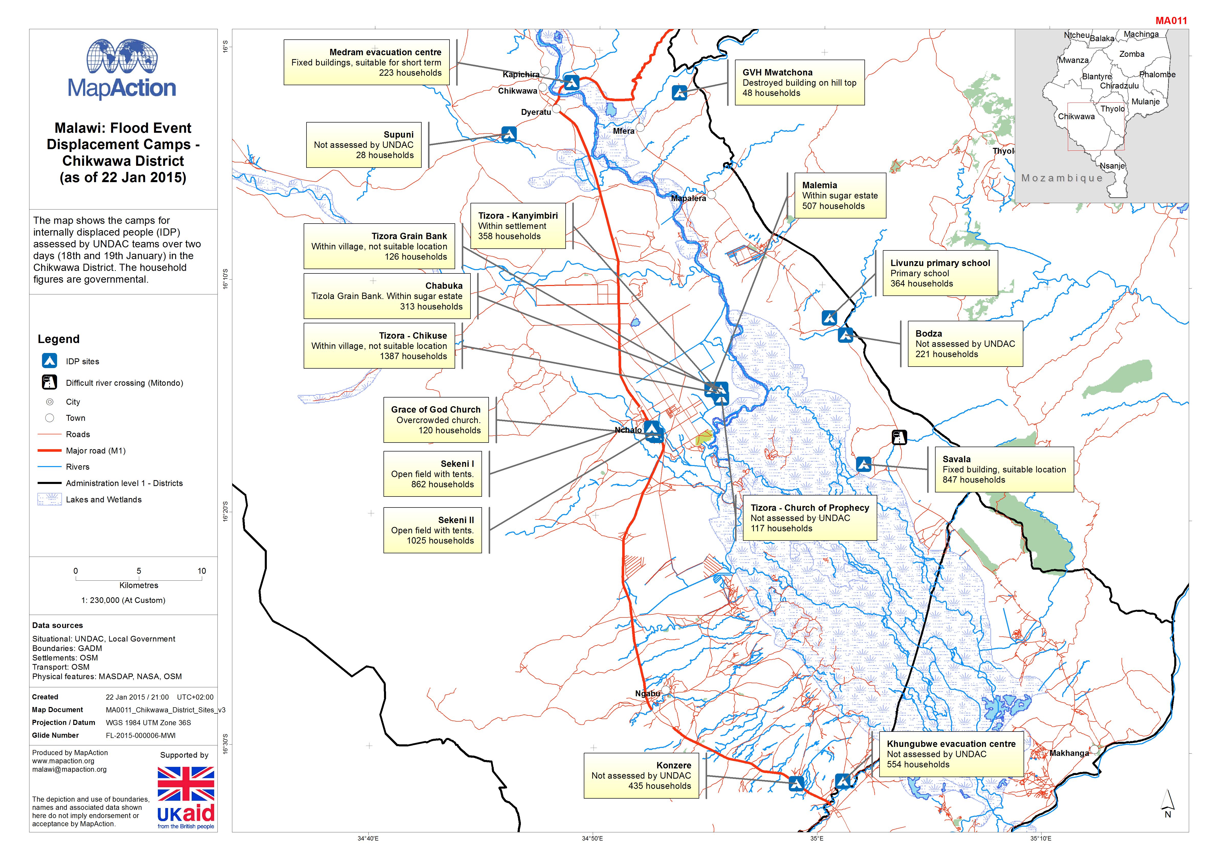
Malawi: Floods - Displacement Camps - Chikwawa District (as of 22 Jan 2015)
The map shows the camps for internally displaced people (IDP) assessed by UNDAC teams over two days (18th and 19th January) in the Chikwawa District. The household figures are... -
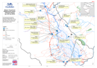
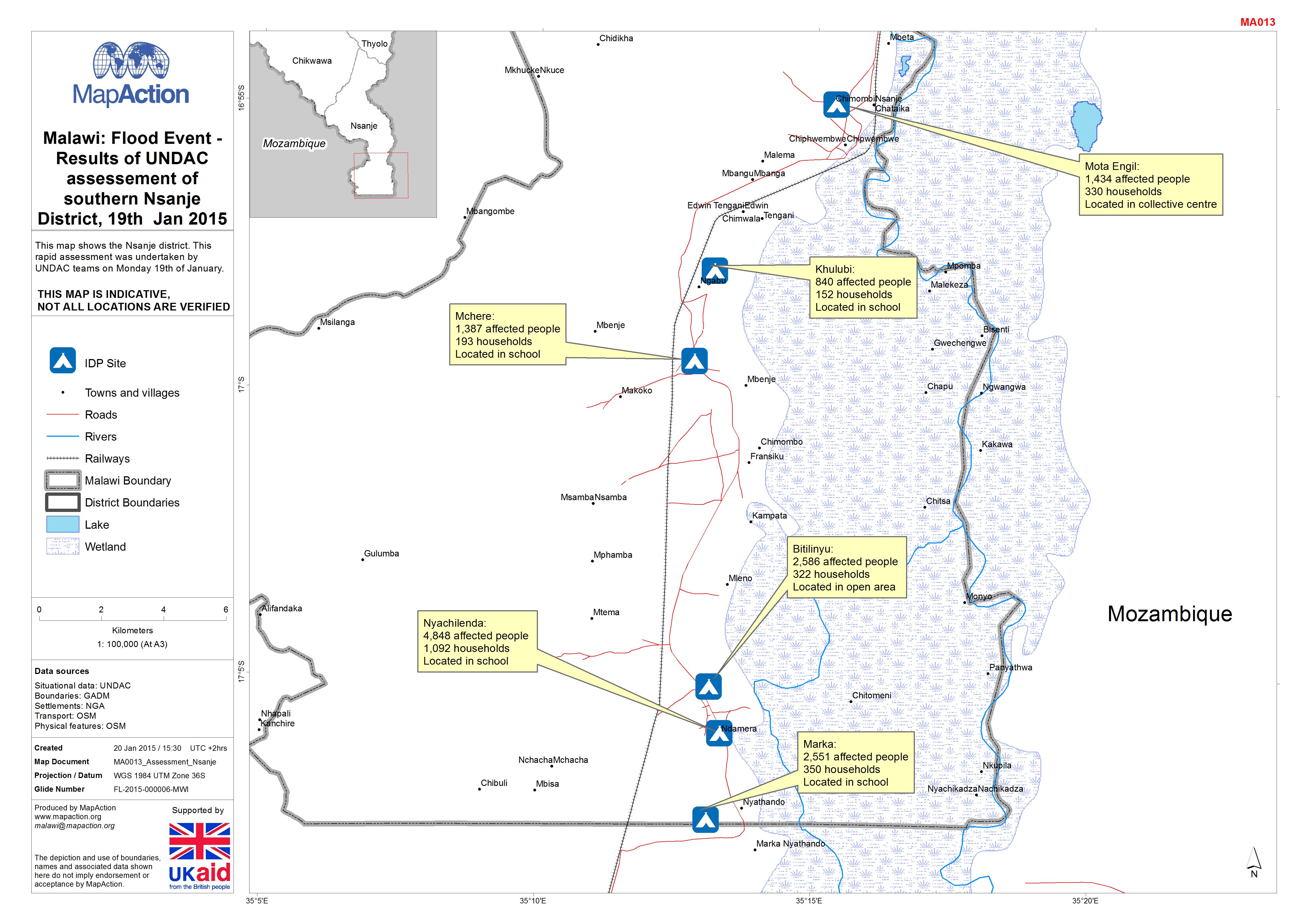
Malawi: Floods -Results of UNDAC assessement of southern Nsanje District, 19t...
This map shows the Nsanje district. This rapid assessment was undertaken by UNDAC teams on Monday 19th of January. -

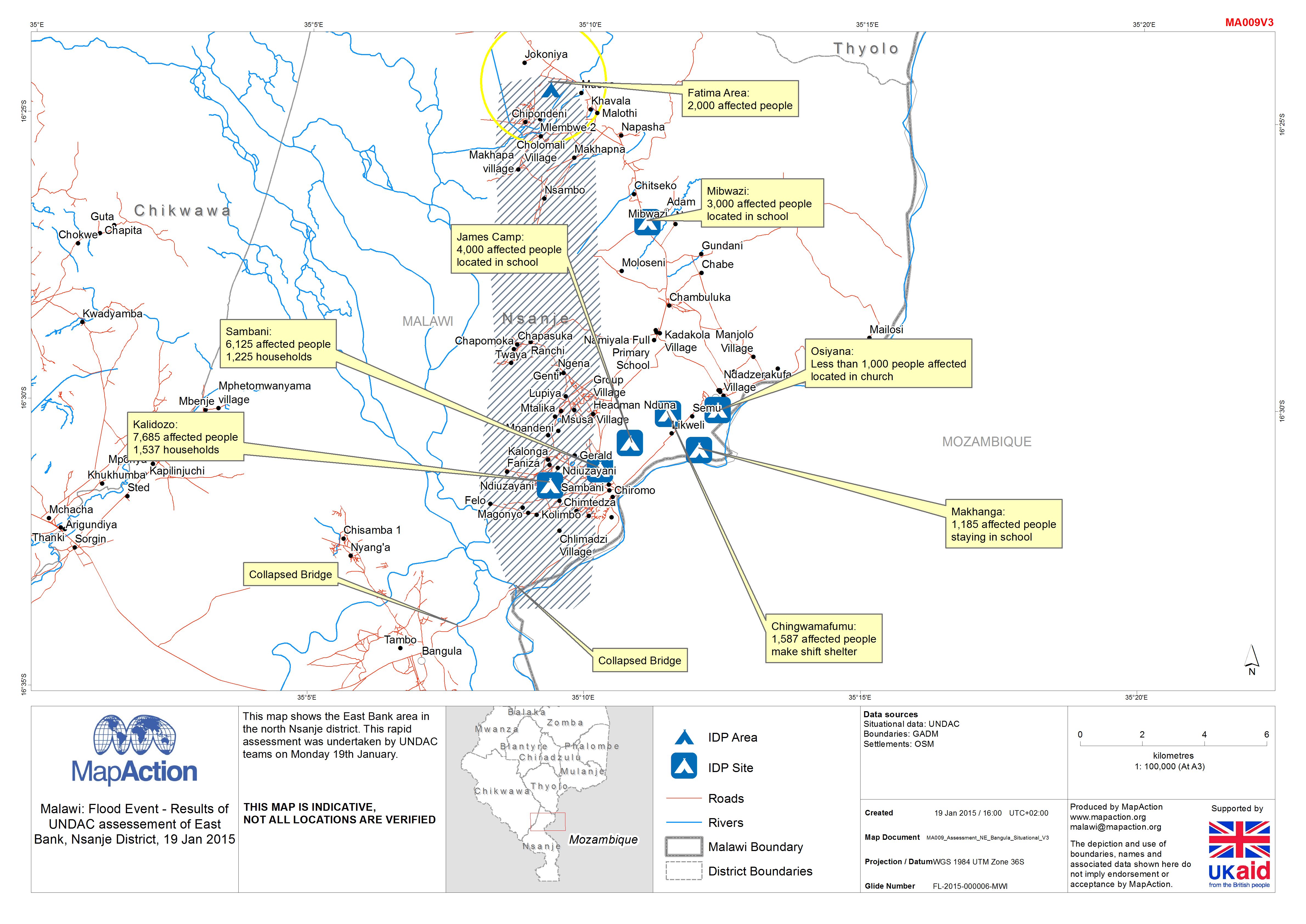
Malawi: Floods - Results of UNDAC assessement of East Bank, Nsanje District, ...
This map shows the East Bank area in the north Nsanje district. This rapid assessment was undertaken by UNDAC teams on Monday 19th January. -
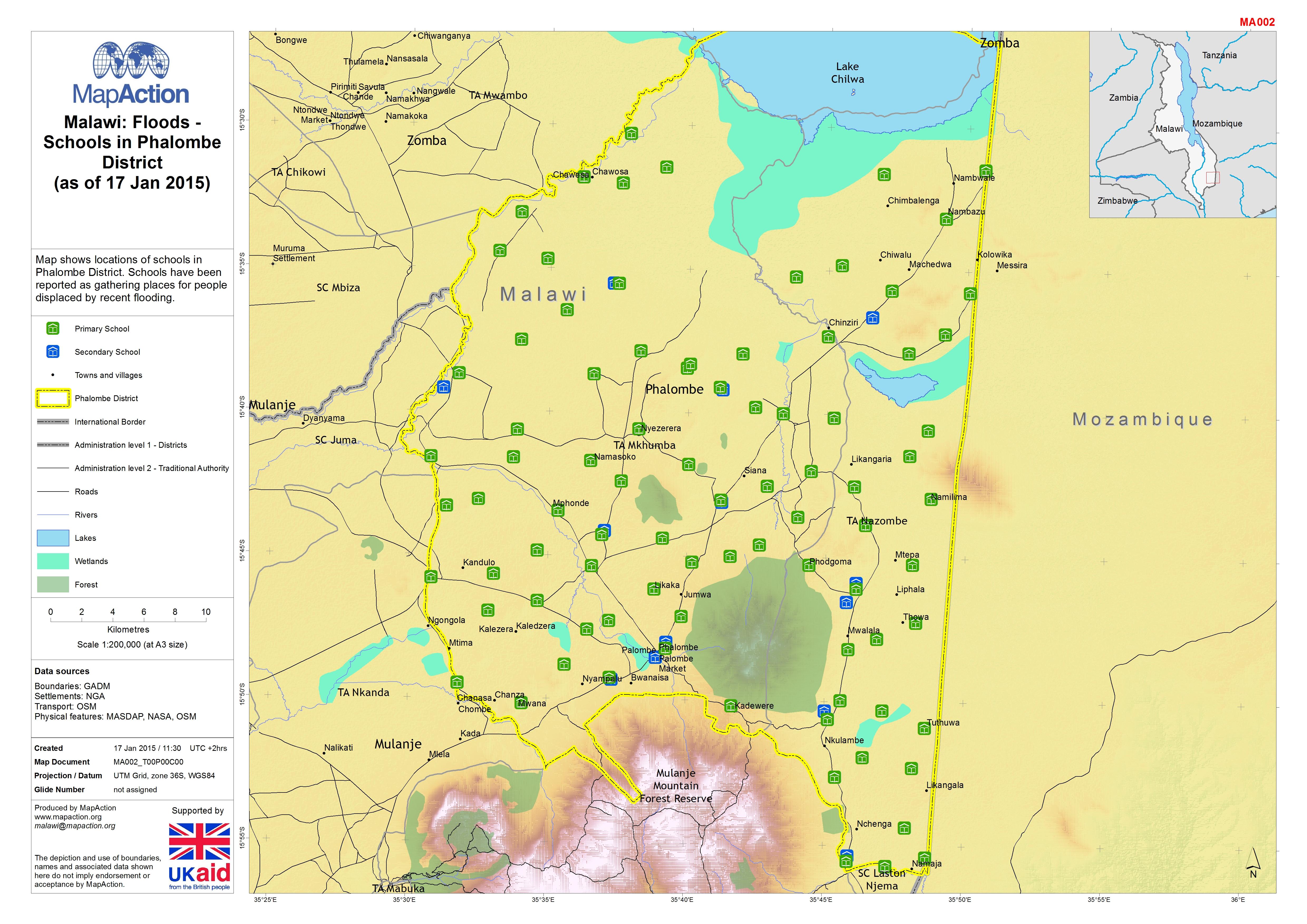
Malawi: Floods - Schools in Phalombe District (as of 17 Jan 2015)
Map shows locations of schools in Phalombe District. Schools have been reported as gathering places for people displaced by recent flooding. -
Malawi: Floods - Results of UNDAC assessement of East Bank, Nsanje District, ...
The East Bank area of north Nsanje District, Malawi, showing results of a rapid assessment undertaken by UNDAC teams on 19 January 2015 in response to recent flooding. -

Malawi: Floods - 7 day cumulative rainfall (as of 15 Jan 2015)
Map shows the cumulative rainfall total in millimetres (mm) during the seven day period 8-15 Jan 2015 (03:00 UTC) across Malawi. Figures are estimates from satellite...