-
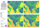
Mediterranean/Europe: Refugees/Migrants Emergency Response-average maximum wi...
This map shows the average wind speed at each cell for November, December, January and February at 5 km spatial resolution. The data was modelled from ECMWF operational,... -
Mediterranean/Europe: Refugees/Migrants Emergency Response-Monthly average sn...
The map shows calculated average monthly snow cover data for November, December, January and February; derived from data extracted for each year from the full available period... -

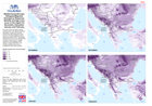
Mediterranean/Europe: Refugees/Migrants Emergency Response-average minimum te...
The map shows the monthly average minimum temperature in °C for November, December, January and February. This WorldClim data was generated through interpolation of average... -

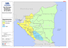
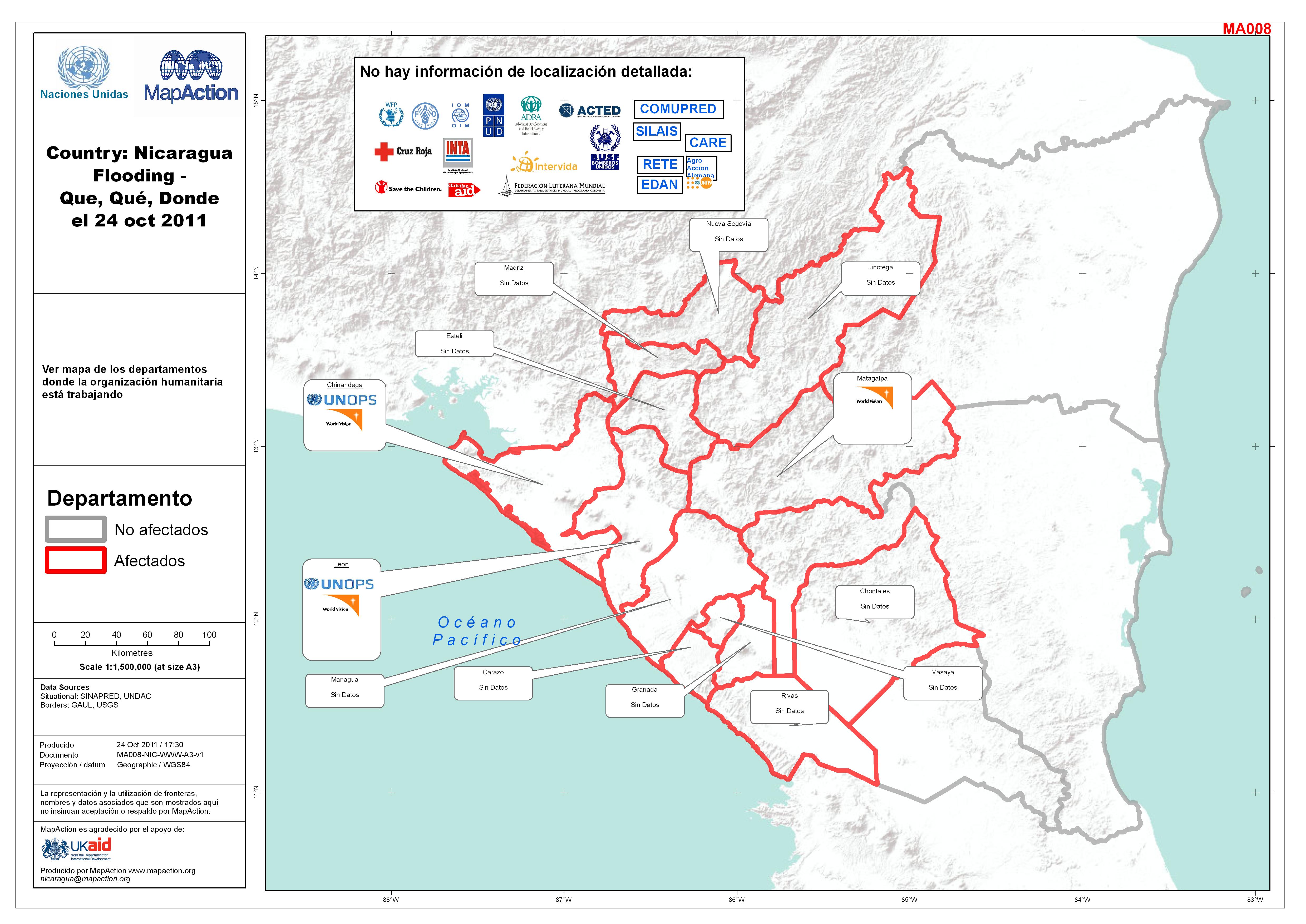
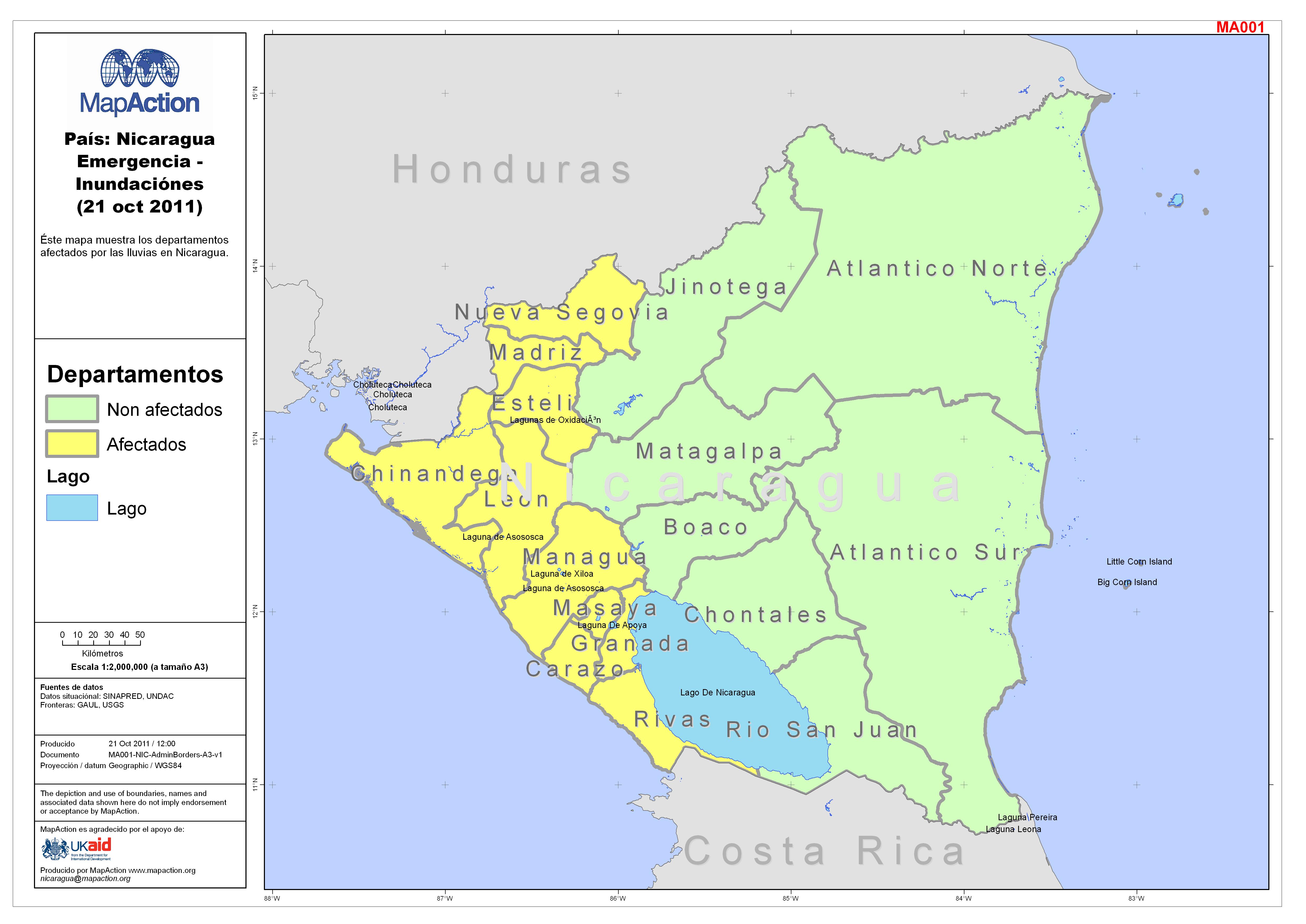
País: Nicaragua Inundaciónes - Salud en Departamentos Afectados por las Lluvi...
Éste mapa muestra información correspondiente al sector salud en los departamentos afectados por las lluvias. Éste mapa incluye el numero de pacientes, la cantidad y nombres... -
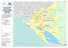
País: Nicaragua Inundaciónes - Visitas de Campo Conjuntas UNDAC-SINAPRED el 2...
This dataset has no description
-

-
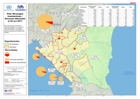
País: Nicaragua Inundaciónes - Personas Afectadas el 22 oct 2011
This dataset has no description
-

País: Nicaragua Inundaciónes - Albergues en Mangua el 22 oct 2011
This dataset has no description
-

País: Nicaragua Inundaciónes - Personas Albergadas el 22 oct 2011
This dataset has no description
-
-

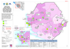
Sierra Leone: District Health Facility Dashboard
One page per district. This dashboard represents a snapshot in time in a rapidly changing situation. Figures must be used with caution. Case numbers in map are only indicative,... -

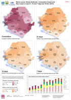
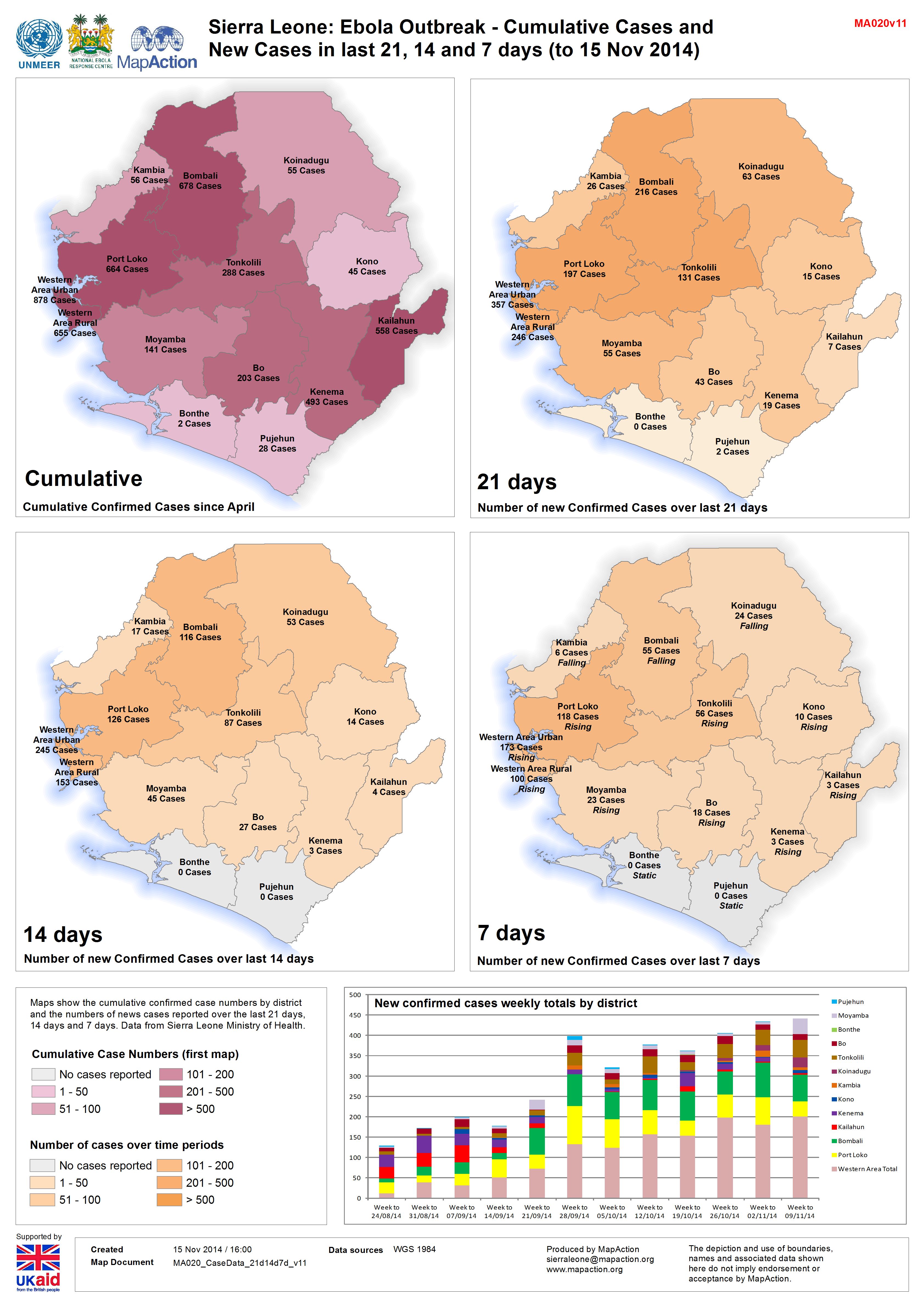
Sierra Leone: Ebola Outbreak - Cumulative Cases and New Cases in last 21, 14 ...
Maps show the cumulative confirmed case numbers by district and the numbers of news cases reported over the last 21 days, 14 days and 7 days. Data from Sierra Leone Ministry of... -
Sierra Leone Ebola Outbreak:Location & Status of Ebola Treatment Units and Cu...
Map shows the location and status of the known Ebola Treatment Units (as of 17/11/2014). Cumulative confirmed case totals and daily case movement/number (as of 17/11/2014) are... -
Sierra Leone: District Health Facility Dashboard
One page per district. This dashboard represents a snapshot in time in a rapidly changing situation. Figures must be used with caution. Case numbers in map are only indicative,... -

Sierra Leone: Ebola Outbreak - Cumulative Cases and New Cases in last 21, 14 ...
Maps show the cumulative confirmed case numbers by district and the numbers of news cases reported over the last 21 days, 14 days and 7 days. Data from Sierra Leone Ministry of... -
Sierra Leone Ebola Outbreak: Location & Status of Ebola Treatment Units and C...
Map shows the location and status of the known Ebola Treatment Units (as of 15/11/2014). Cumulative confirmed case totals and daily case movement/number (as of 15/11/2014) are... -
Sierra Leone Ebola Outbreak: MoH VHF Case Totals by Chiefdom and Section (in ...
Map shows the total cases from the MoH VHF database from weeks 14 (31/3) to 45 (06/11). Within Western Area this is at Section level, and outside Western Area at Chiefdom level. -
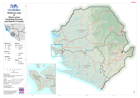
Reference map of Sierra Leone (including Province and District P-Codes)
This dataset has no description
-
Sierra Leone: Ebola Outbreak - Cumulative Cases and New Cases in last 21, 14 ...
Maps show the cumulative confirmed case numbers by district and the numbers of news cases reported over the last 21 days, 14 days and 7 days. Data from Sierra Leone Ministry of... -
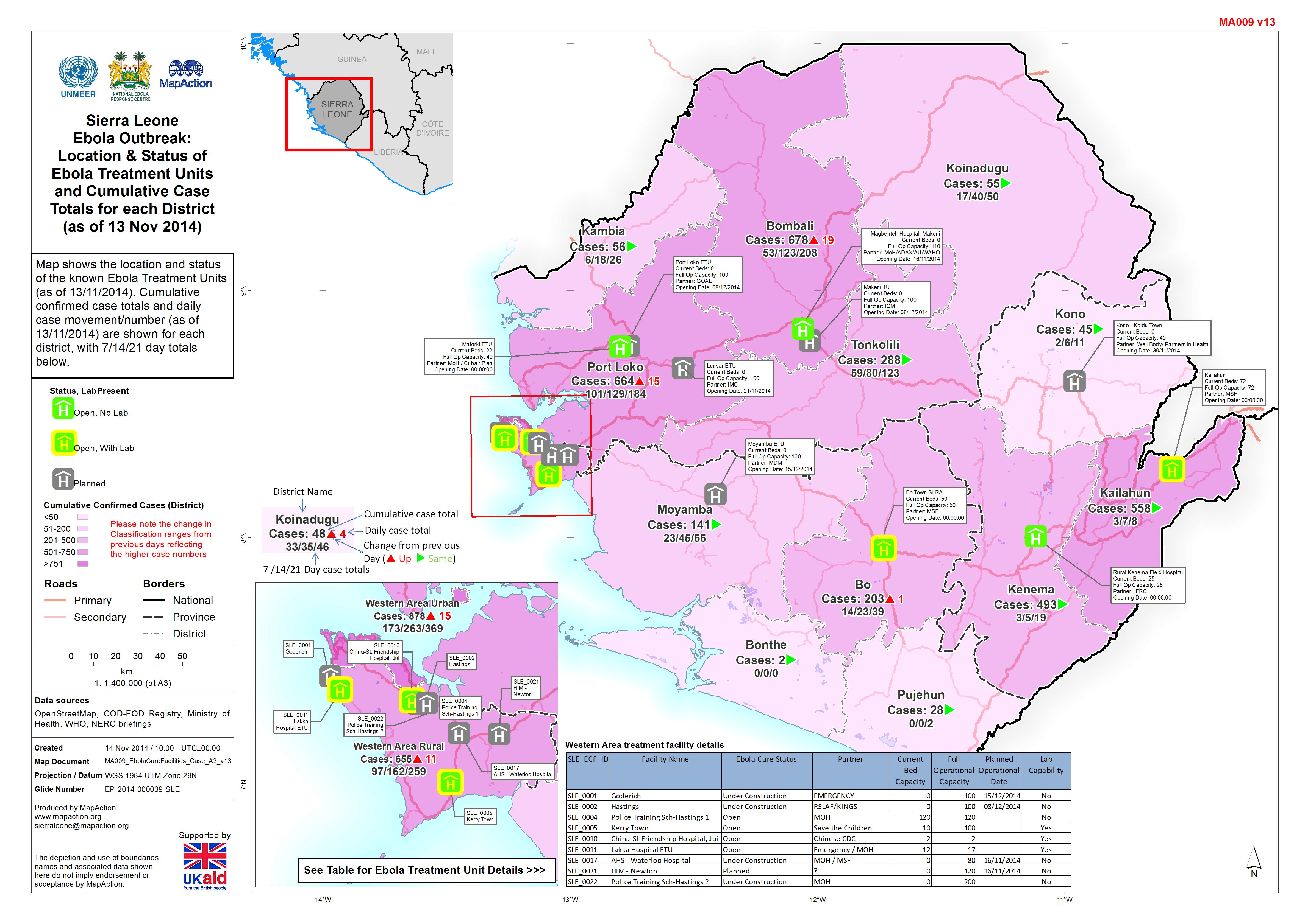
Sierra Leone Ebola Outbreak:Location & Status ofEbola Treatment Unitsand Cumu...
Map shows the location and status of the known Ebola Treatment Units (as of 13/11/2014). Cumulative confirmed case totals and daily case movement/number (as of 13/11/2014) are...