-
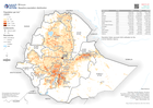
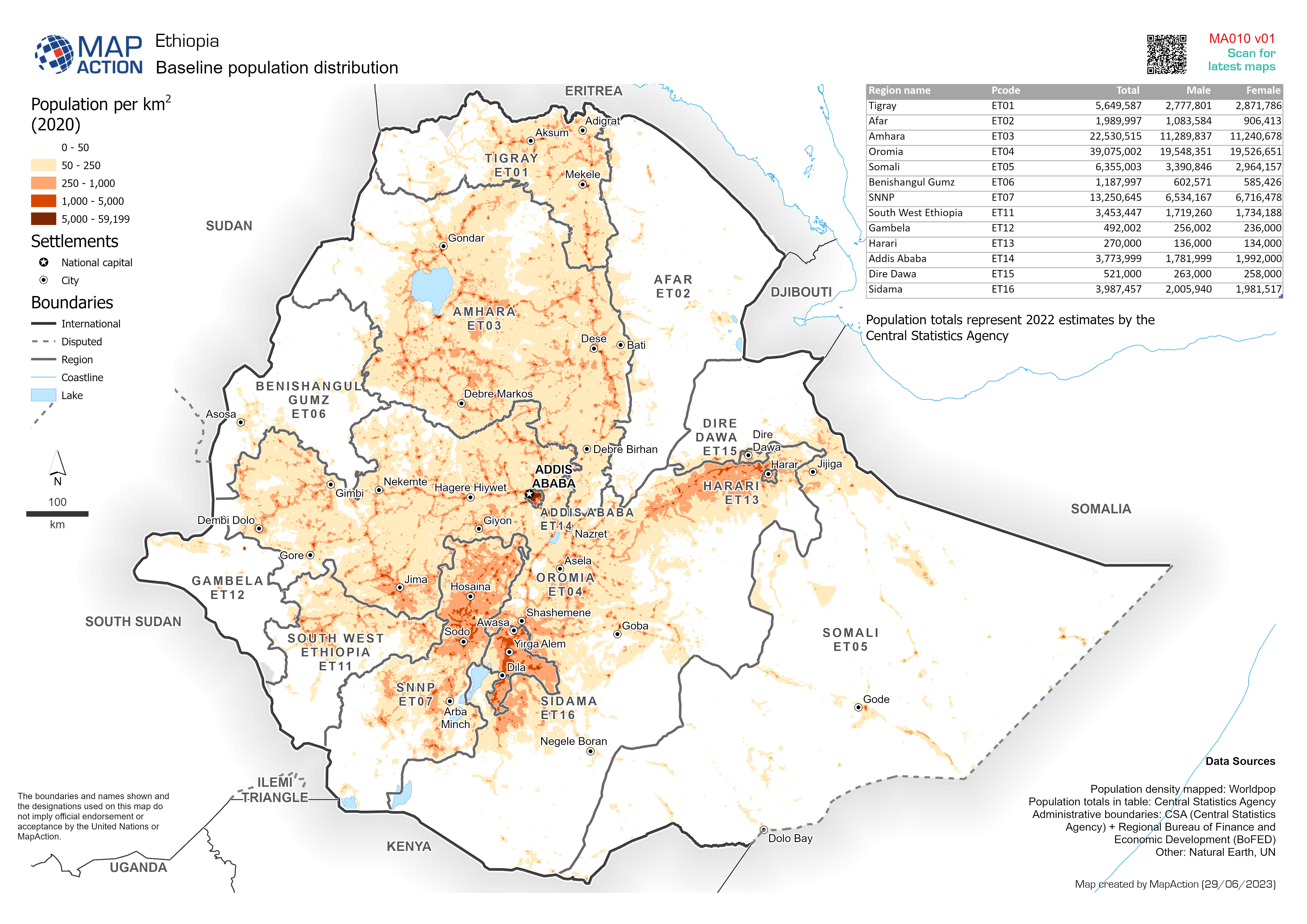
Baseline population distribution
Baseline population. Population density shown is Worldpop estimate for 2020. Population totals represent 2022 estimates by the Central Statistics Agency -
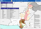
Pakistan Logistics Cluster - Who, What, Where by District - 19 August 2010
This dataset has no description
-

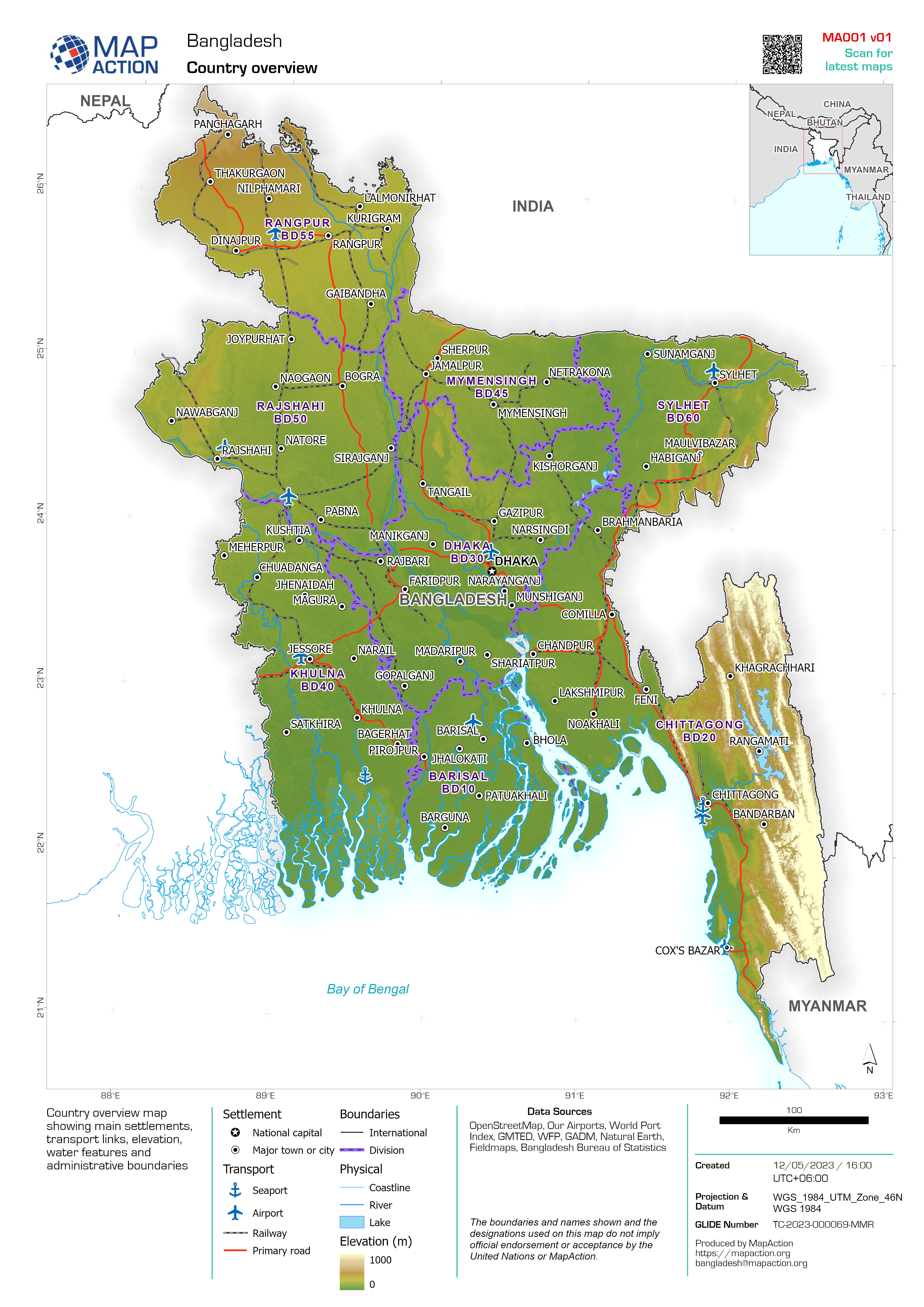
Country overview
Example: Country overview showing administrative boundaries, main settlements, transport infrastructure and natural features -

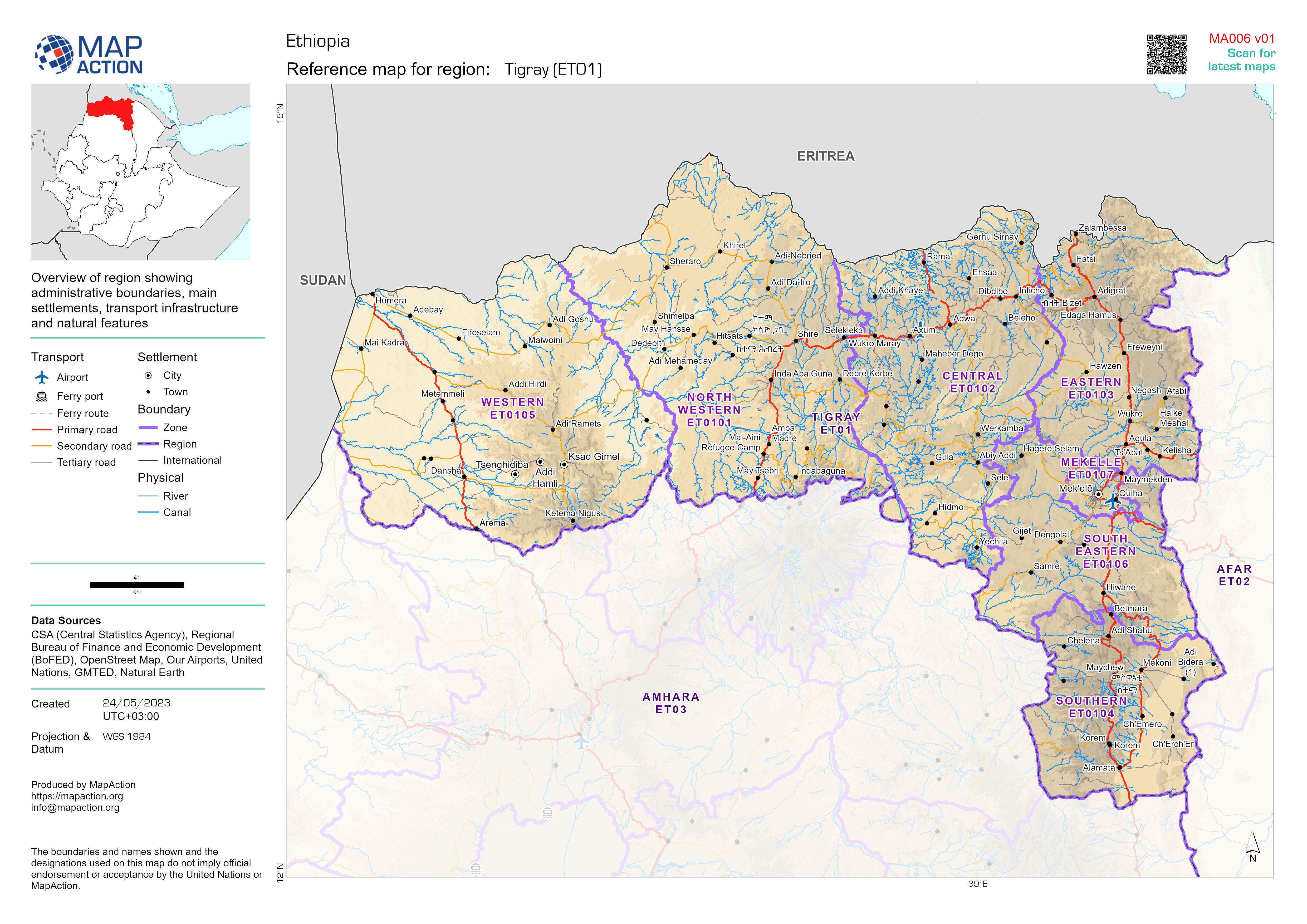
Administrative Boundaries: Districts (admin level 2)
Map atlas of district boundaries (admin level 2) within region (admin level 1) and main settlements -

Baseline population estimates
Tables and graphs based upon population data for 2019 from Pakistan Bureau of Statistics. Population density shown on map is based on Worldpop estimate for 2020 -

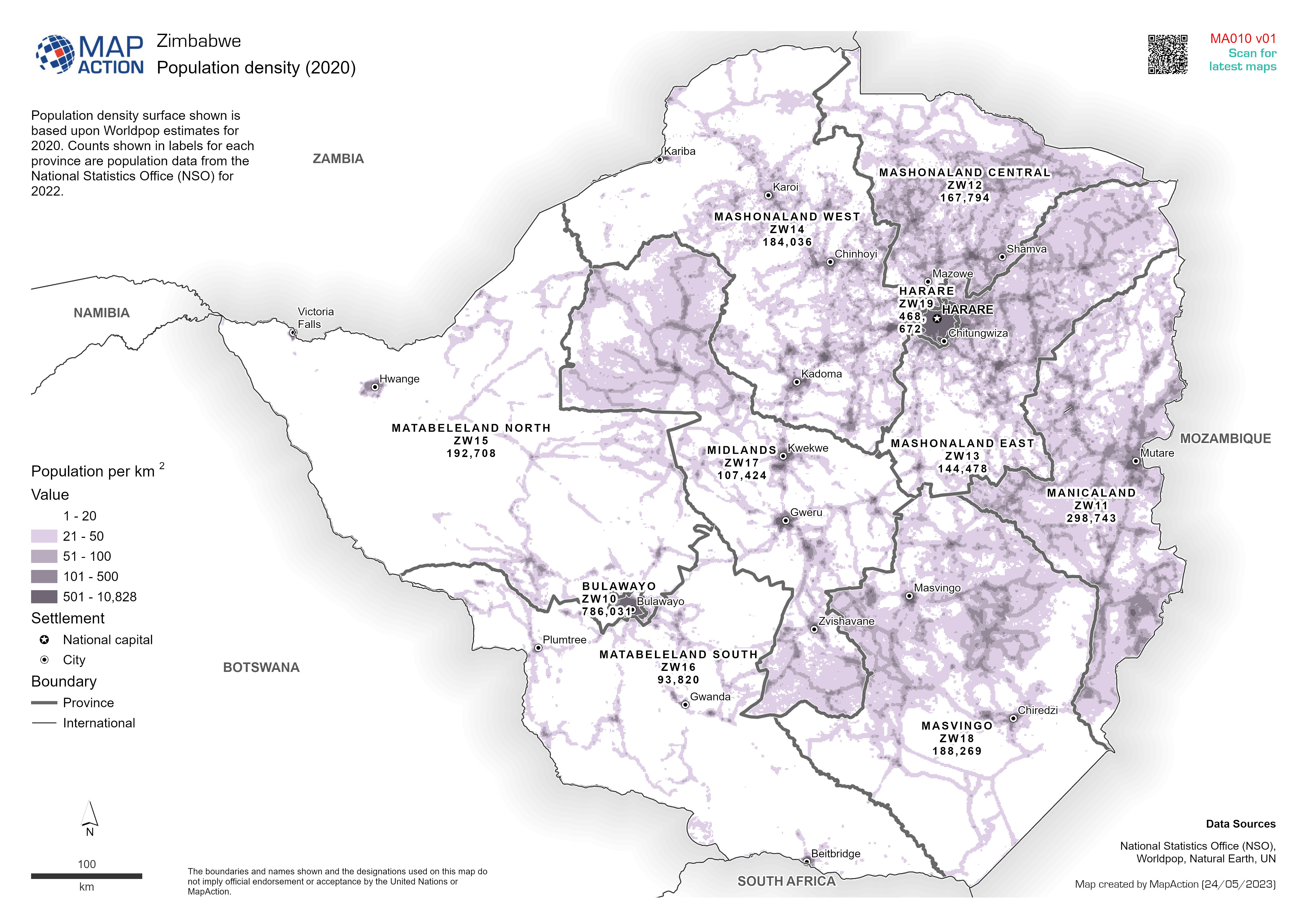
Population density (2020)
Population density surface shown is based upon Worldpop estimates for 2020. Counts shown in labels for each province are population data from the National Statistics Office... -

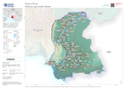
Divisions (administrative level 1)
Overview map showing divisions (administrative level 1) with main settlements -

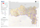
State boundaries (administrative level 1)
State boundaries (administrative level 1) and main settlements -

Storm path tropical cyclone Mocha (as of 15 May 2023) with baseline populatio...
Storm path as reported by Joint Typhoon Warning Centre. Population totals in table are 2022 estimates by UNFPA and US Census Bureau (USCB). Baseline population distribution... -

Storm path tropical cyclone Mocha (as of 14 May 2023) with baseline populatio...
Storm path as reported by Joint Typhoon Warning Centre. Population totals in table are 2022 estimates by UNFPA and US Census Bureau (USCB). Baseline population distribution... -

Reference Map of States, Nigeria
State overview showing administrative boundaries, main settlements, transport infrastructure and natural features. -

Baseline population for 2022
Population totals in table are 2022 estimates by UNFPA and US Census Bureau (USCB) Baseline population distribution mapped is 2022 estimates by Kontur -

Country overview
Country overview map showing main settlements, transport links, elevation, water features and administrative boundaries -

Población impactada con respecto a la poblacion total 2022: Tumbes - (datos r...
Representación de la población impactada por inundación entre en el departamentos de Tumbes. -

Número de personas en albergues: Piura - (datos reportados Mayo 11, 2023).
Representación de la población impactada y la población en albergues en el departamentos de Piura. -

Número de personas en albergues: Piura - (datos reportados Mayo 04, 2023).
Representación de la población impactada y la población en albergues en el departamentos de Piura.

