-

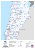
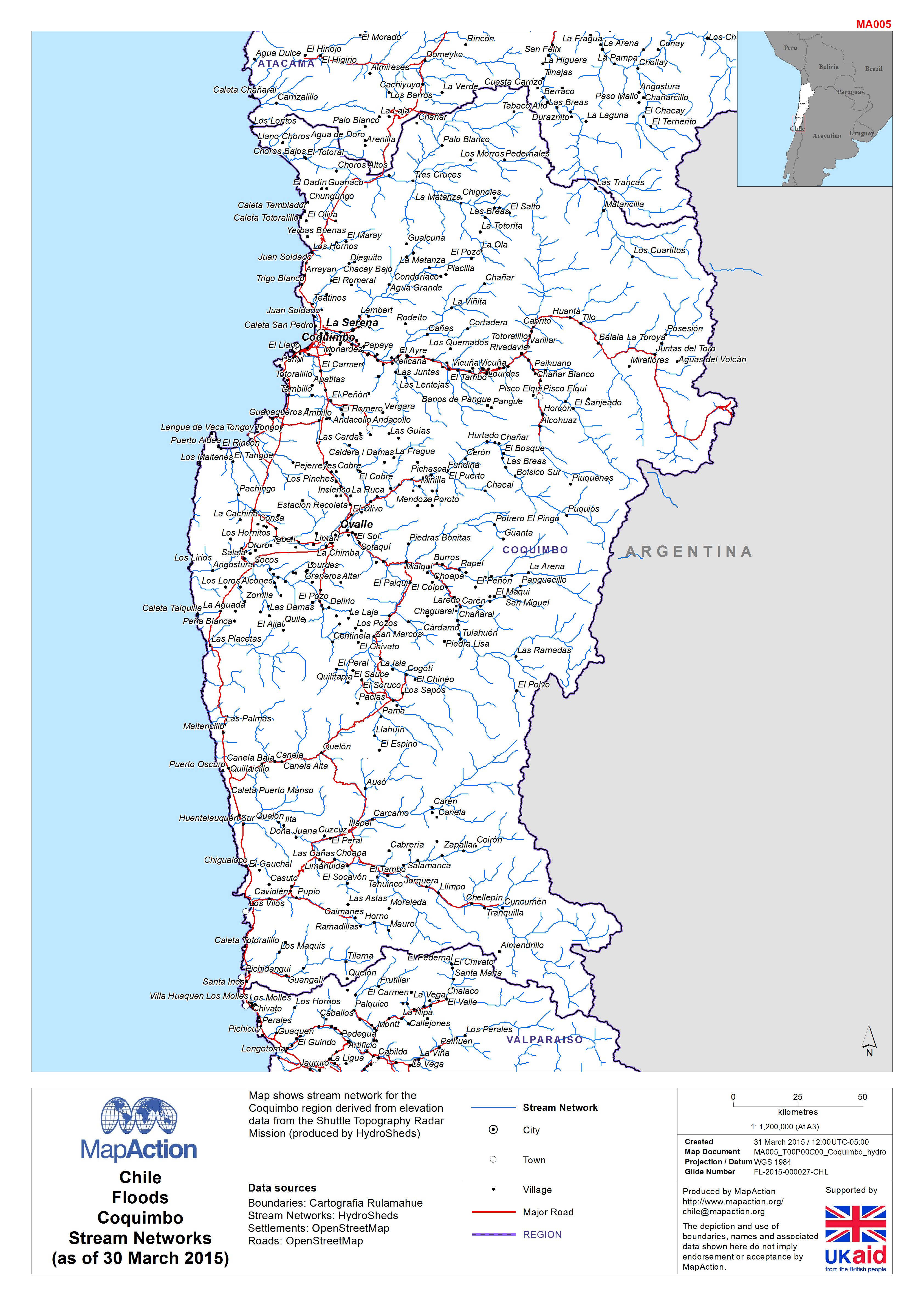
Chile: Floods - CoquimboStream Networks(as of 30 March 2015)
Map shows stream network for the Coquimbo region derived from elevation data from the Shuttle Topography Radar Mission (produced by HydroSheds) -
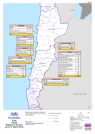
Chile: Floods - AtacamaStream Network(as of 30 March 2015)
Map shows stream network for the Atacama region derived from elevation data from the Shuttle Topography Radar Mission (produced by HydroSheds) -
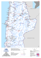
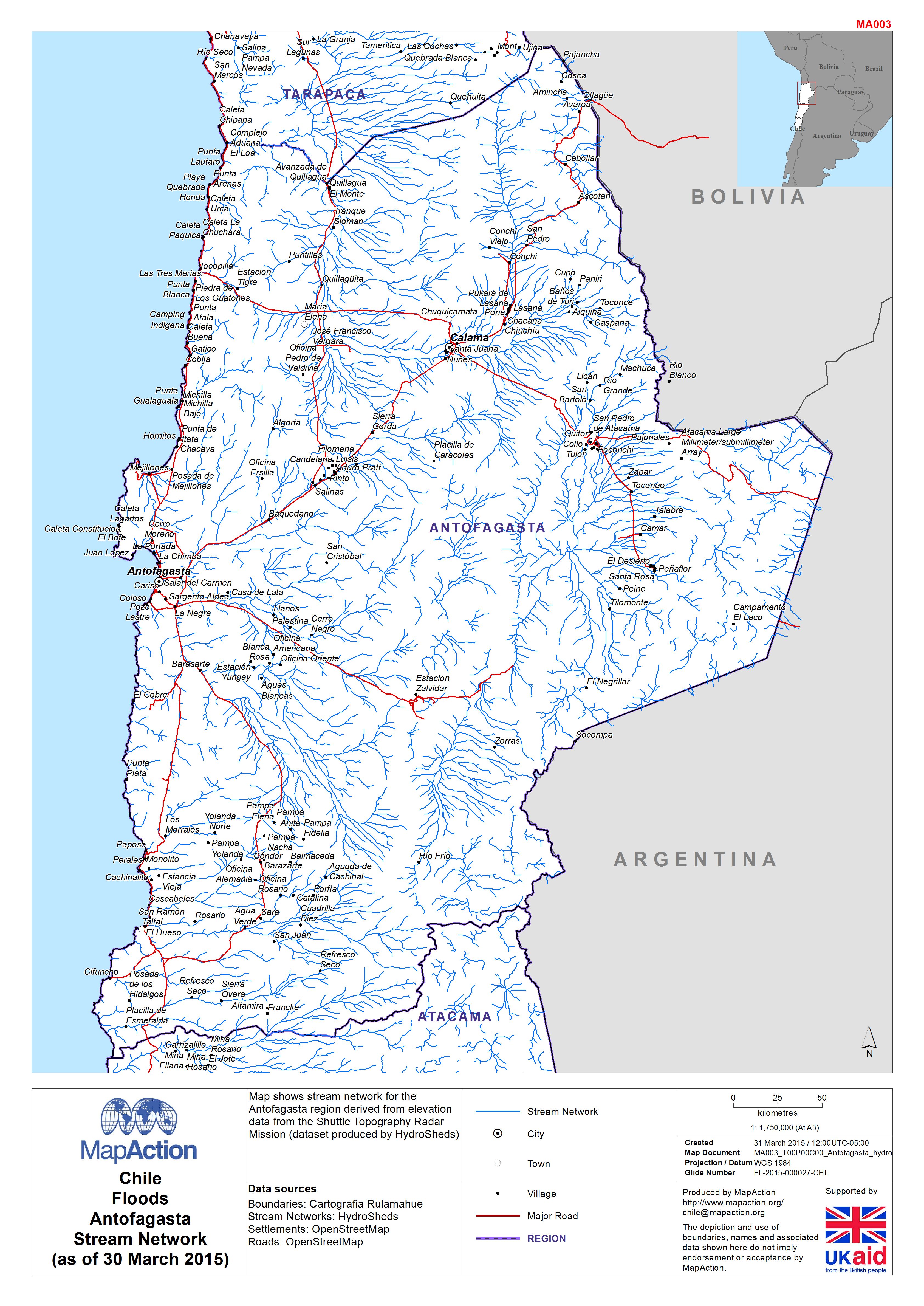
Chile: Floods - Antofagasta Stream Network(as of 30 March 2015)
Map shows stream network for the Antofagasta region derived from elevation data from the Shuttle Topography Radar Mission (dataset produced by HydroSheds) -
Chile FloodsShelters in Schools (as of 31 March 2015)
Map provides information on shelters in schools within affected areas of Atacama and Antofagasta -

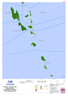
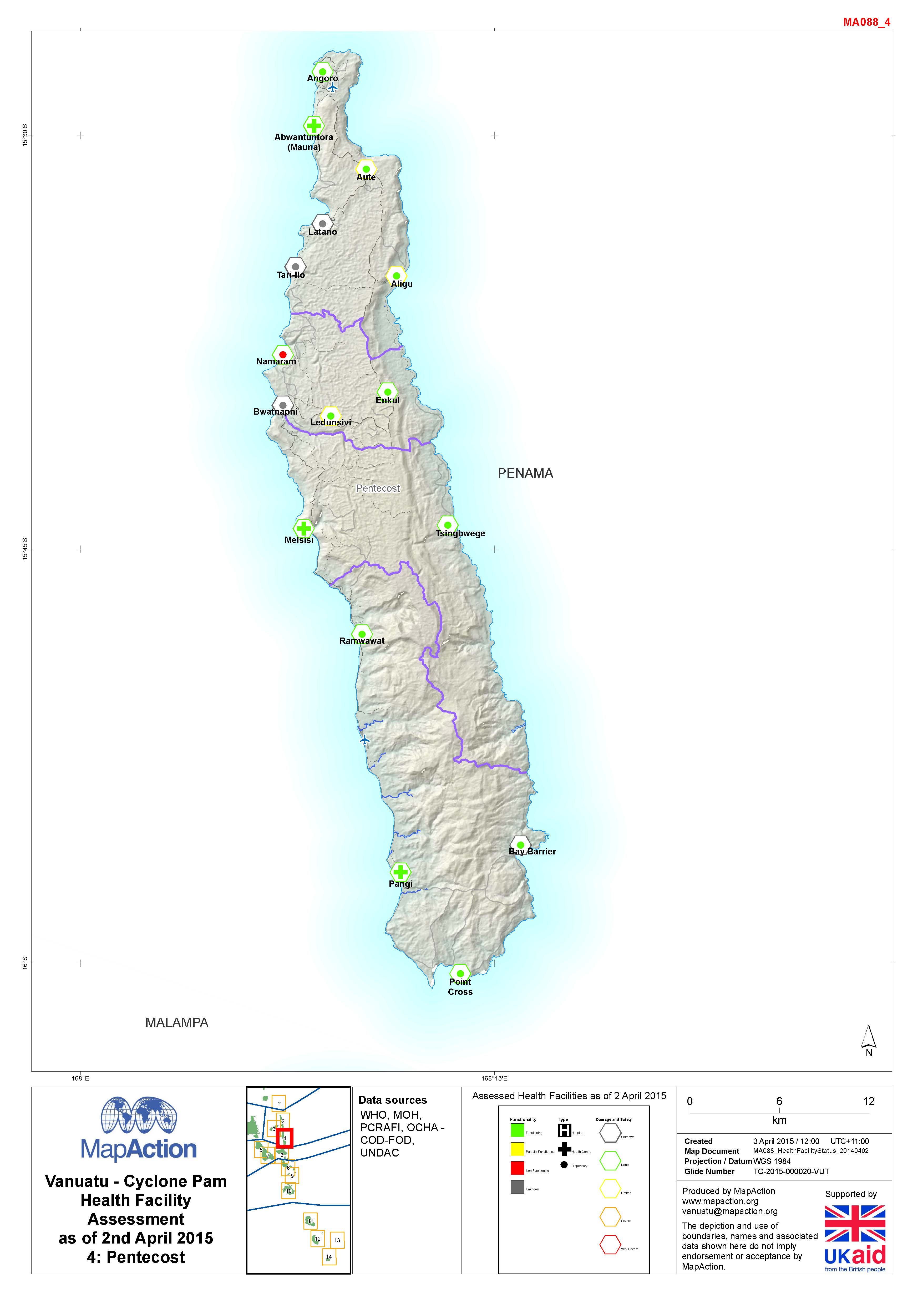
Vanuatu - Cyclone PAM Health Facility Assessment (as of 2 April 2015)
Assessed Health Facilities as of 2 April 2015. -
Vanuatu - Cyclone PAM Location and status of the Foreign Medical Teams(FMTs) ...
Maps show the type, team size, location and status of the Foreign Medical Teams (FMTs) in Vanuatu. -
Vanuatu - Cyclone PAM Health Facility Assessment Summary as of 2nd April 2015
Summary of assessed Health Facilities as of 2 April 2015 -

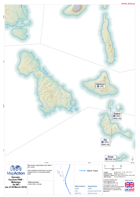
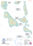
Vanuatu: Cyclone PAM - Assessment Field Maps - Penama (and Mere Lava) Sheet: ...
Large scale reference maps for assessment field teams -
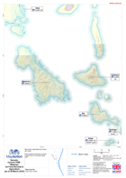
Vanuatu: Cyclone PAM - Assessment Field Maps - Penama (and Mere Lava) Sheet: ...
Large scale reference maps for assessment field teams. -
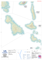
Vanuatu: Cyclone PAM - Assessment Field Maps - Penama (and Mere Lava) Sheet: ...
Large scale reference maps for assessment field teams. -
Vanuatu: Cyclone PAM - Assessment Field Maps - Penama (and Mere Lava) Sheet: ...
Large scale reference maps for assessment field teams. -
Vanuatu: Cyclone PAM - Assessment Field Maps - Penama (and Mere Lava) Sheet: ...
Large scale reference maps for assessment field teams -
Vanuatu: Cyclone PAM - Assessment Field Maps - Penama (and Mere Lava) Sheet: ...
Large scale reference maps for assessment field teams. -
Vanuatu: Cyclone PAM - Assessment Field Maps - Penama (and Mere Lava) Sheet: ...
Large scale reference maps for assessment field teams. -

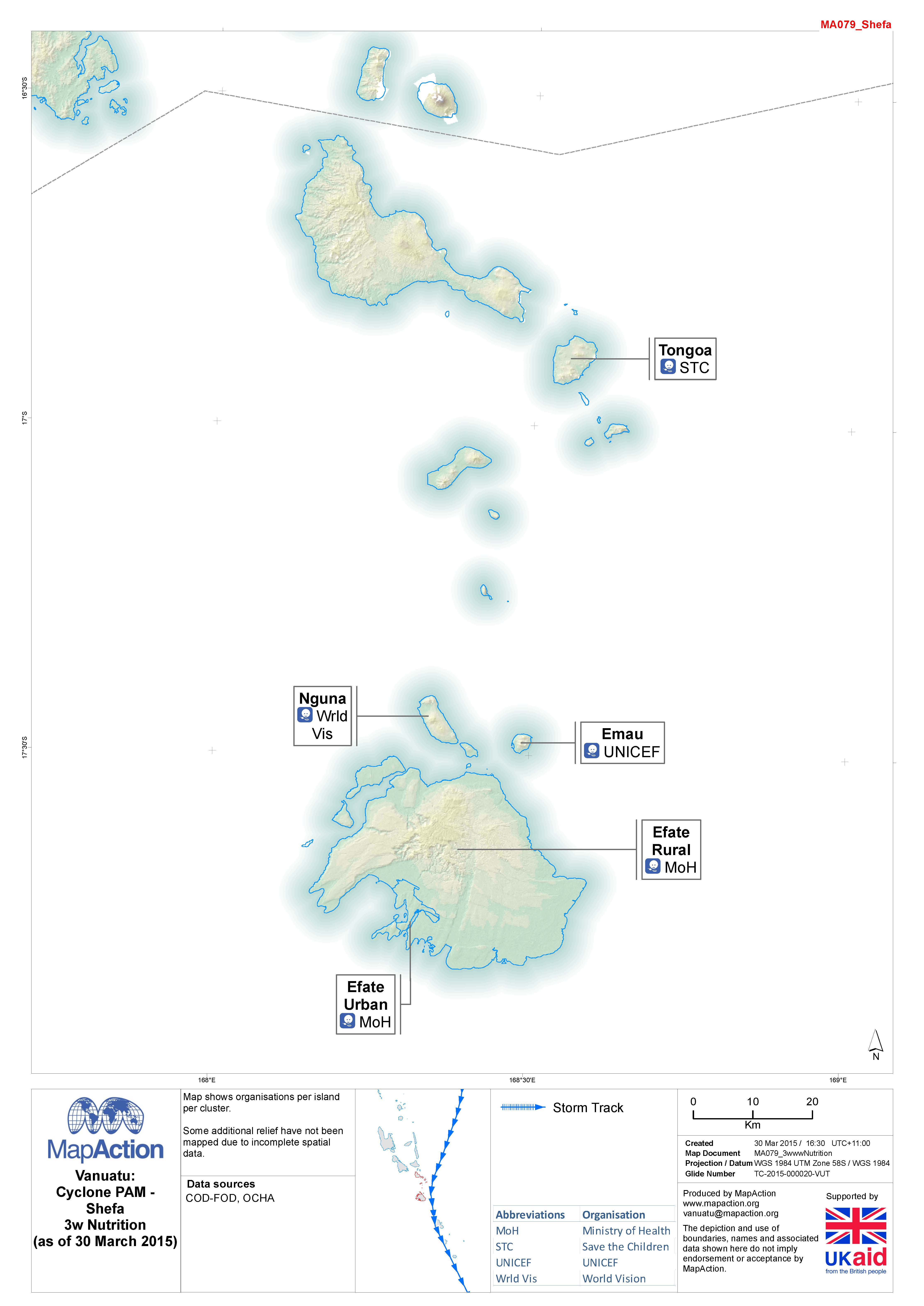
Vanuatu: Cyclone PAM - 3w Nutrition (as of 30 March 2015)
Map shows organisations per island for the Nutrition sector (as of 30 March 2015) -

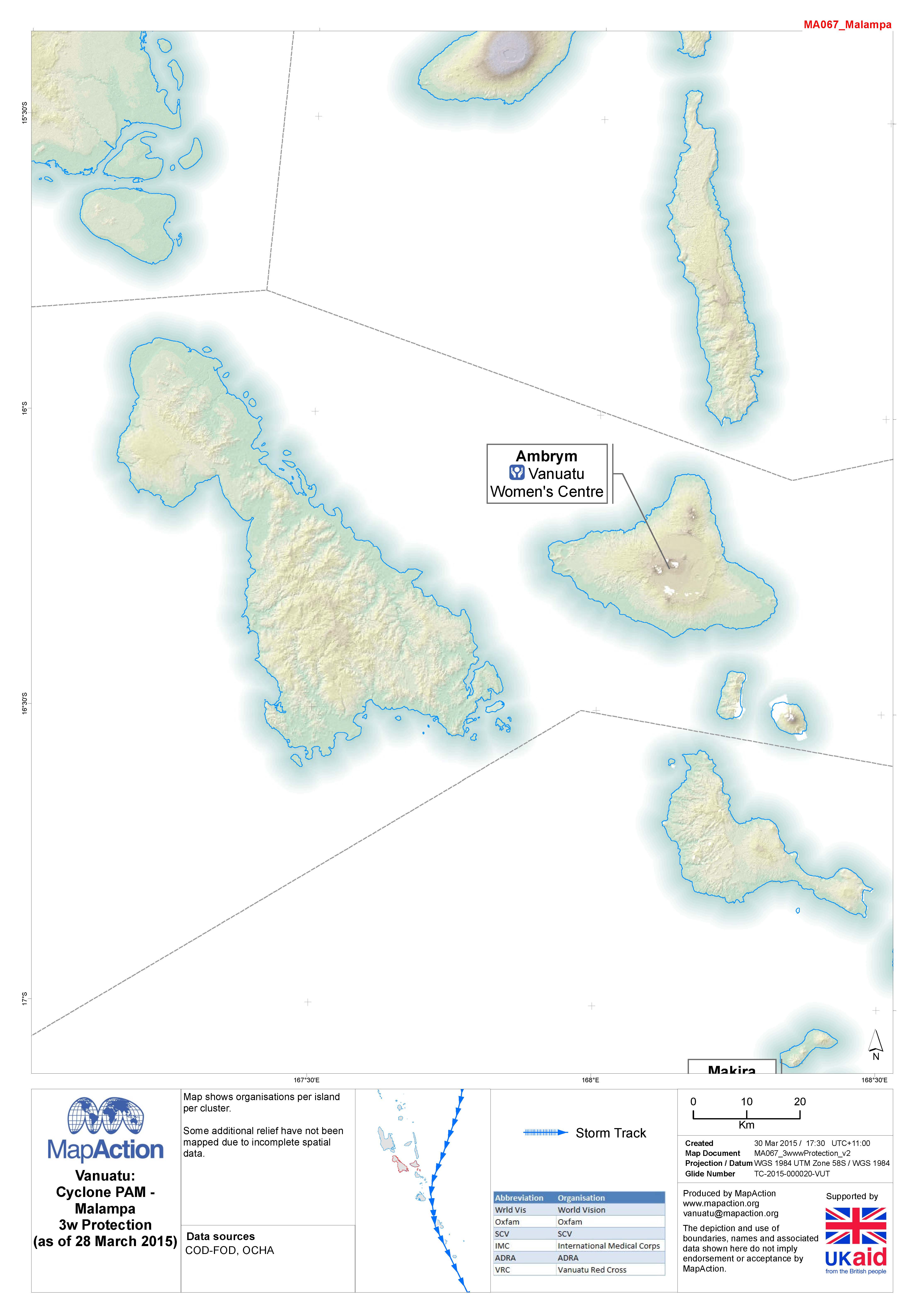
Vanuatu: Cyclone PAM - 3w Protection (as of 28 March 2015)
Map shows organisations per island in the Protection Cluster (as of 28 March 2015) -
Vanuatu: Cyclone PAM - 3w NFI (as of 28 March 2015)
Map shows organisations per island for the Non Food Items (NFI) cluster -
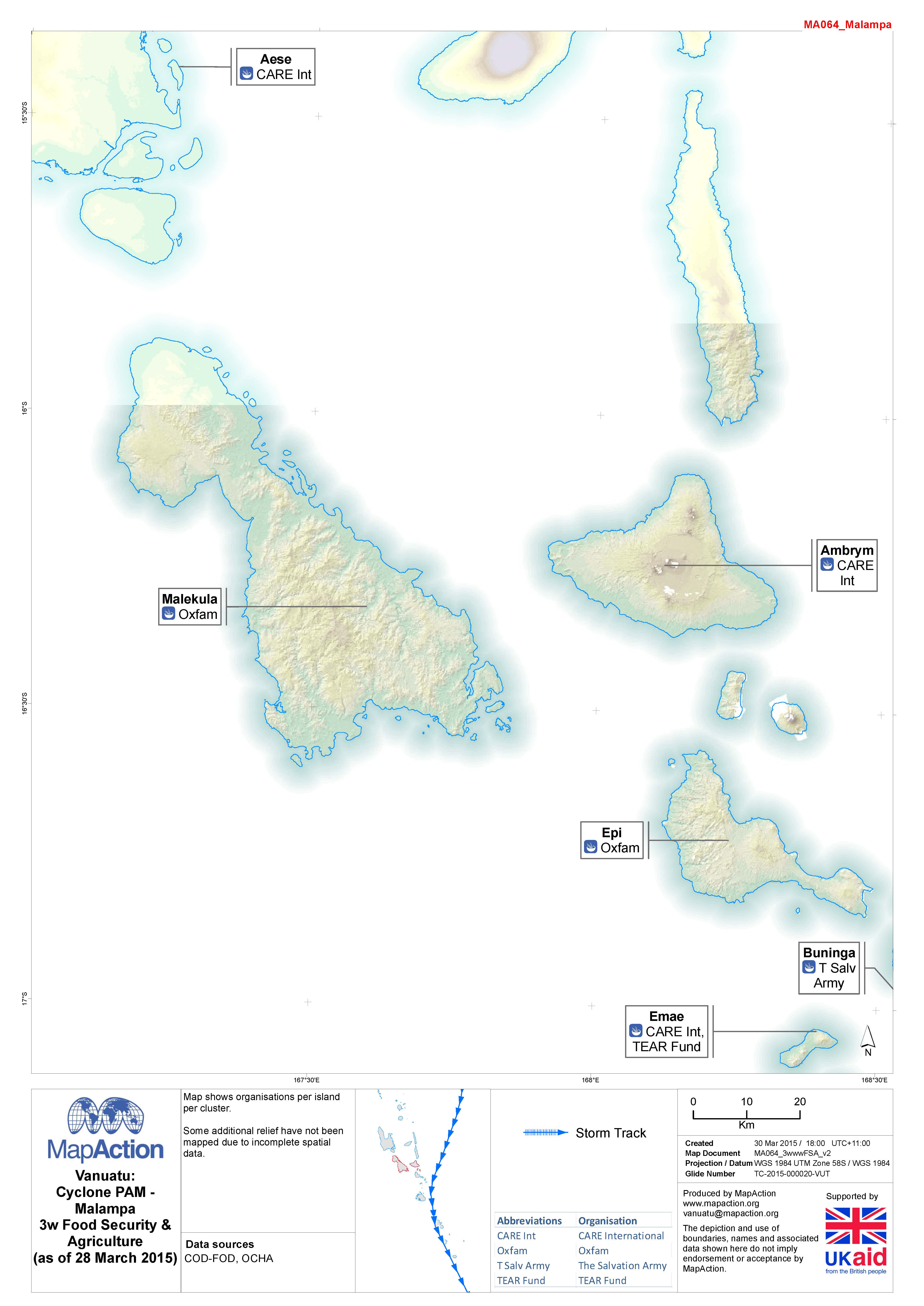
Vanuatu: Cyclone PAM - 3w FSA (as of 28 March 2015)
Map shows organisations per island for the Food Security & Agriculture (FSA) cluster. -
Vanuatu: Cyclone PAM - 3w Shelter (as of 28 March 2015)
Map shows organisations per island for the Shelter cluster. -
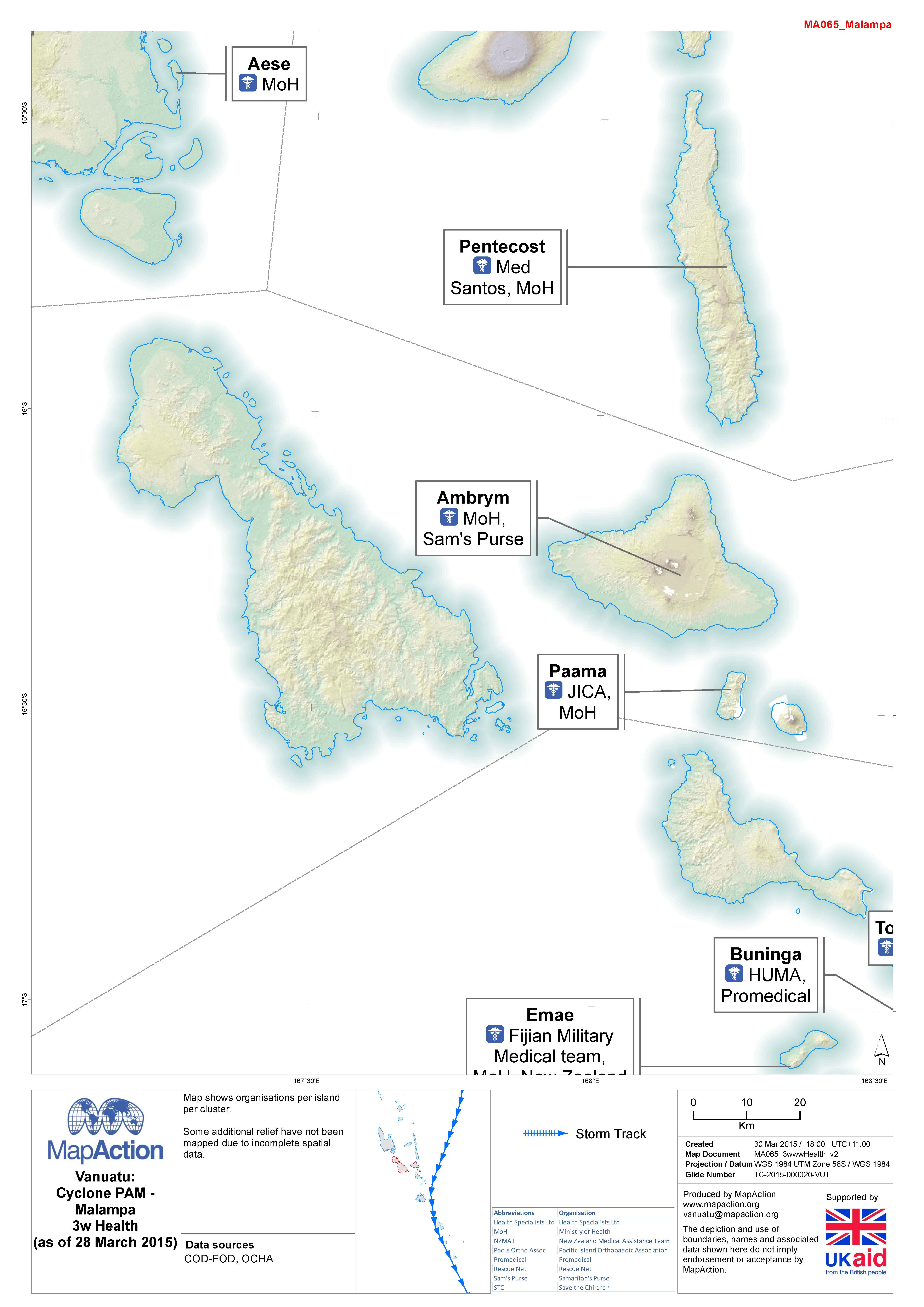
Vanuatu: Cyclone PAM - 3w Health (as of 28 March 2015)
Map shows oranisations per island per health cluster as of 28 March 2015