-
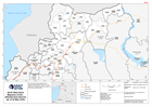
North West Syria Migration Crisis - Affected Sub-districts (as of 04 May 2020)
This map shows the affected sub-districts (administration level 3) in the Aleppo and Idleb governorate regions of the Syrian Arab Republic. -

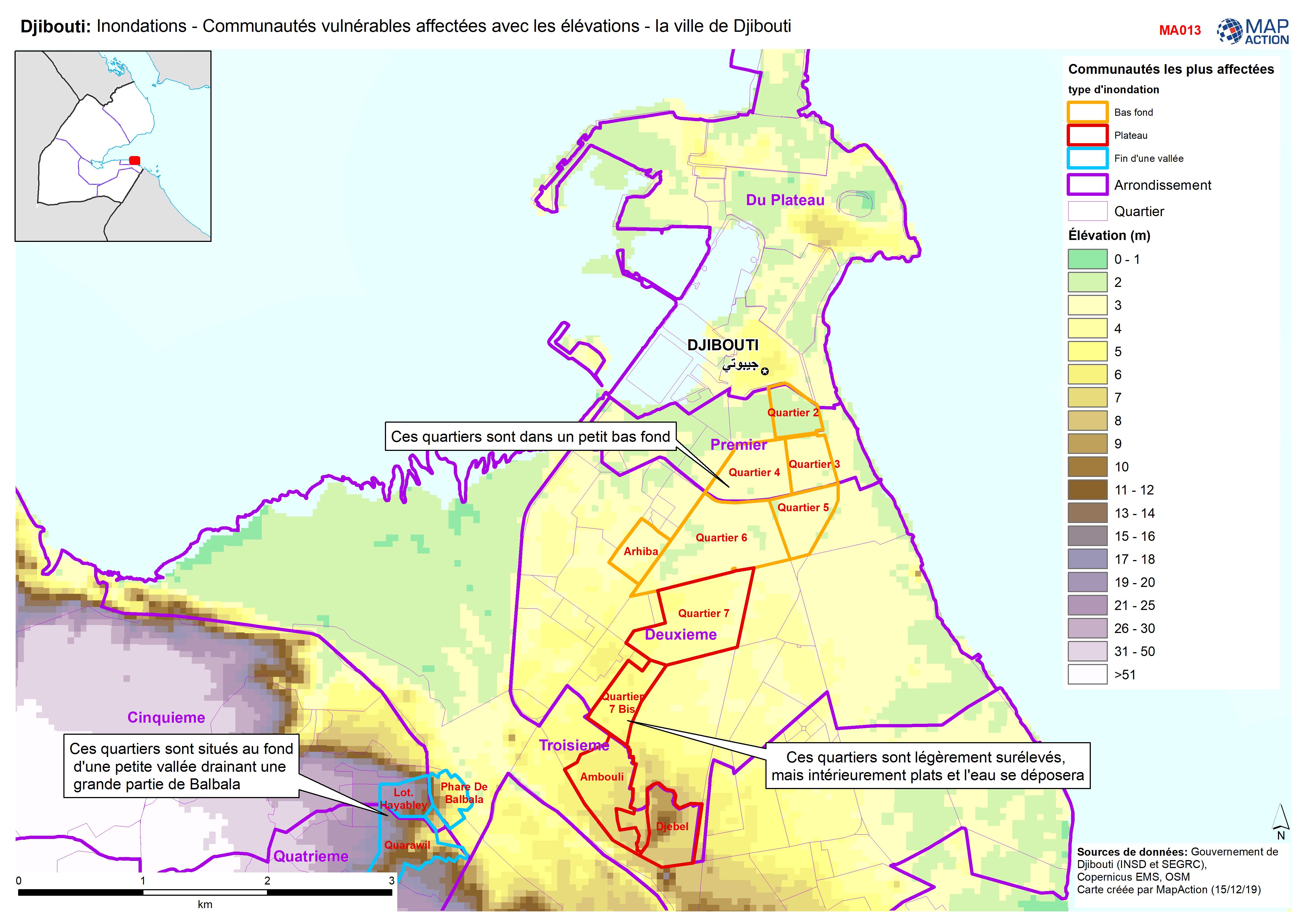
Djibouti: Inondations - Communautés vulnérables affectées avec les élévations...
Djibouti City - Map shows the most affected flooded communities, containing the most vulnerable populations, alongside elevation data to demonstrate the effects of elevation and... -

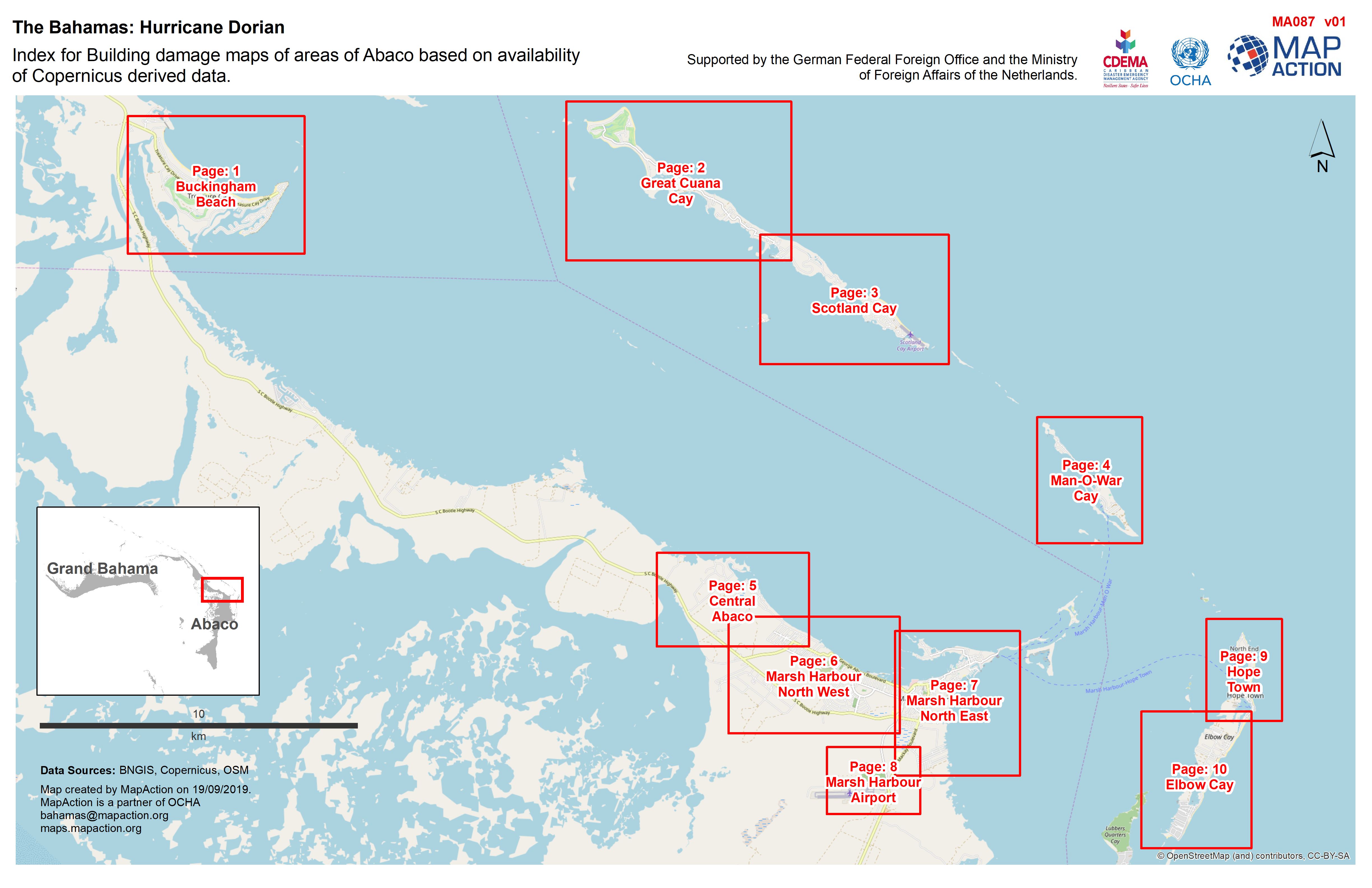
Index for Building damage maps of areas of Abaco based on availability of Cop...
Building damage in areas of Abaco and surrounding islands -
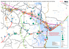
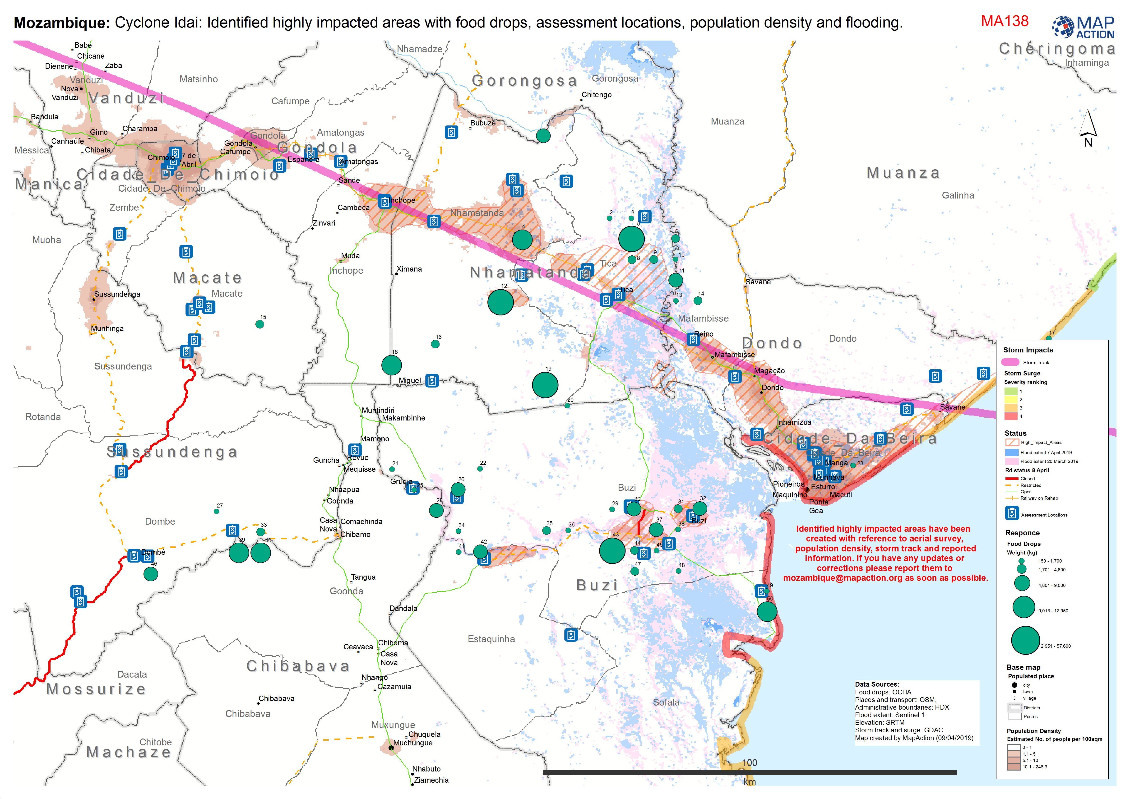
Mozambique: Cyclone Idai: Identified highly impacted areas with food drops, a...
Situation map showing areas of high impact, assessment locations, access and food drops to date. As at 9 April 2019. -

Mozambique: Reference map of flood effected postos
Map displays flood extent (as of 31.03.2018) for effected postos with additional reference data including physical and transport features. This is a "Map Book" and contains 17... -

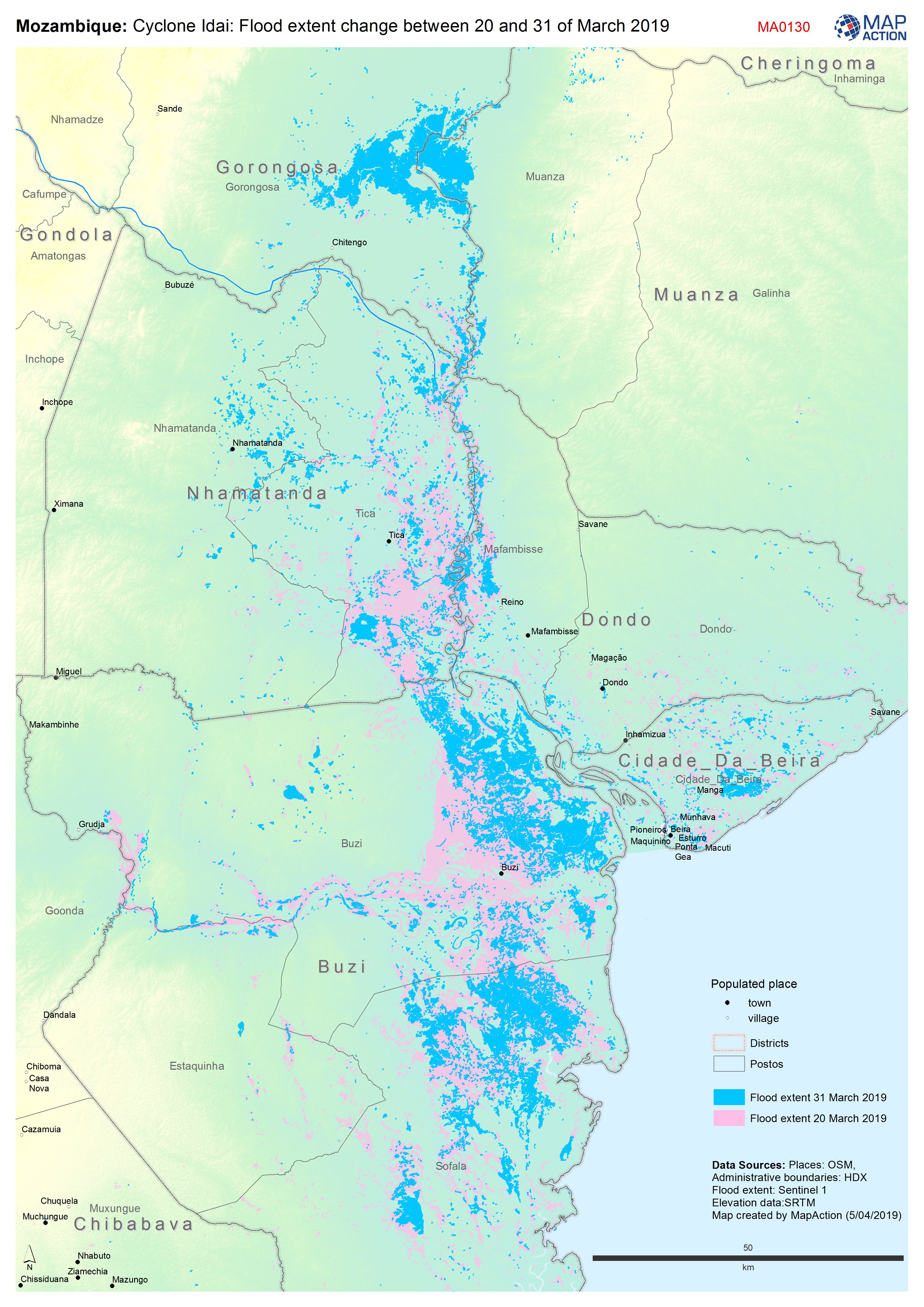
Mozambique: Cyclone Idai: Flood extent change between 20th and 31st March 2019
Map shows the change in flood extent between the 20th and 31st March -
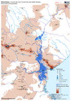
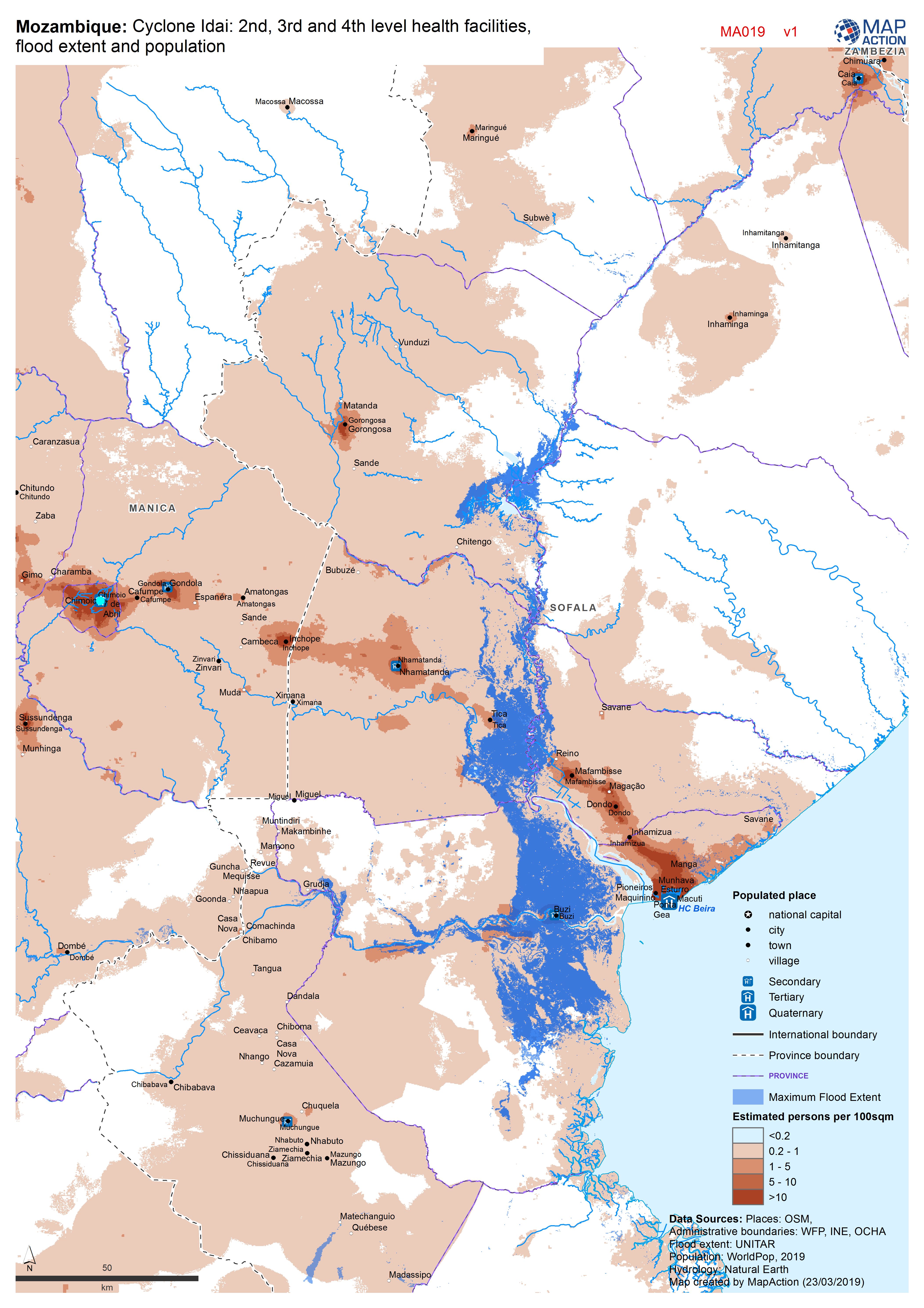
Mozambique: Cyclone Idai - 2nd, 3rd and 4th level health facilities, flood ex...
Map shows the population (based on WorldPop at 100m resolution generating through AI) and the Flood Extents known as of 19/20 March 2019 plus Health facilities -

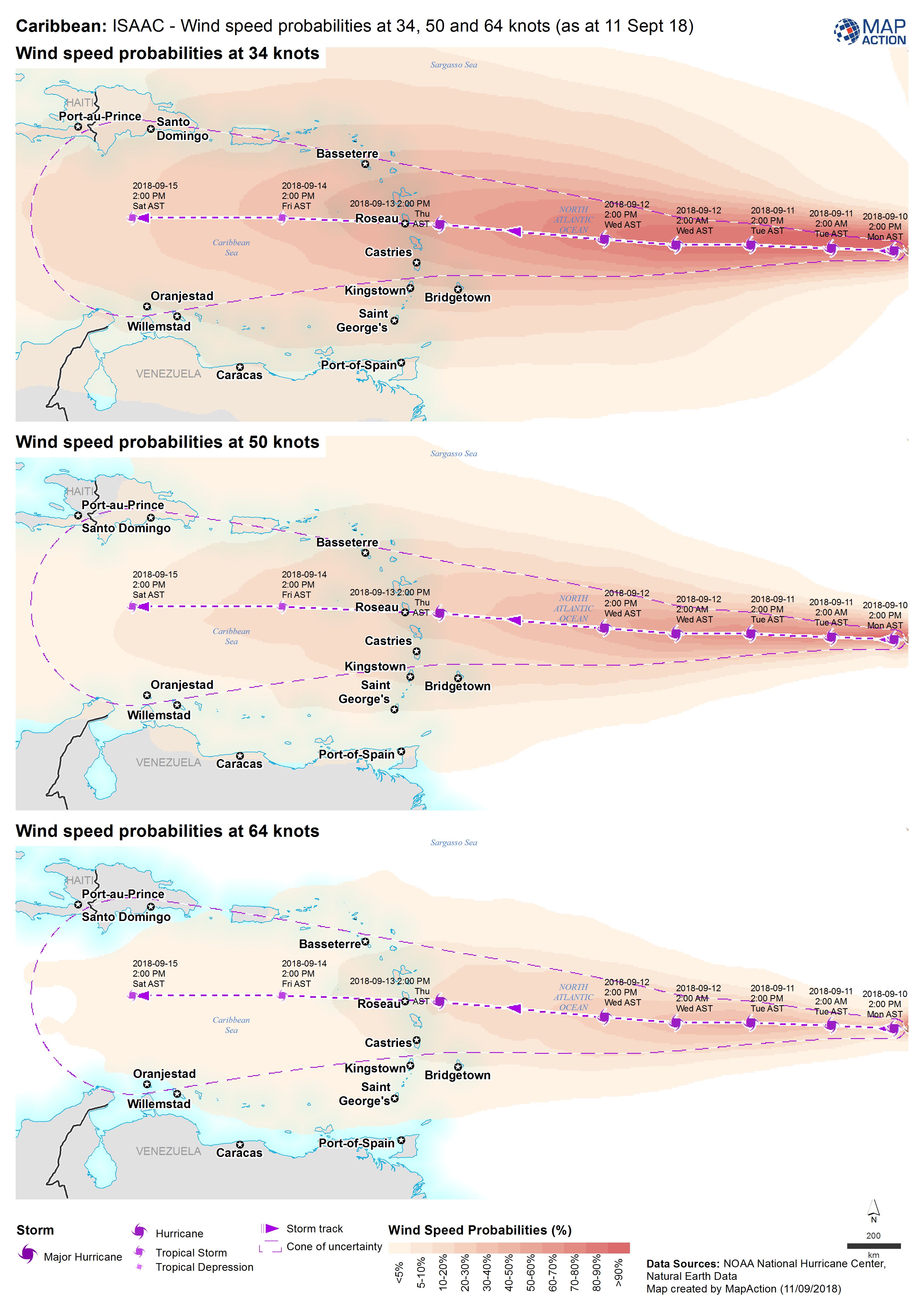
Caribbean: Isaac - Wind speed probabilities at 34, 50 and 64 knots (as at 11 ...
Map shows the wind probabilities at 34, 50 and 64 knots for Hurricane Isaac -

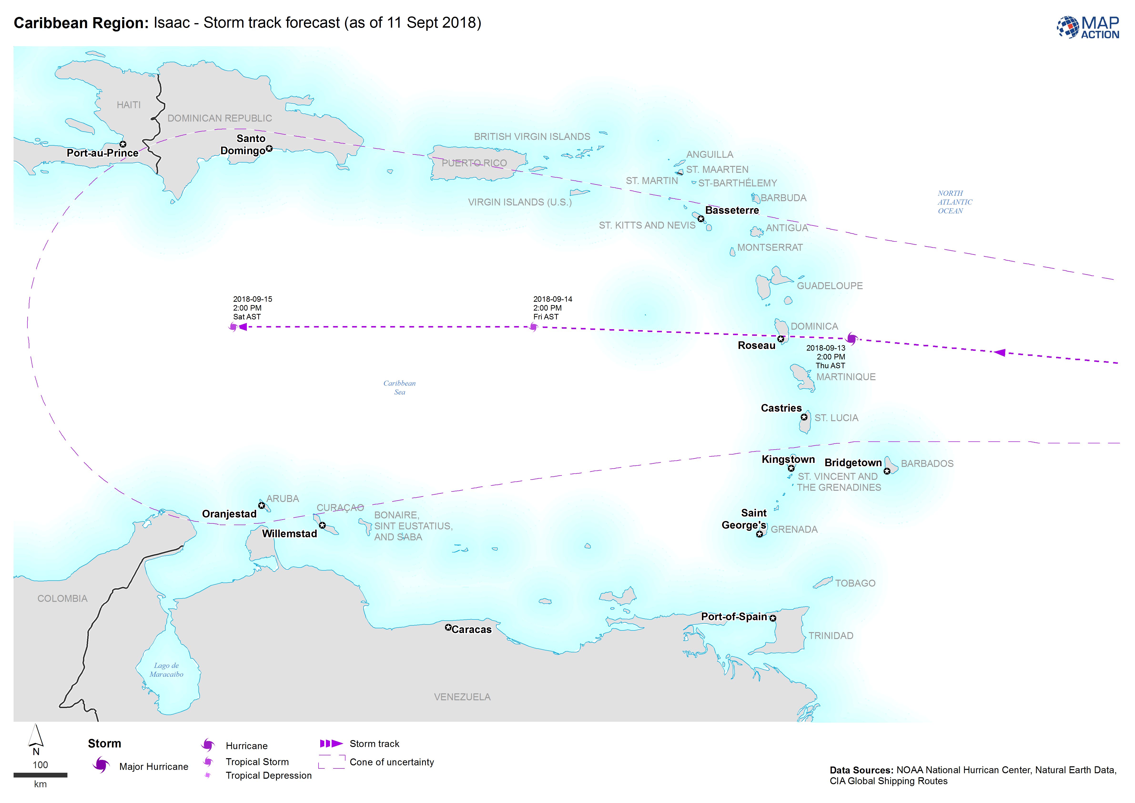
Caribbean Region: Isaac - Storm track forecast (as of 11 Sept 2018)
Map shows the the forecasted storm track for Hurricane Isaac -

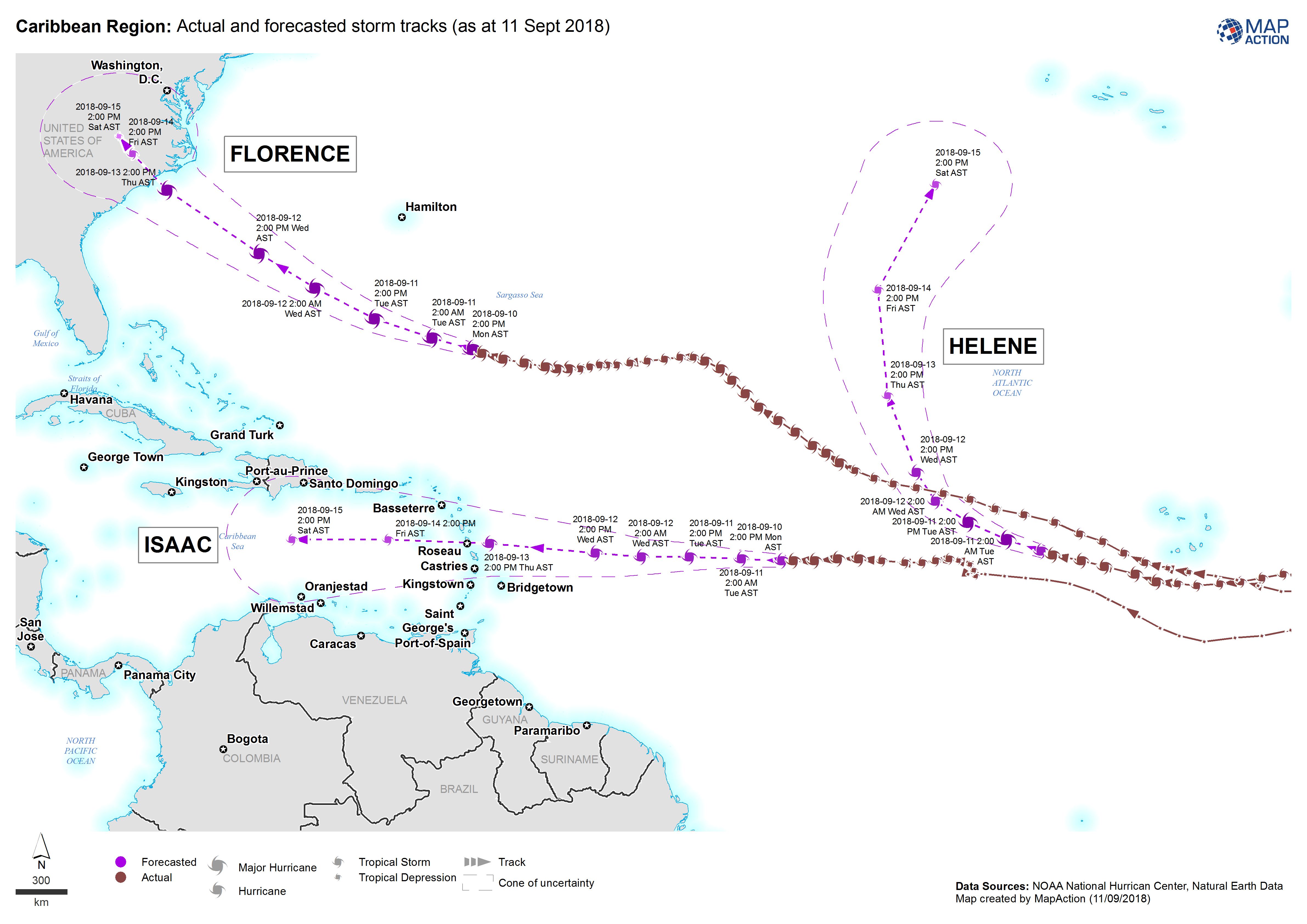
Caribbean Region: Actual and forecasted storm tracks (as at 11 Sept 2018)
Map shows the actual and forecasted storm tracks for Hurricanes Florence, Helene and Isaac -
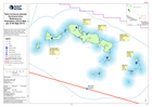
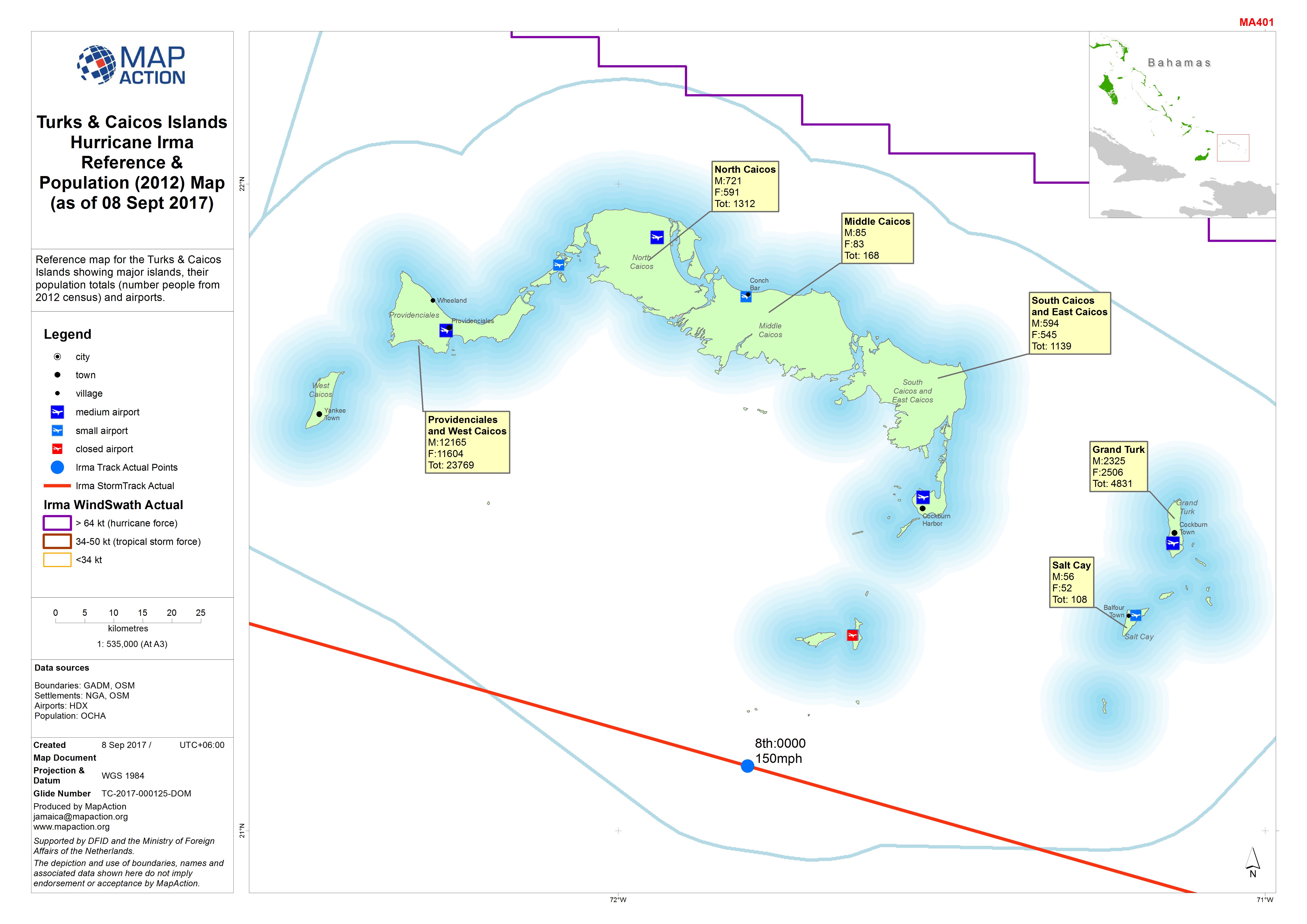
Turks & Caicos Islands Hurricane Irma Reference & Population (2012) Map (as o...
Reference map for the Turks & Caicos Islands showing major islands, their population totals (number people from 2012 census) and airports. -
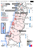
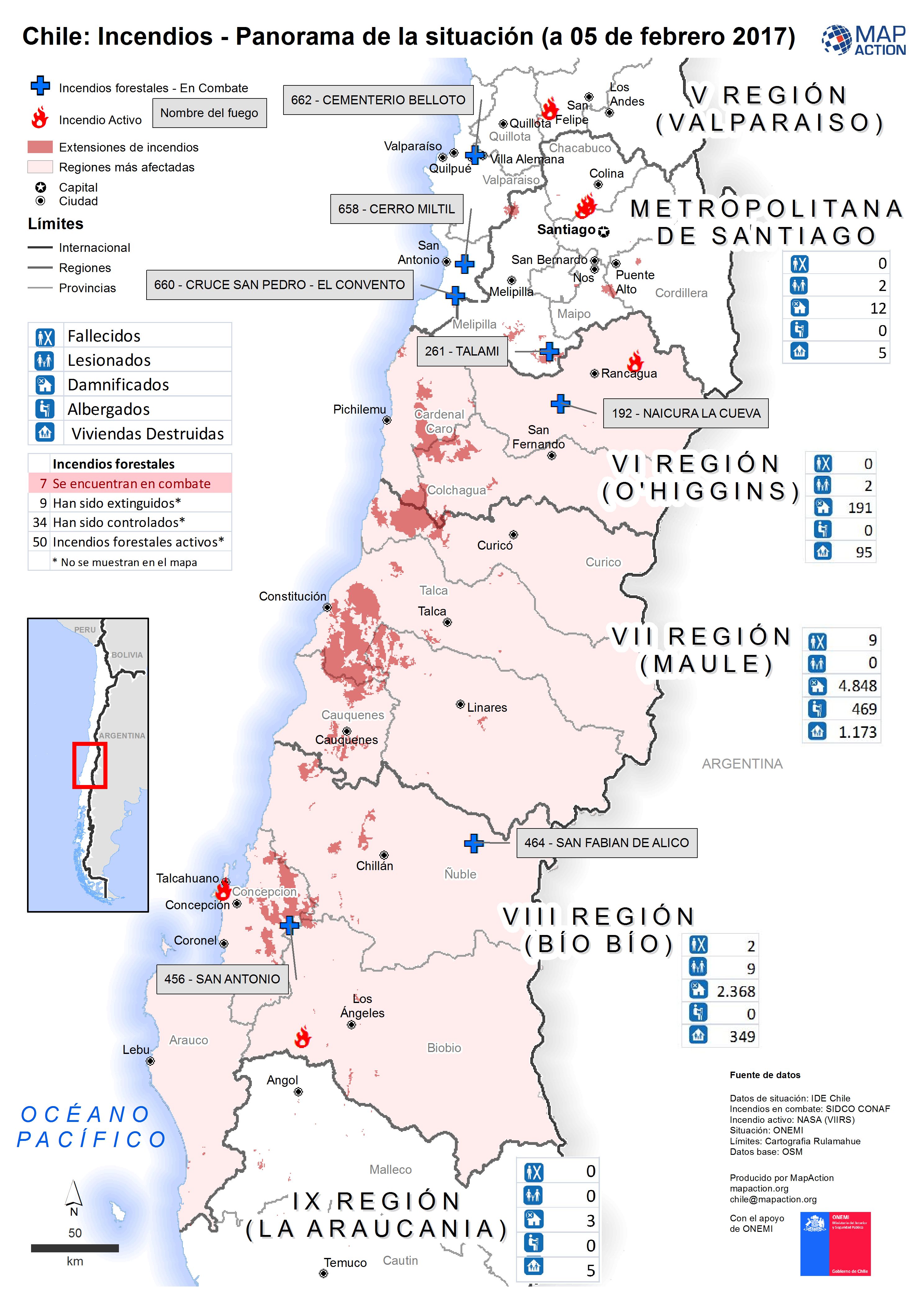
Chile: Incendios - Panorama de la situación (a 05 de febrero 2017)
Panorama de la situación de los Incendios Forestales (a 05 de febrero 2017) -

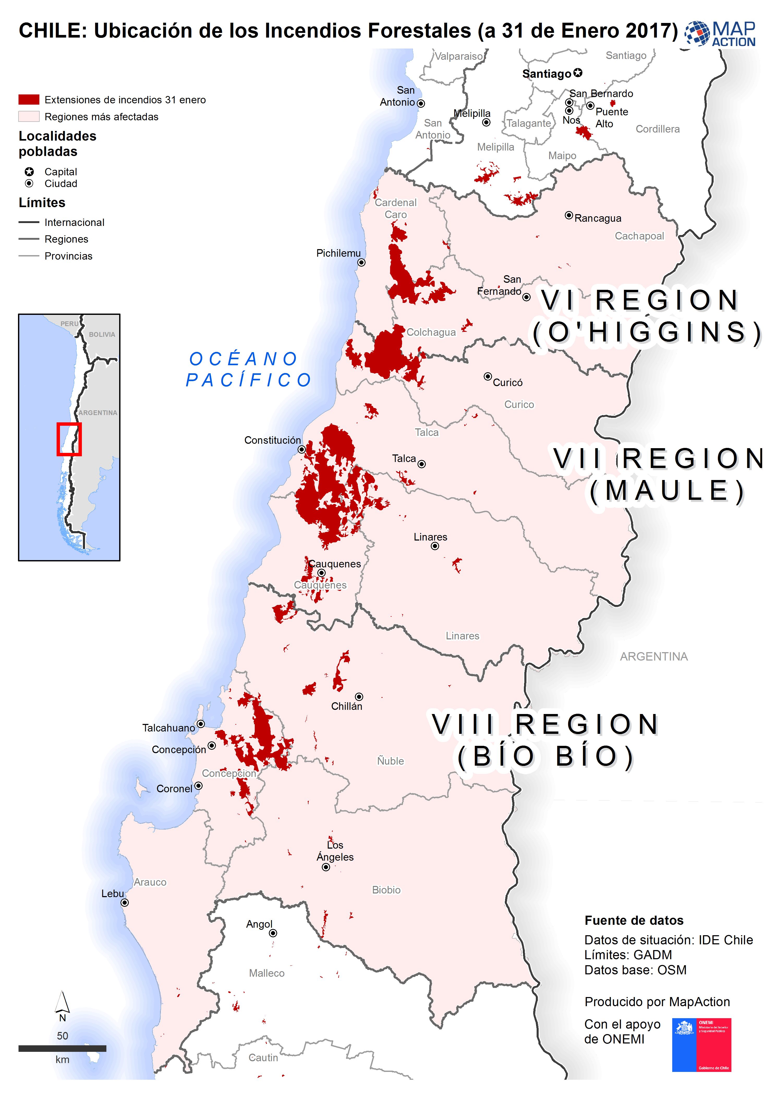
CHILE: Ubicación de los Incendios Forestales (a 31 de Enero 2017)
Ubicación de los incendios forestales (de 31 Enero 2017) -
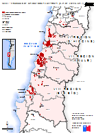
CHILE: Ubicación de los Incendios Forestales (a 31 de Enero 2017)
Ubicación de los incendios forestales (de 31 Enero 2017) -

CHILE: Ubicación de los Incendios Forestales (a 31 de Enero 2017)
Ubicación de los incendios forestales (de 31 Enero 2017) - Spanish Location of forest fires (31 January 2017) - English -

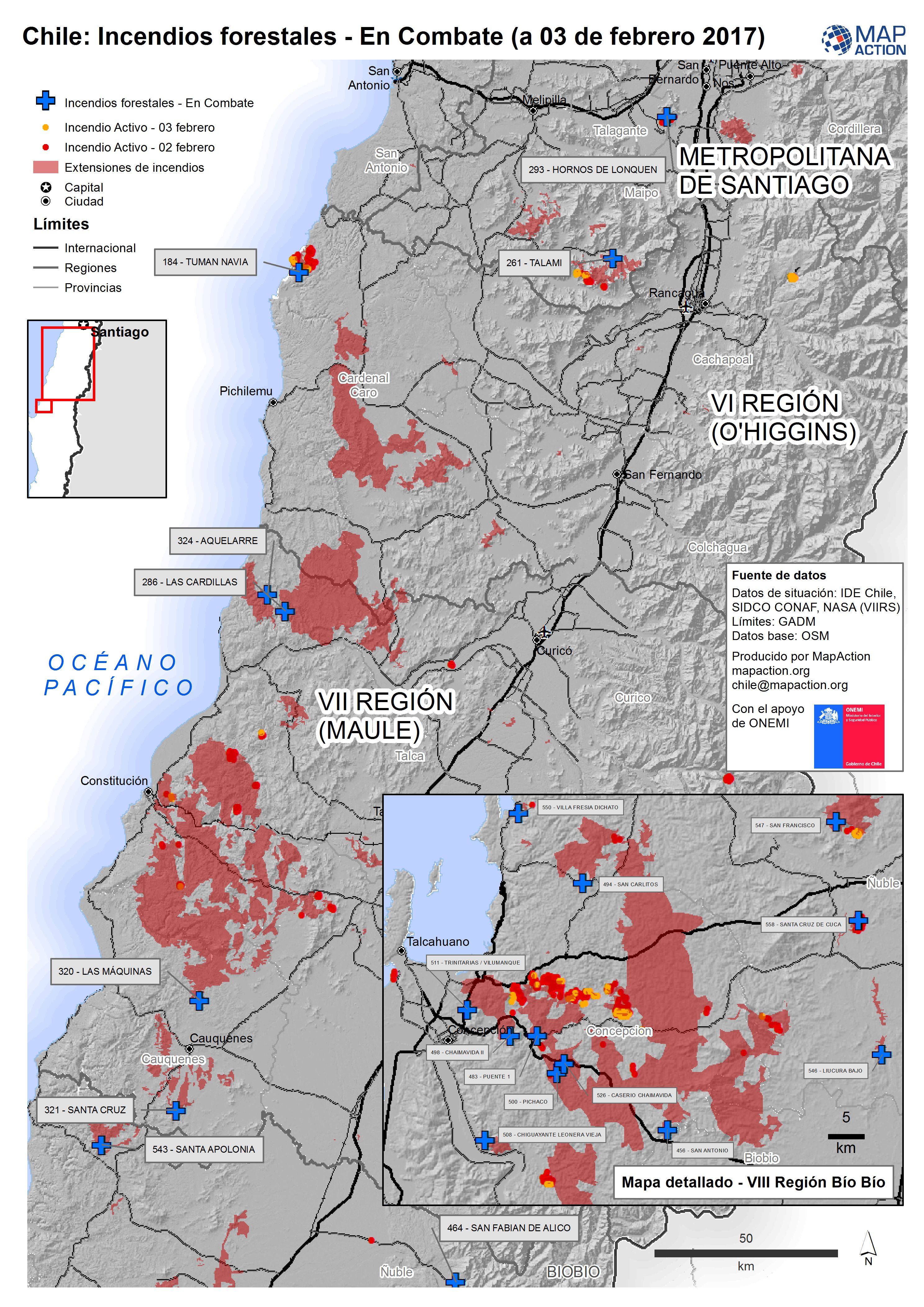
Chile: Incendios forestales - En Combate (a 03 de febrero 2017)
Incendios forestales - En Combate (a 03 de febrero 2017) -
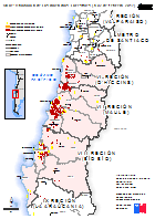
Chile: Ubicación de los Incendios Forestales (a 02 de febrero 2017)
Ubicación de los Incendios Forestales (a 02 de febrero 2017) -
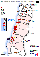
Chile: Ubicación de los Incendios Forestales (a 03 de febrero 2017)
Ubicación de los Incendios Forestales (a 03 de febrero 2017) -

Bahamas: Hurricane Matthew- Reference - Island Assessments
1:100 000 Reference maps for Bahamas showing islands, settlements, transport infrastructure, districts and topographic features -
Bahamas: Hurricane Matthew- Reference - Island Assessments
1:100 000 Reference maps for Bahamas showing islands, settlements, transport infrastructure, districts and topographic features