-
The Philippines: Reported number of partially and totally destroyed houses by...
Map shows the reported number of damaged and destroyed houses per province. -

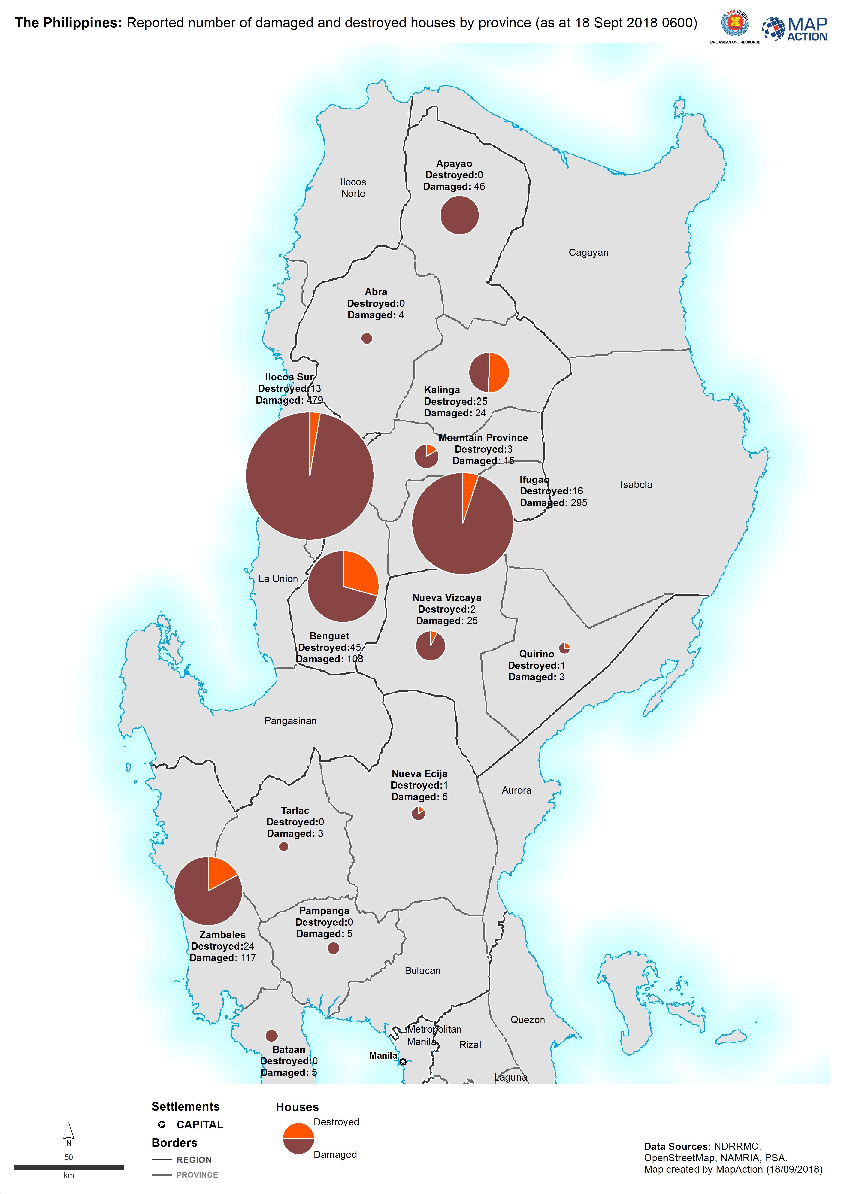
The Philippines: Reported number of damaged and destroyed houses by province ...
Map shows the reported number of damaged and destroyed houses per province. -

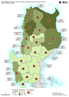
The Philippines: Reported number of damaged and destroyed houses by province ...
Map shows the reported number of damaged and destroyed houses per province. -
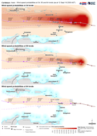
Caribbean: Isaac - Wind speed probabilities at 34, 50 and 64 knots (as at 12 ...
Map shows the wind probabilities at 34, 50 and 64 knots for Hurricane Isaac -
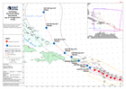
Caribbean Region: Isaac - Storm track forecast (as at 12 Sept 18 2300 AST)
Map shows the forecasted track of Isaac. -
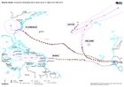
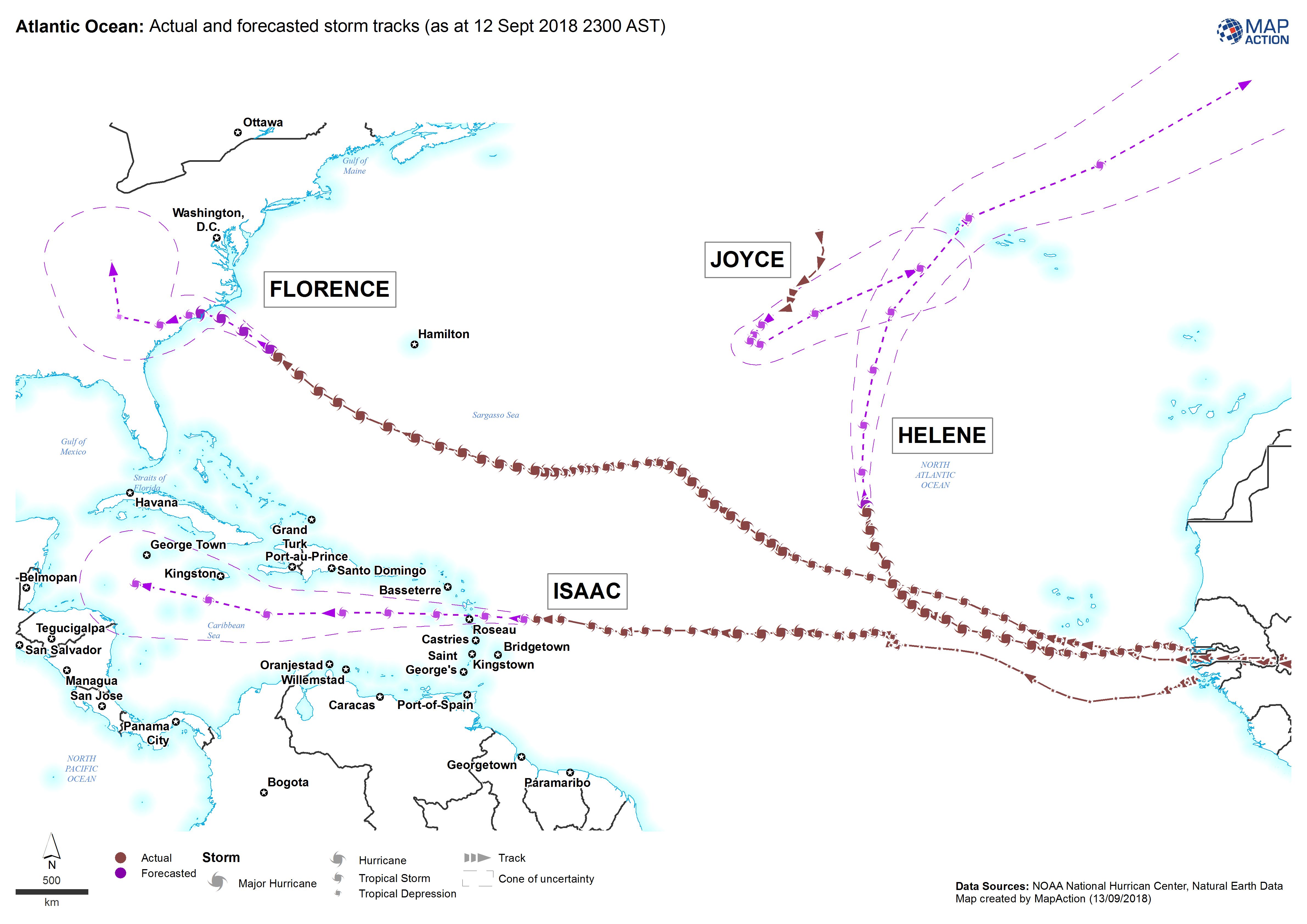
Atlantic Ocean: Actual and forecasted storm tracks (as at 12 Sept 2018 2300 AST)
Map shows the actual and forecasted tracks for Florence, Helene, Isaac and Joyce -

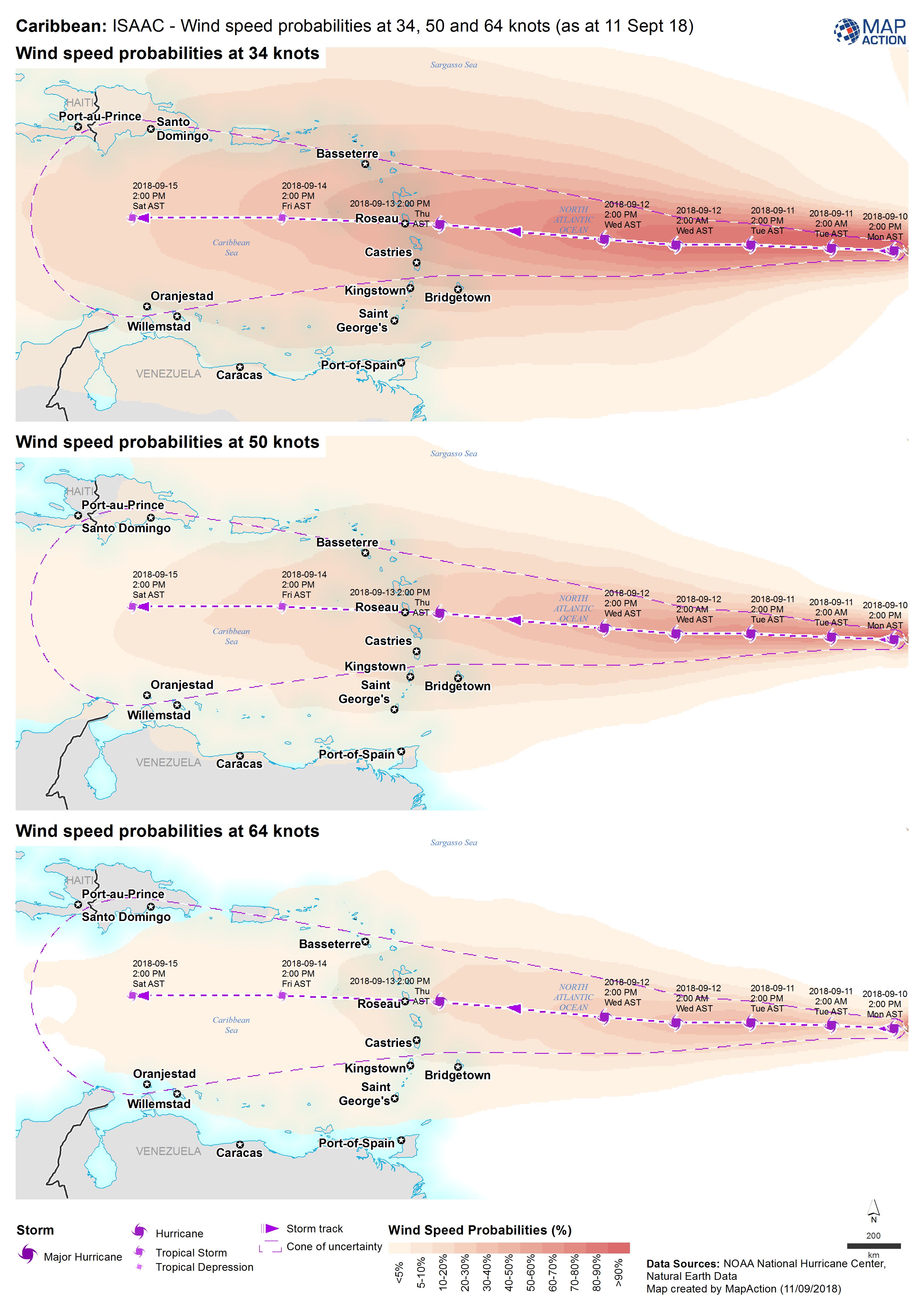
Caribbean: Isaac - Wind speed probabilities at 34, 50 and 64 knots (as at 11 ...
Map shows the wind probabilities at 34, 50 and 64 knots for Hurricane Isaac -

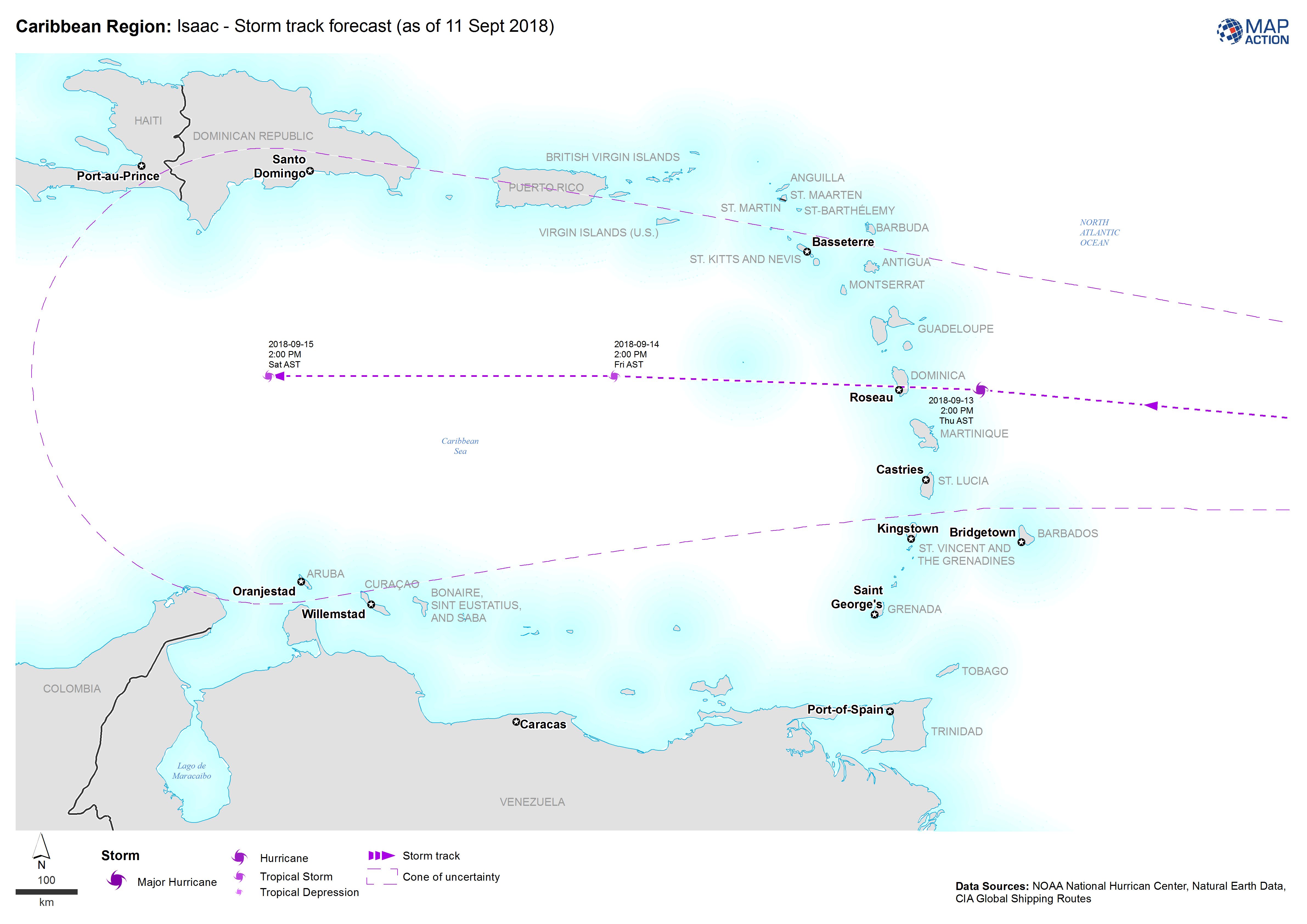
Caribbean Region: Isaac - Storm track forecast (as of 11 Sept 2018)
Map shows the the forecasted storm track for Hurricane Isaac -

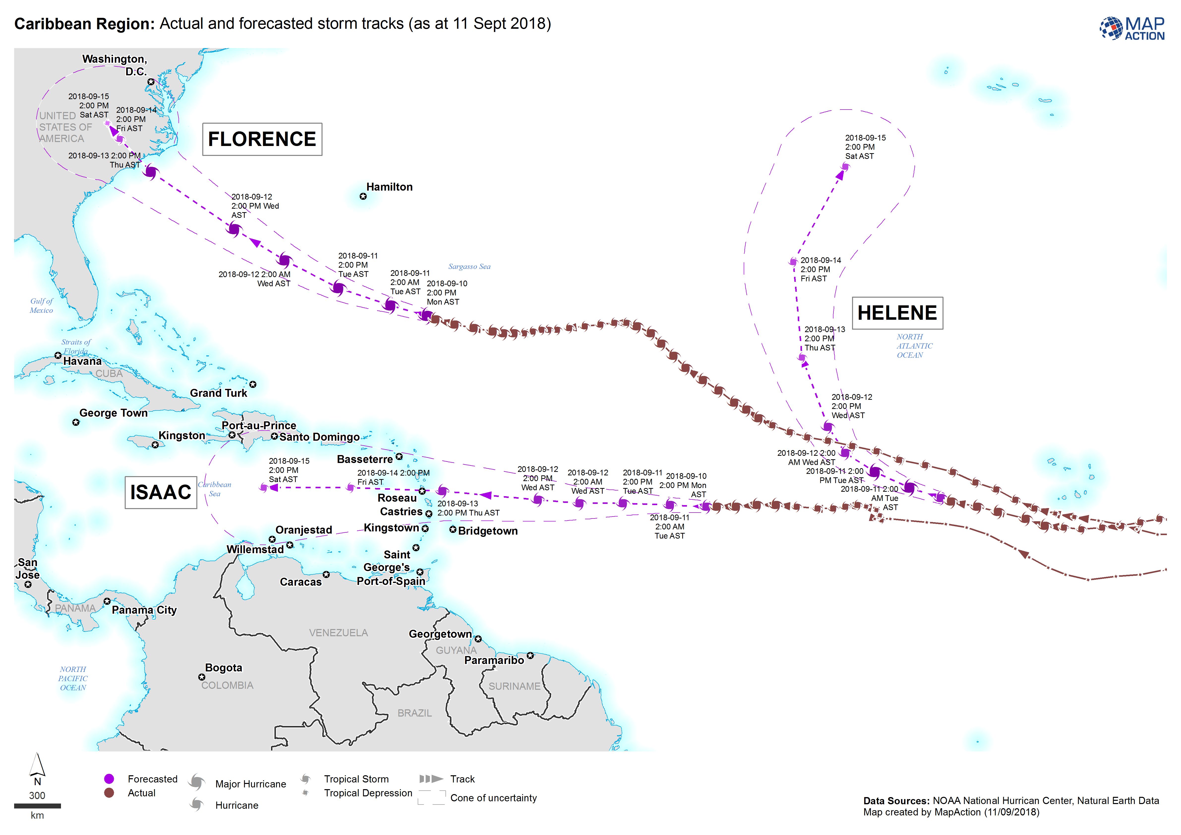
Caribbean Region: Actual and forecasted storm tracks (as at 11 Sept 2018)
Map shows the actual and forecasted storm tracks for Hurricanes Florence, Helene and Isaac -

-
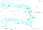
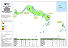
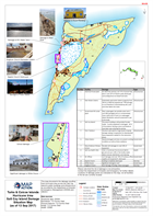
Turks and Caicos Islands MASTER Assessment Areas
Turks and Caicos sections for assessments with landmarks for reference.- JPEG
-
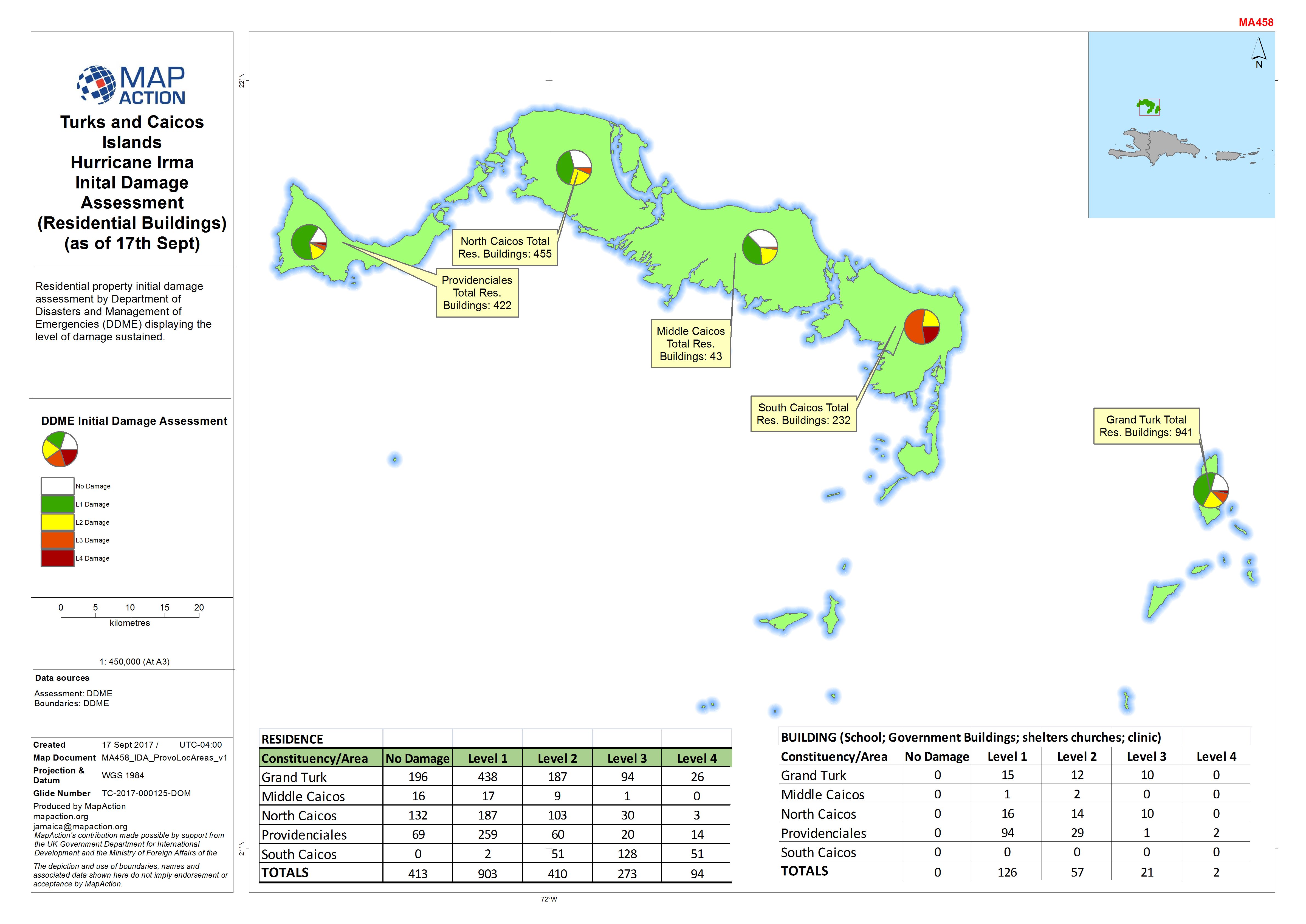
Turks and Caicos Islands Hurricane Irma Initial Damage Assessment (Residentia...
Residential property initial damage assessment by Department of Disasters and Management of Emergencies (DDME) displaying the level of damage sustained. -

Caribbean Hurricane Maria Stormtrack (as of 22 Sept 2017; 06:00 AST)
Map showing the track of Hurricane Maria over the Caribbean, their windspeed estimate and forecast path -
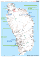
Dominica: Hurricane Maria humanitarian access (as at 21 Sep 2017 - update 4 a...
Map of humanitarian access, as reported to the EOC in Roseau up to 14.00 local time on 21 September. This map will change frequently as access conditions change and more... -

Caribbean Hurricane Maria Stormtrack (as of 21 Sept 2017; 18:00 AST)
Map showing the track of Hurricane Maria over the Caribbean, their windspeed estimate and forecast path -
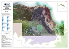
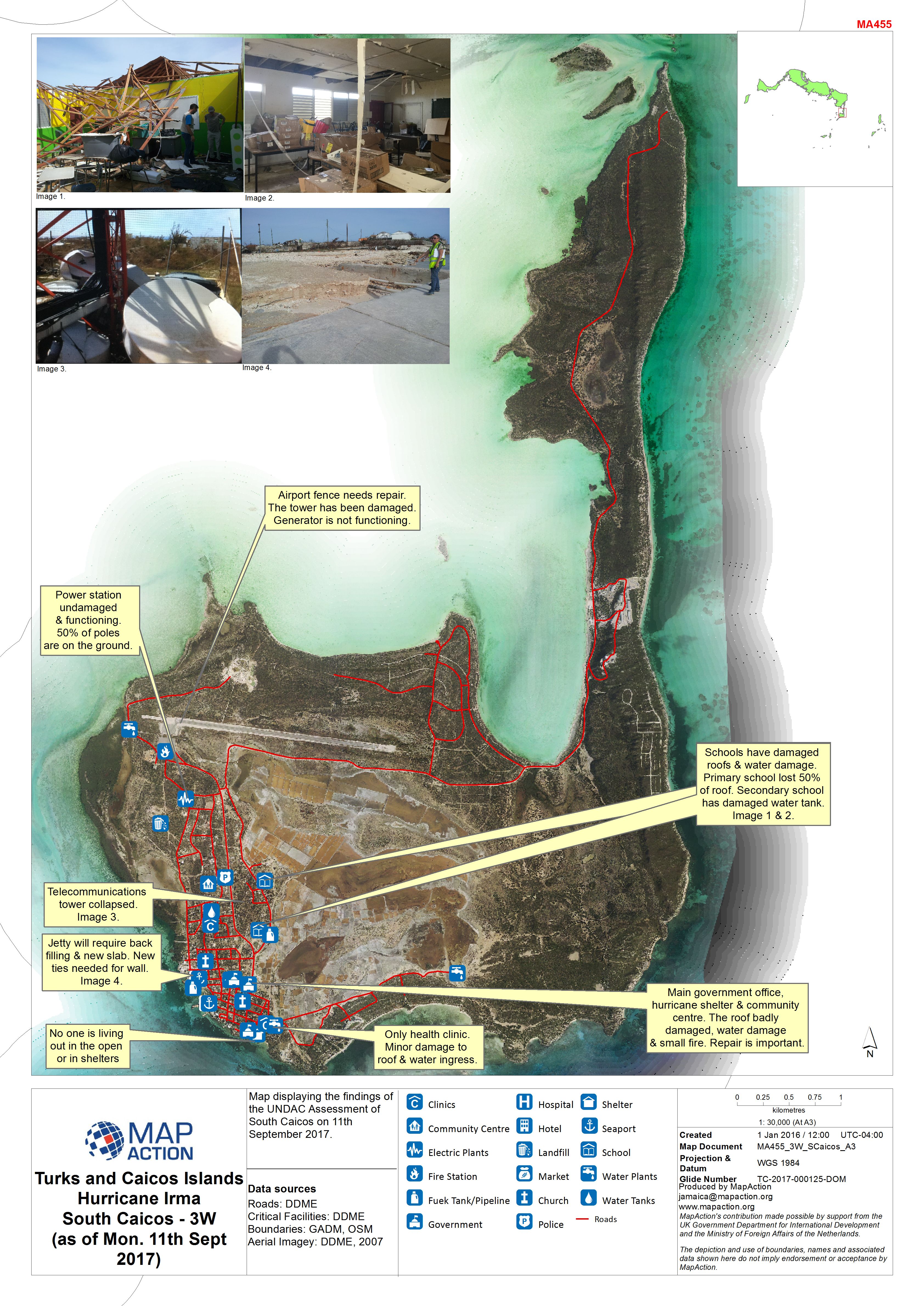
Turks and Caicos Islands - Hurricane Irma: UNDAC Assessment of South Caicos o...
Map displaying the findings of the UNDAC Assessment of South Caicos on 11th September 2017. -

Caribbean Hurricane Maria Stormtrack (as of 21 Sept 2017; 00:01 AST)
Map showing the track of Hurricane Maria over the Caribbean, their windspeed estimate and forecast path -
Caribbean Hurricane Maria Stormtrack (as of 19 Sept 2017, 12:00)
Map showing the track of Hurricane Maria over the Caribbean, their windspeed estimate and forecast path -
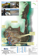
Turks & Caicos Islands Hurricane Irma Salt Cay Island Damage Situation Map (a...
This map documents the damage resulting from Hurricane Irma across the Salt Cay island to public buildings and infrastructure as recorded by the Department of Disaster &...