-

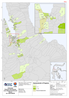
Indonesia Sulawesi Earthquake Palu Region Damage to Schools
Map shows extent of damage to schools in Palau region, based on satellite data assesment. -

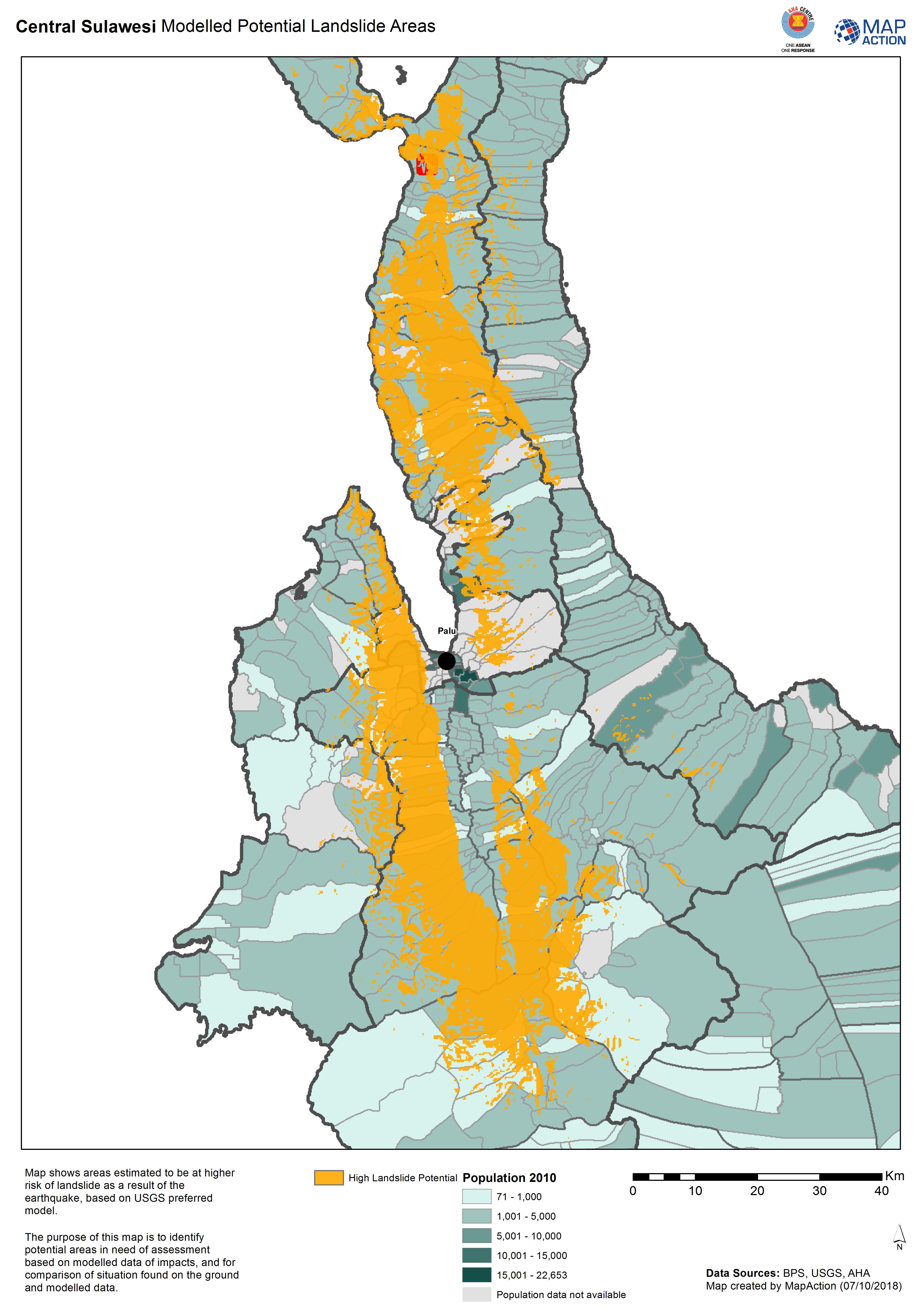
Central Sulawesi Modelled Potential Landslide Areas
Map shows areas estimated to be at higher risk of landslide as aresult of the earthquake, based on USGS preferred model. -

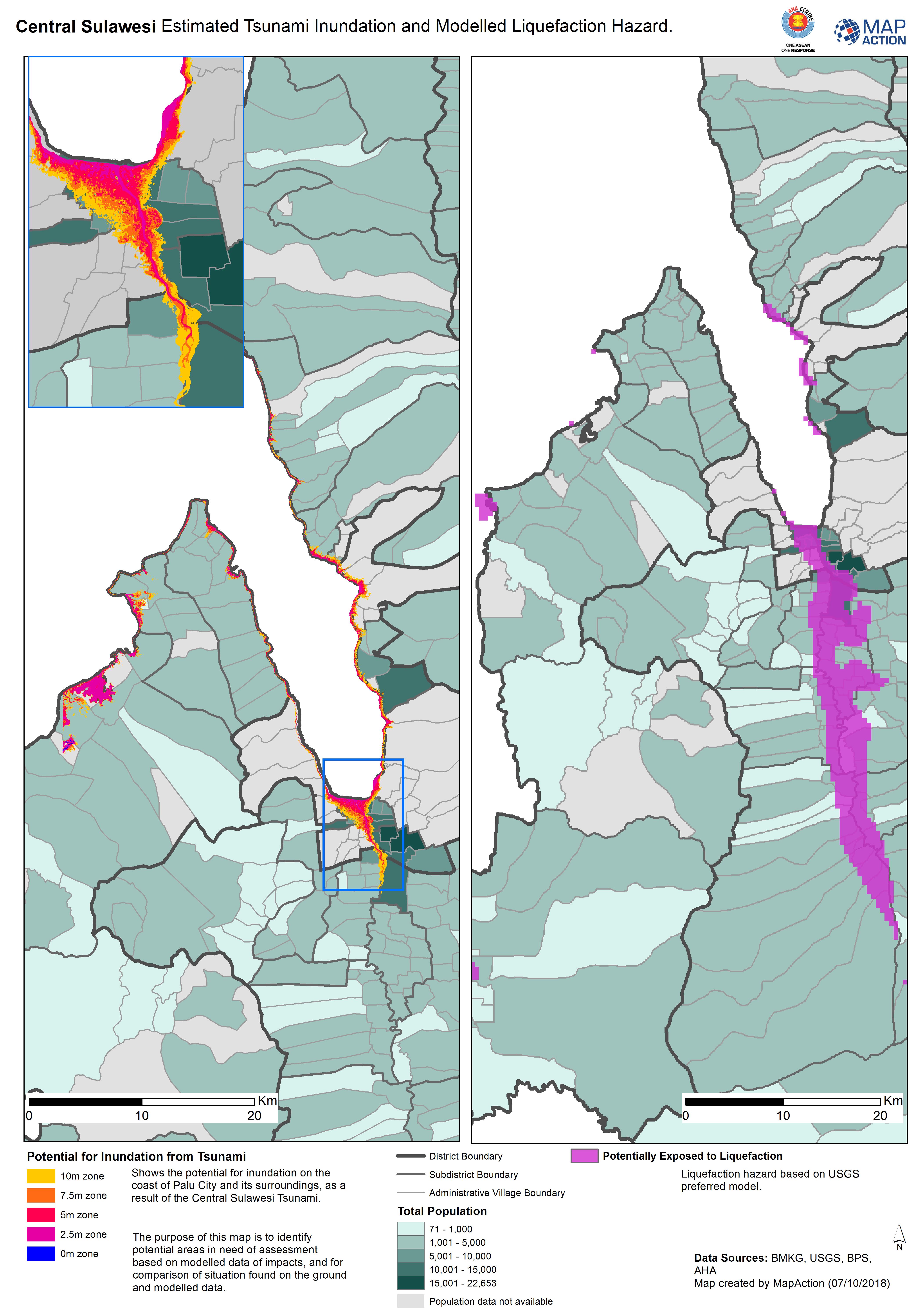
Central Sulawesi Estimated Tsunami Inundation and Modelled Liquefaction Hazard.
Shows the potential for inundation on the coast of Palu City and its surroundings, as a result of the Central Sulawesi Tsunami. The purpose of this map is to identify potential... -
Indonesia Sulawesi Earthquake Joint Needs Assessment Status as of 06/10/2018
Map shows number of Joint Needs Assessments planned and completed in Central Sulawesi at 06/10/2018 -

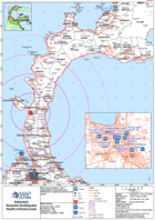
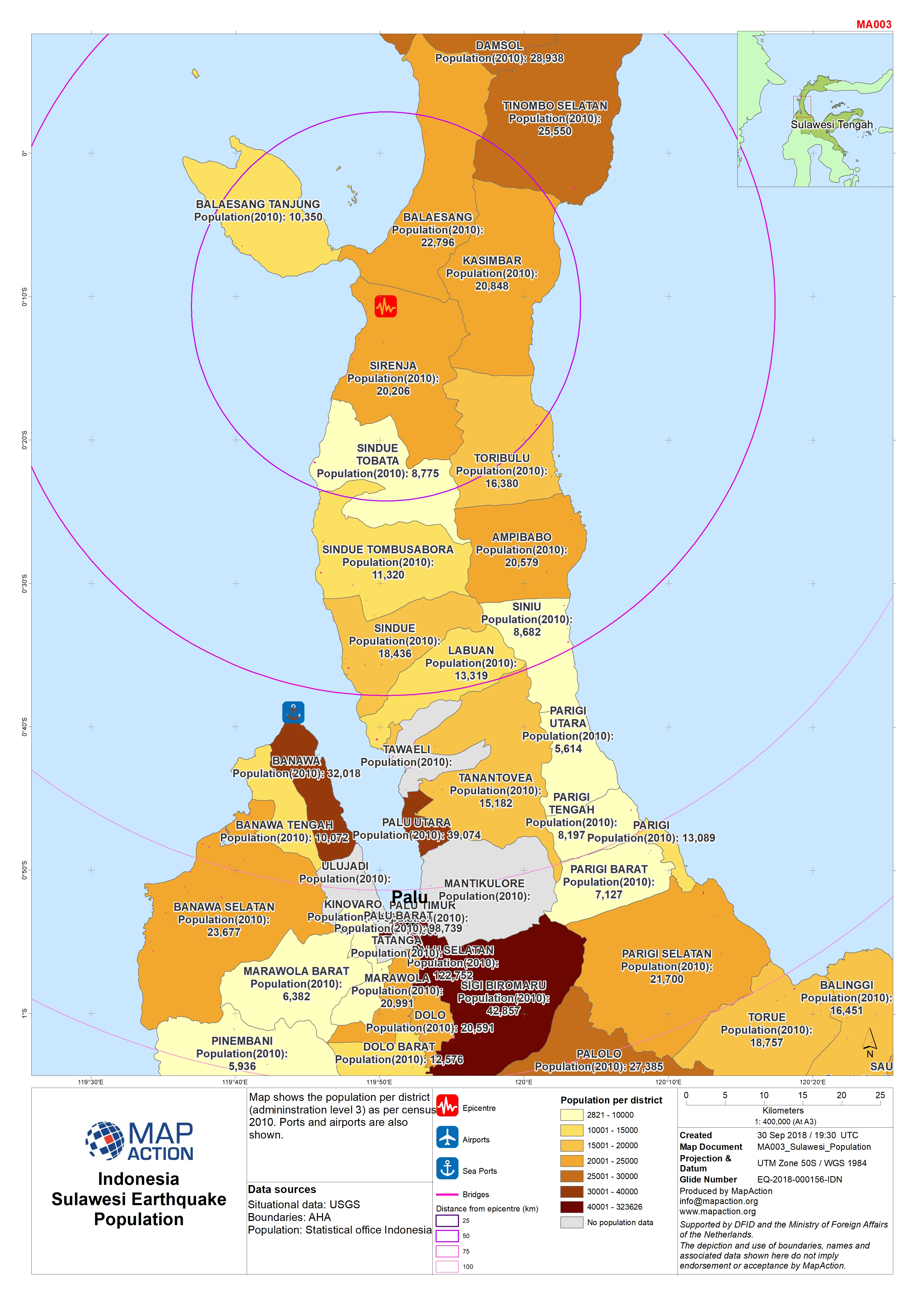
Sulawesi Earthquake - Population
Map shows population per district (admininstration level 3). Ports are also shown. -
Sulawesi Earthquake - Health
Map shows hospitals, level 3 admininstration boundaries and settlements. Roads and ports are also shown. -
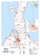
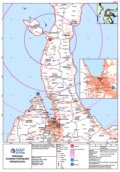
Sulawesi Earthquake - Infrastructure
Map shows level 3 admininstration boundaries and settlements. Roads and ports are also shown. -
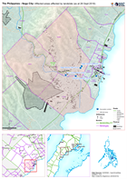
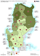
The Philippines - Naga City: Situational overview of area affected by landsli...
Map shows the affected areas, number of displaced and location of the evacuation centres being used as a result of the landslide to hit Naga city. The table below shows the... -
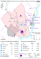
The Philippines - Naga City: Affected areas affected by landslide (as at 28 S...
Map shows the affected by the landslide in Naga City, Cebu. -
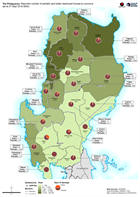
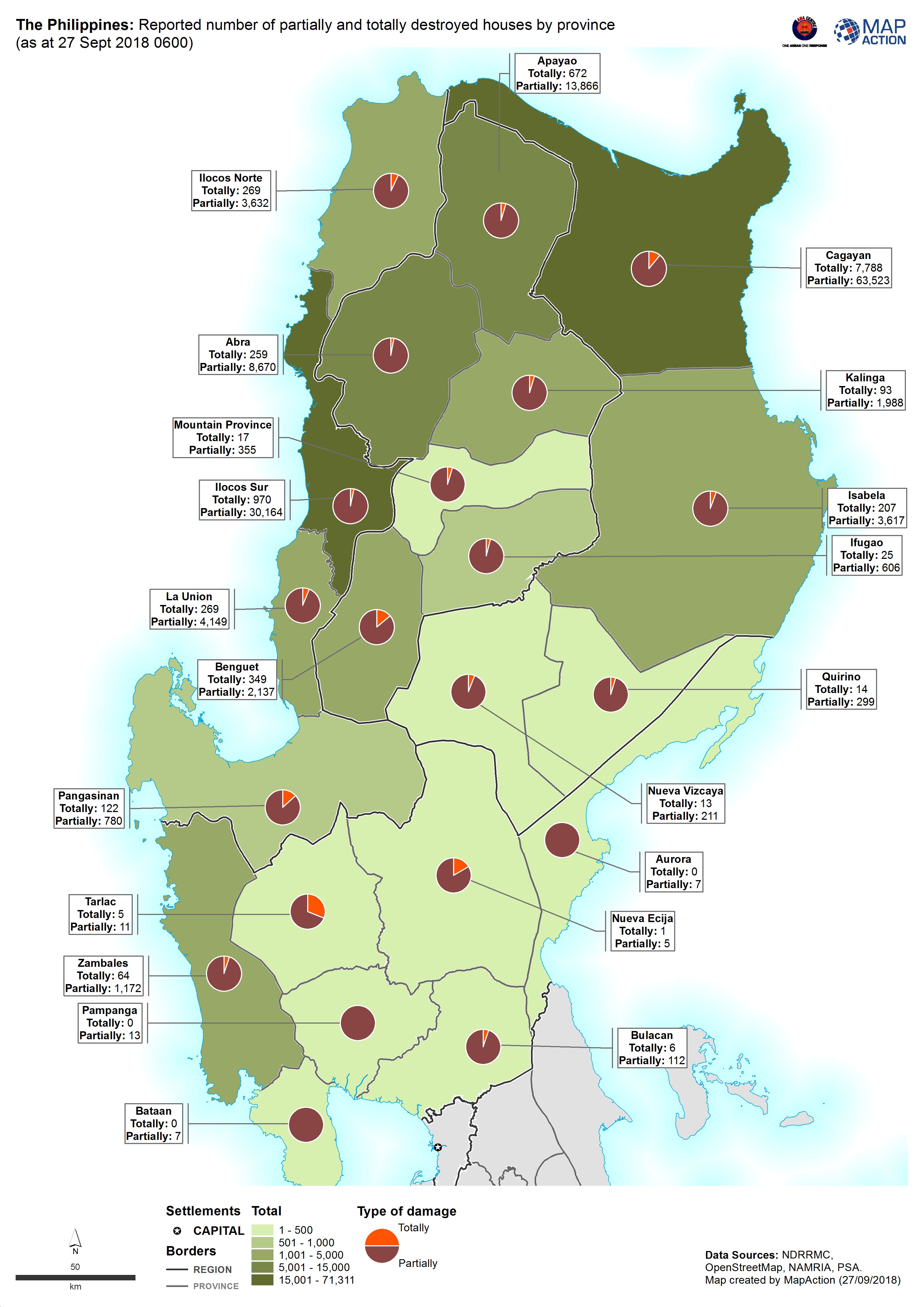
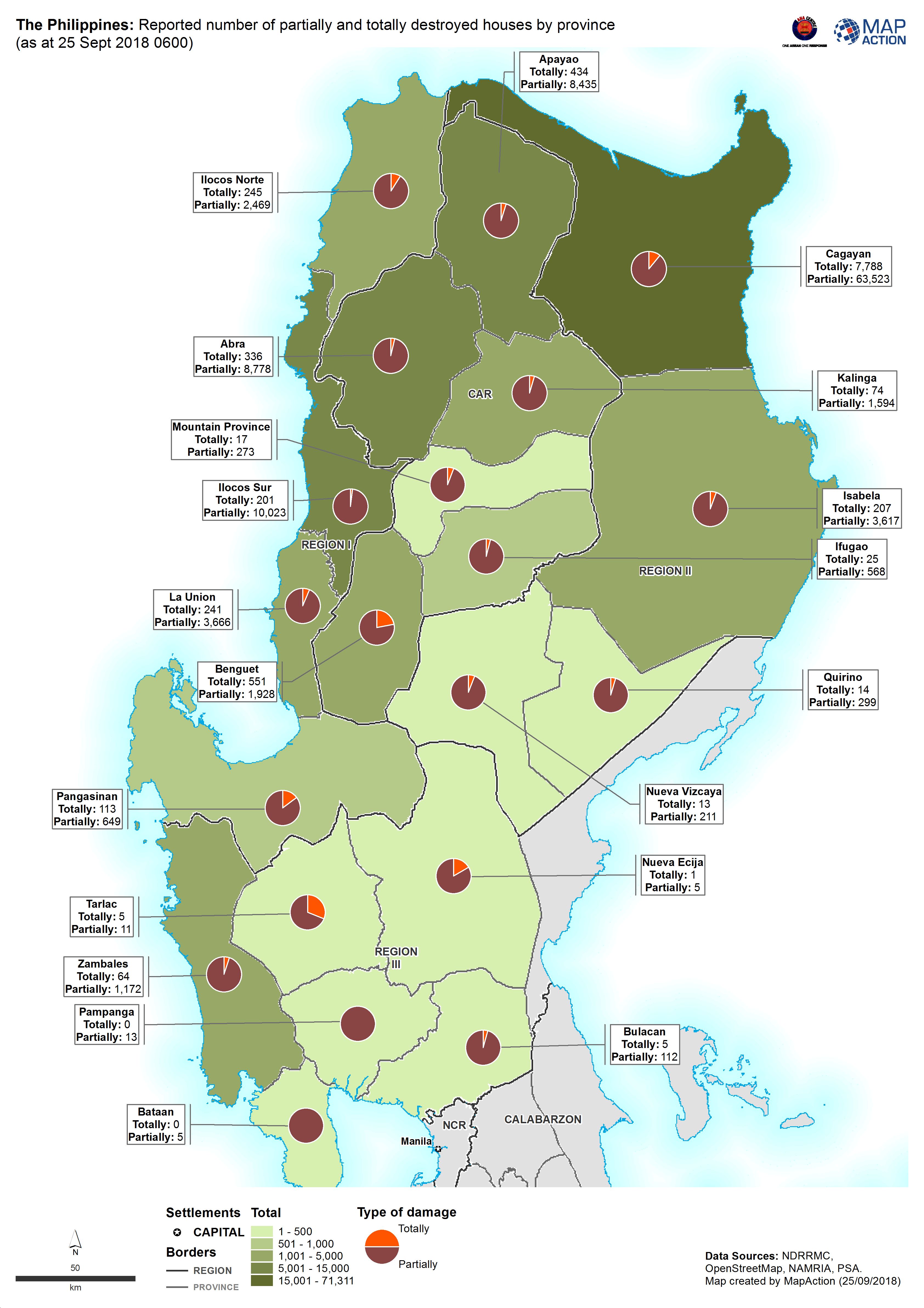
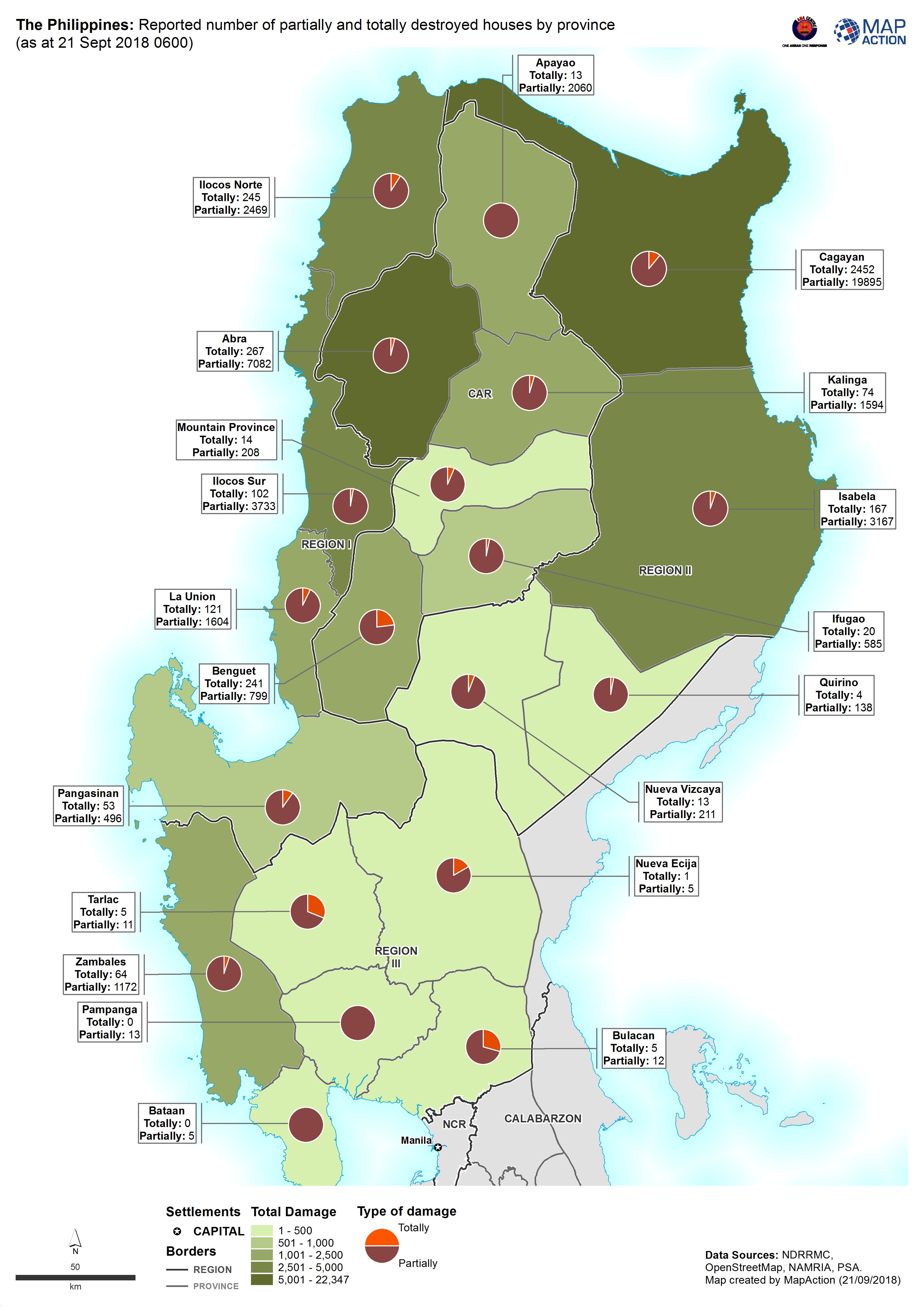
The Philippines: Reported number of partially and totally destroyed houses by...
Map shows the reported number of damaged and destroyed houses per province. -

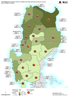
The Philippines: Reported number of partially and totally destroyed houses by...
Map shows the reported number of damaged and destroyed houses per province. -

The Philippines: Reported number of partially and totally destroyed houses by...
Map shows the reported number of damaged and destroyed houses per province. -
The Philippines: Reported number of partially and totally destroyed houses by...
Map shows the reported number of damaged and destroyed houses per province. -
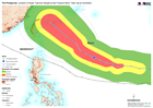
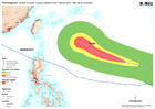
The Philippines: Location of Super Typhoon Mangkhut and Tropical Storm Trami ...
Map shows the paths of Super Typhoon Mangkhut and Typhoon Trami. -

The Philippines: Location of Super Typhoon Mangkhut and Tropical Storm Trami ...
Map shows the paths of Super Typhoon Mangkhut and Typhoon Trami. -

The Philippines: Areas at potential risk of a 2m storm surge based on histori...
Map shows areas at potential of a 2m storm surge based on historical data and inundation maps -

The Philippines: Reported number of partially and totally destroyed houses by...
Map shows the reported number of damaged and destroyed houses per province. -

The Philippines: Areas at potential risk of a 2m storm surge based on histori...
Map shows areas at potential of a 2m storm surge based on historical data and inundation maps -
The Philippines: Location of Super Typhoon Mangkhut and Tropical Storm Trami ...
Map shows the paths of Super Typhoon Mangkhut and Typhoon Trami. -
The Philippines: Reported number of partially and totally destroyed houses by...
Map shows the reported number of damaged and destroyed houses per province.