-
Who What Where activities / presence at sub-island level as of 20th September...
Who What Where activities / presence at sub-island level as of 20th September 2019 16:30 EDT -

Who What Where activities / presence in affected area by cluster: Education -...
Who, What, Where for Education -
Who What Where activities / presence at sub-island level as of 18th September...
Who What Where activities / presence at sub-island level as of 18th September 2019 16:30 EDT -

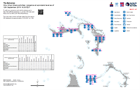
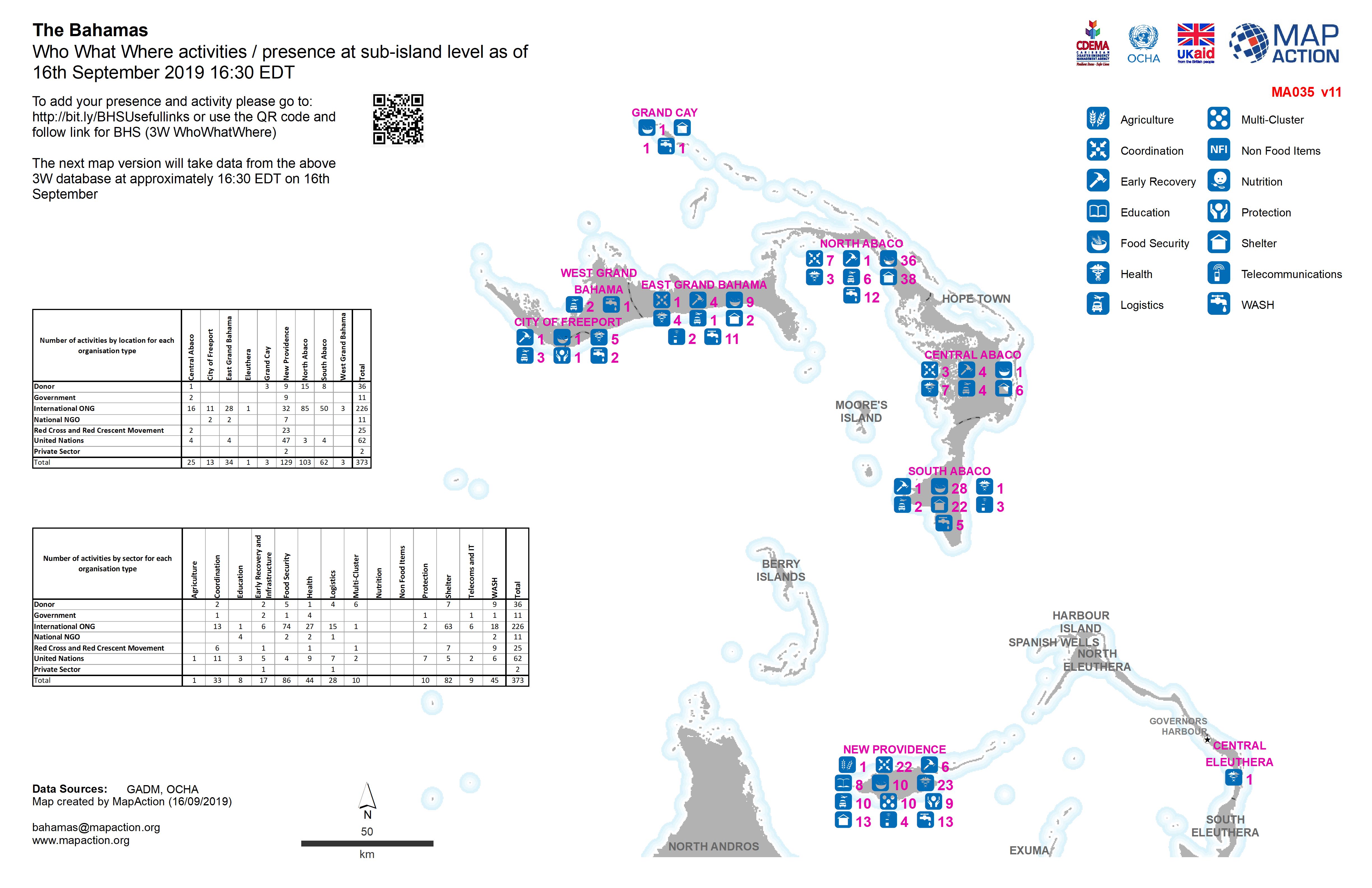
Who What Where activities / presence at sub-island level as of 16th September...
Who What Where activities / presence at sub-island level as of 16th September 2019 16:30 EDT -

Who What Where activities / presence in affected area by cluster - Education:...
Who, What, Where for Education -

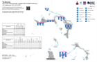
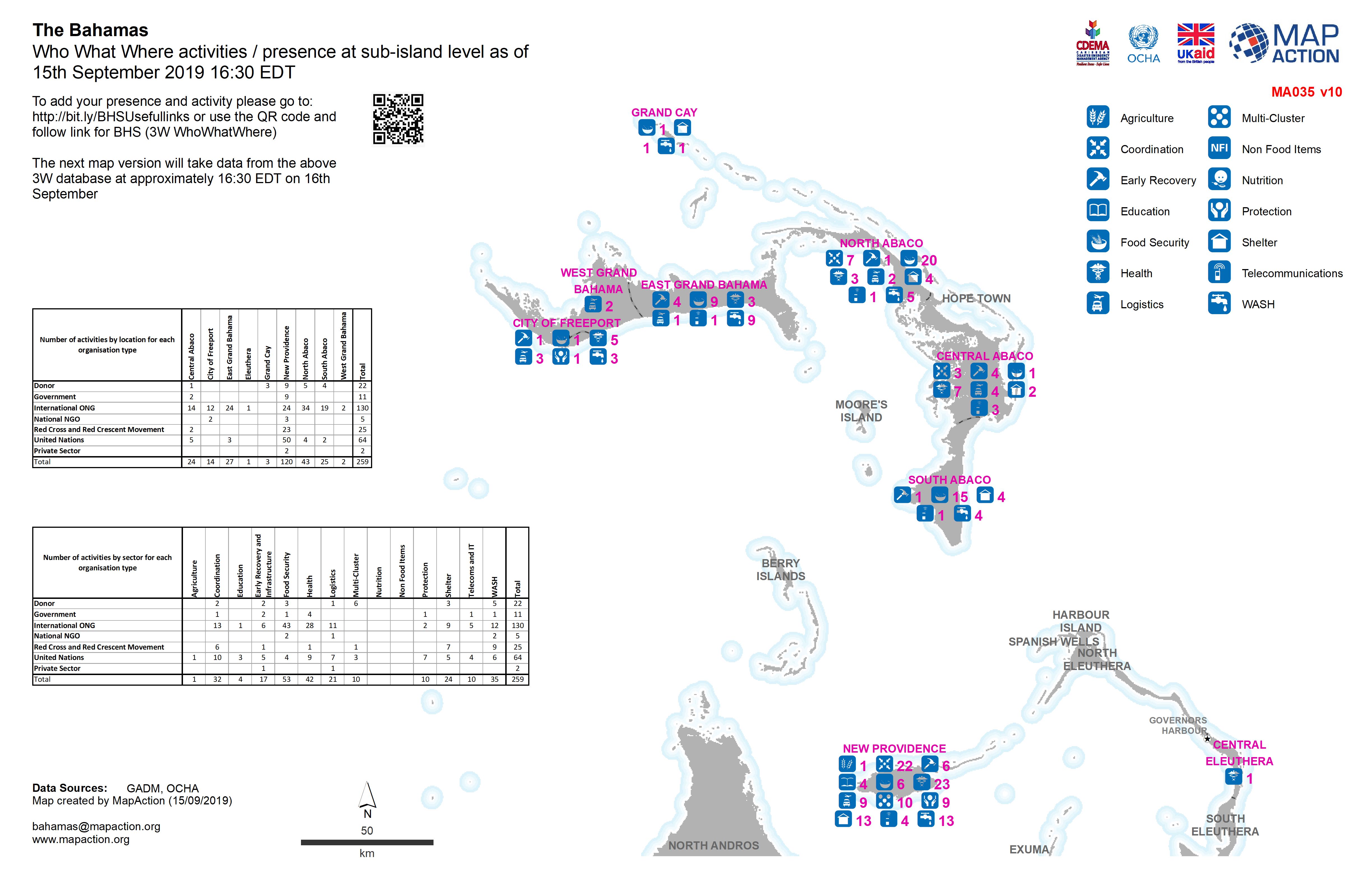
Who What Where activities / presence at sub-island level as of 15th September...
Who What Where activities / presence at sub-island level as of 15th September 2019 16:30 EDT -

Who What Where activities / presence in affected area by cluster as of: 12th ...
Who, What, Where for Education -

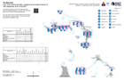
Who What Where activities / presence at sub-island level as of 13th September...
Who What Where activities / presence at sub-island level as of 13th September 2019 16:30 EDT -
Who What Where activities / presence at sub-island level as of 12th September...
Who What Where activities / presence at sub-island level as of 12th September 2019 16:30 EDT -
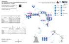
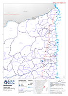
Who What Where activities / presence at sub-island level as of 11th September...
Who What Where activities / presence at sub-island level as of 11th September 2019 16:30 EDT -
Who What Where activities / presence in affected area by cluster as of 11th S...
3W for Education and Nutrition -
Mozambique: Cyclone Idai - District details showing Schools facilities
Map shows District details and School facilities - focuses on Cabo Delgado, Manica, Nampula, Sofala and Zambezia provinces. -
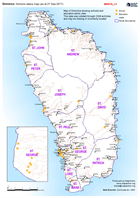
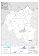
Dominica: Schools status map (as at 27 Sep 2017)
Map of Dominica showing schools and education admin sites This data was collated through OSM activities and may be missing or incorrectly located -

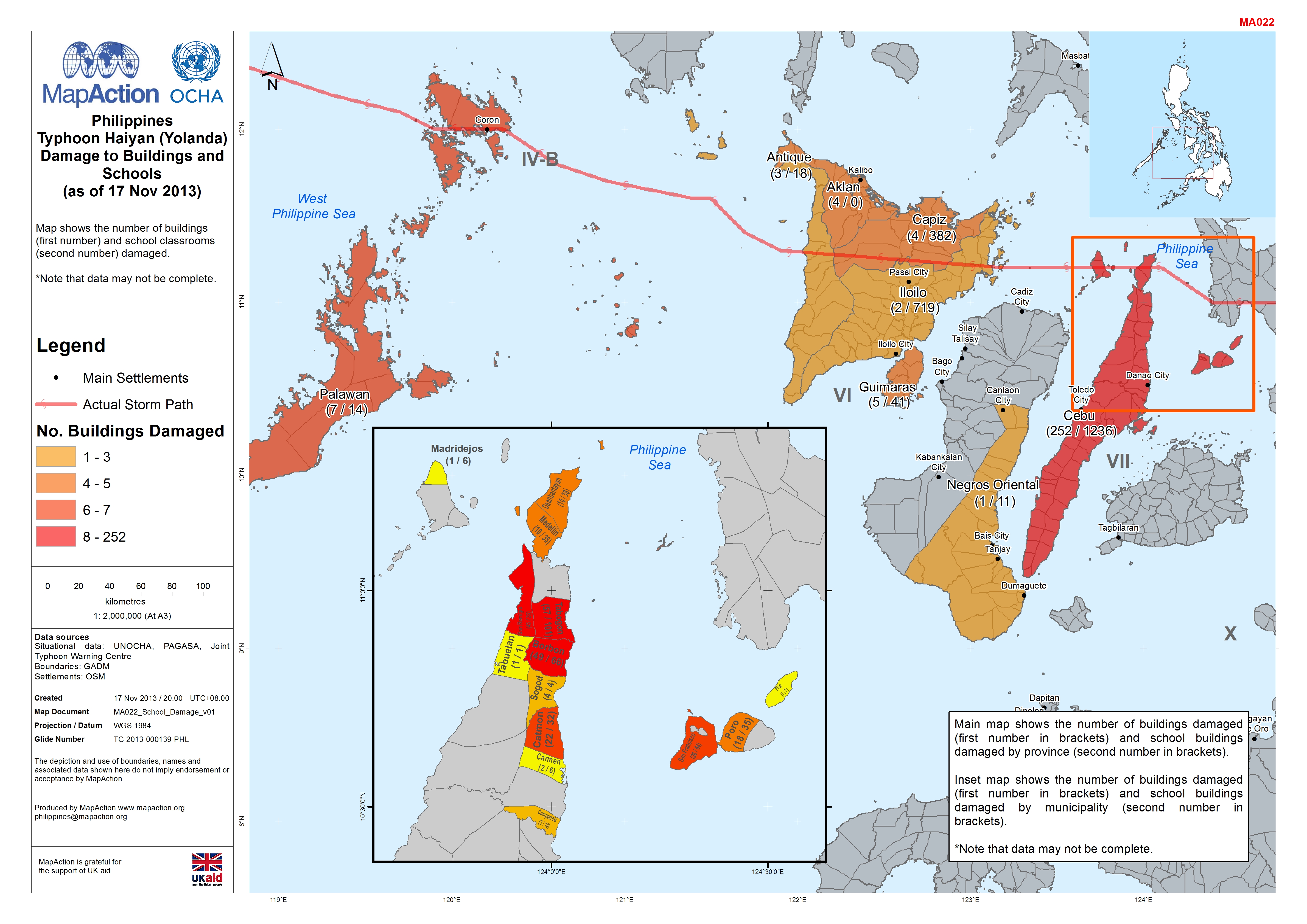
Philippines Typhoon Haiyan (Yolanda) Damage to Buildings and Schools (as of 1...
Map shows the number of buildings (first number) and school classrooms (second number) damaged.*Note that data may not be complete. -

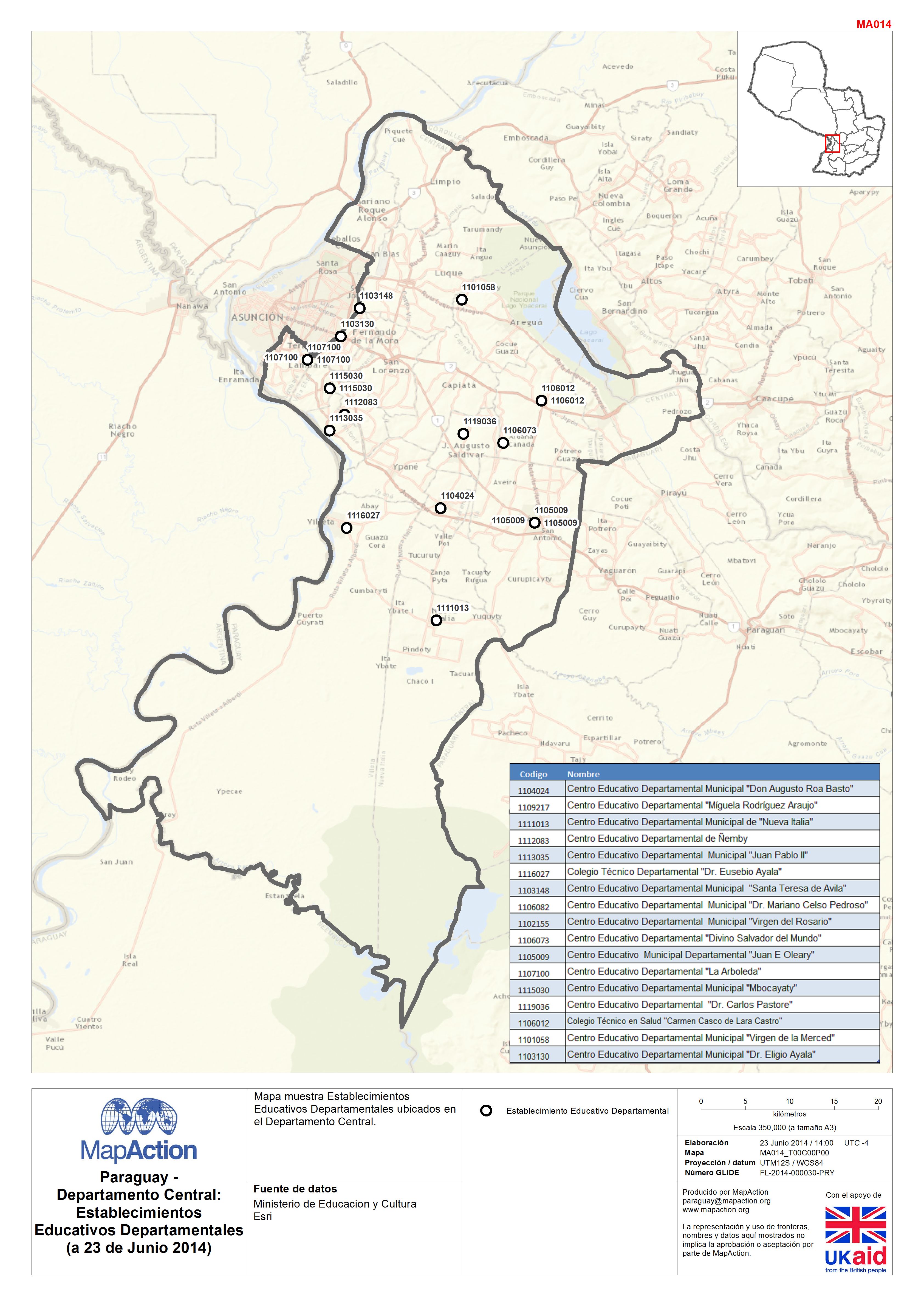
Paraguay - Departamento Central:Establecimientos Educativos Departamentales(a...
Mapa muestra Establecimientos Educativos Departamentales ubicados en el Departamento Central. -
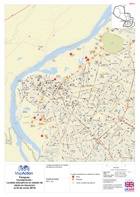
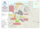
Paraguay: Inundaciones - Locales educativos en estado de alerta en Asuncion (...
Locales educativos en estado de alerta en Asuncion -
Nepal: Earthquake - Education Cluster District Lead Agencies (as of 11 May 2015)
Map shows Education Clusters district lead agencies, number of affected schools and percentage of damaged classrooms in each district. -

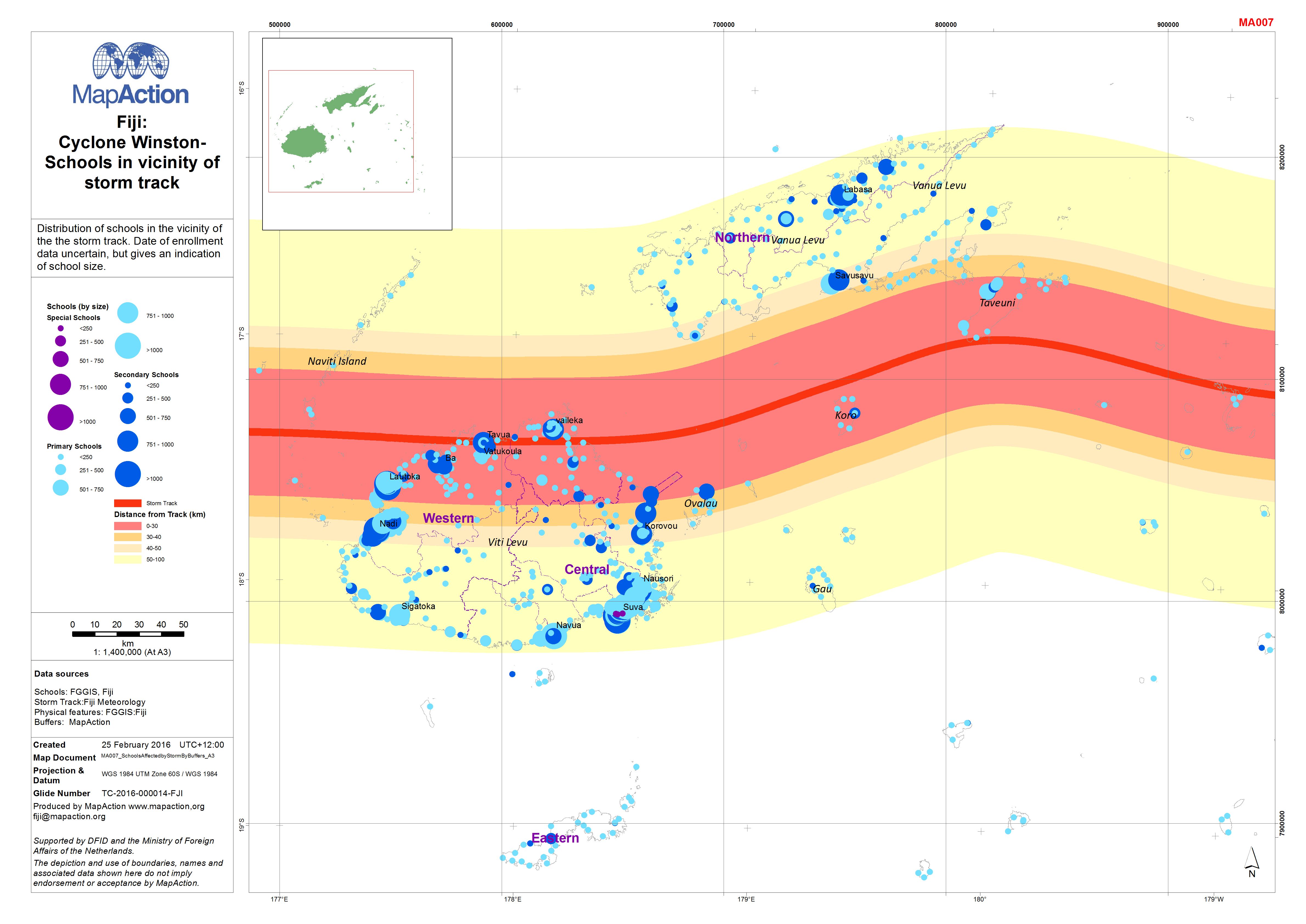
Fiji: Cyclone Winston - Schools in vicinity of storm track
Distribution of schools in the vicinity of the the storm track. Date of enrollment data uncertain, but gives an indication of school size. -
Philippines TS Washi (Sendong) MIRA (Multi-Cluster Initial Rapid Assessment) ...
Status of schools and education reported by the Multi-Cluster Initial Rapid Assessment, January 2012. -
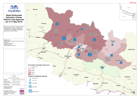
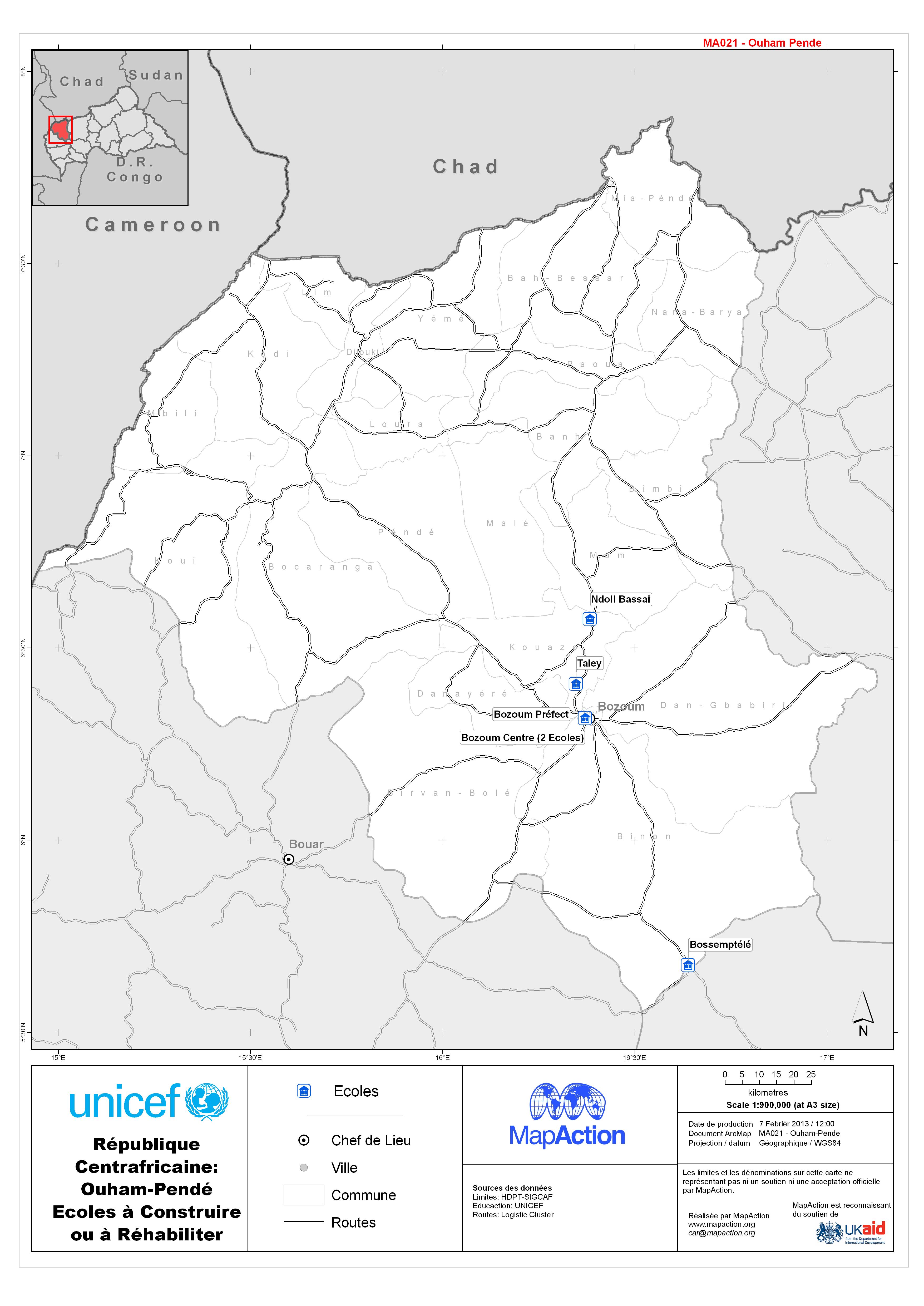
République Centrafricaine: Ouham-Pendé Ecoles à Construire ou à Réhabiliter
Schools to be built or re-built in areas affected by the conflict.