-
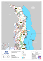
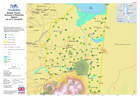
Malawi: Floods - Emergency - Flood Overview Map of Northern Region
Reference Map of the Northern Region of Malawi showing district areas and major urban areas and towns. -
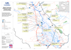
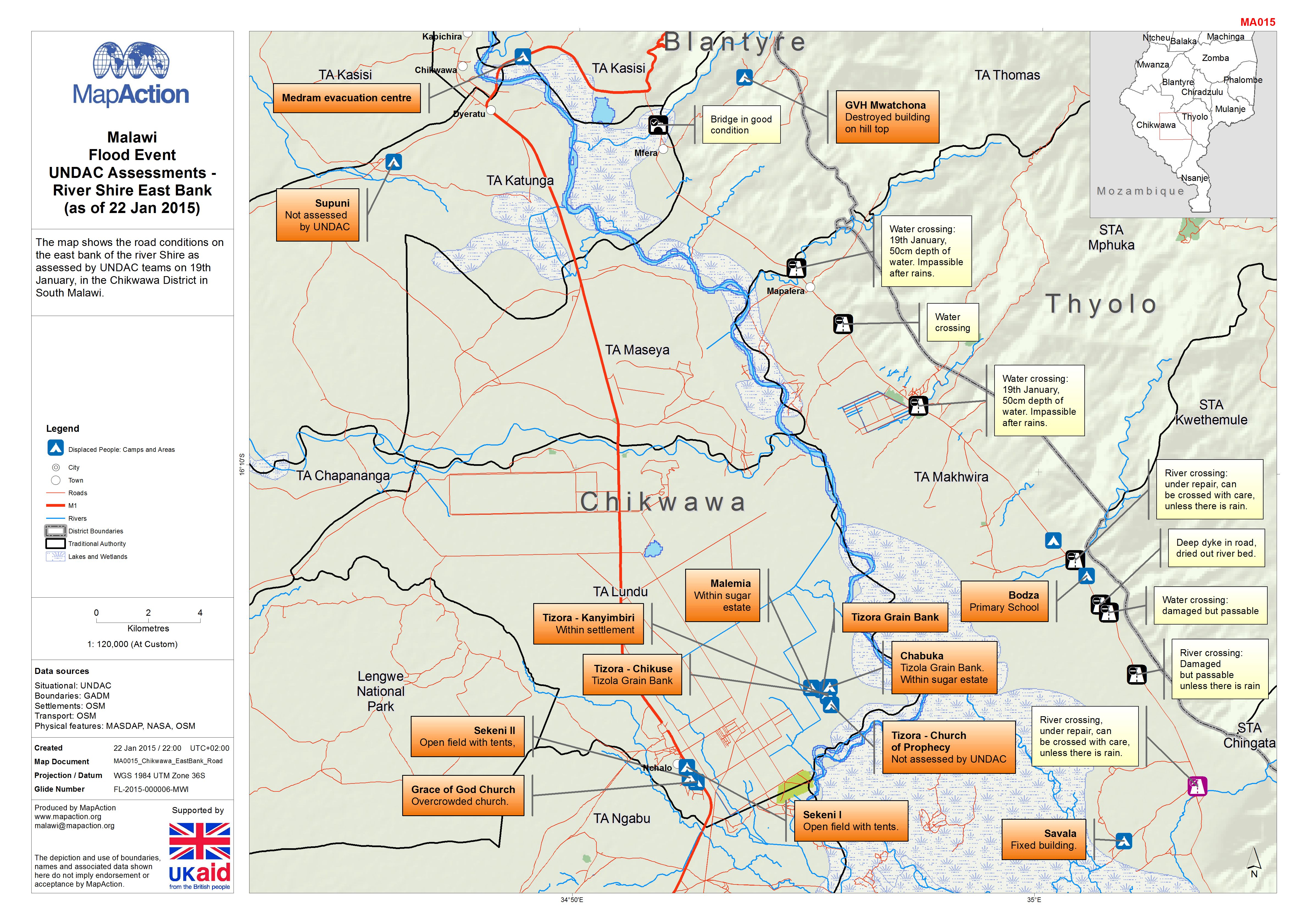
Malawi: Floods - UNDAC Assessments - River Shire East Bank (as of 22 Jan 2015)
The map shows the road conditions on the east bank of the river Shire as assessed by UNDAC teams on 19th January, in the Chikwawa District in South Malawi. -
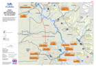
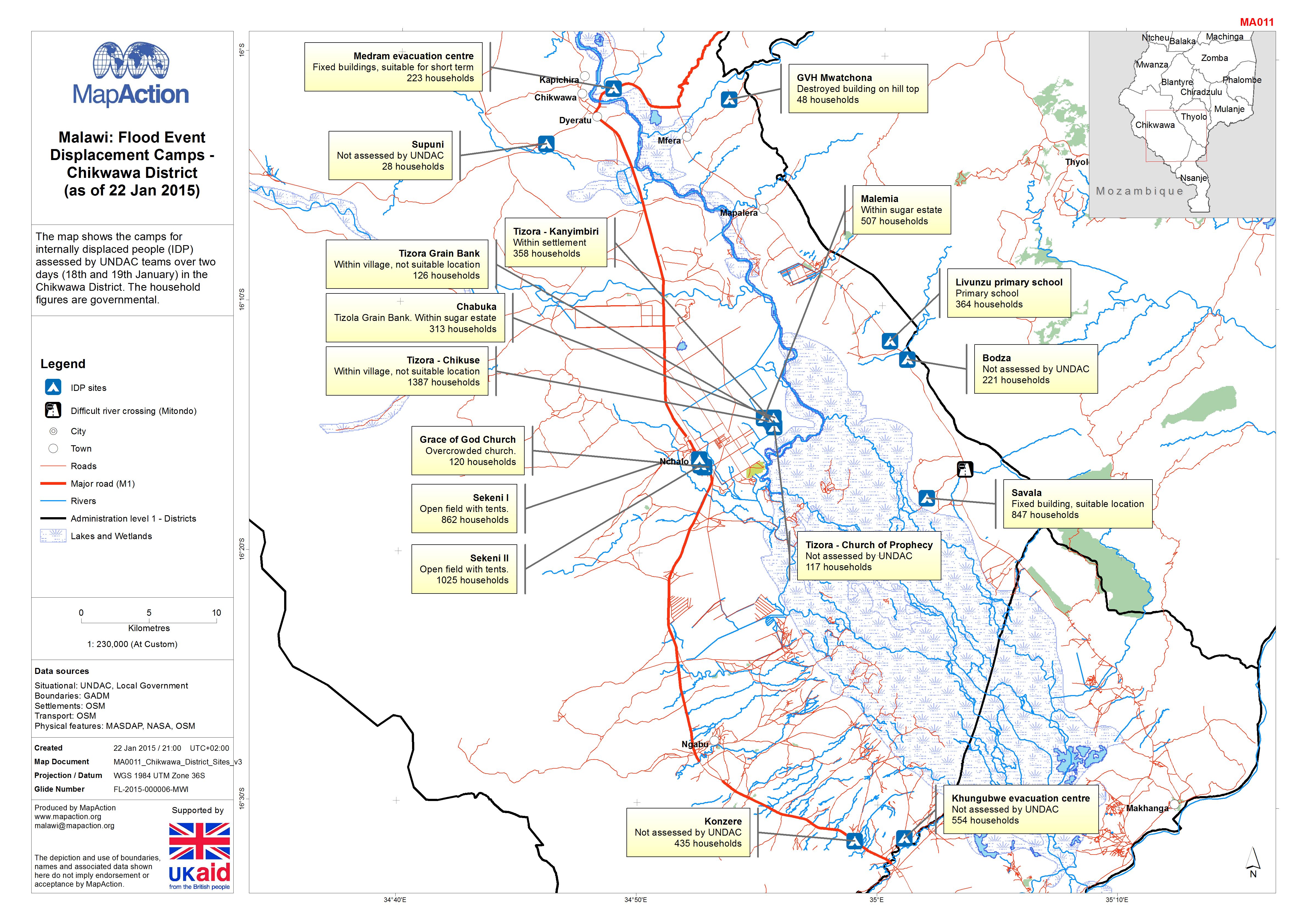
Malawi: Floods - Displacement Camps - Chikwawa District (as of 22 Jan 2015)
The map shows the camps for internally displaced people (IDP) assessed by UNDAC teams over two days (18th and 19th January) in the Chikwawa District. The household figures are... -
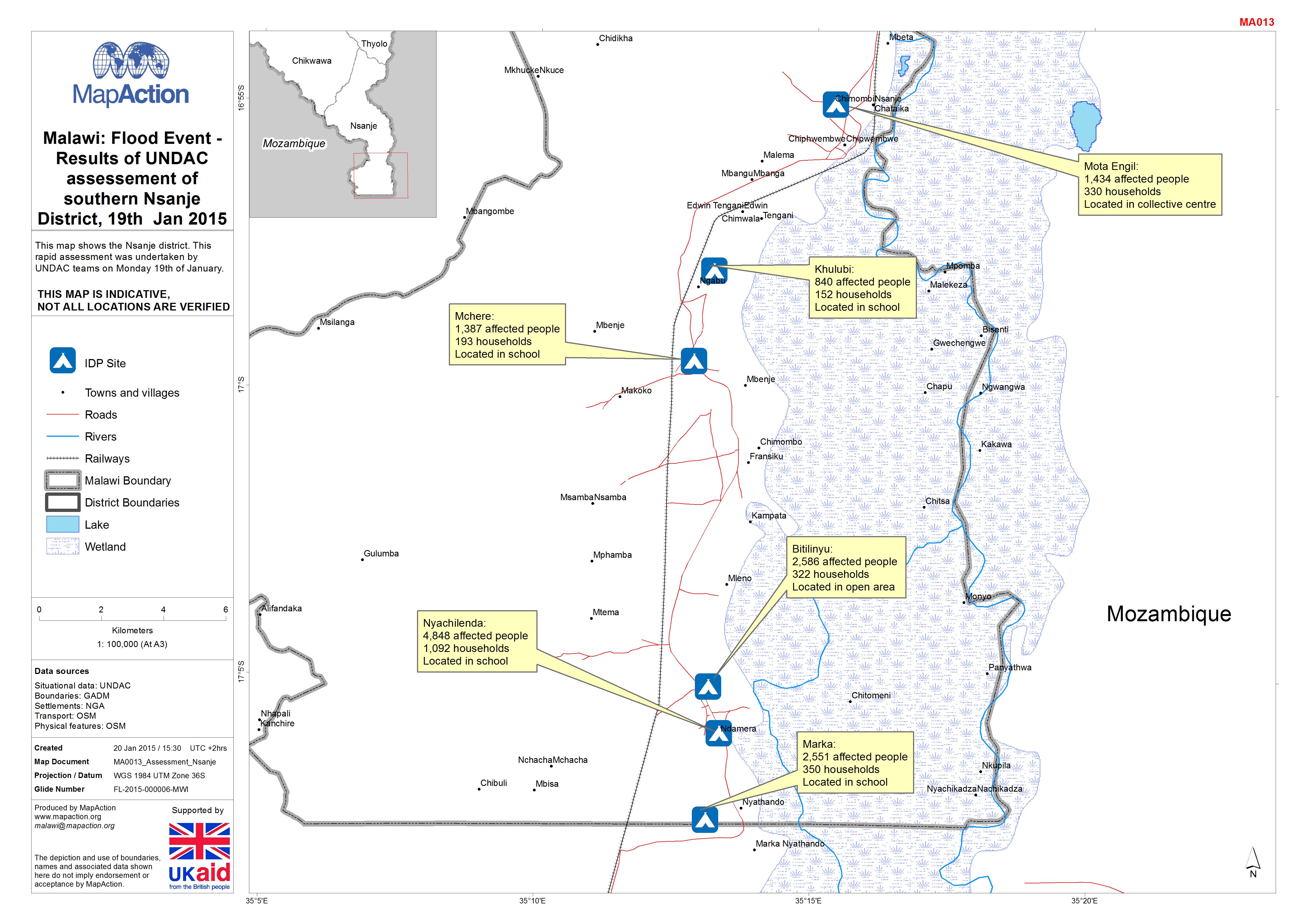
Malawi: Floods -Results of UNDAC assessement of southern Nsanje District, 19t...
This map shows the Nsanje district. This rapid assessment was undertaken by UNDAC teams on Monday 19th of January. -

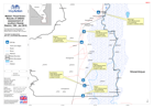
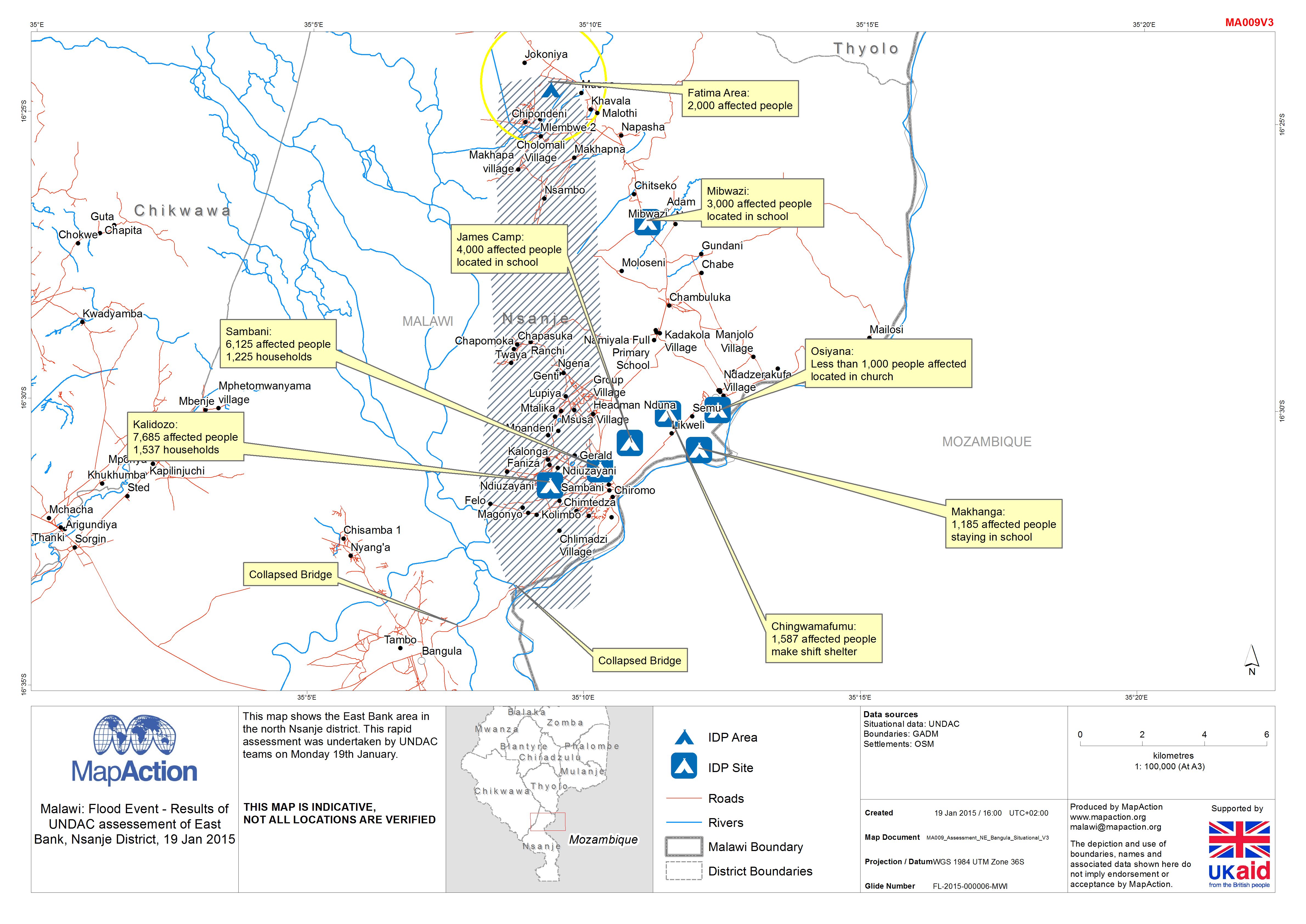
Malawi: Floods - Results of UNDAC assessement of East Bank, Nsanje District, ...
This map shows the East Bank area in the north Nsanje district. This rapid assessment was undertaken by UNDAC teams on Monday 19th January. -
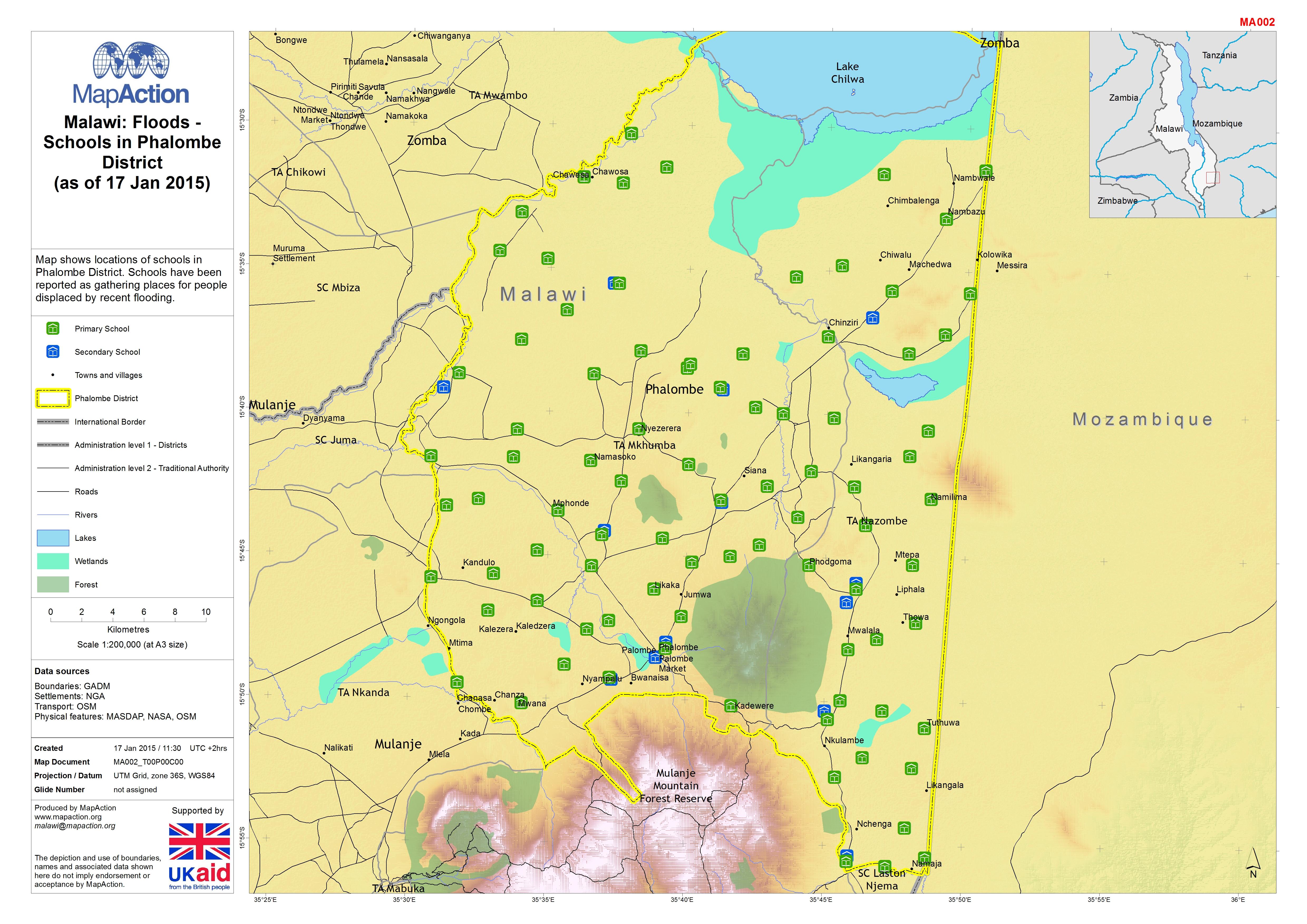
Malawi: Floods - Schools in Phalombe District (as of 17 Jan 2015)
Map shows locations of schools in Phalombe District. Schools have been reported as gathering places for people displaced by recent flooding. -
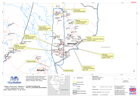
Malawi: Floods - Results of UNDAC assessement of East Bank, Nsanje District, ...
The East Bank area of north Nsanje District, Malawi, showing results of a rapid assessment undertaken by UNDAC teams on 19 January 2015 in response to recent flooding. -

Malawi: Floods - 7 day cumulative rainfall (as of 15 Jan 2015)
Map shows the cumulative rainfall total in millimetres (mm) during the seven day period 8-15 Jan 2015 (03:00 UTC) across Malawi. Figures are estimates from satellite... -
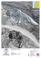
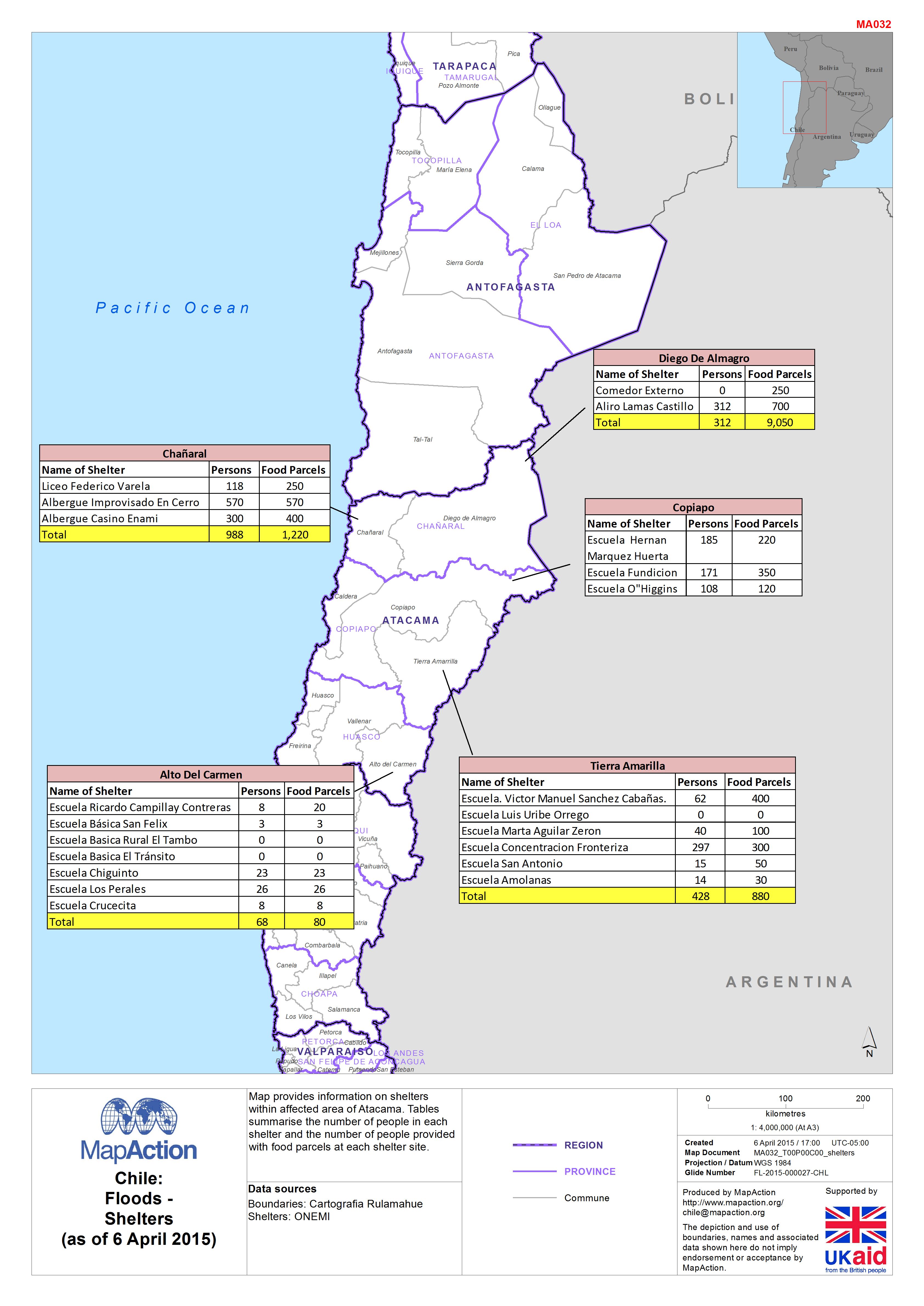
Chile:Floods -Shelters(as of 6 April 2015)
Map provides information on shelters within affected area of Atacama. Tables summarise the number of people in each shelter and the number of people provided with food parcels... -

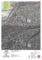
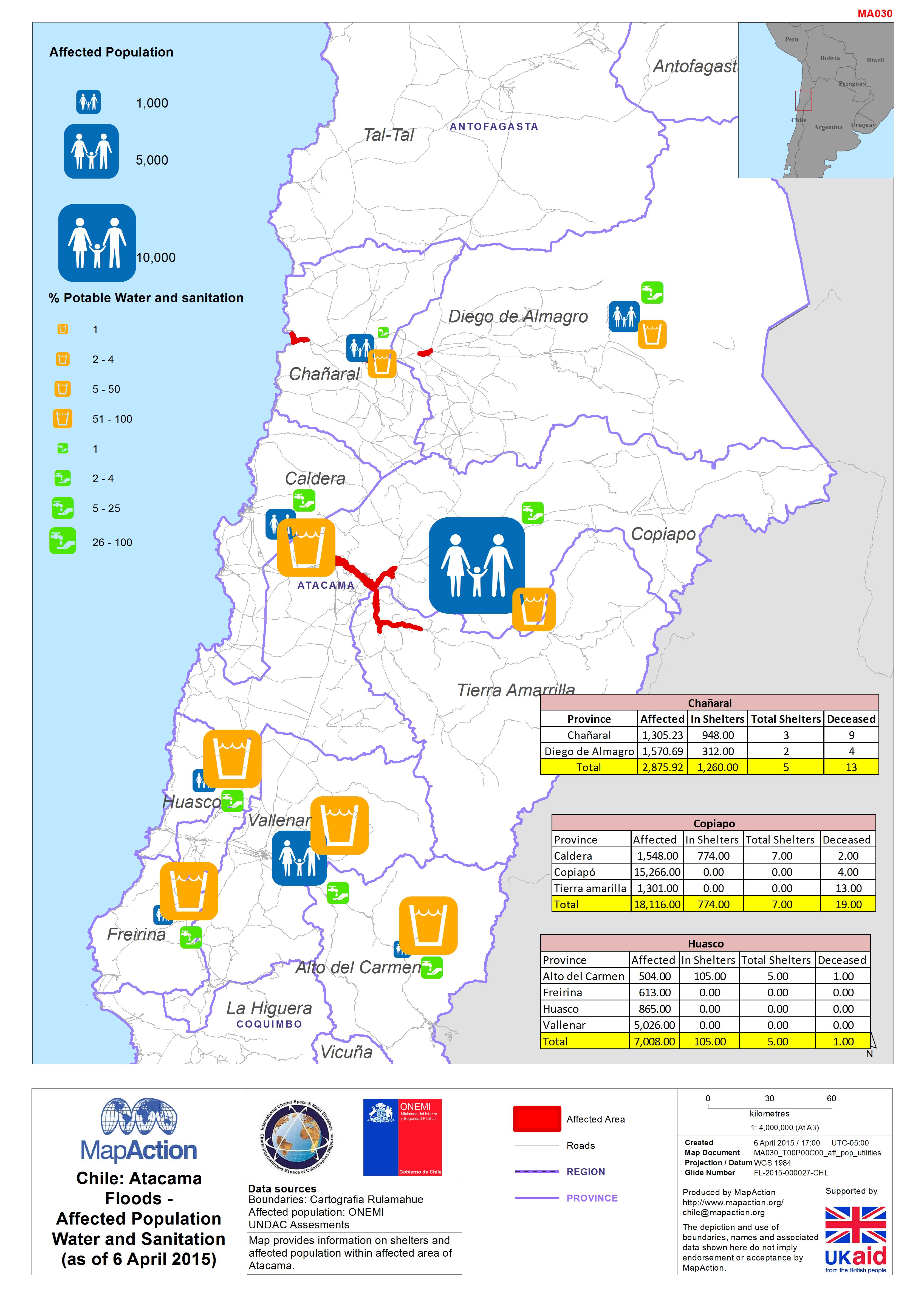
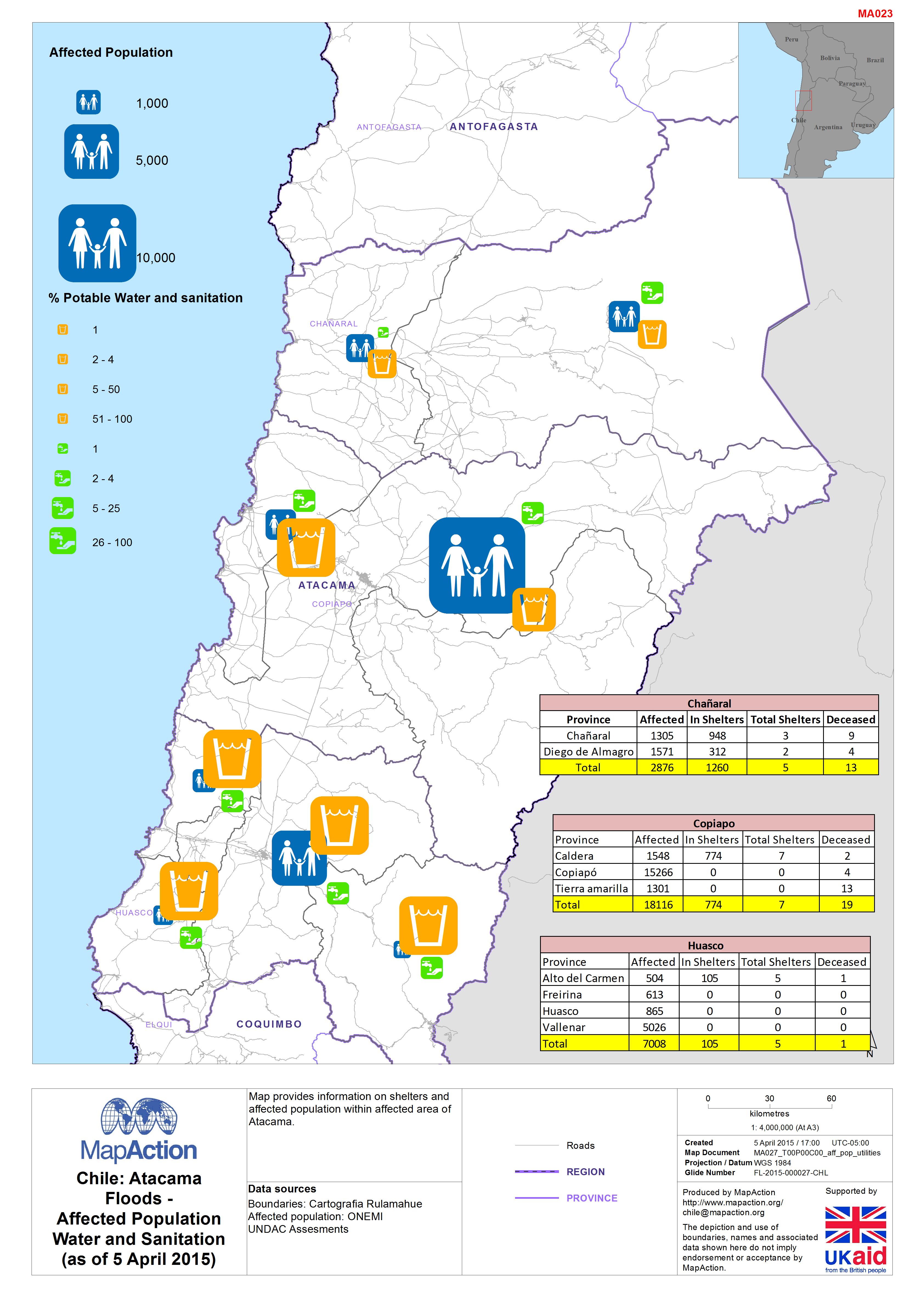
Chile: AtacamaFloods -Affected PopulationWater and Sanitation(as of 6 April 2...
Map provides information on shelters and affected population within affected area of Atacama. -
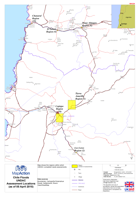
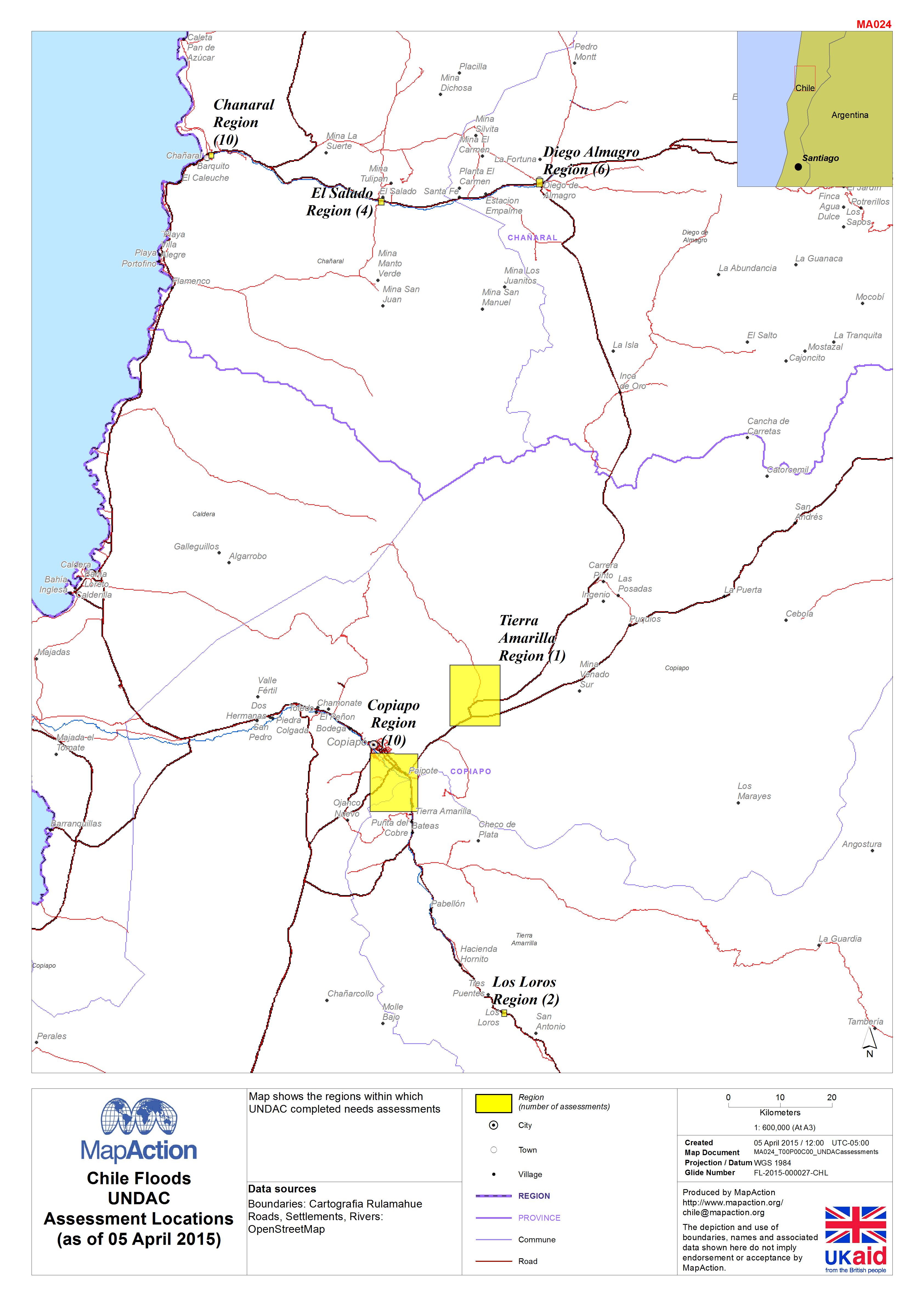
Chile Floods UNDAC Assessment Locations (as of 05 April 2015)
This dataset has no description
-

Chile: AtacamaFloods -Affected PopulationWater and Sanitation(as of 5 April 2...
This dataset has no description
-

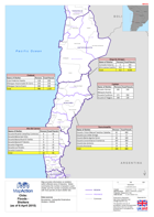
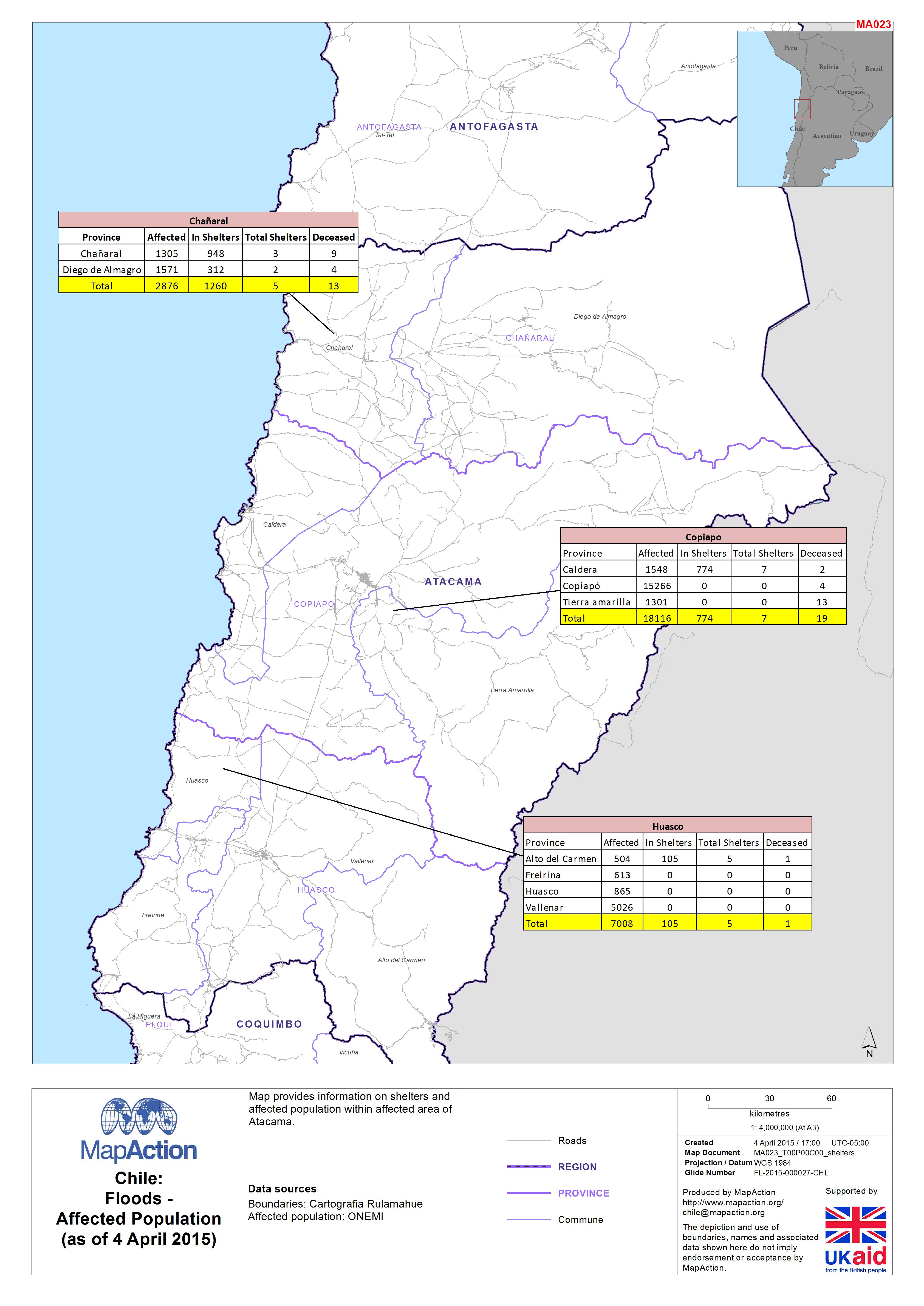
Chile:Floods -Affected Population(as of 4 April 2015)
Map provides information on shelters and affected population within affected area of Atacama. -

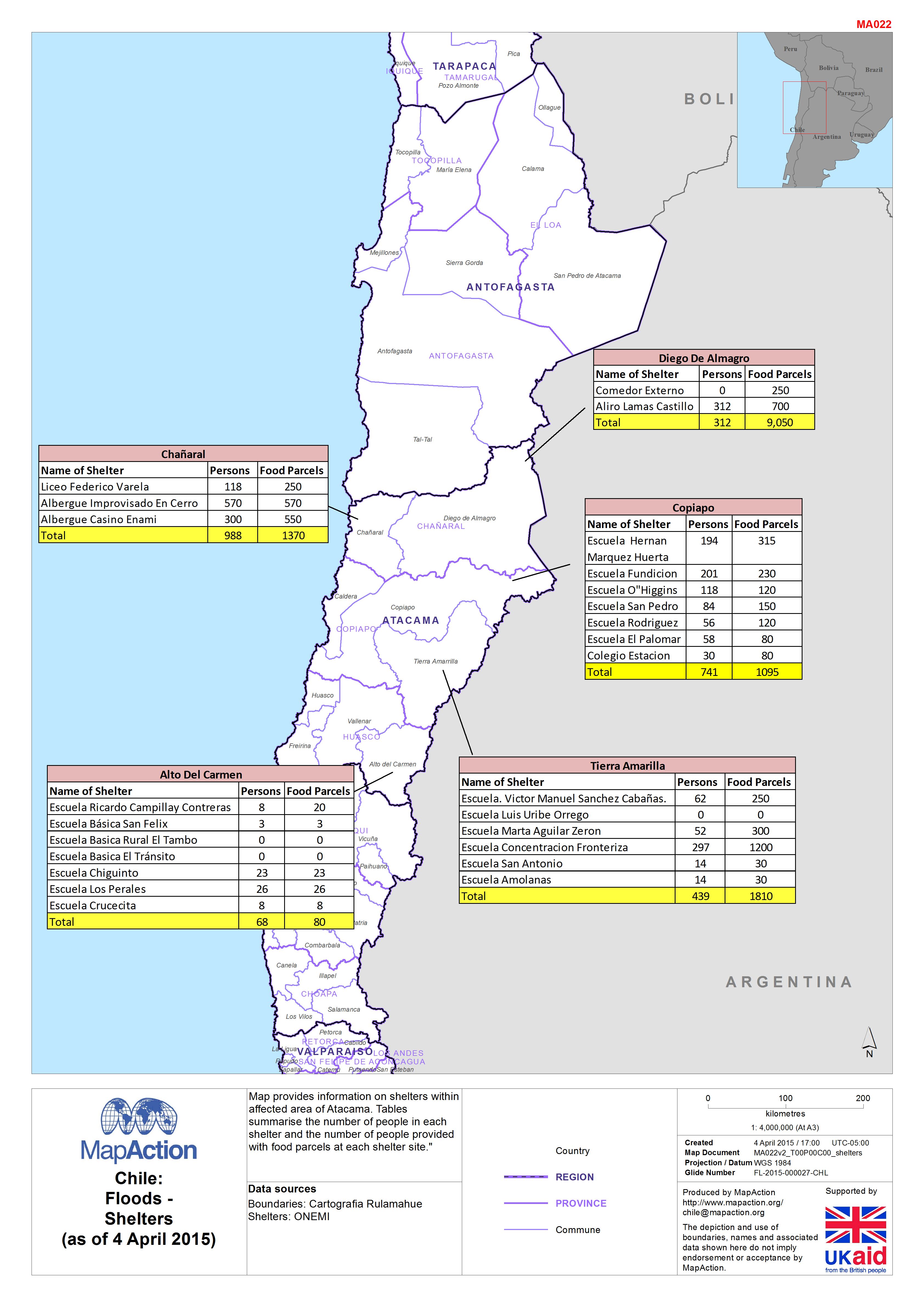
Chile:Floods -Shelters(as of 4 April 2015)
Map provides information on shelters within affected area of Atacama. Tables summarises the number of people in each shelter and the number of people provided with food parcels... -
-
-

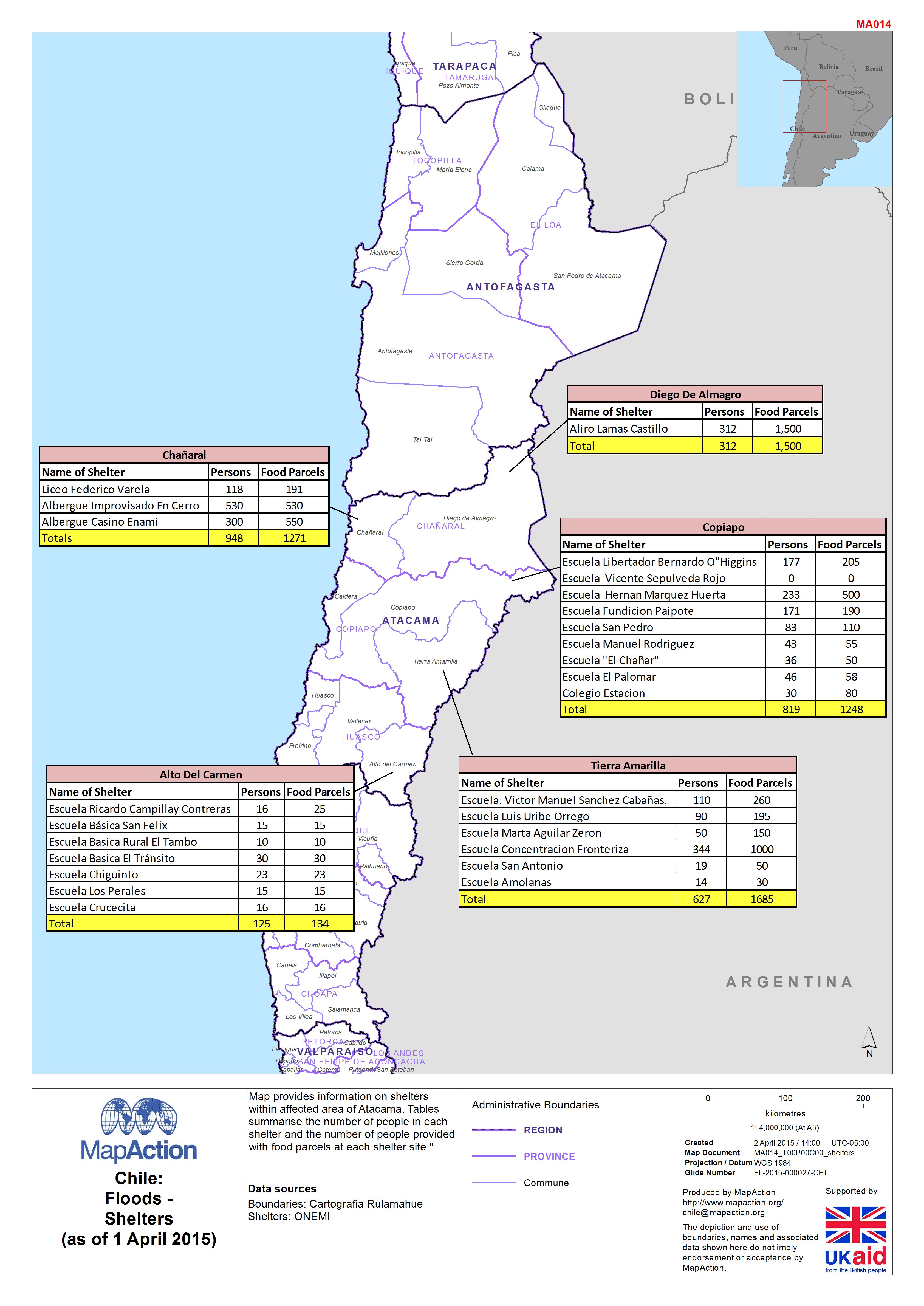
Chile:Floods -Shelters (as of 1 April 2015)
Map provides information on shelters within affected area of Atacama. Tables summarise the number of people in each shelter and the number of people provided with food parcels... -
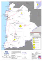
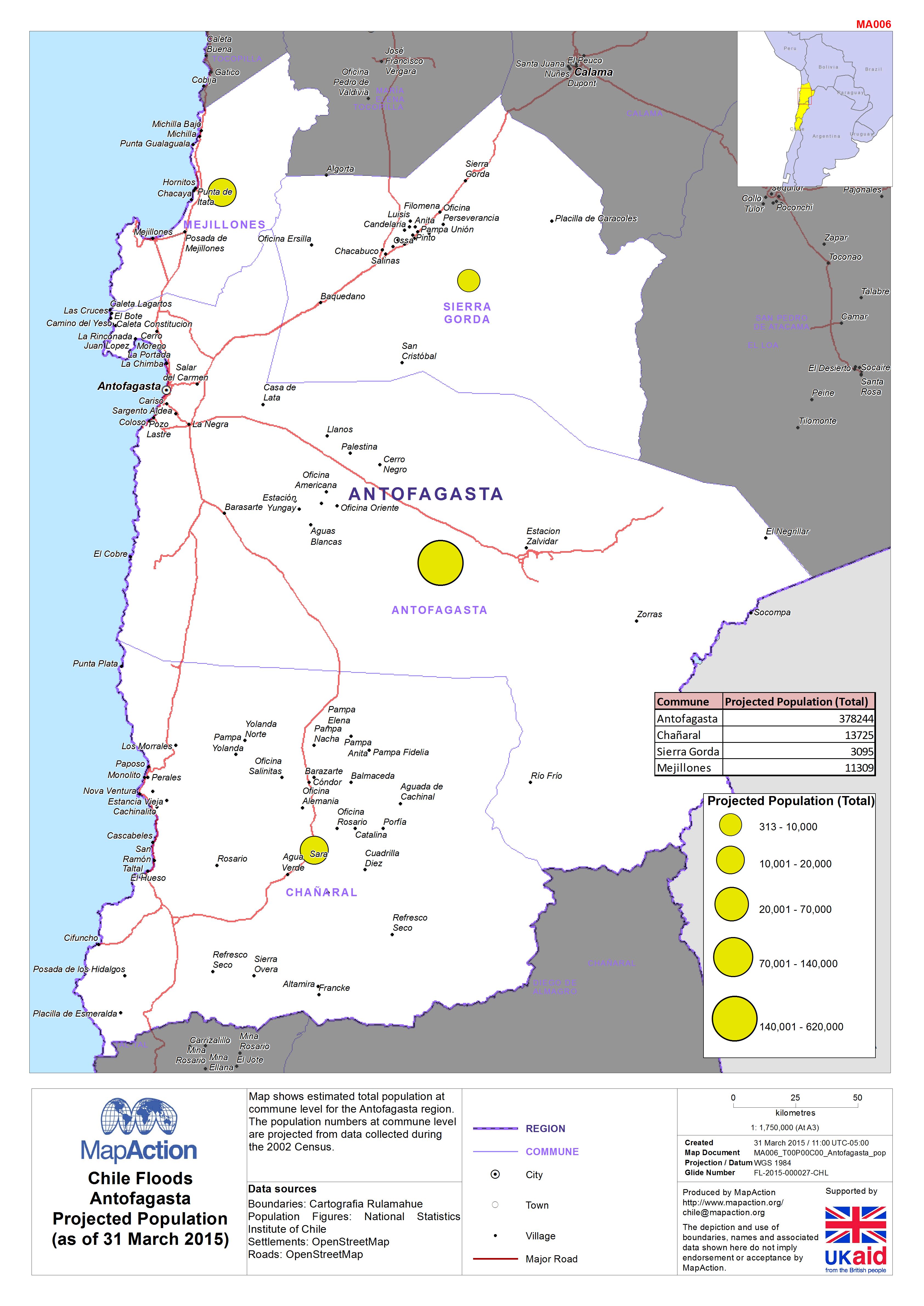
Chile: Floods - Antofagasta Projected Population (as of 31 March 2015)
Map shows estimated total population at commune level for the Antofagasta region. The population numbers at commune level are projected from data collected during the 2002 Census. -

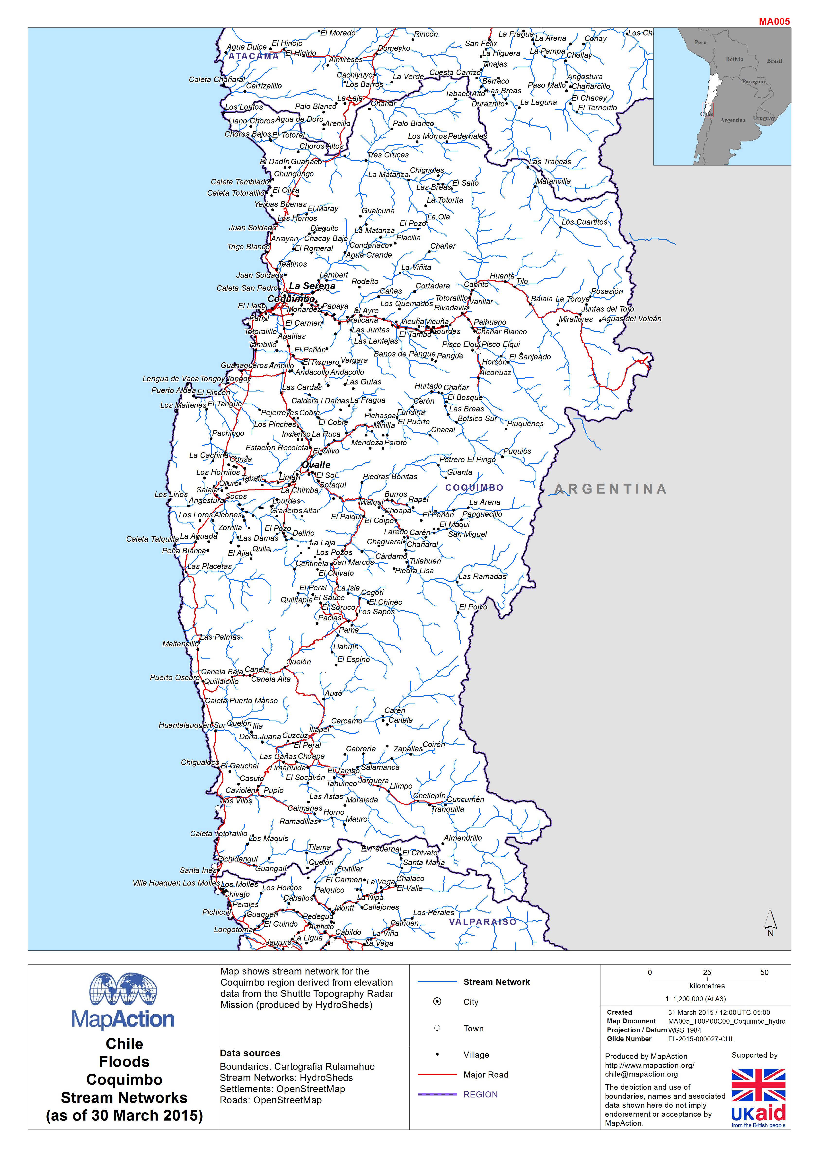
Chile: Floods - CoquimboStream Networks(as of 30 March 2015)
Map shows stream network for the Coquimbo region derived from elevation data from the Shuttle Topography Radar Mission (produced by HydroSheds) -
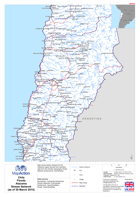
Chile: Floods - AtacamaStream Network(as of 30 March 2015)
Map shows stream network for the Atacama region derived from elevation data from the Shuttle Topography Radar Mission (produced by HydroSheds)