-
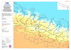
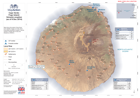
Nepal: Earthquake - Winterisation planning: mean January temperature in prior...
Mean temperature of coldest month (January) in the priority affected districts of the April 2015 earthquake. Based on historical temperature data from BioClim. -
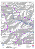
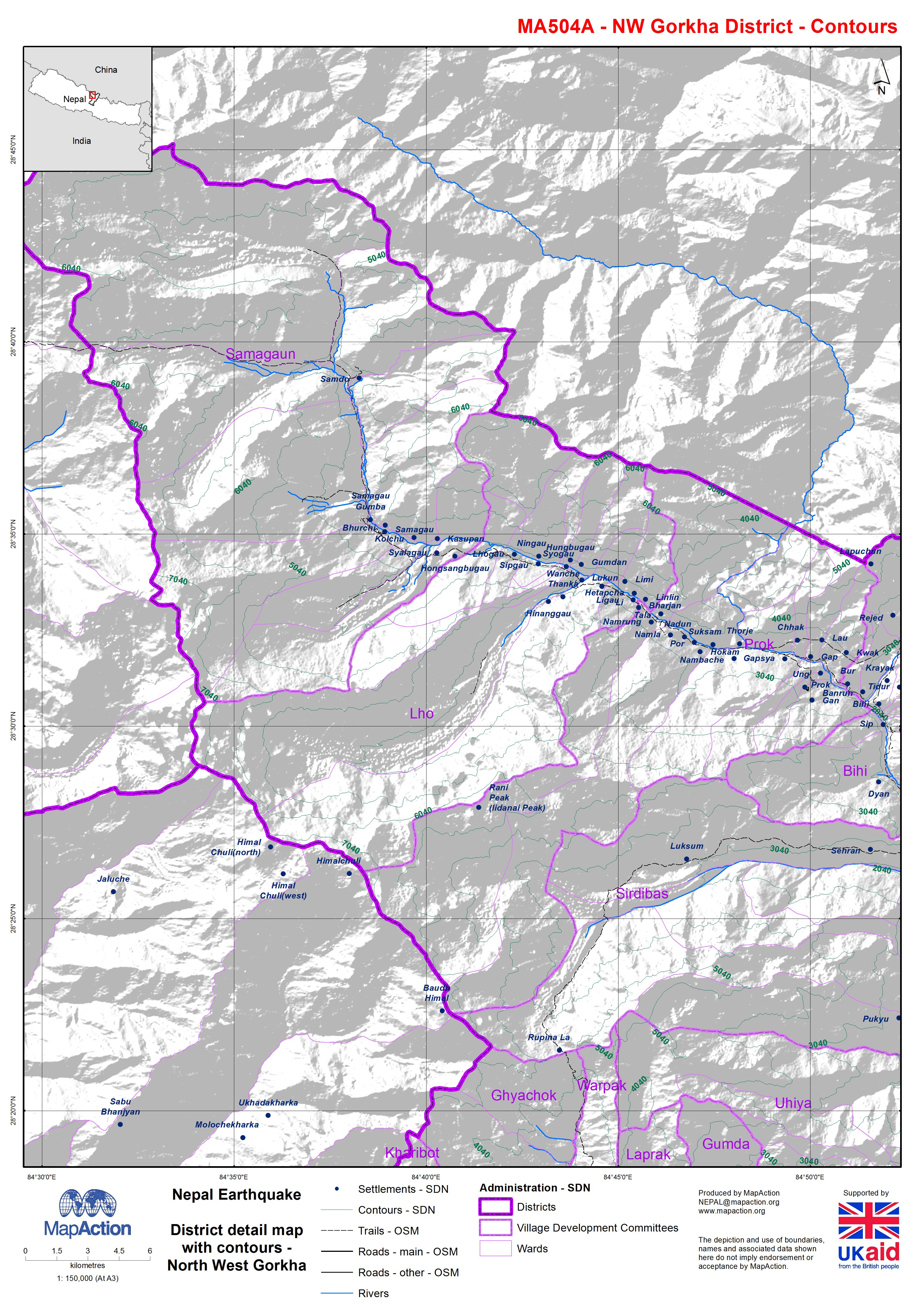
Nepal: Earthquake - District detail map with contours - North West Gorkha
Map shows the terrain, roads, rivers and settlements. -

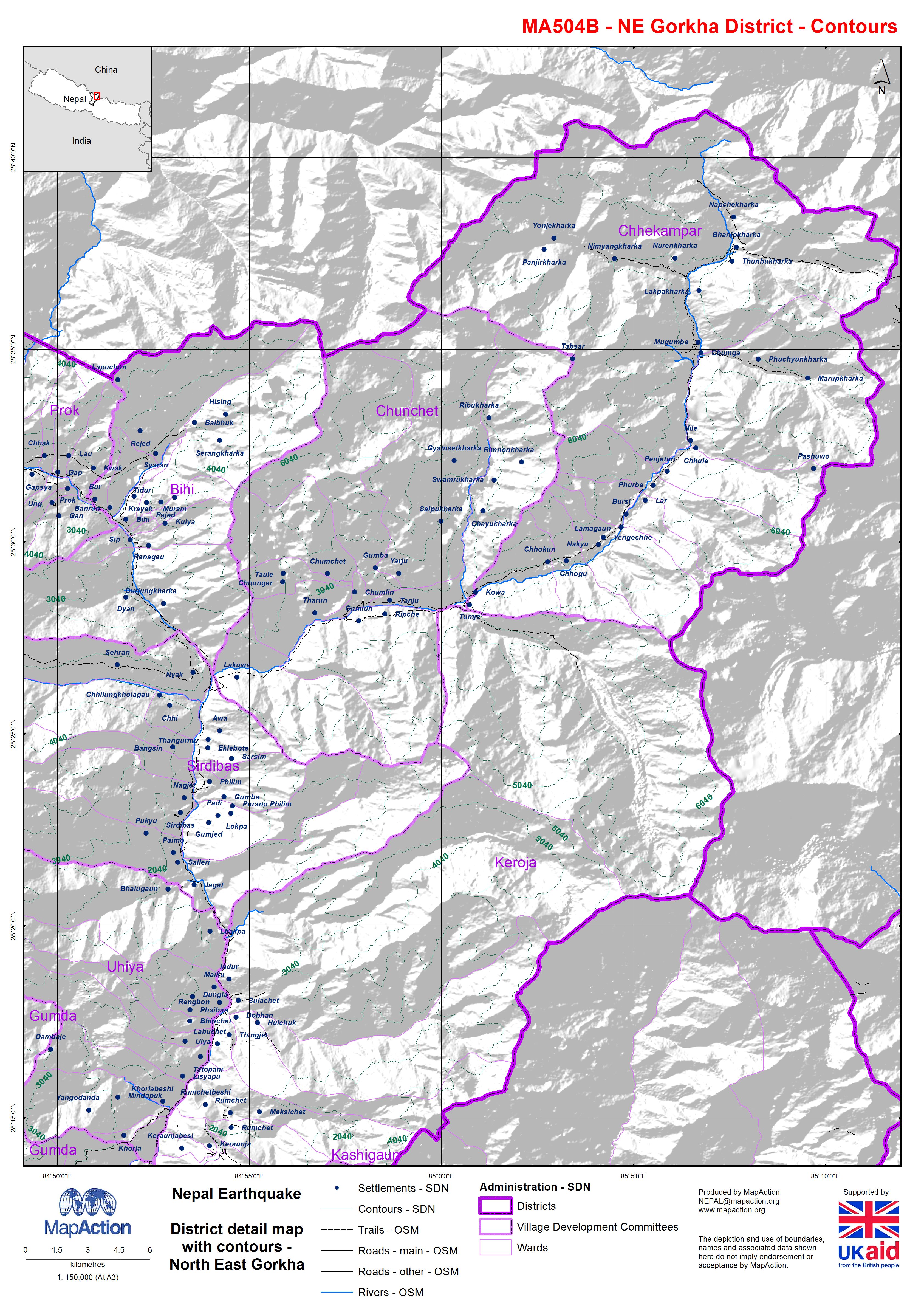
Nepal: Earthquake - District detail map with contours - North East Gorkha
Map shows the terrain, roads, rivers and settlements. -
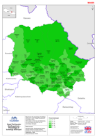
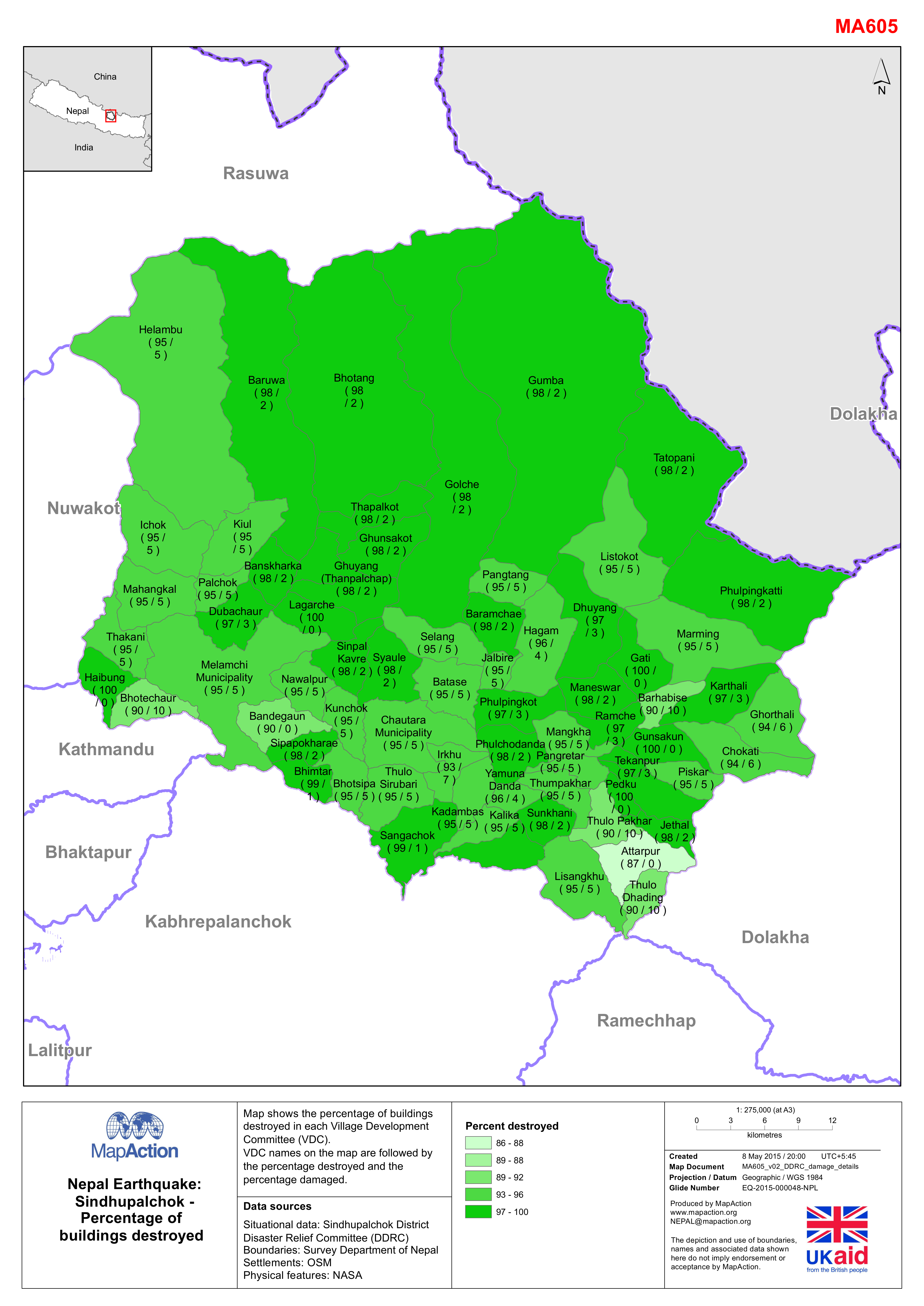
Nepal: Earthquake - Sindhupalchok - Percentage of destroyed buildings
Map shows the percentage of buildings destroyed in each Village Development Committee (VDC). The VDC names on the map are followed by the percentage destroyed and the percentage... -

Vanuatu: Cyclone PAM - Purification Tablets - Needs, Delivered, For Delivery ...
Map shows information on the number of Purification tablets required, delivered and for delivery per island. The gap is the difference between the requirement needs and what has... -
Pakistan WASH Cluster - Who, What, Where, by District - 19 August 2010
This dataset has no description
-

Pakistan Wash Cluster - Who, What, Where by District - 19 August 2010
This dataset has no description
-

Cape Verde - Fogo Island: Shelters location (as of 11 Dec 2014)
Map shows the shelter locations, evacuation points and critical points for lava flow. -
Cape Verde - Fogo Island: Volcanic eruption (as of 9 Dec 2014)
Map shows the extent of lava flows from satellite images on 8 Dec 2014. Evacuated population located in Monte Grande, Achada das Fumas and Mosteiros (UNDAC). -
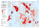
MA508 Philippines Typhoon Haiyan (Yolanda): Negros Occ. Barangay Reference Ma...
MA508 Philippines Typhoon Haiyan (Yolanda): Negros Occ. Barangay Reference Map Series (as of 16 Dec 2013) -
MA508 Philippines Typhoon Haiyan (Yolanda): Guimaras Barangay Reference Map S...
MA508 Philippines Typhoon Haiyan (Yolanda): Guimaras Barangay Reference Map Series (as of 16 Dec 2013) -
MA508 Philippines Typhoon Haiyan (Yolanda): Antique Barangay Reference Map Se...
MA508 Philippines Typhoon Haiyan (Yolanda): Antique Barangay Reference Map Series (as of 16 Dec 2013) -
MA508 Philippines Typhoon Haiyan (Yolanda): Aklan Barangay Reference Map Seri...
This dataset has no description
-

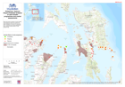
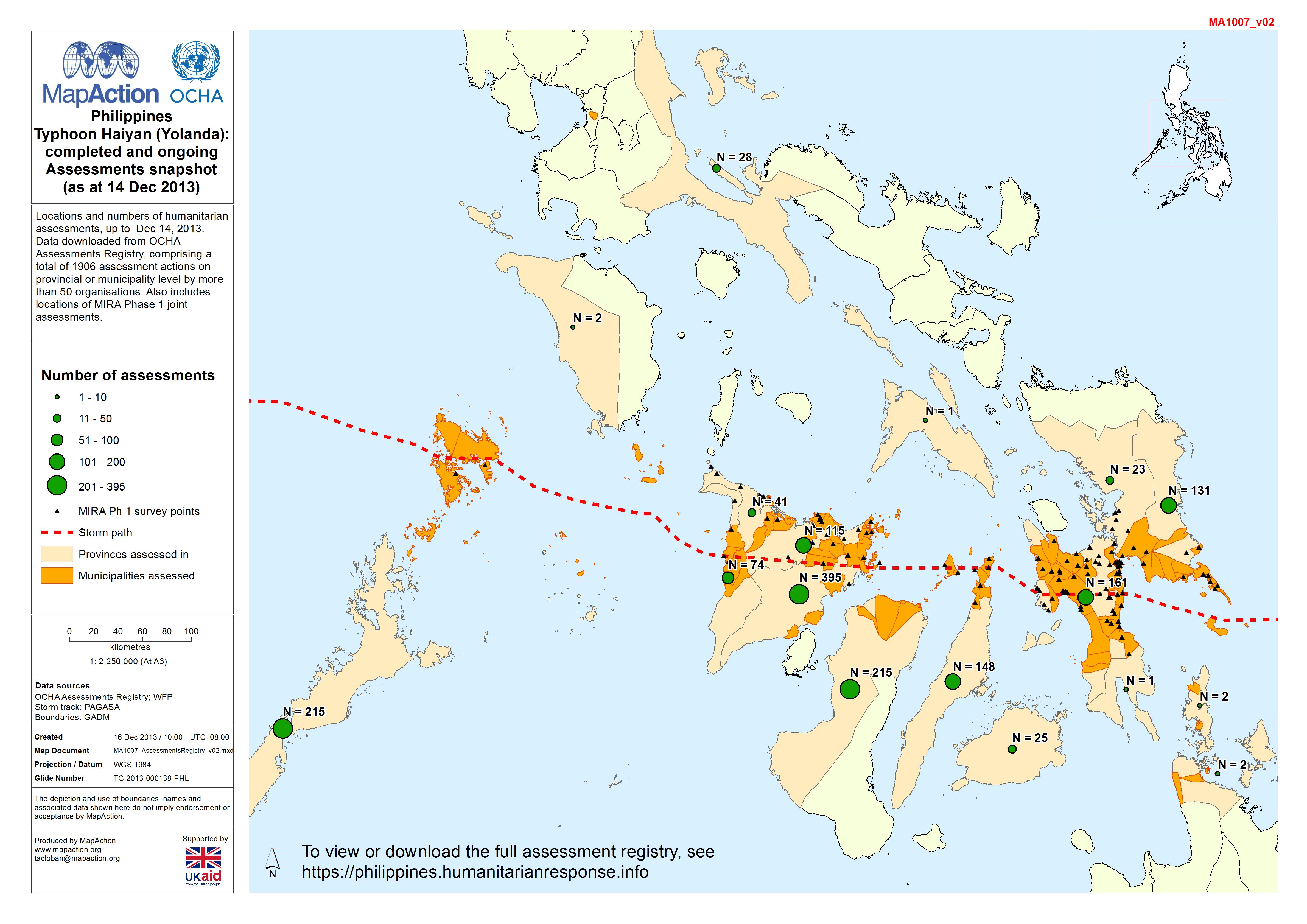
Philippines Typhoon Haiyan (Yolanda): completed and ongoing Assessments snaps...
Map shows locations and numbers of humanitarian assessments up to Dec 14, 2013. -
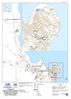
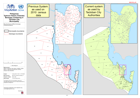
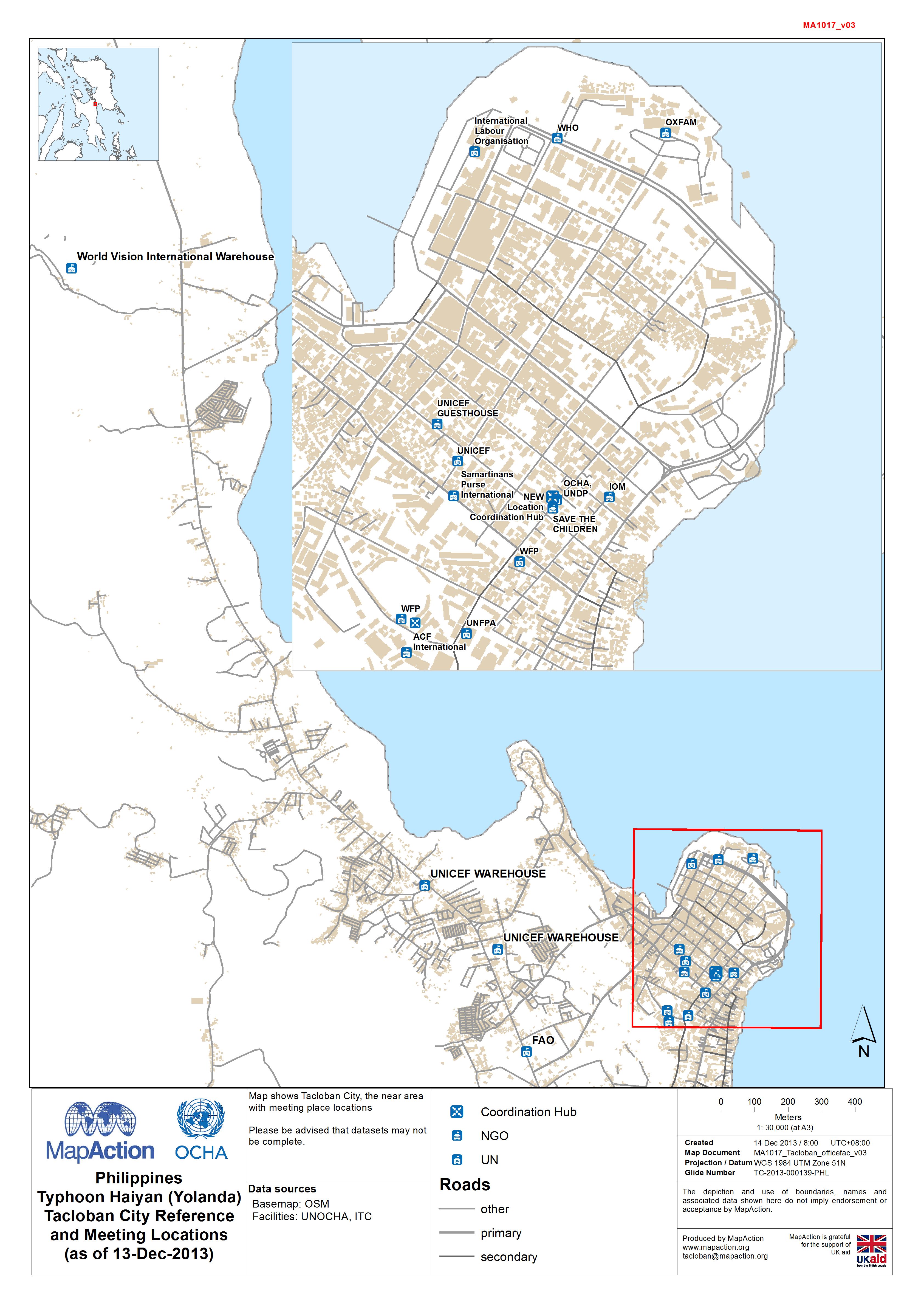
Philippines Typhoon Haiyan (Yolanda) Tacloban City Reference and Meeting Loca...
Map shows Tacloban City and surrounding area, with meeting place locations -
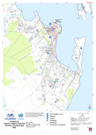
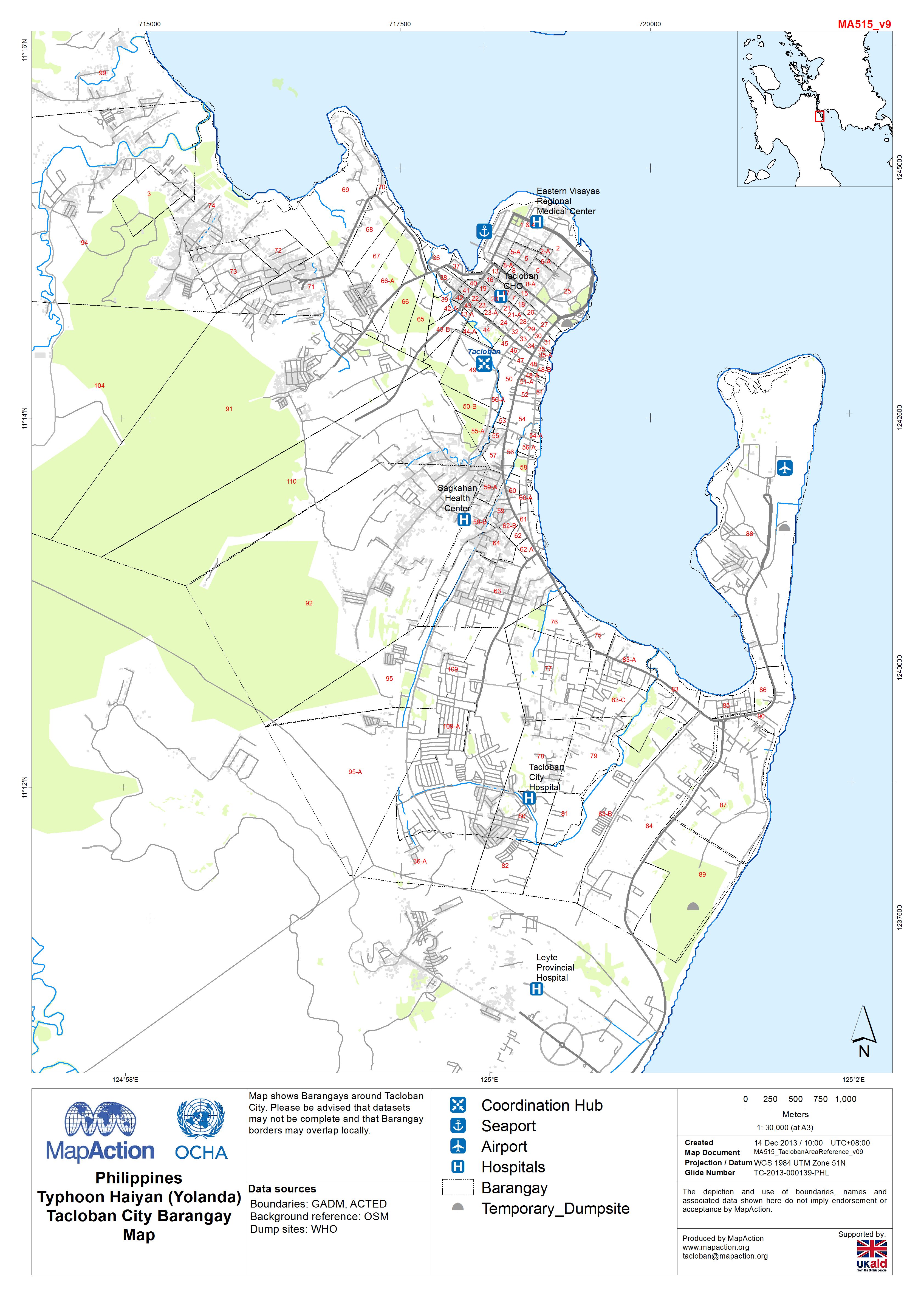
Philippines Typhoon Haiyan (Yolanda) Tacloban City Barangay Map
Map shows Barangays around Tacloban City. Please be advised that datasets may not be complete and that Barangay borders may overlap locally. -
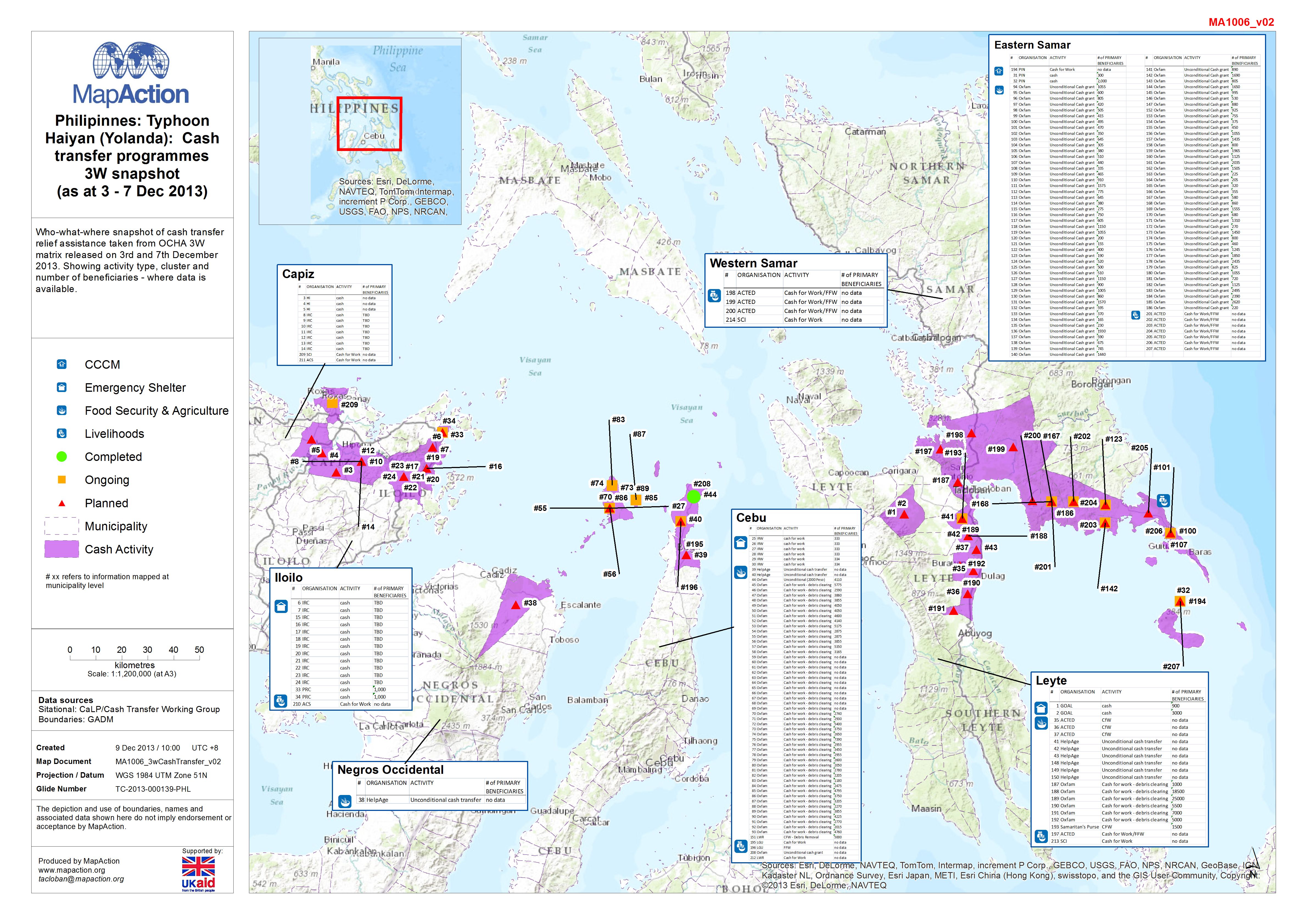
Philipinnes: Typhoon Haiyan (Yolanda) - Cash transfer programmes 3W snapshot ...
Who-what-where snapshot of cash transfer relief assistance taken from OCHA 3W matrix released on 3rd and 7th December 2013. Showing activity type, cluster and number of... -
PhilippinesTyphoon Haiyan (Yolanda):3W Overview - Data from 10-Dec-2013
Map shows number of Cluster activities per Province. Increase or decrease since last 3W matrix output is also indicated. Information has been taken from OCHA and... -
PhilippinesTyphoon Haiyan (Yolanda):Barangay numbering in Tacloban CityMunici...
Map showing two different barangay numbering systems -
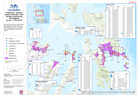
MA1014 Philipinnes: Typhoon Haiyan (Yolanda): Analysis of cash transfer progr...
Who-what-where snapshot of cash transfer relief assistance taken from OCHA 3W matrix released on 3rd and 7th December 2013. Combined with market assessment data. Symbols...