-
Indonesia: Sumatra Earthquake - Assessment East 05-Oct-2009
Map shows administrative boundaries within Sumatera Barat (West Sumatra) province. Place codes (p-codes) are shown in labels and should be used when referring to districts and... -
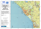
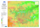
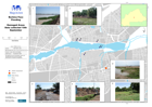
Indonesia: Sumatra Earthquake - Topographic map of main affected area (Southe...
Map is based on a 1:250,000 scale sheet from Bakosurtenal the Indonesian national mapping agency. The map was surveyed in 1981. Administrative boundaries of districts are overlaid. -
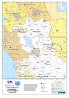
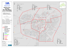
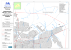
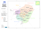
Indonesia: Sumatra Earthquake - Agam District 06-Oct-2009
Map shows administrative boundaries within Sumatera Barat (West Sumatra) province. Place codes (p-codes) are shown in labels and should be used when referring to districts and... -

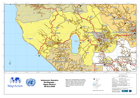
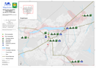
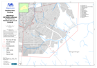
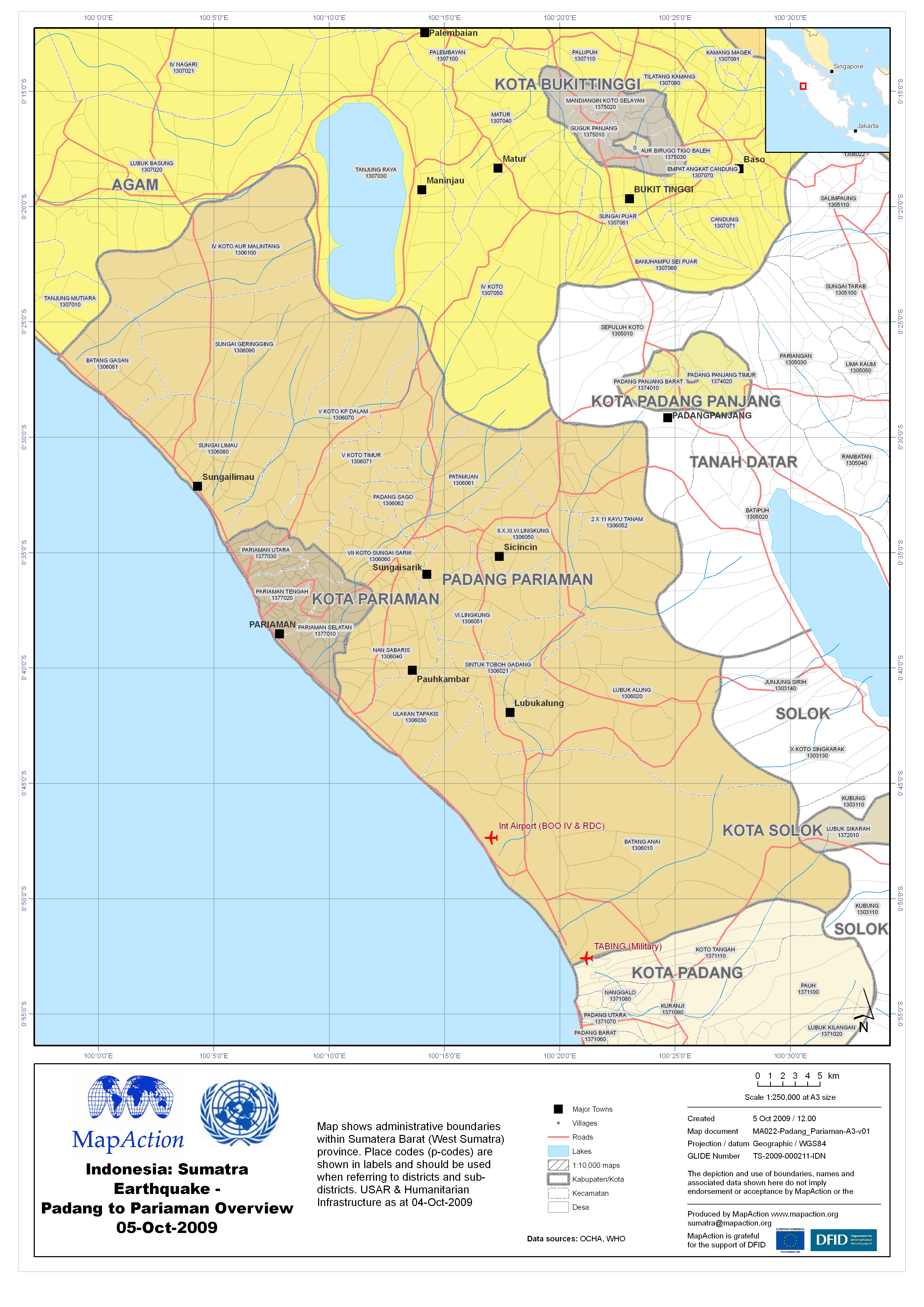
Indonesia: Sumatra Earthquake - Padang to Pariaman Overview 05-Oct-2009
Map shows administrative boundaries within Sumatera Barat (West Sumatra) province. Place codes (p-codes) are shown in labels and should be used when referring to districts and... -

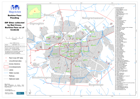
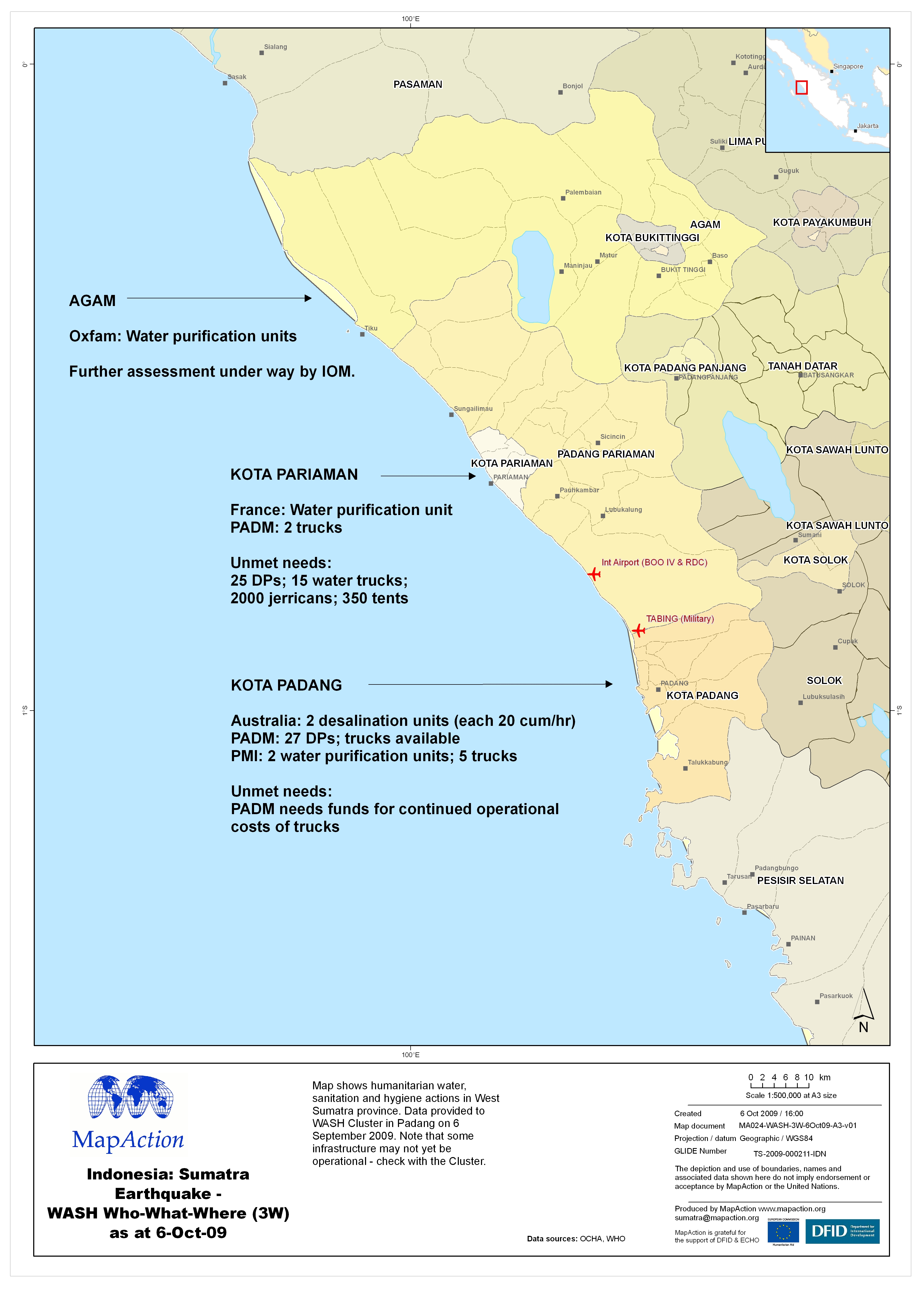
Indonesia: Sumatra Earthquake - WASH Who-What-Where (3W) as at 6-Oct-09
Map shows humanitarian water, sanitation and hygiene actions in West Sumatra province. Data provided to WASH Cluster in Padang on 6 September 2009. Note that some infrastructure... -

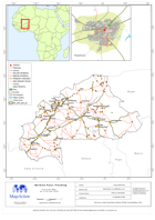
Burkina Faso: Flooding - Inondations Provinces sinistrees (au 17 Sept 2009)
La carte montre les provinces sinistrees par les inondations au Burkina Faso. -
-
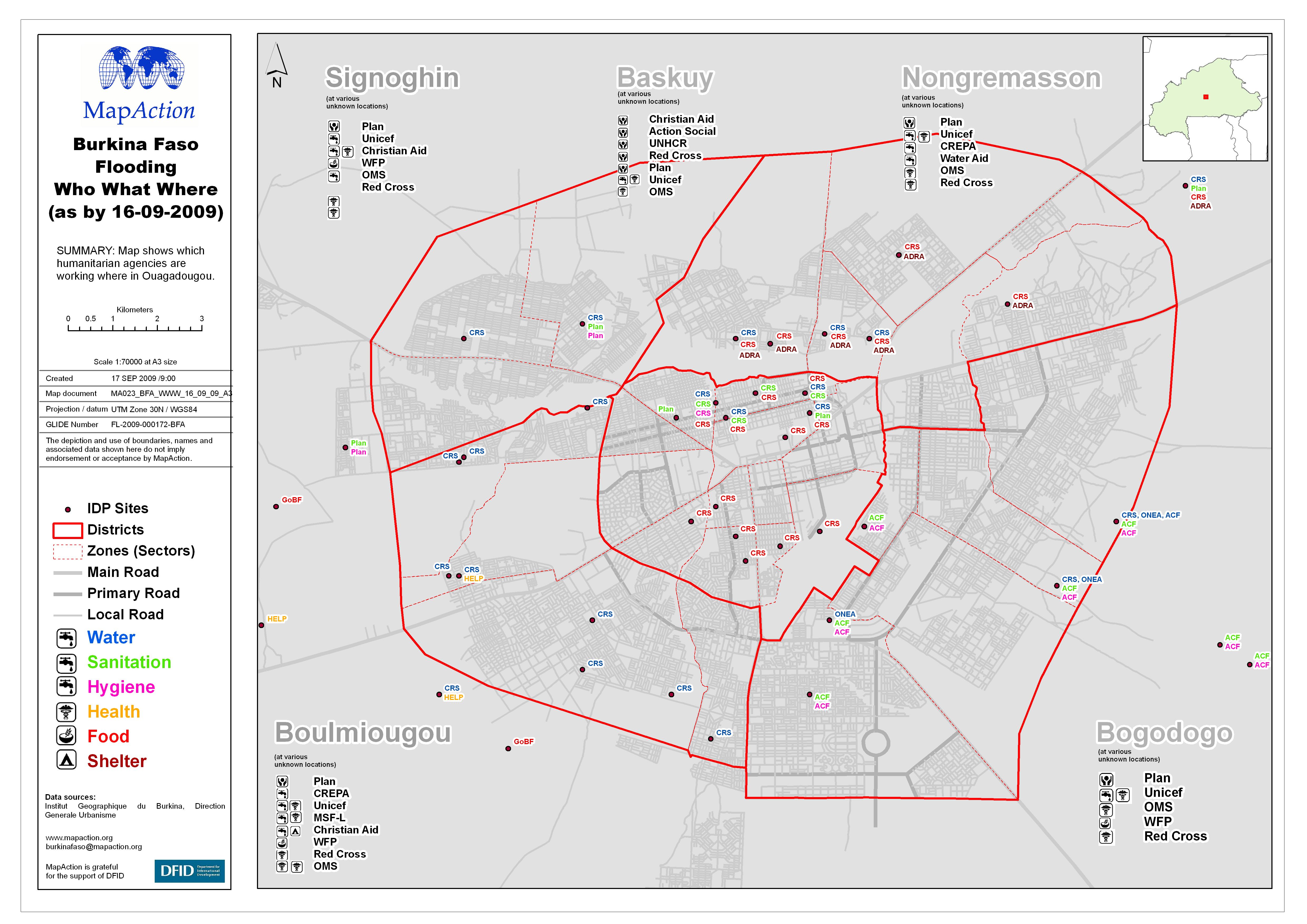
Burkina Faso: Flooding - Who What Where (as by 16-09-2009)
Map shows which humanitarian agencies are working where in Ouagadougou. -
Burkina Faso: Flooding - Ponts affecte (en date de 14 Sep 2009)
This dataset has no description
-
Burkina Faso: Flooding - Elevation and Waterways in the Ouagadougou area
This dataset has no description
-
Burkina Faso: Flooding - IDP Sites collected by Red Cross as of 10 Sept 2009
This dataset has no description
-

Burkina Faso: Flooding - Baskuy IDP Sites collected by Red Cross as of 10 Sep...
This dataset has no description
-
Burkina Faso: Flooding - Bogodogo IDP Sites collected by Red Cross as of 10 S...
This dataset has no description
-
Burkina Faso: Flooding - Nongremasson IDP Sites collected by Red Cross as of ...
This dataset has no description
-

Burkina Faso: Flooding - Boulmiougou IDP Sites collected by Red Cross as of 1...
This dataset has no description
-

Burkina Faso: Flooding - Signoghin IDP Sites collected by Red Cross as of 10 ...
This dataset has no description
-
Burkina Faso: Flooding - Damaged Areas Data collected 10th September
This dataset has no description
-
-
Burkina Faso: Flooding - Ouagadougou Administration
Carte de arrondissements et secteurs de Ouagodougou -
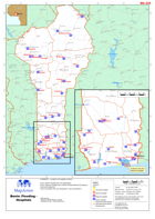
Benin: Flooding - Hospitals
Locations of hospitals in Benin. Every district hospital has one ambulance. Every regional hospital has a SAMU (Mobile Medical Emergency Service) ambulance. Every fire station...