-
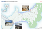
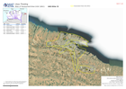
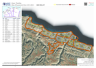
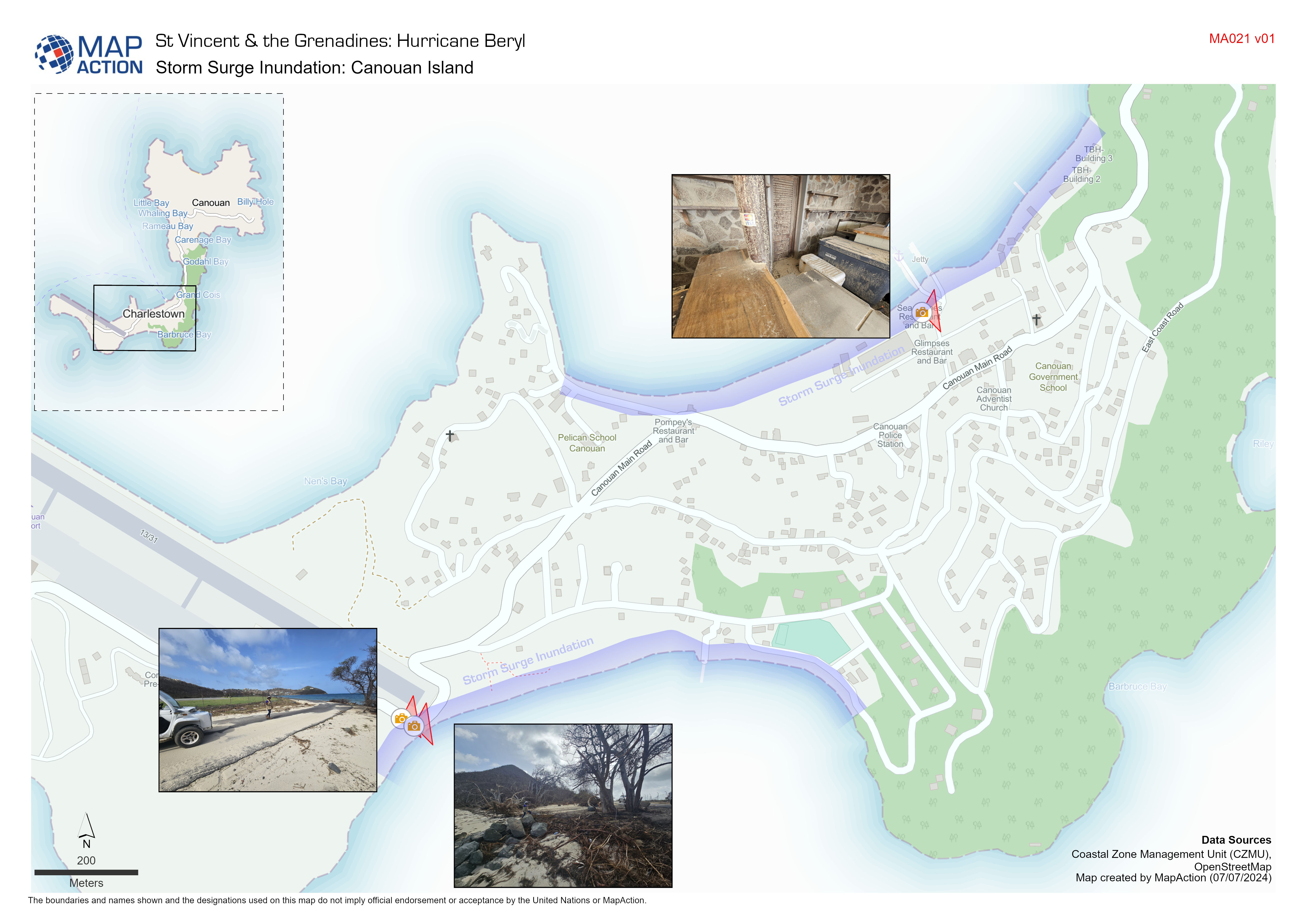
Storm Surge Inundation: Canouan Island
Indicative storm surge inundation from field observations conducted by Coastal Zone Management Unit. -
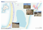
Storm Surge Inundation: Mayreau Island
Indicative storm surge inundation from field observations conducted by Coastal Zone Management Unit -
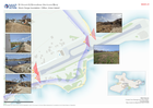
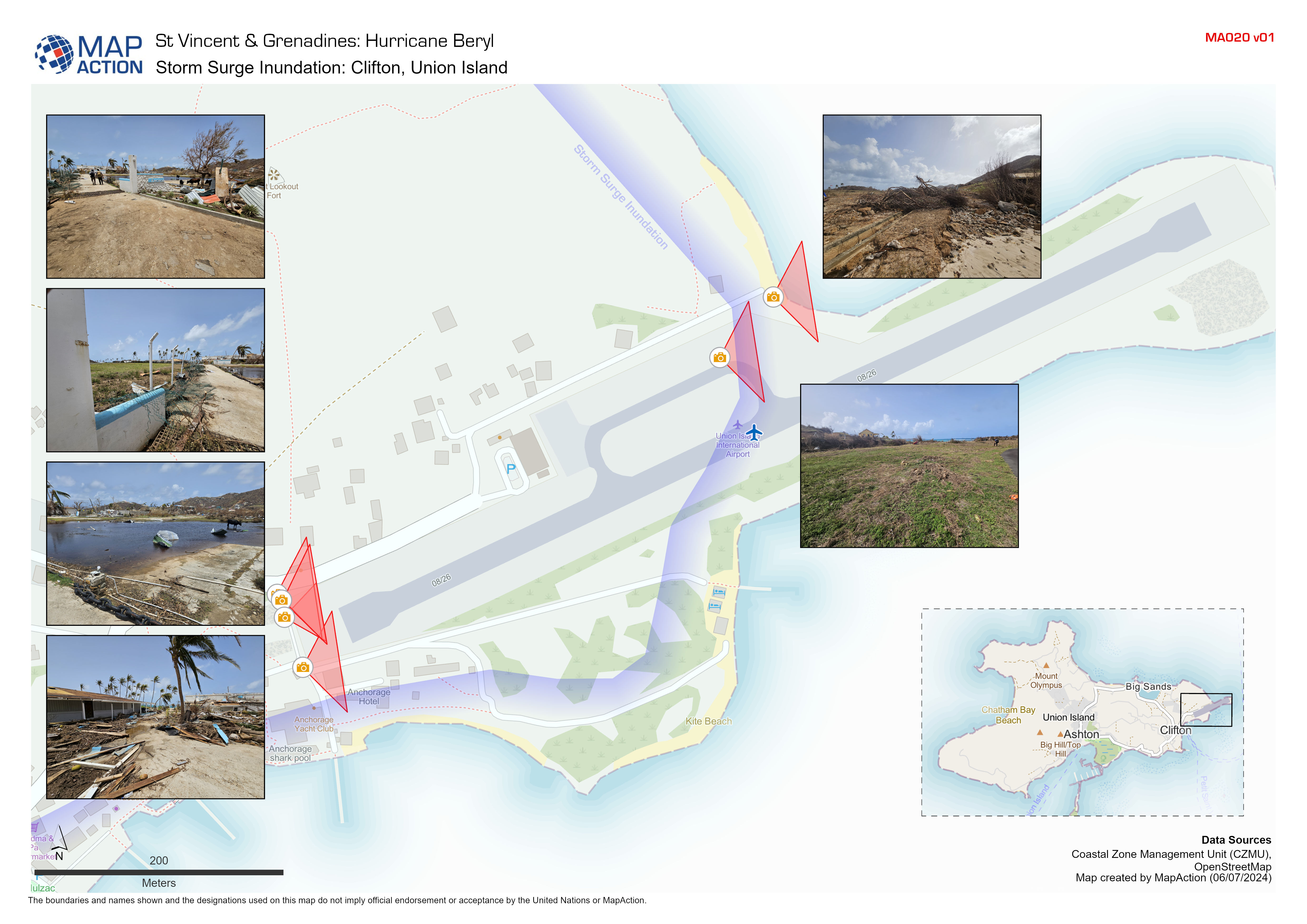
Storm Surge Inundation: Clifton, Union Island
Indicative storm surge inundation from field observations conducted by Coastal Zone Management Unit -

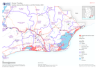
COPERNICUS EMS Building Assessment 5 July - Union Island: Atlas
Overview of Union Island showing damage assessment data sourced from Copernicus EMS, 5 July. -

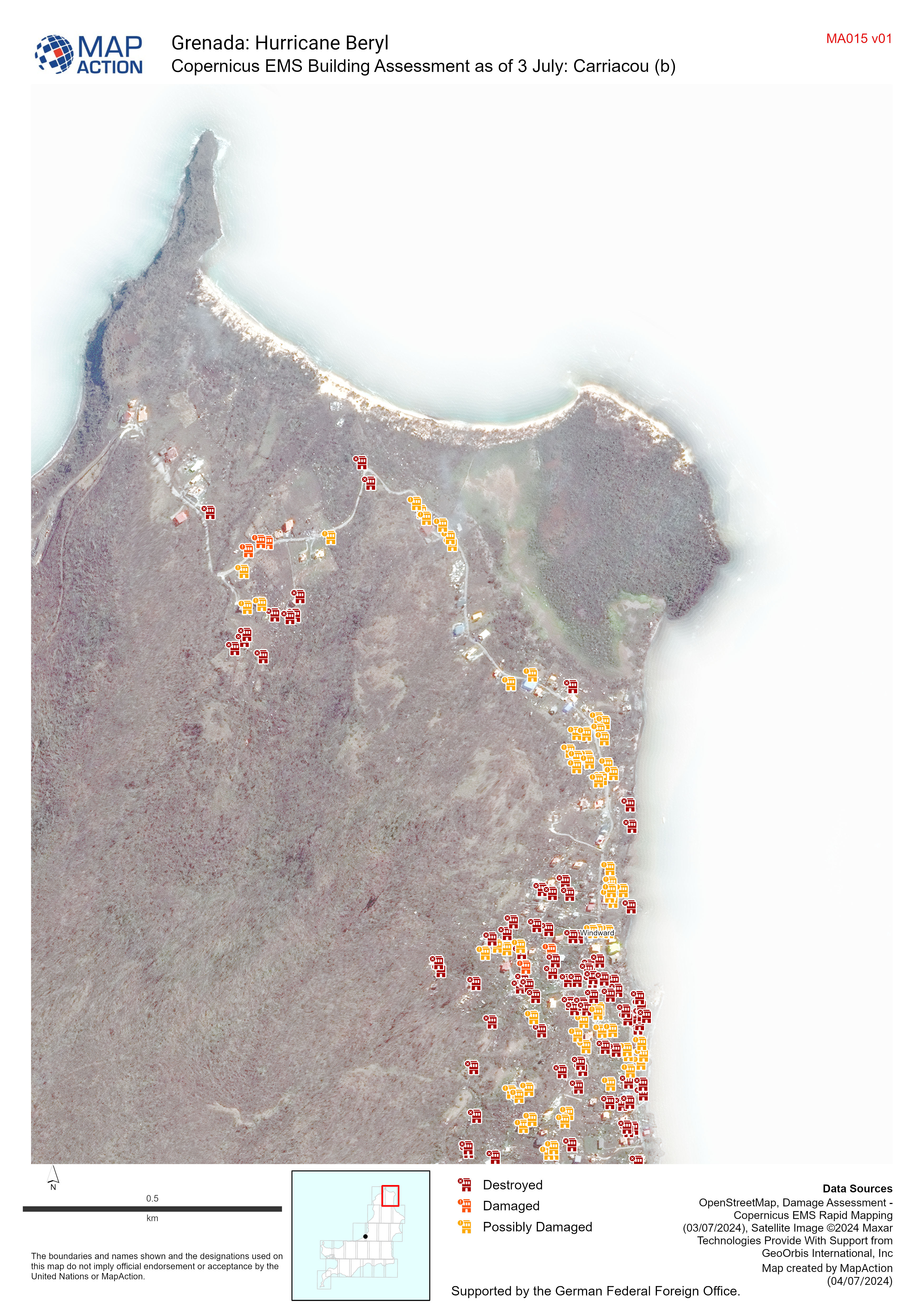
Copernicus EMS Building Assessment as of 3 July Carriacou
Map shows the building assessment done by Copernicus EMS as of 3 July -

Buildings and Extent of Wildfires within NEMO Area of Focus:
A map showing building footprints and the extent of wildfires derived by the Copernicus Emergency Mapping Service (EMS) and from Sentinel-2 satellite images. Populated areas and... -

Extent of Wild Fires from the Copernicus EMSR726 Activation:
A map showing the extent of wildfires derived by the Copernicus Emergency Mapping Service (EMS). Affected areas shown in context of populated areas and main road network on... -

NEMO Area of Focus:
A map showing the indicative extent of wildfires from aerial imagery within areas of interest (AOI) in the context of populated areas and main road network on district (admin 1)... -

Protected Areas and Extent of Wildfires within NEMO Area of Focus:
A map showing protected areas and the extent of wildfires derived by the Copernicus Emergency Mapping Service (EMS) and from Sentinel-2 satellite images. Populated areas and... -

Protected Areas and Extent of Wildfires:
A map showing protected areas and the extent of wildfires derived by the Copernicus Emergency Mapping Service (EMS) and Sentinel-2 satellite images. Populated areas and main... -

Indicative Areas Affected by Wildfires in Cayo and Toledo districts
A map showing the indicative extent of wildfires from aerial imagery in the context of populated areas and main road network on district (admin 1) level -

Flood Extent (02 Dec) and Baseline Population for South Somalia
The maps show the flood extent combined with population density to highlight potentially affected areas. The table shows the estimated baseline population by district (2021).... -

Flood Extents (As of 02 Dec 2023) and Baseline Population
Table shows estimated baseline population in 2022 for affected regions in South Somalia. Population distribution shown on map is based on Worldpop estimate for 2020. Flood... -
Satellite detected flood waters as of 23rd October 2023
Satellite detected water as of 23rd October 2023 for affected area -

ASAL Humanitarian Network Drought Response - Activity by Ward (as of 23 Augus...
The map shows the 3w (who, what, where) response activity by wards for the planned and ongoing multi-purpose cash program implemented by the ASAL Humanitarian Network (AHN), in... -

ASAL Humanitarian Network Drought Response - Activity by Sub County (as of 23...
The map shows the 3w (who, what, where) response activity by sub-county for the planned and ongoing multi-purpose cash program implemented by the ASAL Humanitarian Network... -
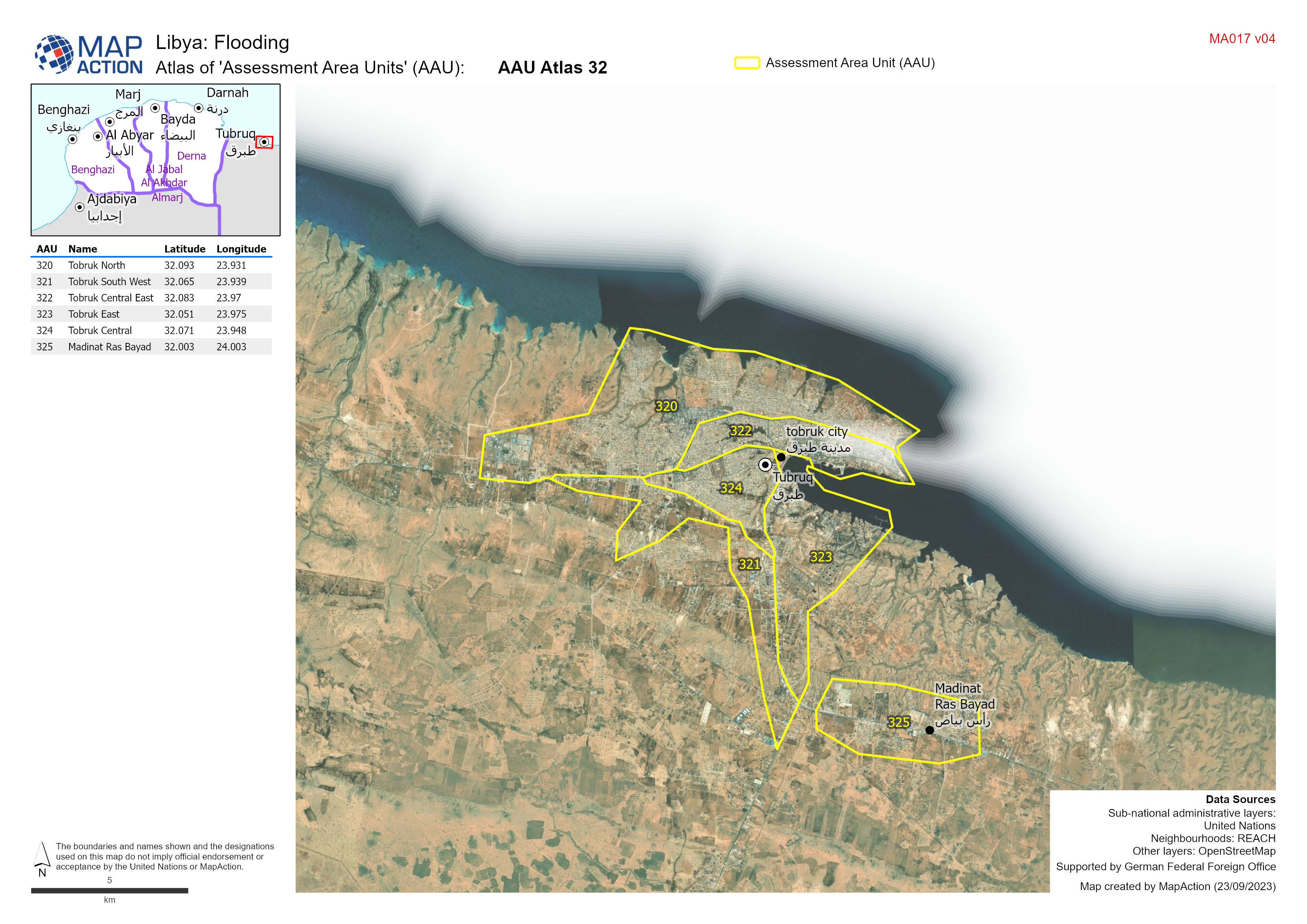
Atlas of 'Assessment Area Units' (AAU):
Atlas showing Assessment Area Units (AAUs) for urban area between Benghazi and Derna -
A3 Atlas of 'Assessment Area Units' (AAU) with imagery
Atlas showing Assessment Area Units (AAUs) for urban area between Benghazi and Derna version 3 -
'Assessment Area Units' (AAU) Overview
Showing Assesment Area Units (AAUs) atlas ages for urban area between Benghazi and Derna
