-

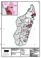
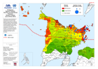
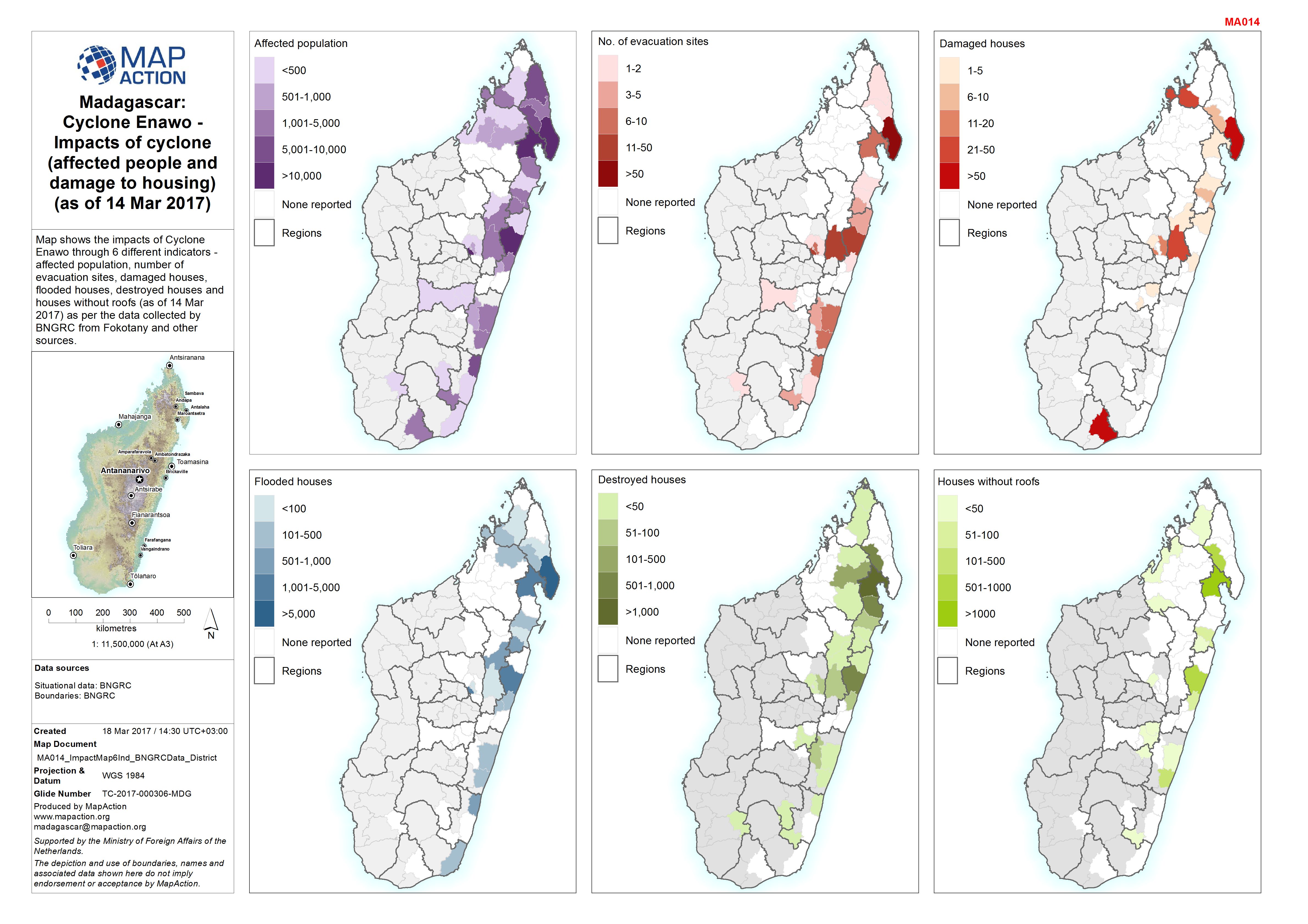
Madagascar: Cyclone Enawo - Impacts of cyclone (affected people and damage to...
Map shows the impacts of Cyclone Enawo through 6 different indicators - affected population, number of evacuation sites, damaged houses, flooded houses, destroyed houses and... -

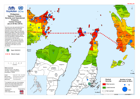
Madagascar: Cyclone Enawo - Current number of displaced people (as of 16 Mar ...
Map shows the current number of displaced people (as of 16 Mar 2017) as per the data collected by BNGRC from Fokotany and other sources. -
Madagascar: Cyclone Enawo - Current number of displaced people (as of 15 Mar ...
Map shows the current number of displaced people (as of 15 Mar 2017) as per the data collected by BNGRC from Fokotany and other sources. -

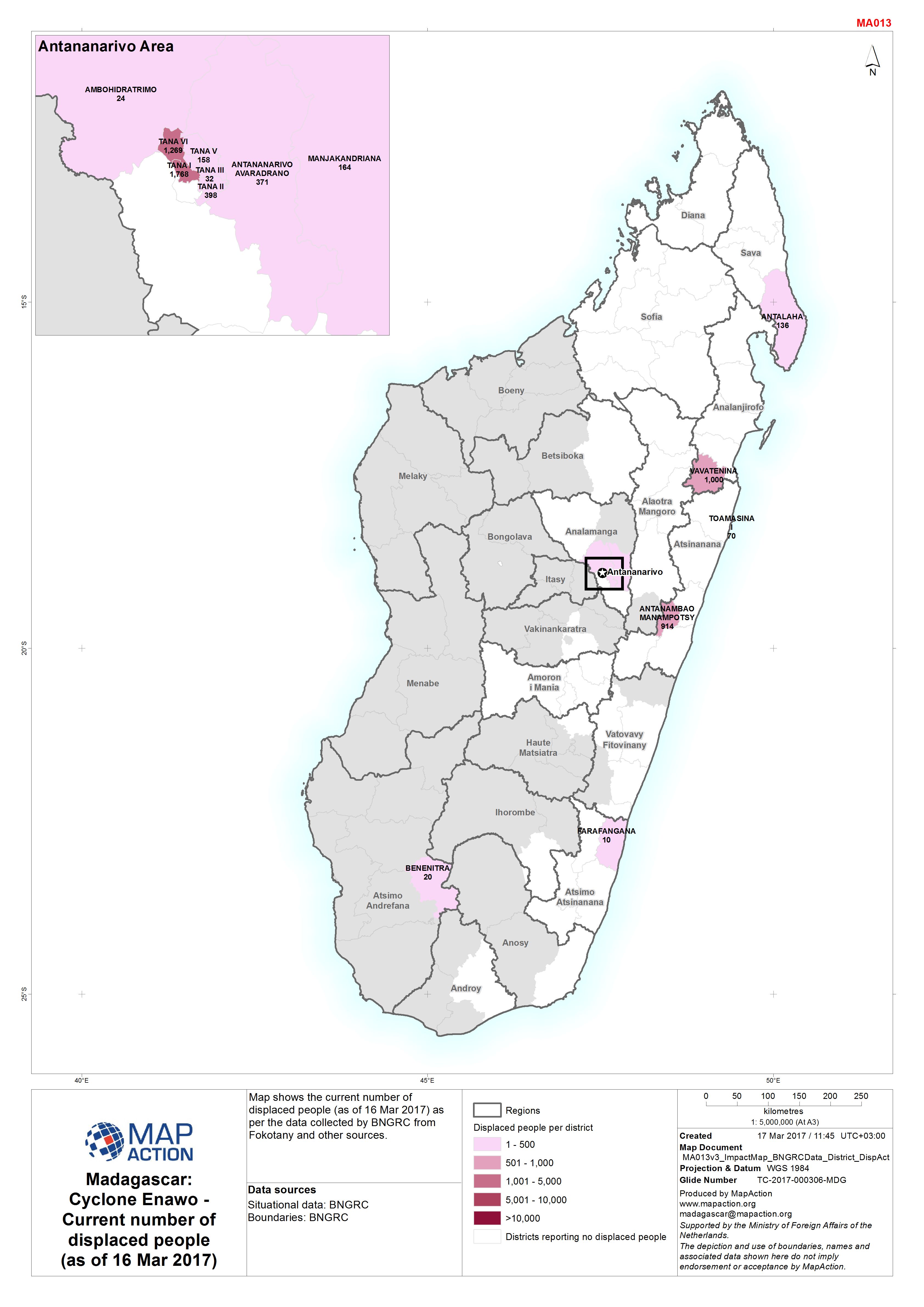
Madagascar: Cyclone Enawo - Current number of displaced people (as of 14 Mar ...
Map shows the current number of displaced people (as of 14 Mar 2017) as per the data collected by BNGRC from Fokotany and other sources. -

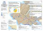
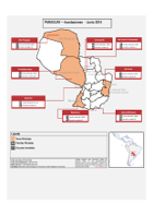
Paraguay: Inundaciones - Campamentos y Refugios (a 21 de Abril 2016)
El mapa muestra la ubicación de campamentos y refugios en Asunción con los hospitales. -

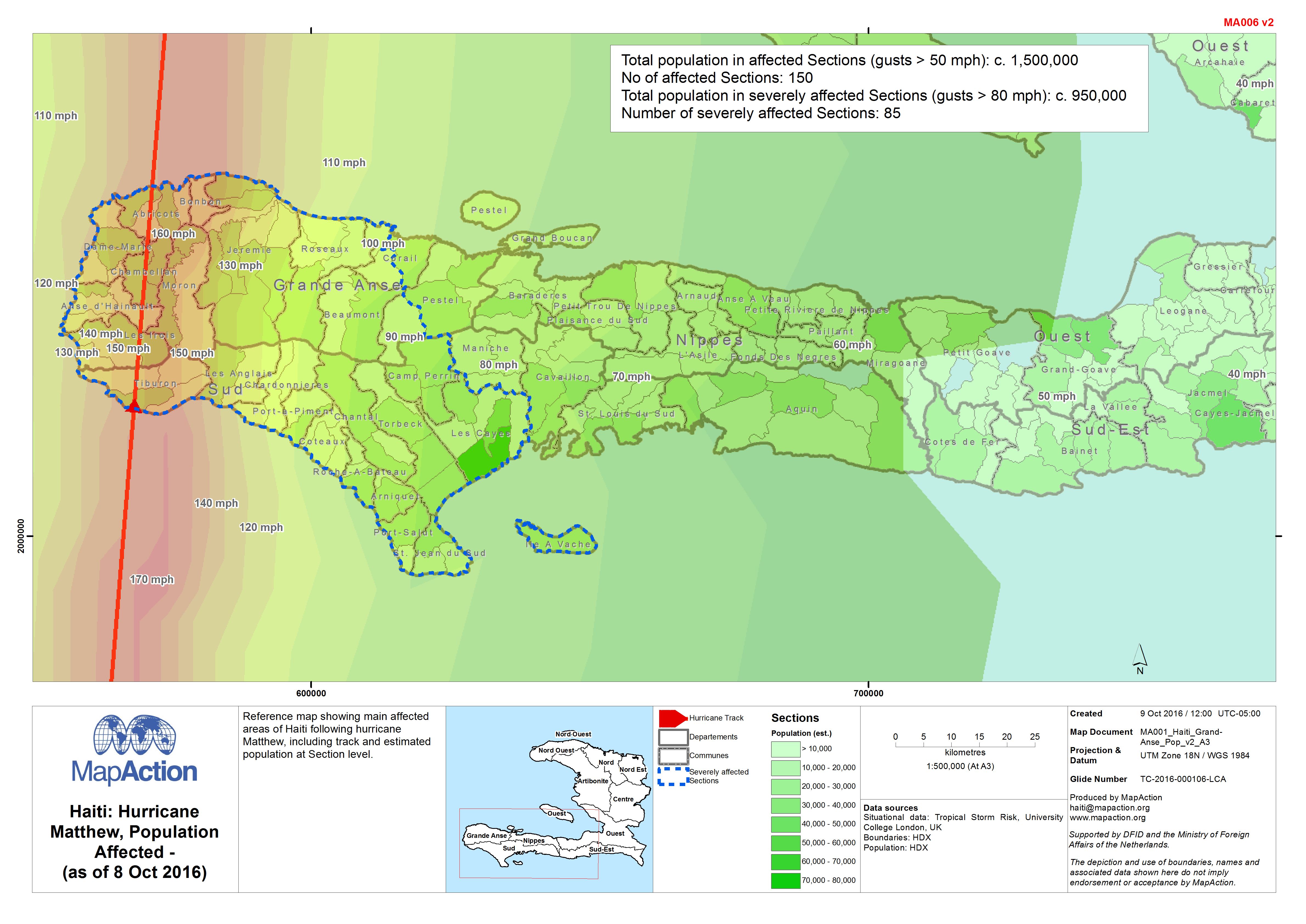
Haiti: Hurricane Matthew, Population Affected - (as of 8 Oct 2016)
Reference map showing main affected areas of Haiti following hurricane Matthew, including track and estimated population at Section level. -
SORLAND Hurricane Windblown IDP Sites Assessment Findings (from 27 September)
Summarises the findings of initial multi-cluster needs assessments. Assessments were carried out by mixed teams at six IDP sites on 27 September 2016 following Hurricane Windblown. -

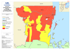
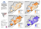
Tanzania Earthquake response Baseline Population (Census of 2012)
Map shows the affected Wards with total population from the 2012 Census extracted from NBS report. -

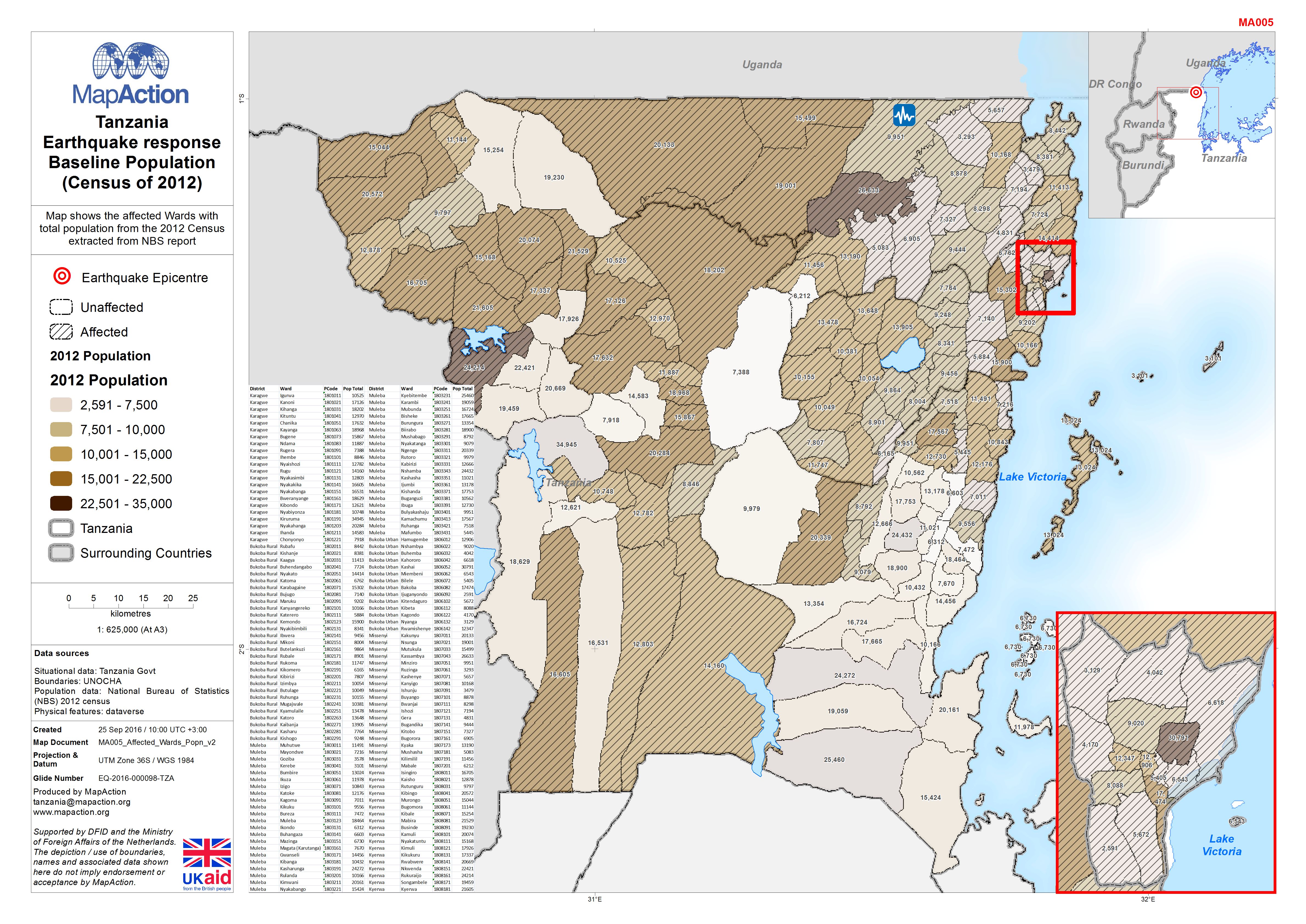
Tanzania Earthquake response Baseline Population (Census of 2012)
Map shows the affected Wards with total population from the 2012 Census extracted from NBS report -
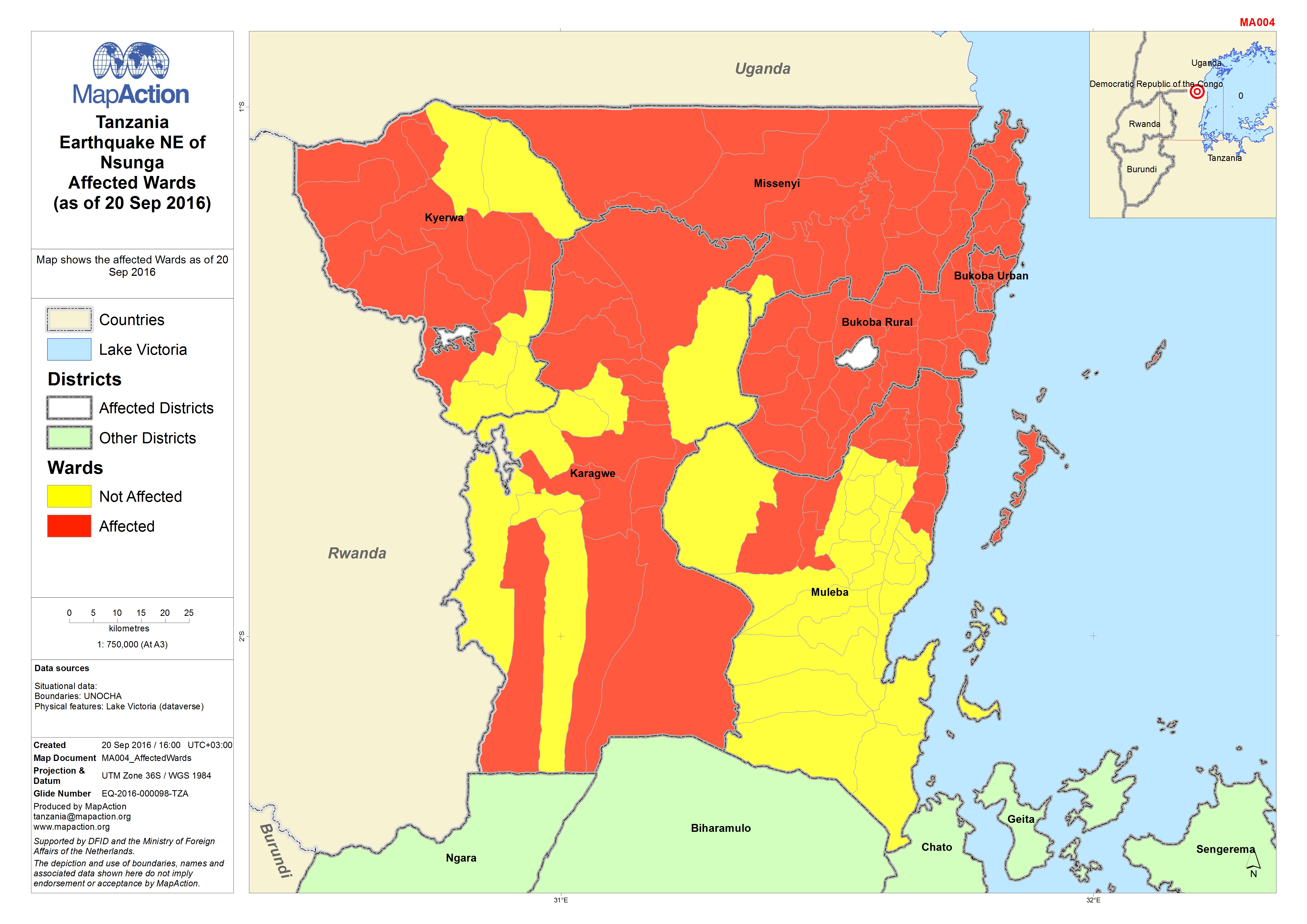
Tanzania Earthquake NE of Nsunga Affected Wards (as of 20 Sep 2016)
Map shows the affected Wards as of 20 Sep 2016 -
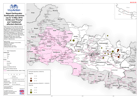
Nepal: Earthquake - Epicentres (up to 12 May 2015 14:00) and 'Priority' and '...
Map shows Priority Affected Districts as designated by the Government of Nepal in the week following the original earthquake, and Additional Affected Districts designated on 10... -
MA1005 Philippines:Typhoon Yolanda - Severity and Operational Presence,Wester...
Severity score was generated from a multivariate formula incorporating physical factors (est storm surge, proximity to storm path, etc) reported affected population stats and... -
MA1004 Philippines:Typhoon Yolanda -Severity and Operational Presence,Central...
Severity score was generated from a multivariate formula incorporating physical factors (est storm surge, proximity to storm path, etc) reported affected population stats and... -
MA1003 Philippines:Typhoon Yolanda -Severity and OperationalPresence,Eastern ...
Severity score was generated from a multivariate formula incorporating physical factors (est storm surge, proximity to storm path, etc) reported affected population stats and... -

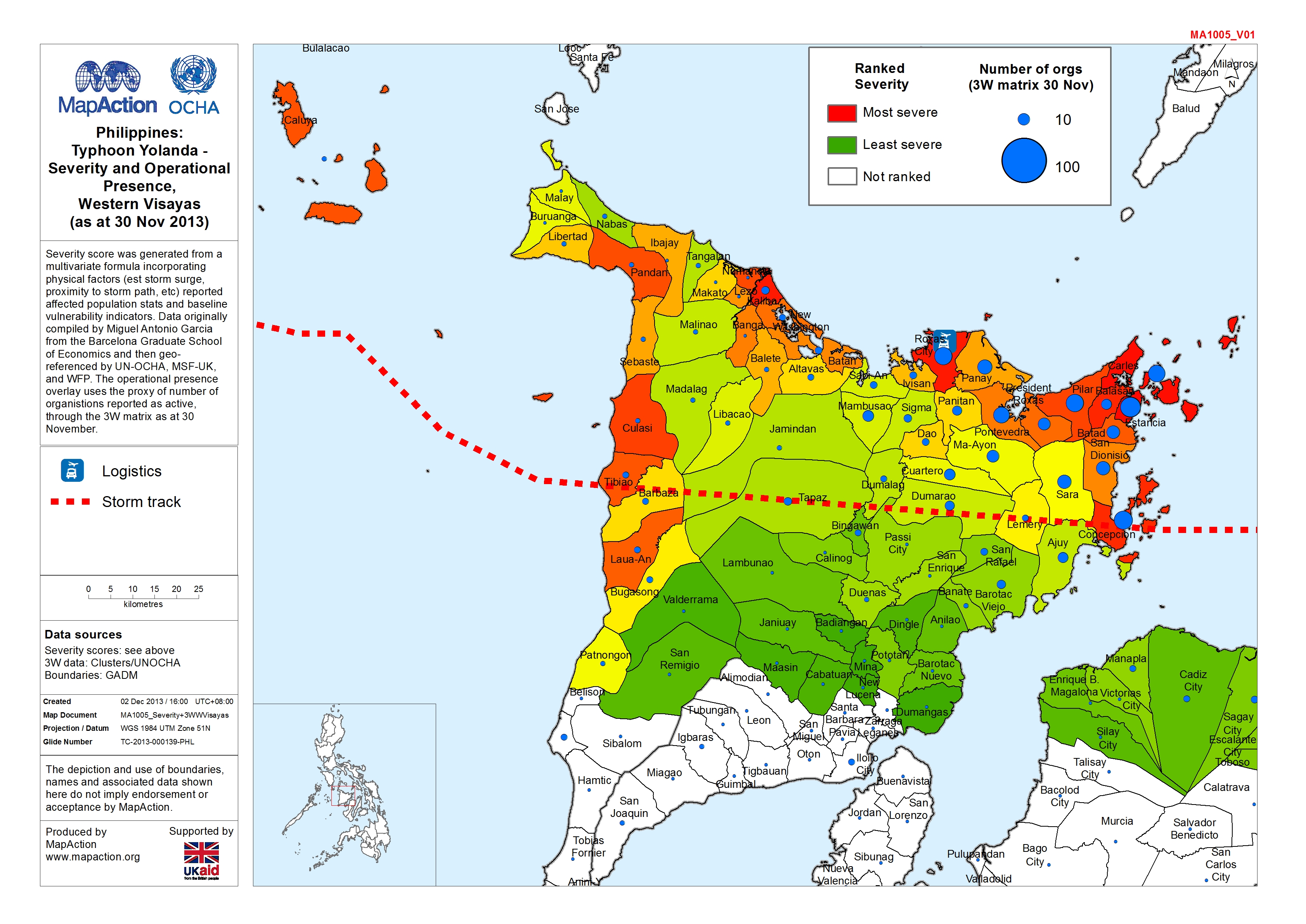
MA1001 Philippines:Typhoon Yolanda -Severity Ranking (as at 30 Nov 2013)
Severity score was generated from a multivariate formula incorporating physical factors (est storm surge, proximity to storm path, etc) reported affected population stats and... -

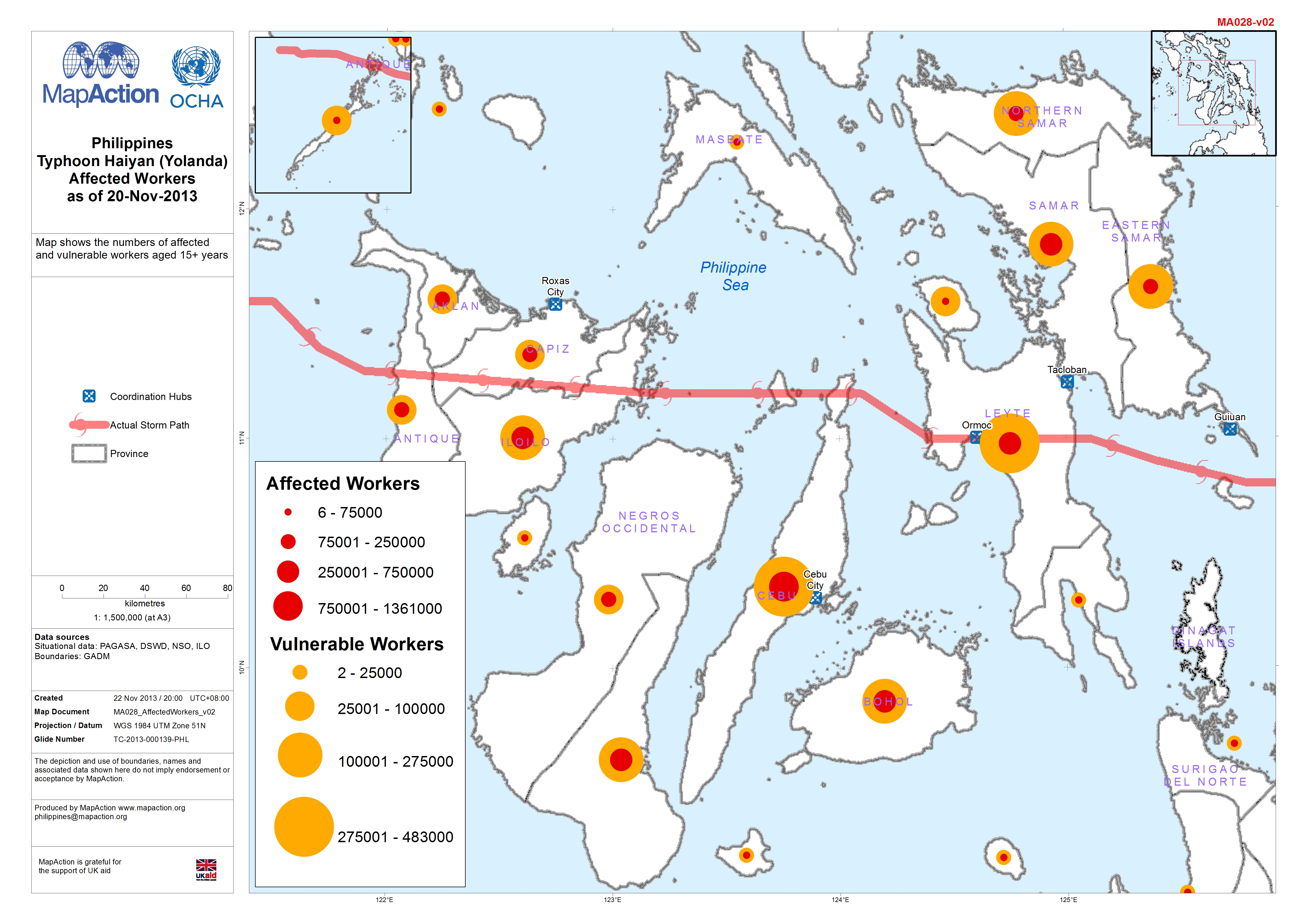
Philippines: Typhoon Haiyan (Yolanda) - Affected Workers as of 20-Nov-2013
This dataset has no description
-

Philippines: Typhoon Haiyan (Yolanda) - Percentage Affected population as of ...
Map shows percentage affected population by Municipality, DROMIC Report No. 20. Areas where no data has been reported are in white. Also shown is predicted storm surge > 0.5 m -
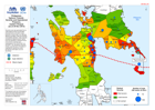
India: Tropical Cyclone Phailin and Flood -Selected Vulnerablity Indicators i...
Map shows the selected population demographics taken from the 2011 census at block level, for the districts that have been identified as affected by Tropical Cyclone Phailin and... -
