-

The Bahamas: Comparison of flood extent data from Sentinel 1 analysed by Spo...
Comparison of flood extent based on Copernicus and Spottitt analysed Sentinel1 satellite imagery. Dates = 04/09/2019 and 03/09/2019 for Copernicus in Abaco. -
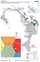
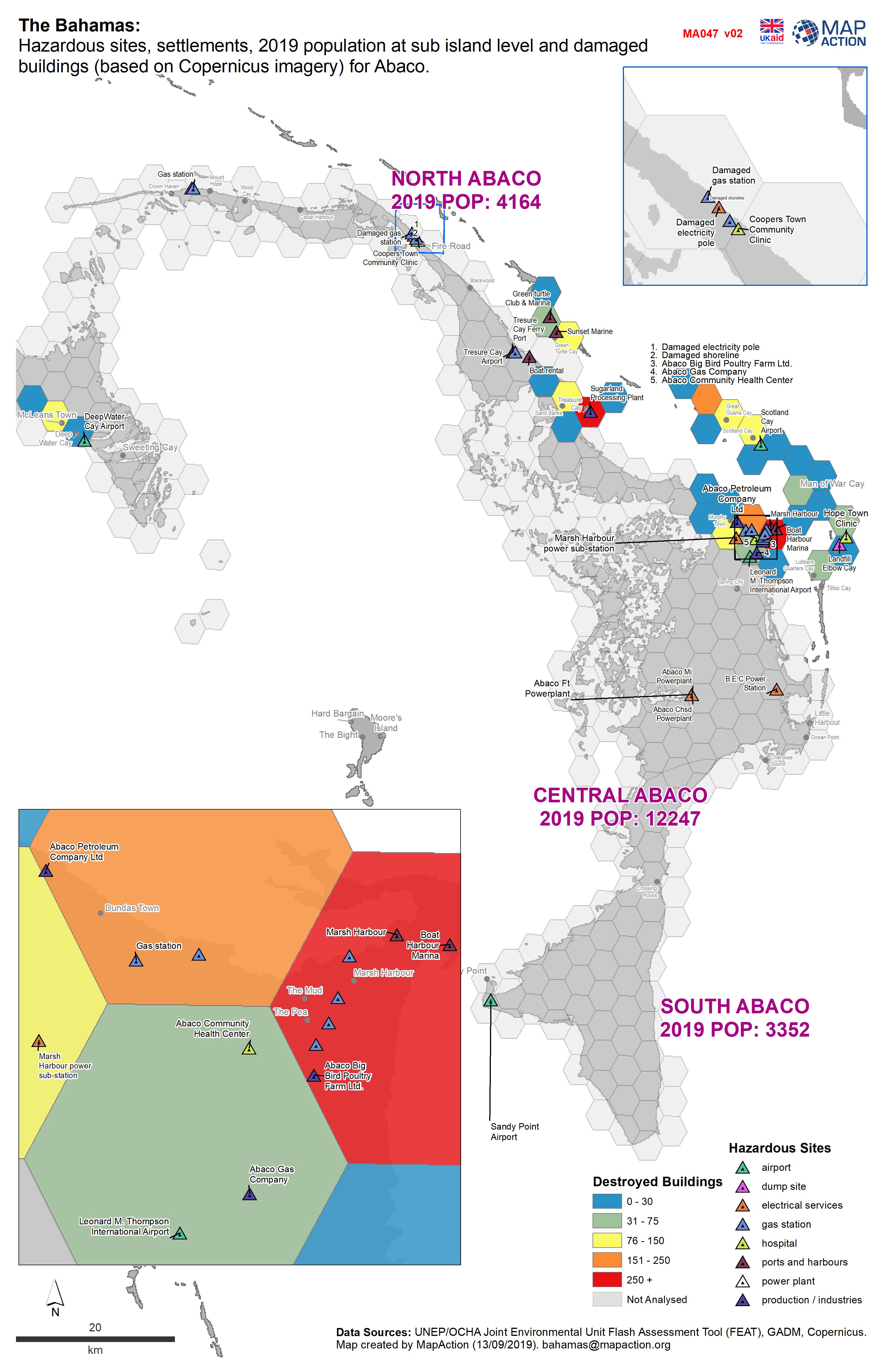
The Bahamas: Hazardous sites, settlements, 2019 population at sub island leve...
Hazardous sites in Abaco, with population and building damage assessment data -

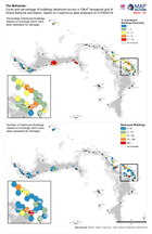
The Bahamas: Hazardous sites, settlements, 2019 population at sub island leve...
Hazardous sites, population and building assessment data, Grand Bahama -

The Bahamas: Hazardous sites, settlements, 2019 population at sub island leve...
Hazardous sites in Abaco, with population and building damage assessment data -

The Bahamas: Hazardous sites, settlements, 2019 population at sub island leve...
Hazardous sites, population and building assessment data -
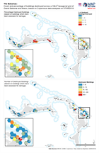
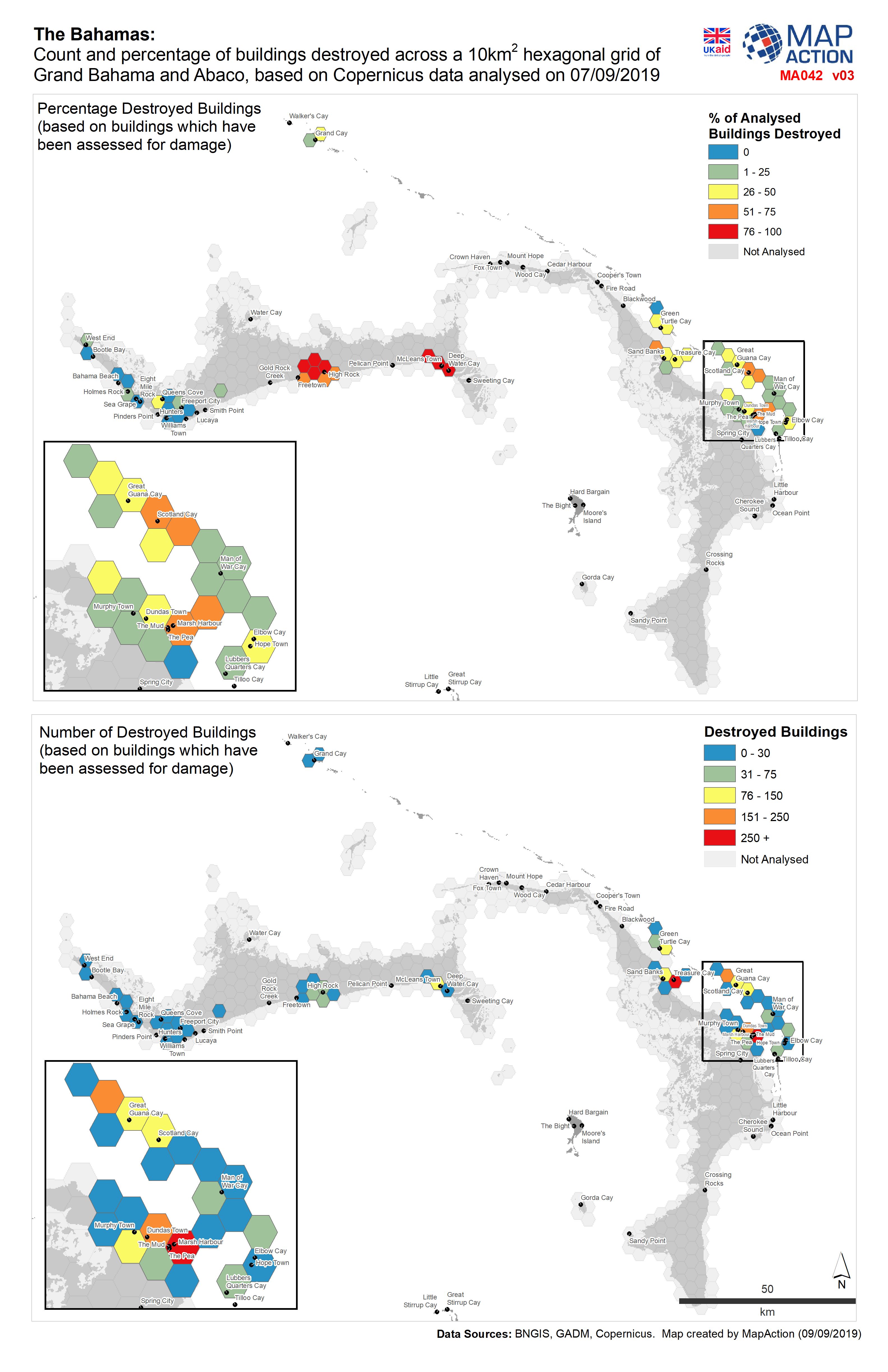
The Bahamas: Count and percentage of buildings destroyed across a 10km2 hexa...
Count and percentage of buildings destroyed across a 10km2 grid of Grand Bahama and Abaco, based on Copernicus data from 07/09/2019. -
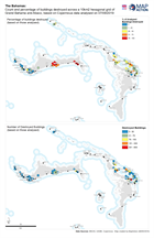
The Bahamas: Count and percentage of buildings destroyed across a 10km2 hexa...
Count and percentage of buildings destroyed across a 10km2 grid of Grand Bahama and Abaco, based on Copernicus data from 07/09/2019. -
Count and percentage of buildings destroyed across a 10km2 hexagonal grid of ...
Count and percentage of buildings destroyed across a 10km grid of Grand Bahama and Abaco, based on Copernicus data -

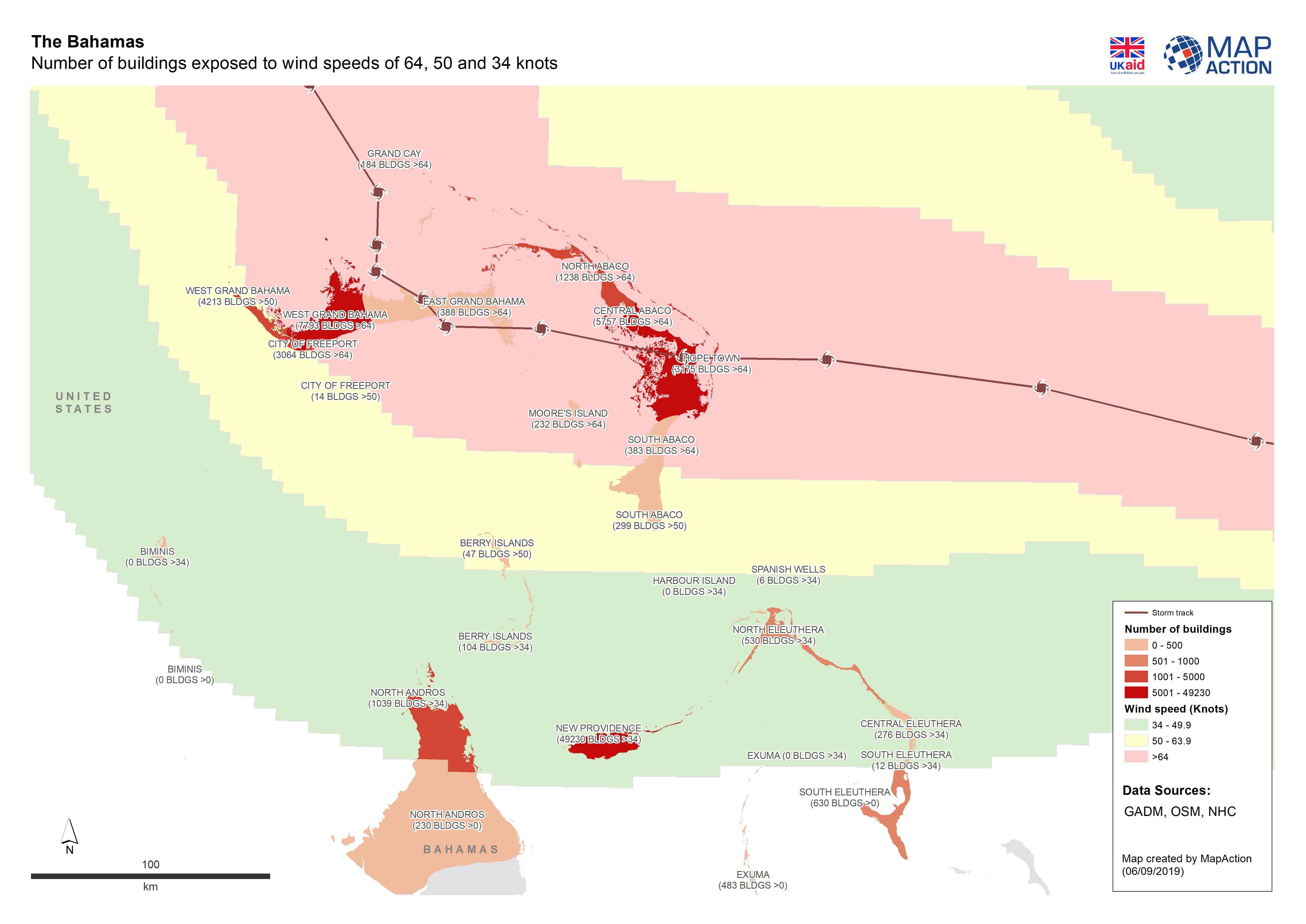
Number of buildings exposed to wind speeds of 64, 50 and 34 knots
Number of buildings exposed to wind speeds of 64, 50 and 34 knots in admin polygons or part admin polygon. -
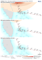
Caribbean: Dorian - Wind speed probabilities at 34, 50 and 64 knots (as at 5 ...
This dataset has no description
-

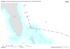
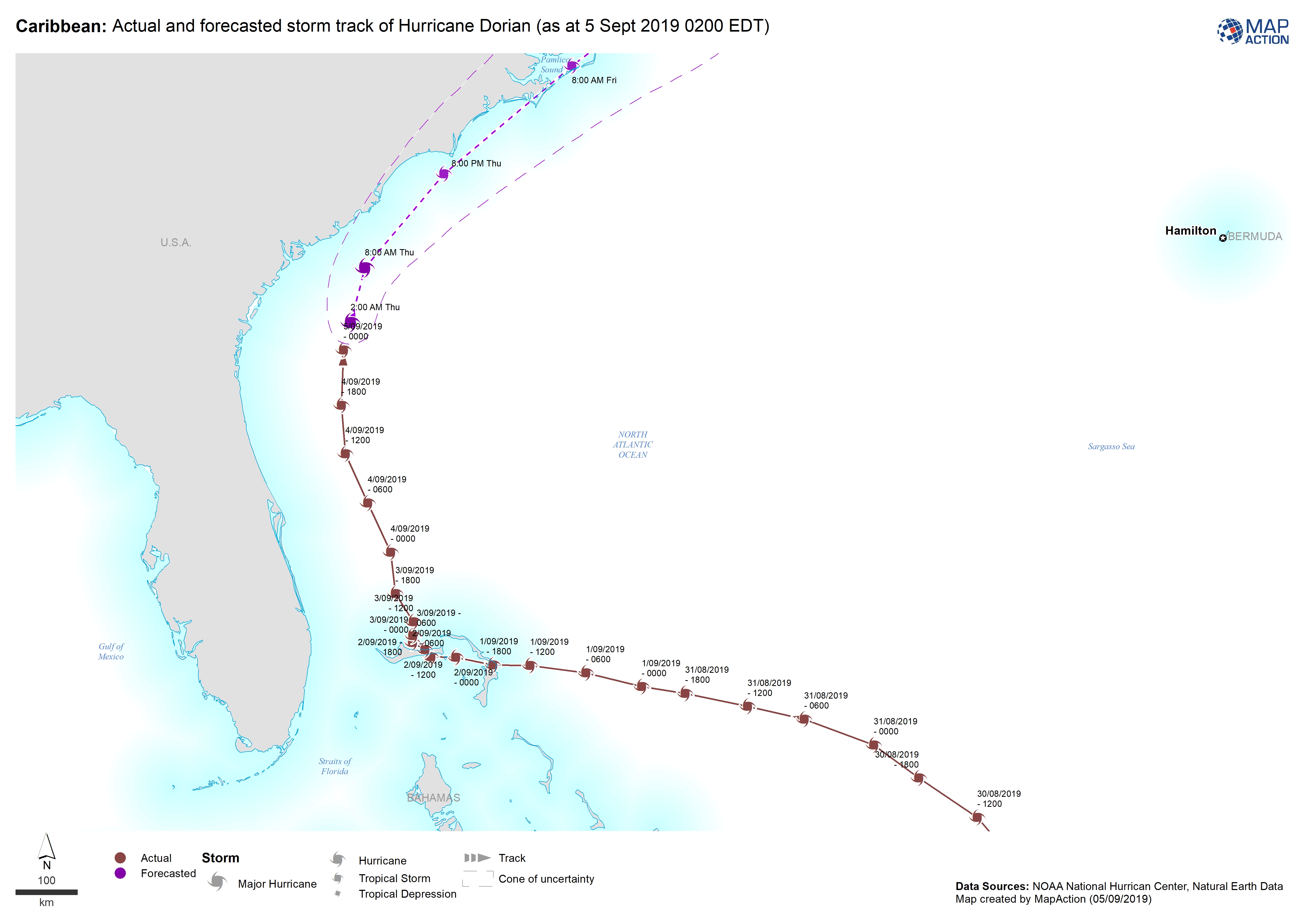
Caribbean: Actual and forecasted storm track of Hurricane Dorian (as at 5 Sep...
This dataset has no description
-
Caribbean: Actual and forecasted storm track of Hurricane Dorian (as at 4 Sep...
This dataset has no description
-
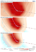
Caribbean: Dorian - Wind speed probabilities at 34, 50 and 64 knots (as at 3 ...
This dataset has no description
-
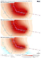
Caribbean: Dorian - Wind speed probabilities at 34, 50 and 64 knots (as at 2 ...
This dataset has no description
-

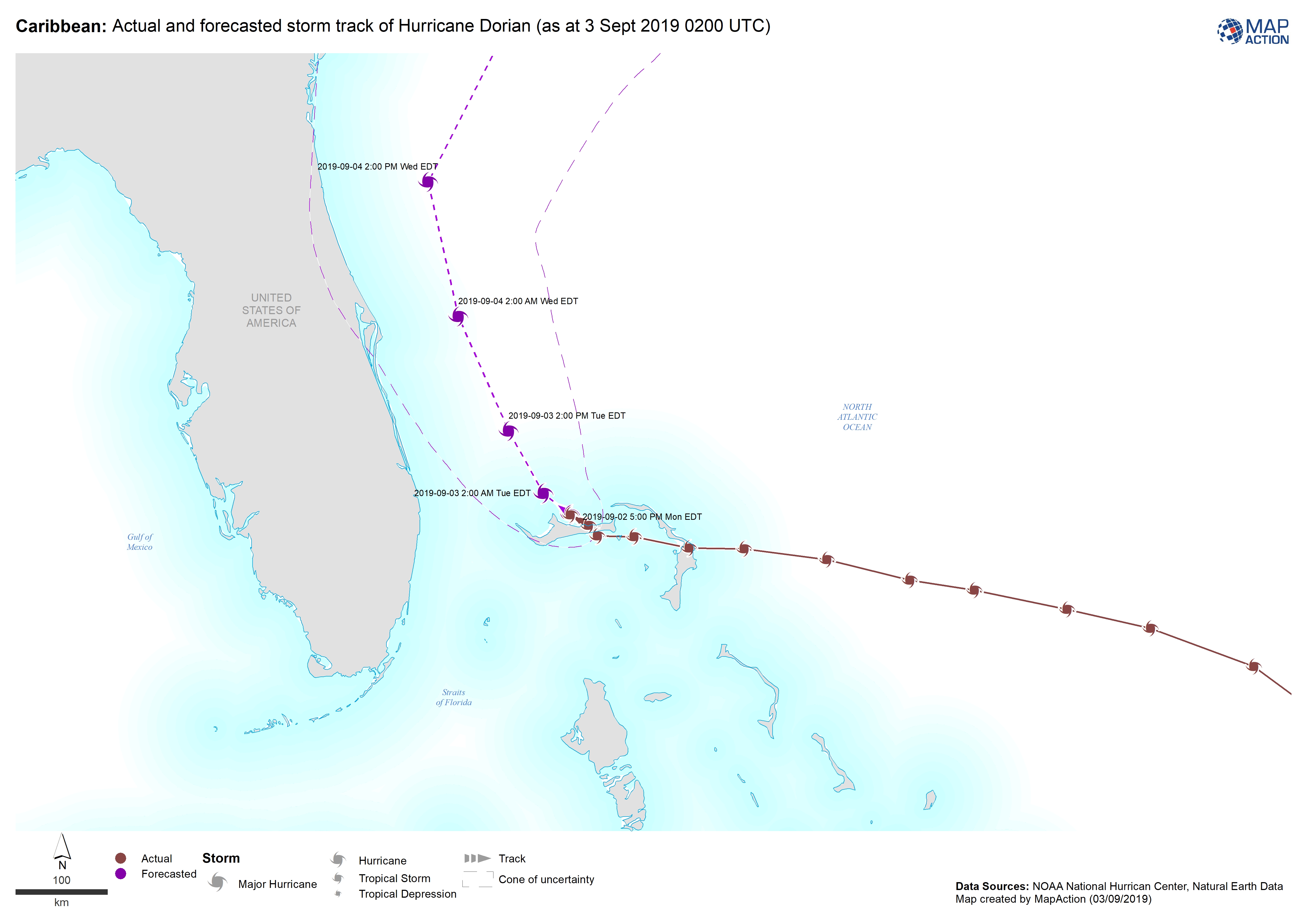
Caribbean: Actual and forecasted storm track of Hurricane Dorian (as at 3 Sep...
This dataset has no description
-
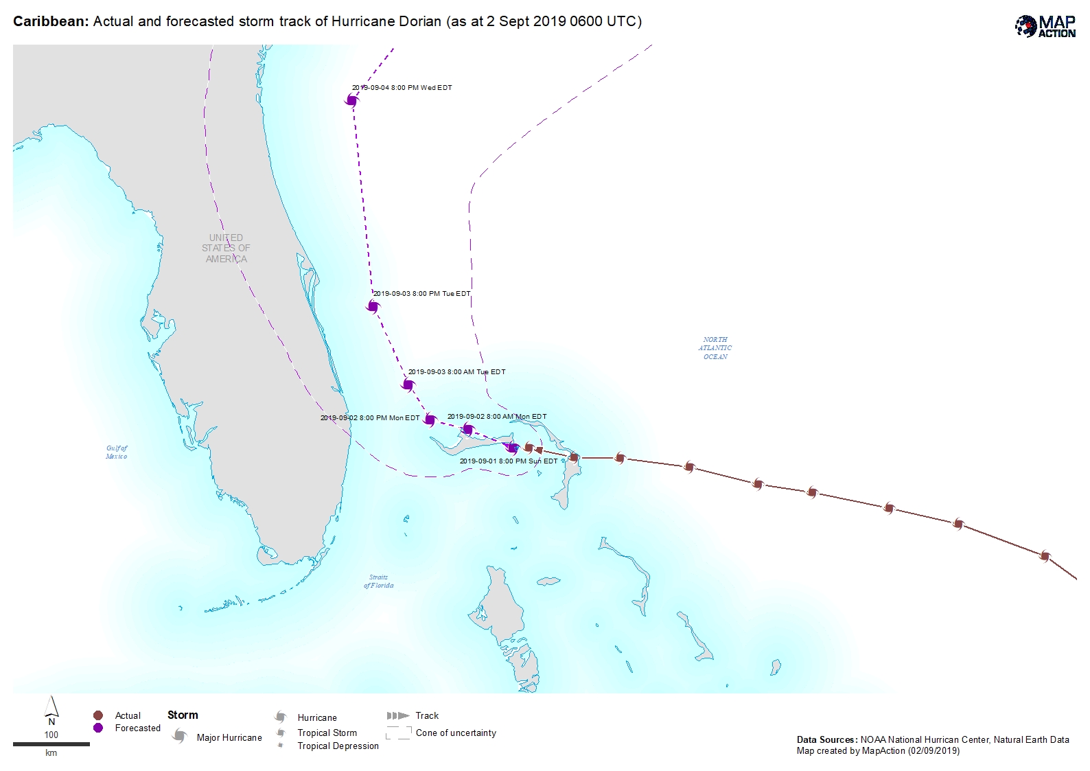
Caribbean: Actual and forecasted storm track of Hurricane Dorian (as at 2 Sep...
This dataset has no description
-
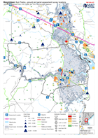
Mozambique: Buzi Postos - ground and aerial assessment survey locations
Location of ground and aerial assessment survey's within the postos of Buzi. -

Mozambique: Nhamatanda District - ground and aerial assessment survey locations
Location of ground and aerial assessment survey's within the district of Nhamatanda. -
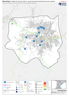
Mozambique: Cidade de Chimoio District - ground and aerial assessment survey ...
Location of assessment survey's within the district of Cidade de Chimoio -

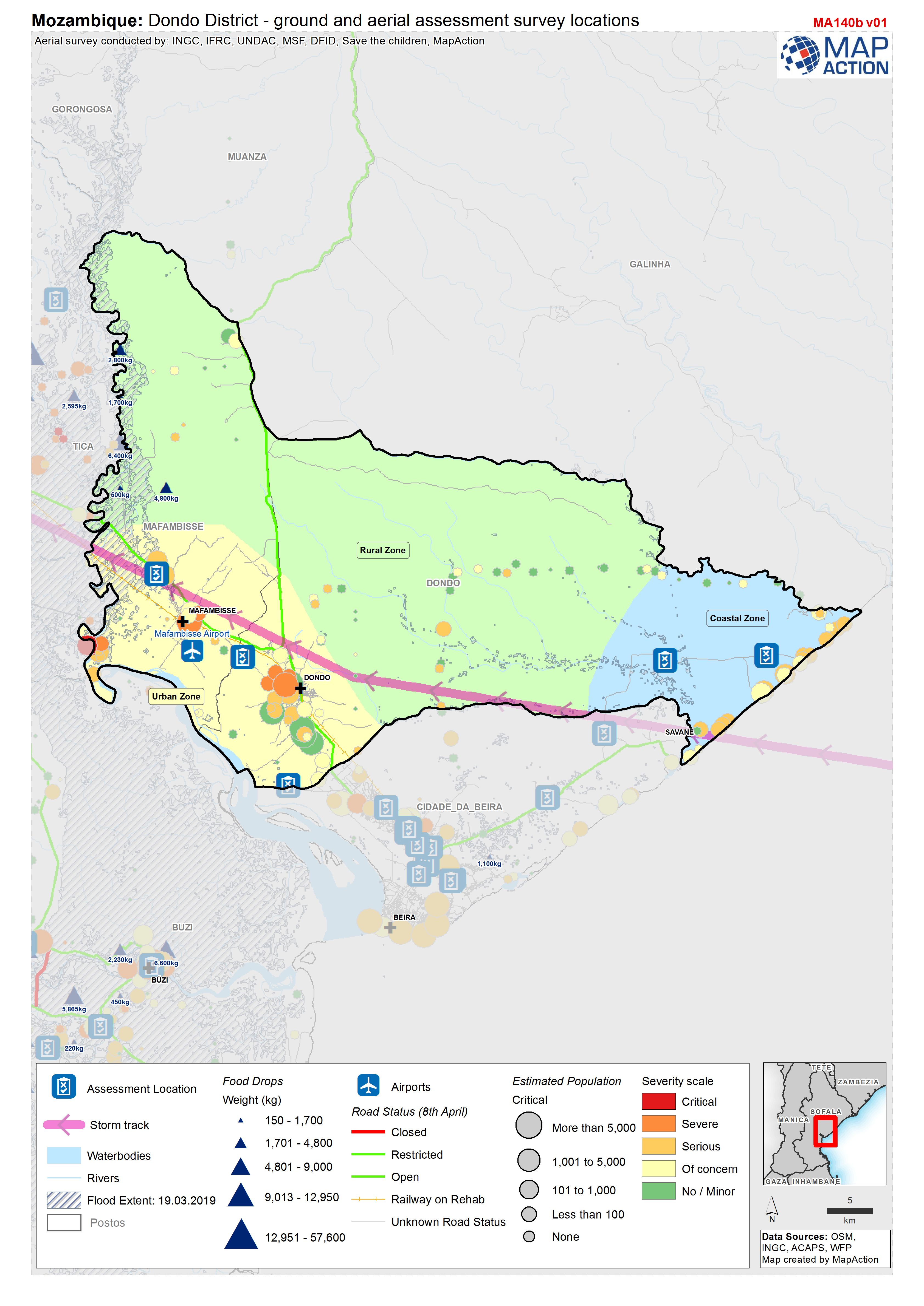
Mozambique: Dondo District - ground and aerial assessment survey locations
Location of ground and aerial assessment survey's within the district of Dondo.