-
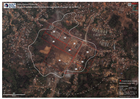
Imágenes de satélite que muestran la extensión de la explosión (fecha de la i...
Satellite imagery showing extent of explosion (imagery date = 09/03/2021) -
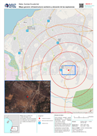
Mapa general, infraestructura sanitaria y ubicación de las explosiones
Mapa que muestra la ciudad de Bata, sus principales centros de salud y la ubicación de la explosión con anillos de distancia de 1 km. -
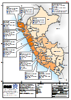
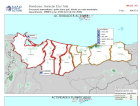
Peru: Emergencia por Temporada de Lluvias - Personas Damnificadas por Departa...
El mapa muestra la afectacion por la temporada de lluvias, diciembre 2016 a marzo 2017. Provincias en 12 departamentos han sido declaradas en Estato de Emergencia. Actualizado... -
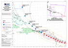
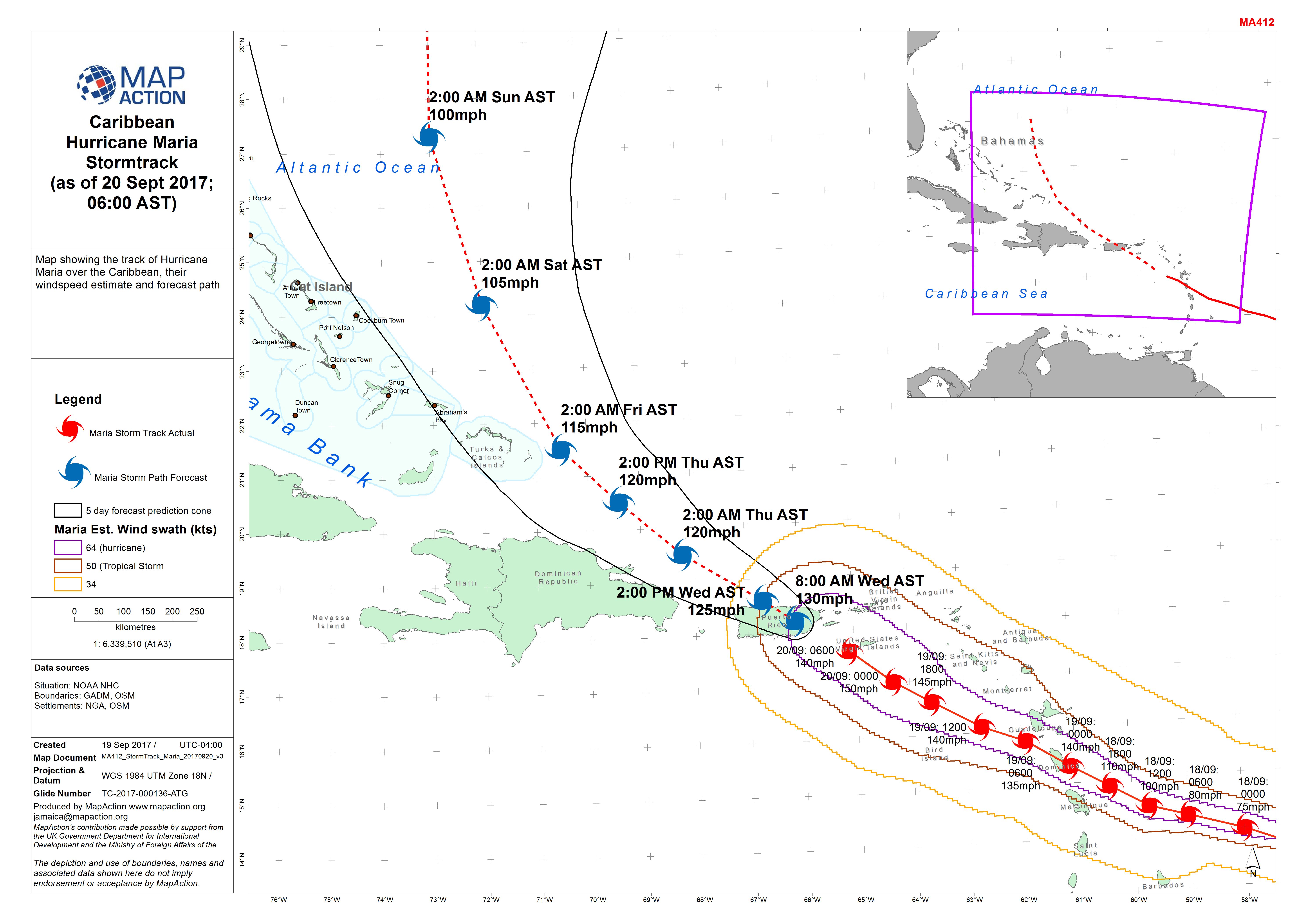
Caribbean Hurricane Maria Stormtrack (as of 20 Sept 2017, 06:00 AST)
Map showing the track of Hurricane Maria over the Caribbean, with windspeed estimate and forecast path. -

UNICEF Water Testing Communities
Location of communites scheduled or have had water tested by UNICEF and Guyana Red Cross as of 25 Nov 2018 -

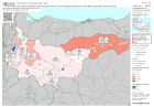
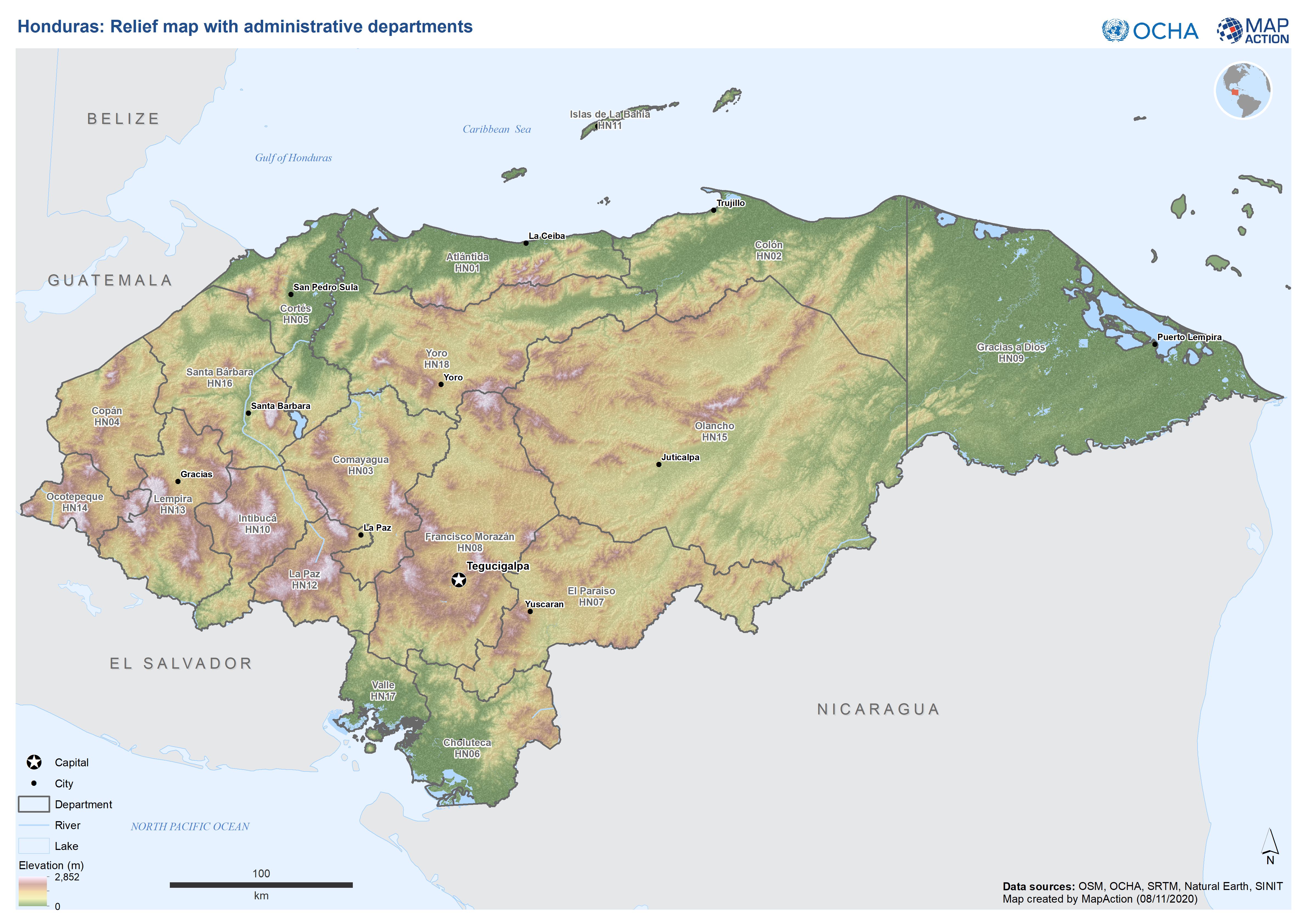
Honduras: Relief map with administrative departments
This map shows elevation, administration level 1 departments and major cities for Honduras. -

Guatemala: Presencia humanitaria - quién hace qué, dónde en cada municipio, d...
Mapbook shows the number of reported activities per Sector, and who is delivering them, per Municipality in Guatemala. Satellite derived flood extents are also shown, with... -
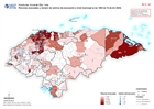
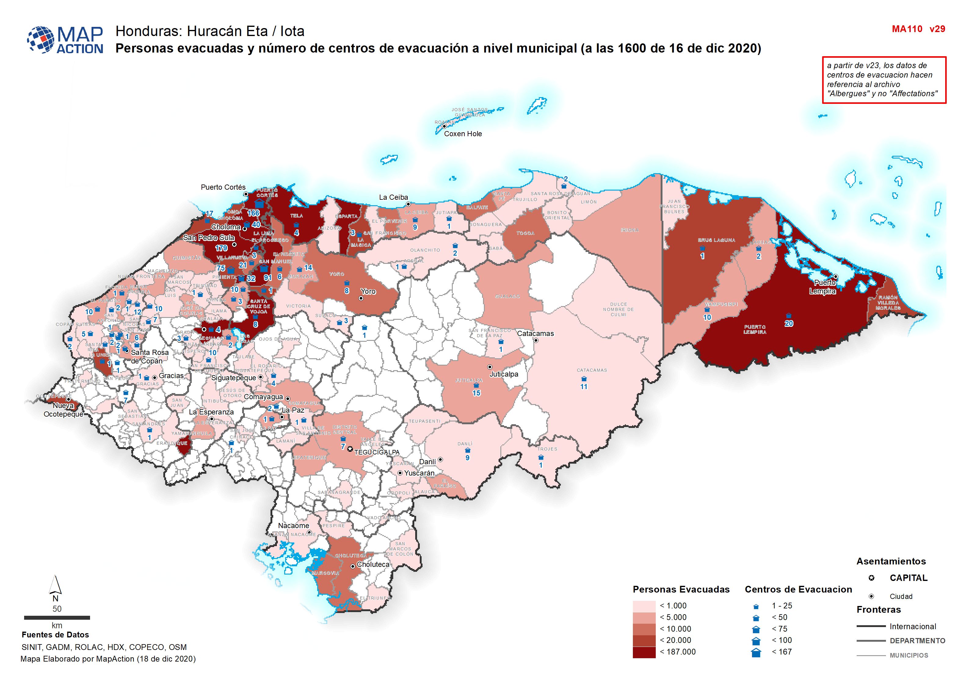
Personas evacuadas y número de centros de evacuación a nivel municipal (a las...
Personas evacuadas y número de centros de evacuación a nivel municipal (a 03 Diciembre 2020 -

Presencia humanitaria: quién hace qué, dónde en cada municipio. Departmento: ...
Mapbook shows who is delivering Sector activities, per Municipality in Honduras. Population density, number of shelters and occupants per Municipality -

Guatemala: Presencia humanitaria - quién hace qué, dónde en cada municipio, ...
Mapbook shows the number of reported activities per Sector, and who is delivering them, per Municipality in Guatemala. Critical and High priority response areas and satellite... -

Actual and forecasted storm tracks of Tropical Cyclones Yasa and Zazu (as at ...
Map shows the actual and forecasted storm tracks for tropical cyclones Yasa and Zazu. The cone of uncertainty is the area in which the storm track is predicted to move along but... -

-
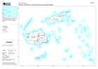
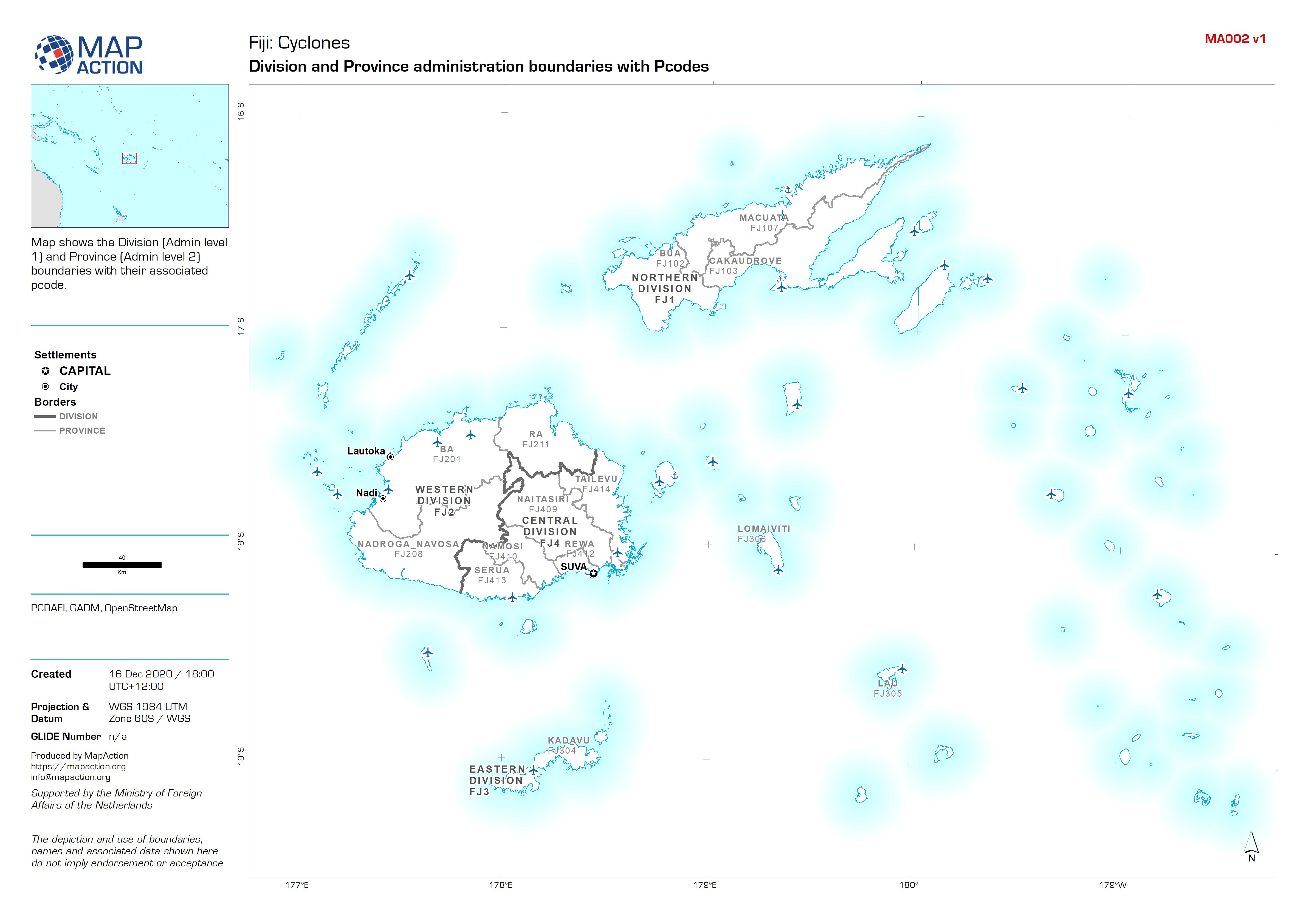
Fiji: Division and Province administration boundaries with Pcodes
Map shows the Division (Admin level 1) and Province (Admin level 2) boundaries with their associated pcode. -
Fiji: Reference map atlas
Atlas series of maps showing borders, settlements, physical and transport features for each Division. -
Fiji: Admininistration boundaries atlas
Atlas shows the Division (Admin level 1), Province (Admin level 2) and Districts (Admin level 3) boundaries with their associated pcode. -

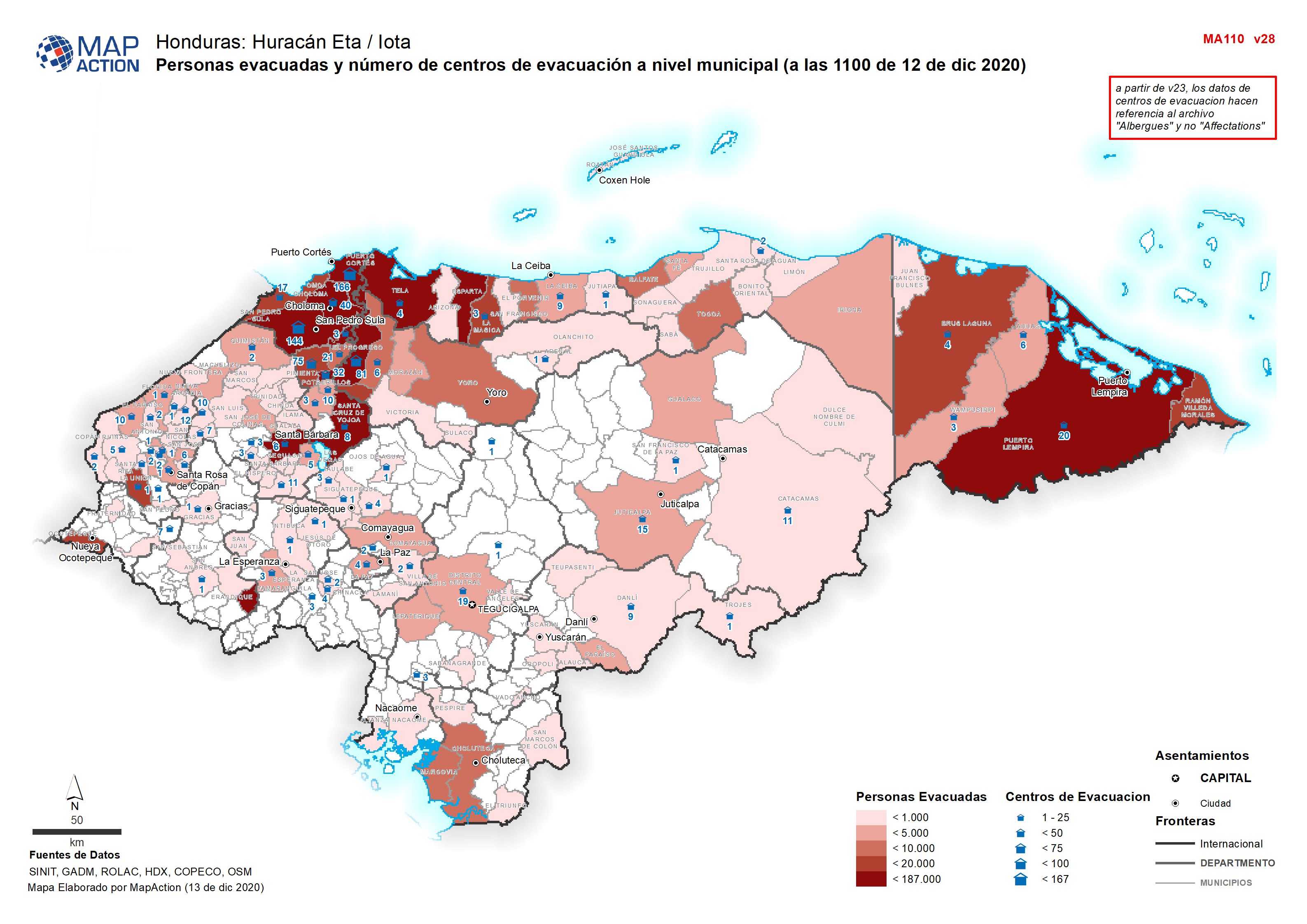
Personas evacuadas y número de centros de evacuación a nivel municipal (a las...
Personas evacuadas y número de centros de evacuación a nivel municipal (a 03 Diciembre 2020 -

Presencia humanitaria: quién hace qué, dónde en cada municipio por department...
Mapbook shows the number of reported activities per Sector, and who is delivering them, per Municipality in Honduras. Critical and High priority response areas are also shown,... -
Presencia humanitaria: quién hace qué, dónde en cada municipio por department...
Mapbook shows who is delivering Sector activities, per Municipality in Honduras. Population density, number of shelters and occupants per Municipality -

Presencia humanitaria: quién hace qué, dónde en cada municipio, por departmen...
Mapbook shows the number of reported activities per Sector, and who is delivering them, per Municipality in Honduras. Critical and High priority response areas are also shown,... -

Presencia humanitaria: quién hace qué, dónde en cada municipio por department...
Mapbook shows who is delivering Sector activities, per Municipality in Honduras. Population density, number of shelters and occupants per Municipality