-

Departments and Settlements of Haiti
Administrative departments and main settlements of Haiti -

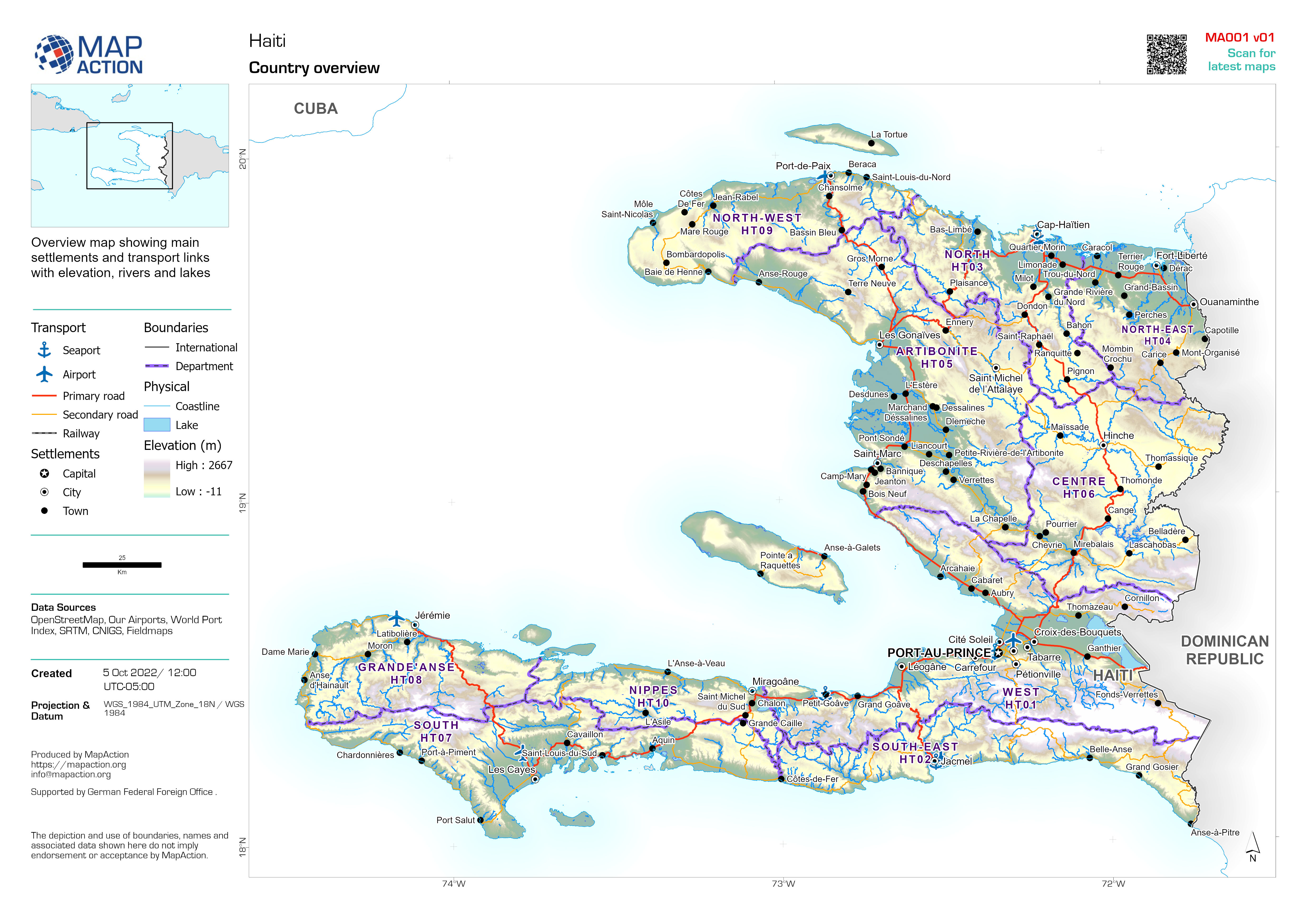
Country Overview: Haiti
Overview map showing main settlements and transport links with elevation, rivers and lakes -

Country overview of Malawi
Country overview map showing main settlements, transport links, elevation, water features and administrative boundaries -

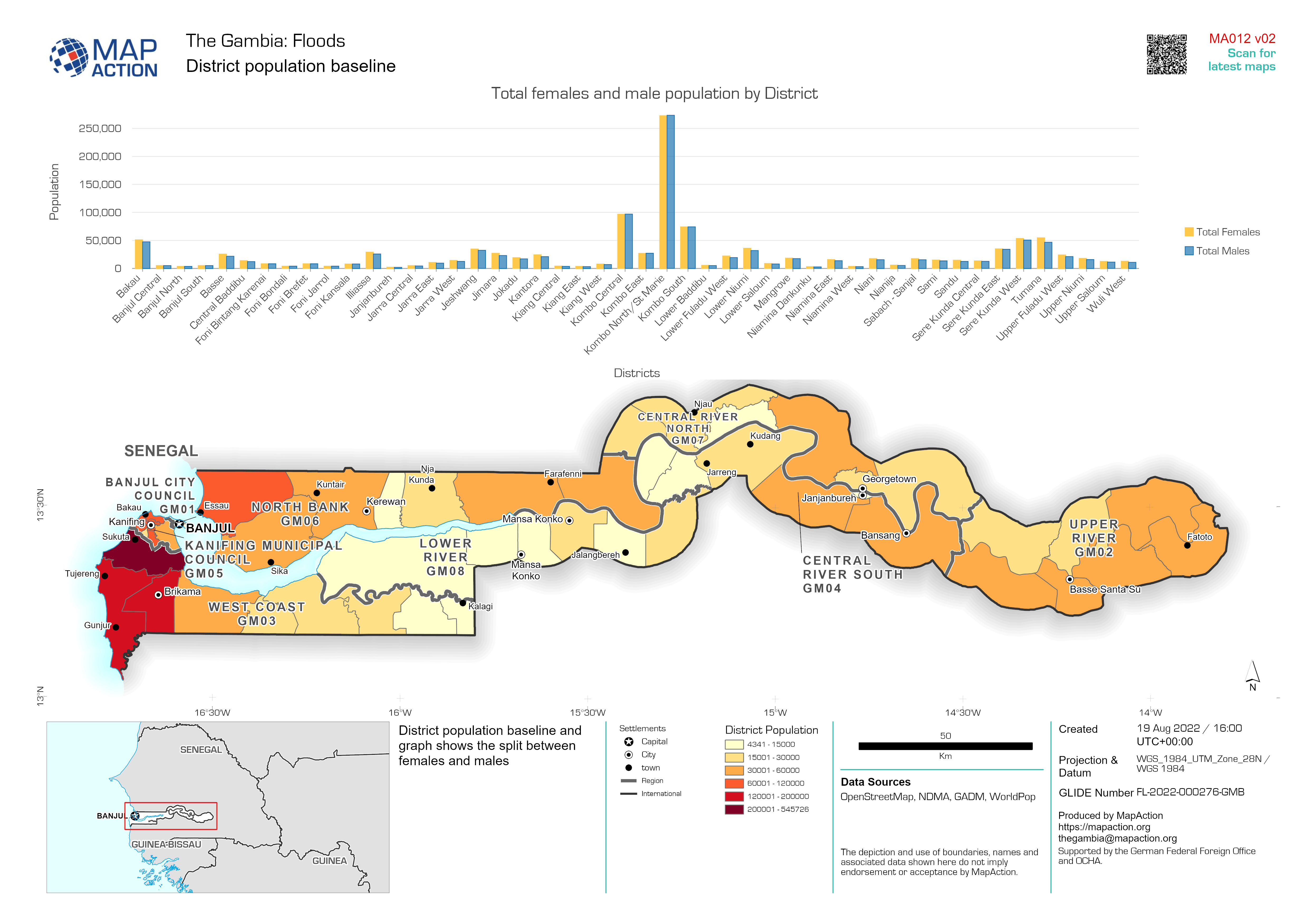
District population baseline
District population baseline and graph shows the split between females and males -

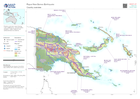
Country Overview
Country overview map showing main settlements, transport links, elevation, water features and administrative regions -

Población de Presidente Hayes, Boquerón y Alto Paraguay
Densidad de población: Worldpop estimación 2020. Otros datos de población: UNFPA and Dirección General de Estadísticas, Encuestas y Censos Estimación de población diferente para... -

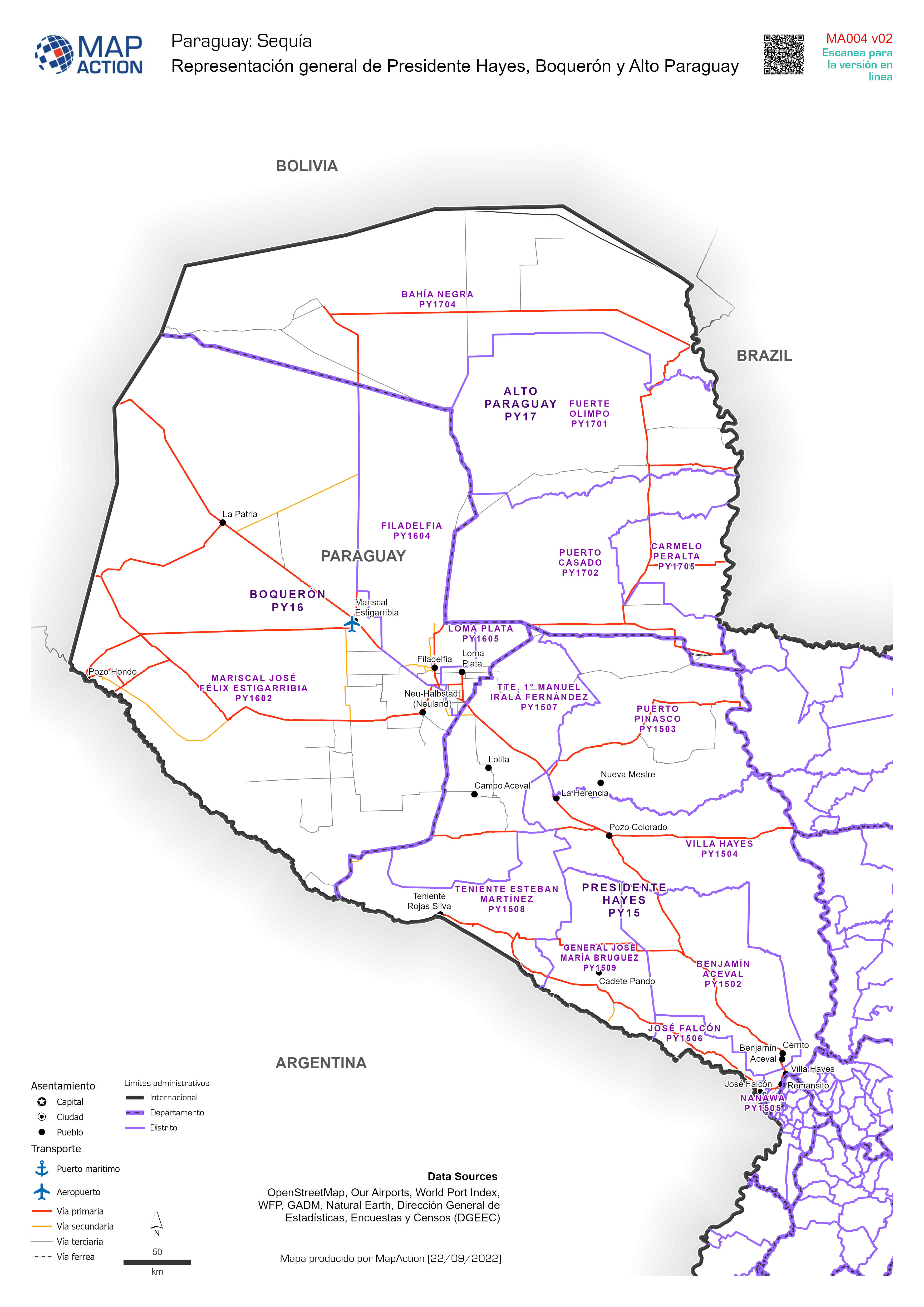
Representación general de Presidente Hayes, Boquerón y Alto Paraguay
Overview of Presidente Hayes, Boquerón and Alto Paraguay showing main settlements, and transport. Representación general de Presidente Hayes, Boquerón and Alto Paraguay ,... -

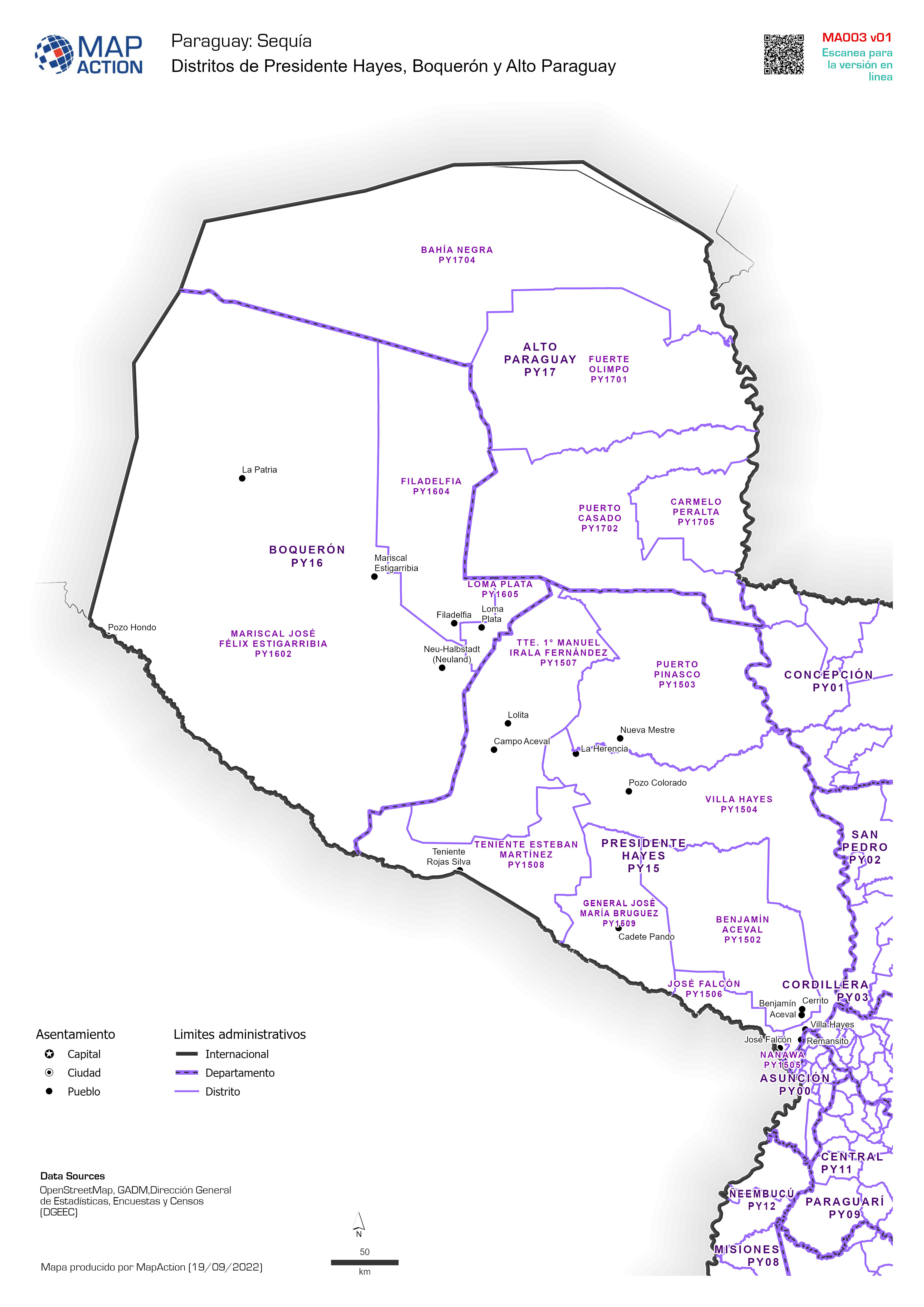
Distritos de Presidente Hayes, Boquerón y Alto Paraguay
Distritos de Presidente Hayes, Boquerón y Alto Paraguay -

-
Country overview
Country overview map showing main settlements, transport links, elevation, water features and administrative boundaries -

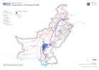
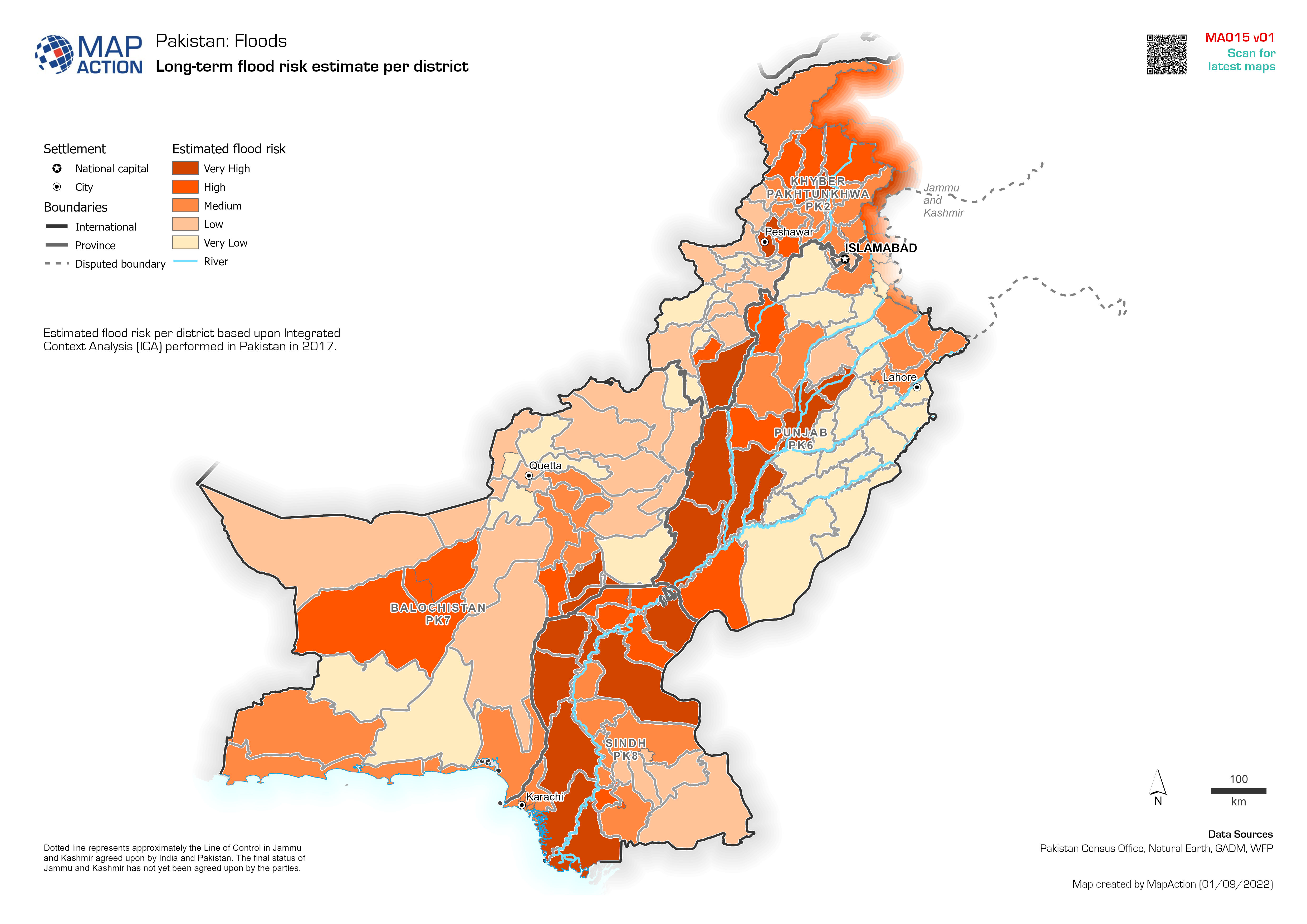
Long-term flood risk estimate per district
Estimated flood risk per district based upon Integrated Context Analysis (ICA) performed in Pakistan in 2017. -

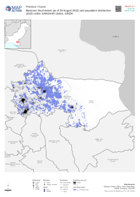
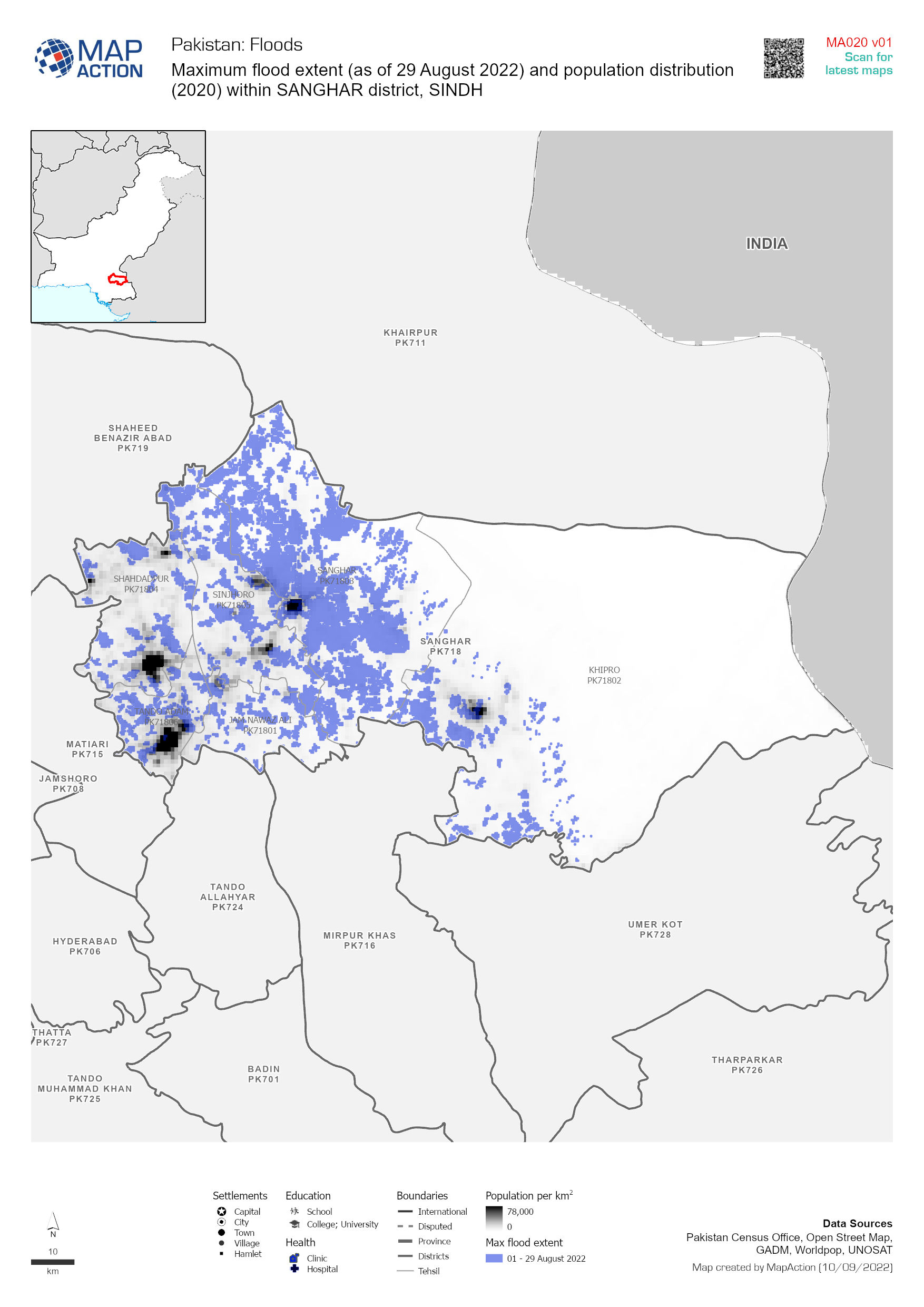
Population density (2020) and maximum flood extents during 01 - 29 August
Flood extents for 01 - 29 August as detected by UNOSAT and estimates of population affected based upon Worldpop data for 2020 -

-

Flood extents and affected population estimates for 12 - 21 July and 01 - 29 ...
Flood extents for 12 - 21 July and 01 - 29 August as detected by UNOSAT and estimates of population affected based upon Worldpop data for 2020 -

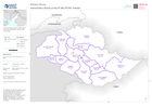
Maximum severity index score per district (as of 26 August 2022)
Maximum severity index score per district (as of 26 Aguust 2022) -

Mean severity index per district (as of 26 August 2022)
Mean severity index per district (as of 26 Aguust 2022) -

-
Flooded areas from 15 to 30 August from GFM
Flooded areas from 15 to 30 from GFM show with main cities, roads and railways