-

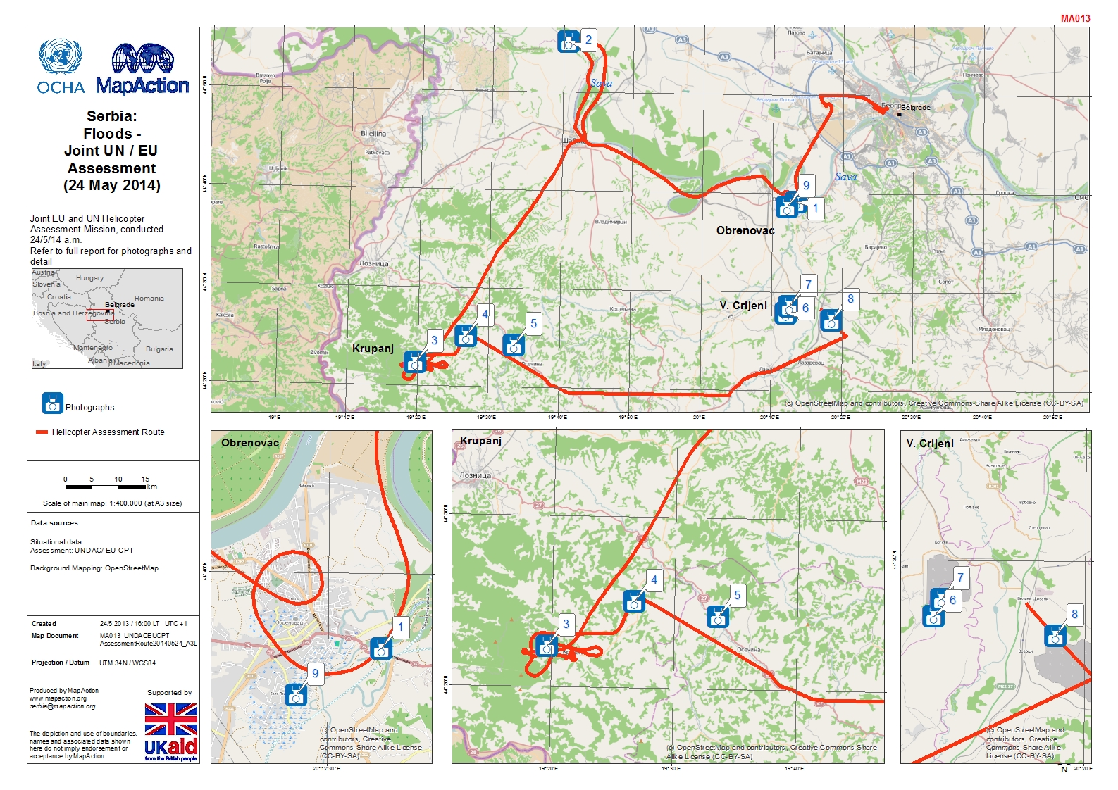
Joint UN / EU Assessment (24 May 2014)
Joint EU and UN Helicopter Assessment Mission, conducted 24/5/14 a.m. Refer to full report for photographs and detail -
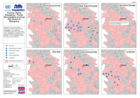
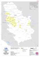
Municipalities showing Key Drivers of Emergency
Distribution of key drivers of the emergency over the majority affected municipalities. Icons represent municipalities where drivers have been noted. Highlighted municipalities... -

Serbia:Floods -Situation(as of 22 May 2014)
Situation in most affected areas as of 22 May. Peak of flood wave expected in Belgrade on 23rd.Map shows surface water including floods mapped by NASA MODIS satellite for 10 day... -
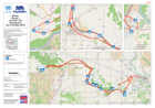
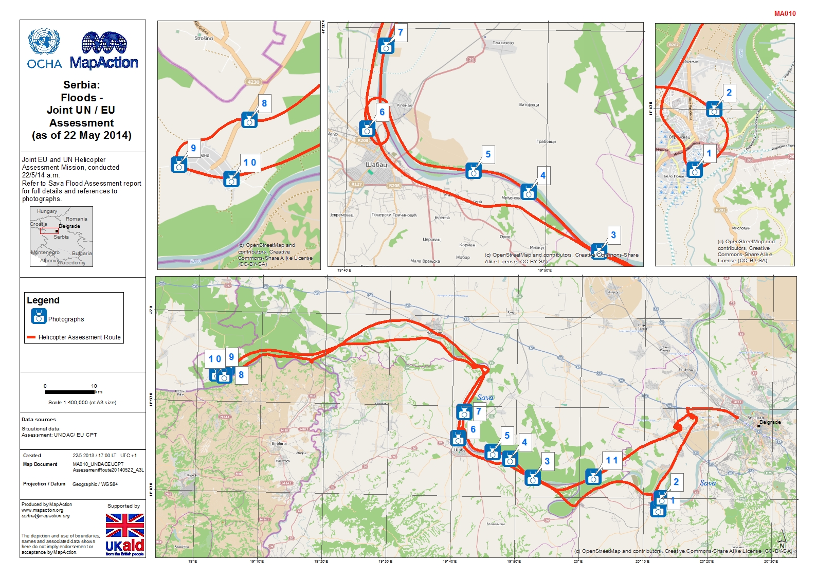
Serbia: Floods - Joint UN / EU Assessment (as of 22 May 2014)
Joint EU and UN Helicopter Assessment Mission, conducted 22/5/14 a.m. Refer to Sava Flood Assessment report for full details and references to photographs -

-

-

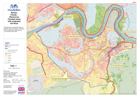
Serbia: Floods - Obrenovac Flooded areas with projected 6m flood
Potential Area of inundation based on elevation above Sava River. A 6m flood shown in light blue would reach the 73m elevation above MSL. -

Serbia: Floods - Obrenovac Flooded areas with projected 2m flood
Potential Area of inundation based on elevation above Sava River. A 2m flood shown in light blue would reach the 69m elevation above MSL. -
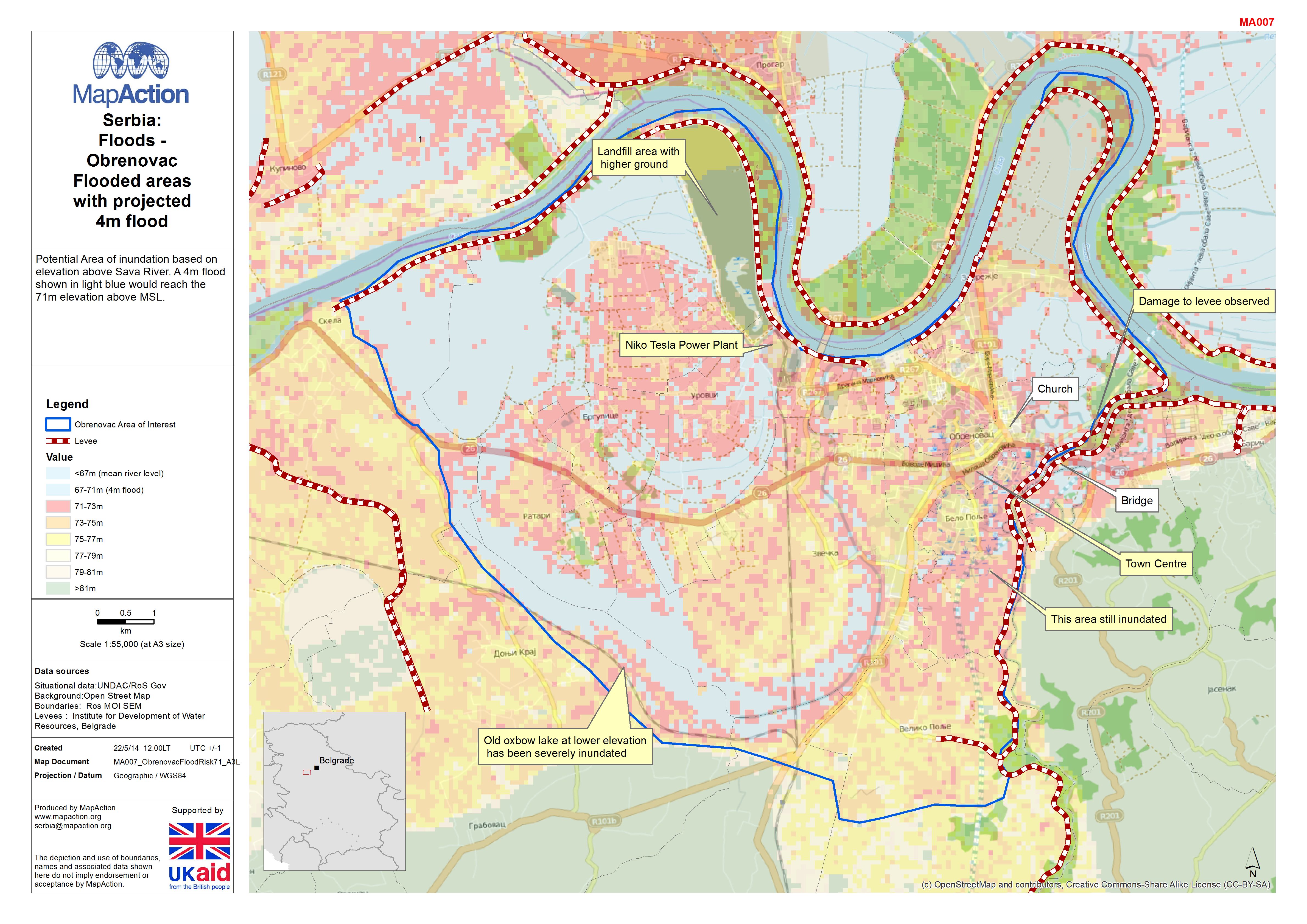
Serbia: Floods - Obrenovac Flooded areas with projected 4m flood
Potential Area of inundation based on elevation above Sava River. A 4m flood shown in light blue would reach the 71m elevation above MSL. -
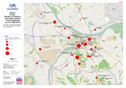
Serbia: Floods - Number of people in evacuation centres around Belgrade
Evacuation Centres around Belgrade with numbers of people housed there as of 21 May 2014. -
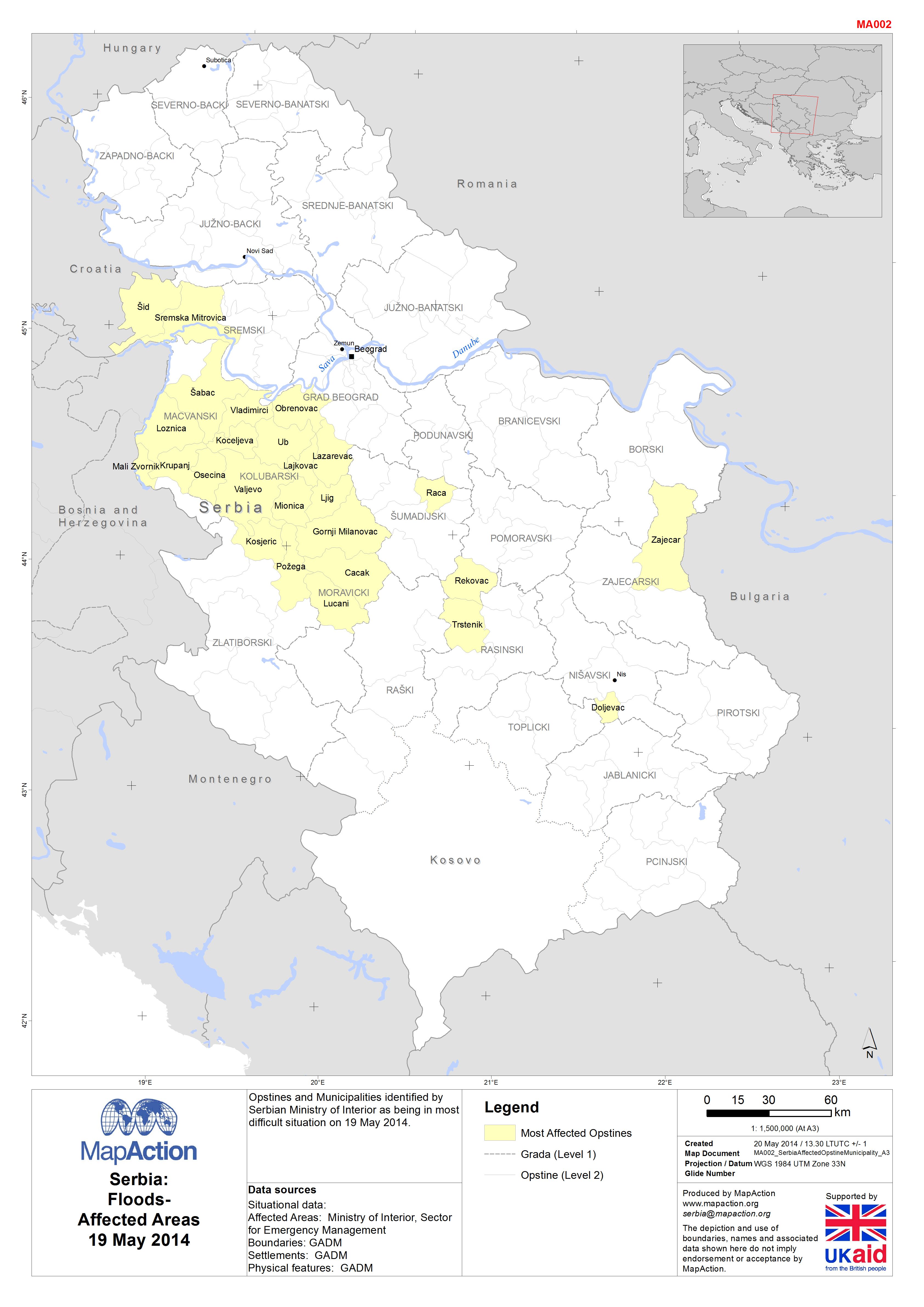
Serbia: Floods-Affected Areas19 May 2014
Opstines and Municipalities identified by Serbian Ministry of Interior as being in most difficult situation on 19 May 2014. -

Floods In Serbia, Bosnia And Herzegovina
Serbia and Bosnia and Herzegovina (BiH) have been affected by cyclone Tamara experiencing extremely heavy rain, strong winds and low temperatures (ACT Alliance 16/05/2014). On... -

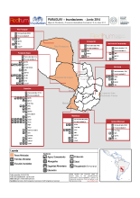
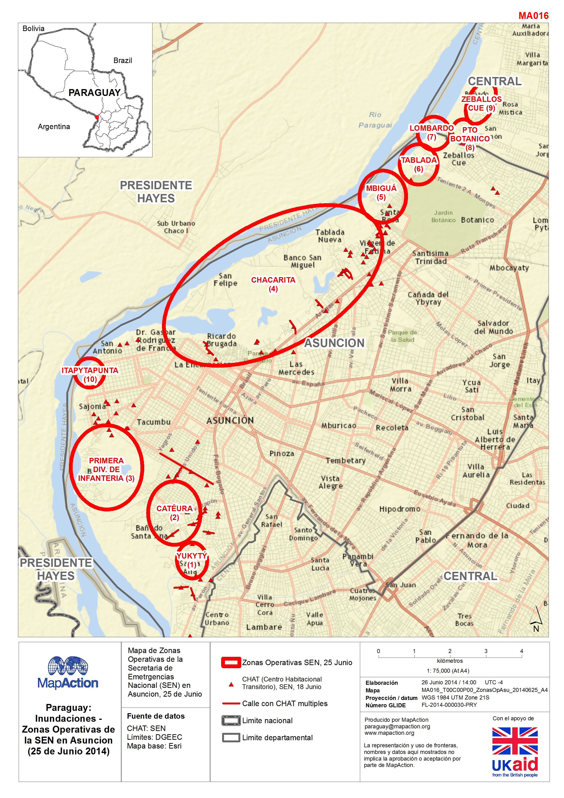
Paraguay: Inundaciones - Zonas Operativas de la SEN en Asuncion (25 de Junio ...
Mapa de Zonas Operativas de la Secretaria de Emetrgencias Nacional (SEN) en Asuncion, 25 de Junio 2014 -

Paraguay: Inundaciones - Evaluacion UNDAC
Mapa de los areas/sitios elegidos para la evaluacion UNDAC del dia 23 de Junio 2014 en Asuncion -
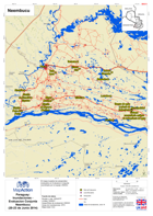
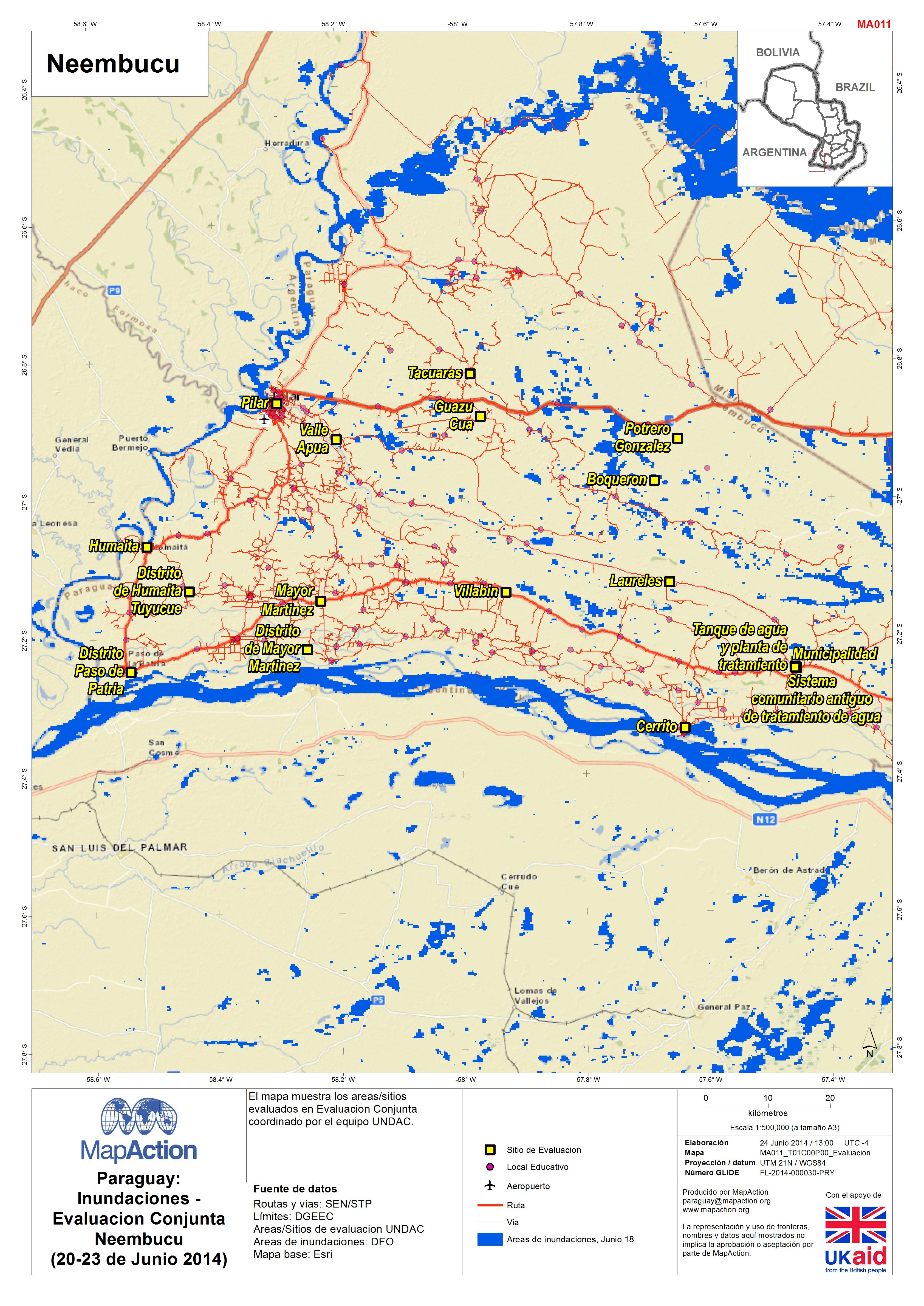
Paraguay: Inundaciones - Evaluacion Conjunta Neembucu (20-23 de Junio 2014)
El mapa muestra los areas/sitios evaluados en Evaluacion Conjunta coordinado por el equipo UNDAC. -
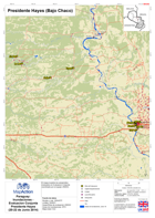
Paraguay: Inundaciones - Evaluacion Conjunta Presidente Hayes (20-22 de Junio...
El mapa muestra los areas/sitios evaluados en Evaluacion Conjunta coordinado por el equipo UNDAC. -

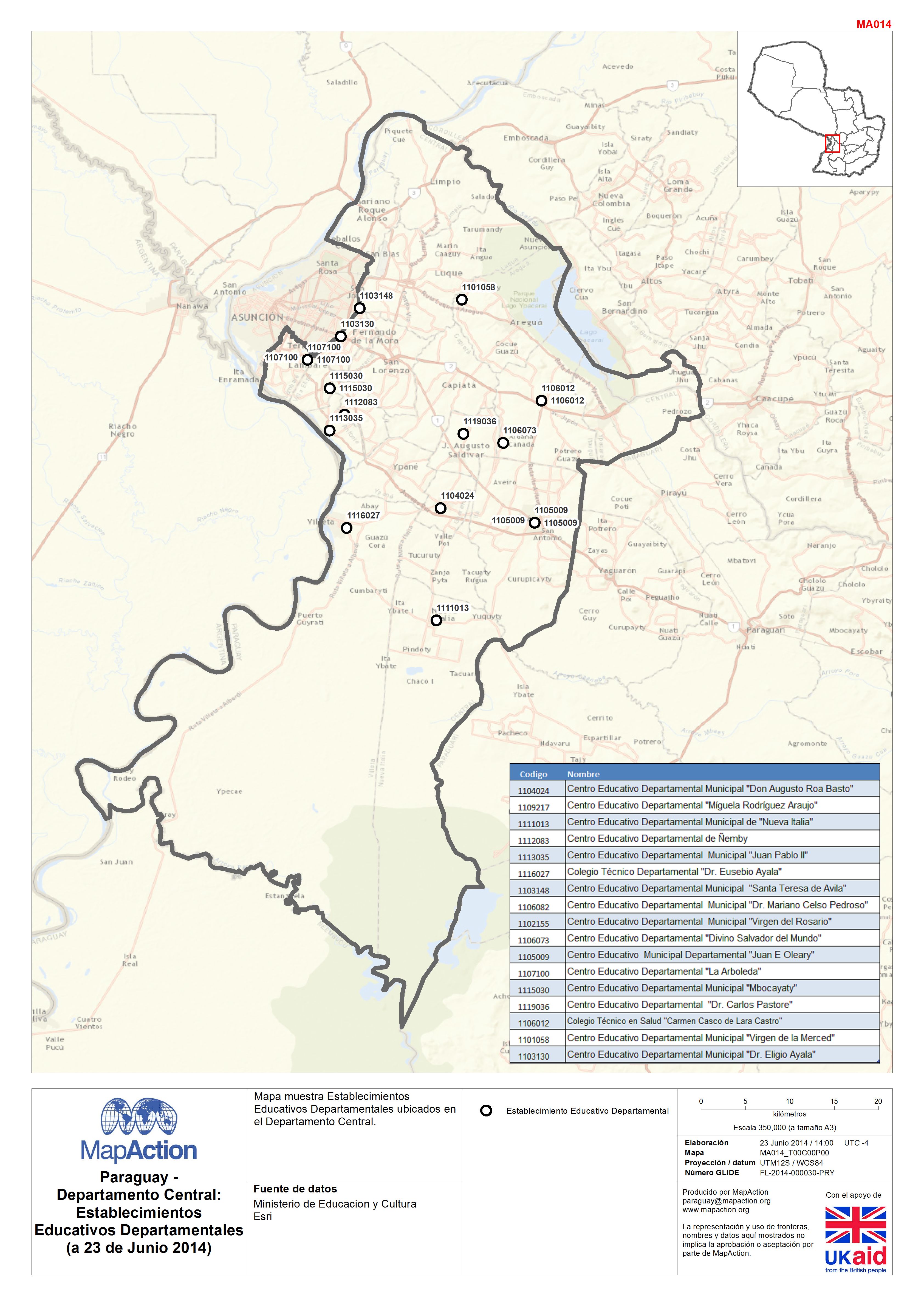
Paraguay - Departamento Central:Establecimientos Educativos Departamentales(a...
Mapa muestra Establecimientos Educativos Departamentales ubicados en el Departamento Central. -
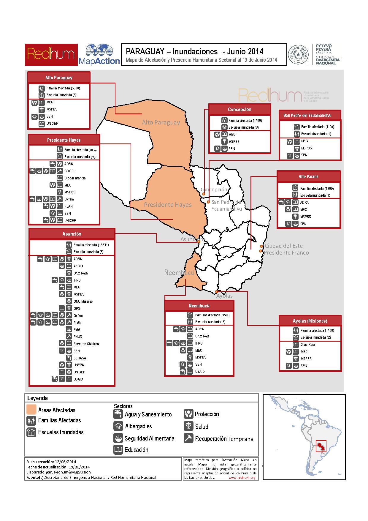
Paraguay: Inundaciones - Mapa de Afectación y Presencia Humanitaria Sectorial...
Map represents humanitarian sector presence in the most affected areas (Alto Paraguay, Presidente Hayes (Bajo Chaco), Asuncion, Ñeembucú). -
Paraguay: Inundaciones - Locales educativos en estado de alerta en Asuncion (...
Locales educativos en estado de alerta en Asuncion -

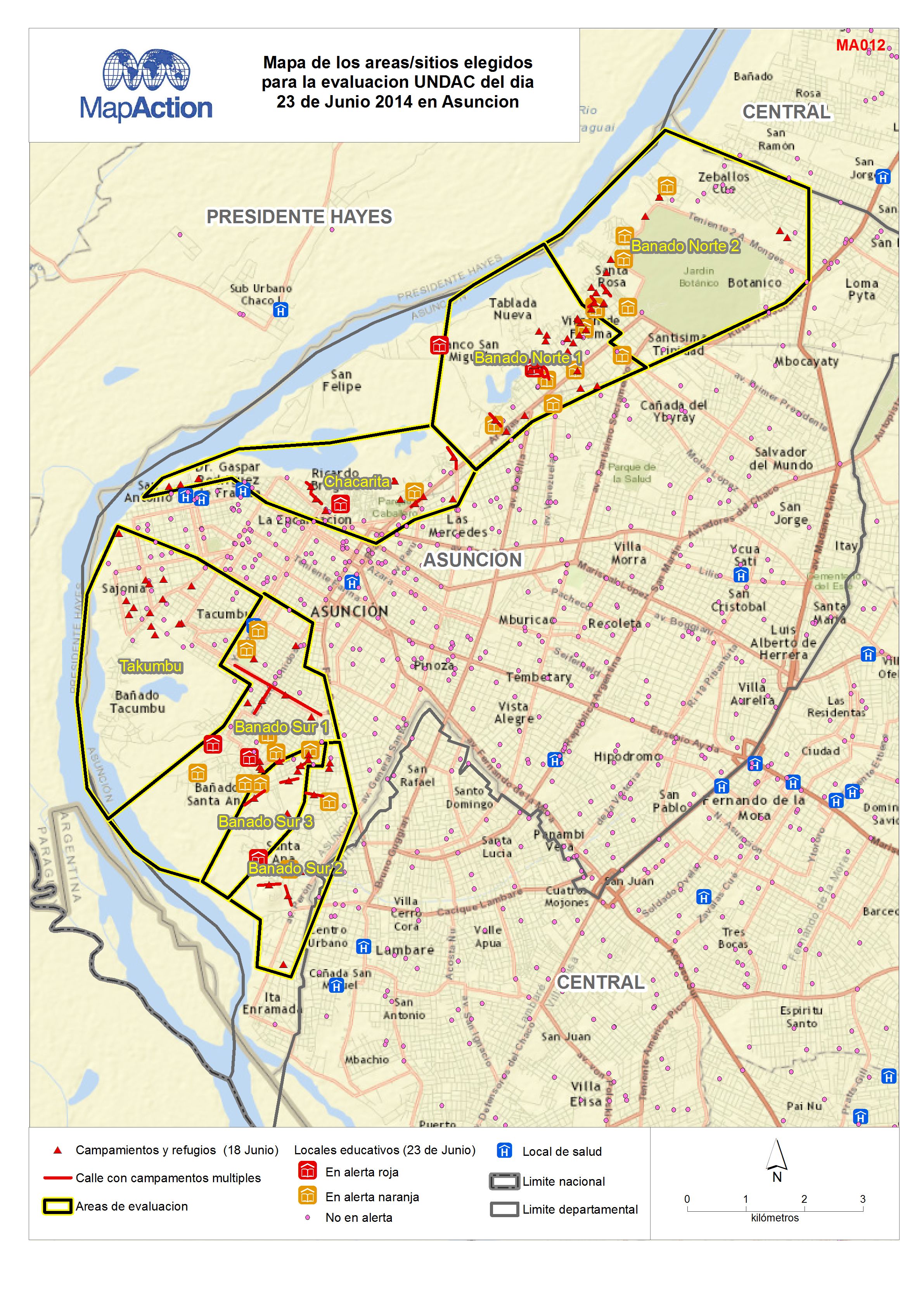
Paraguay: Inundaciones - Evaluacion UNDAC en Asuncion (23 de Junio 2014)
El mapa muestra los areas/sitios elegidos para la evaluacion UNDAC.