-

ASAL Humanitarian Network Drought Response - Activity by Ward (as of 23 Augus...
The map shows the 3w (who, what, where) response activity by wards for the planned and ongoing multi-purpose cash program implemented by the ASAL Humanitarian Network (AHN), in... -
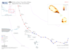
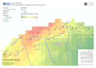
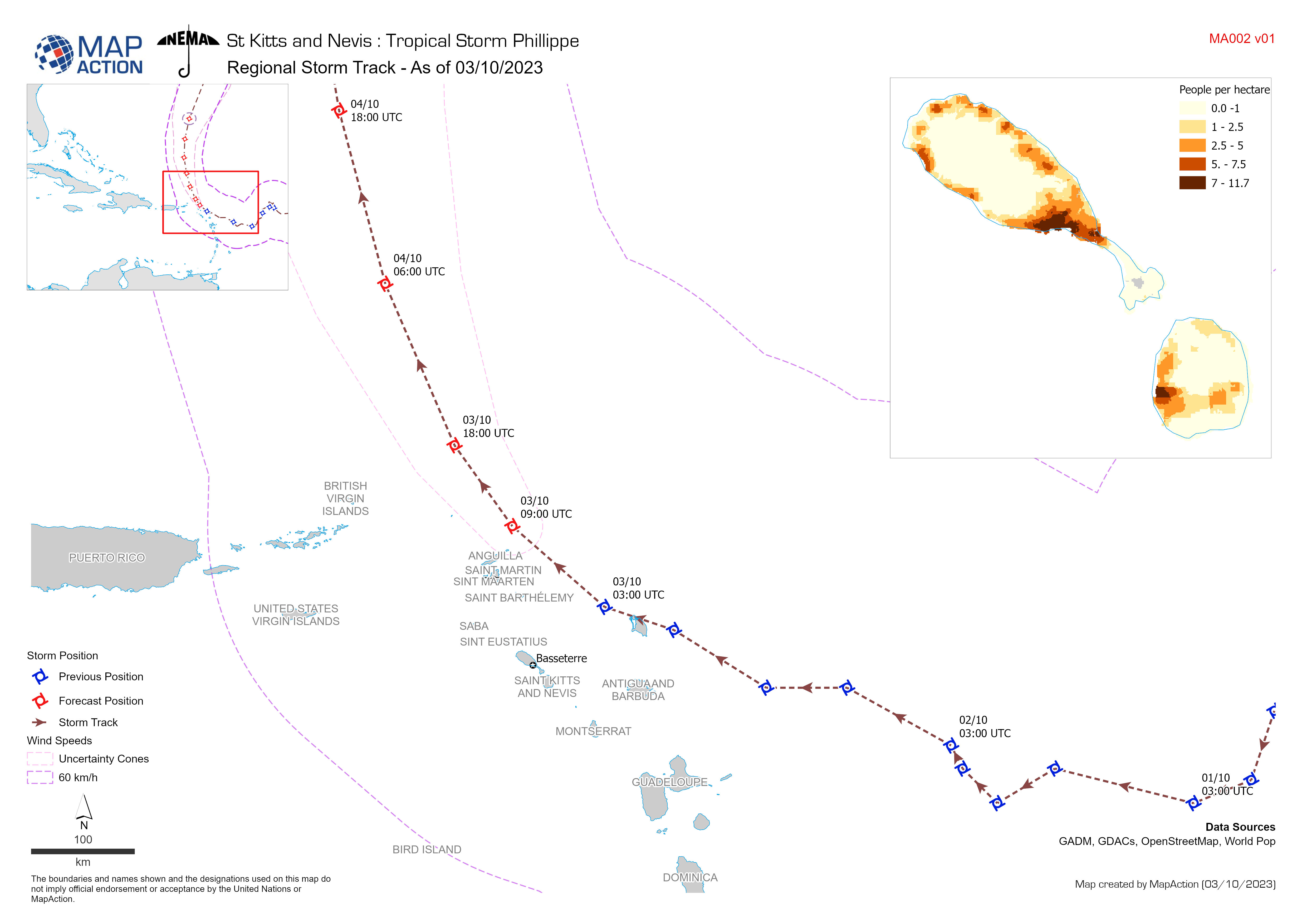
Regional Storm Track - As of 03/10/2023
Storm Path for Tropical Storm Philippe (actual as of 3 October 2023, forecast as of 4 October 2023). All forecasted storm positions, path, and wind speeds are the best available... -

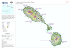
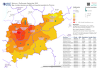
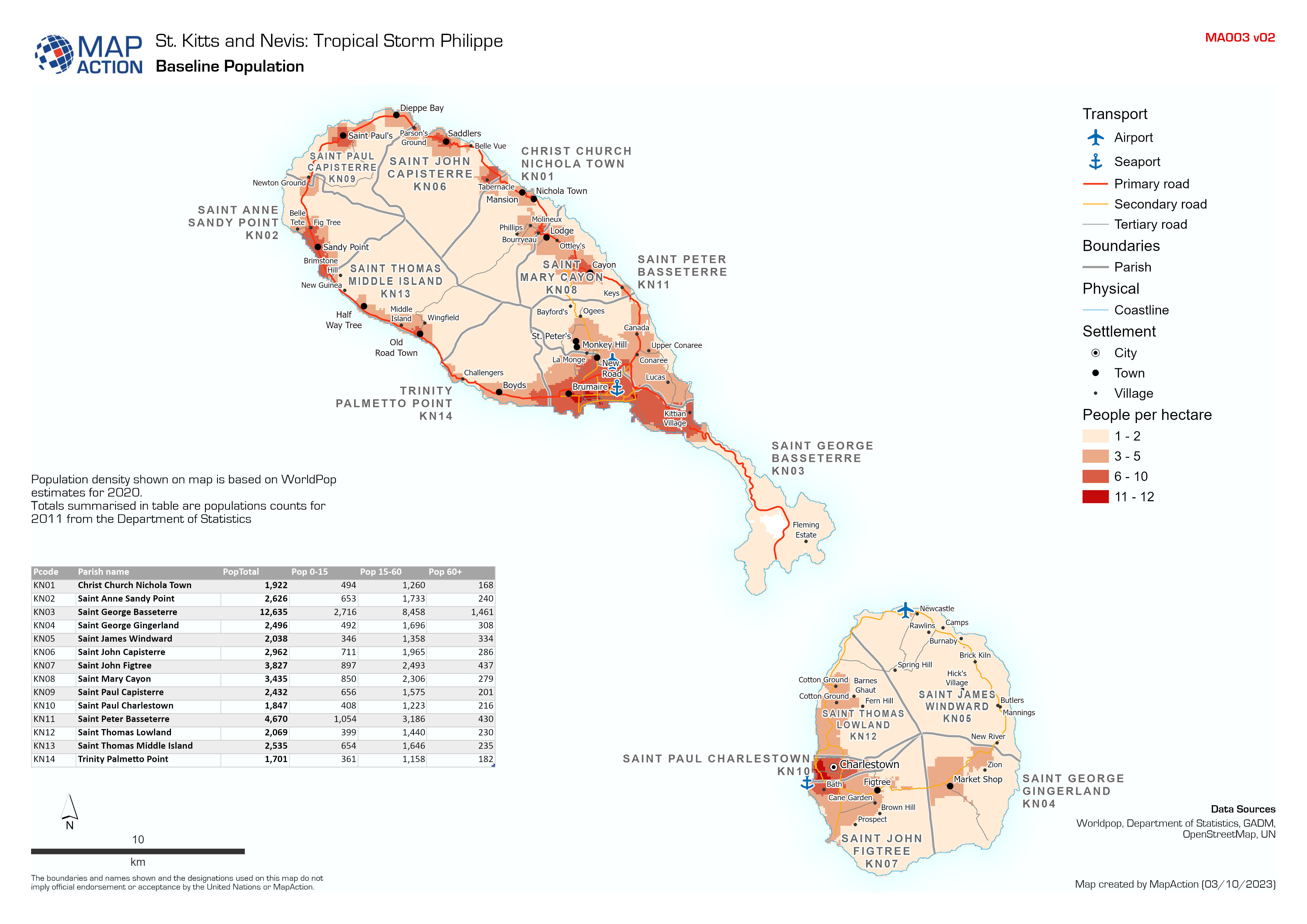
Baseline Population
Population density shown on map is based on WorldPop estimates for 2020. Totals summarised in table are populations counts for 2011 from the Department of Statistics -
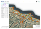
Country overview
Country overview showing administrative boundaries, main settlements, transport infrastructure and natural features. The overview map shows the storm track and the estimated... -

-

-
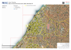
A3 Atlas of 'Assessment Area Units' (AAU) with imagery
Atlas showing Assessment Area Units (AAUs) for urban area between Benghazi and Derna version 3 -

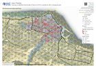
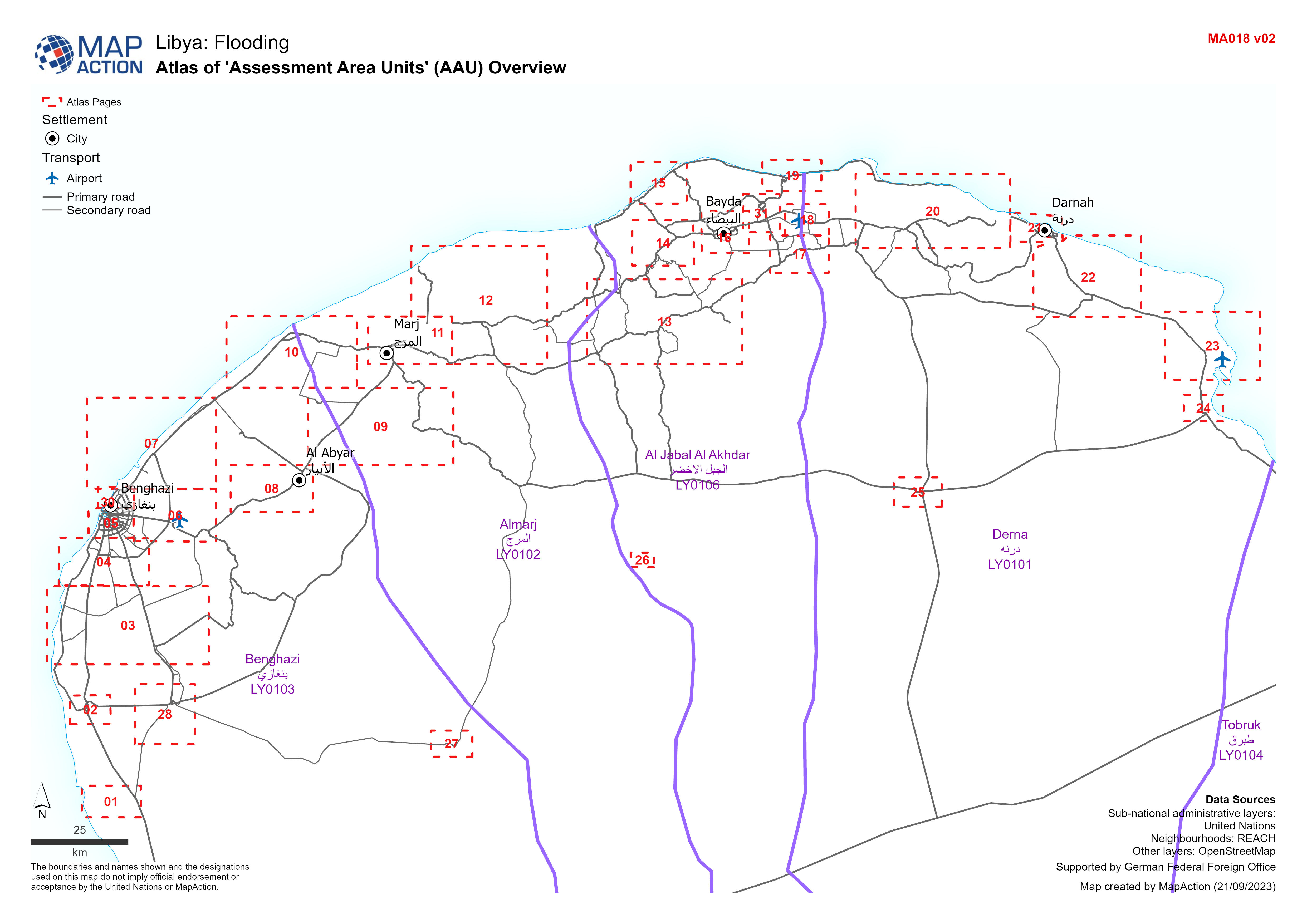
'Assessment Area Units' (AAU) Overview
Showing Assesment Area Units (AAUs) atlas pages for urban area between Benghazi and Derna -

A4 Atlas of 'Assessment Area Units' (AAU):
Atlas showing Assessment Area Units (AAUs) for urban area between Benghazi and Derna -

A3 Atlas of 'Assessment Area Units' (AAU):
Atlas showing Assessment Area Units (AAUs) for urban area between Benghazi and Derna -
-
Atlas of 'Assessment Area Units' (AAU)
Atlas showing Assesment Area Units (AAUs) for urban area between Benghazi and Derna -
Storm Daniel rainfall accumulations (9-12 September 2023)
Storm Daniel rainfall accumulations (9-12 September 2023) over affected admin 2 areas -

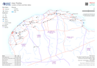
Physical Access Constraints (PAC) - Roads in Derna as of 12 September 2023
Status of road access to the city of Derna as reported by the Logistics cluster -

Schools hosting IDPs in Benghazi (as of 11 September IOM Flash Appeal)
Location of schools hosting IDPs (internally displaced persons) in Benghazi following Storm Daniel -
Overview of affected Governorate of Derna (LY0101) overlaid by 250 m hexagona...
Overview of affected area overlaid by 250 m diameter hexagonal grid -

Overview of affected governorate of Derna (LY0101)
Overview of affected area showing transport infrastructure and natural features with flood extents -

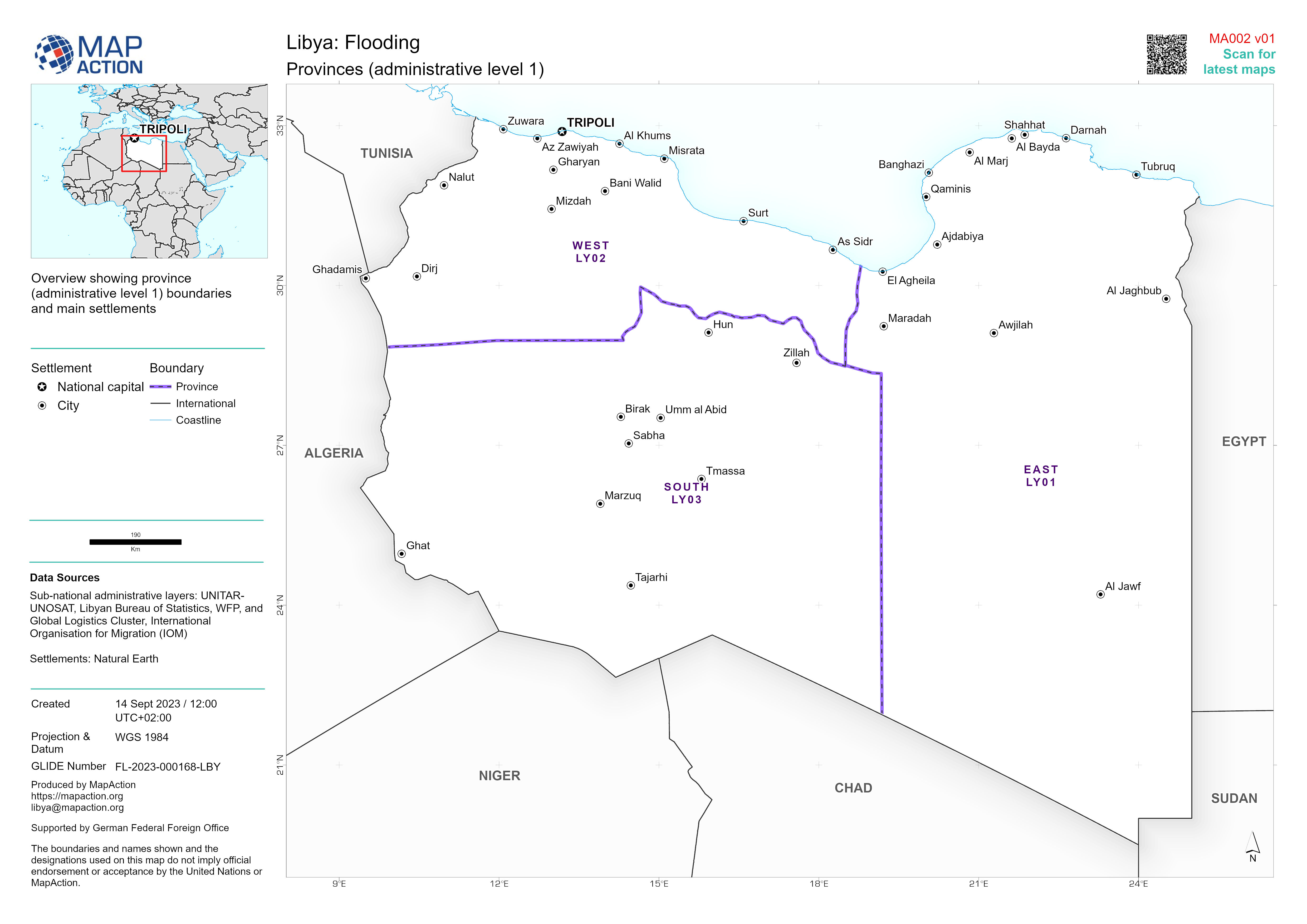
Provinces (administrative level 1)
Overview showing province (administrative level 1) boundaries and main settlements -
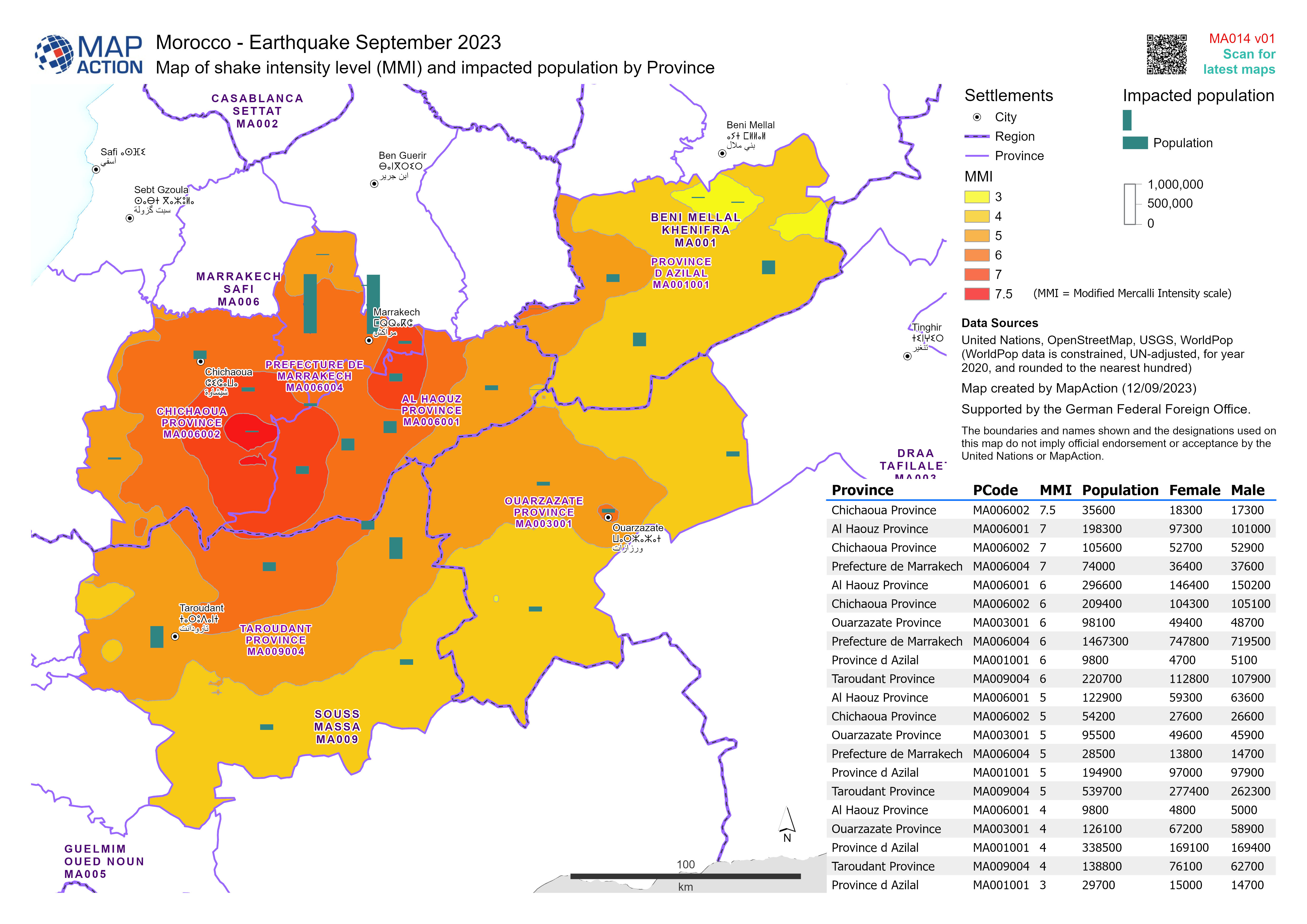
Map of shake intensity level (MMI) and impacted population by Province
Map showing sex-disaggregated and total population for the 6 affected Provinces -

Overview of affected governorates
Overview of affected area showing transport infrastructure and natural features