-

Vanuatu: Cyclone PAM - Buckets - Needs, Delivered, For Deliveryand Gaps- Mala...
Map shows information on the number of buckets required, delivered and for delivery per island. The gap is the difference between the requirement needs and what has been... -
Vanuatu: Cyclone PAM - Jerry Cans - Needs,Delivered, For Deliveryand Gaps- Ma...
Map shows information on the number of Jerry Cans required, delivered and for delivery per island. The gap is the difference between the requirement needs and what has been... -
Vanuatu: Cyclone PAM - Soap - Needs, Delivered, For Deliveryand Gaps- Malampa...
Map shows information on the number of soap required, delivered and for delivery per island. The gap is the difference between the requirement needs and what has been delivered. -
Vanuatu: Cyclone PAM - Hygiene Kits - Needs, Delivered, For Deliveryand Gaps-...
Map shows information on the number of hygiene kits required, delivered and for delivery per island. The gap is the difference between the requirement needs and what has been... -
-

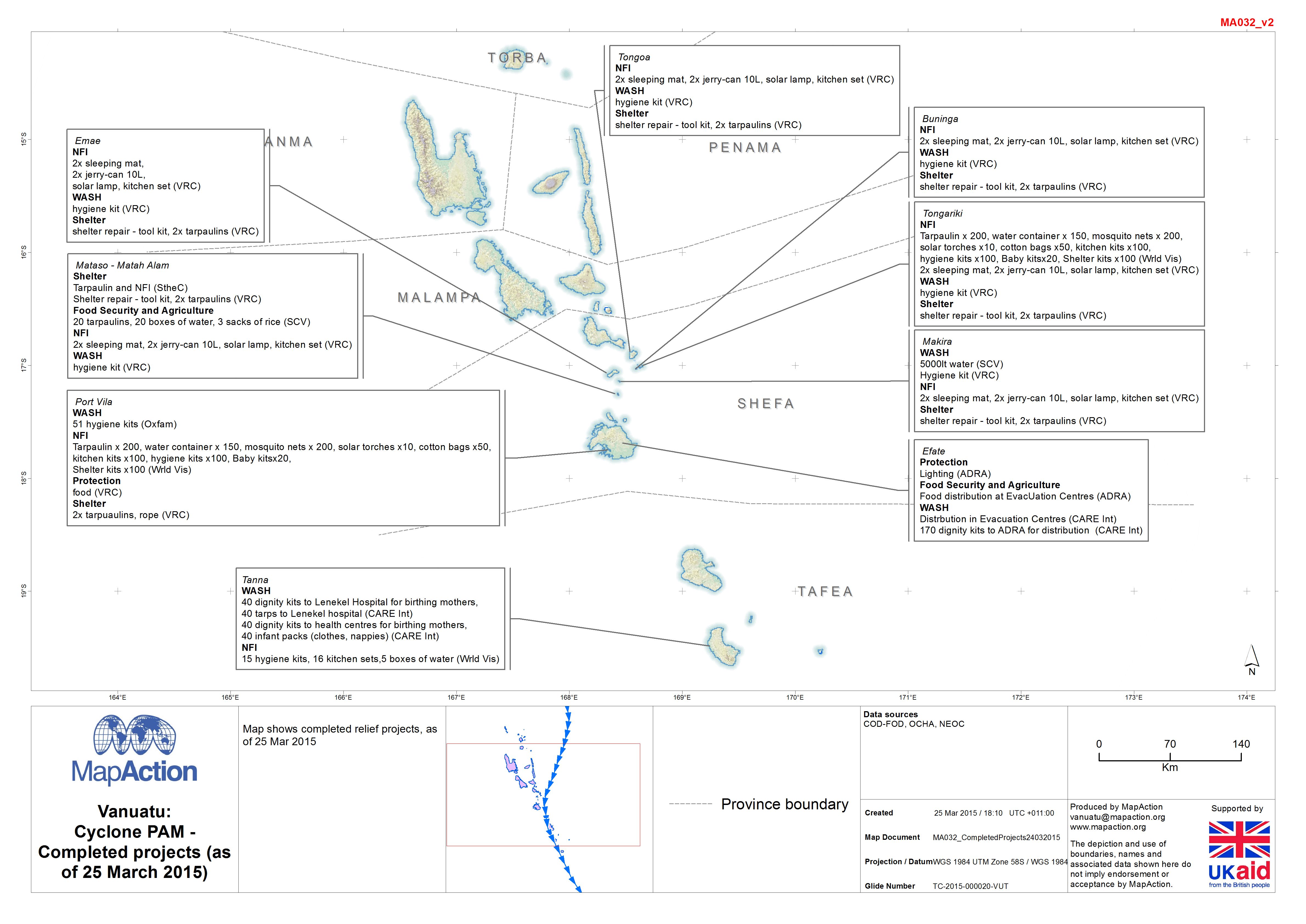
Vanuatu: Cyclone PAM - Completed projects (as of 25 March 2015)
Map shows completed relief projects, as of 25 Mar 2015. -

-
Vanuatu: Cyclone PAM - Shelter Distribution Priority Plan (as of 22 Mar 2015)
Map shows the priority areas based upon the preliminary needs analysis. -
Vanuatu: Cyclone PAM - Food Distribution Priority Plan (as of 22 Mar 2015)
Map shows the priority areas based upon the preliminary needs analysis. -
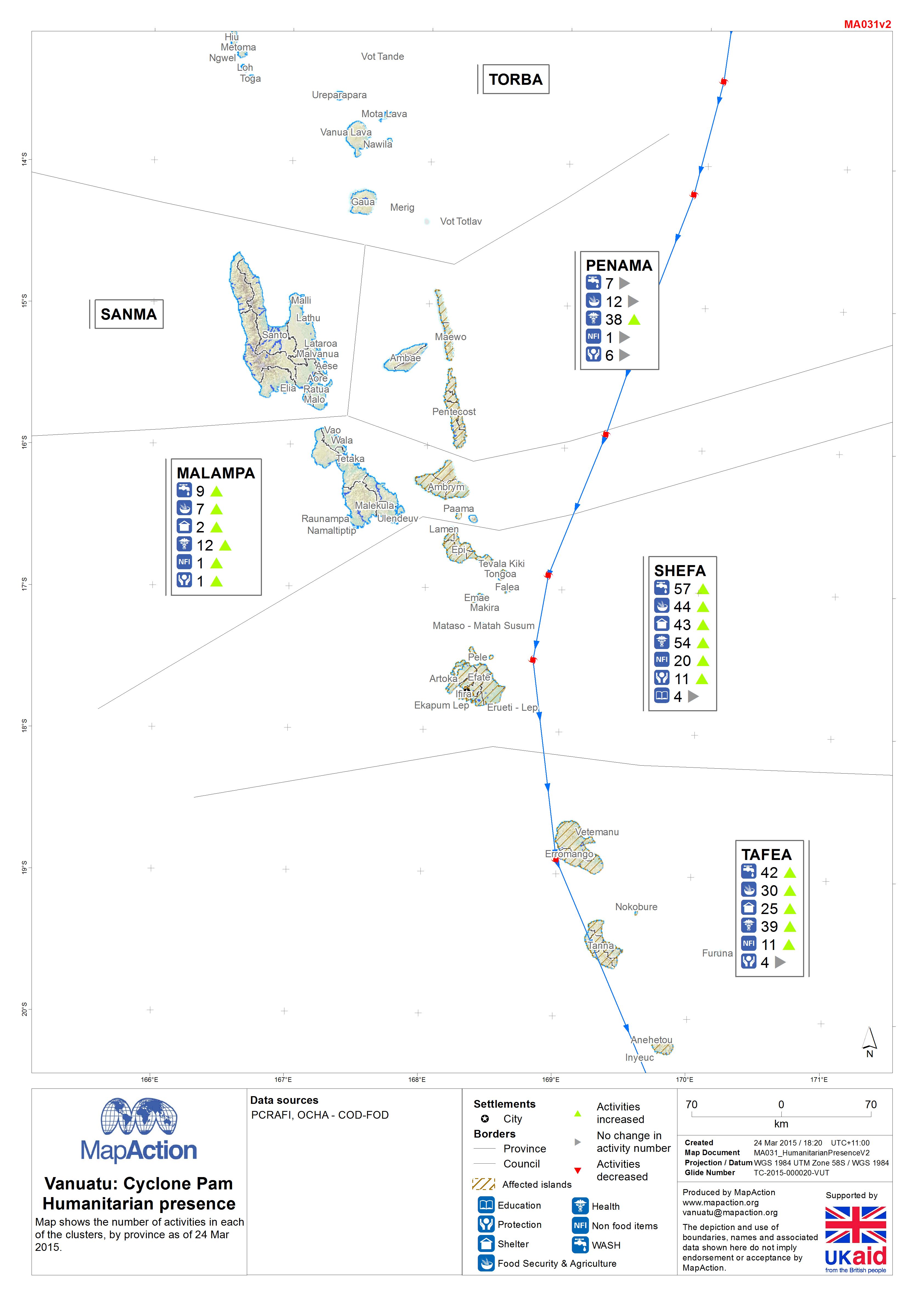
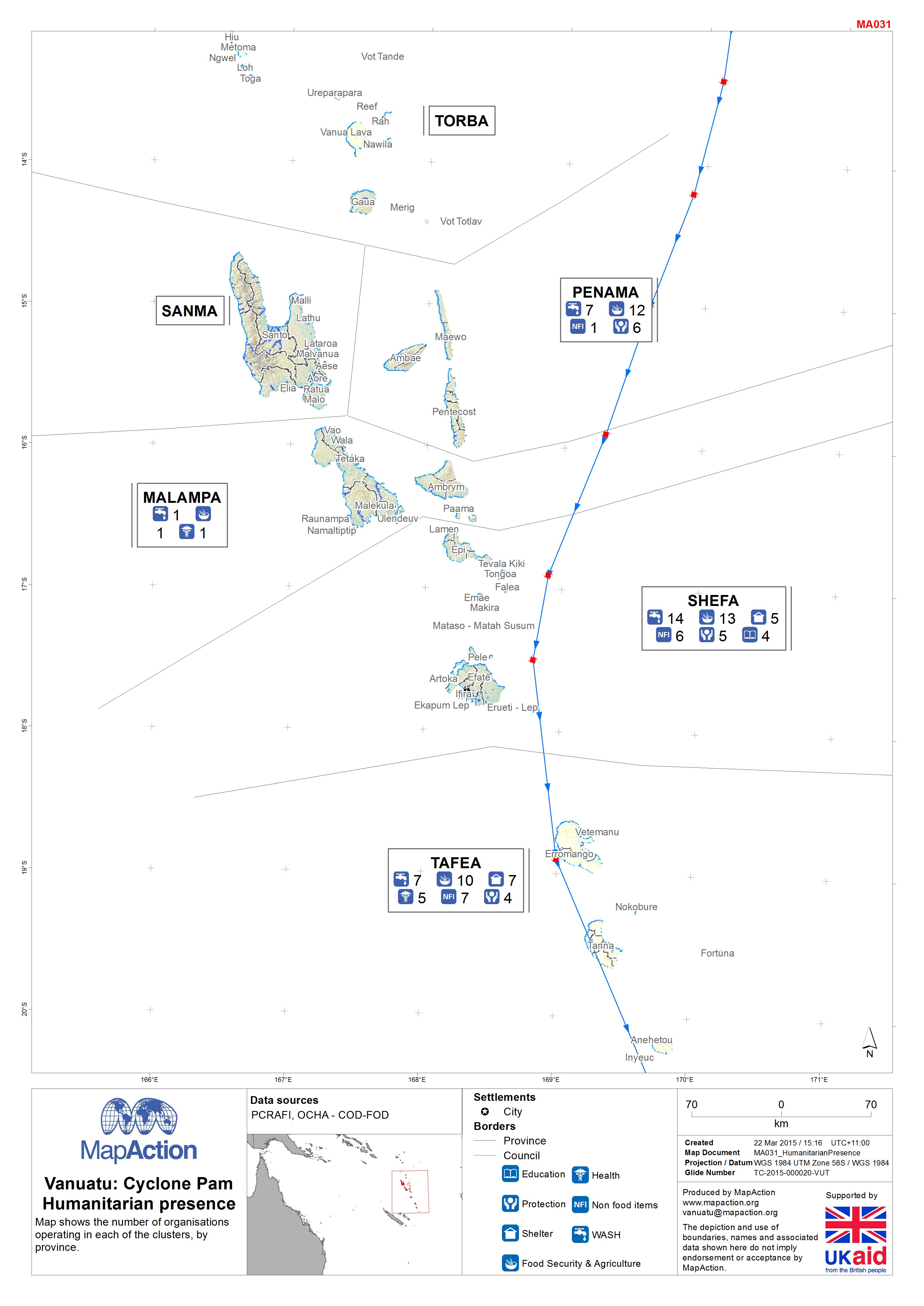
Vanuatu: Cyclone PAM - Who, What, Where (as at 24 March 2015)
Map shows organisations per island, per cluster. -
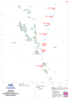
Vanuatu: Cyclone PAM - Helicopter landing zones in the Shepherd Islands(as of...
This dataset has no description
-

-

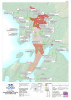
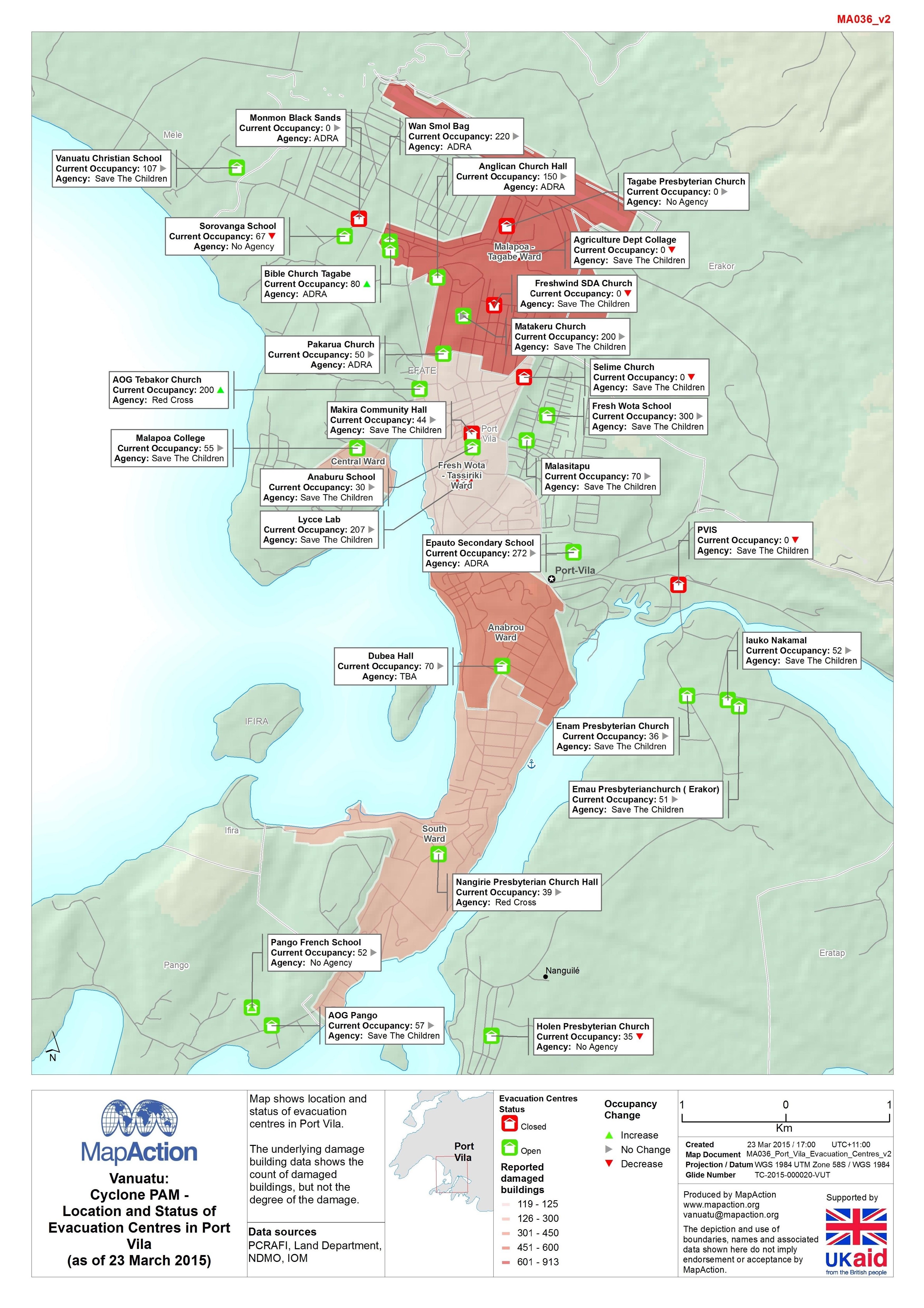
Vanuatu: Cyclone PAM - Location and Status of Evacuation Centres in Port Vila...
Map shows location and status of evacuation centres in Port Vila. The underlying damage building data shows the count of damaged buildings, but not the degree of the damage. -
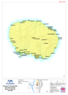
Vanuatu: Cyclone PAM - Number of Households per Area Council
Maps show the number of households for each of the 63 area councils in Vanuatu. -

Vanuatu: Cyclone PAM - Location and status of the Foreign Medical Teams (FMTs...
Map shows the location and status of the Foreign Medical Teams (FMT) in Vanuatu. -
Vanuatu: Cyclone PAM - Reported damage in Port Vila(as of 22 March 2015)
Map shows the number of location and status of evacation centres in Port Vila. The underlying damage building data shows the count of damaged buildings, but not the degree of... -

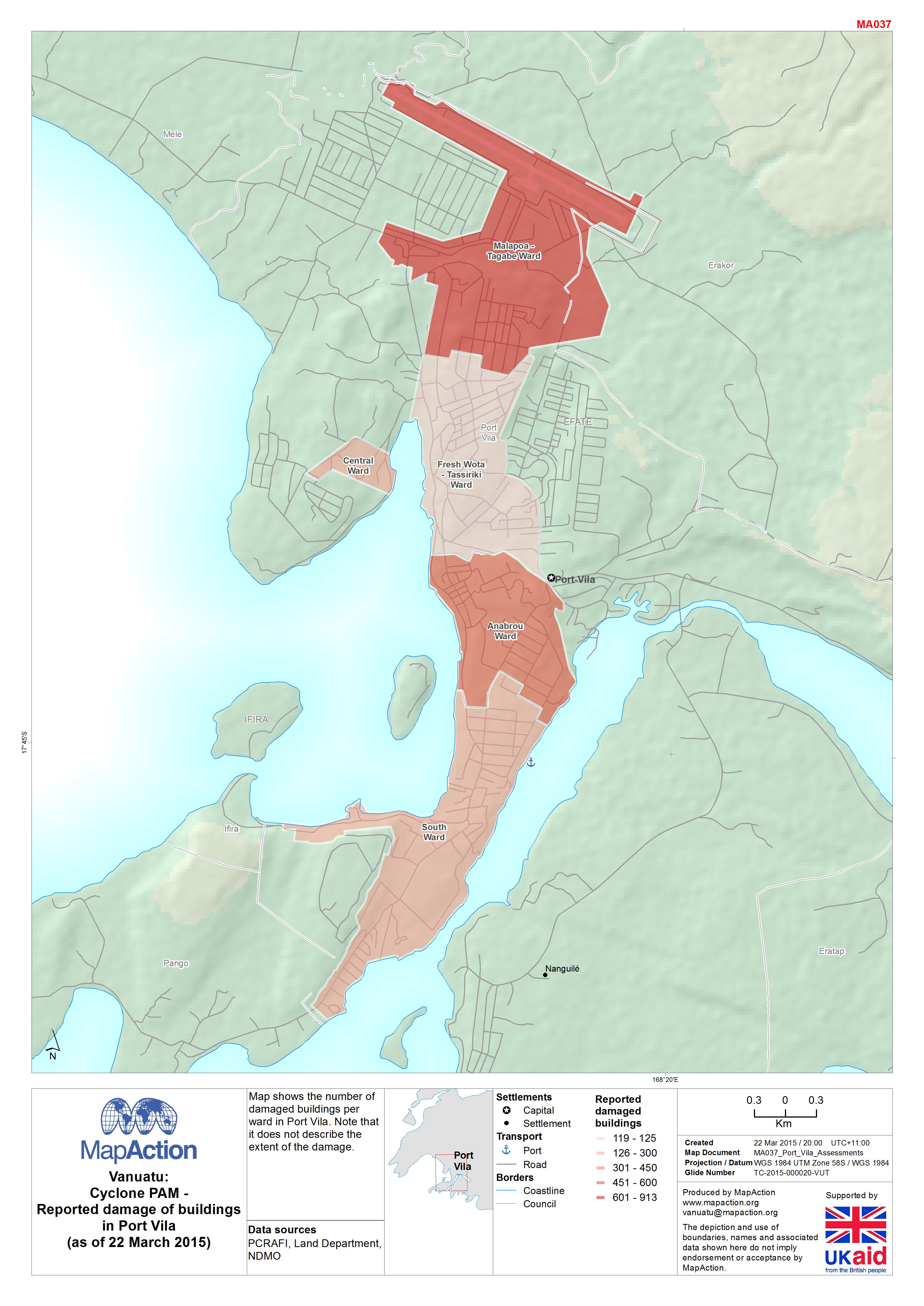
Vanuatu: Cyclone PAM - Reported damage of buildings in Port Vila(as of 22 Mar...
Map shows the number of damaged buildings per ward in Port Vila. Note that it does not describe the extent of the damage. -
Vanuatu: Cyclone PAM - Who, What, Where (as at 21 March 2015)
Map shows organisations per island per cluster. -
Vanuatu: Cyclone PAM - Completed projects (as of 21 March 2015)
Map shows completed relief projects, as of 21 Mar 2015 -