-
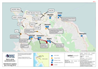
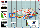
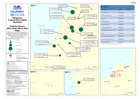
Sierra Leone Landslide/floods - Operations/Logistics (as of 23 Aug 2017)
Map shows key operational locations and the activies being conducted at each site. Points of Interest relevant to the operational setting are also provided. -
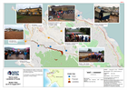
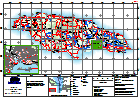
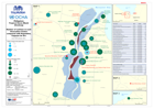
Sierra Leone Landslide & Floods Shelter Sites as of 23 August 2017
Map indicates the location of active and proposed shelters in Freetown identified by national agencies. Confirmation is needed of the status and population of these shelters. -
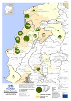
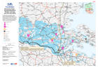
Ecuador: Terremoto Personas Albergades (a 24 Abril 2016)
El mapa muestra el numero de personas albergadas en refugios communidades a 24 abríl. Remarca que la cantidad de personas desplazadas pueda ser elevado. Los cantones afectados y... -
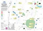
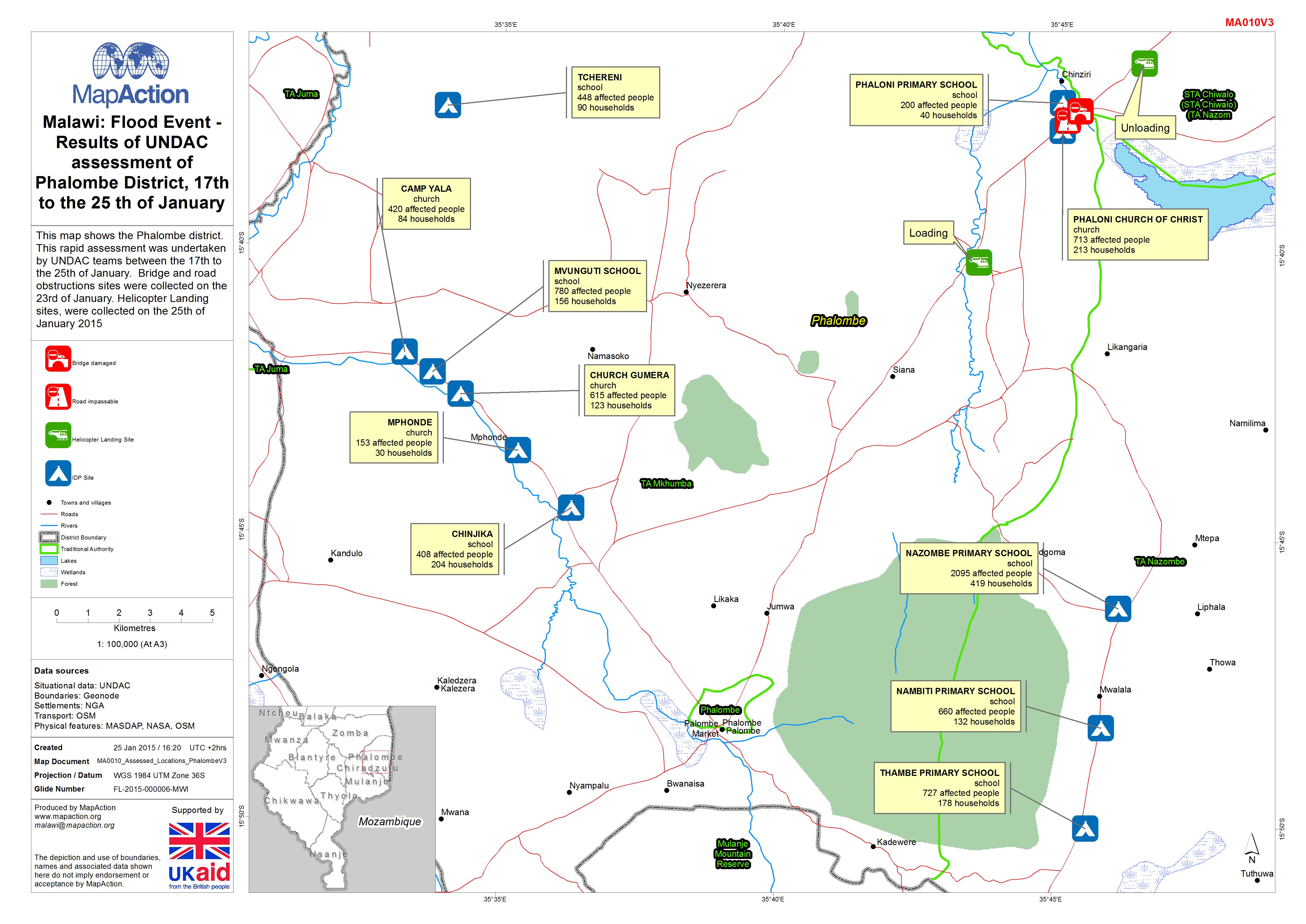
Malawi: Floods - Results of UNDAC assessment of Phalombe District, 17th to th...
This dataset has no description
-
Bahamas: Hurricane Matthew- Rapid Assessment Housing Damage Estimate New Prov...
Estimates of housing damage in areas assessed for CDEMA. Level 0 - no damage, Level 1 - superficial damage, Level 2 - significant damage but habitable, Level 3 - not... -
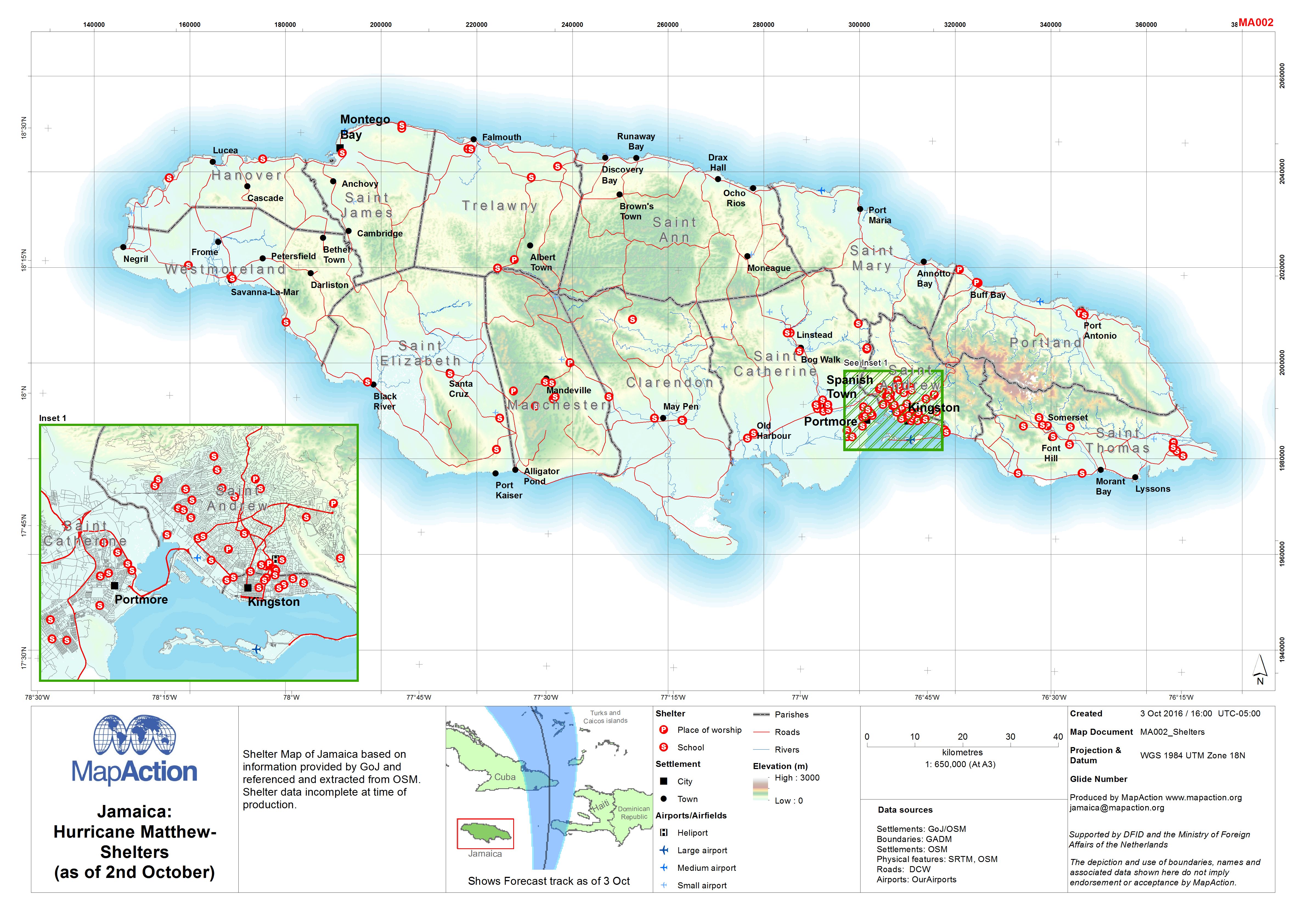
Jamaica: Hurricane Matthew - Shelters (as of 2nd October)
Shelter Map of Jamaica based on information provided by GoJ and referenced and extracted from OSM. Shelter data incomplete at time of production. -

Cape Verde - Fogo Island: Shelters location (as of 11 Dec 2014)
Map shows the shelter locations, evacuation points and critical points for lava flow. -

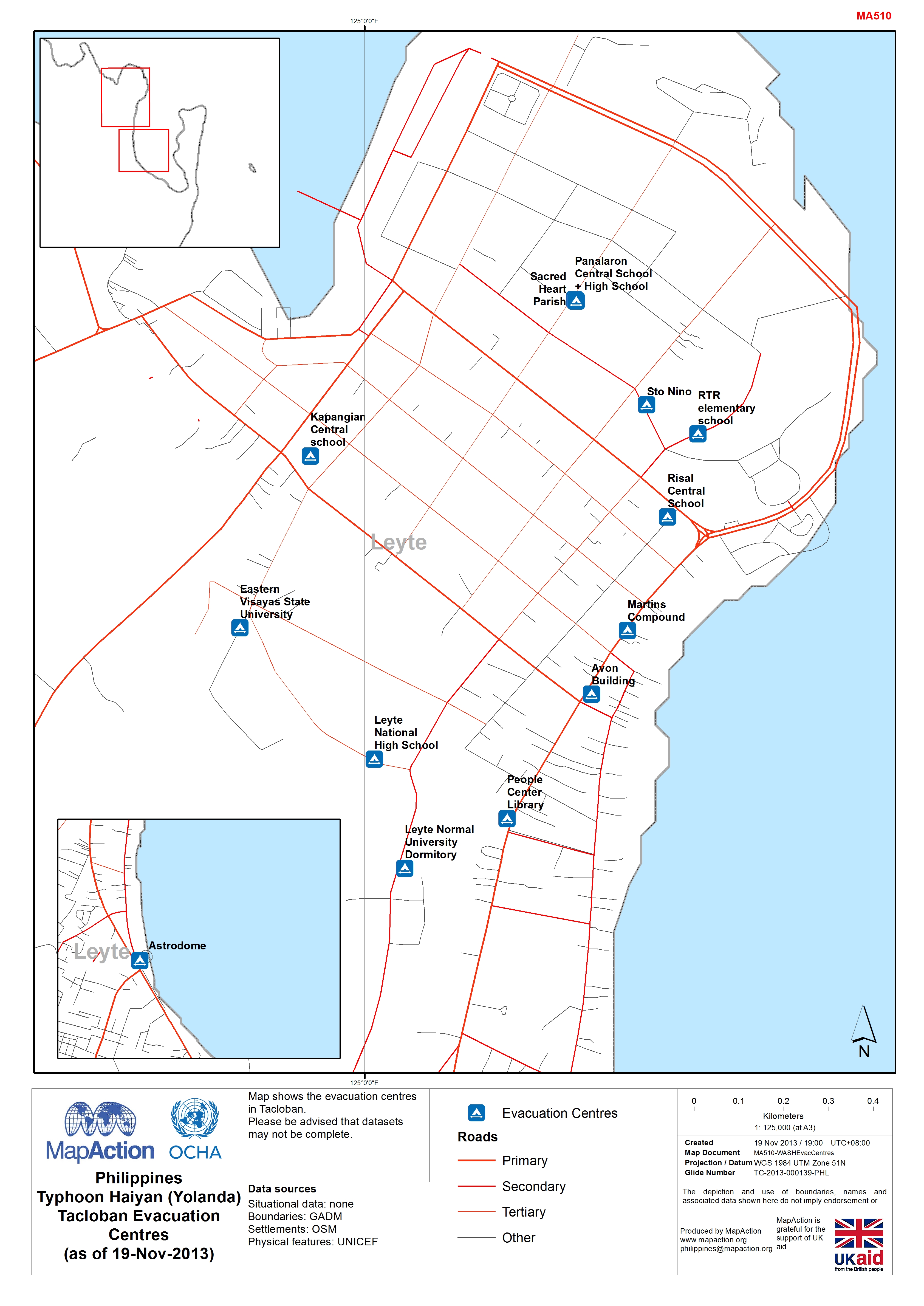
MA510 PhilippinesTyphoon Haiyan (Yolanda)Tacloban Evacuation Centres(as of 19...
Map shows the evacuation centres in Tacloban.Please be advised that datasets may not be complete. -

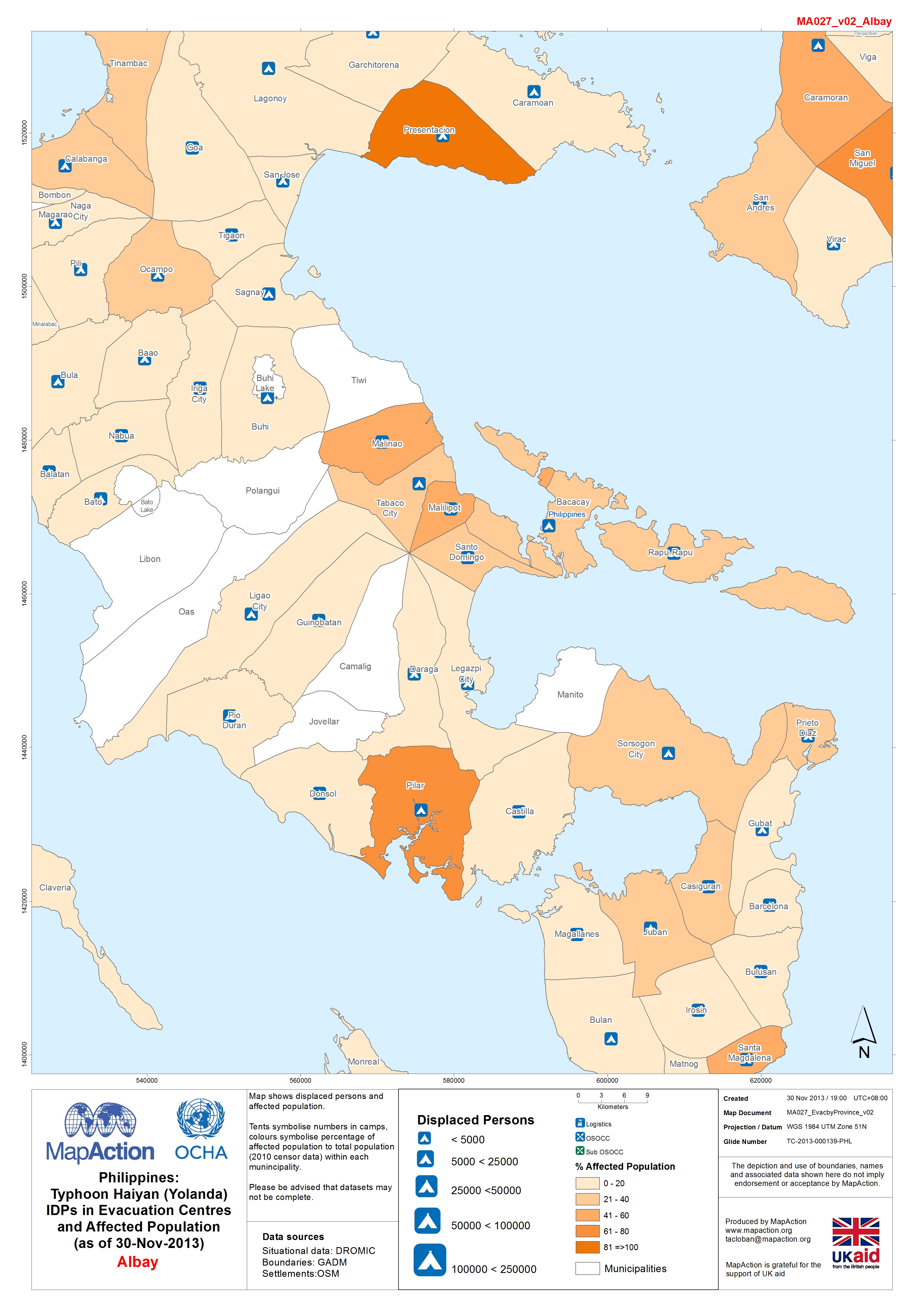
Philippines:Typhoon Haiyan (Yolanda) IDPs in Evacuation Centres and Affected ...
Map shows displaced persons and affected population. Tents symbolise numbers in camps, colours symbolise percentage of affected population to total population (2010 censor data)... -

Philippines Typhoon Haiyan (Yolanda) Evacuation Centres Cebu and Bohol (as of...
Map shows evacuation centres and affected population. Numbers symbolise camps, colours symbolise population at municipality level.White areas show areas of no data. Please be... -

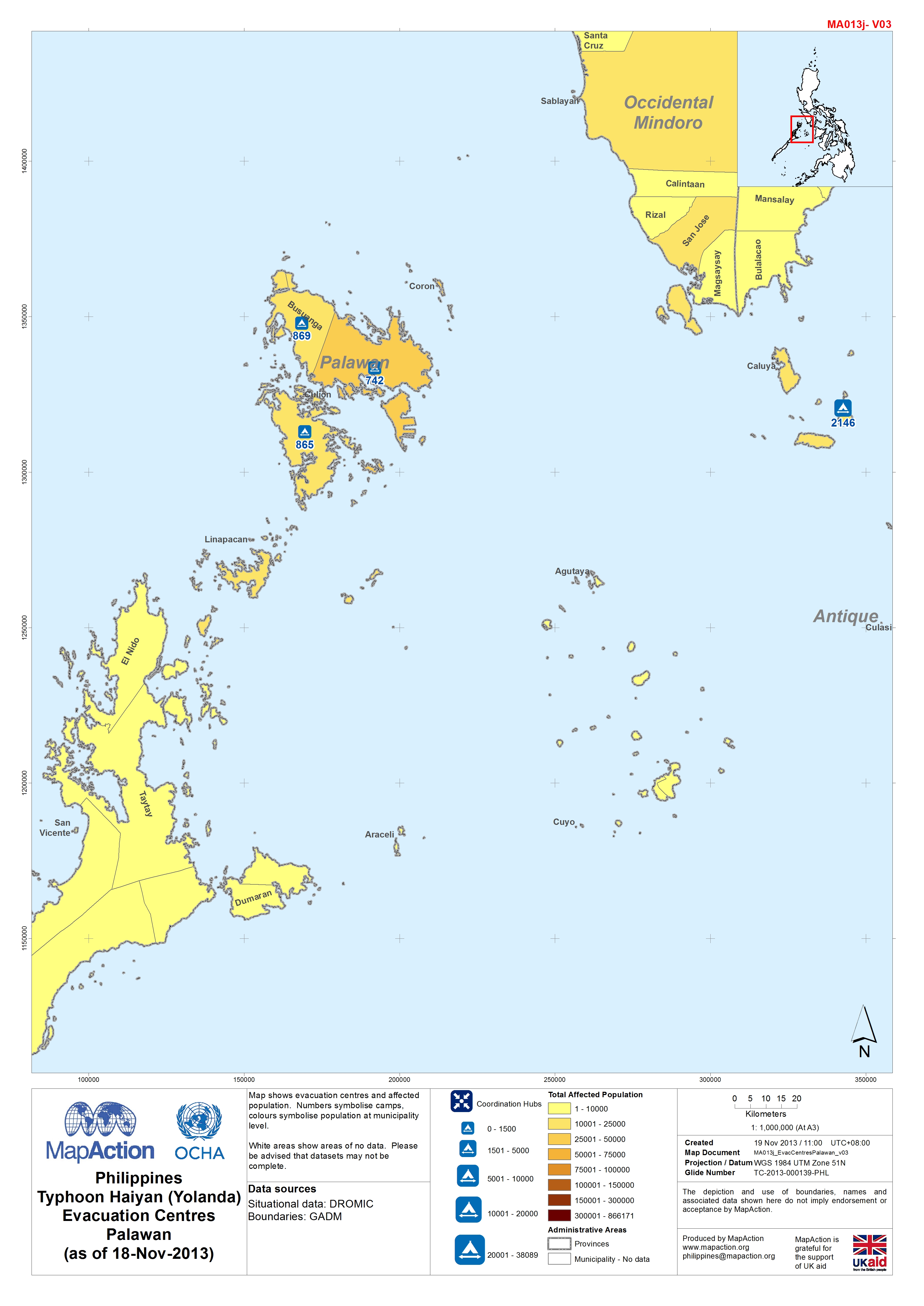
Philippines Typhoon Haiyan (Yolanda) Evacuation Centres Palawan (as of 18-Nov...
Map shows evacuation centres and affected population. Numbers symbolise camps, colours symbolise population at municipality level.White areas show areas of no data. Please be... -

Philippines Typhoon Haiyan (Yolanda) Evacuation Centres, Masbate and Sorgoson...
Map shows number of people in evacuation centres by municipality in Masbate and Sorgoson regions.Please be advised that datasets may not be complete. -

-

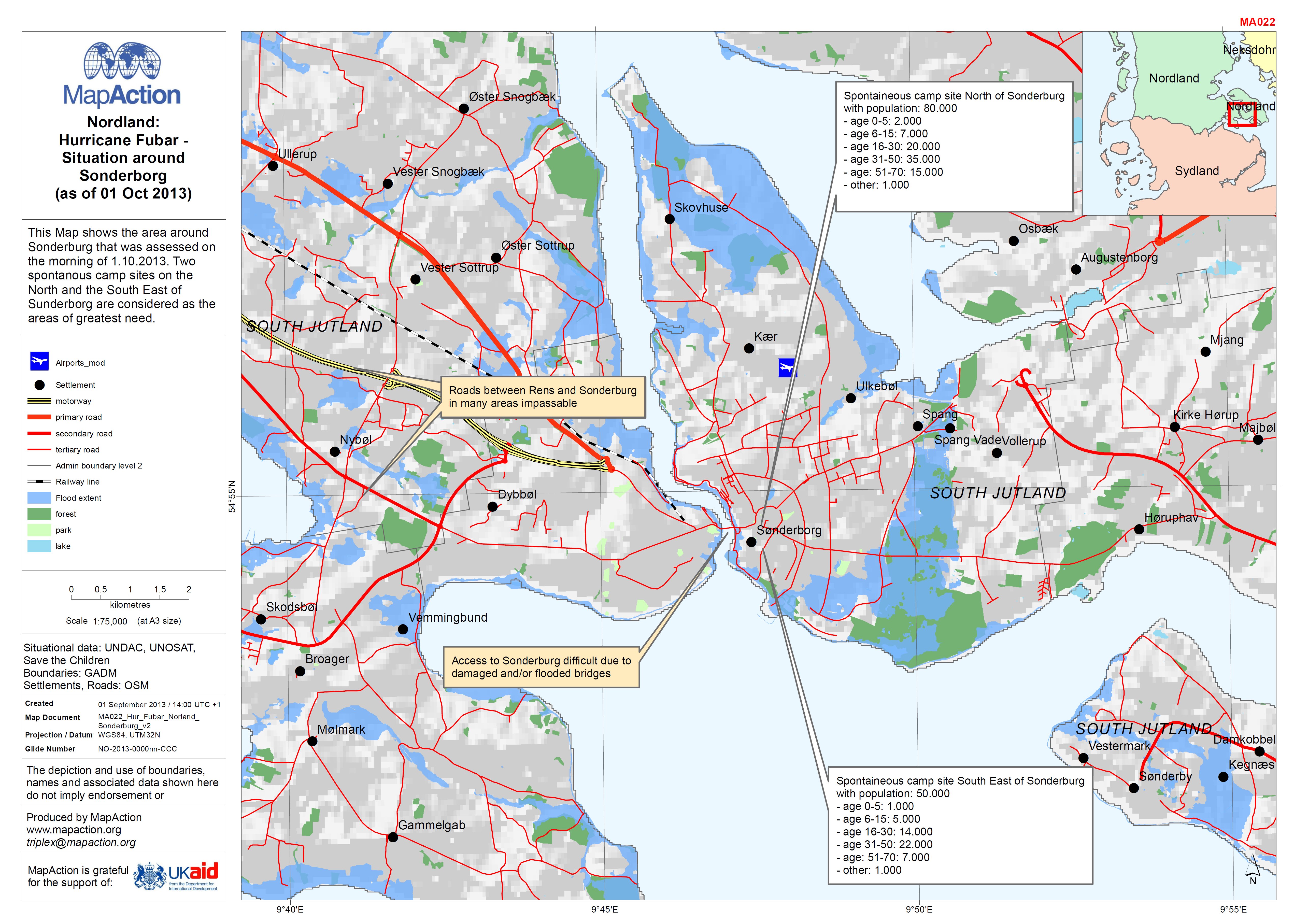
EXERCISE: Nordland: Hurricane Fubar - Situation around Sonderborg (as of 01 O...
This Map shows the area around Sonderburg that was assessed on the morning of 1.10.2013. Two spontanous camp sites on the North and the South East of Sunderborg are considered... -
EXERCISE: Hurricane Fubar - Nordland/Sydland Shelter overview (as of 01 Oct 2...
This map shows the general situation overview including the likely area to be flooded as well as number of IDPs in camps on the morning of 1.10.2013. The Camp location are only... -
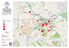
Serbia: Floods - Number of people in evacuation centres around Belgrade
Evacuation Centres around Belgrade with numbers of people housed there as of 21 May 2014. -

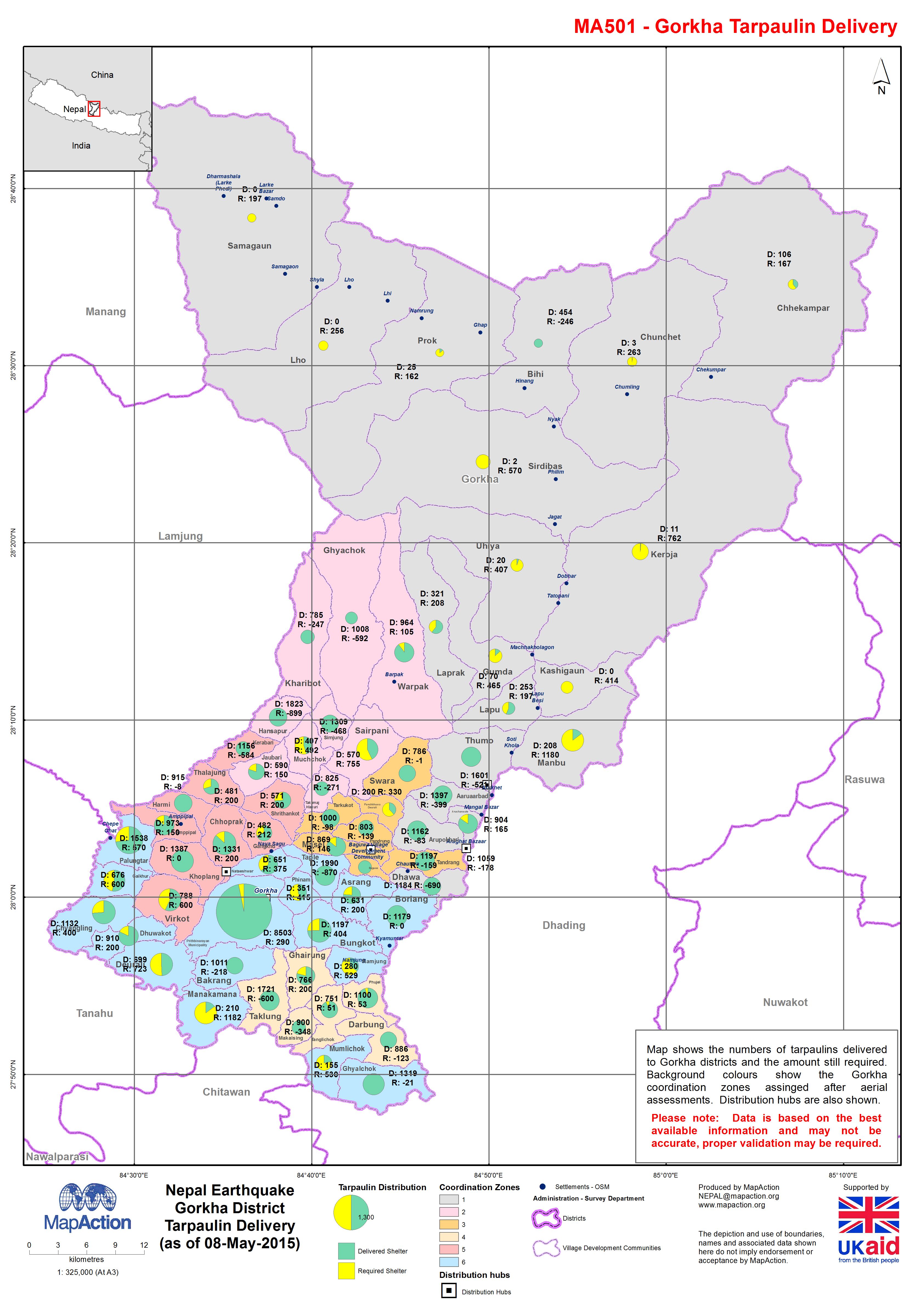
Nepal Earthquake; Gorkha District - Tarpaulin Delivery (as of 08-May-2015)
Map shows the numbers of tarpaulins delivered to Gorkha districts and the amount still required. Background colours show the Gorkha coordination zones assigned after aerial... -
Philippines Tropical Storm Washi (Sendong) Nutrition Cluster Who, What, Where...
Map shows the humanitarian organisations working on nutrition cluster activities at each Evacuation Centre (EC) / Transitory Site (TS) together with number of people at each... -
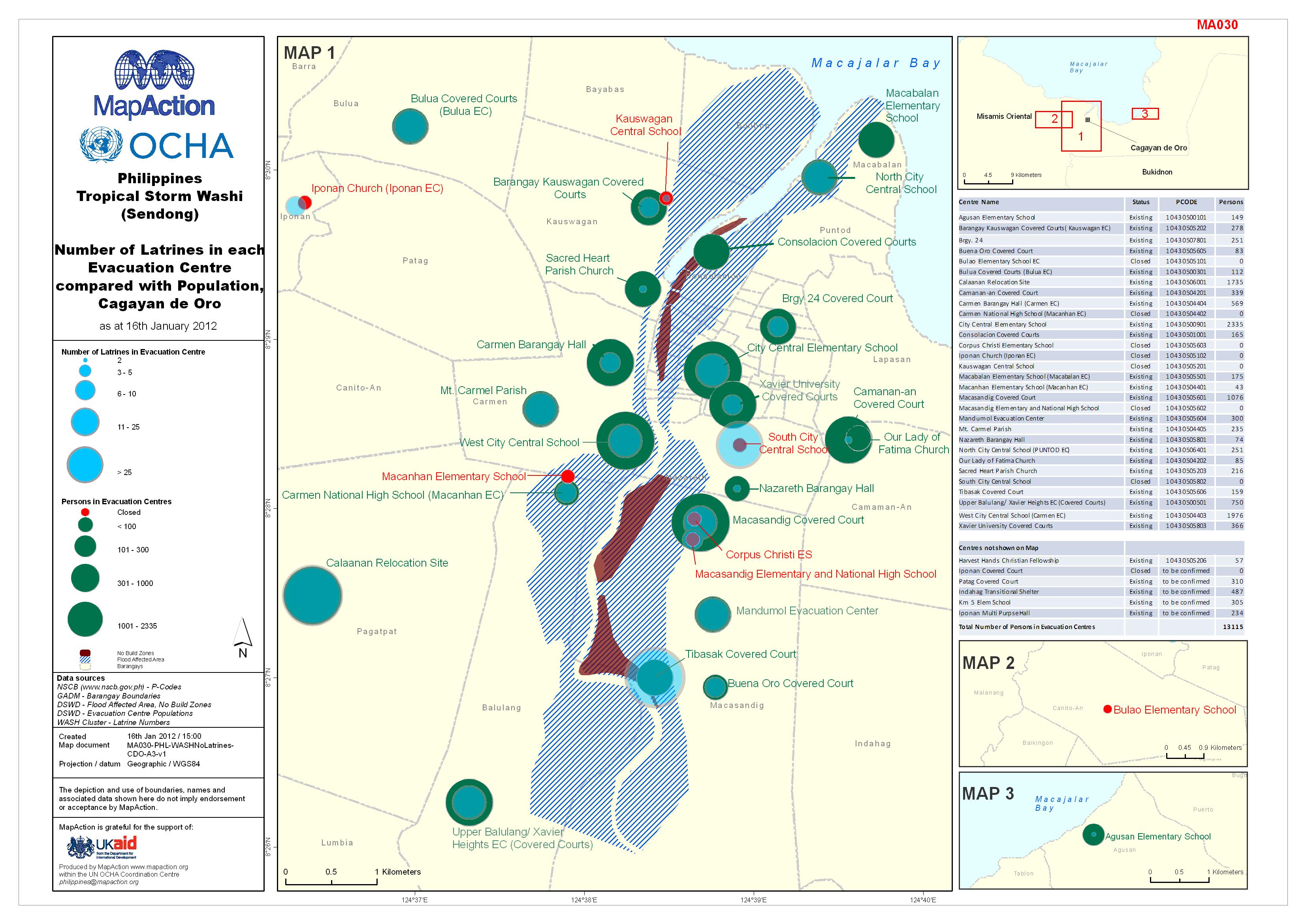
Philippines Tropical Storm Washi (Sendong) Number of Latrines in each Evacuat...
Number of Latrines in each Evacuation Centre compared with Population, Cagayan de Oro, as at 16th January 2012 -

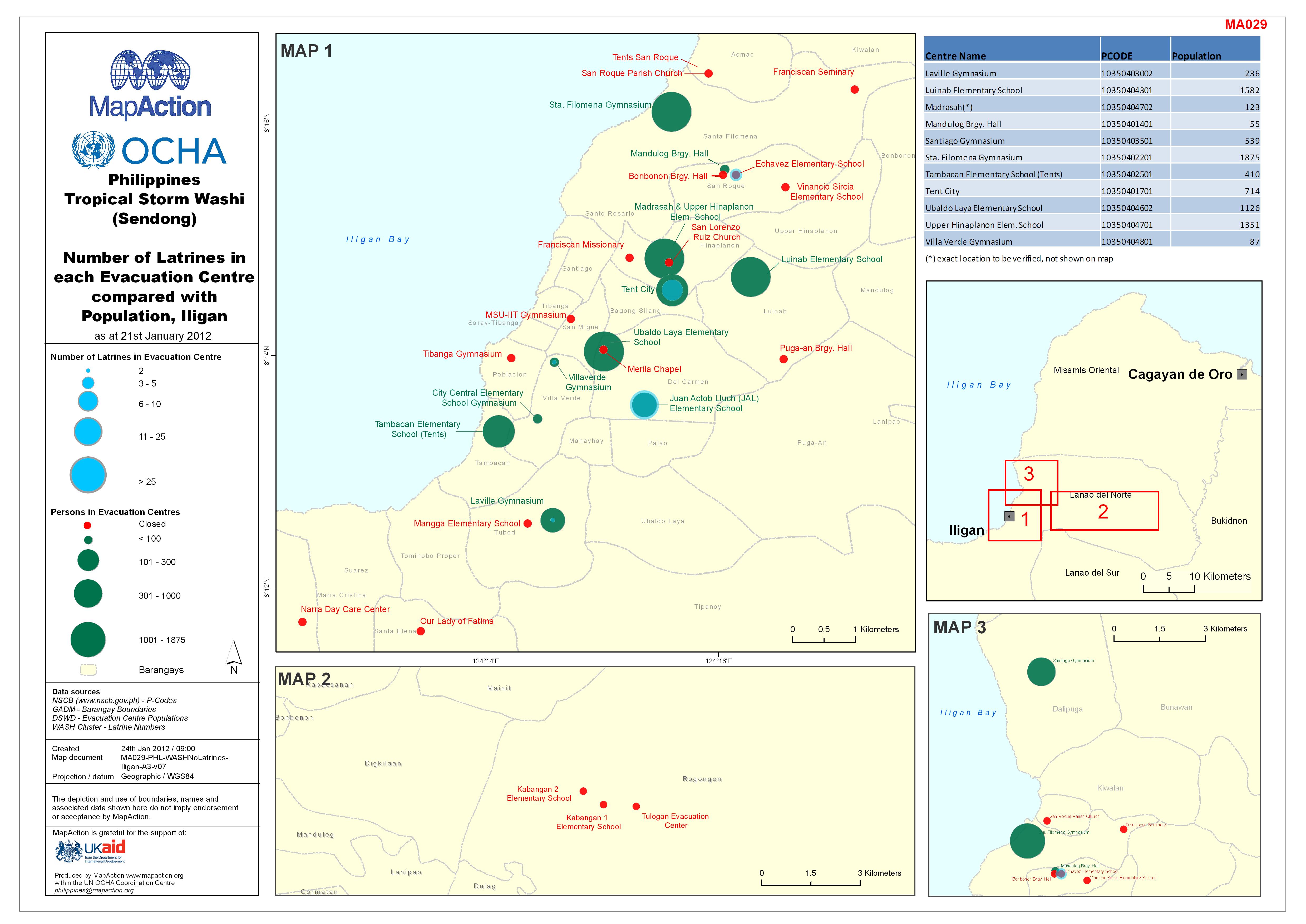
Philippines Tropical Storm Washi (Sendong) Number of Latrines in each Evacuat...
Number of Latrines in each Evacuation Centre compared with Population, Iligan, as at 21st January 2012