-

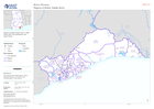
Administrative Boundaries: Regions (admin level 1)
Country overview showing administrative boundaries for regions (admin level 1) and main settlements -

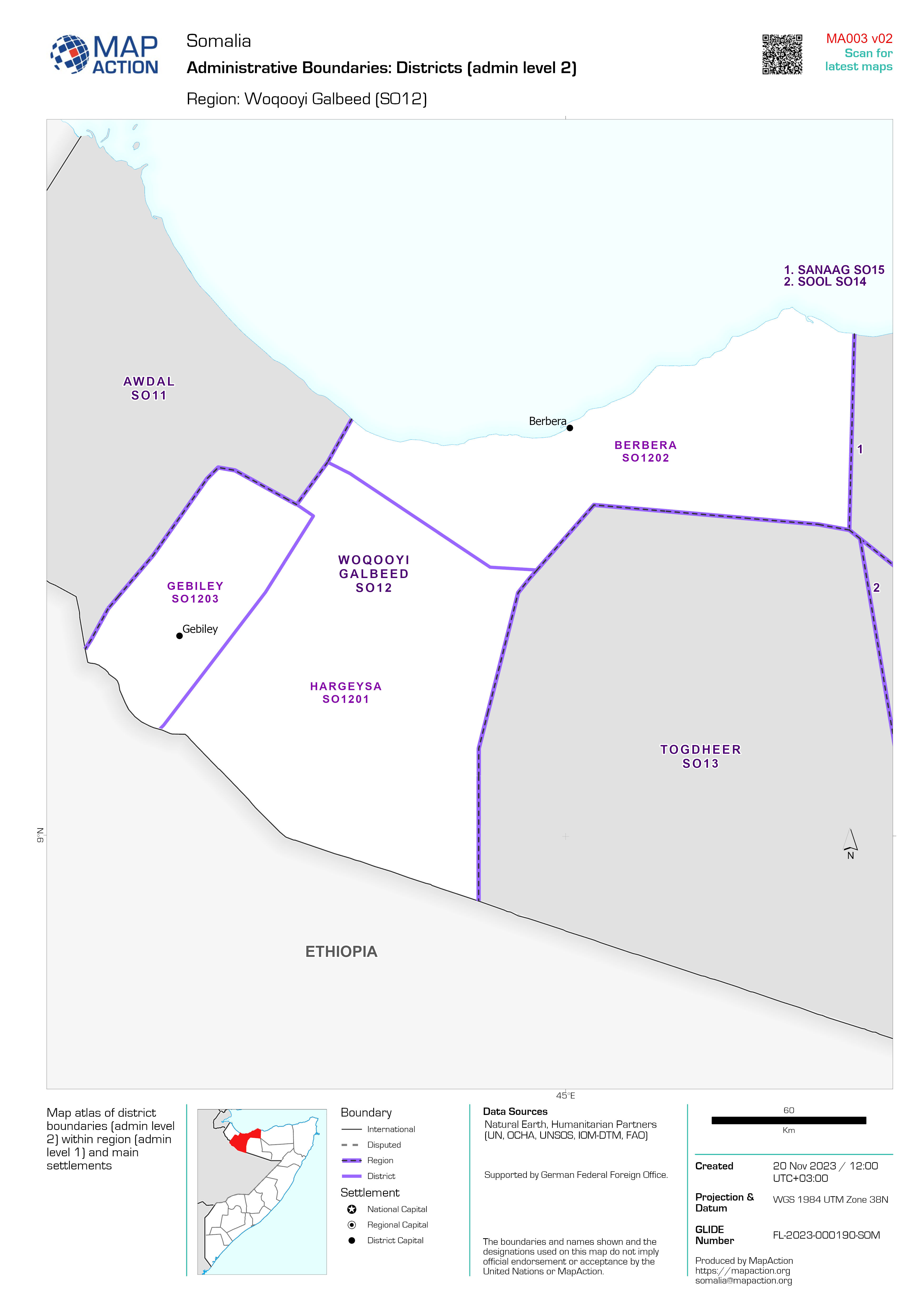
Administrative Boundaries: Districts (admin level 2)
Map atlas of district boundaries (admin level 2) within region (admin level 1) and main settlements -

Country overview
Country overview showing administrative boundaries, main settlements, transport infrastructure and natural features -
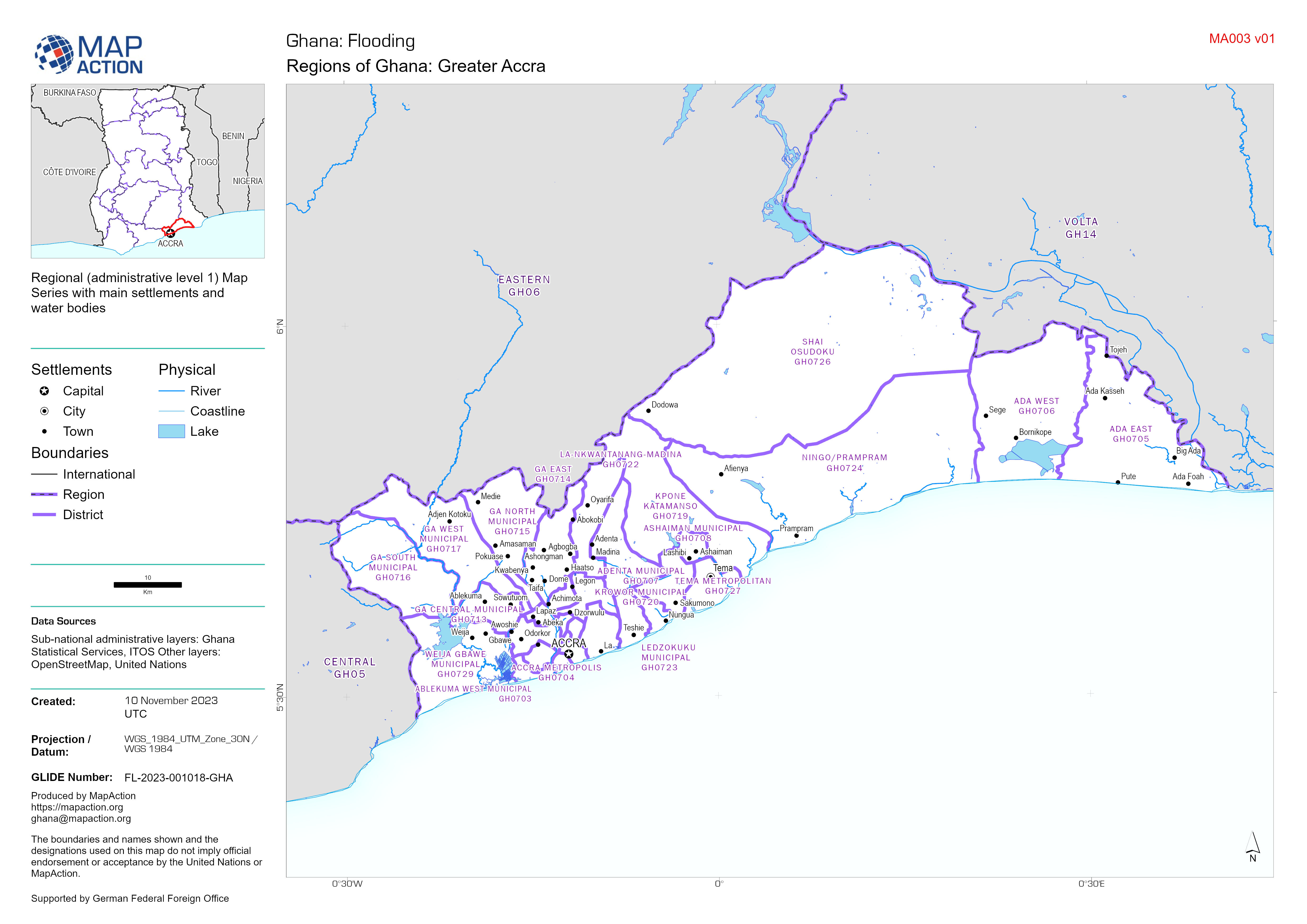
Regions of Ghana Map Series - Central, Eastern, Greater Accra, Volta
Regional (administrative level 1) Map Series with main settlements and water bodies -

-

Country Overview
Country overview showing administrative boundaries, main settlements, transport infrastructure and natural features -
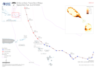
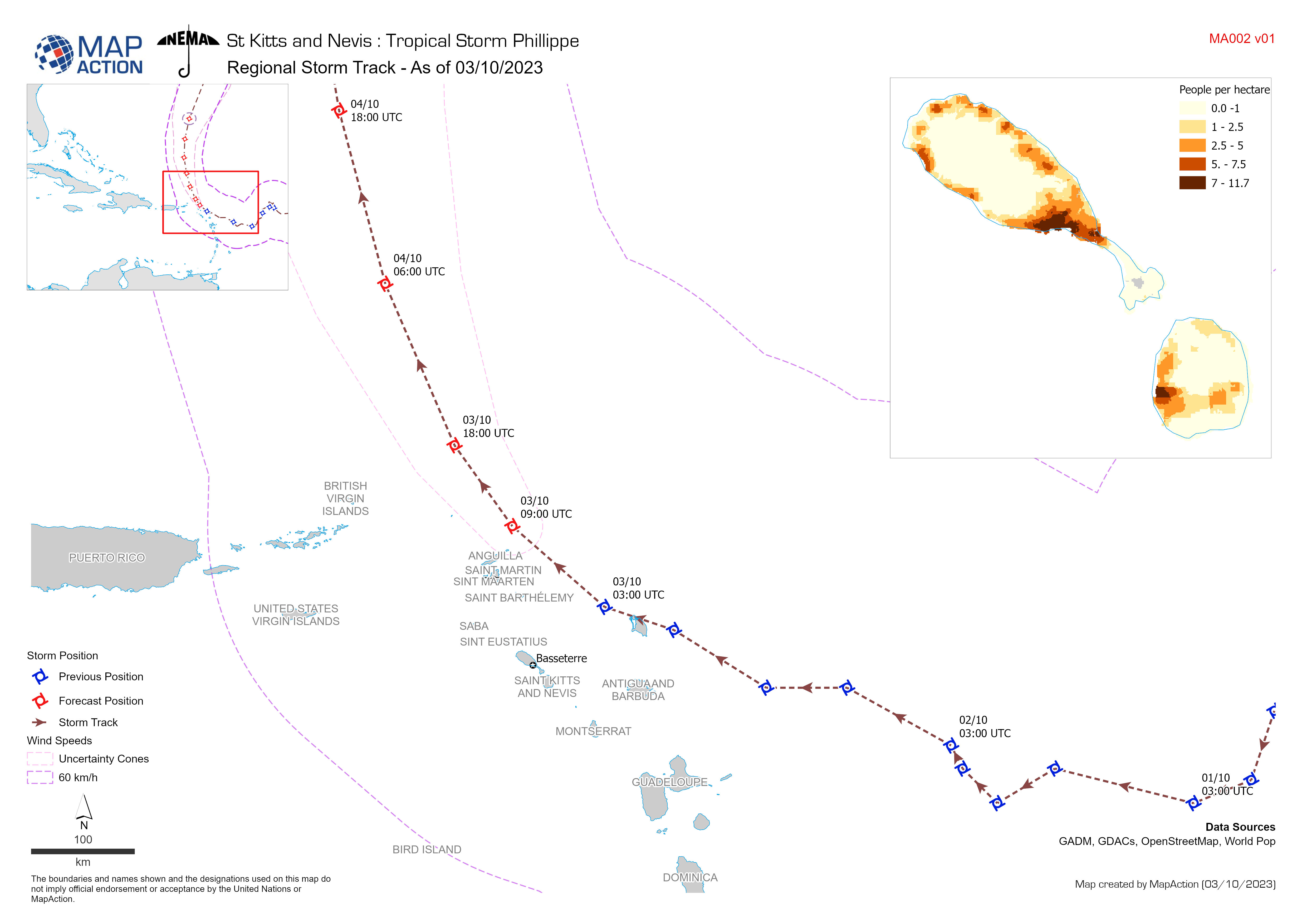
Regional Storm Track - As of 03/10/2023
Storm Path for Tropical Storm Philippe (actual as of 3 October 2023, forecast as of 4 October 2023). All forecasted storm positions, path, and wind speeds are the best available... -
Country overview
Country overview showing administrative boundaries, main settlements, transport infrastructure and natural features. The overview map shows the storm track and the estimated... -
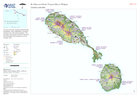
Overview of affected Governorate of Derna (LY0101) overlaid by 250 m hexagona...
Overview of affected area overlaid by 250 m diameter hexagonal grid -

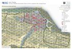
Overview of affected governorate of Derna (LY0101)
Overview of affected area showing transport infrastructure and natural features with flood extents -

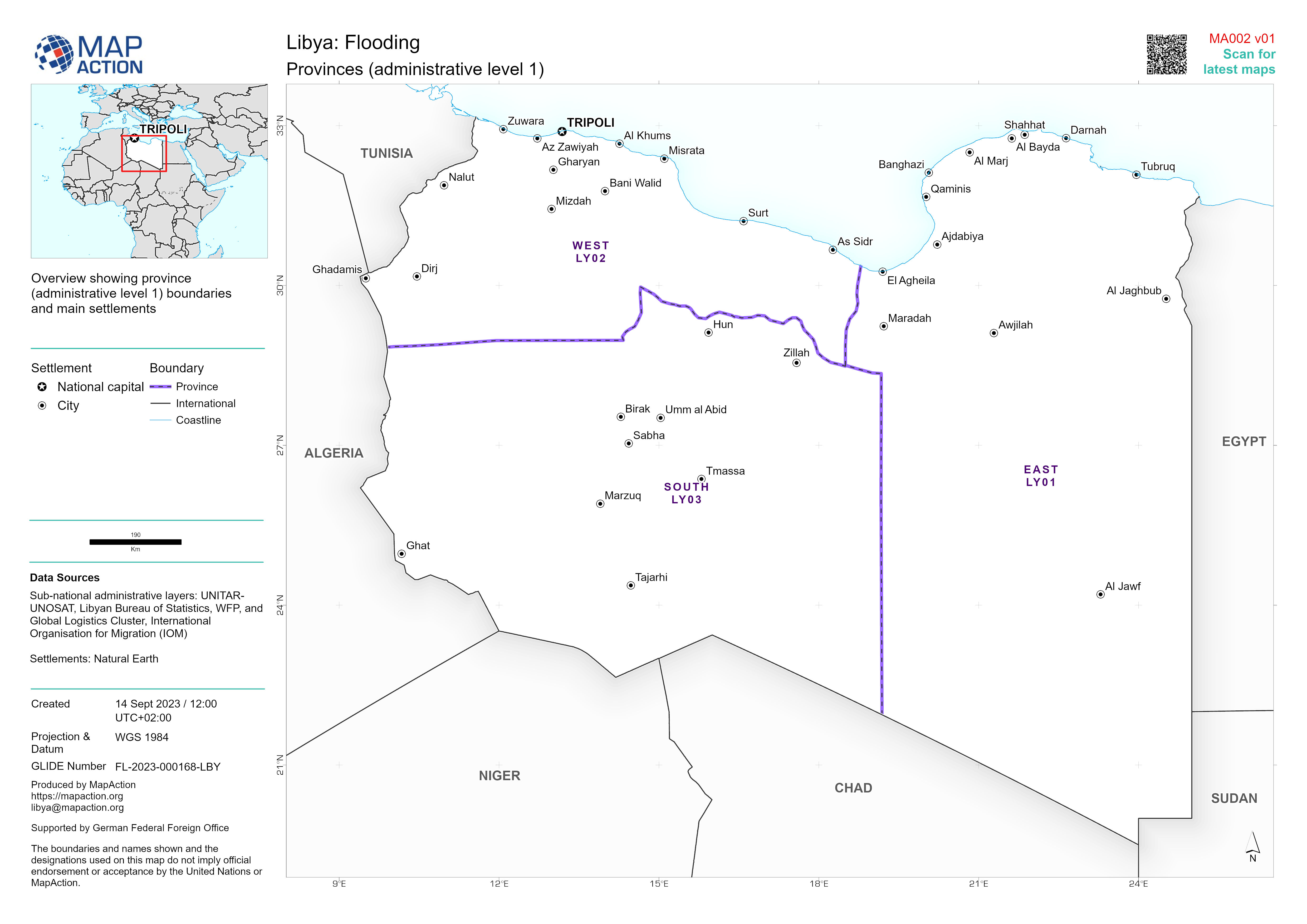
Provinces (administrative level 1)
Overview showing province (administrative level 1) boundaries and main settlements -

Overview of affected governorates
Overview of affected area showing transport infrastructure and natural features -

Country overview
Country overview showing administrative boundaries, main settlements, transport infrastructure and natural features -

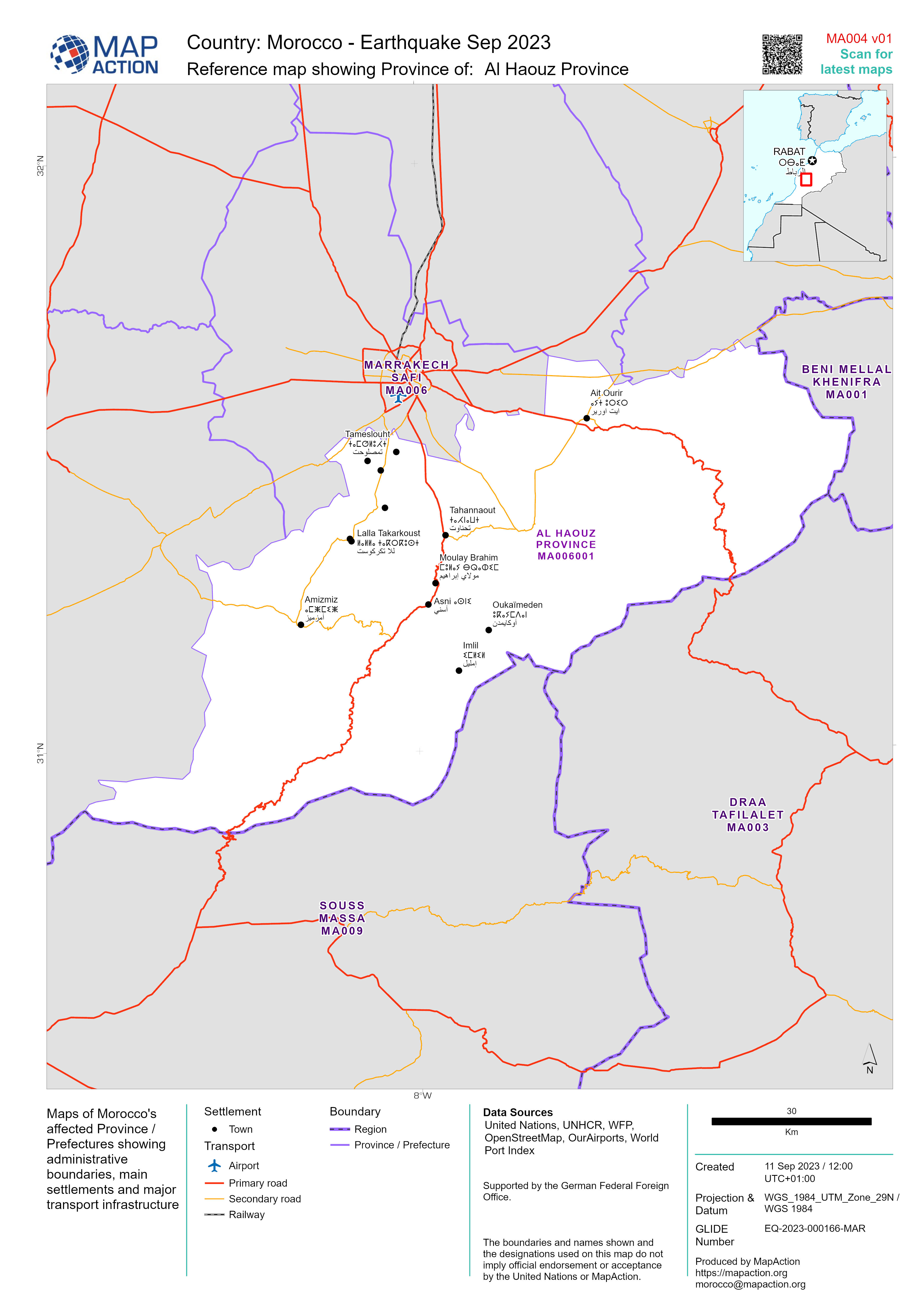
Reference map showing Province of:
Maps of Morocco's affected Province / Prefectures showing administrative boundaries, main settlements and major transport infrastructure -

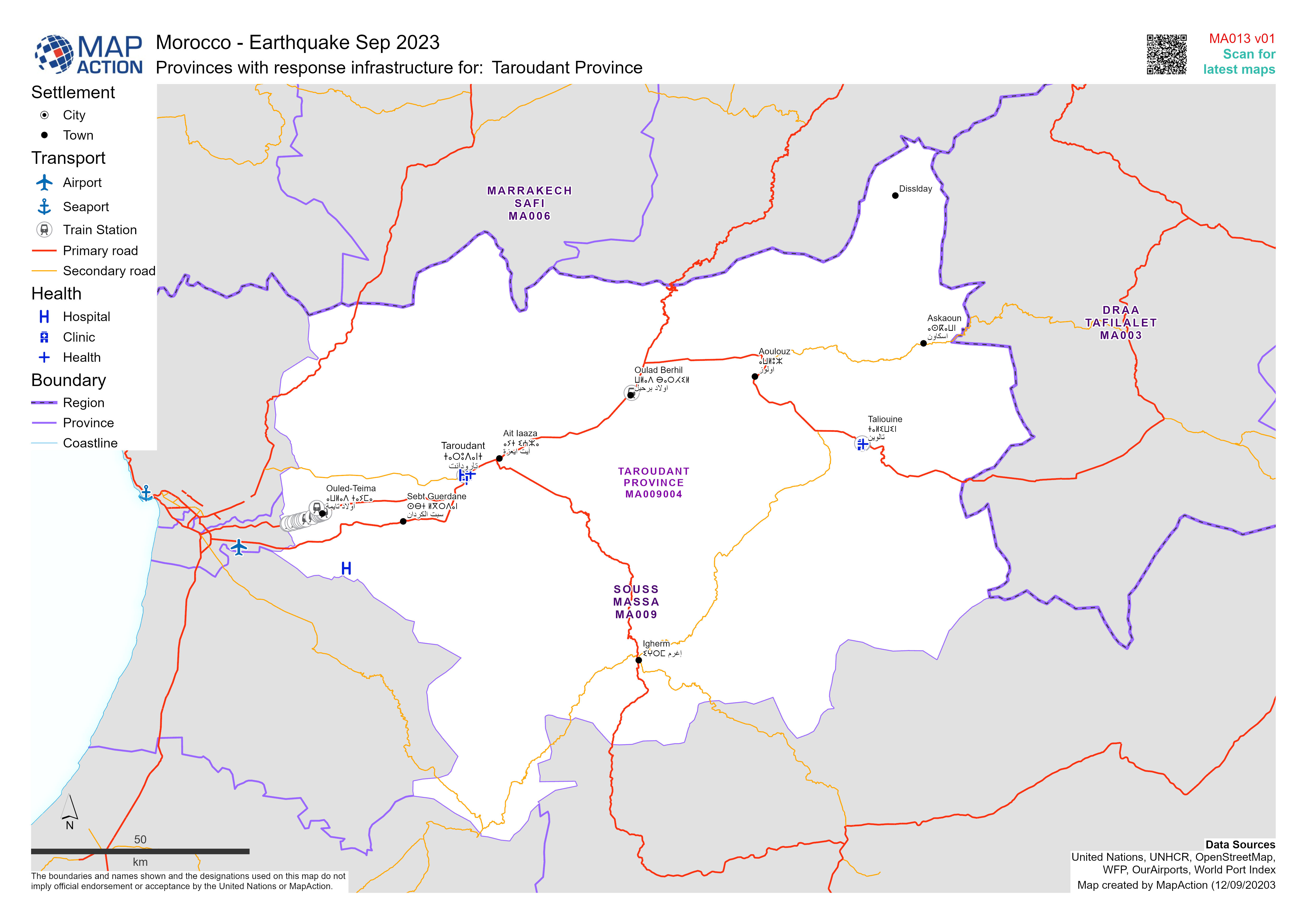
Reference map showing affected Province / Prefectures
Maps of Morocco's affected Province / Prefectures showing administrative boundaries, main settlements and major transport infrastructure -

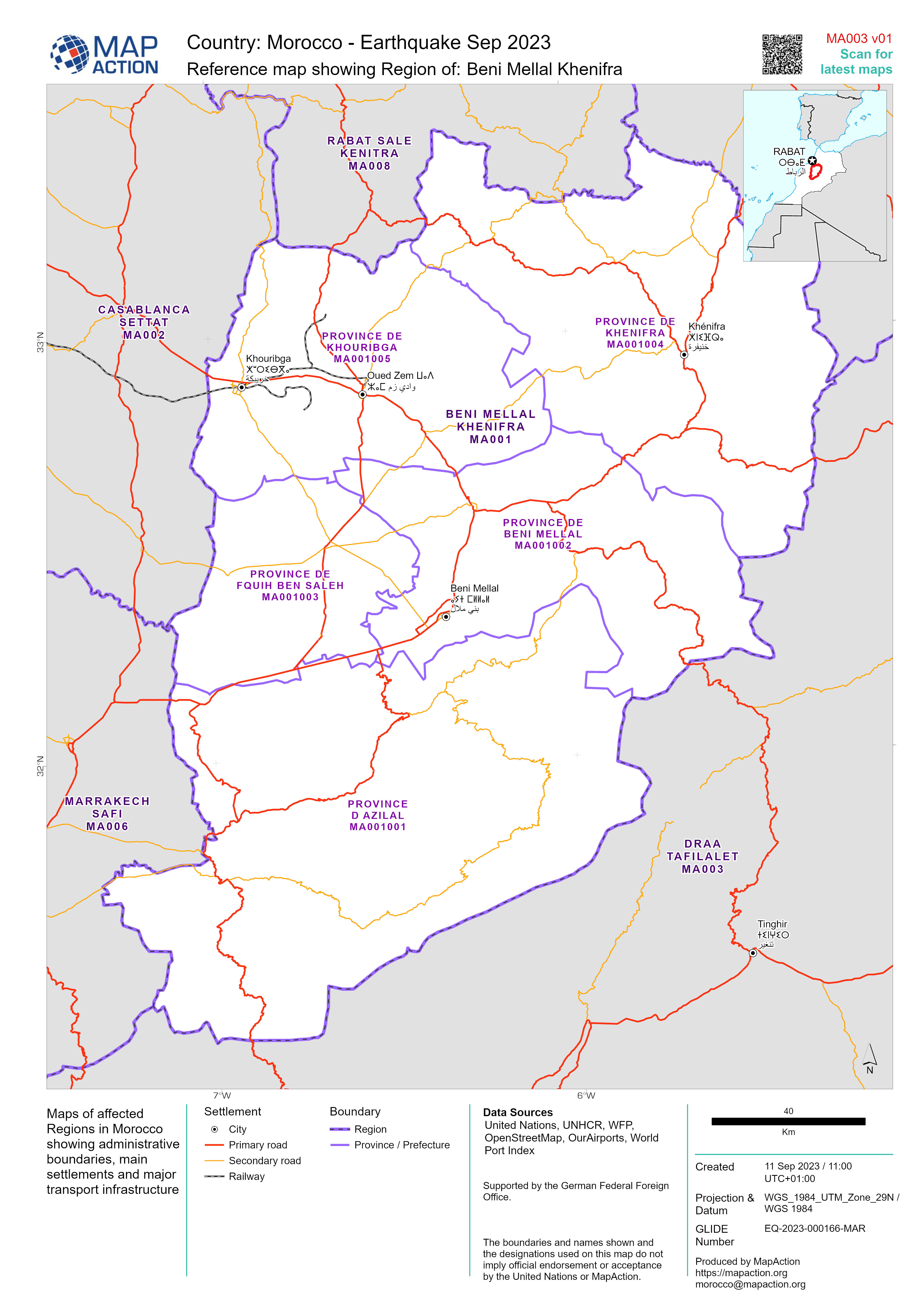
Reference maps showing affected Regions
Maps of affected Regions in Morocco showing administrative boundaries, main settlements and major transport infrastructure -

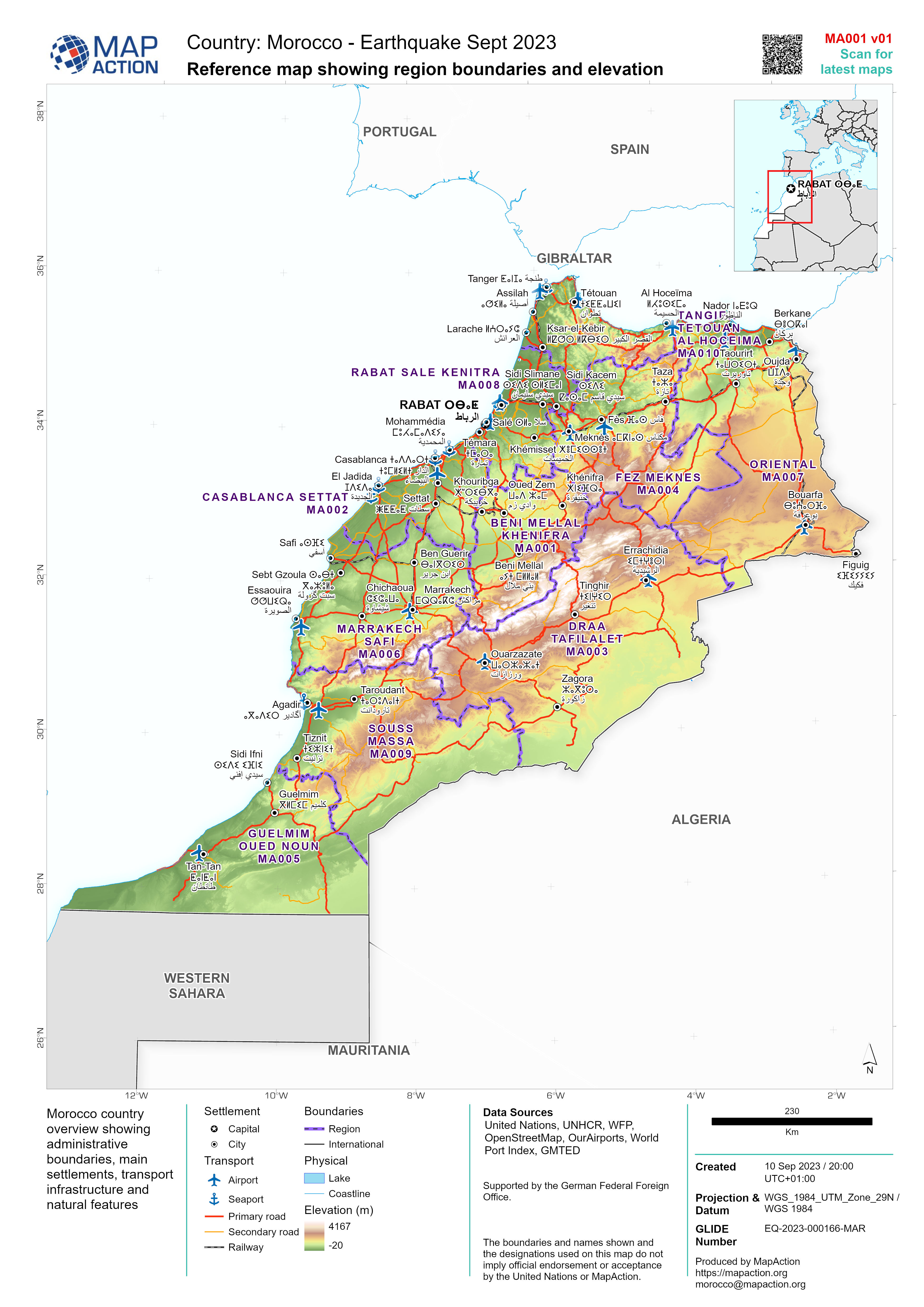
Reference map showing region boundaries and elevation
Morocco country overview showing administrative boundaries, main settlements, transport infrastructure and natural features -
Departments: Administrative level 1 boundaries
Administrative level 1 boundaries (departments) with main settlements

