-

Ebola Outbreak - Quality of Core Services: Contact Tracing (as of 3 Sept 2014)
Map shows the status/quality of Contact Tracing as of 3rd September, and Reported Cumulative Cases as of 1st September by Administrative levels 1 or 2. If your... -

Ebola Outbreak - Quality of Core Services: Referral Centres (as of 3 Sept 2014)
Map shows the status/quality of Referral Centres as of 3rd September, and Reported Cumulative Cases as of 1st September by Administrative levels 1 or 2 . If your... -
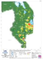
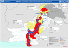
Malawi: Floods-Density of displacement sites(as of 18 Feb 2015)
Map shows the density of displacement sites that have been reported since the start of the flooding in Malawi. It does not reflect the status (open or closed) of the sites... -
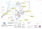
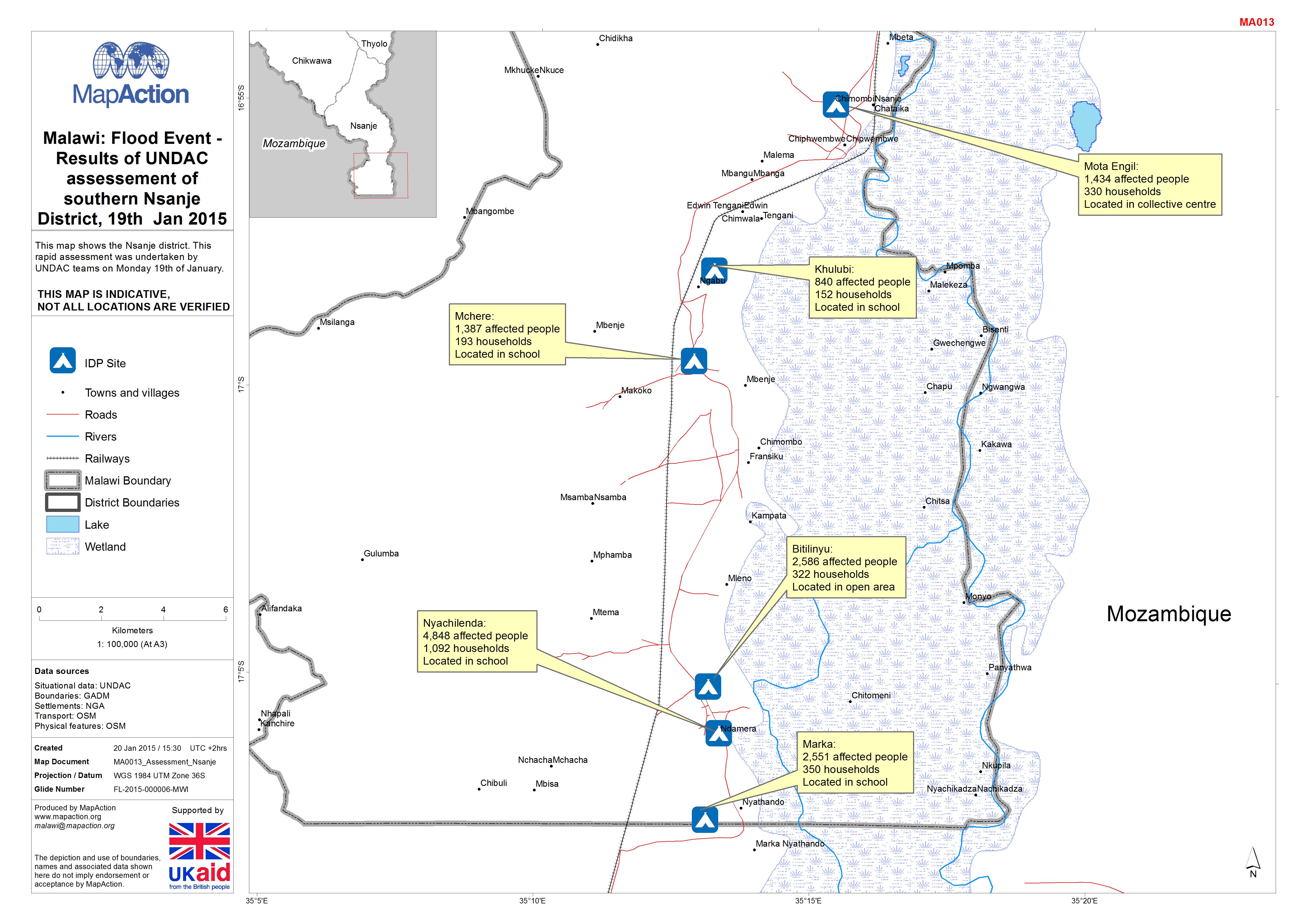
Malawi: Floods -Results of UNDAC assessement of southern Nsanje District, 19t...
This map shows the Nsanje district. This rapid assessment was undertaken by UNDAC teams on Monday 19th of January. -
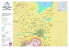
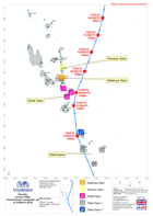
Malawi: Floods - Results of UNDAC assessement of Phalombe District, 17th and ...
This map shows the Phalombe district. This rapid assessment was undertaken by UNDAC teams on17th and 18th of January. -

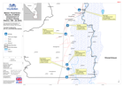
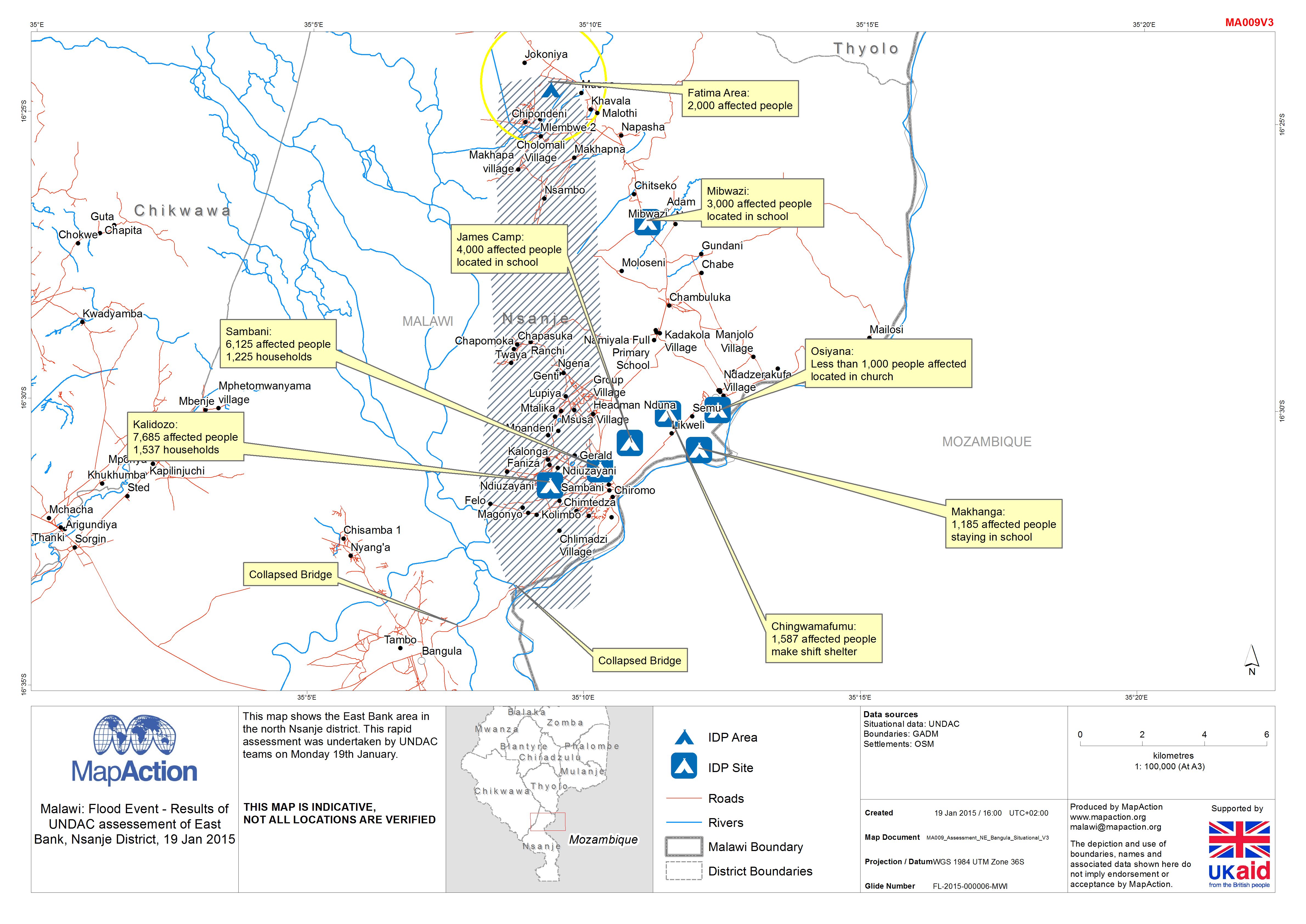
Malawi: Floods - Results of UNDAC assessement of East Bank, Nsanje District, ...
This map shows the East Bank area in the north Nsanje district. This rapid assessment was undertaken by UNDAC teams on Monday 19th January. -
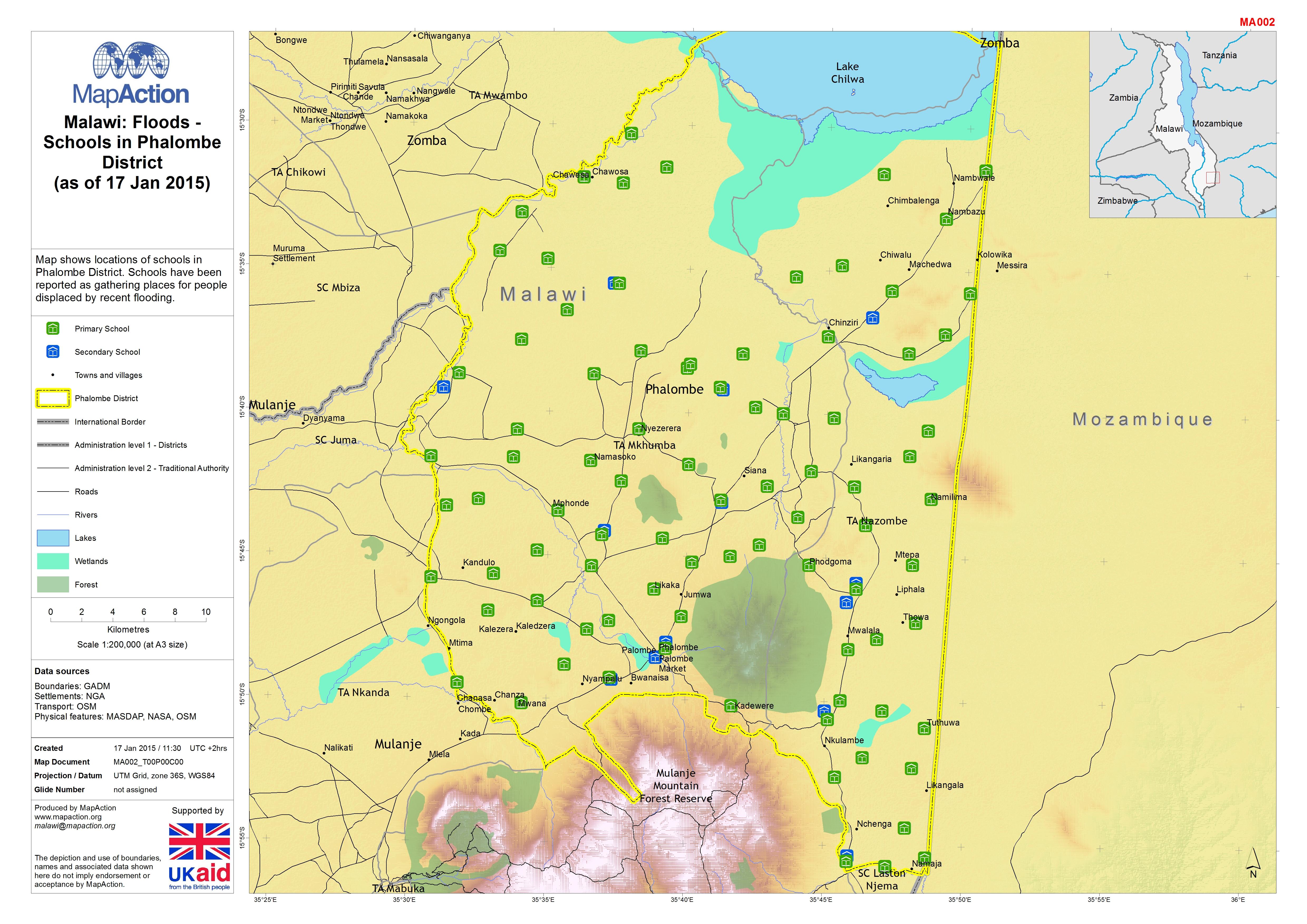
Malawi: Floods - Schools in Phalombe District (as of 17 Jan 2015)
Map shows locations of schools in Phalombe District. Schools have been reported as gathering places for people displaced by recent flooding. -
Malawi: Floods - Results of UNDAC assessement of East Bank, Nsanje District, ...
The East Bank area of north Nsanje District, Malawi, showing results of a rapid assessment undertaken by UNDAC teams on 19 January 2015 in response to recent flooding. -

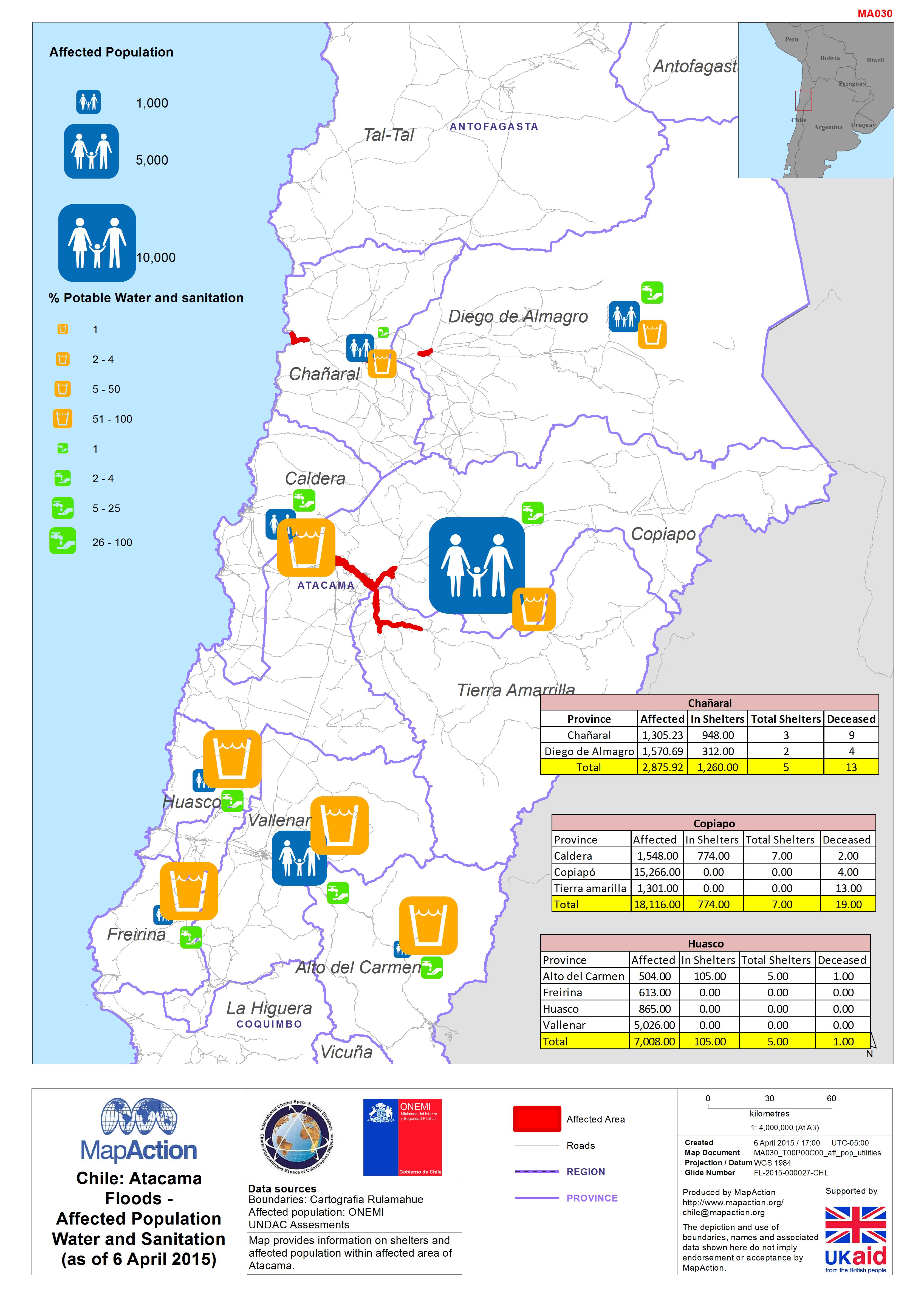
Chile: AtacamaFloods -Affected PopulationWater and Sanitation(as of 6 April 2...
Map provides information on shelters and affected population within affected area of Atacama. -

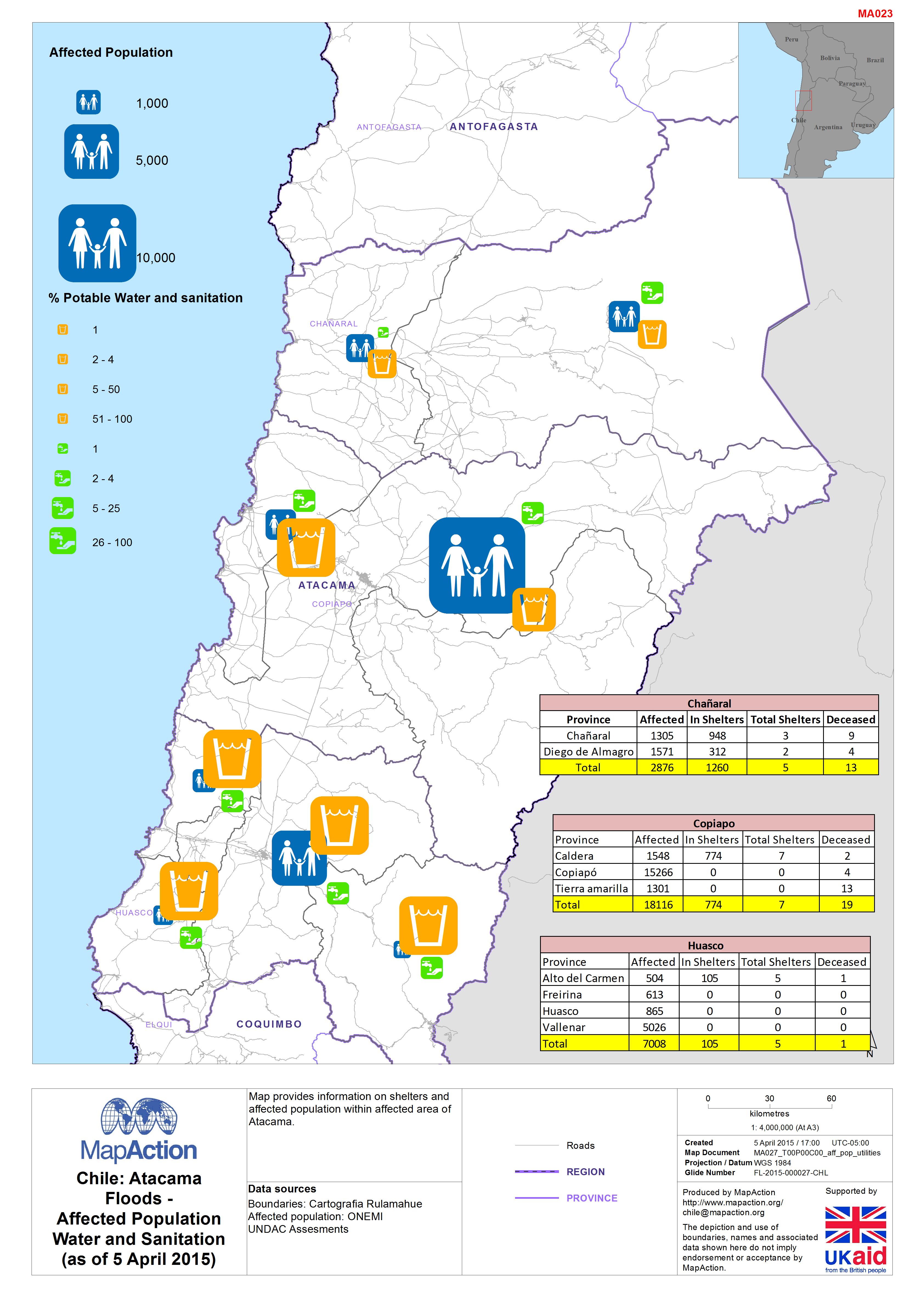
Chile: AtacamaFloods -Affected PopulationWater and Sanitation(as of 5 April 2...
This dataset has no description
-
Vanuatu: Cyclone PAM - Food Distribution Priority Plan (as of 22 Mar 2015)
Map shows the priority areas based upon the preliminary needs analysis. -

Vanuatu: Cyclone PAM - Assessments completed (as of 19 March 2015)
Overview of assessment locations for each assessment team on 18th and 19th Mar 2015. -
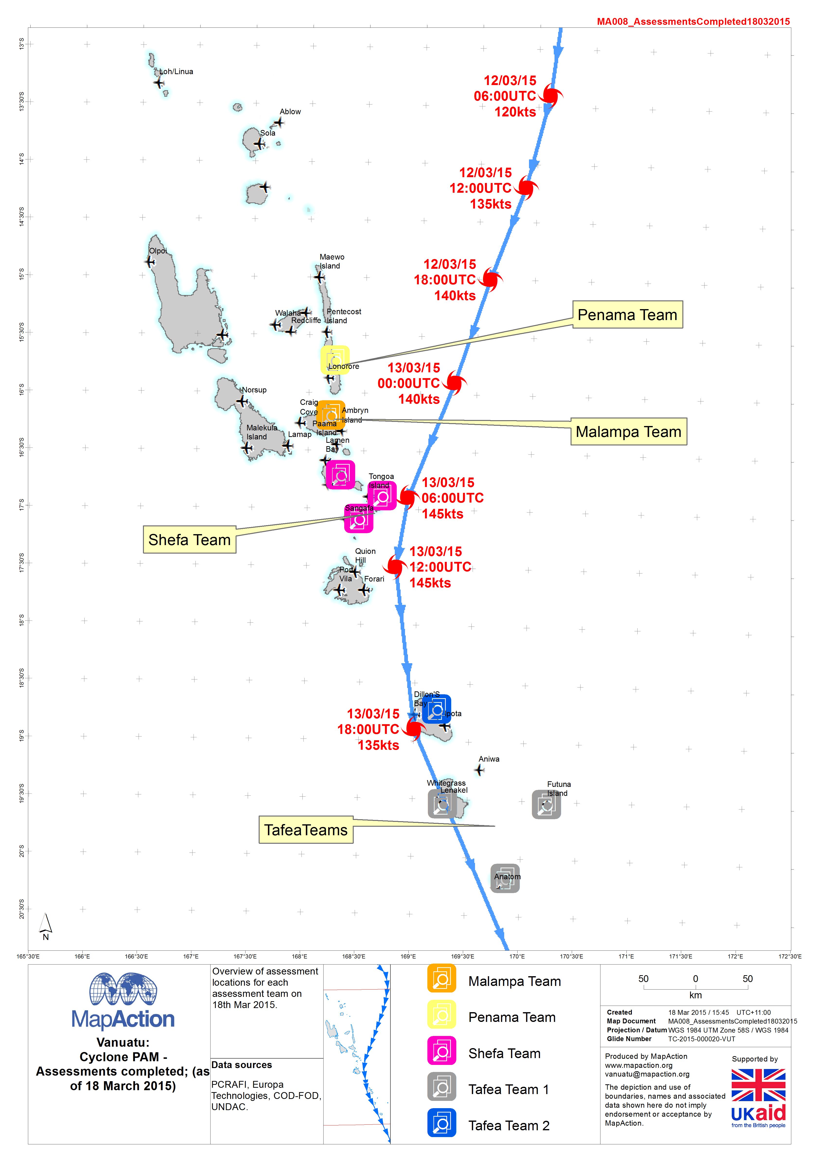
Vanuatu: Cyclone PAM - Assessments completed (as of 18 March 2015)
Overview of assessment locations for each assessment team on 18th Mar 2015. -

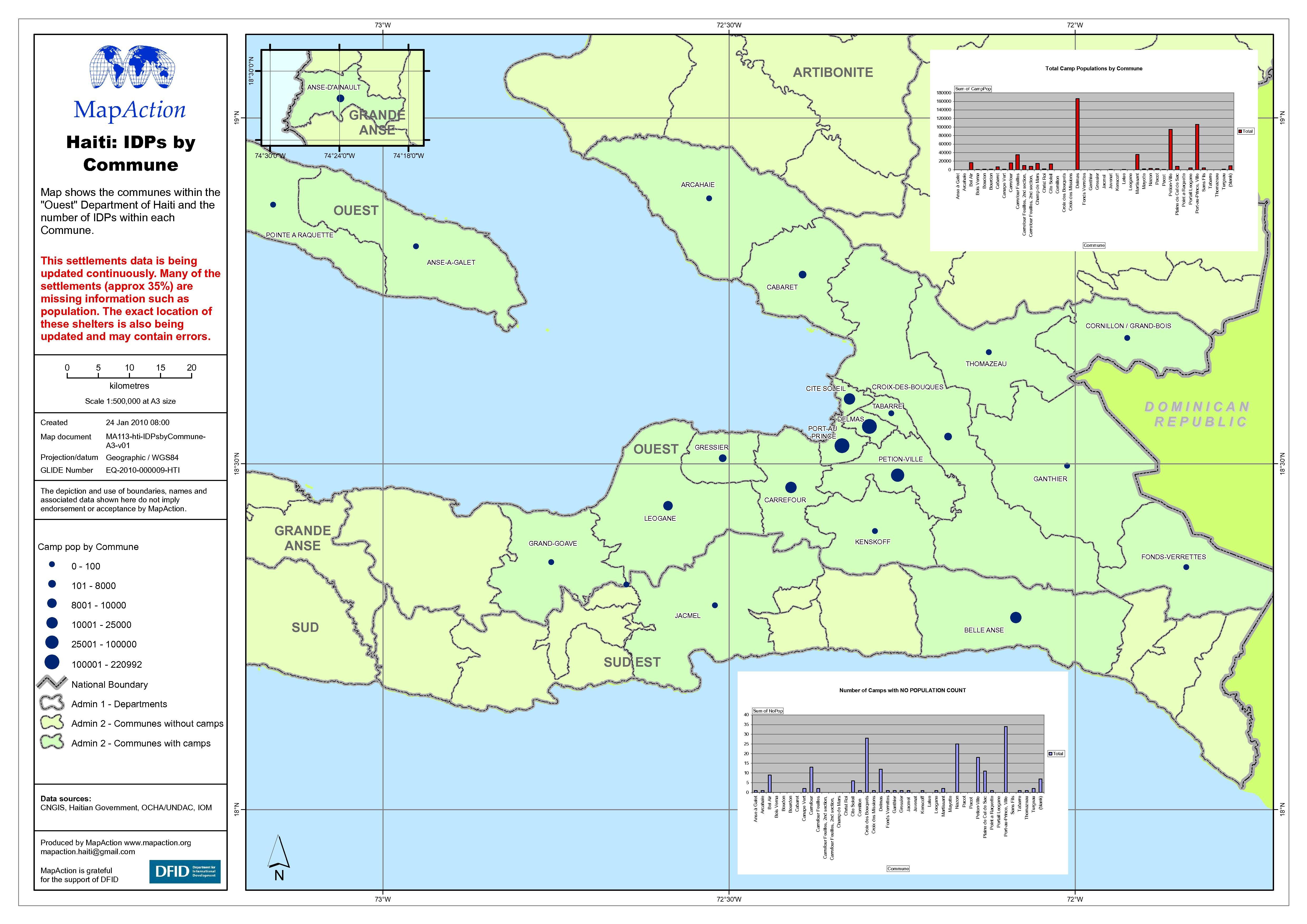
Haiti: IDP numbers by Commune
Map shows the Communes within the Ouest Department of Haiti and the number of internally displaced persons (IDPs) within each Commune. -

C.A.R. Humanitarian Emergency Displaced Population Version 2
Map shows displaced people reported in the RRM Assesment conducted during January 2013 in various locations within the affected area by the conflict. -

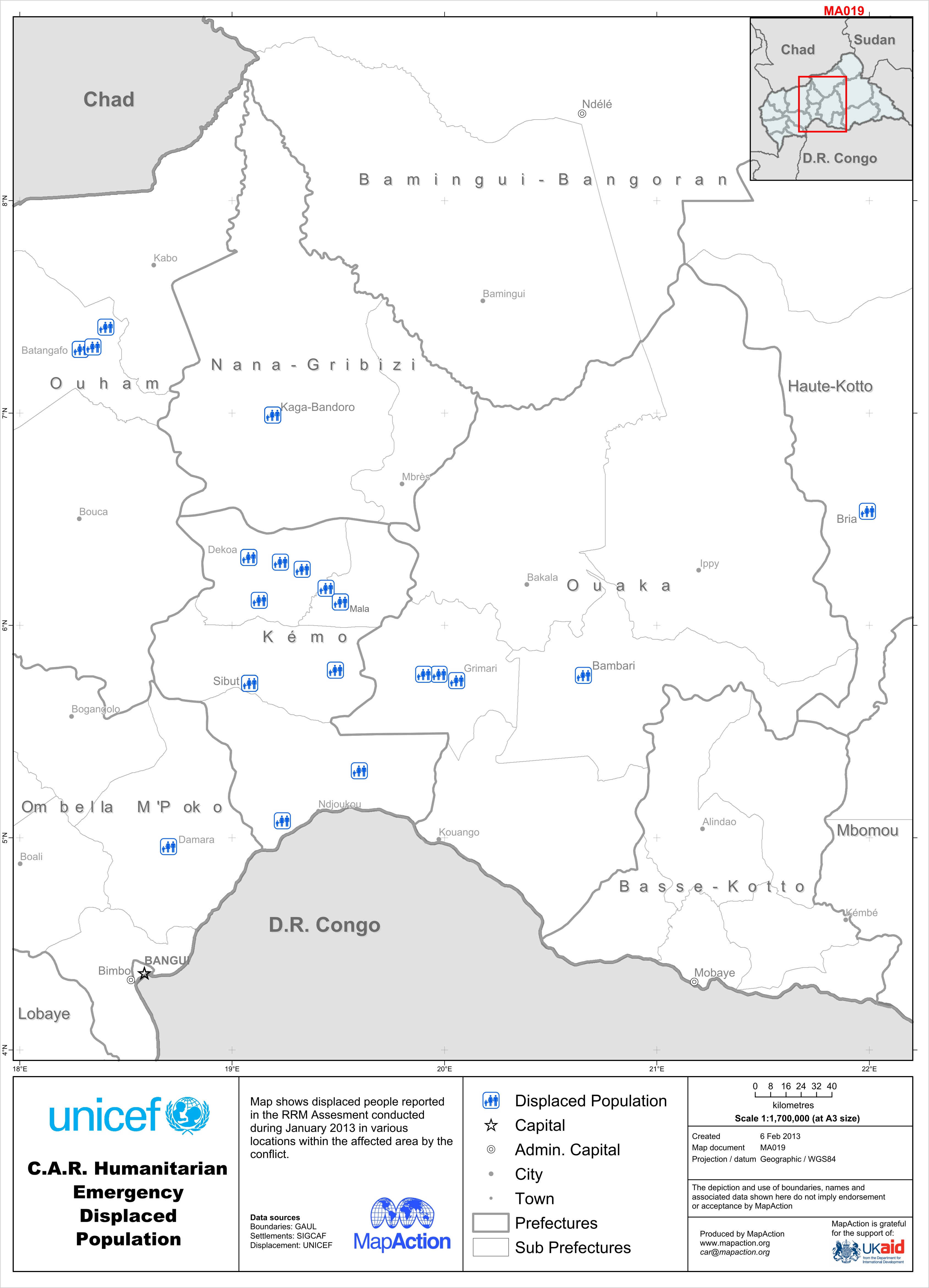
C.A.R. Humanitarian Emergency Displaced Population
Map shows displaced people reported in the RRM Assesment conducted during January 2013 in various locations within the affected area by the conflict. -

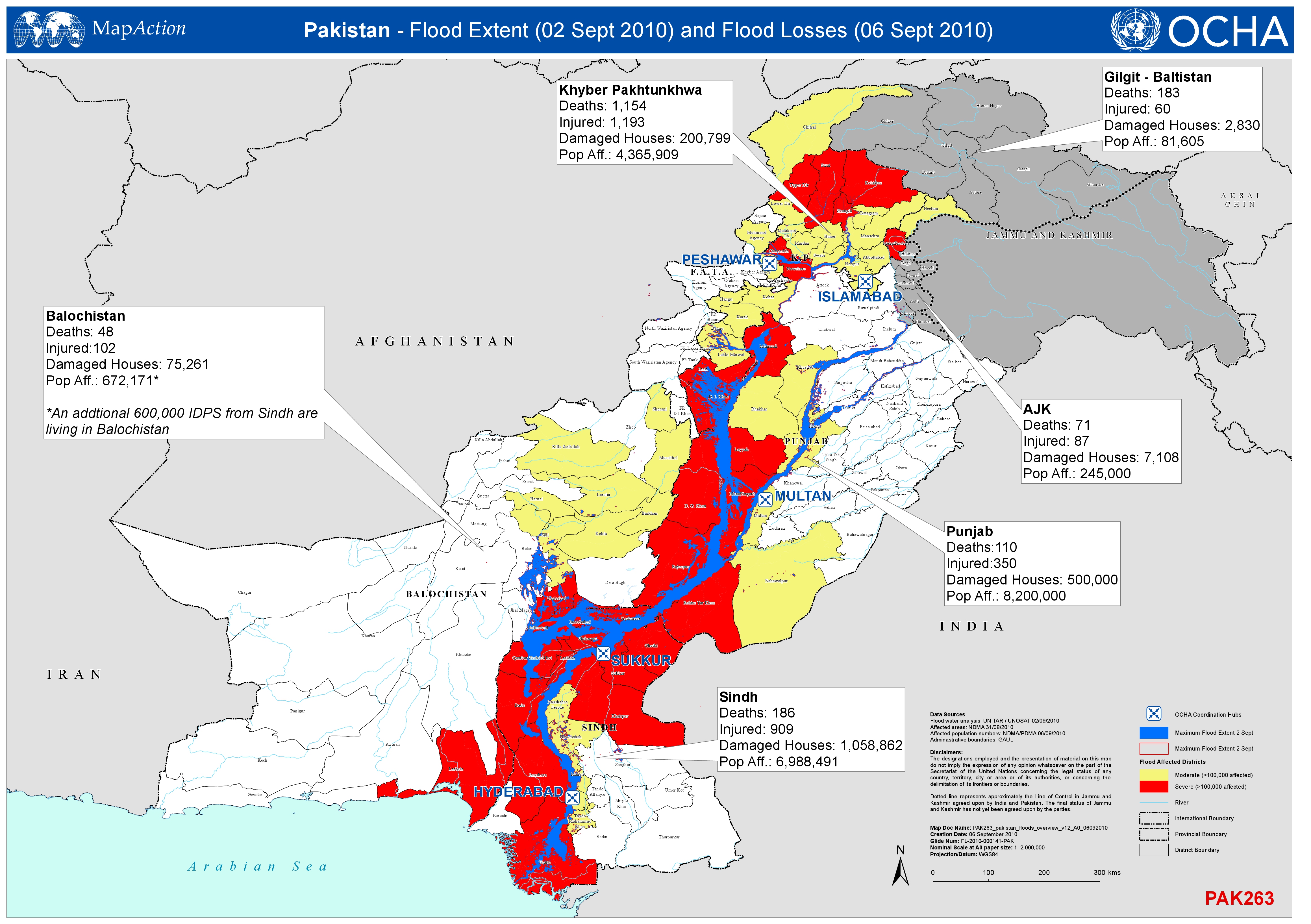
Pakistan - Flood Extent (2 Sept 2010) and Flood Losses (6 Sept 2010)
Shows the extent of the flood (2nd Sept 2010) and the numbers of deaths, injured persons, damaged houses and affected population by Province ( 6th Sept 2010). -
Pakistan Floods: Sindh Province - Flood Impact Profile (6 Sept 2010
Summary of the situation in Sindh Province as of 2010-08-21. Data extracted from Government of Sindh Provincial Disaster Management Authority Situation Report 2010-08-21 16:00 PST -

Sindh Overview - Flood Extent and Situational Information
Shows the Maximum Flood Extent and Situational Information in Sindh Province as of 05 Sept 2010. -
Pakistan Floods Overview - Extent and Losses
Shows the extent of the flood (2nd Sept 2010) and the numbers of deaths, injured persons, damaged houses and affected population by Province (3rd Sept 2010).