-
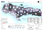
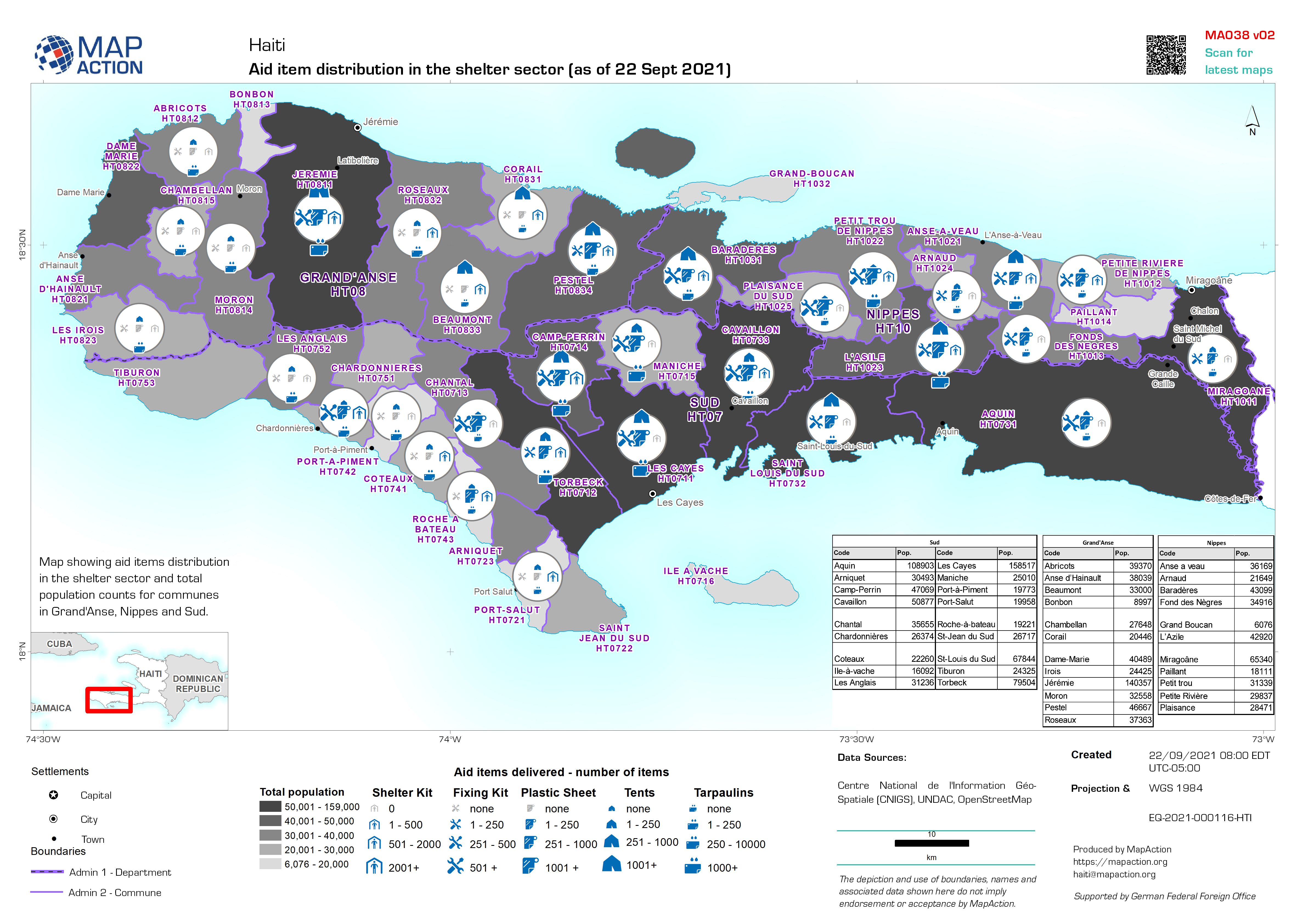
Aid item distribution in the shelter sector (as of 22 Sept 2021)
Map showing aid items distribution in the shelter sector and total population counts for communes in Grand'Anse, Nippes and Sud. -
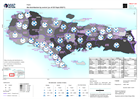
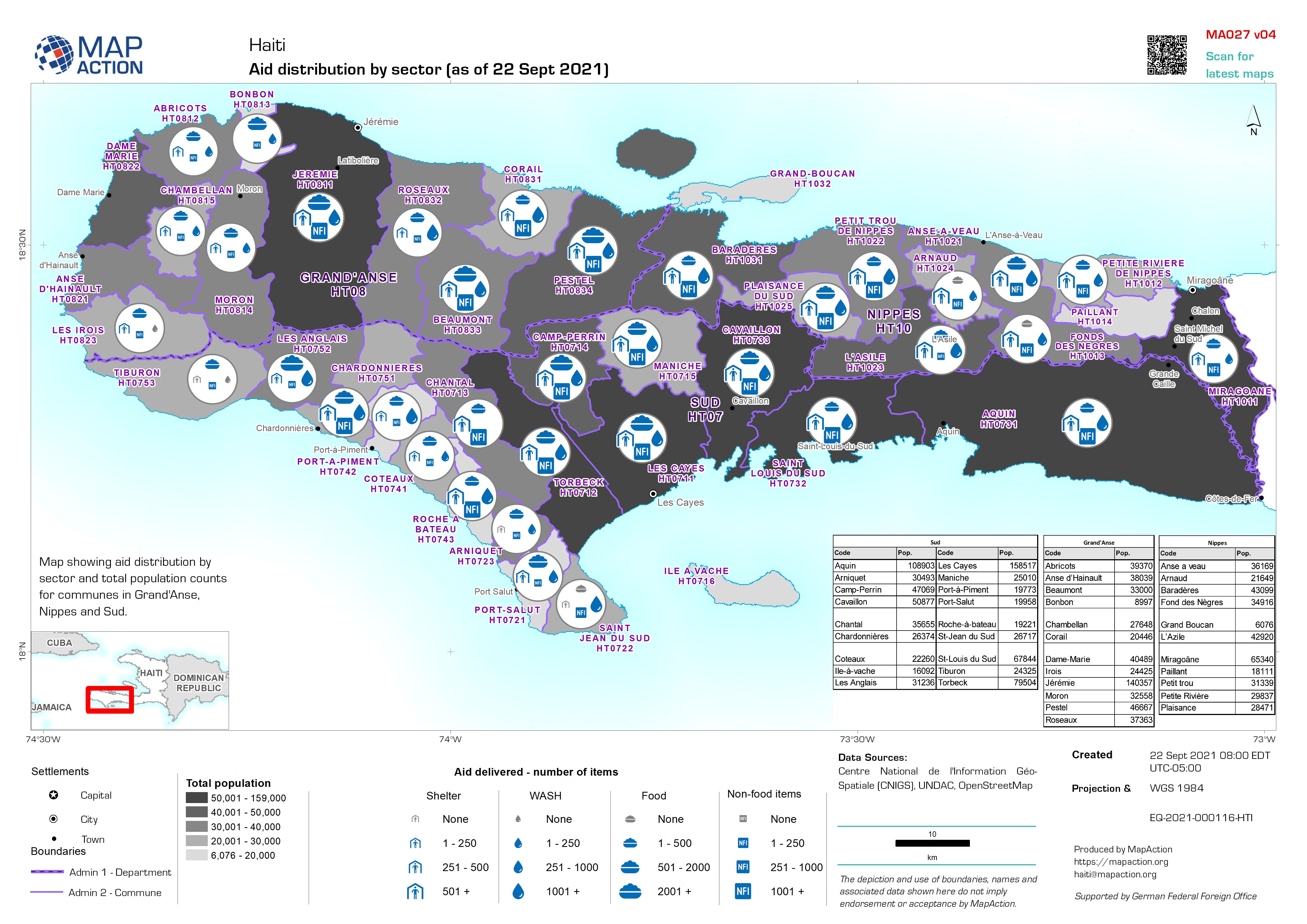
Aid distribution by sector (as of 22 Sept 2021)
Map showing aid distribution by sector and total population counts for communes in Grand'Anse, Nippes and Sud. -
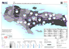
Aid item distribution in the shelter sector (as of 4th September 2021)
Map showing aid items distribution in the shelter sector and total population counts for communes in Grand'Anse, Nippes and Sud. -
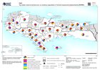
Top shelter concerns by Commune, as named by respondents in Tearfund assessme...
Summary of responses in Tearfund assessment to question 'What are your top three shelter concerns?' (Multiple respondents were interviewed in each Commune and charts represent... -

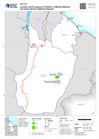
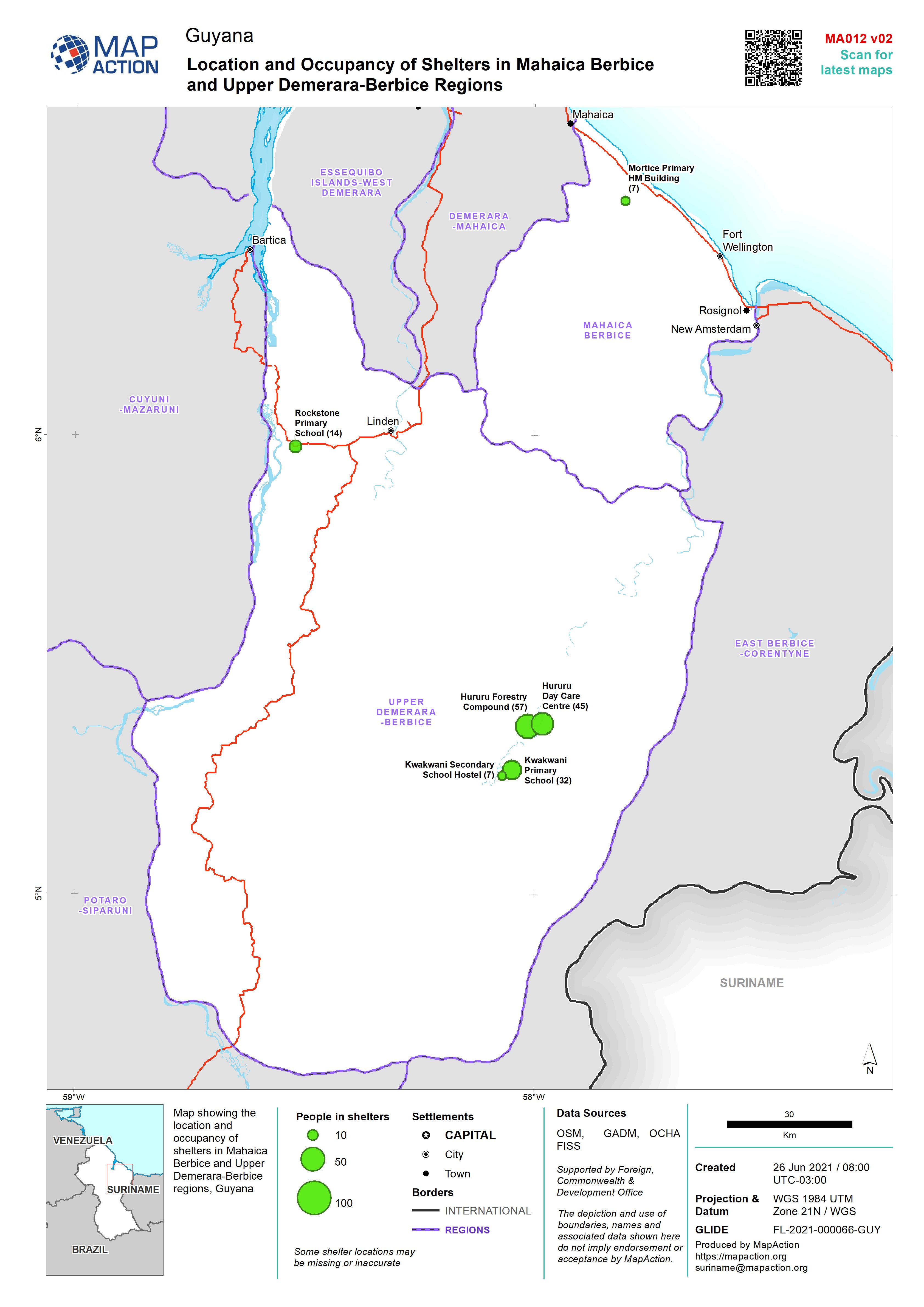
Location and Occupancy of Shelters in Mahaica Berbice and Upper Demerara-Berb...
Map showing the location and occupancy of shelters in Mahaica Berbice and Upper Demerara-Berbice regions, Guyana -
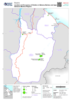
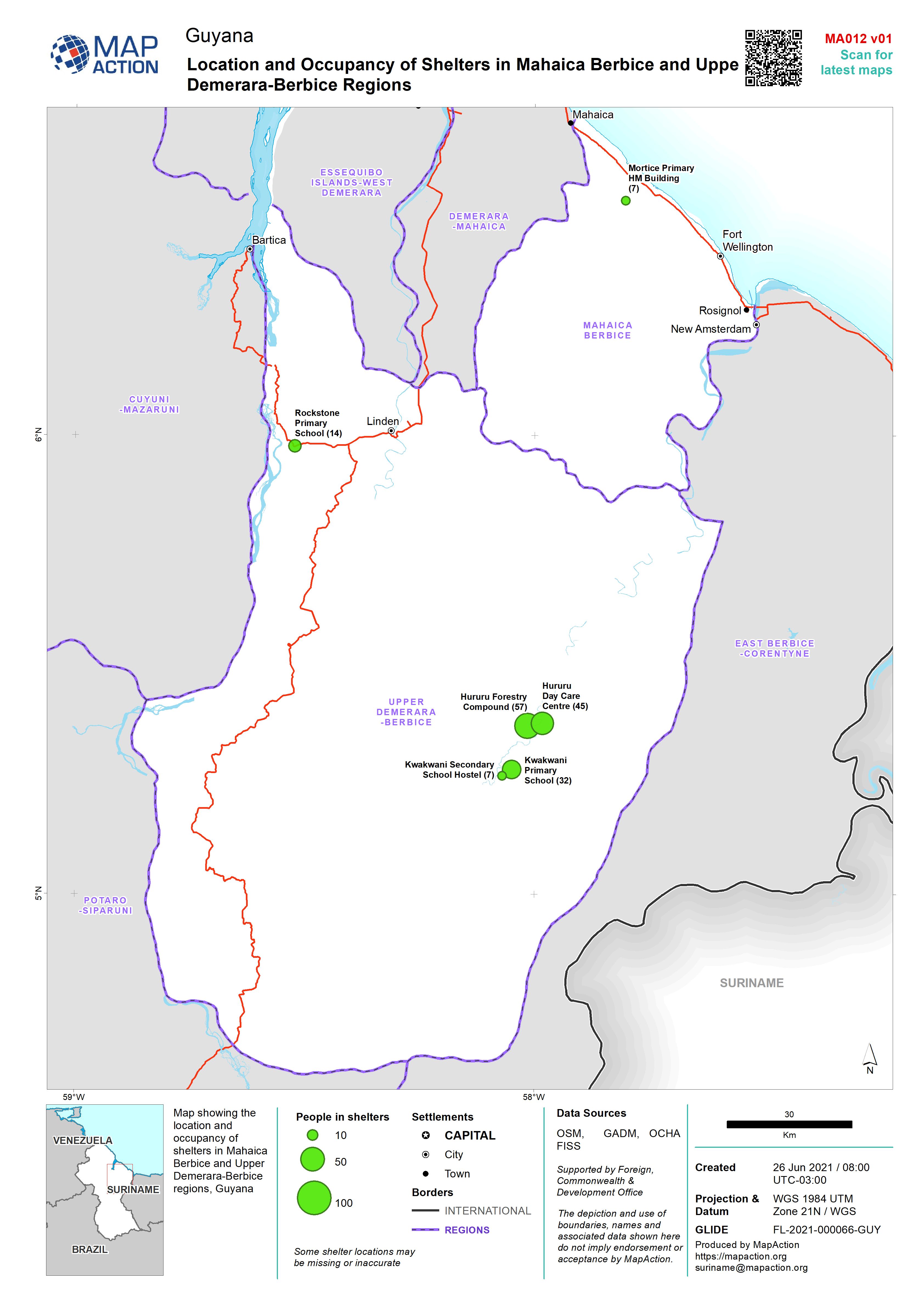
Location and Occupancy of Shelters in Mahaica Berbice and Upper Demerara-Berb...
Map showing the location and occupancy of shelters in Mahaica Berbice and Upper Demerara-Berbice regions, Guyana -
Location and Occupancy of Shelters in Mahaica Berbice and Upper Demerara-Berb...
Map showing the location and occupancy of shelters in Mahaica Berbice and Upper Demerara-Berbice regions, Guyana -
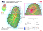
Situational Overview (as of 21 April 2021)
Map shows the situational overview of the current events and activities as a result of the ongoing eruption of the La Soufrière volcano. -

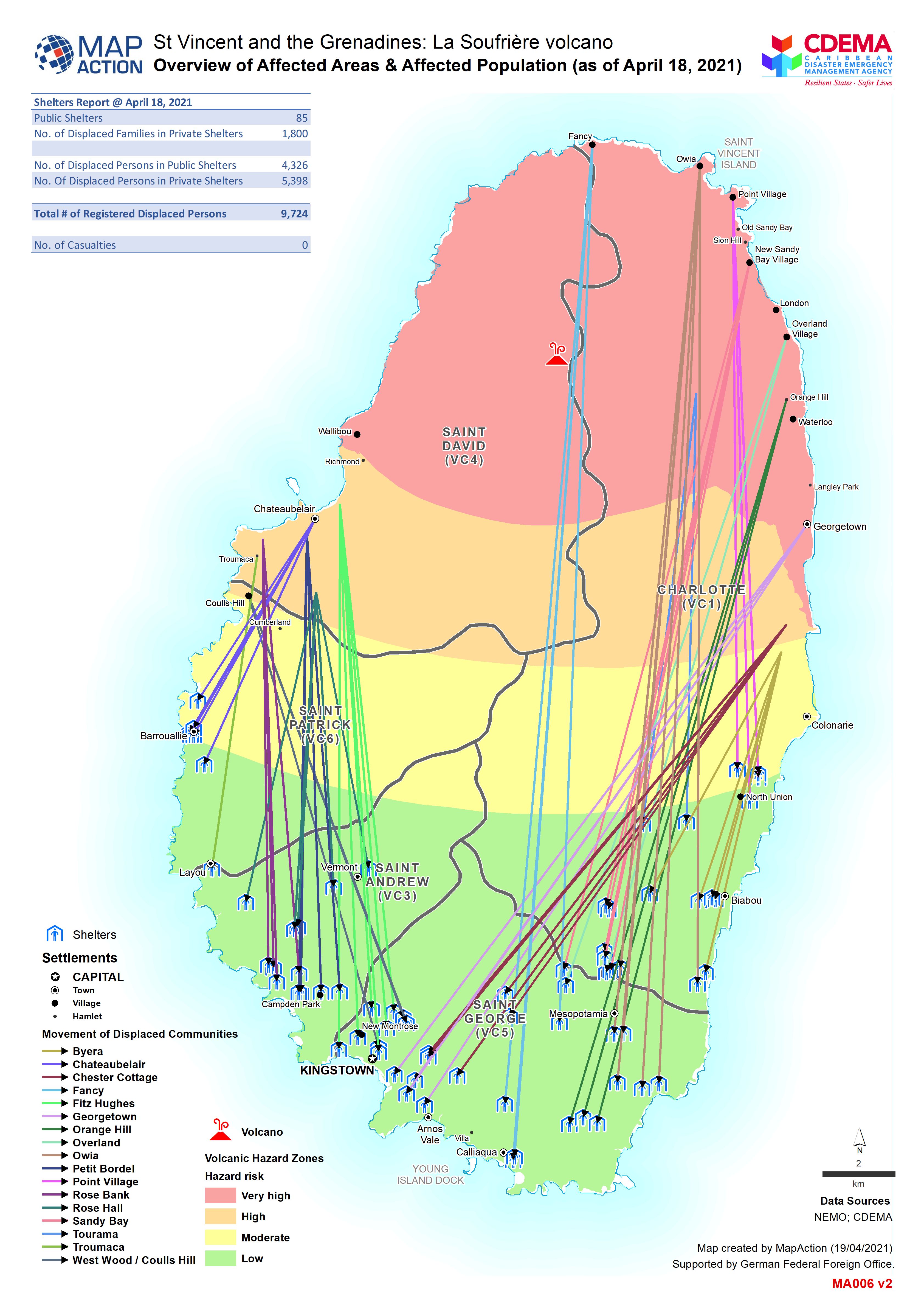
Overview of Affected Areas & Affected Population (as of 18 Apr 2021)
Map shows movement of displaced persons from affected communities. -

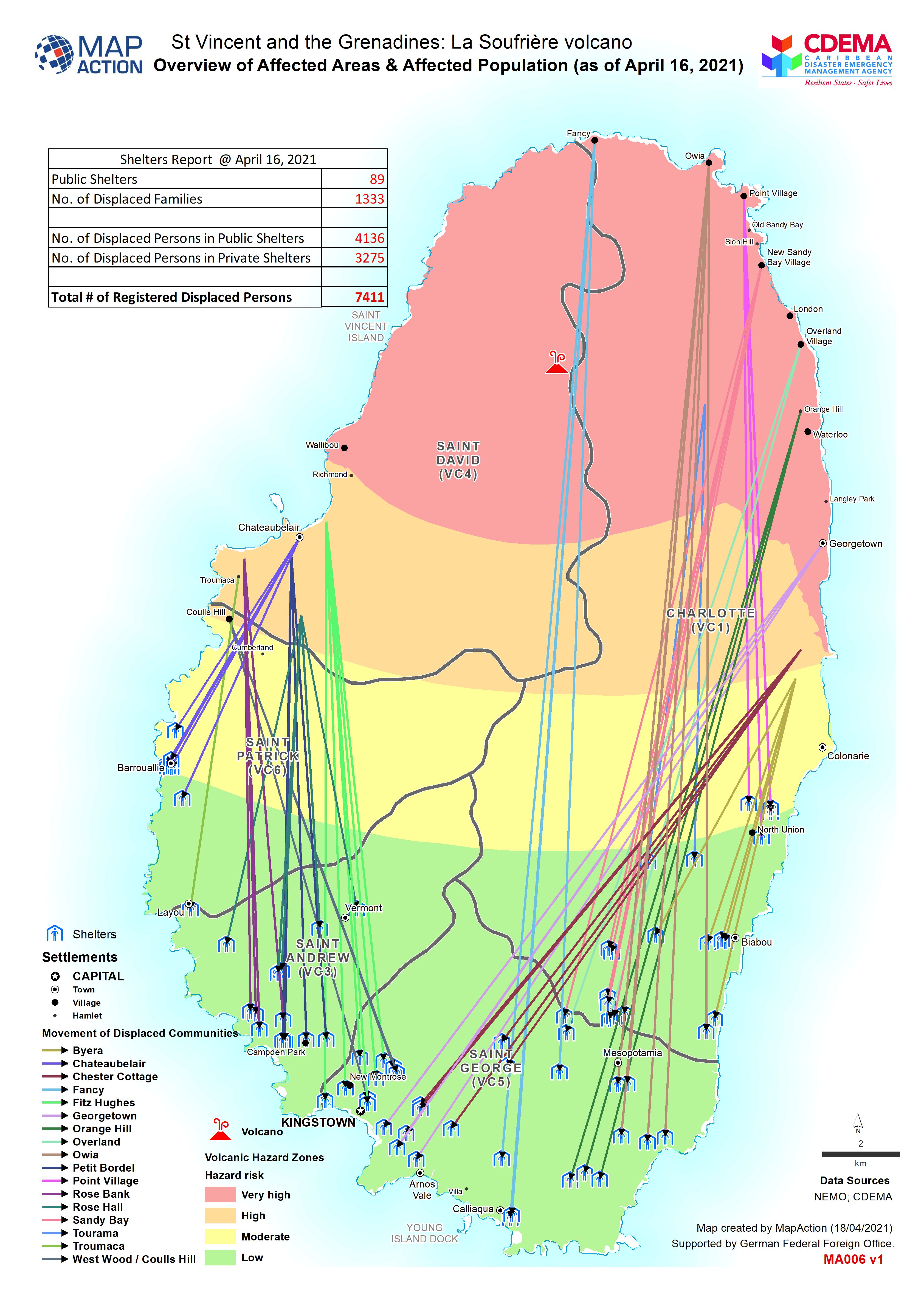
Overview of Affected Areas & Affected Population (as of April 16, 2021)
Map shows movement of displaced persons from affected communities. -

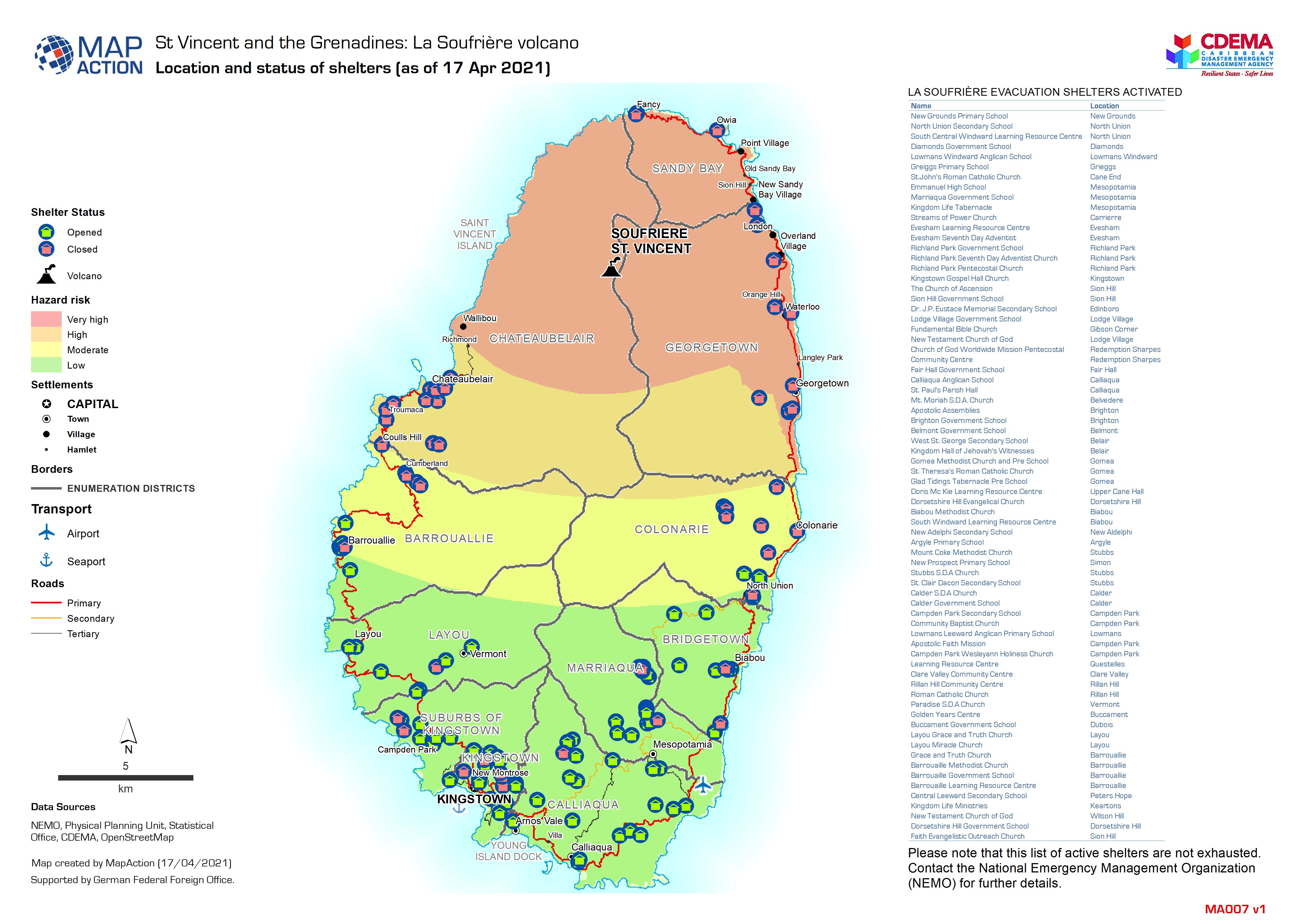
Location and status of shelters
Map shows the location of all shelters in St Vincent and their status. -
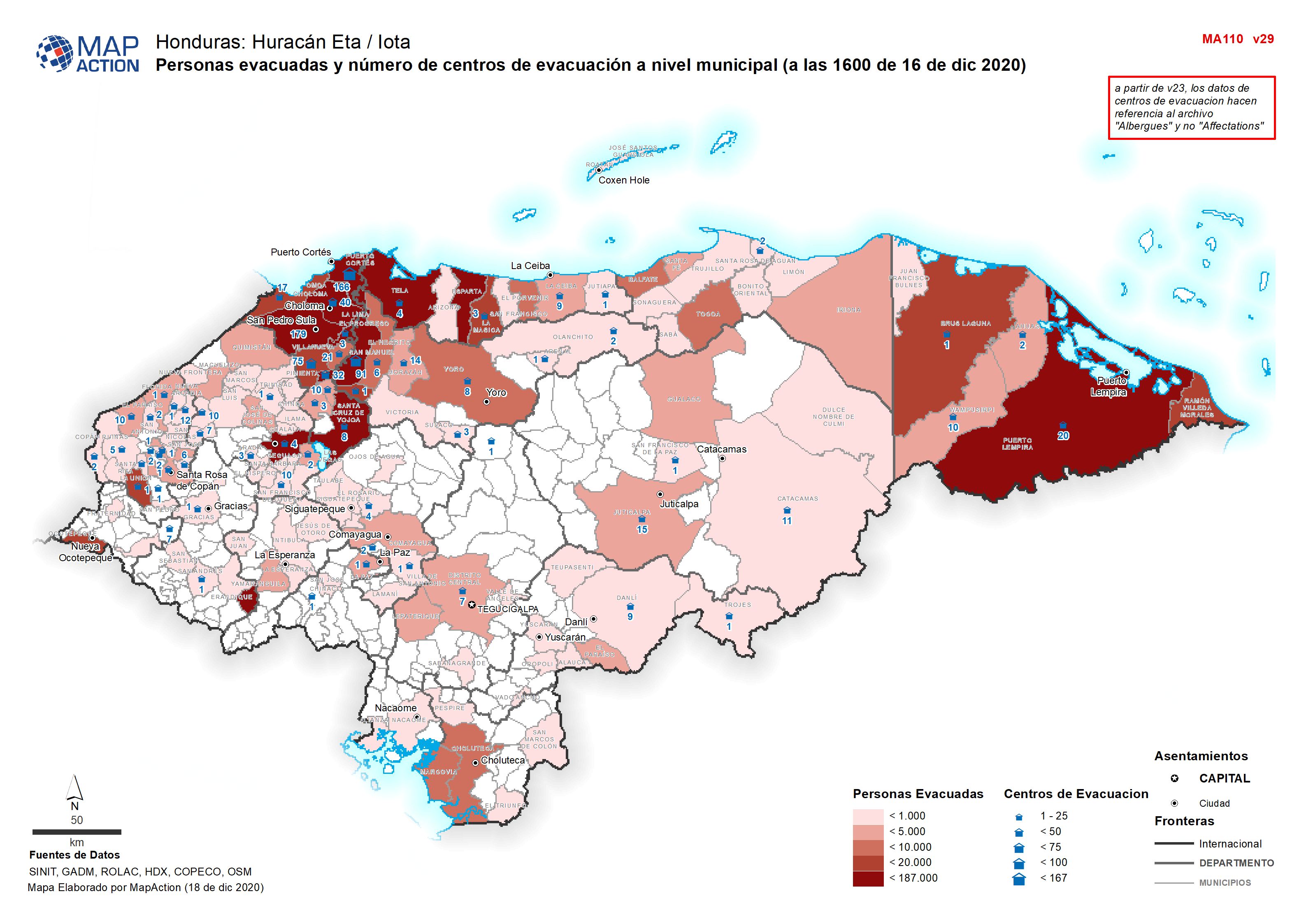
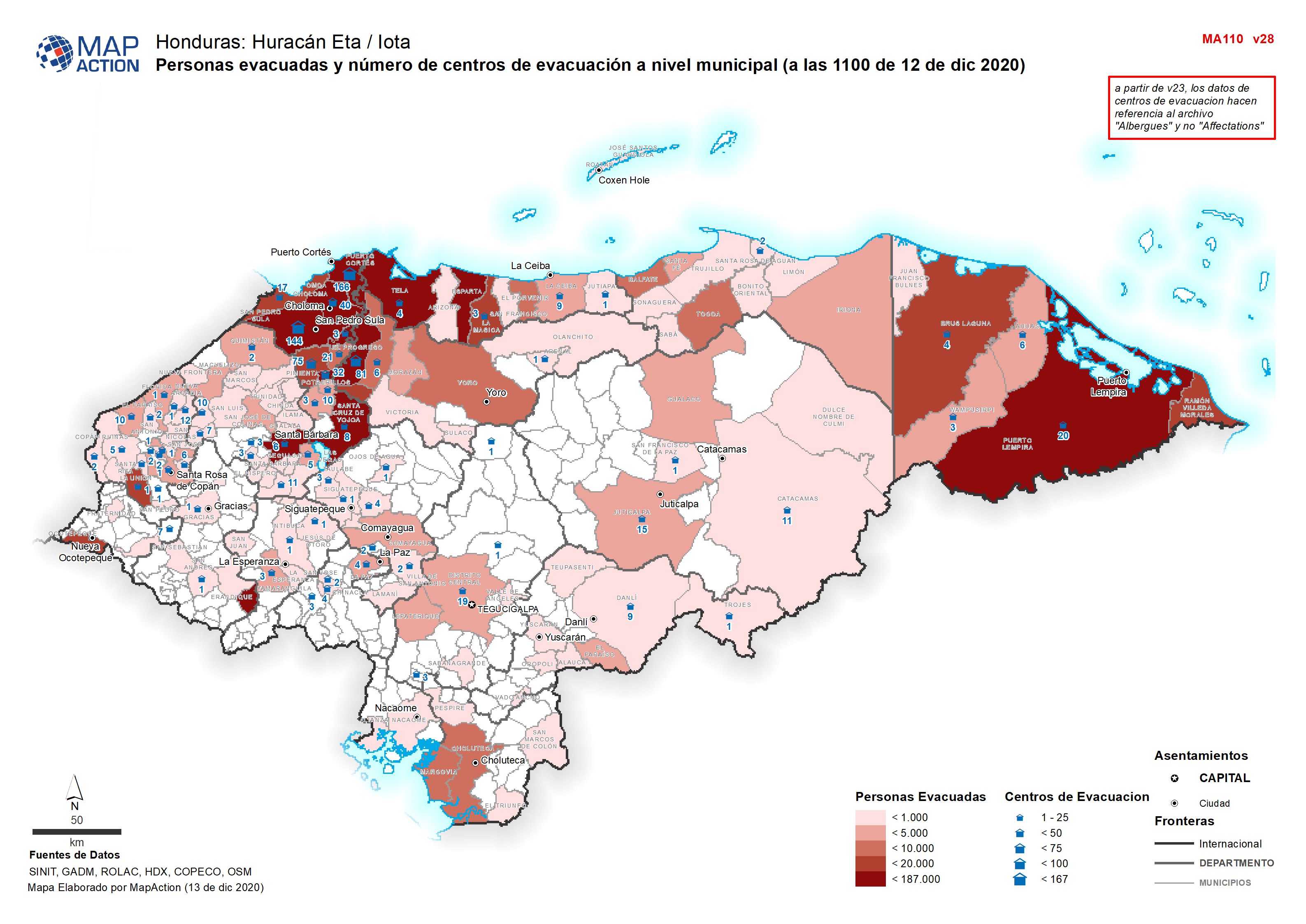
Personas evacuadas y número de centros de evacuación a nivel municipal (a las...
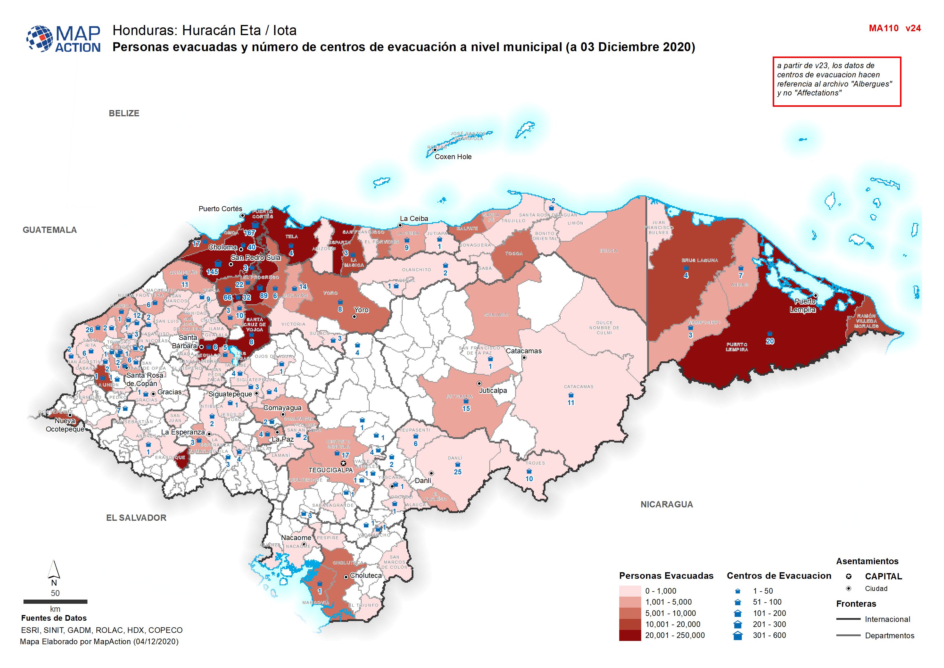
Personas evacuadas y número de centros de evacuación a nivel municipal (a 03 Diciembre 2020 -

Personas evacuadas y número de centros de evacuación a nivel municipal (a las...
Personas evacuadas y número de centros de evacuación a nivel municipal (a 03 Diciembre 2020 -

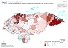
HONDURAS: TORMENTAS TROPICALS ETA - Noroeste municipios afectados y personas ...
This map shows the affected administration level 2 municipalities for north-west Honduras, population by 30m square (facebook), flood extents (satellite data from 5-9 and 13-17... -

Honduras: Tormentas Tropicals ETA - Noroeste municipios afectados y personas ...
This map shows the affected administration level 2 municipalities for north-west Honduras, population by 30m square (facebook), flood extents (satellite data from 5-9 and 13-17... -

Personas evacuadas y número de centros de evacuación a nivel municipal (a 03 ...
Personas evacuadas y número de centros de evacuación a nivel municipal (a 03 Diciembre 2020 -

Personas evacuadas y número de centros de evacuación a nivel municipal (a 02 ...
Personas evacuadas y número de centros de evacuación a nivel municipal (a 02 Diciembre 2020 -

Guatemala: Persons evacuated and in shelter (26 November 2020)
Map shows the number of reported activities per Sector per Department in Guatemala. Critical and High priority response areas are also shown. -

Honduras: Personas evacuadas y número de centros de evacuación a nivel munici...
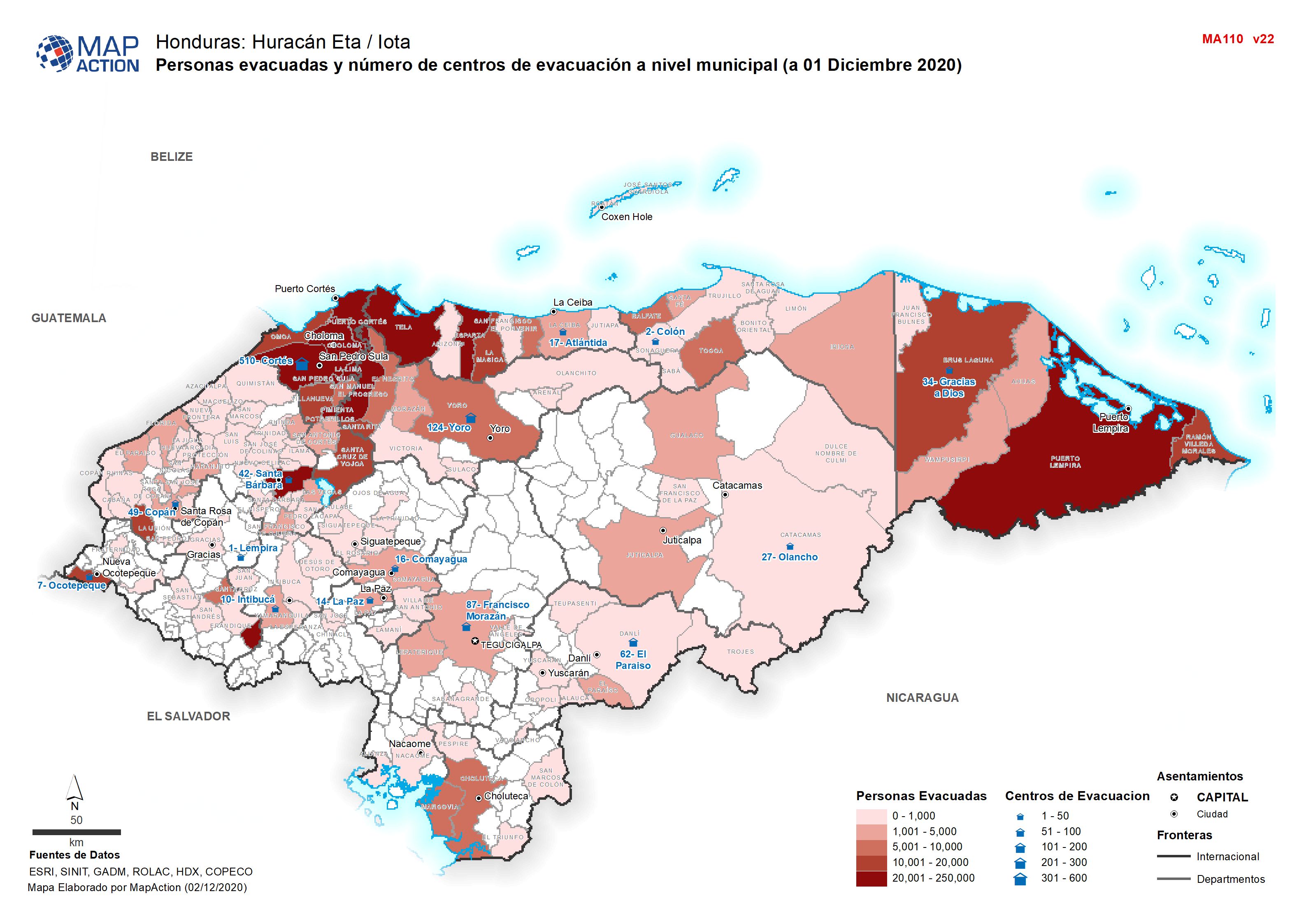
Personas evacuadas y número de centros de evacuación a nivel municipal (a 01 Diciembre 2020 -

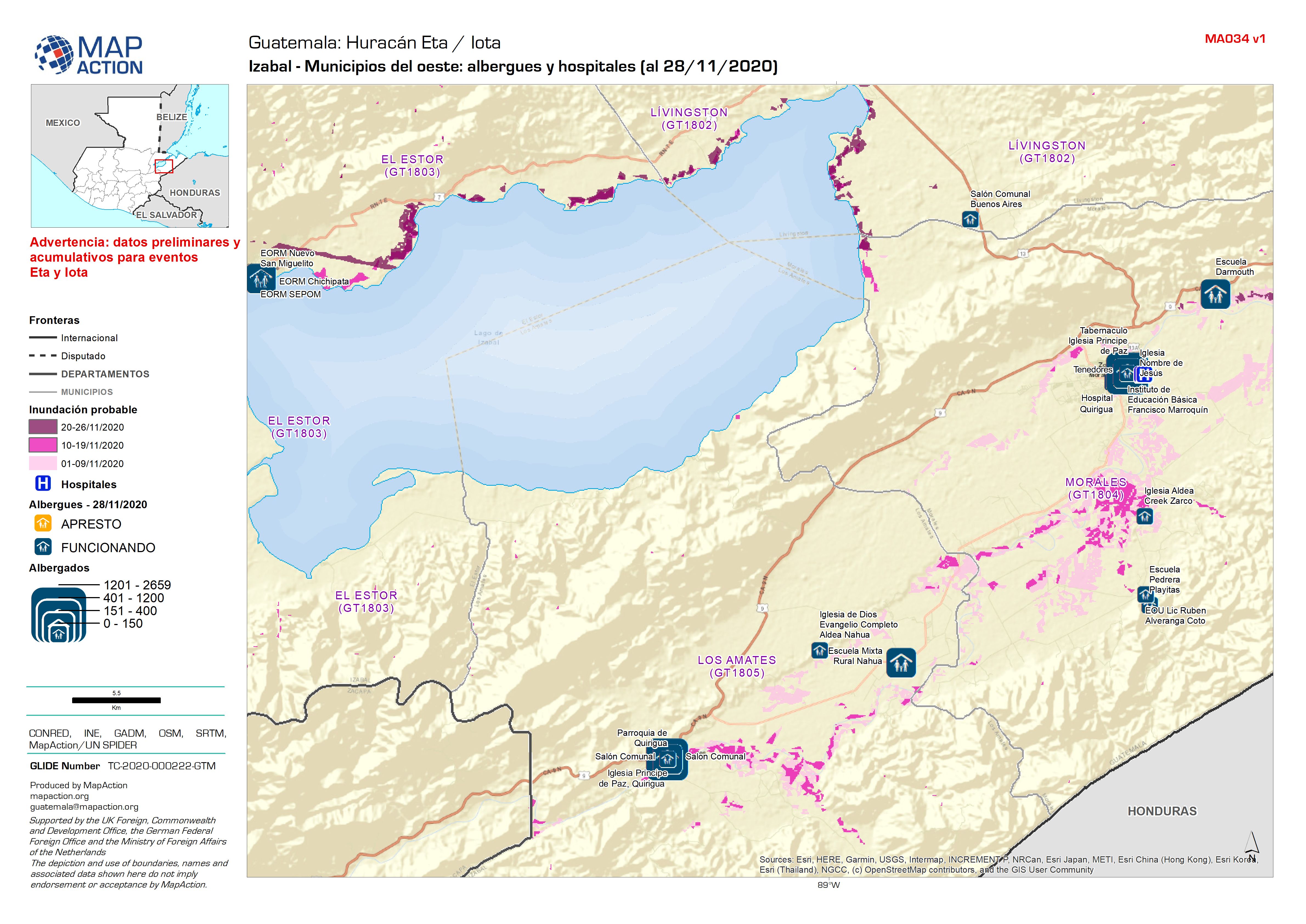
Guatemala: Izabal - Municipios del oeste: albergues y hospitales (al 28/11/2020)
Shelters and Hospitals