-
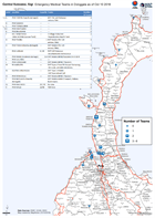
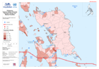
Central Sulawesi, Sigi Emergency Medical Teams in Donggala as of Oct 10 2018
Emergency Medical Teams in Donggala as of Oct 10 2018 -
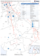
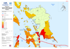
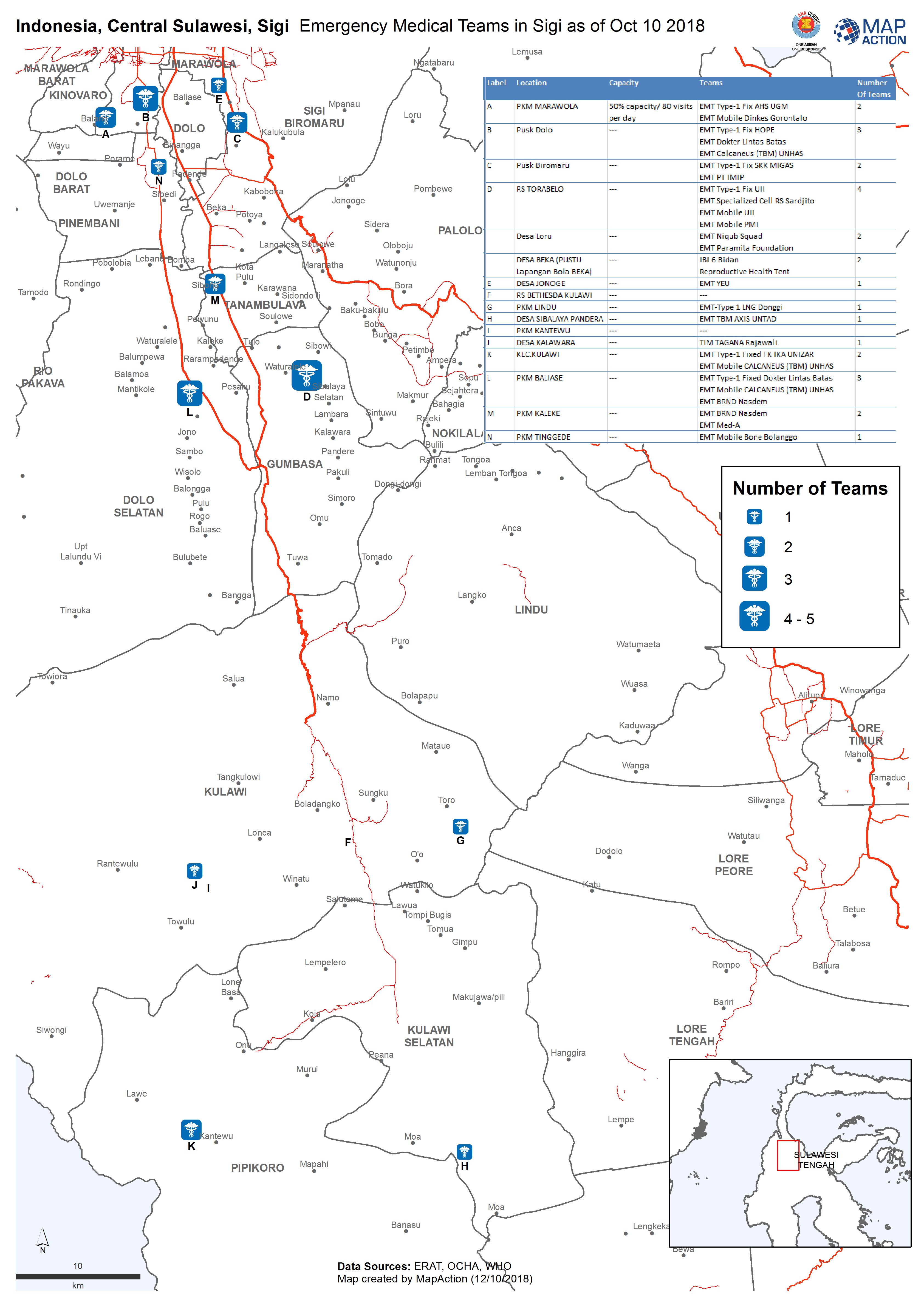
Indonesia, Central Sulawesi, Sigi Emergency Medical Teams in Sigi as of Oct 1...
Emergency Medical Teams in Sigi as of Oct 10 2018 -

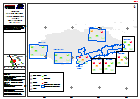
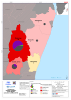
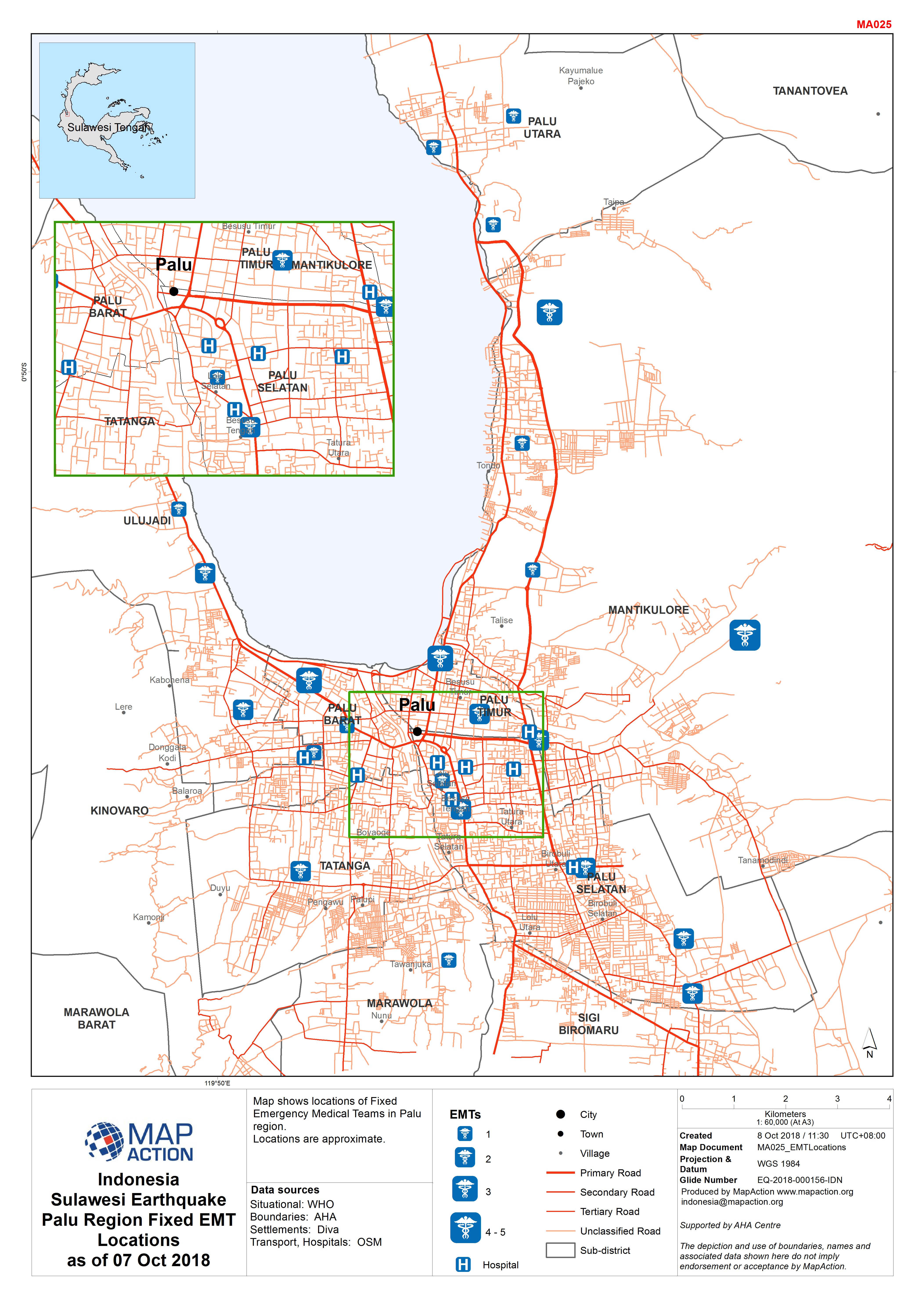
Indonesia Sulawesi Earthquake Palu Region Fixed EMT Locations as of 07 Oct 2018
Map shows locations of Fixed Emergency Medical Teams in Palu region. Locations are approximate. -
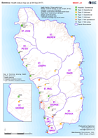
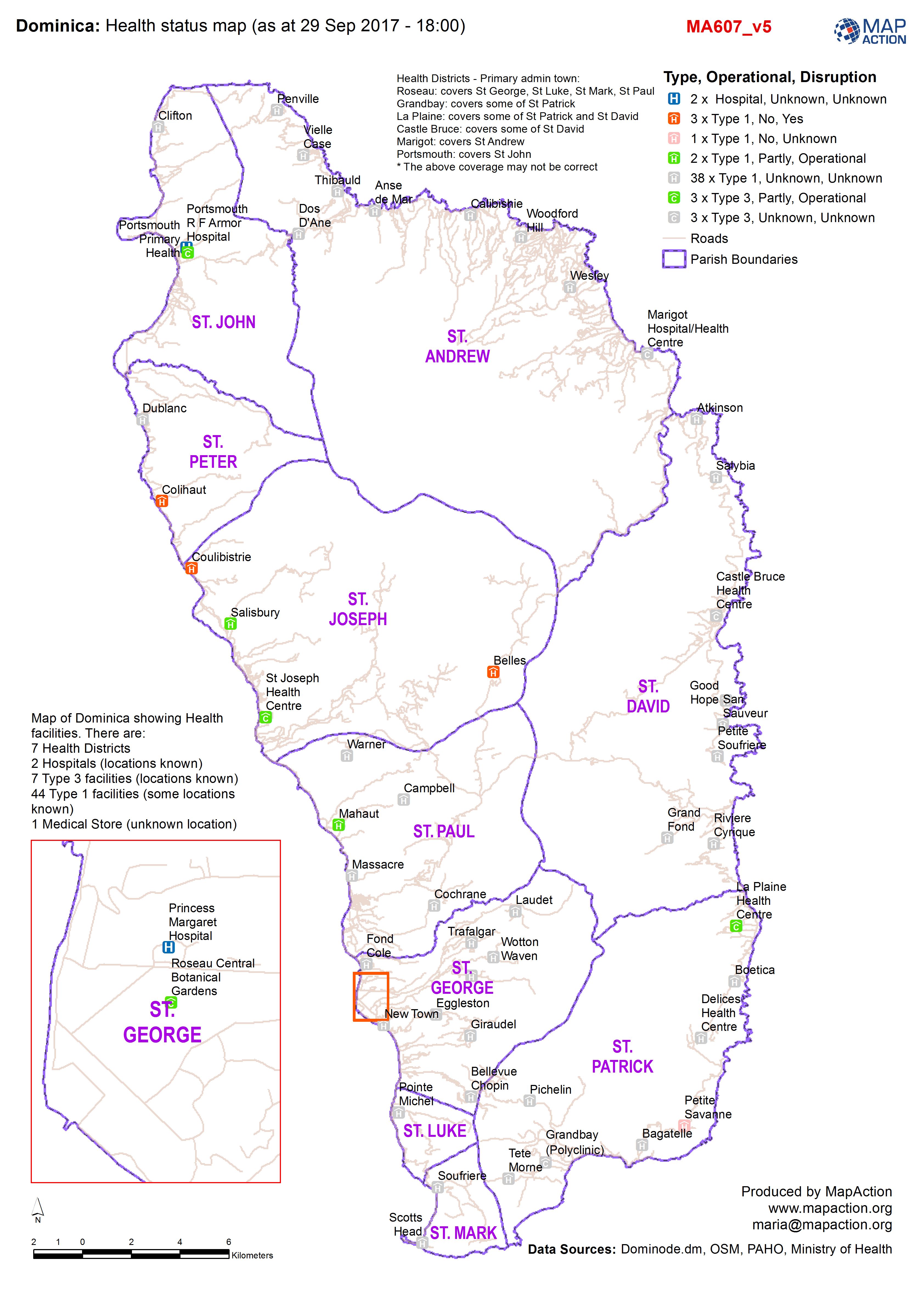
Health status map (as at 29 Sep 2017 - 18:00)
Map of Dominica showing Health facilities. There are: 7 Health Districts 2 Hospitals (locations known) 7 Type 3 facilities (locations known) 44 Type 1 facilities (some locations... -

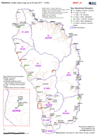
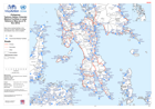
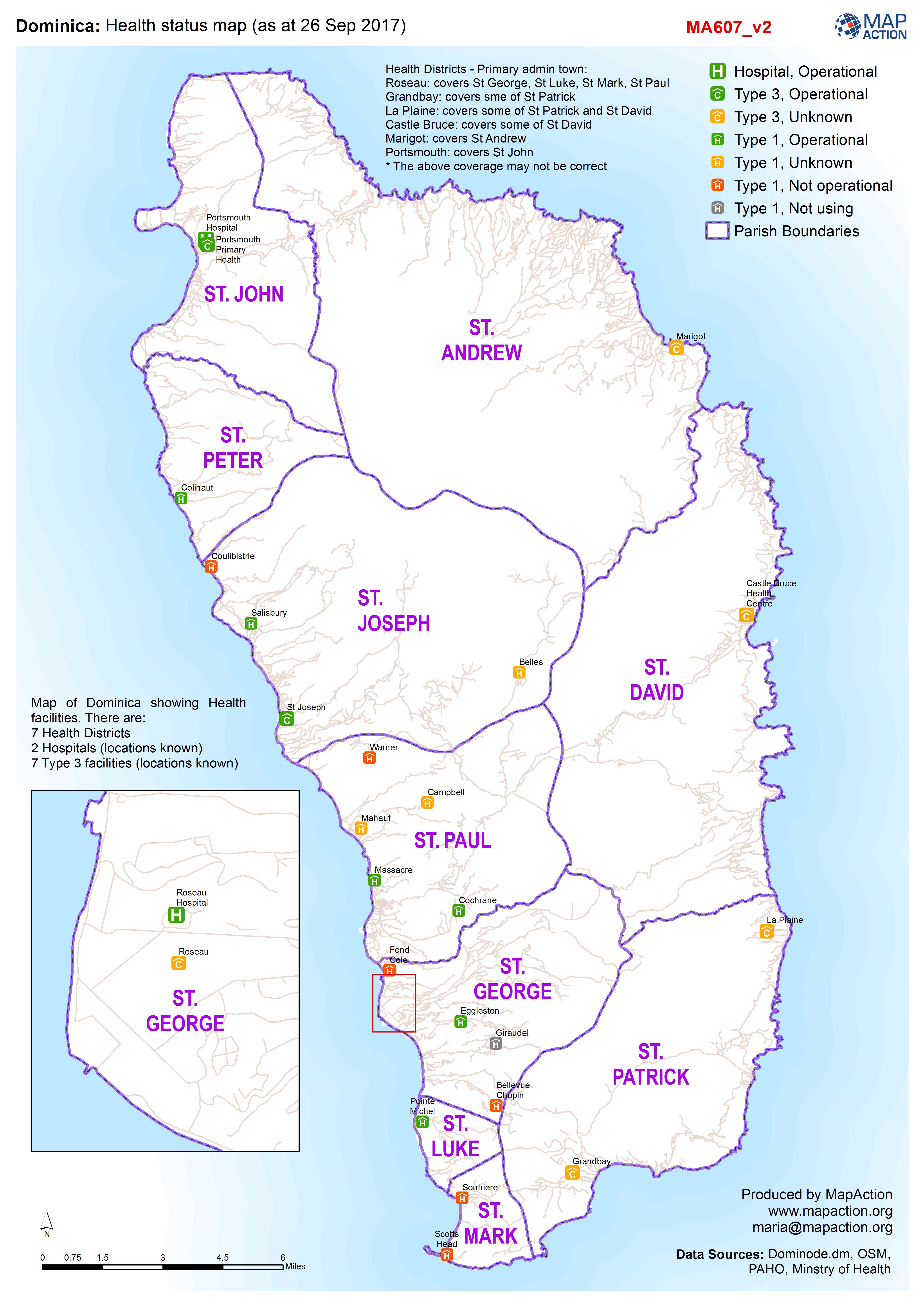
Dominica: Health status map (as at 26 Sep 2017)
Map of Dominica showing Health facilities. There are: 7 Health Districts 2 Hospitals (locations known) 7 Type 3 facilities (locations known) 40 (?) Type 1 facilities (some... -
Dominica: Health status map (as at 26 Sep 2017)
Map of Dominica showing Health facilities. There are: 7 Health Districts 2 Hospitals (locations known) 7 Type 3 facilities (locations known) 40 (?) Type 1 facilities (some... -
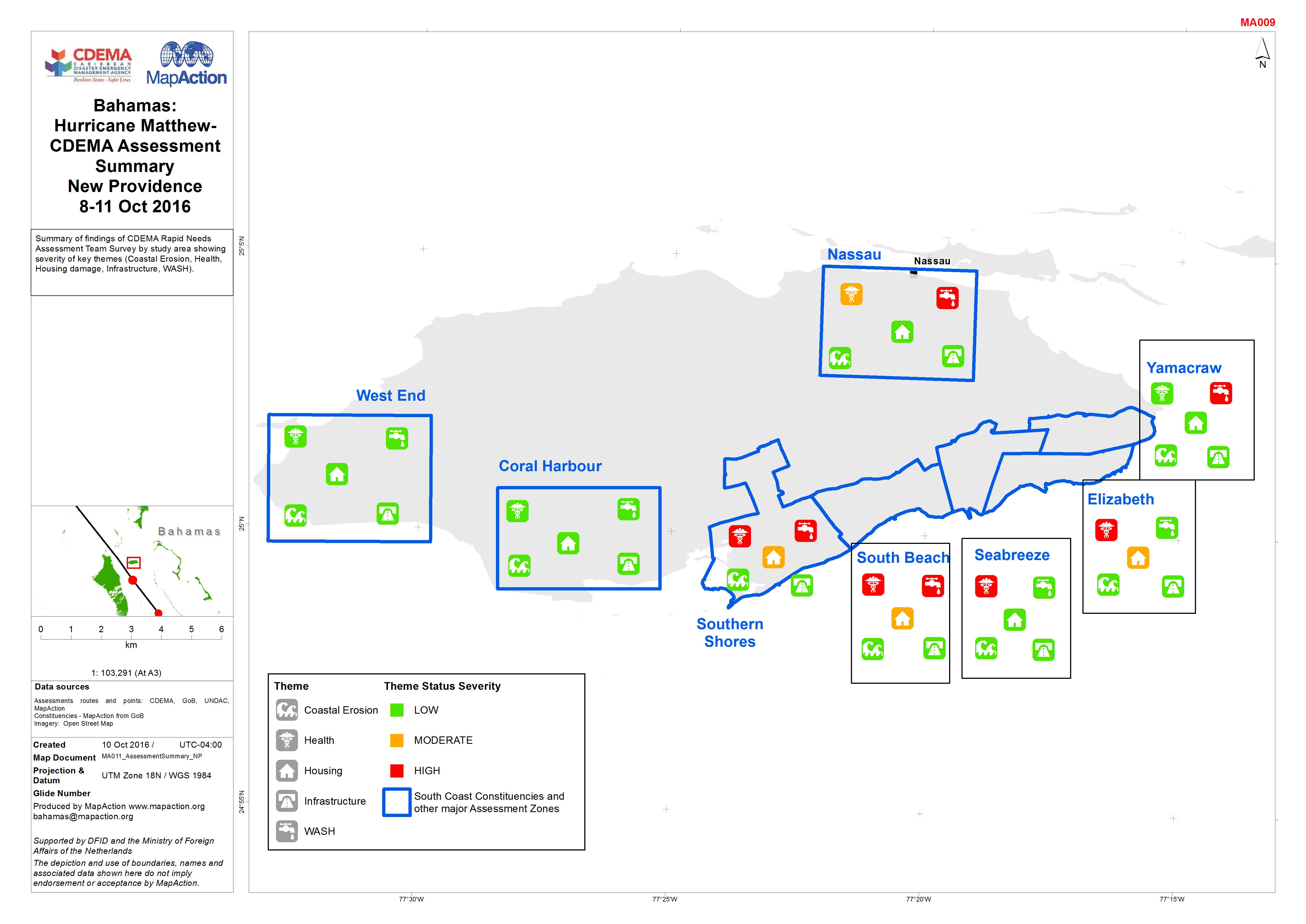
Bahamas: Hurricane Matthew- CDEMA Assessment Summary New Providence 8-11 Oct ...
Summary of findings of CDEMA Rapid Needs Assessment Team Survey by study area showing severity of key themes (Coastal Erosion, Health, Housing damage, Infrastructure, WASH). -
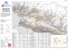
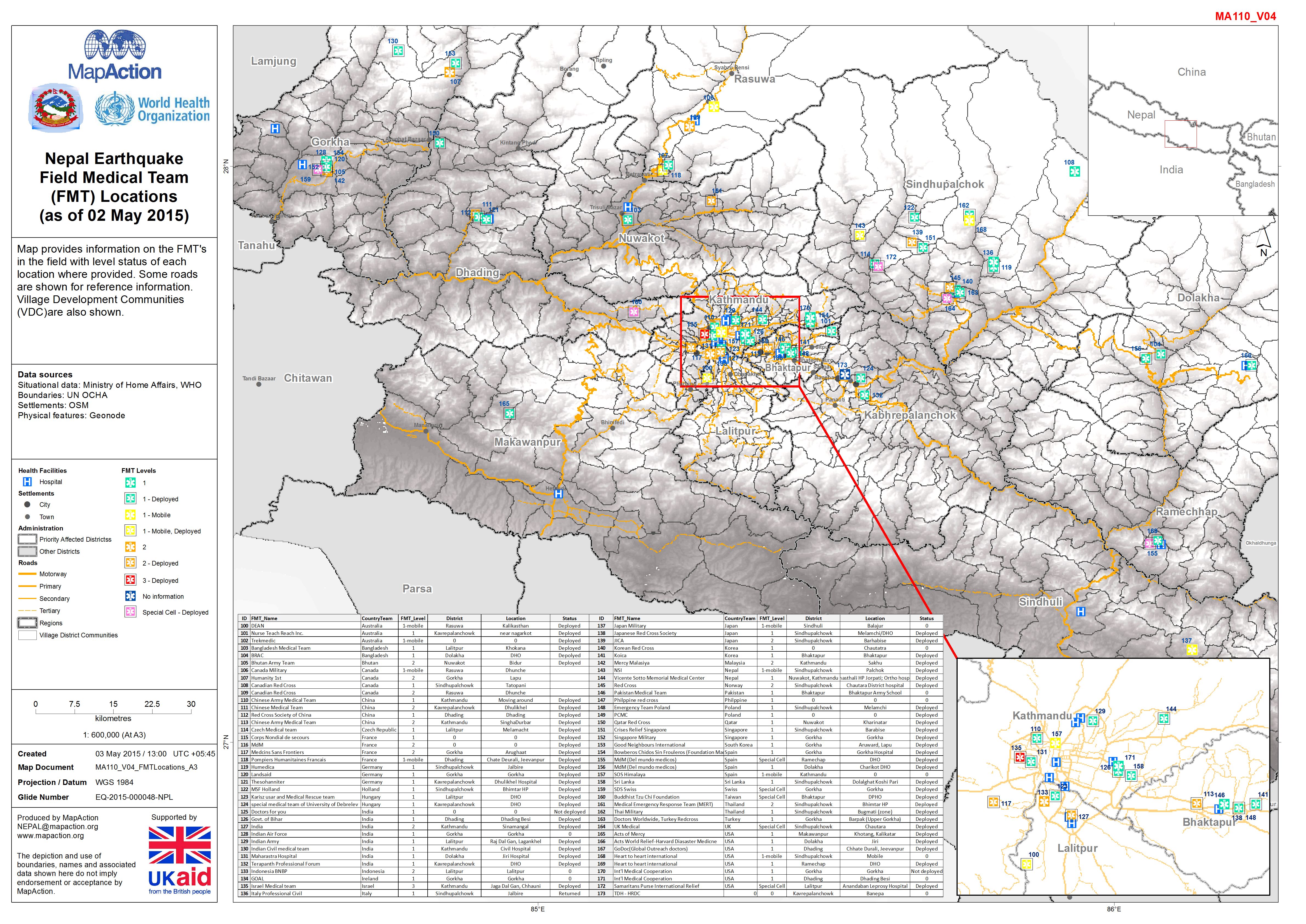
Nepal: Earthquake - Field Medical Team (FMT) Locations (as of 02 May 2015)
Map provides information on the FMT's in the field with level status of each location where provided. Some roads are shown for reference information. Village Development... -

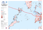
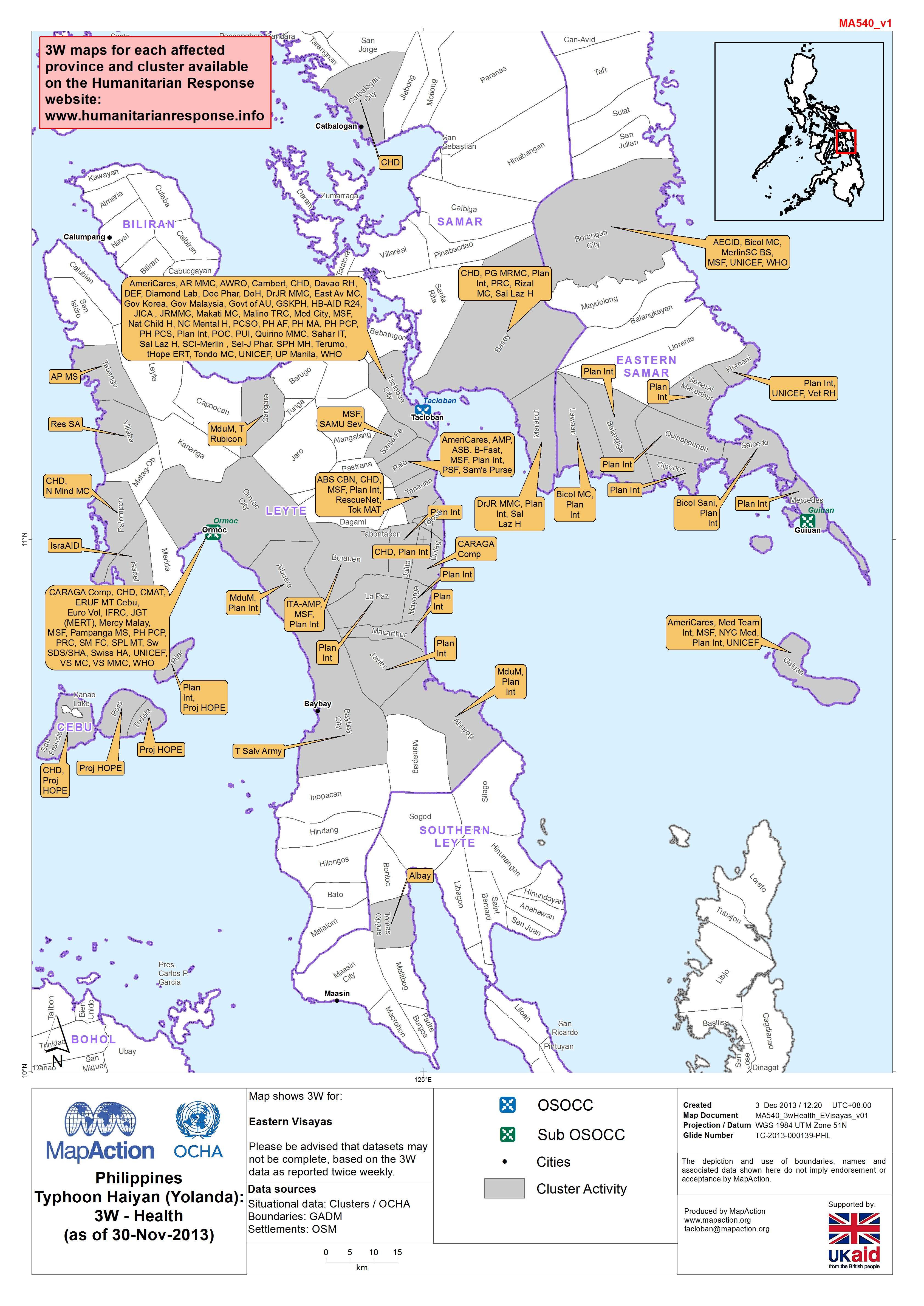
Philippines - Typhoon Haiyan (Yolanda): 3W - Health (as of 30-Nov-2013)
Map shows 3W for: Eastern Visayas Please be advised that datasets may not be complete, based on the 3W data as reported twice weekly. -

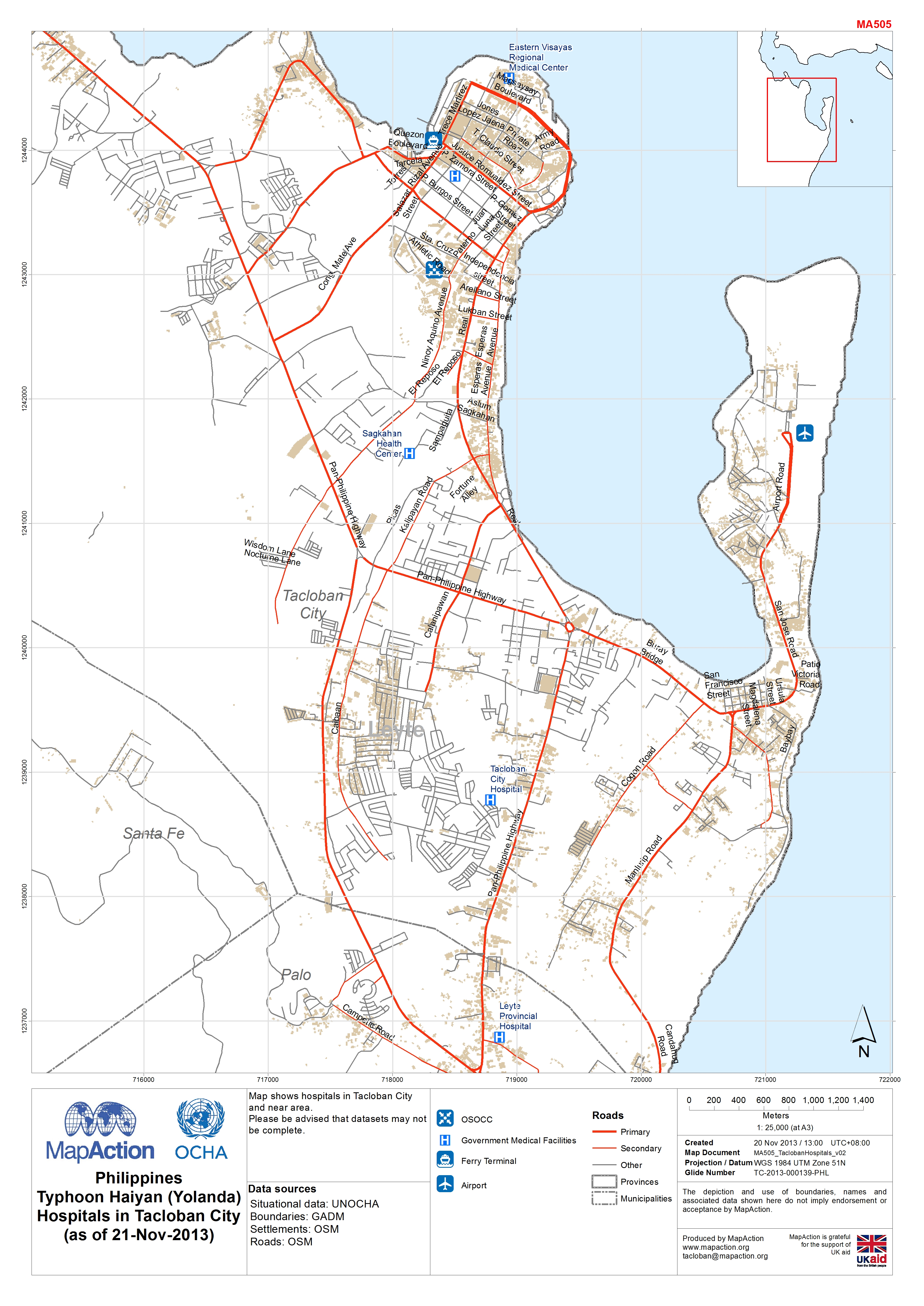
Philippines Typhoon Haiyan (Yolanda) Hospitals in Tacloban City (as of 21-Nov...
Map shows hospitals in Tacloban City and near area.Please be advised that datasets may not be complete. -
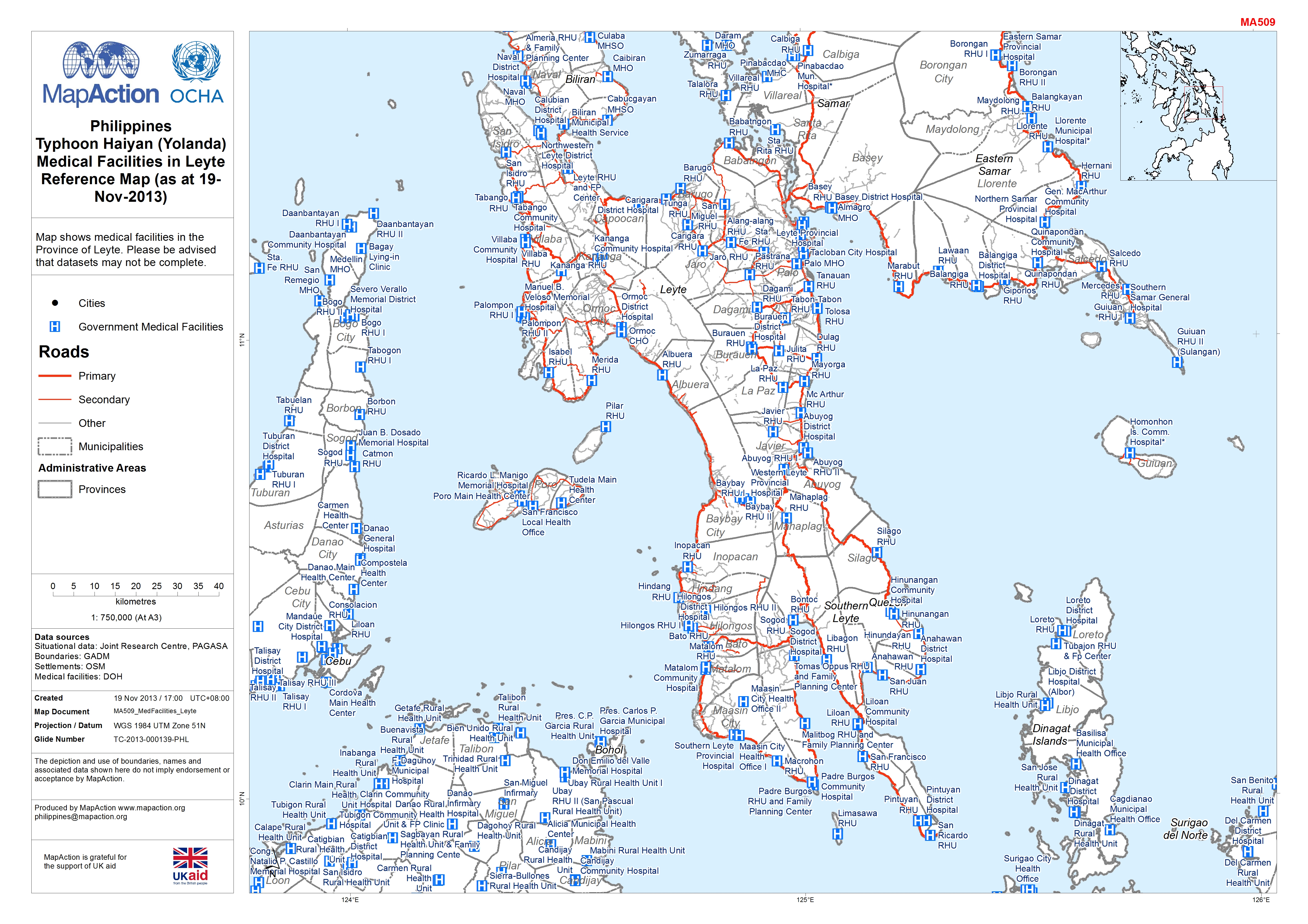
Philippines Typhoon Haiyan (Yolanda) Medical Facilities in Leyte Reference Ma...
that datasets may not be complete.Province of Leyte. Please be advisedMap shows medical facilities in the -
Philippines Typhoon Haiyan (Yolanda) Population Density and Medical Facilities
Map shows populaiton density and medical facilities. -

Philippines Typhoon Haiyan (Yolanda) Storm Surge and Medical Facilities
Map shows predicted storm surge levels based on actual storm track, and medical facilities. -
Philippines Typhoon Haiyan (Yolanda) Population density and Medical Facilities
Map shows population density and medical facilities. -
Philippines Typhoon Haiyan (Yolanda) Storm surge and Medical Facilities
Map shows predicted storm surge and medical facilities. -

EXERCISE: Nordland: Hurricane Fubar - Medical Facilities (as of 30 Sept 2013)
This Map shows the southern part of Nordland and its medical facilities.Operational status has not been validated. -

Fiji: Cyclone Winston - Health Facility Status as of 2/3/2016 - Overview
Overview of damage status and functionality of Health Facilities as of 02/03/2016 against the storm track. -
Madagascar: Cyclone Giovanna - Sante Dégâts (situation du 8 Mars 2012)
La carte montre les cinq districts les plus affectés avec le nombre d'établissements de santé de base et le pourcentage de centres des santé de base touchés par Giovanna cyclone... -

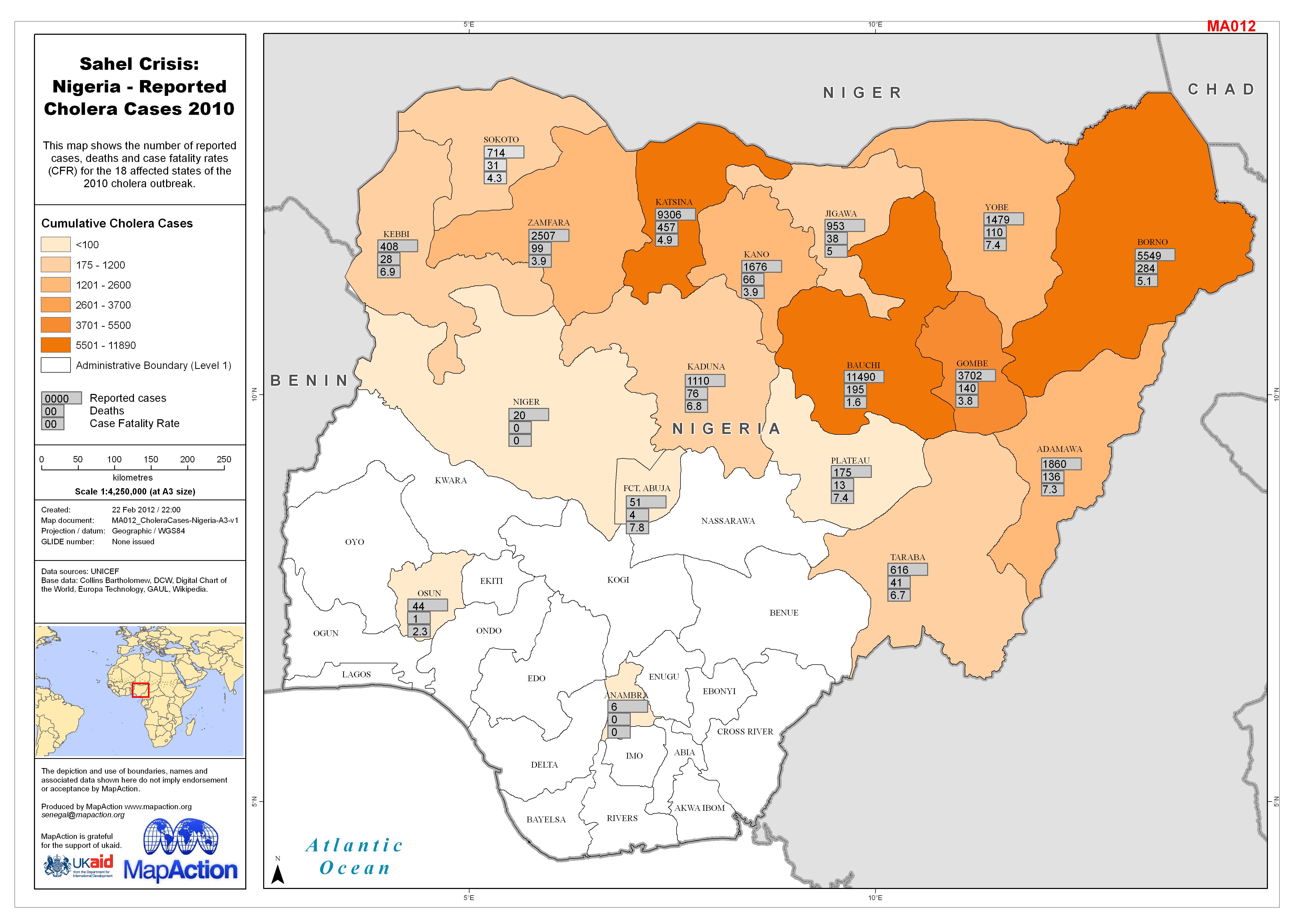
Sahel Crisis: Nigeria - Reported Cholera Cases 2010
This map shows the number of reported cases, deaths and case fatality rates (CFR) for the 18 affected states of the 2010 cholera outbreak. -

Congo: Brazzaville Munitions Depot Explosion - Field Ambulance RV Sites - Eng...
This dataset has no description