-

Mozambique: Dondo District - ground assessment survey locations
Location of ground assessment surveys within the district of Dondo. -
Mozambique: Manica District - ground assessment survey locations
Location of ground assessment surveys within the district of Manica. -
Mozambique: Sussundenga District - ground assessment survey locations
Location of ground assessment surveys within the district of Sussundenga. -
Mozambique: Gondola District - ground assessment survey locations
Location of ground assessment surveys within the district of Gondola. -
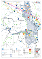
Mozambique: Buzi Postos - ground and aerial assessment survey locations
Location of ground and aerial assessment survey's within the postos of Buzi. -

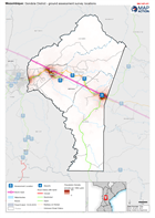
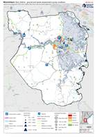
Mozambique: Nhamatanda District - ground and aerial assessment survey locations
Location of ground and aerial assessment survey's within the district of Nhamatanda. -
Mozambique: Cidade de Chimoio District - ground and aerial assessment survey ...
Location of assessment survey's within the district of Cidade de Chimoio -

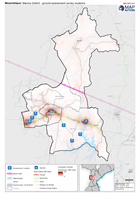
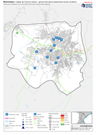
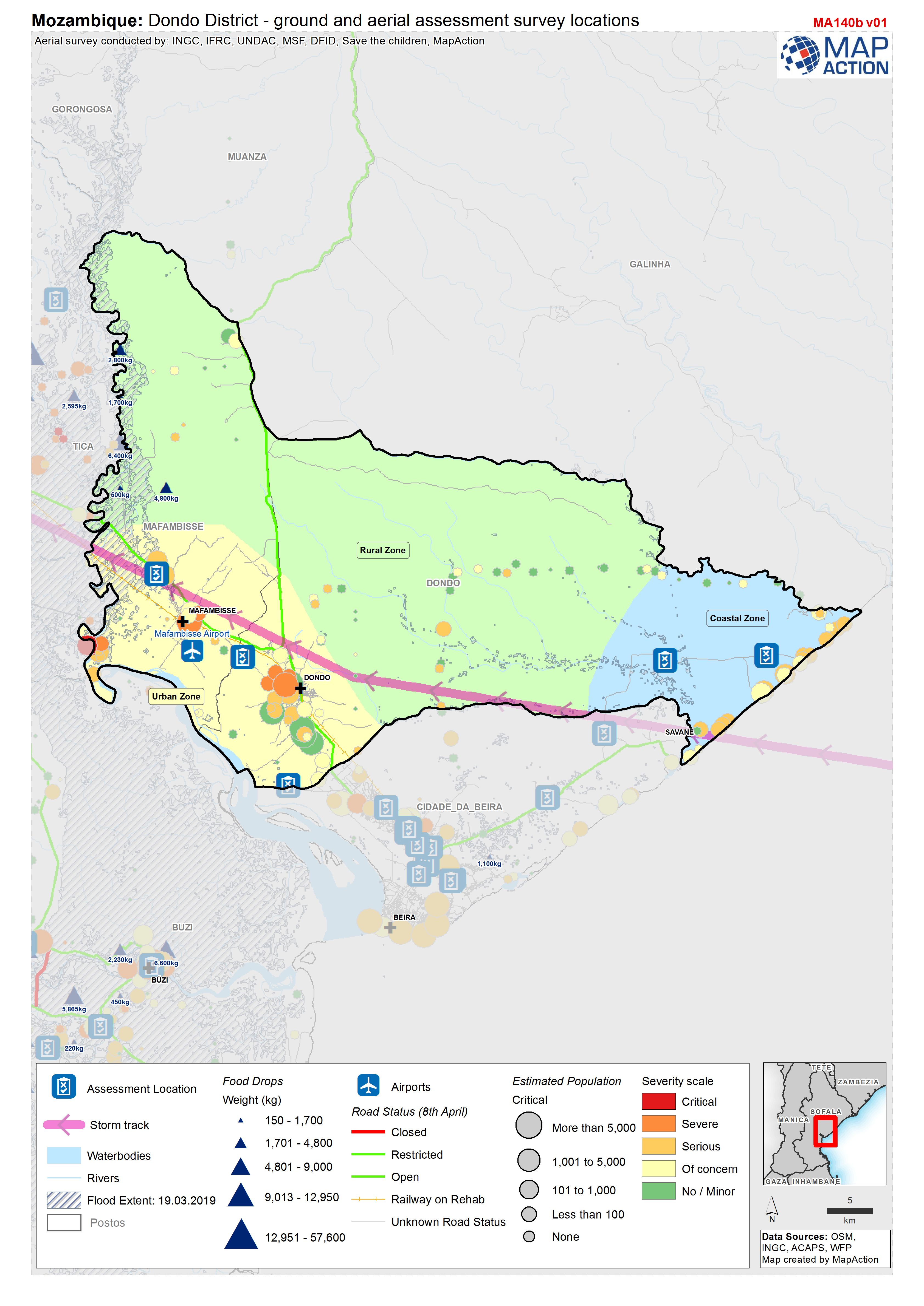
Mozambique: Dondo District - ground and aerial assessment survey locations
Location of ground and aerial assessment survey's within the district of Dondo. -
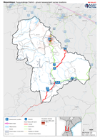
Mozambique: Buzi District - ground and aerial assessment survey locations
Location of ground and aerial assessment survey's within the district of Buzi. -
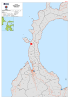
Indonesia Sulawesi Earthquake Administrative Village Boundaries: Palu
Map shows the administrative village (admin level 4) boundaries for the Palu Region of Central Sulawesi and road network. -
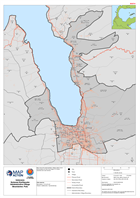
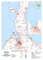
Indonesia Sulawesi Earthquake Donggala and Palu Infrastructure
Maps shows the main roads and settlements of the Pula and Donggala districts of Central Sulawesi, Indonesia -
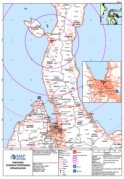
Sulawesi Earthquake - Infrastructure
Map shows level 3 admininstration boundaries and settlements. Roads and ports are also shown. -
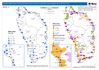
Potable Water status: litres delivered in last 5 days and remaining days supp...
Map shows potable water distributions and remaining supplies up to 8th October 2017 -
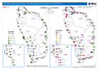
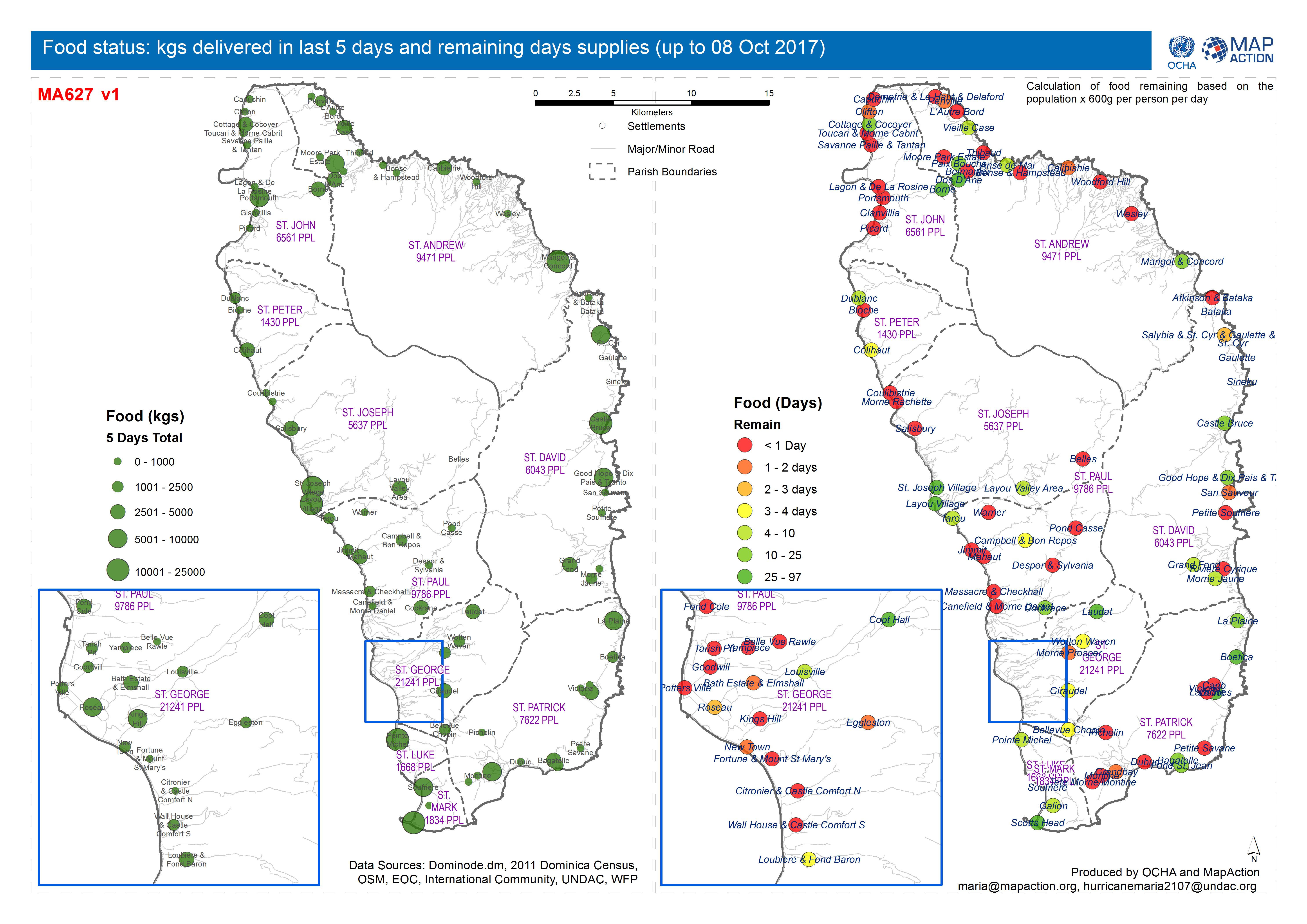
Food status: kgs delivered in last 5 days and remaining days supplies (up to ...
Map shows food status and gap analysis up to 8th October 2017 -
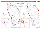
Tarpaulin Distribution: tarpaulins required per settlement and total tarpauli...
Map shows tarpaulin distribution and gap analysis up to 8th October 2017. -
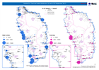
DOMINICA: Food and water distributions (to end of 30 September 2017)
Map shows food and water distributions to the end of 30th September 2017 -

DOMINICA: CN, FR, NL, UK and VZ food and water distributions (as of 27 Septem...
Map shows food and water distributions on 27th September 2017 -

DOMINICA: CN, FR, NL and VZ food and water distributions (as of 26 September ...
Map shows food and water distributions on 26th September 2017 -
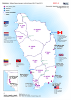
Dominica: Military Resources and Activity Areas (26-27 Sep 2017)
Shows the approx areas of response of the International Military Assets -
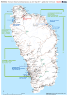
Dominica: Hurricane Maria humanitarian access (as at 21 Sep 2017 - update 4 a...
Map of humanitarian access, as reported to the EOC in Roseau up to 14.00 local time on 21 September. This map will change frequently as access conditions change and more...