-
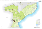
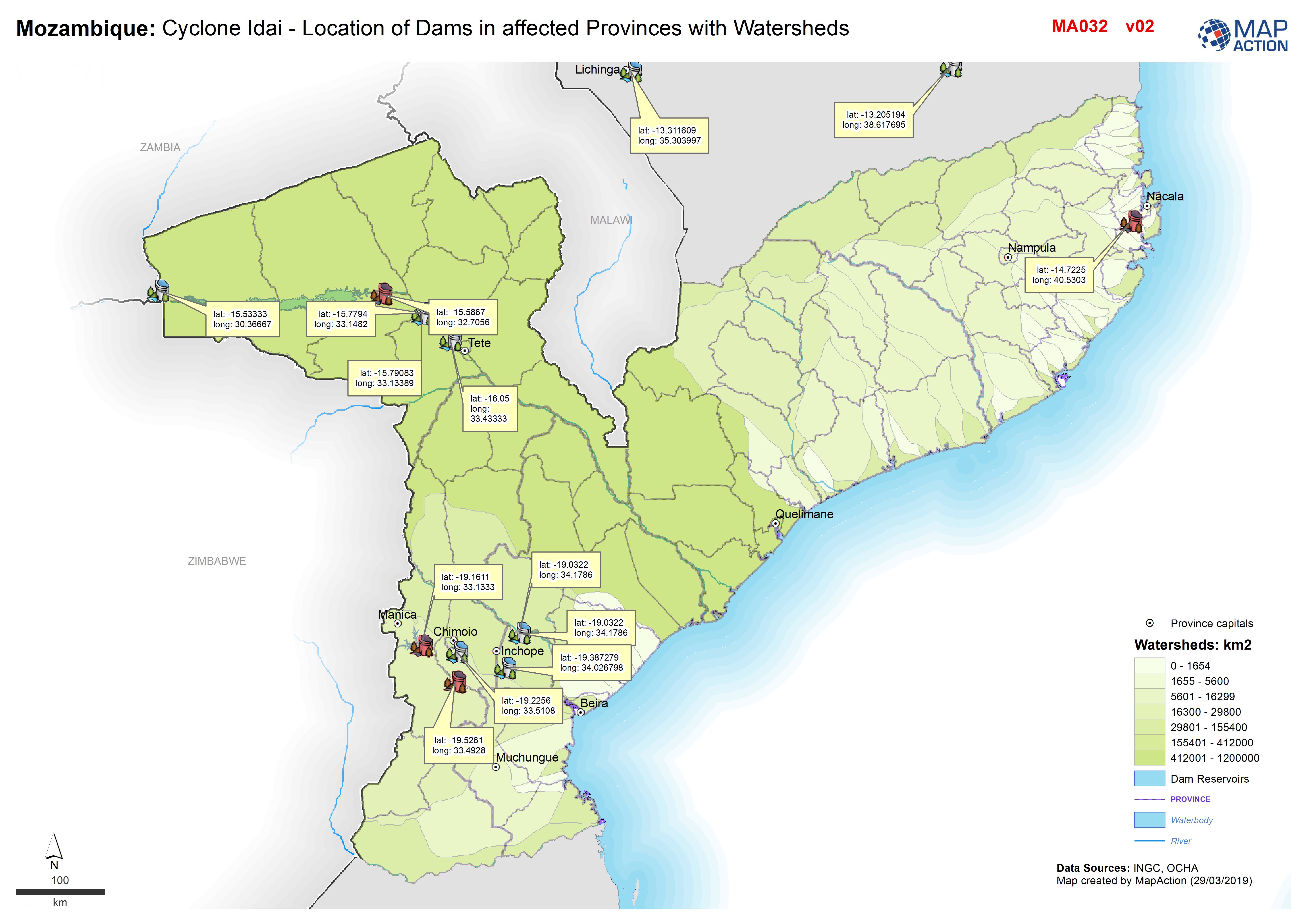
Mozambique: Cyclone Idai - Location of Dams in affected Provinces with Waters...
Location of Dams in four affected Provinces (Nampulam Zambezia, Manica and Sofala plus Tete which is only slightly affected -

Mozambique: Cyclone Idai - Location of Dams in affected Provinces with Waters...
Location of Dams in four affected Provinces (Nampulam Zambezia, Manica and Sofala plus Tete which is only slightly affected -
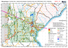
Mozambique: Cyclone Idai - results and analysis of aerial survey as of 28th M...
UNDAC and IFRC surey started 23rd March and will continue until finished -

Mozambique: Cyclone Idai - results and analysis of aerial survey as of 27th M...
UNDAC and IFRC surey started 23rd and will continue until finished -
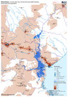
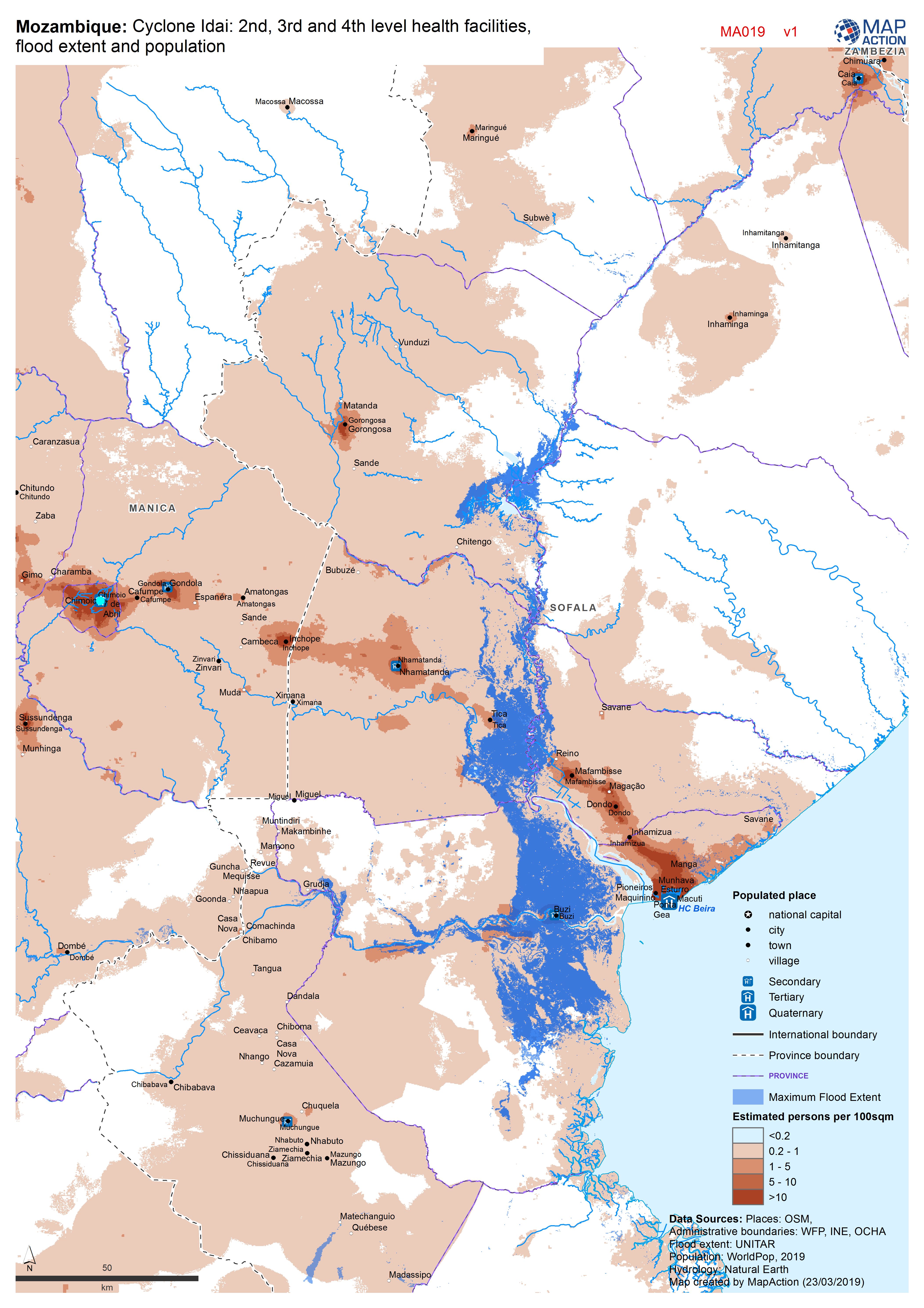
Mozambique: Cyclone Idai - 2nd, 3rd and 4th level health facilities, flood ex...
Map shows the population (based on WorldPop at 100m resolution generating through AI) and the Flood Extents known as of 19/20 March 2019 plus Health facilities -

-

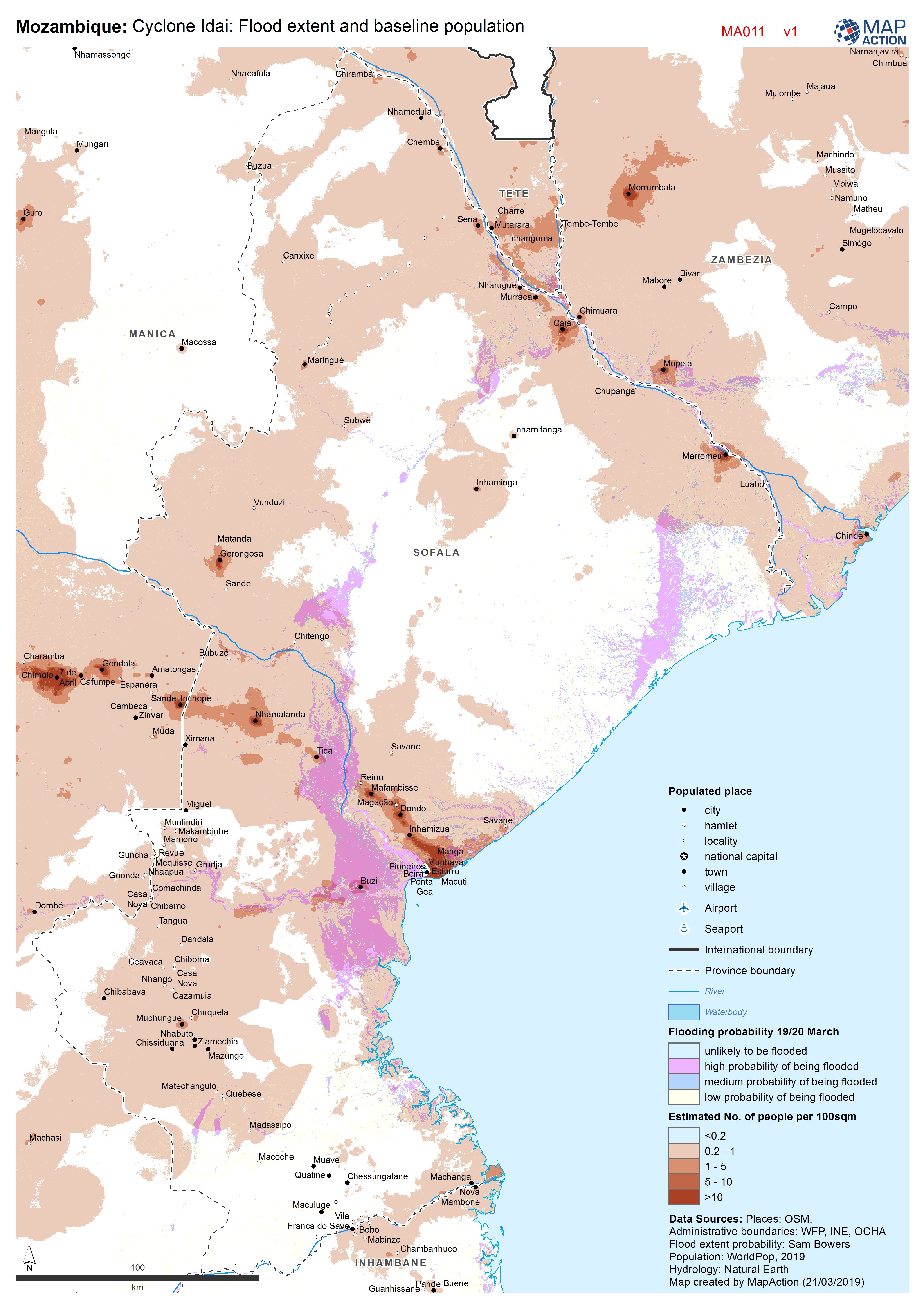
Cyclone Idai: Flood extent and baseline population
Map shows the population (based on WorldPop at 100m resolution generating through AI) and the Flood Extents known as of 19/20 March 2019 -
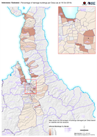
Indonesia: Sulawesi - Percentage of damage buildings per Desa (as at 19 Oct 2...
Map shows the percentage of buildings damaged per Desa based on satellite-derived analysis. -

Indonesia, Central Sulawesi Situational Overview
Based on Copernicus analysis, this map shows building damage detected in the areas where satellite imagery was captured and processed. This map is intended to be indicative... -

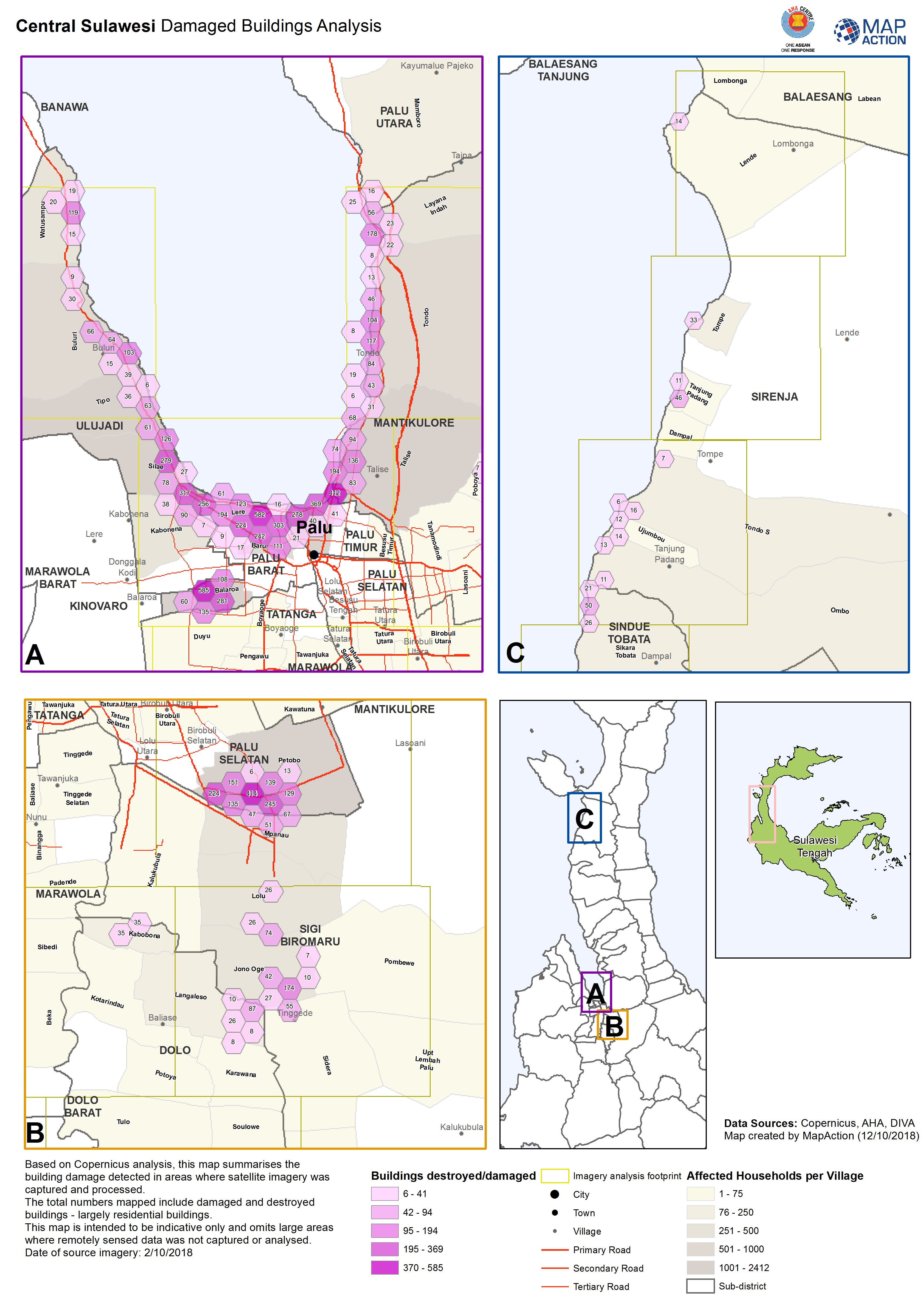
Central Sulawesi Damaged Buildings Analysis
Based on Copernicus analysis, this map summarises the building damage detected in areas where satellite imagery was captured and processed. The total numbers mapped include... -
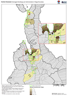
Central Sulawesi Damaged Buildings per Administrative Village Boundary
Based on Copernicus analysis, this map summarises the building damage detected in the areas where satellite imagery was captured and processed. The total numbers mapped include... -
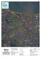
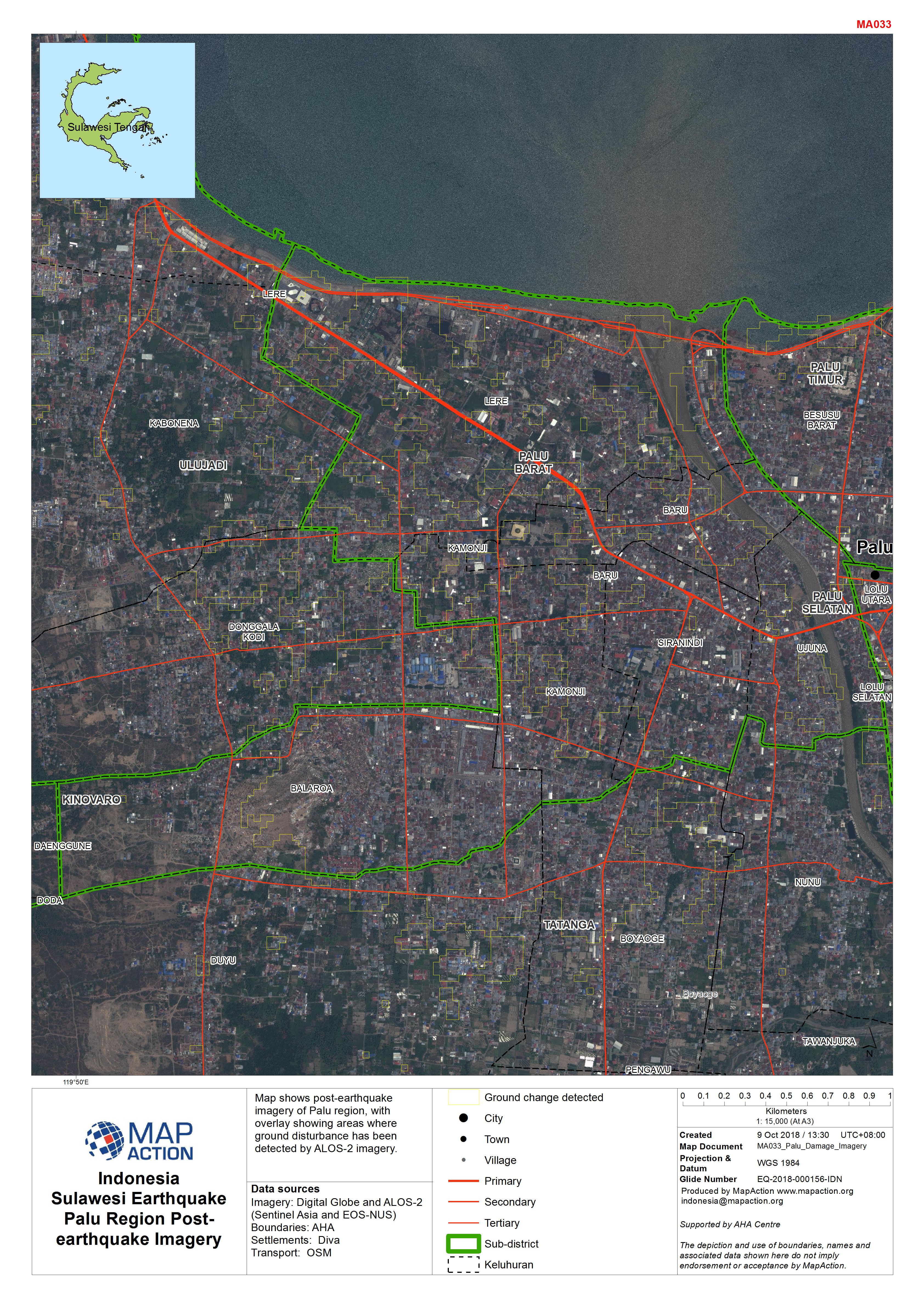
Indonesia Sulawesi Earthquake Palu Region Post-earthquake Imagery
Map shows post-earthquake imagery of Palu region, with overlay showing areas where ground disturbance has been detected by ALOS-2 imagery. -

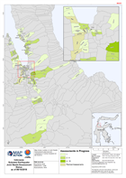
Indonesia Sulawesi Earthquake Joint Needs Assessment Status as of 07/10/2018
Map shows number of Joint Needs Assessments planned and completed in Central Sulawesi at 07/10/2018 -

Indonesia Sulawesi Earthquake Palu Region Damage to Schools
Map shows extent of damage to schools in Palau region, based on satellite data assesment. -

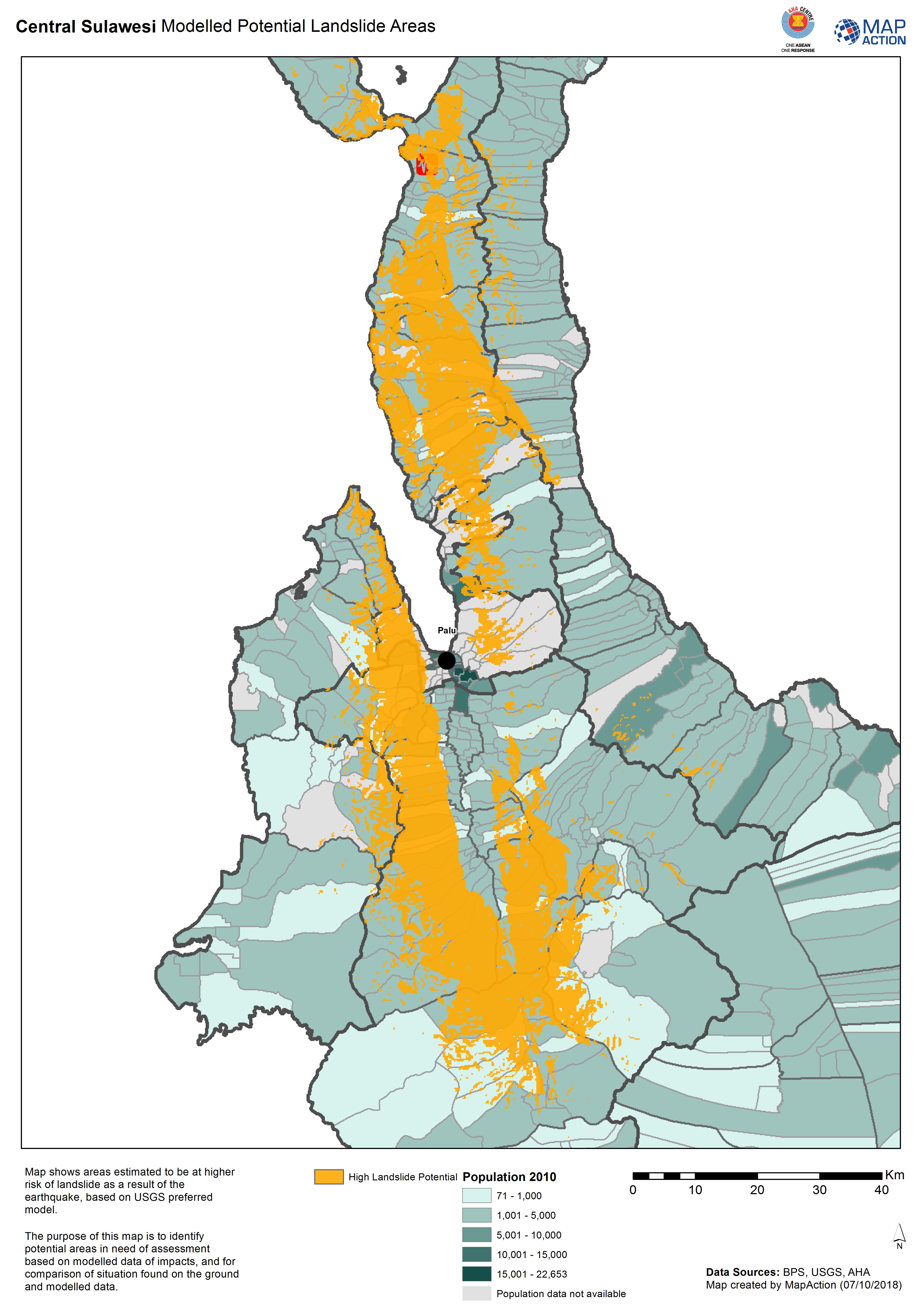
Central Sulawesi Modelled Potential Landslide Areas
Map shows areas estimated to be at higher risk of landslide as aresult of the earthquake, based on USGS preferred model. -

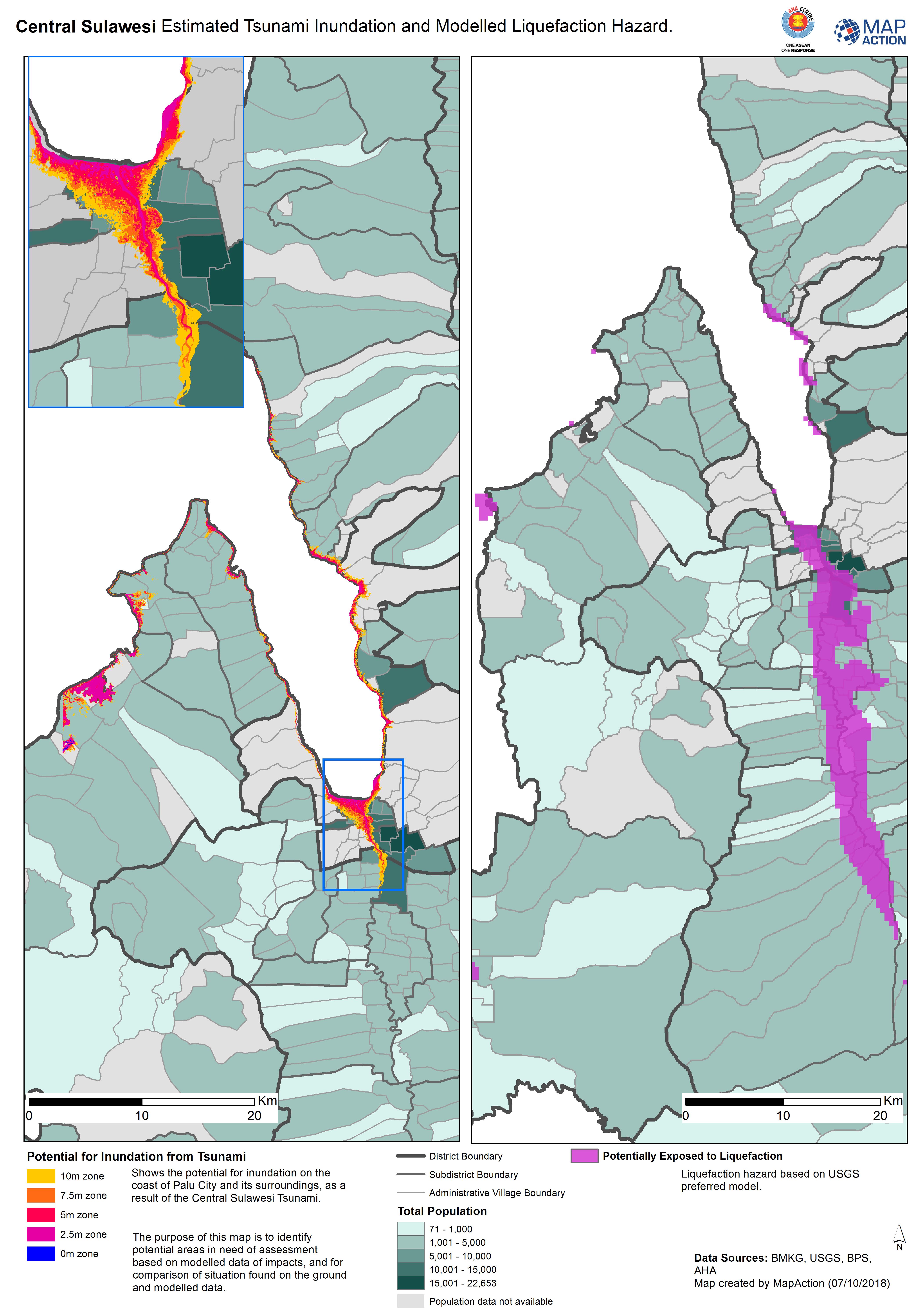
Central Sulawesi Estimated Tsunami Inundation and Modelled Liquefaction Hazard.
Shows the potential for inundation on the coast of Palu City and its surroundings, as a result of the Central Sulawesi Tsunami. The purpose of this map is to identify potential... -
Indonesia Sulawesi Earthquake Joint Needs Assessment Status as of 06/10/2018
Map shows number of Joint Needs Assessments planned and completed in Central Sulawesi at 06/10/2018 -
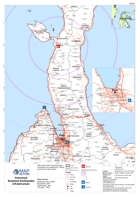
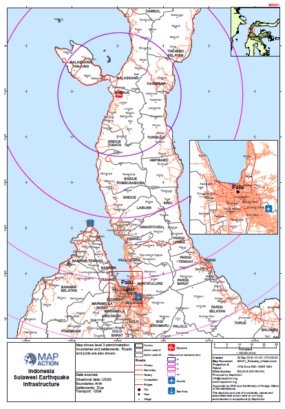
Sulawesi Earthquake - Infrastructure
Map shows level 3 admininstration boundaries and settlements. Roads and ports are also shown. -
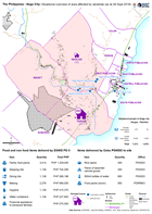
The Philippines - Naga City: Situational overview of area affected by landsli...
Map shows the affected areas, number of displaced and location of the evacuation centres being used as a result of the landslide to hit Naga city. The table below shows the... -
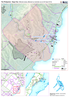
The Philippines - Naga City: Affected areas affected by landslide (as at 28 S...
Map shows the affected by the landslide in Naga City, Cebu.