-
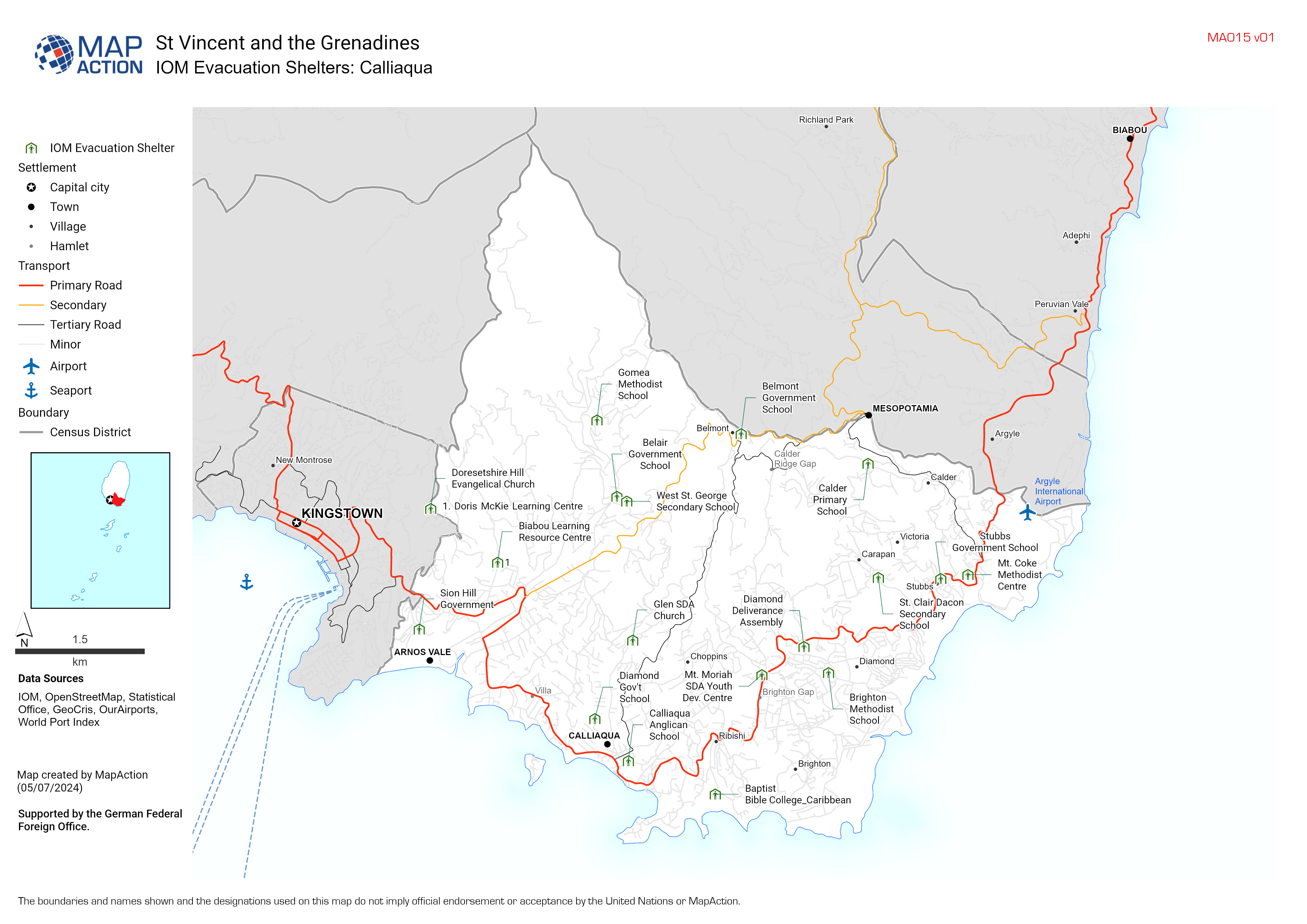
IOM Evacuation Shelters Atlas
IOM Emergency Shetlers for Hurricane Beryl in St. Vincent and the Grenadines -

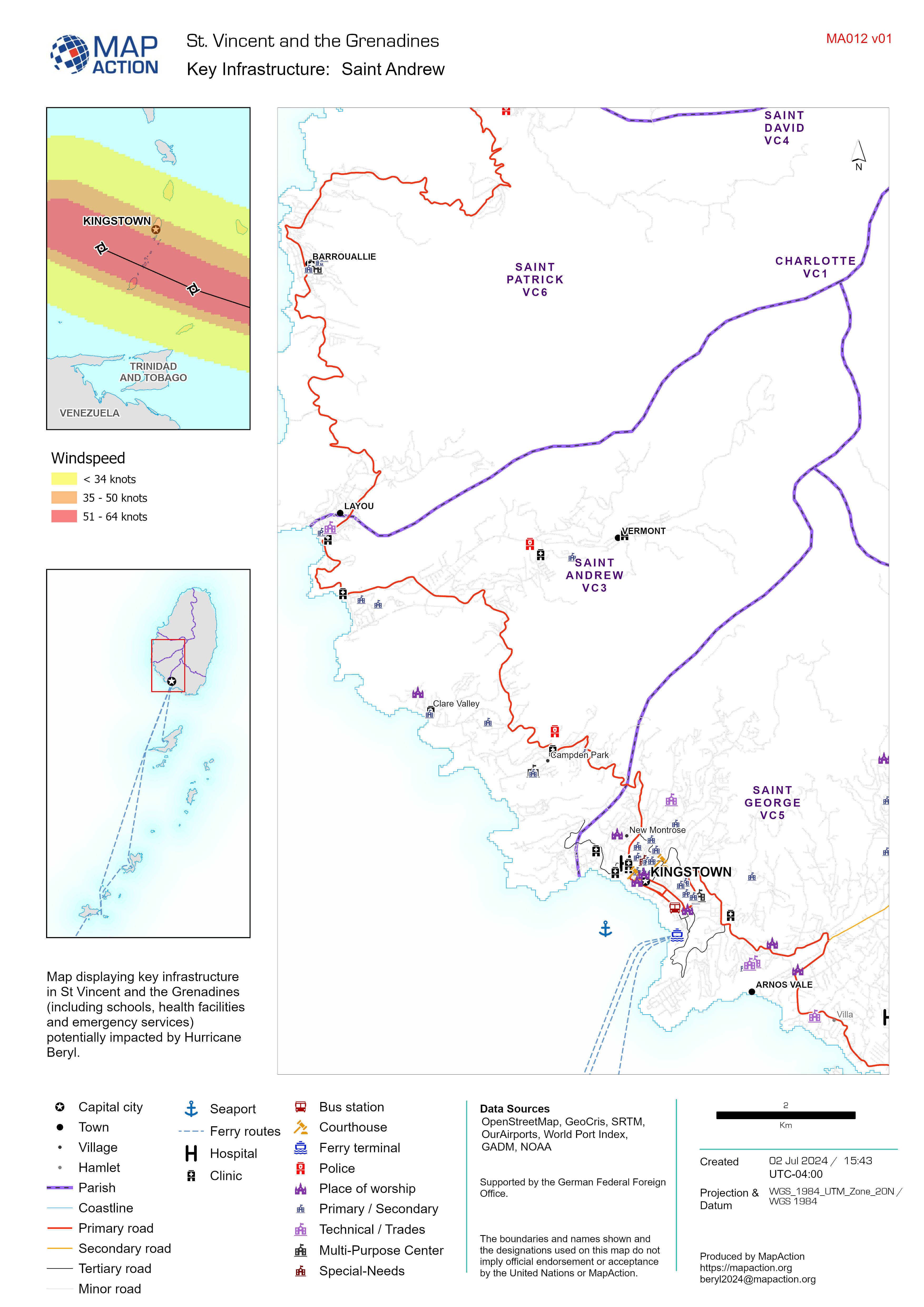
Key Infrastructure Map Atlas
Map displaying key infrastructure in St Vincent and the Grenadines (including schools, health facilities and emergency services) potentially impacted by Hurricane Beryl. -

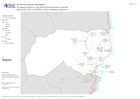
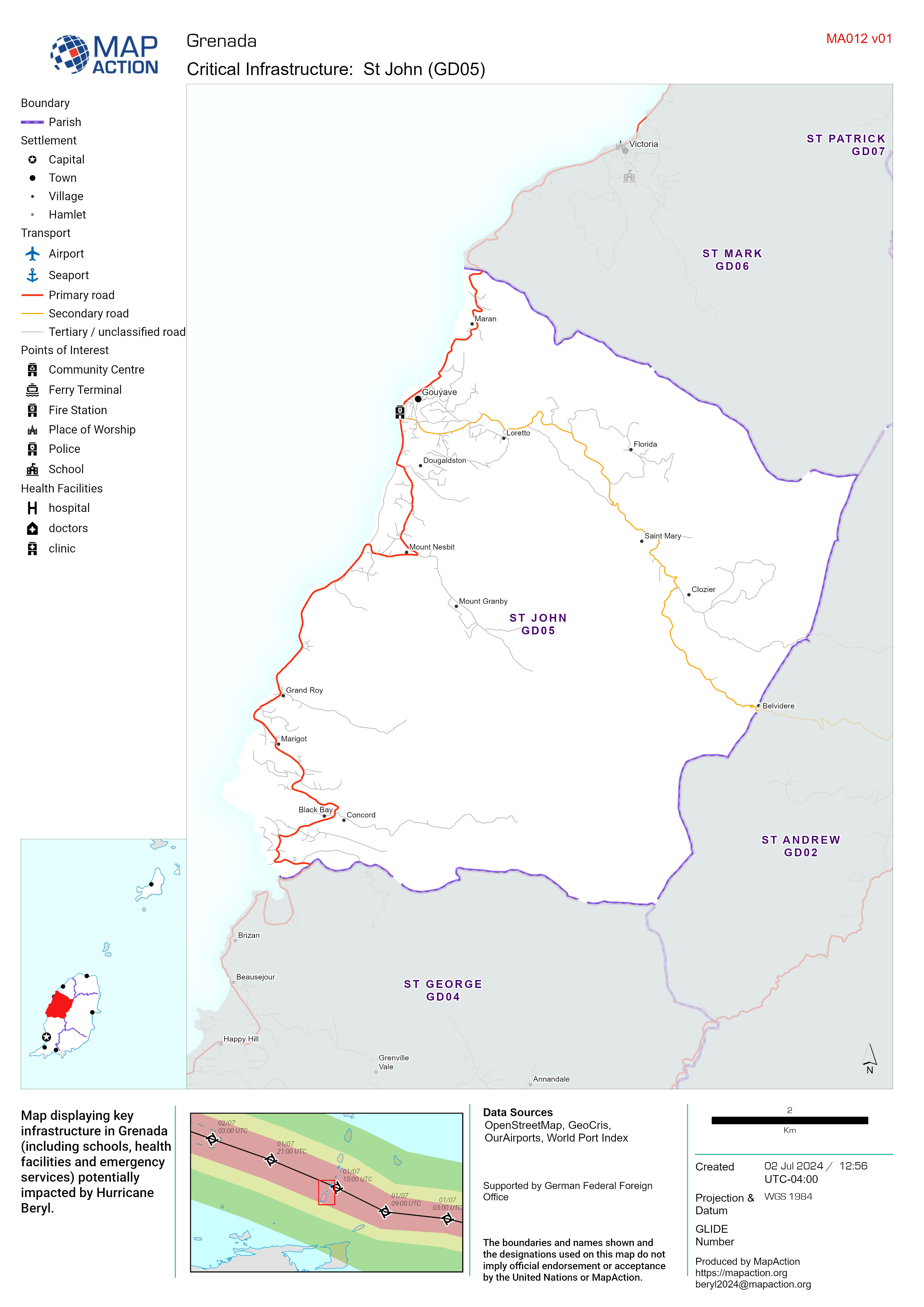
Critical Infrastructure Map Atlas
Map displaying key infrastructure in Grenada (including schools, health facilities and emergency services) potentially impacted by Hurricane Beryl. -
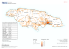
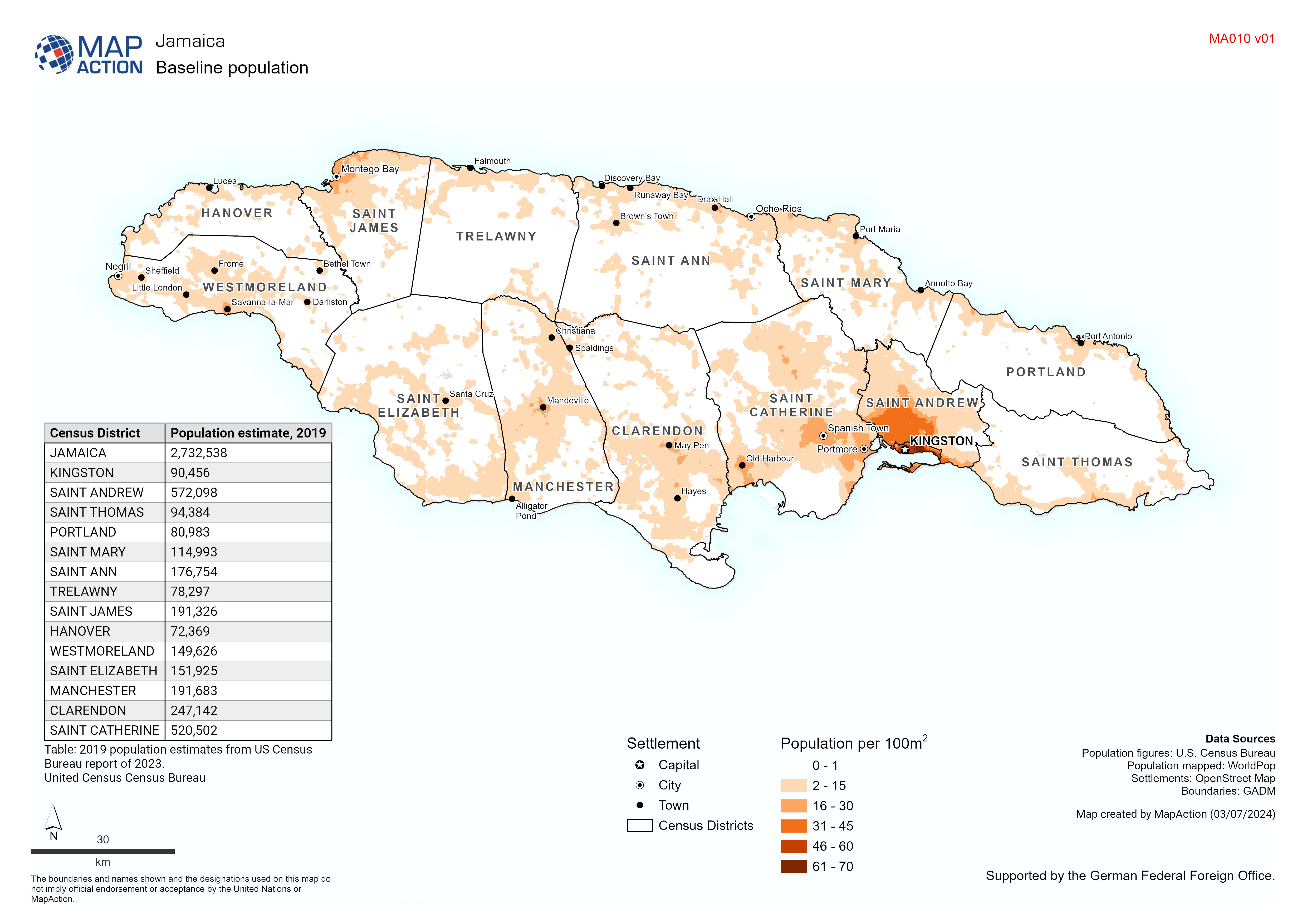
Baseline population
Baseline Population: Map based on 2020 estimate from WorldPop. Table based on 2023 estimate from U.S. Census Bureau -

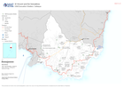
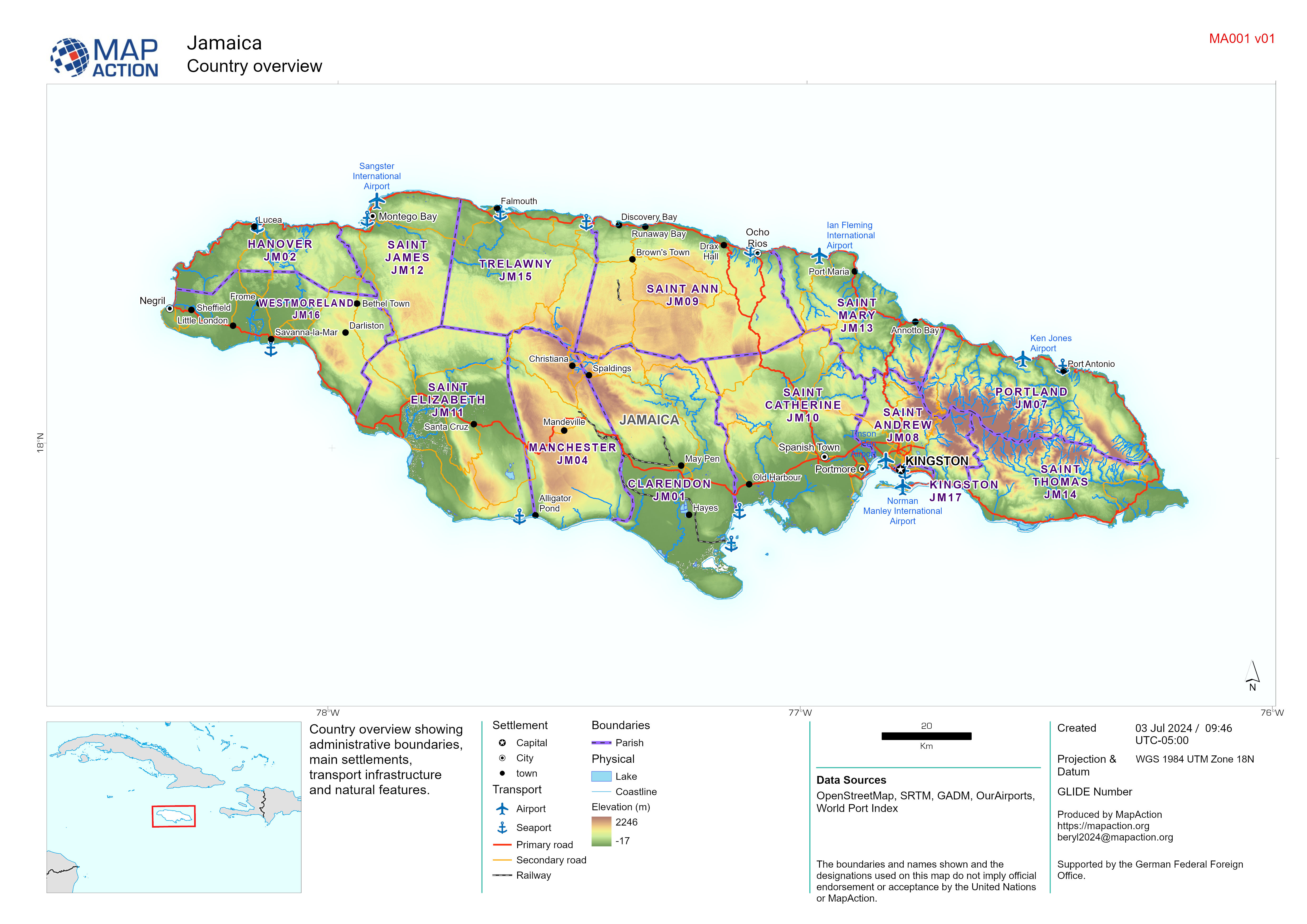
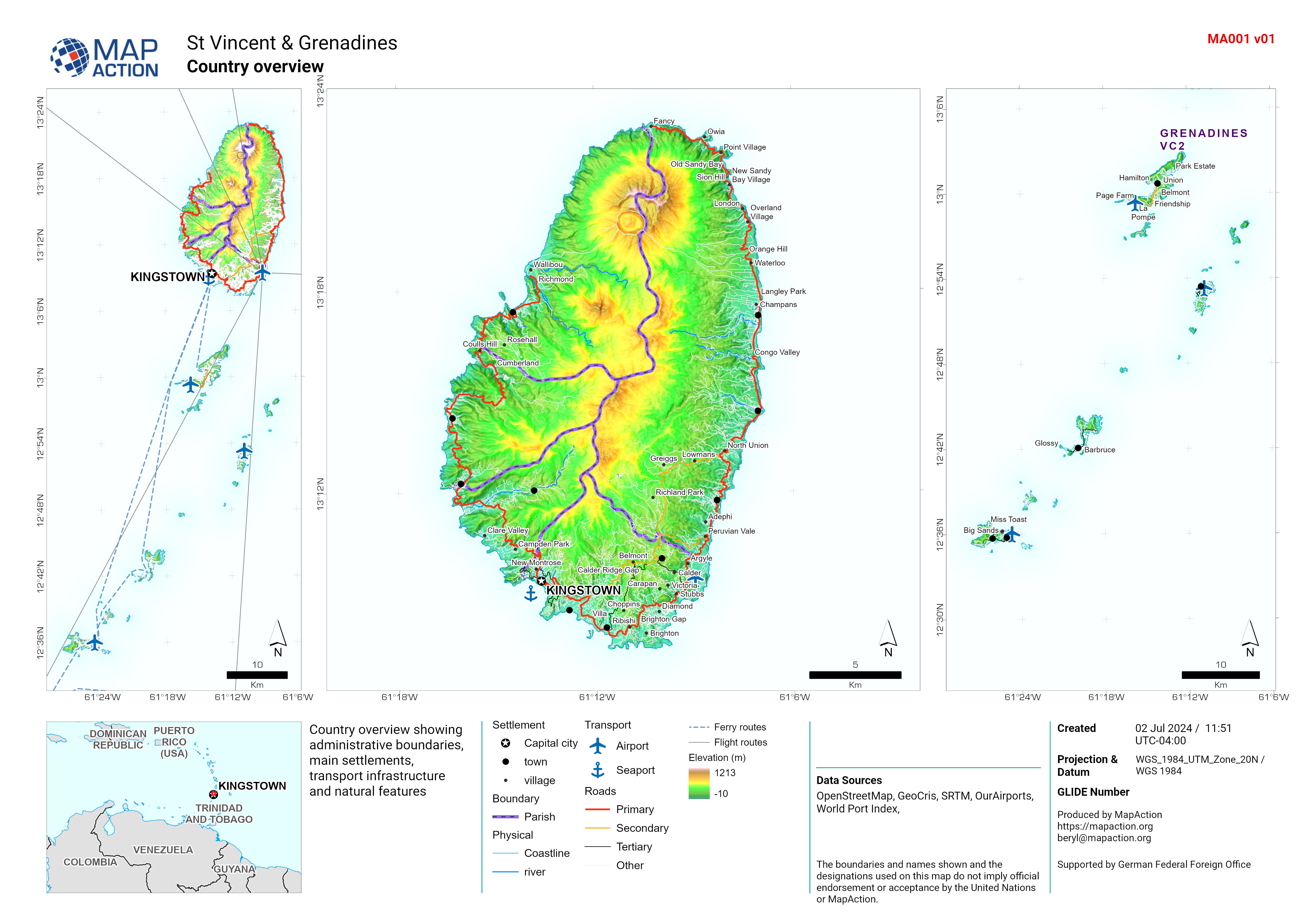
Country overview
Country overview showing administrative boundaries, main settlements, transport infrastructure and natural features. -
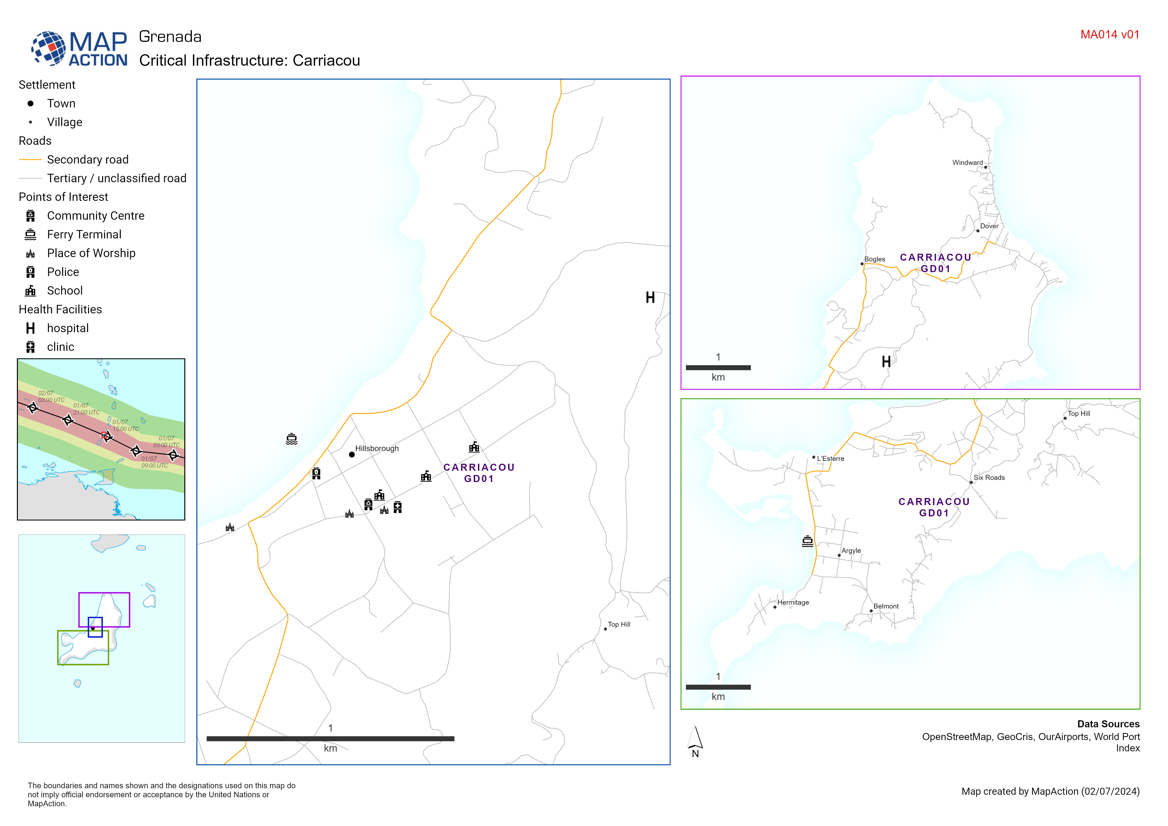
Critical Infrastructure: Carriacou
Map displaying key infrastructure in Carriacou Grenada (including schools, health facilities and emergency services) potentially impacted by Hurricane Beryl. -

Emergency Shelters for the 2024 Hurricane Season: Parish
Map shows the locations of emergency shelters identified by NaDMA Grenada for the 2024 hurricane season -
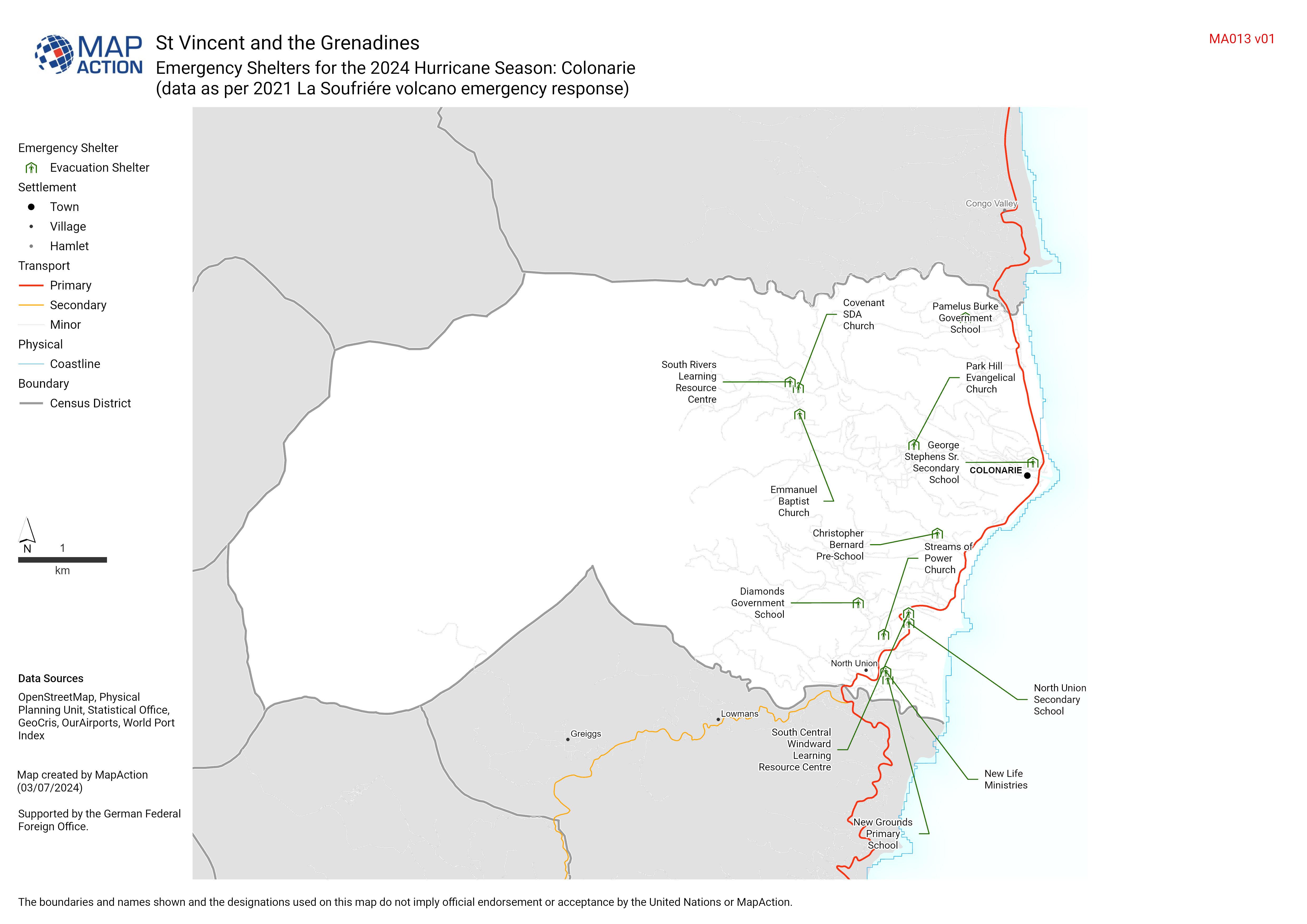
Emergency Shelters for the 2024 Hurricane Season: Census District (data as pe...
Add summary text here (update via layout tool). Even when not displayed on the map it is added to metadata -

Baseline population
Baseline Population: Map based on 2020 estimate from WorldPop Table based on 2019 estimate from Grenada Central Statistics Office -
Country overview
Country overview showing administrative boundaries, main settlements, transport infrastructure and natural features -

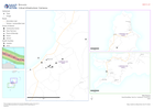
Storm path tropical cyclone Mocha (as of 14 May 2023) with baseline populatio...
Storm path as reported by Joint Typhoon Warning Centre. Population totals in table are 2022 estimates by UNFPA and US Census Bureau (USCB). Baseline population distribution... -

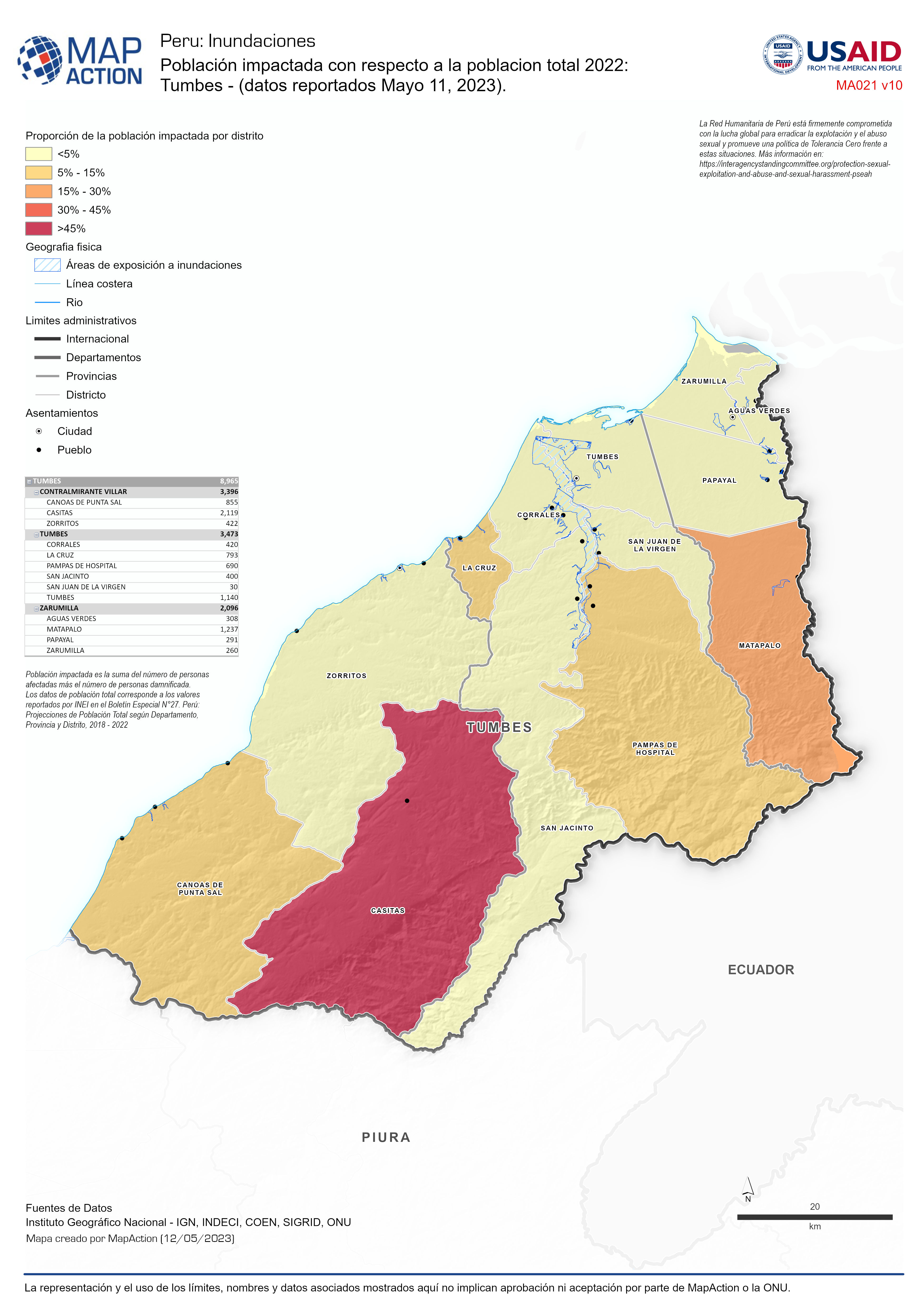
Población impactada con respecto a la poblacion total 2022: Tumbes - (datos r...
Representación de la población impactada por inundación entre en el departamentos de Tumbes. -

Número de personas en albergues: Piura - (datos reportados Mayo 11, 2023).
Representación de la población impactada y la población en albergues en el departamentos de Piura. -

Número de personas en albergues: Piura - (datos reportados Mayo 04, 2023).
Representación de la población impactada y la población en albergues en el departamentos de Piura. -

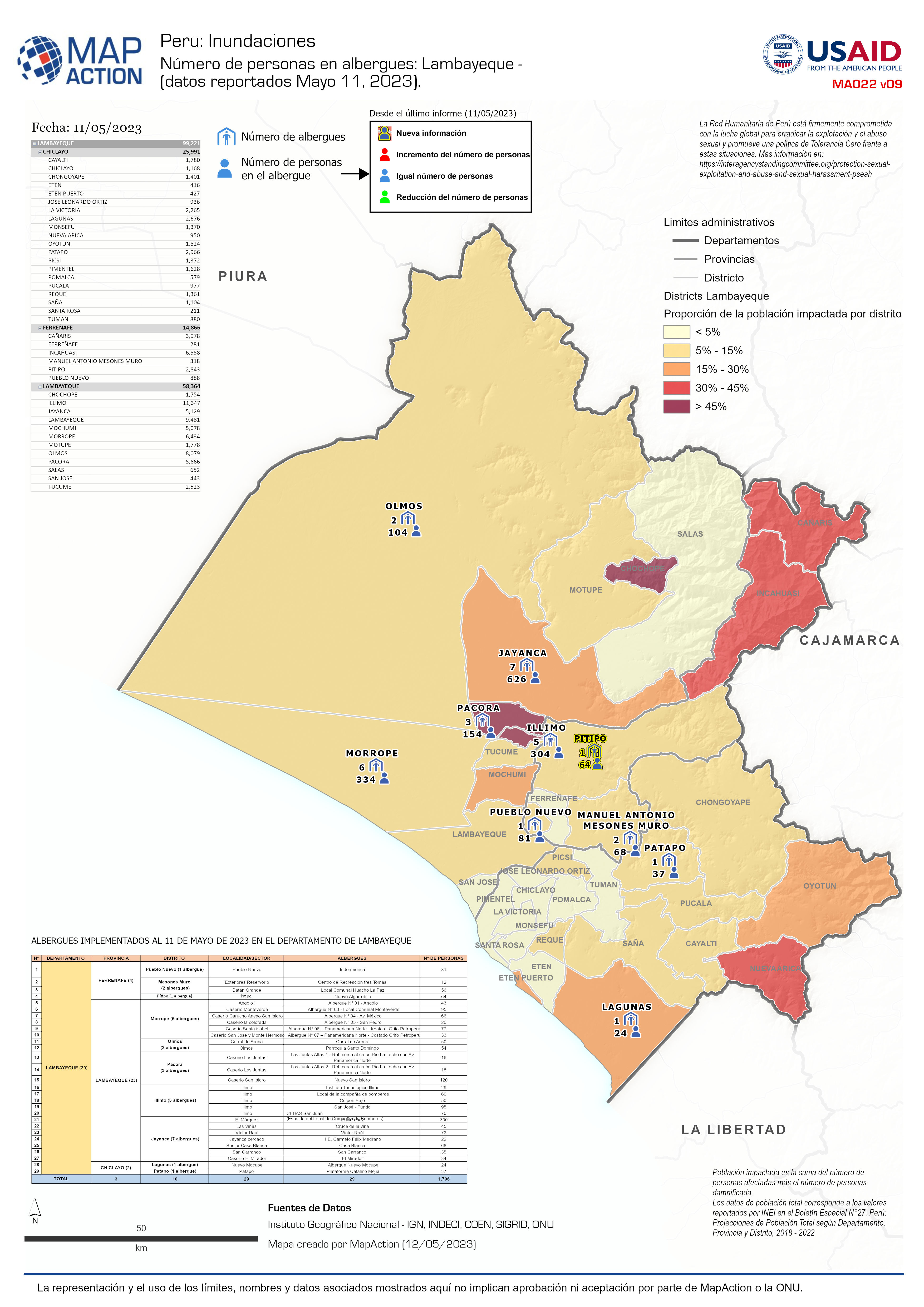
Número de personas en albergues: Lambayeque - (datos reportados Mayo 11, 2023).
Representación de la población impactada y la población en albergues en el departamentos de Lambayeque. -

Número de personas en albergues: Lambayeque - (datos reportados Mayo 04, 2023).
Representación de la población impactada y la población en albergues en el departamentos de Lambayeque. -

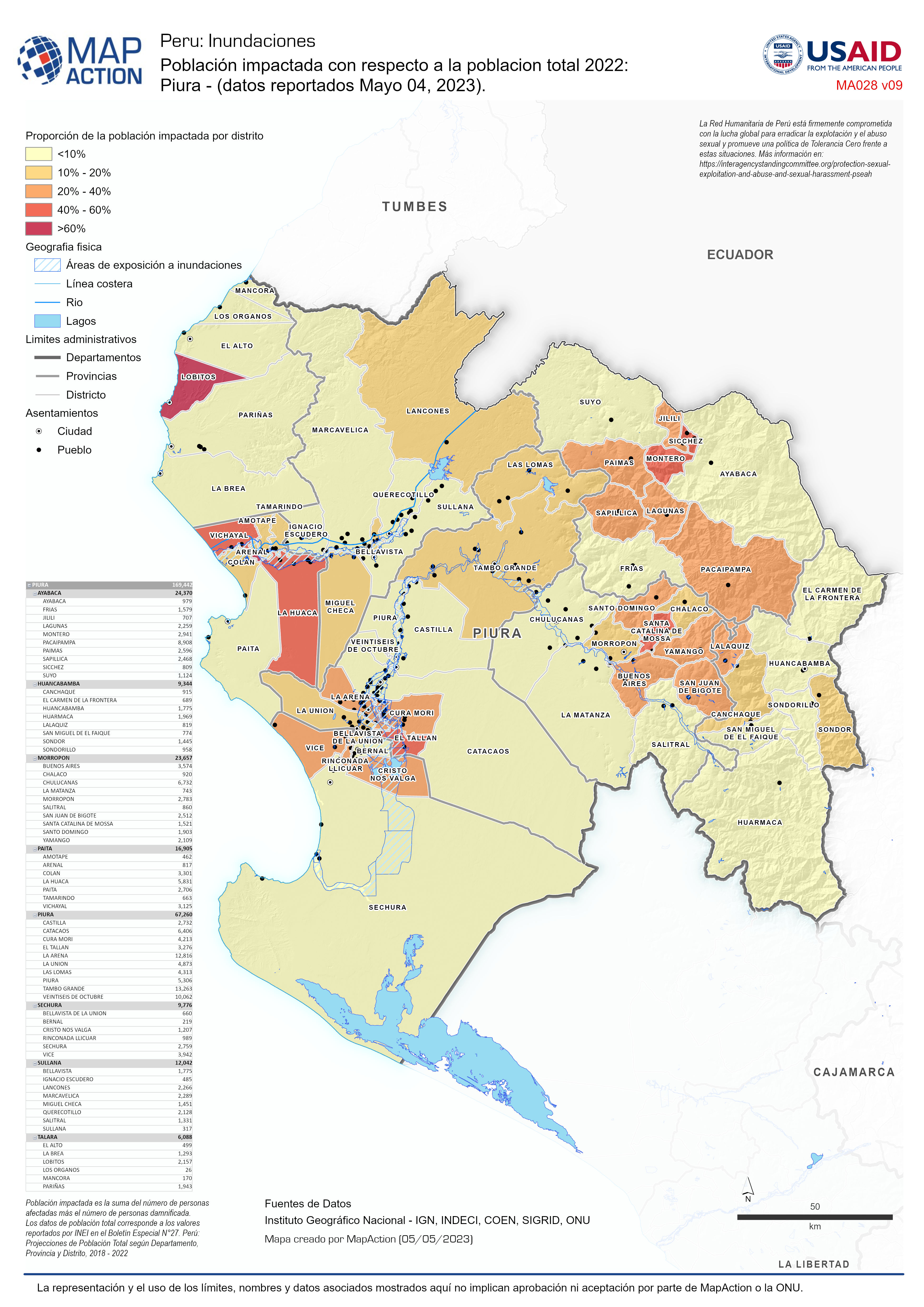
Población impactada con respecto a la poblacion total 2022: Piura - (datos re...
Representación de la población impactada por inundación entre en el departamentos de Piura. -

Población impactada con respecto a la poblacion total 2022: Piura - (datos re...
Representación de la población impactada por inundación entre en el departamentos de Piura. -

Población impactada con respecto a la poblacion total 2022: Tumbes - (datos r...
Representación de la población impactada por inundación entre en el departamentos de Tumbes. -

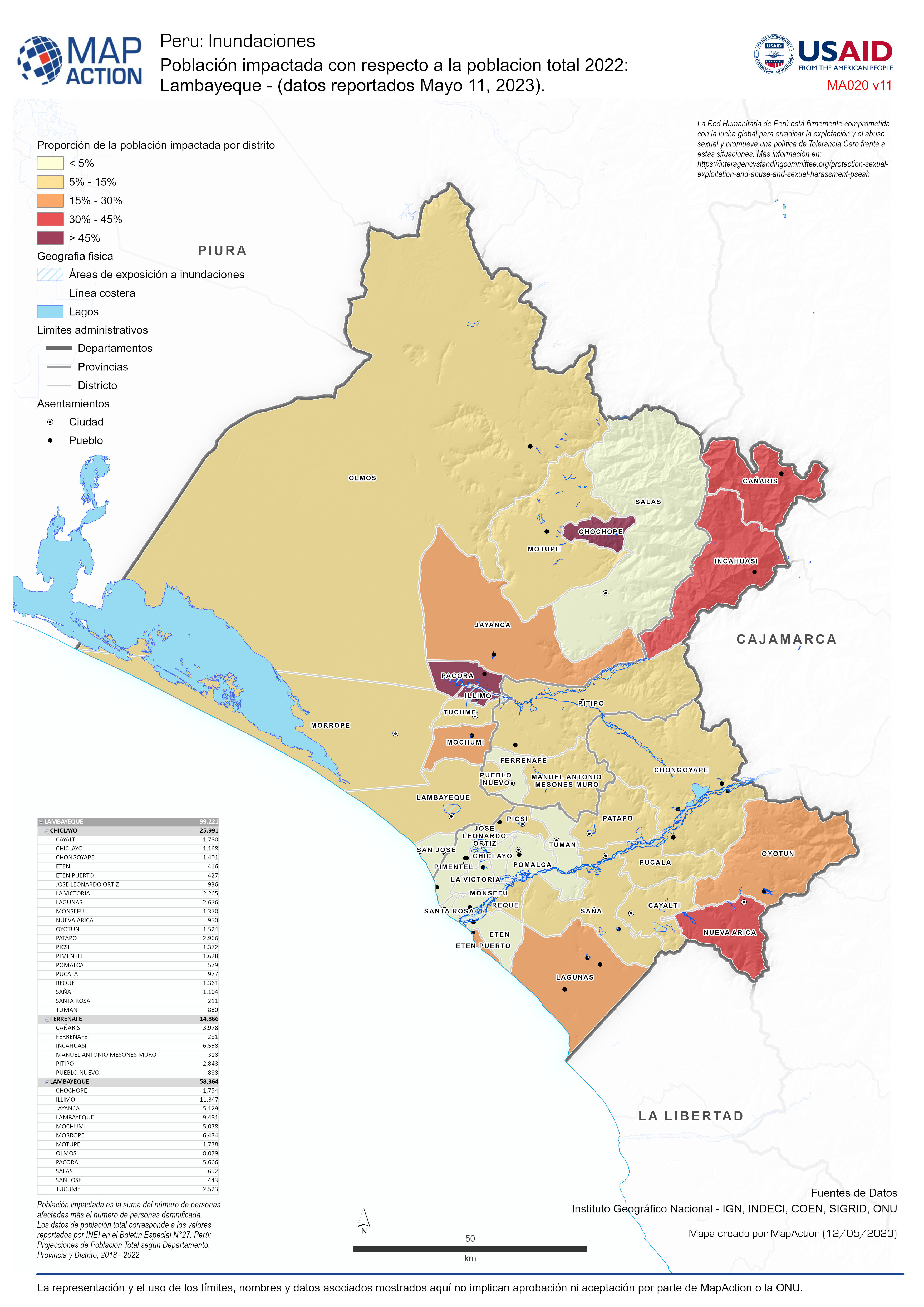
Población impactada con respecto a la poblacion total 2022: Lambayeque - (dat...
Representación de la población impactada por inundación en el departamentos de Lambayeque