-

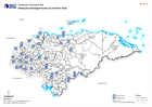
Honduras: Damaged Infrastructure in each Municipality - Departments (as at 12...
Honduras, Damaged Infrastructure as of 12:00 on 22nd Nov 2020 (Displayed per Admin 1 / Department) -
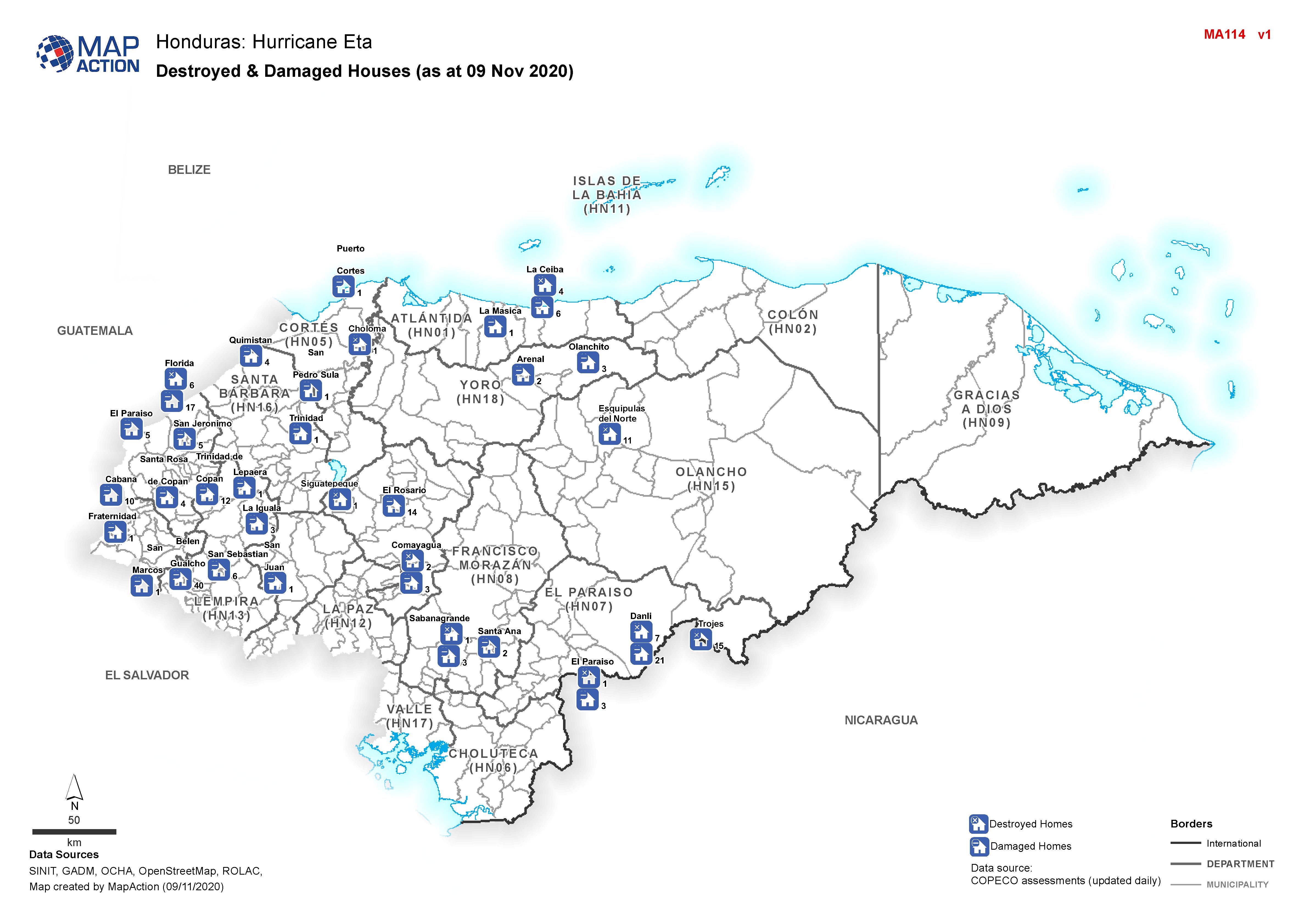
Honduras: Destroyed & Damaged Houses (as at 09 Nov 2020)
Honduras, Destroyed & Damaged Houses per Municipality as of 09th Nov 2020 -
Honduras: Destroyed & Damaged Houses in each Municipality (as at 16:00 on 21s...
Honduras, Destroyed & Damaged Houses per Municipality as of 16:00 on 21st Nov 2020 -
Honduras: Damaged Infrastructure in each Municipality (as at 16:00 21st Nov 2...
Honduras, Damaged Infrastructure as of 16:00 on 21st Nov 2020 (Displayed per Admin 1 / Department) -
Honduras: Damaged Infrastructure in each Municipality (as at 04:00 20th Nov 2...
Honduras, Damaged Infrastructure as of 04:00 on 20th Nov 2020 (Displayed per Admin 1 / Department) -
Honduras: Destroyed & Damaged Houses in each Municipality (as at 16:00 on 19t...
Honduras, Destroyed & Damaged Houses per Municipality as of 16:00 on 19th Nov 2020 -

Centro América: Huacán Iota - Trayectoria potencial de Iota e inundaciones de...
This map shows the storm track for hurricane Iota, with potentially affected administrative departments for Nicaragua and Honduras. It also includes previous flooded areas from... -
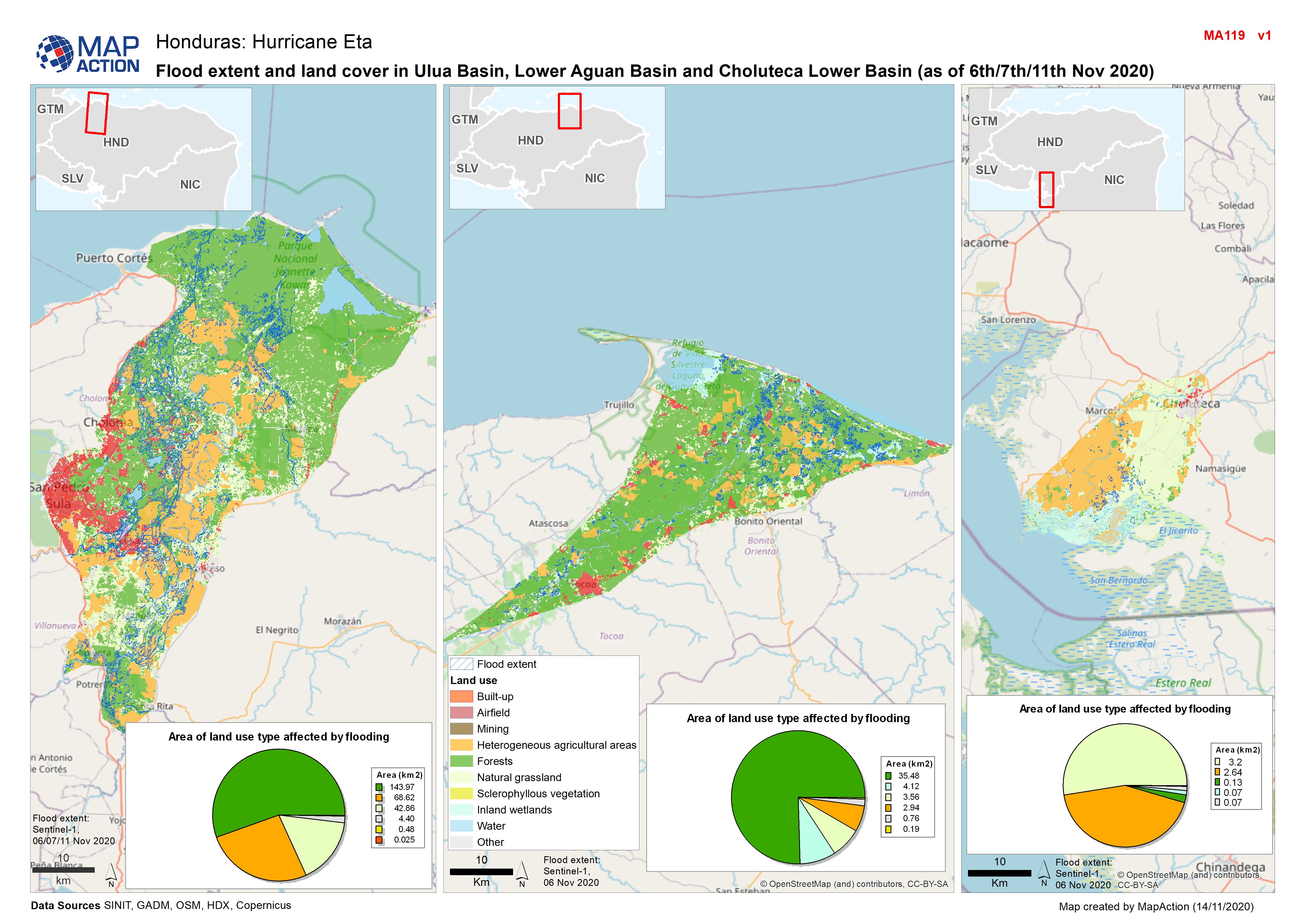
Honduras: Flood extent and land cover in Ulua Basin, Lower Aguan Basin and Ch...
Map shows flood extents and land use in Ulua Basin, Lower Aguan Basin and Choluteca Lower Basin (as at 6th/11th Nov 2020) -
Honduras: Damaged Infrastructure in each Municipality - Department (as at 16 ...
Honduras, Damaged Infrastructure as of 16th Nov 2020 (Displayed per Admin 1 / Department) -
Honduras: Destroyed & Damaged Houses in each Municipality - Department (as at...
Honduras, Destroyed & Damaged Houses per Municipality as of 16th Nov 2020 -
Honduras: Destroyed & Damaged Houses in each Municipality - Department (as at...
Honduras, Destroyed & Damaged Houses per Municipality as of 15th Nov 2020 -
Honduras: Damaged Infrastructure in each Municipality - Department (as at 15 ...
Honduras, Damaged Infrastructure as of 15th Nov 2020 (Displayed per Admin 1 / Department) -

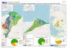
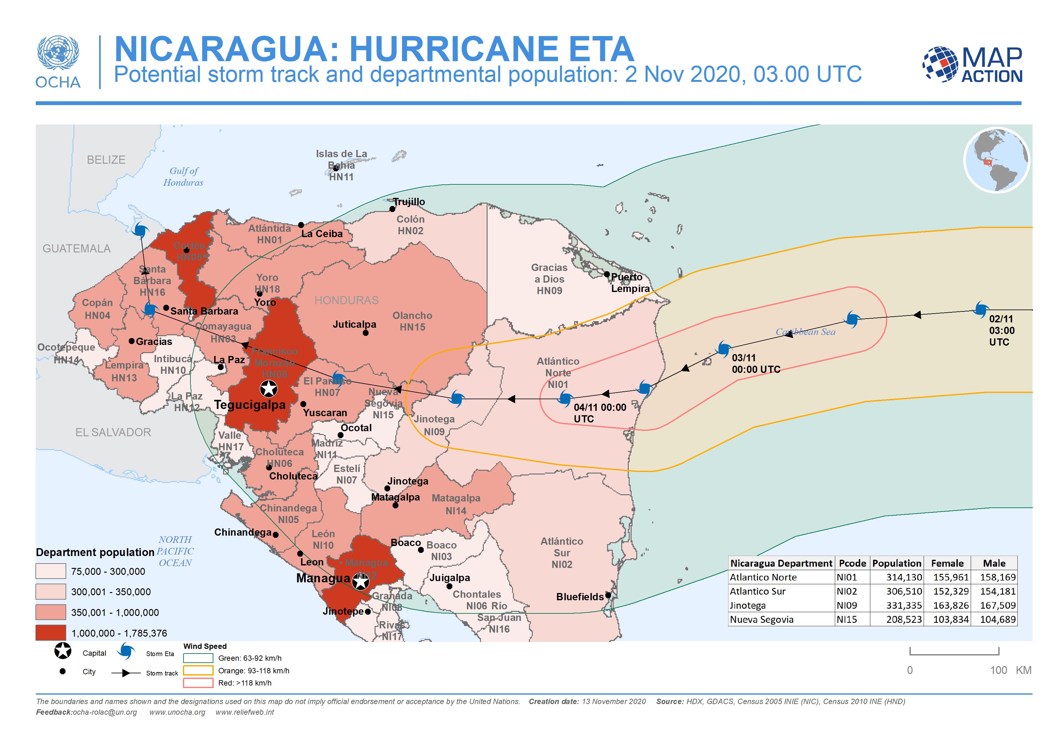
Nicaragua: Potential storm track and departmental population: 2 Nov 2020, 03....
This map shows the potentially affected administration level 1 departments for Nicaragua and Honduras, with departmental population and predicted wind speed cones. -

Nicaragua: Potential storm track, elevation and municipalities: 4 Nov 2020, 0...
This map shows the Hurricane Eta affected administration level 2 municipalities for Nicaragua with predicted wind speed cones, aganst elevation data and settlement locations. -

Nicaragua: Potential storm track, elevation and municipalities: 3 Nov 2020, ...
This map shows the affected administration level 2 municipalities for Nicaragua, with population estimates and predicted wind speed cones. -
Honduras: Destroyed & Damaged Houses in each Municipality - Department (as at...
Honduras, Destroyed & Damaged Houses per Municipality as of 14th Nov 2020 -
Honduras: Damaged Infrastructure in each Municipality - Department (as at 14 ...
Honduras, Damaged Infrastructure as of 14th Nov 2020 (Displayed per Admin 1 / Department) -
Honduras: Damaged Infrastructure in each Municipality - Department (as at 13 ...
Honduras, Damaged Infrastructure as of 13th Nov 2020 (Displayed per Admin 1 / Department) -
Honduras: Destroyed & Damaged Houses in each Municipality - Department (as at...
Honduras, Destroyed & Damaged Houses per Municipality as of 13th Nov 2020 -
Honduras: Damaged Infrastructure in each Municipality - Department (as at 12 ...
Honduras, Damaged Infrastructure as of 12th Nov 2020 (Displayed per Admin 1 / Department)