-

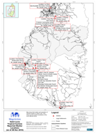
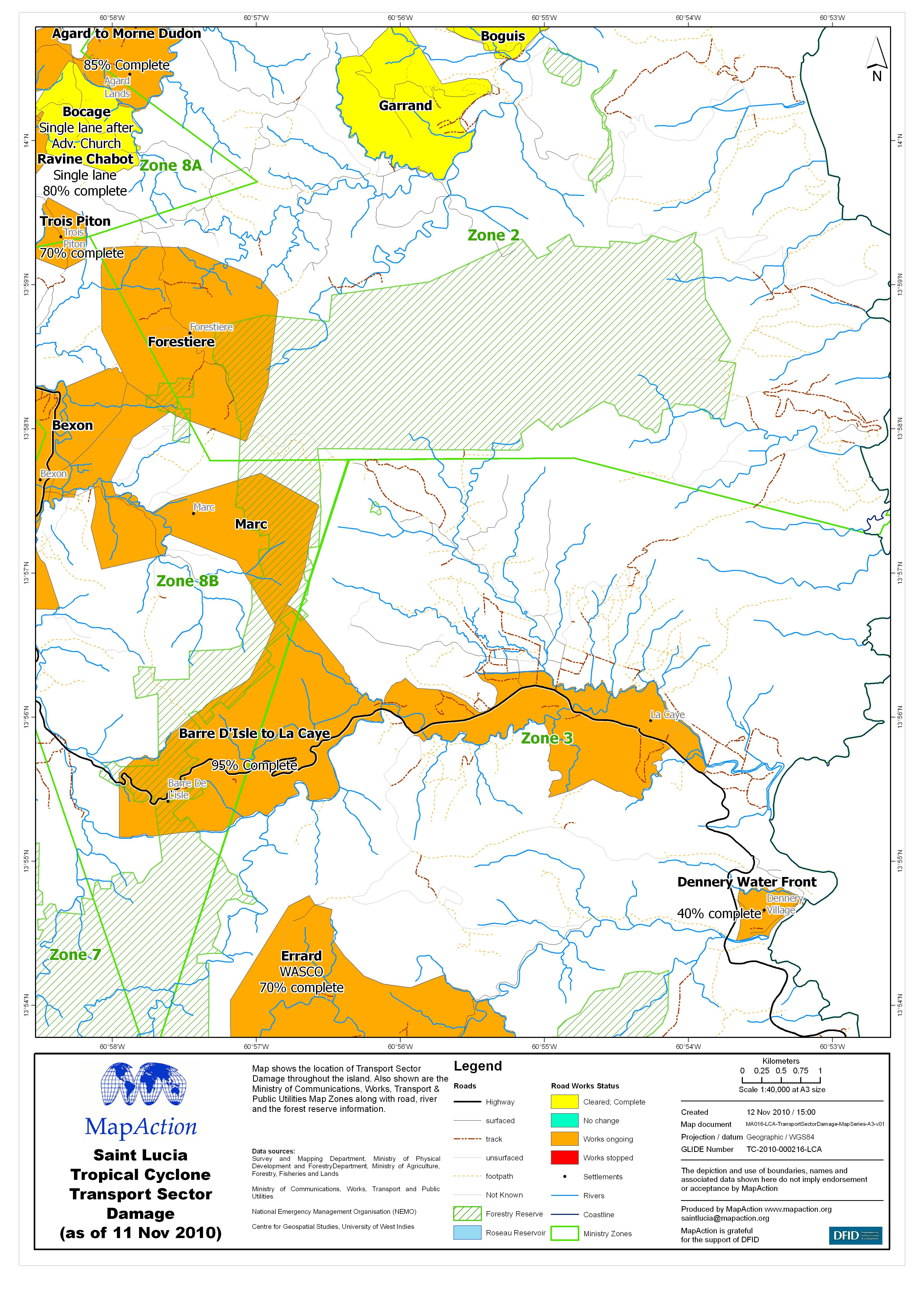
Saint Lucia Tropical Cyclone Transport Sector Damage (as of 11 Nov 2010) - Ma...
Map shows the location of Transport Sector Damage throughout the island. Also shown are the Ministry of Communications, Works, Transport & Public Utilities Map Zones along... -
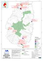
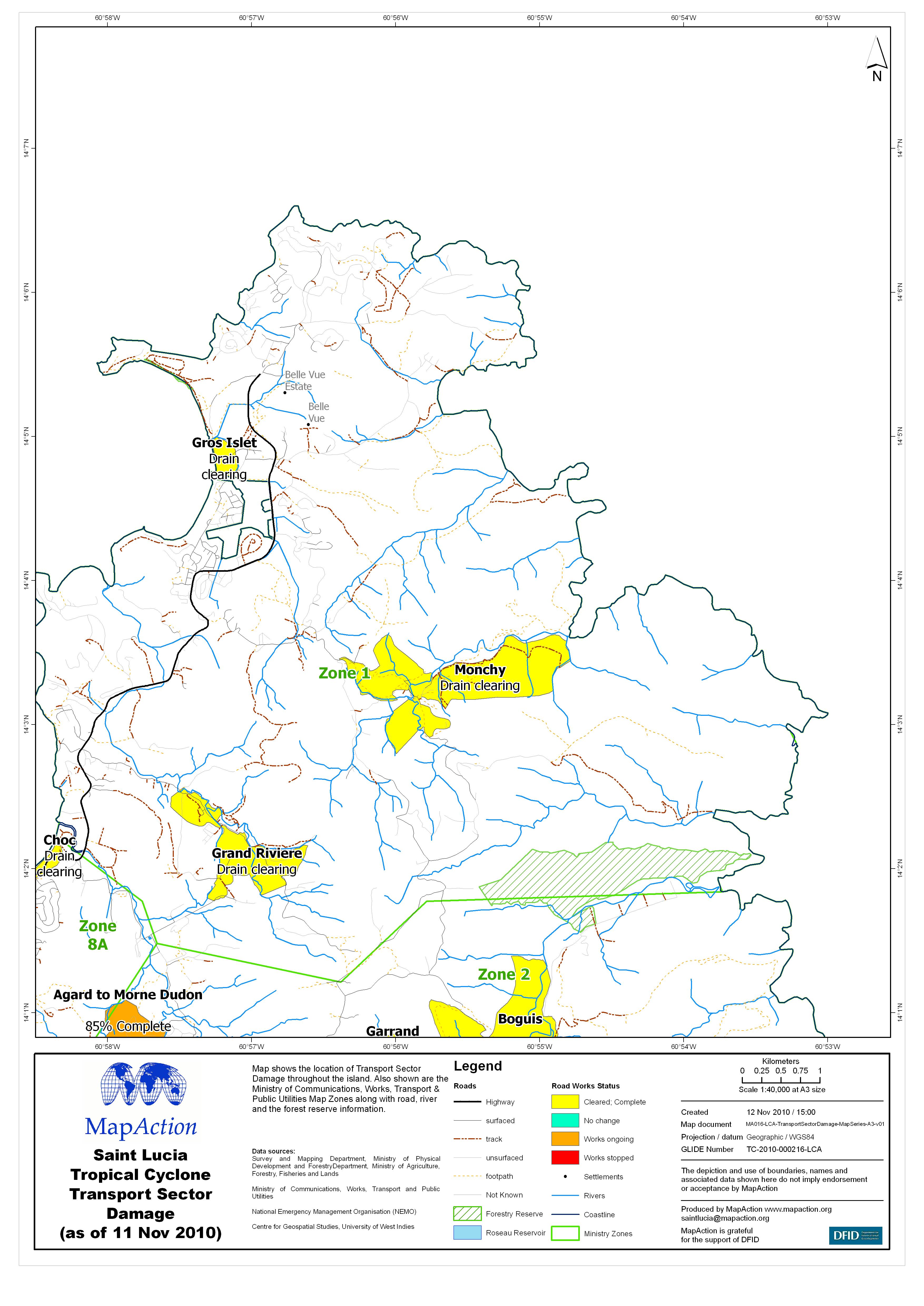
Saint Lucia Tropical Cyclone Transport Sector Damage (as of 11 Nov 2010) - Ma...
Map shows the location of Transport Sector Damage throughout the island. Also shown are the Ministry of Communications, Works, Transport & Public Utilities Map Zones along... -

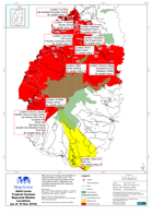
Saint Lucia Tropical Cyclone Transport Sector Damage (as of 11 Nov 2010) - Ma...
Map shows the location of Transport Sector Damage throughout the island. Also shown are the Ministry of Communications, Works, Transport & Public Utilities Map Zones along... -
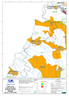
Saint Lucia Tropical Cyclone Transport Sector Damage (as of 11 Nov 2010) - Ma...
Map shows the location of Transport Sector Damage throughout the island. Also shown are the Ministry of Communications, Works, Transport & Public Utilities Map Zones along... -
Saint Lucia Tropical Cyclone Reported Shelter Locations (as of 10 Nov 2010)
Map shows the location and population of reported shelters in Saint Lucia. Also shown are the quarter boundaries of the worst affected areas, settlements with population greater... -
Saint Lucia Tropical Cyclone Education Sector Damage (as of 08 Nov 2010)
Map shows the location of education buildings with reported damage. Also shown are the quarter boundaries, the national forest reserve, roads and the settlements highlighted... -

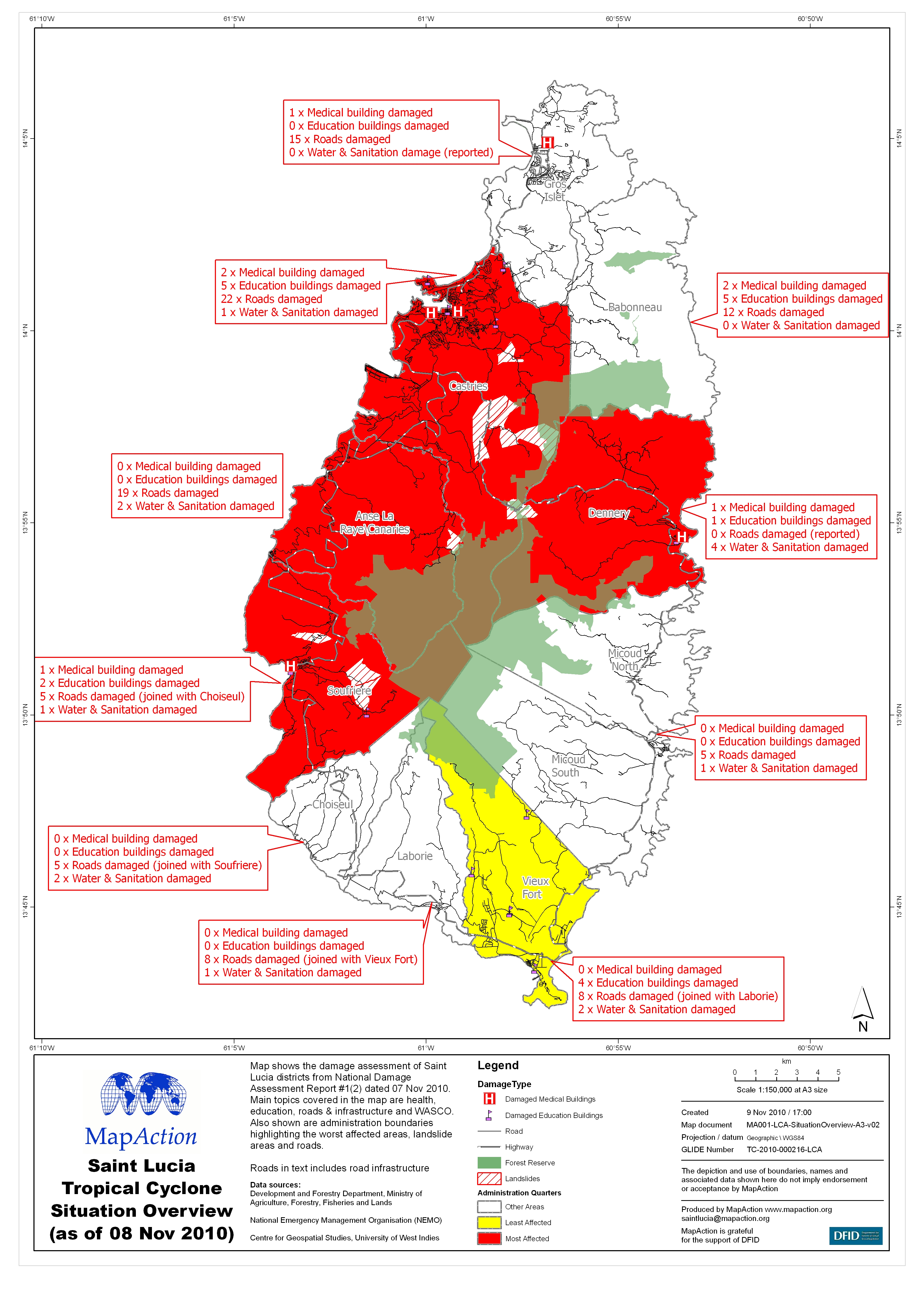
Saint Lucia Tropical Cyclone Situation Overview(as of 08 Nov 2010)
Map shows the damage assessment of Saint Lucia districts from National Damage Assessment Report #1(2) dated 07 Nov 2010. Main topics covered in the map are health,education,... -

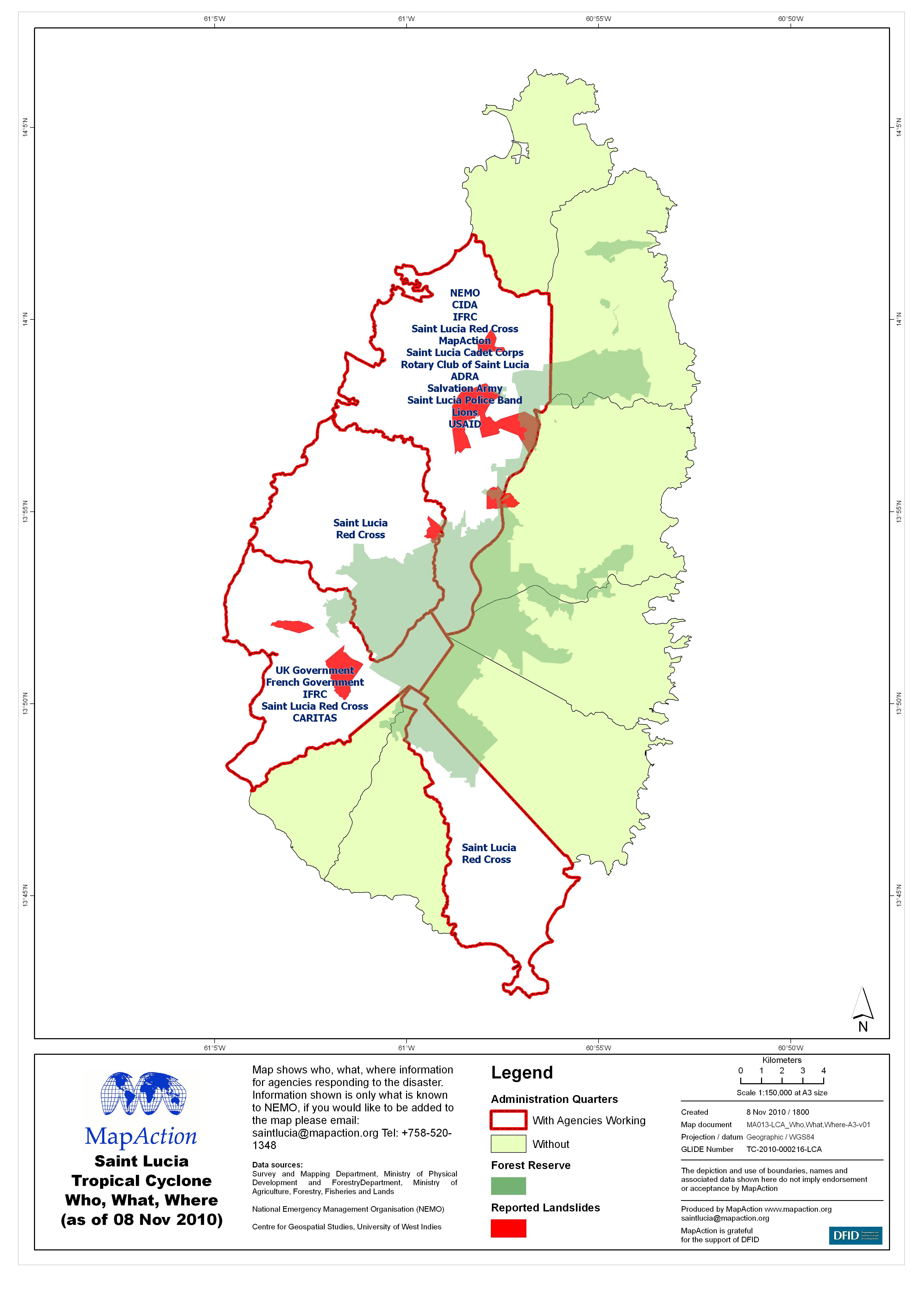
Saint Lucia Tropical Cyclone Who, What, Where (as of 08 Nov 2010)
Map shows who, what, where information for agencies responding to the disaster. Information shown is only what is known to NEMO, if you would like to be added to the map please... -
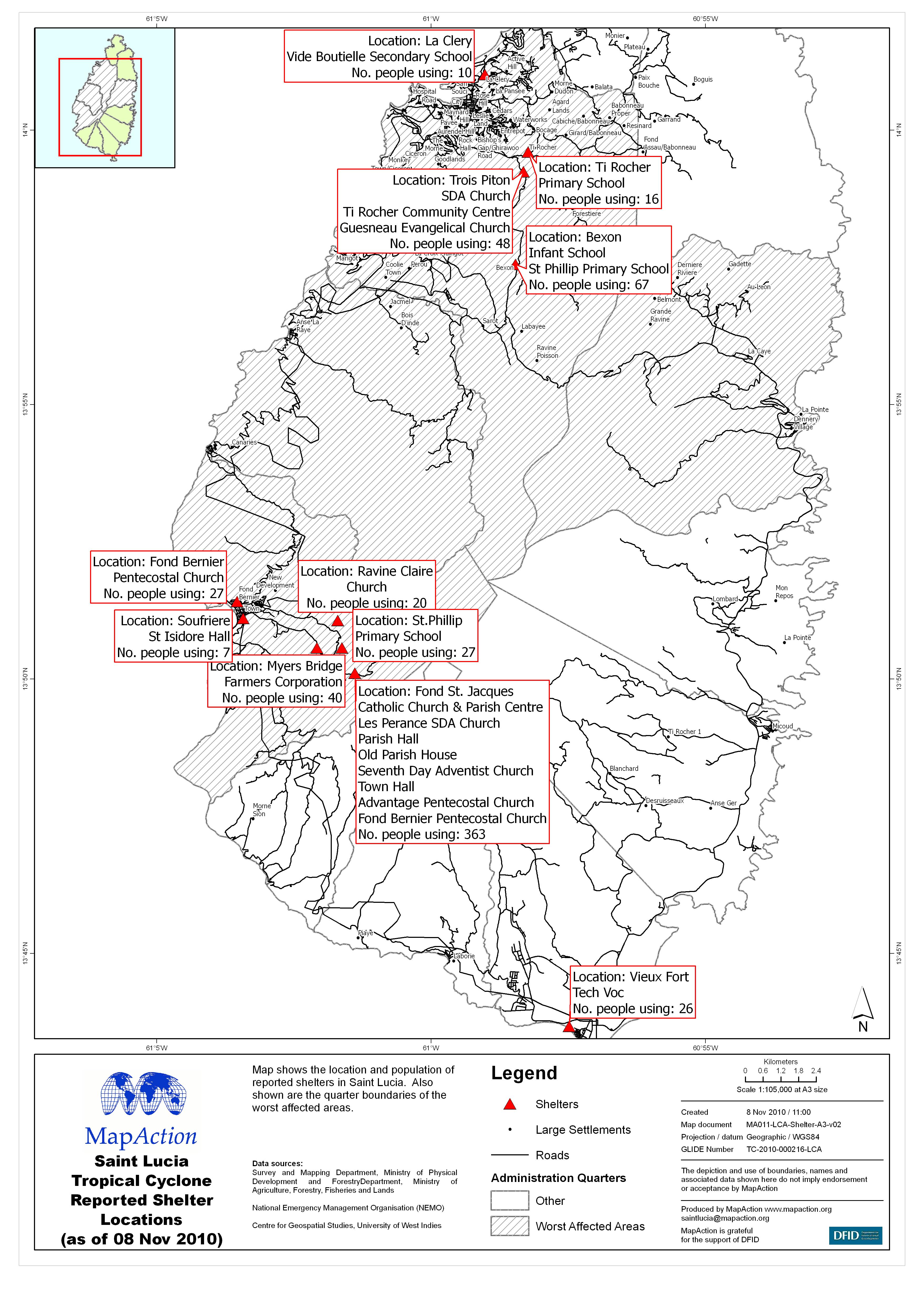
Saint Lucia Tropical Cyclone Reported Shelter Locations (as of 08 Nov 2010)
Map shows the location and population of reported shelters in Saint Lucia. Also shown are the quarter boundaries of the worst affected areas. -

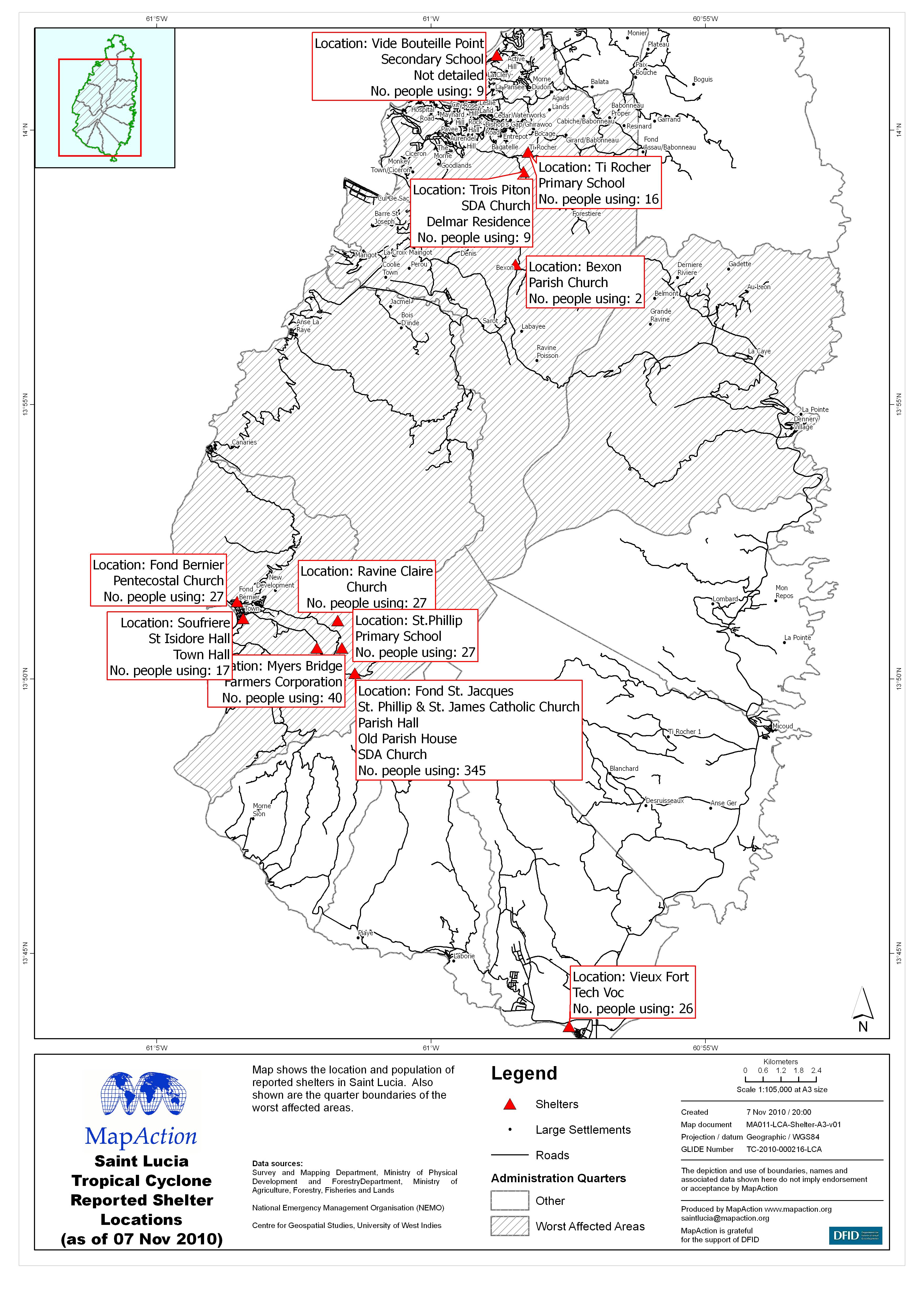
Saint Lucia Tropical Cyclone Reported Shelter Locations (as of 07 Nov 2010)
Map shows the location and population of reported shelters in Saint Lucia. Also shown are the quarter boundaries of the worst affected areas. -
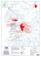
Saint Lucia Tropical Cyclone Soufriere Damage Assessment (as of 07 Nov 2010)
Map shows the localised damage assessment of Soufriere Quarters taken from National Damage Assessment Report #1 dated 30-Oct-2010 & NEMO Sit Rep, 07-Nov-2010. Also shown are... -
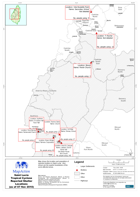
Saint Lucia Tropical Cyclone Dennery North & South Damage Assessment (as of 3...
Map shows the localised damage assessment of Dennery North and South Quarters taken fromNational Damage Assessment Report #1 dated 30-Oct-2010. Also shown are the major... -
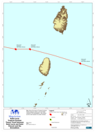
Saint Lucia Tropical Cyclone Tomas Track between Saint Lucia and Saint Vincen...
Map shows the track of Tropical Cyclone Tomas between Saint Lucia and Saint Vincent & The Grenadines. Also shown are the wind speeds for points tracked. -
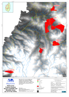
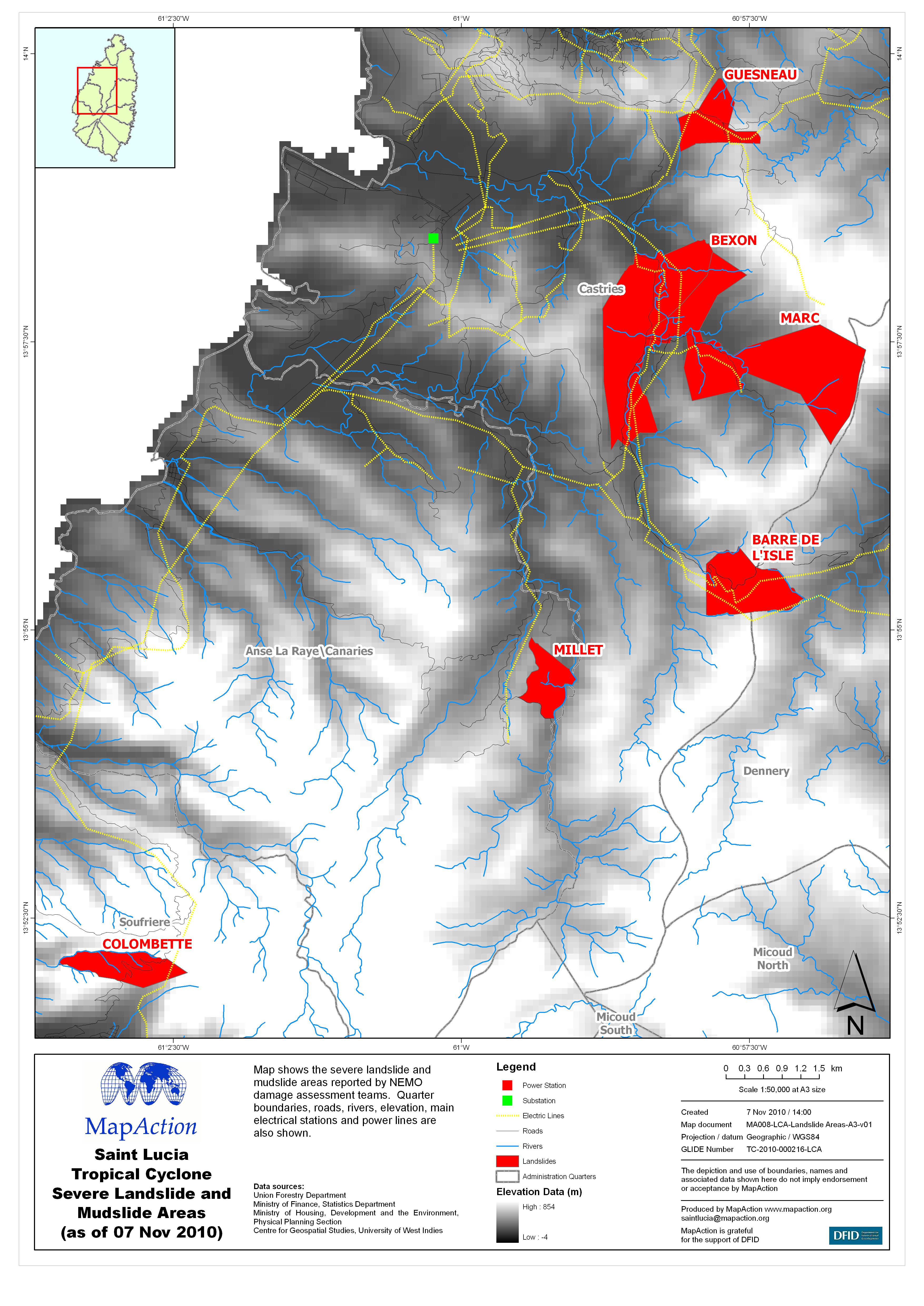
Saint Lucia Tropical Cyclone Severe Landslide and Mudslide Areas (as of 07 No...
Map shows the severe landslide and mudslide areas reported by NEMO damage assessment teams. Quarter boundaries, roads, rivers, elevation, main electrical stations and power... -
Saint Lucia Tropical Cyclone Reported Shelter Locations (as of 07 Nov 2010)
Map shows the location and population of reported shelters in Saint Lucia. Also shown are the quarter boundaries of the worst affected areas. -

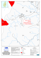
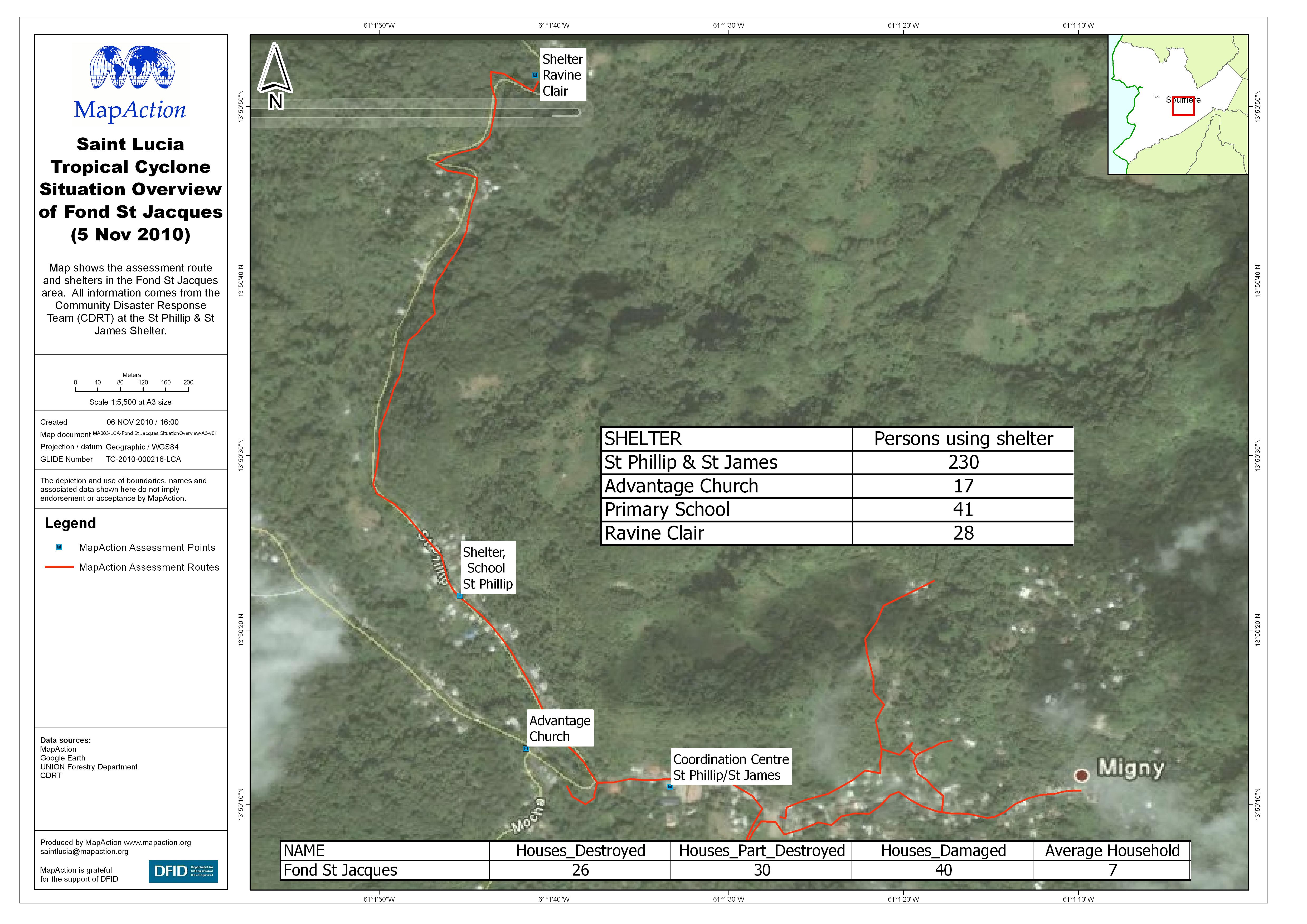
Saint Lucia Tropical Cyclone Situation Overview of Fond St Jacques (5 Nov 2010)
Map shows the assessment route and shelters in the Fond St Jacques area. All information comes from the Community Disaster Response Team (CDRT) at the St Phillip & St James... -

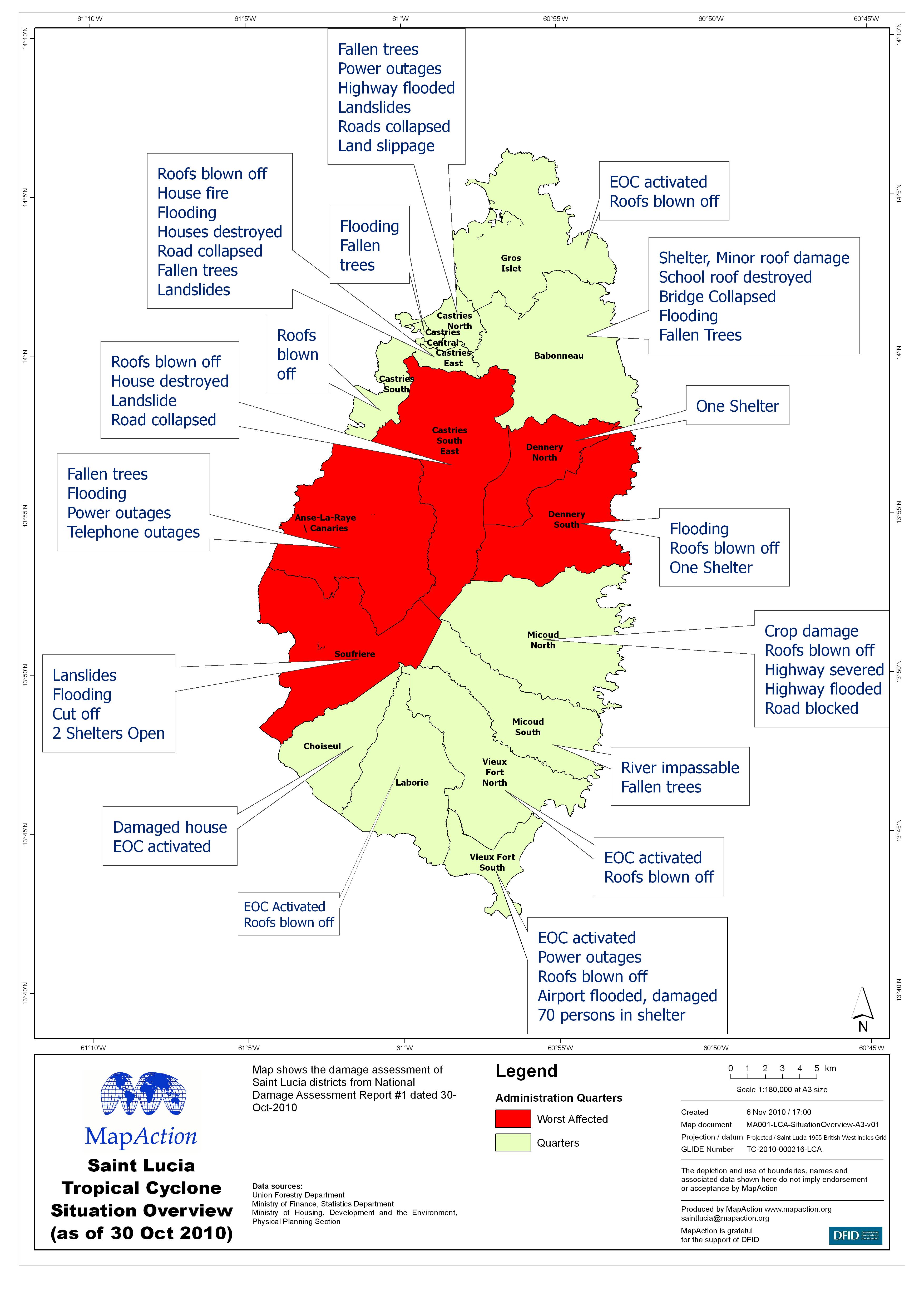
Saint Lucia Tropical Cyclone Situation Overview (as of 30 Oct 2010)
Map shows the damage assessment of Saint Lucia districts from National Damage Assessment Report #1 dated 30-Oct-2010 -
Libya: Complex - Change in individuals staying at Choucha Camp, Tunisia, by n...
This dataset has no description
-
Libya: Complex - Individuals by nationality staying at Choucha Camp, Tunisia,...
This dataset has no description
-

Libya: Complex - (Tunisia) Who-What-Where and WhenOverview (at 13 March 2011)
Map shows WHO is doing WHAT WHERE and WHEN in terms of humanitarian operations in the Tunisian/Libyan border region as known at 17:00 13 March. This is a summary map of all...