-

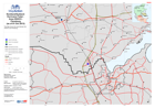
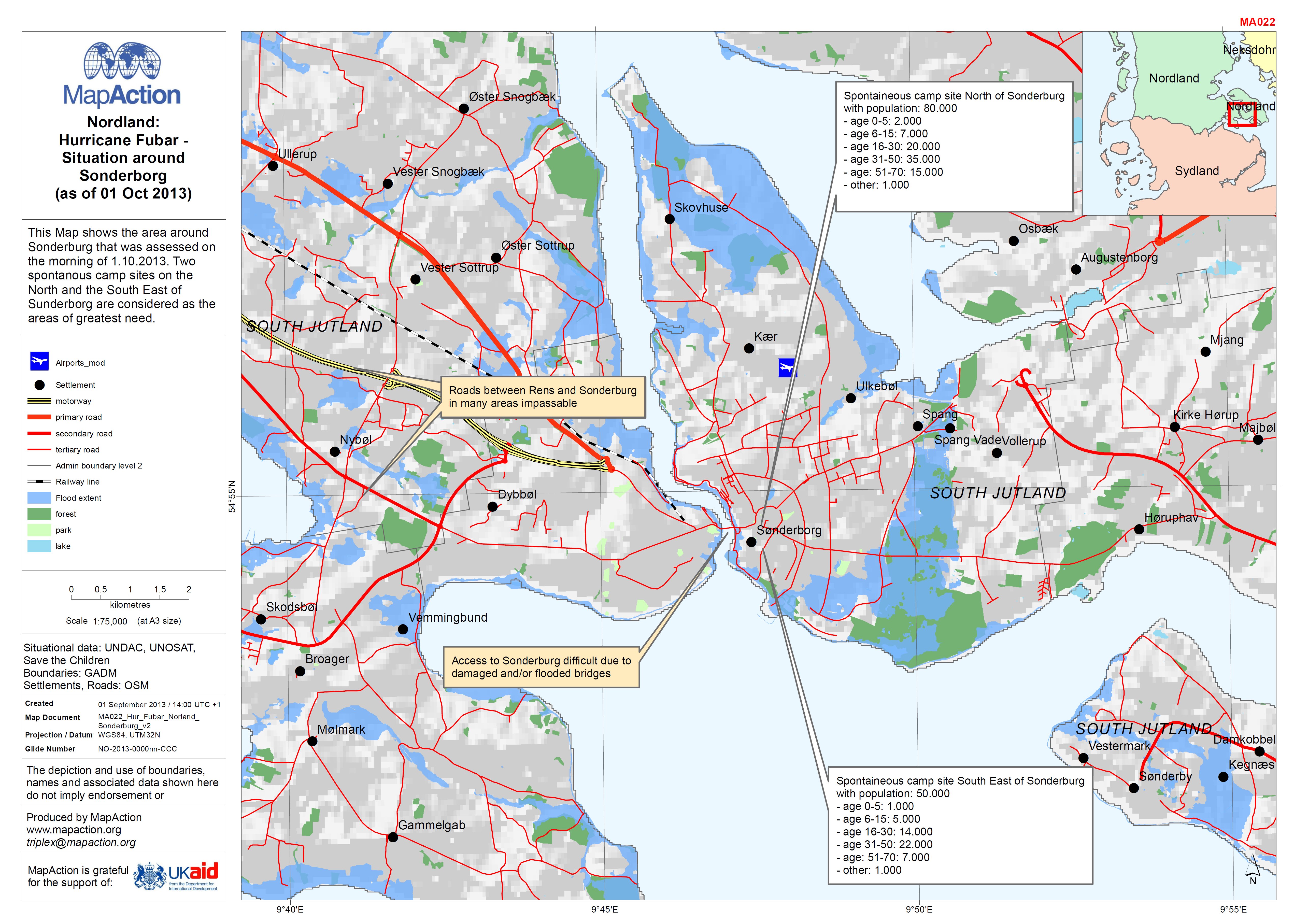
EXERCISE: Nordland: Hurricane Fubar - Situation around Sonderborg (as of 01 O...
This Map shows the area around Sonderburg that was assessed on the morning of 1.10.2013. Two spontanous camp sites on the North and the South East of Sunderborg are considered... -
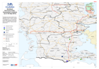
EXERCISE: Hurricane Fubar - Nordland/Sydland Shelter overview (as of 01 Oct 2...
This map shows the general situation overview including the likely area to be flooded as well as number of IDPs in camps on the morning of 1.10.2013. The Camp location are only... -
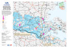
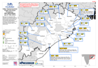
EXERCISE: Nordland/Sydland: Hurricane Fubar - Area OSOCC Flensburg (as of 01 ...
This Map shows the area between the OSOCC and Flensburg. -

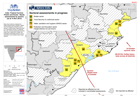
EXERCISE: Hurricane Fubar - Nordland/Sydland Assessment Results (as of 01 Oct...
This Map shows the general situation overview including the likely area to be flooded and some of the results from the assessments on the morning of 01.10.2013. -

EXERCISE: Nordland: Hurricane Fubar - Medical Facilities (as of 30 Sept 2013)
This Map shows the southern part of Nordland and its medical facilities.Operational status has not been validated. -

EXERCISE: Nordland: Hurricane Fubar - possible impact of oil spill (as of 30 ...
This Map shows the country of Nordland and Neksdohr with the location and impact of the oil spill. It also shows basic situational data and roads. -
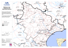
EXERCISE - Nordland: Hurricane Fubar - Assessment locations (as of 30 Sept 2013)
This Map shows the 6 locations to be assessed on the morning of 1.10.2013. The priority areas 1 - 6 were identified by the NEMA. Locations 1 and 3 are airport. Their status and... -
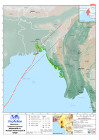
ndia: Tropical Cyclone Phailin - Reported affected population (as at 28 Oct 2...
Map shows data for districts in Odisha state, plus one district of Andhra Preadesh. Figures are shown for percentages of district populations as reported by Government (taking... -
India: Tropical Cyclone Phailin and Flood Emergency - Who-What-Where(as of 7 ...
Map shows who-what-where (3W) information on humanitarian responses following Tropical Cyclone Phailin, and further flooding, during October 2013. The map shows relief... -

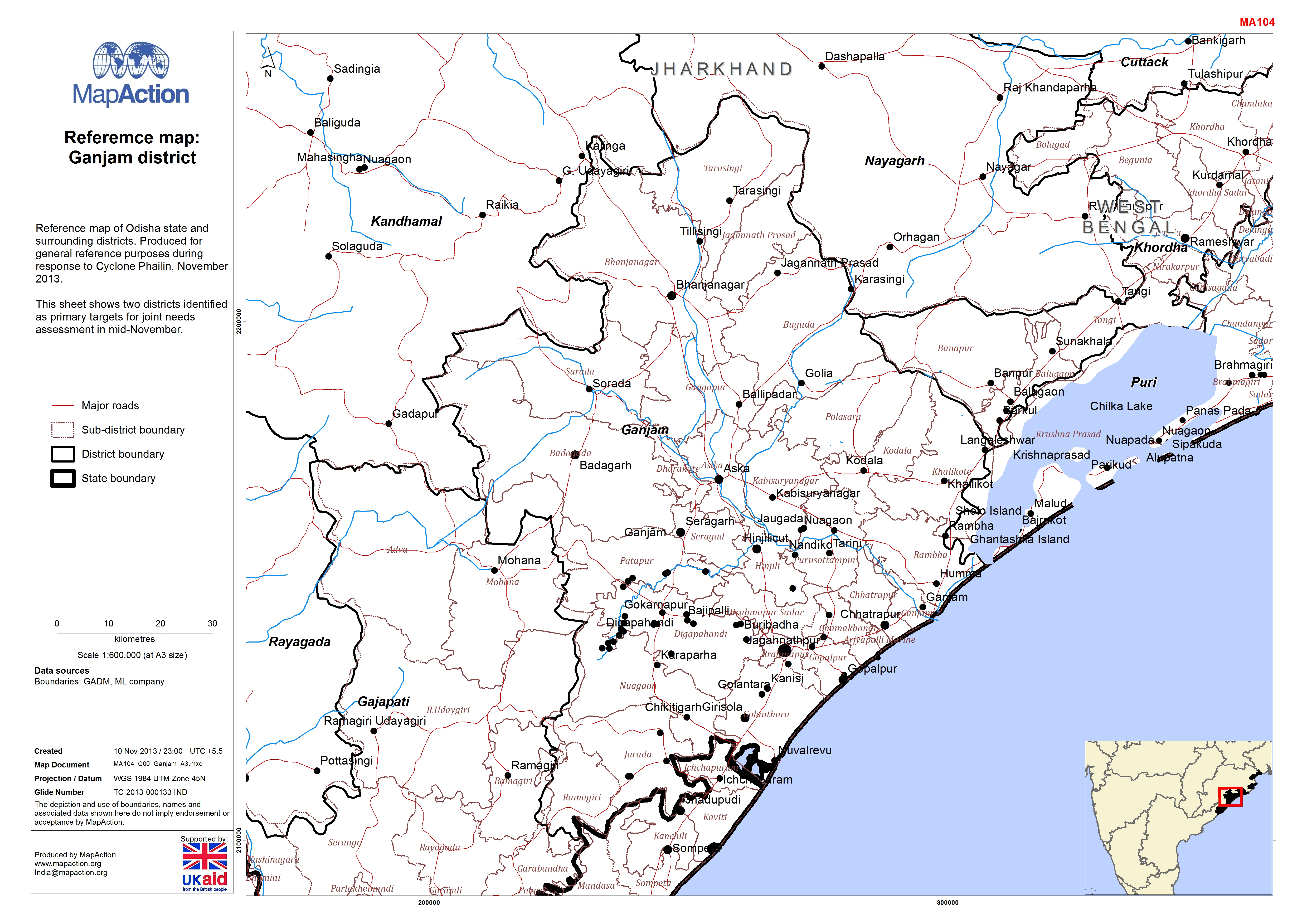
Reference Map: Ganjam district
Reference map of Ganjam district. Produced for general reference purposes during response to Cyclone Phailin, November 2013. This sheet shows two districts identified as primary... -

Reference Map: Puri district
Reference map of Puri district. Produced for general reference purposes during response to Cyclone Phailin, November 2013. This sheet shows two districts identified as primary... -
India: Tropical Cyclone Phailin and floods - Needs assessments by sectors as ...
Map shows districts scheduled for needs assessments by Shelter, WASH and Food Security & Nutrition sector groups in Odisha state, beginning week of 11 November. At time of... -
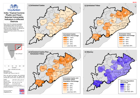
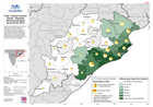
India: Tropical Cyclone Phailin and Flood -Selected Vulnerablity Indicators i...
Map shows the selected population demographics taken from the 2011 census at block level, for the districts that have been identified as affected by Tropical Cyclone Phailin and... -
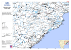
Reference Map: Odisha State
2013.response to Cyclone Phailin, November general reference purposes during surrounding districts. Produced for Reference map of Odisha state and -
Reference Map: Baleshwar and Mayurbhanj districts
This sheet shows two districts identified as primary targets for joint needs assessment in mid-November.Reference map of Odisha state and surrounding districts. Produced for... -

-

Myanmar: Tropical Cyclone MAHASEN-13 - Storm track & surge (as of 15 May 2013)
The map shows the predicted path and surge of Tropical Cyclone MAHASEN-13. The storm surge calculation is based on advisory number 22 of 15 May 2013 12:00. The storm cone... -
Myanmar: Topical cyclone MAHASEN-13 - Actual storm track and surge
Map shows the predicted and actual storm track of Tropical Cyclone MAHASEN-13, with the storm surge. The storm surge calculation is based on advisory 24 of 16 May 2013. -

Wau Satellite Map
This map is a work in progress. Please help us to improve it on www.openstreetmap.org or email corrections/additions to imusouth@un.org. -

Rumbek Satellite Map
This map is a work in progress. Please help us to improve it on www.openstreetmap.org or email corrections/additions to imusouth@un.org.