-
-
-

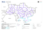
Oblast transport atlas
Transport maps for each Oblast (Region). Maps show roads, rail, airport and other transport networks. -
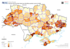
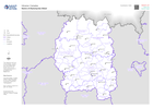
Population Density by Raion (based upon WorldPop population counts for 2020)
Shows population density at raion (admin 2) level for Ukraine, based on summing data from WorldPop population counts for 2020 -

Vatovavy Fitovinany Region (South) - Health Facility Situation
Count and details of damaged health facilities in Vatovavy Fitovinany (South) -

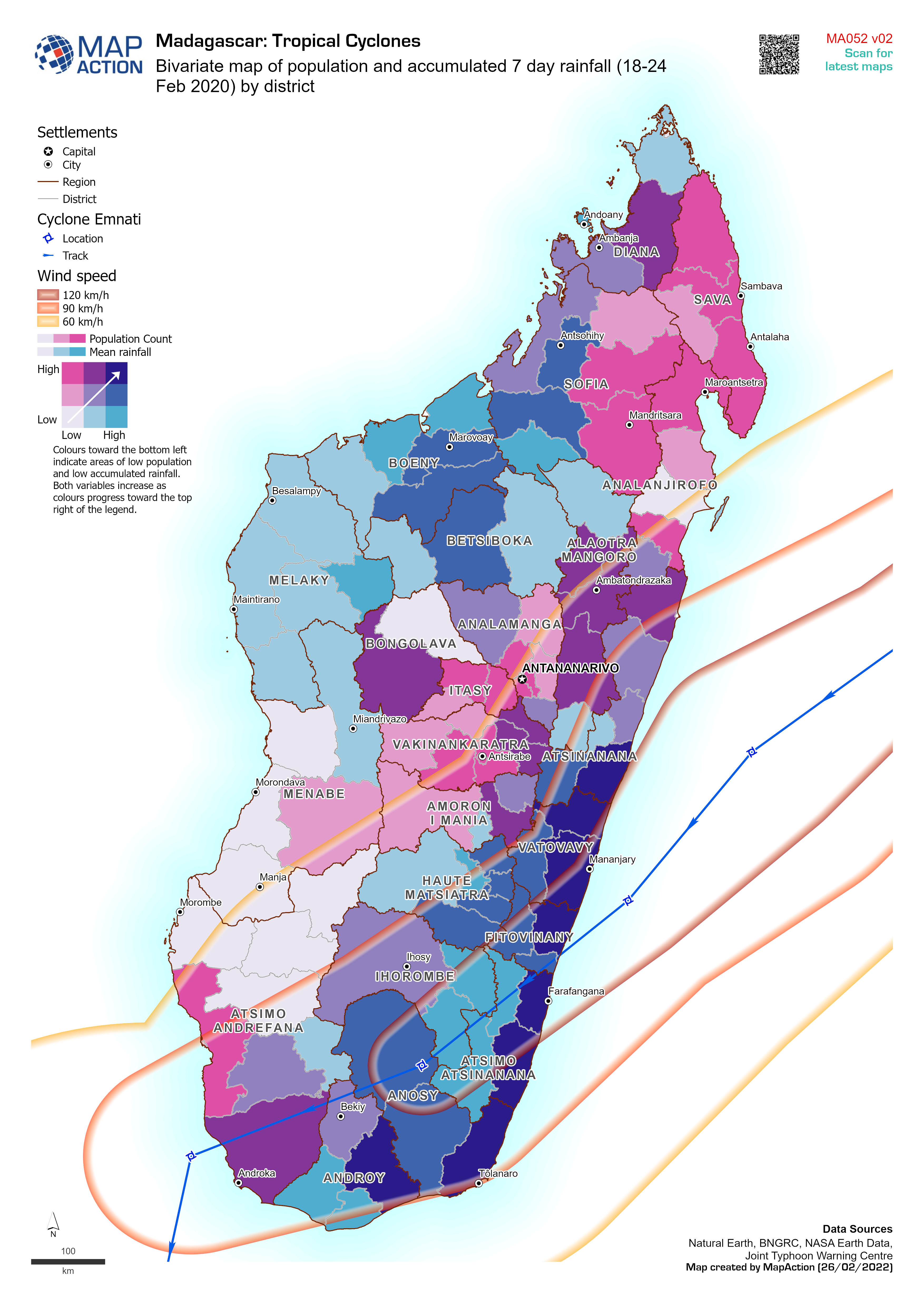
Bivariate map of population and accumulated 7 day rainfall (18-24 Feb 2020) b...
Bivariate map of population (2018 estimate) and accumulated 7 day rainfall (18-24 Feb 2022) by district. Storm track for cyclone Emnati is based on Joint Typhoon Warning Centre... -

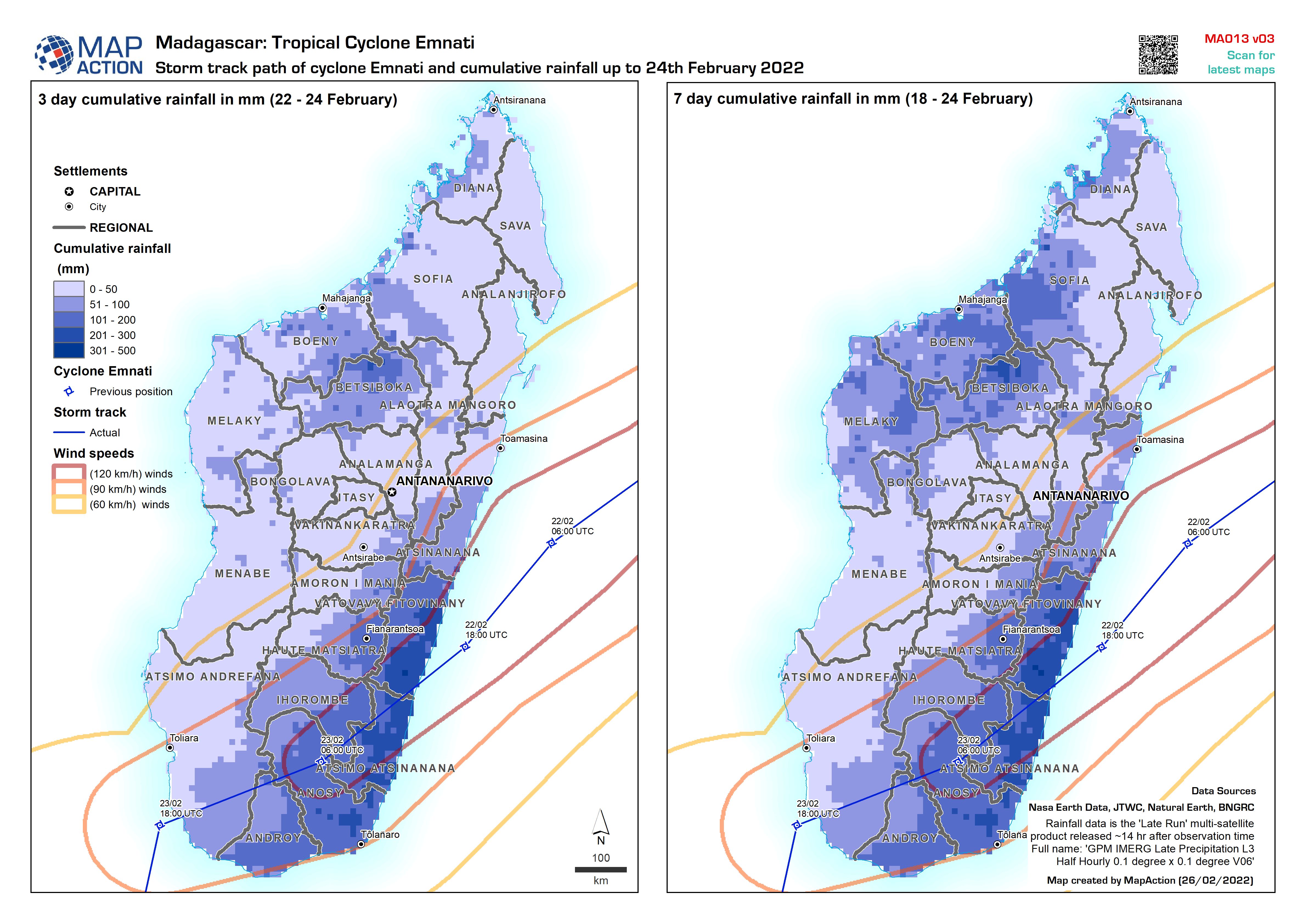
Storm track path of cyclone Emnati and cumulative rainfall up to 24th Februar...
Storm track path of cyclone Emnati (as recorded on 24 Feb 2022) and cumulative 3 day and 7 day rainfall up to 24th February 2022 -
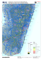
Road map and known access constraints (23/02/22)
Map shows major settlements, transport links, known road access constraints and physical features of Madagascar. -

Storm track path of cyclone Emnati and cumulative rainfall up to 22nd Februar...
Storm track path of cyclone Emnati (as recorded on 24 Feb 2022) and cumulative 3 day and 7 day rainfall up to 22nd February 2022 -

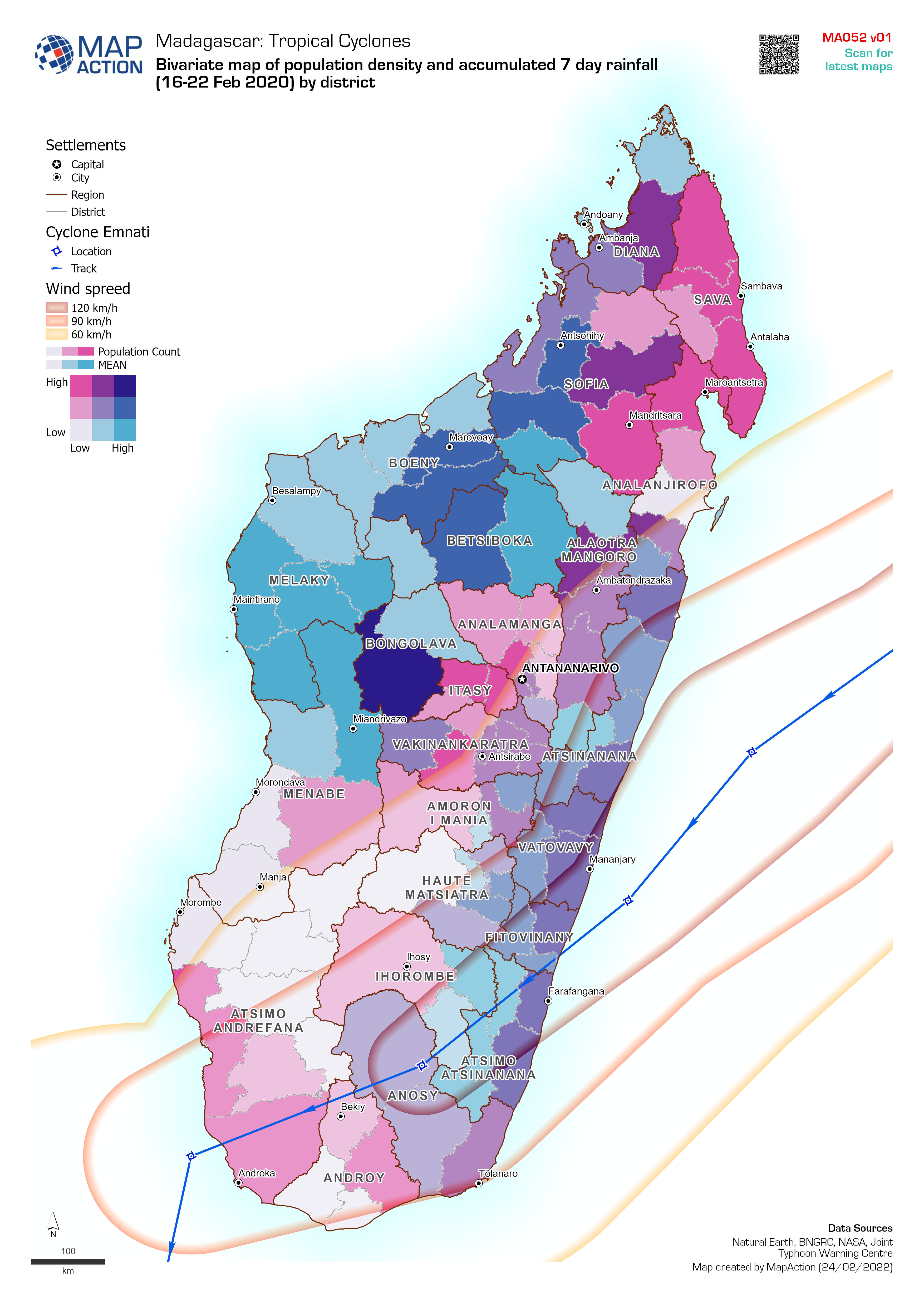
Bivariate map of population density and accumulated 7 day rainfall (16-22 Feb...
Bivariate map of population density (2018 estimate) and accumulated 7 day rainfall (16-22 Feb 2022) by district. Storm track for cyclone Emnati is based on Joint Typhoon Warning... -

Storm path for cylones Batsirai and Emnati (as of 24 Feb 2022) with populatio...
Storm path for cyclones Batsirai (actual on 6 Feb 2022) and Emnati (predicted as of 24 Feb 2022) with population density (2020 estimate) All forecasted storm positions, path... -

Storm path for cylones Batsirai (actual) and Emnati (predicted as of 23 Feb 2...
Storm path for cyclones Batsirai (actual on 6th Feb 2022) and Emnati (predicted as of 23 Feb 2022) with population density (2020 estimate) All forecasted storm positions, path... -

Storm path for cylones Batsirai (actual) and Emnati (predicted as of 22 Feb 2...
Storm path for cyclones Batsirai (actual on 6th Feb 2022) and Emnati (predicted as of 22 Feb 2022) with population density (2020 estimate) All forecasted storm positions, path... -

Storm path for cyclones Batsirai (actual) and Emnati (predicted as of 22 Feb ...
Storm path for cylones Batsirai (actual on 6th Feb 2022) and Emnati (predicted as of 22 Feb 2022) with population density (2020 estimate) All forecasted storm positions, path... -
Storm path for cylones Batsirai (actual) and Emnati (predicted as of 22 Feb 2...
Storm path for cyclones Batsirai (actual on 6th Feb 2022) and Emnati (predicted as of 22 Feb 2022) with population density (2020 estimate) All forecasted storm positions, path... -

-

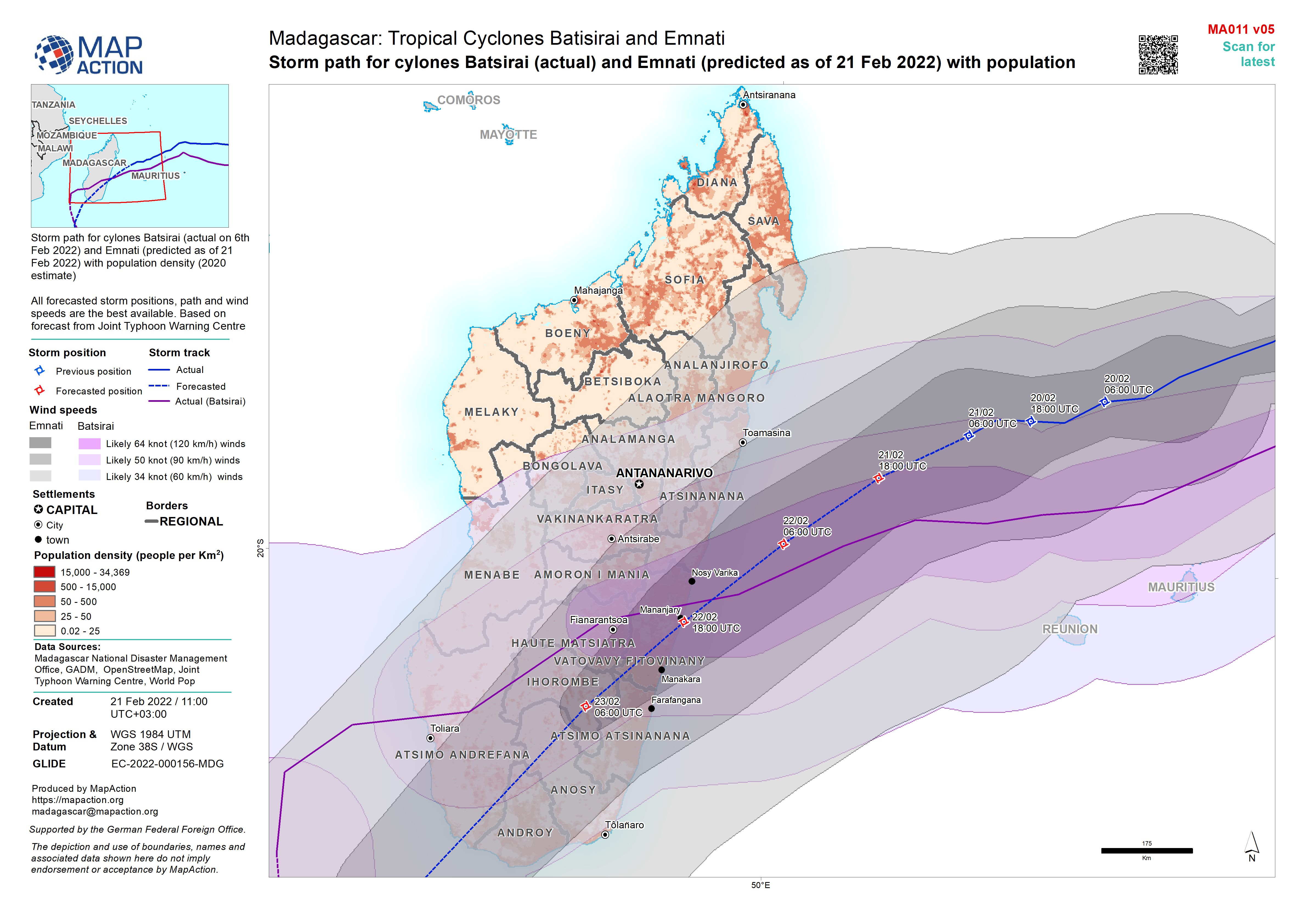
Storm path for cylones Batsirai (actual) and Emnati (predicted as of 21 Feb 2...
Storm path for cylones Batsirai (actual on 6th Feb 2022) and Emnati (predicted as of 21 Feb 2022) with population density (2020 estimate) All forecasted storm positions, path... -

Storm path for cylones Batsirai (actual) and Emnati (predicted as of 19 Feb 2...
Storm path for cylones Batsirai (actual on 6th Feb 2022) and Emnati (predicted as of 19 Feb 2022) with population density (2020 estimate) All forecasted storm positions, path... -
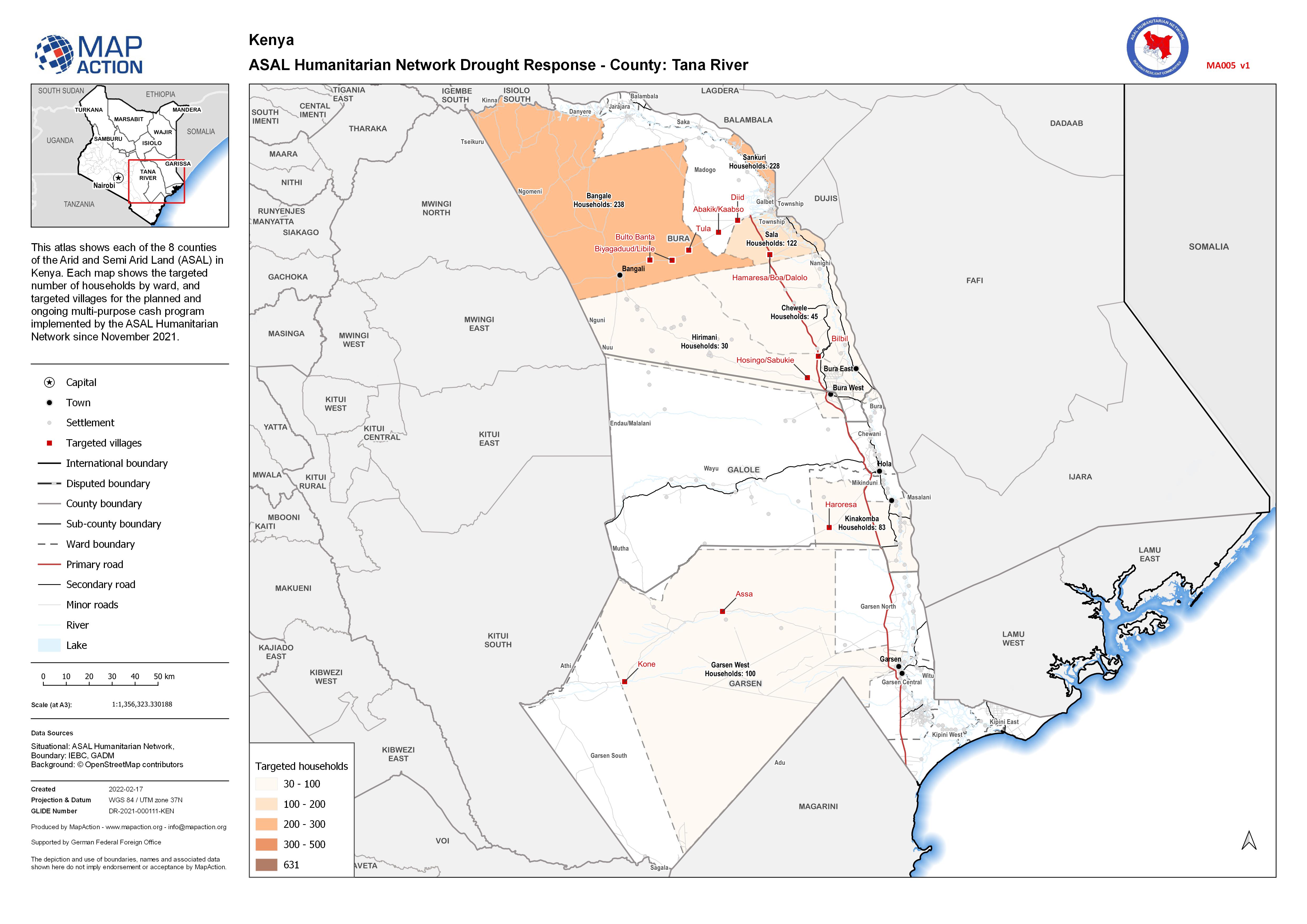
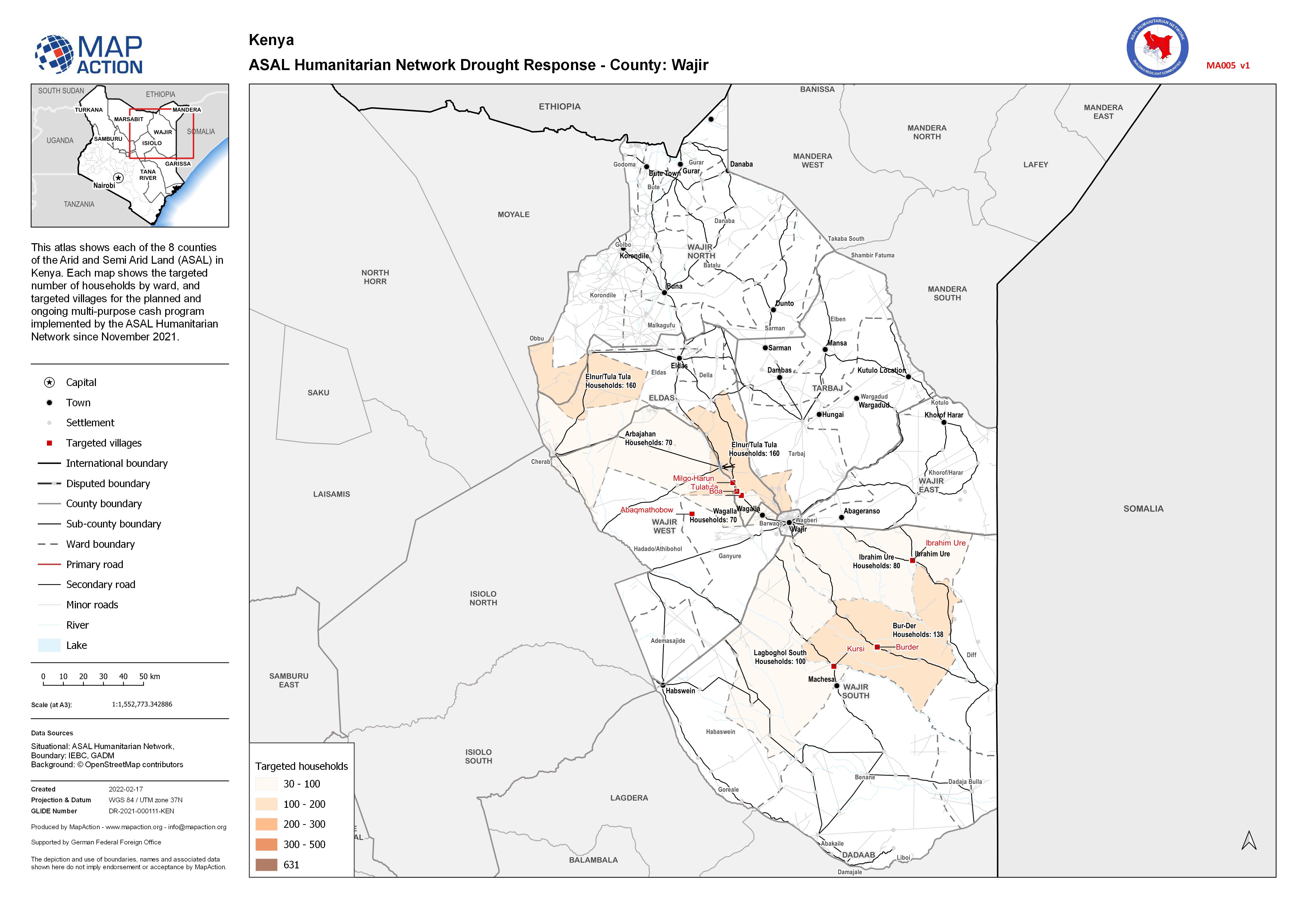
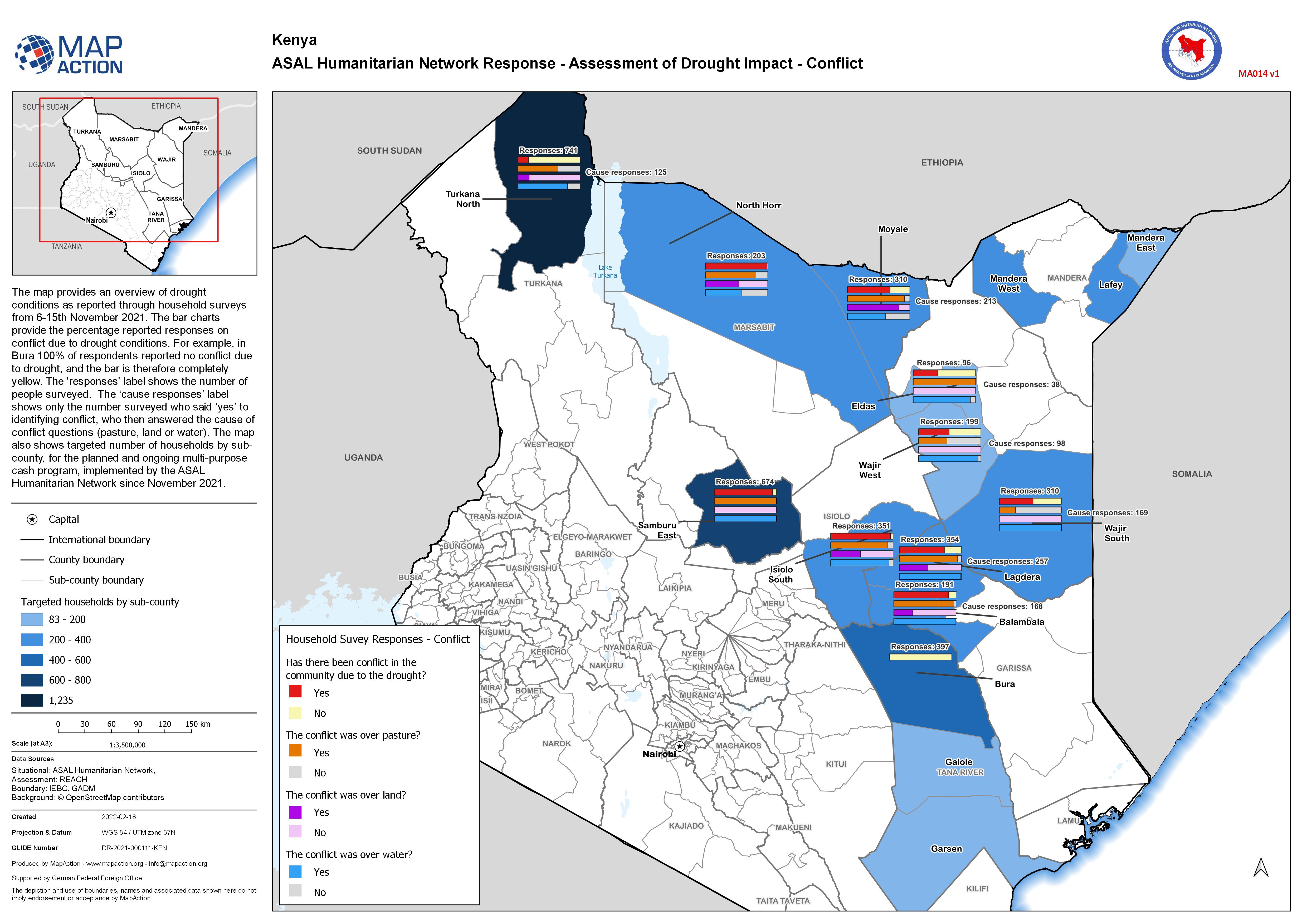
ASAL Humanitarian Network Response - Assessment of Drought Impact - Conflict
The map provides an overview of drought conditions as reported through household surveys from 6-15th November 2021. The bar charts provide the percentage reported responses on...
