-

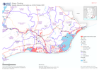
Flood Extent (02 Dec) and Baseline Population for South Somalia
The maps show the flood extent combined with population density to highlight potentially affected areas. The table shows the estimated baseline population by district (2021).... -

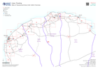
Flood Extents (As of 02 Dec 2023) and Baseline Population
Table shows estimated baseline population in 2022 for affected regions in South Somalia. Population distribution shown on map is based on Worldpop estimate for 2020. Flood... -
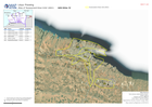
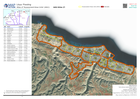
Satellite detected flood waters as of 23rd October 2023
Satellite detected water as of 23rd October 2023 for affected area -

ASAL Humanitarian Network Drought Response - Activity by Ward (as of 23 Augus...
The map shows the 3w (who, what, where) response activity by wards for the planned and ongoing multi-purpose cash program implemented by the ASAL Humanitarian Network (AHN), in... -

ASAL Humanitarian Network Drought Response - Activity by Sub County (as of 23...
The map shows the 3w (who, what, where) response activity by sub-county for the planned and ongoing multi-purpose cash program implemented by the ASAL Humanitarian Network... -
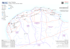
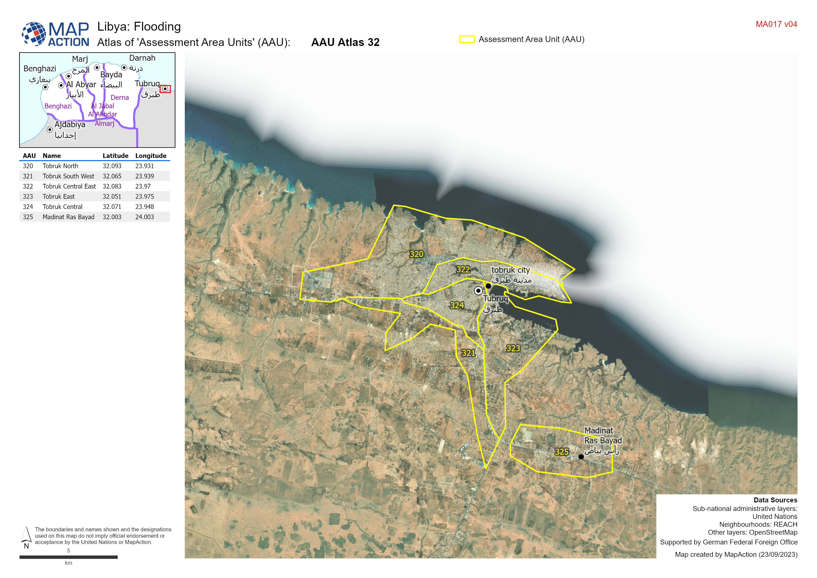
Atlas of 'Assessment Area Units' (AAU):
Atlas showing Assessment Area Units (AAUs) for urban area between Benghazi and Derna -
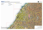
A3 Atlas of 'Assessment Area Units' (AAU) with imagery
Atlas showing Assessment Area Units (AAUs) for urban area between Benghazi and Derna version 3 -
'Assessment Area Units' (AAU) Overview
Showing Assesment Area Units (AAUs) atlas ages for urban area between Benghazi and Derna -
-
Atlas of 'Assessment Area Units' (AAU)
Atlas showing Assesment Area Units (AAUs) for urban area between Benghazi and Derna -
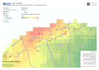
Storm Daniel rainfall accumulations (9-12 September 2023)
Storm Daniel rainfall accumulations (9-12 September 2023) over affected admin 2 areas -

Physical Access Constraints (PAC) - Roads in Derna as of 12 September 2023
Status of road access to the city of Derna as reported by the Logistics cluster -
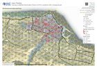
Overview of affected Governorate of Derna (LY0101) overlaid by 250 m hexagona...
Overview of affected area overlaid by 250 m diameter hexagonal grid -

Overview of affected governorate of Derna (LY0101)
Overview of affected area showing transport infrastructure and natural features with flood extents -

Shake intensity and epicentre with Regions affected
Shake Intensity focused on the affected / reported Regions from discussions in the UN Assessment & Analysis cell -

Shake Intensity and Epicentre with Regions affected and population
Shake Intensity focused on the affected / reported Regions from discussions in the UN Assessment & Analysis cell -

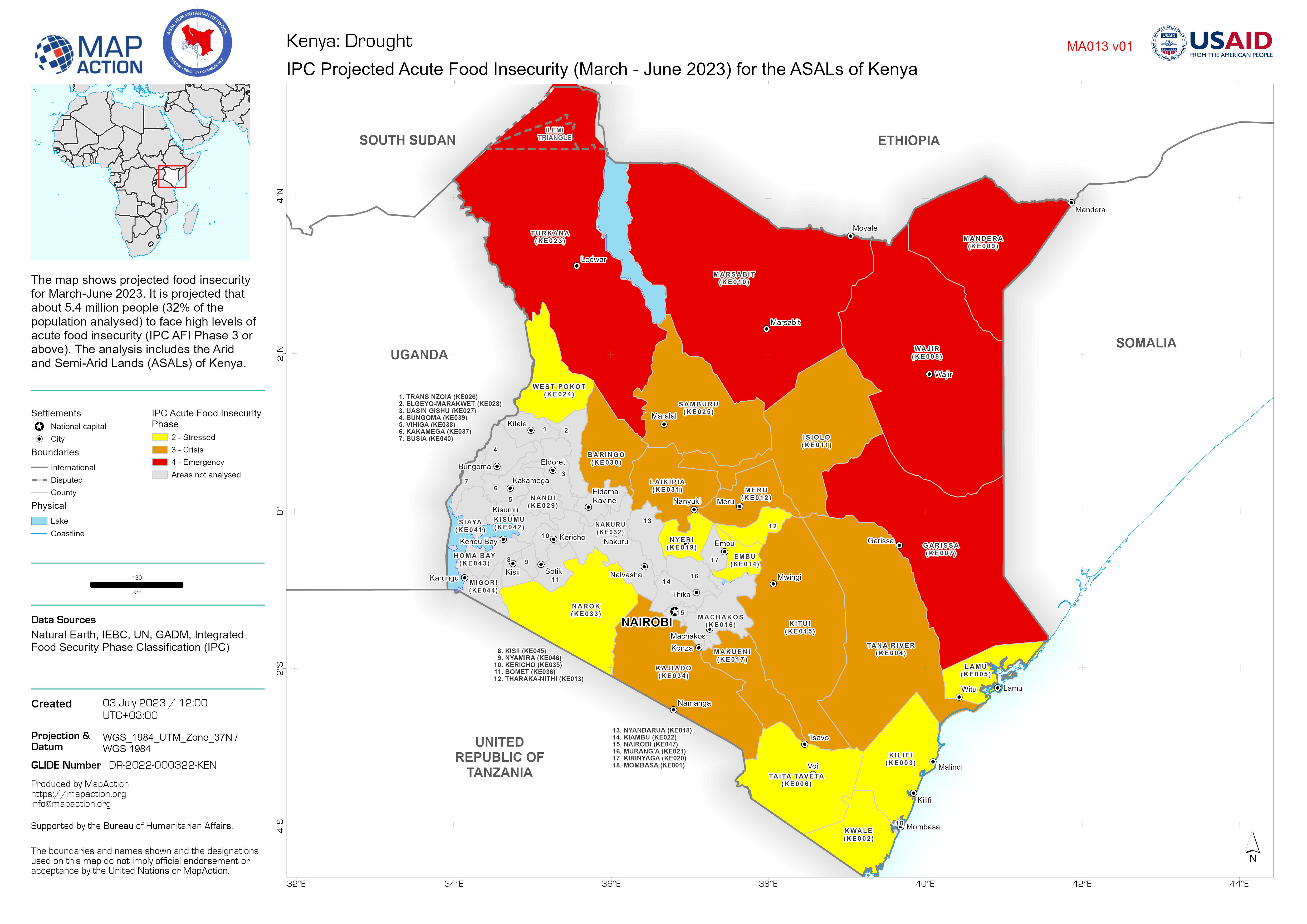
IPC Projected Acute Food Insecurity (March - June 2023) for the ASALs of Kenya
The map shows projected food insecurity for March-June 2023. It is projected that about 5.4 million people (32% of the population analysed) to face high levels of acute food... -

Storm path tropical cyclone Mocha (as of 15 May 2023) with baseline populatio...
Storm path as reported by Joint Typhoon Warning Centre. Population totals in table are 2022 estimates by UNFPA and US Census Bureau (USCB). Baseline population distribution... -

Daños a la infraestructura de salud: (datos reportados Abril 27, 2023).
Representación de la población impactada y daños a la infraestructura de salud: en el departamentos de Lambayeque, Piura y Tumbes.
